
Trip · Dolomites, Italy · September 2025
Alta Via 1
- Hiking
- Video
- Guide
- Photos
I went alone, in September 2025. 7 days, 75 miles. My film of it is below, and my free guide to the route, day by day, is in Details.
Highlights
Milestone · January 20, 2026
Hiking 75 miles Alone on the Alta Via 1 Dolomites

My film of the trip, published January 2026.
Also from this trip:
Milestone · September 25, 2026
The free guide
7 days hut to hut through the Dolomites. Everything from my September 2025 hike, from Lago di Braies to La Pissa, in one guide you can keep on your phone. Day-by-day stats and maps, the huts and how I booked them, the buses in and out, what I spent, and GPX files for every day. Every page is free to read in Details below, with the PDF and GPX download.
Story
Photos
Photos from the trip.
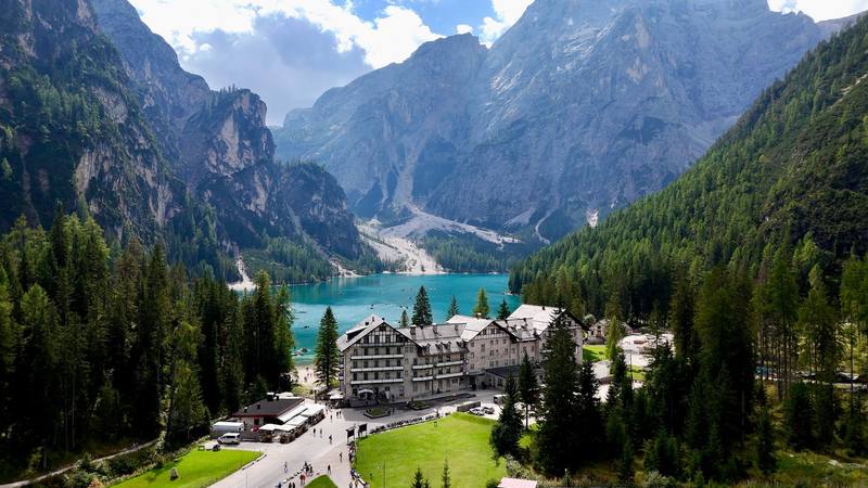
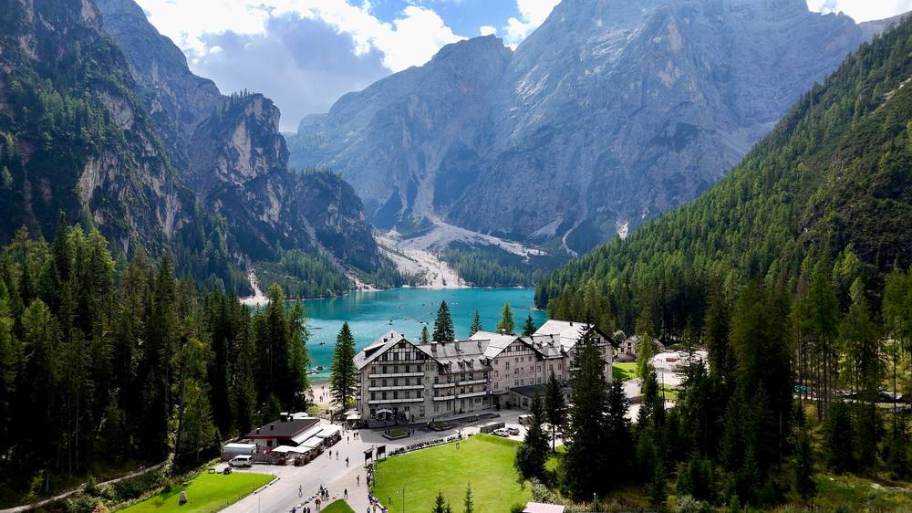
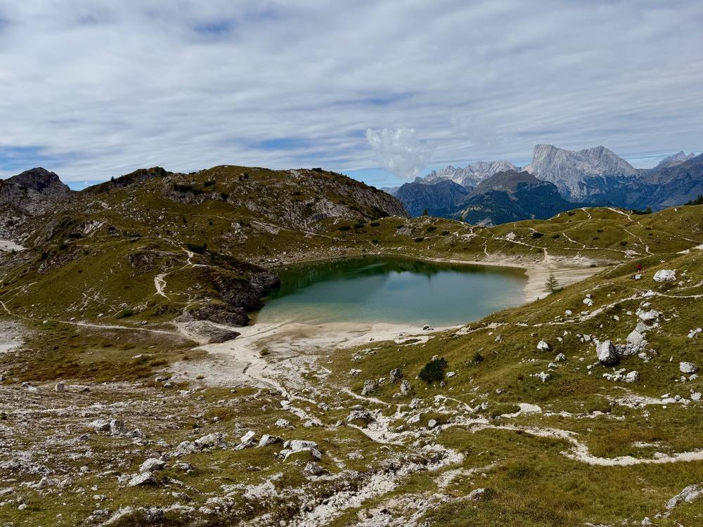
Lago di Braies, where Day 1 starts. 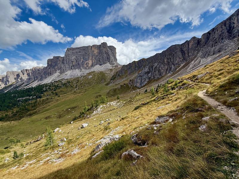
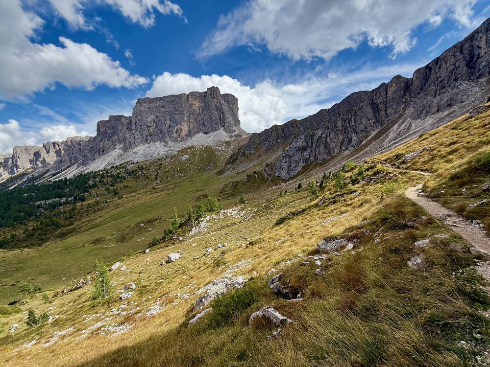
The empty trail south of Passo Giau on Day 3. 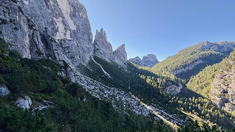
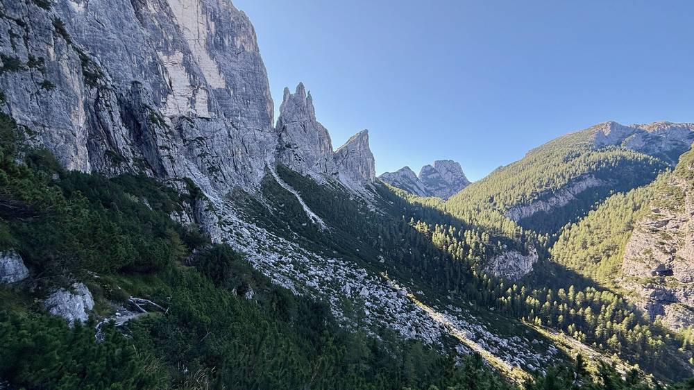
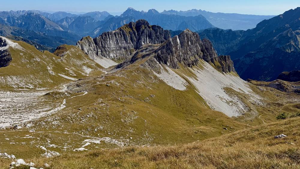
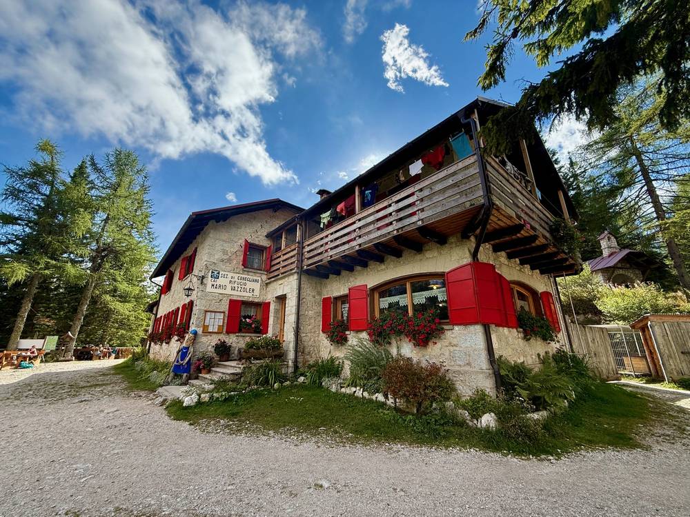
Rock towers above the forested valley between Vazzoler and Carestiato. 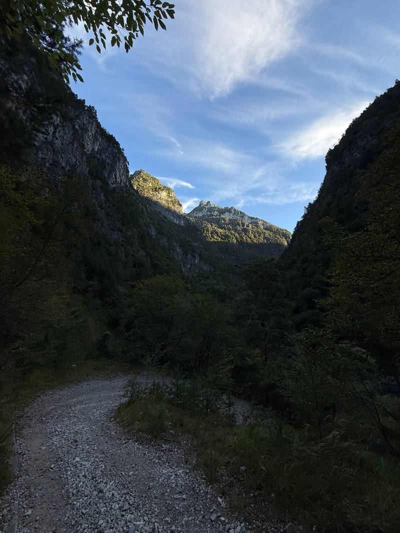
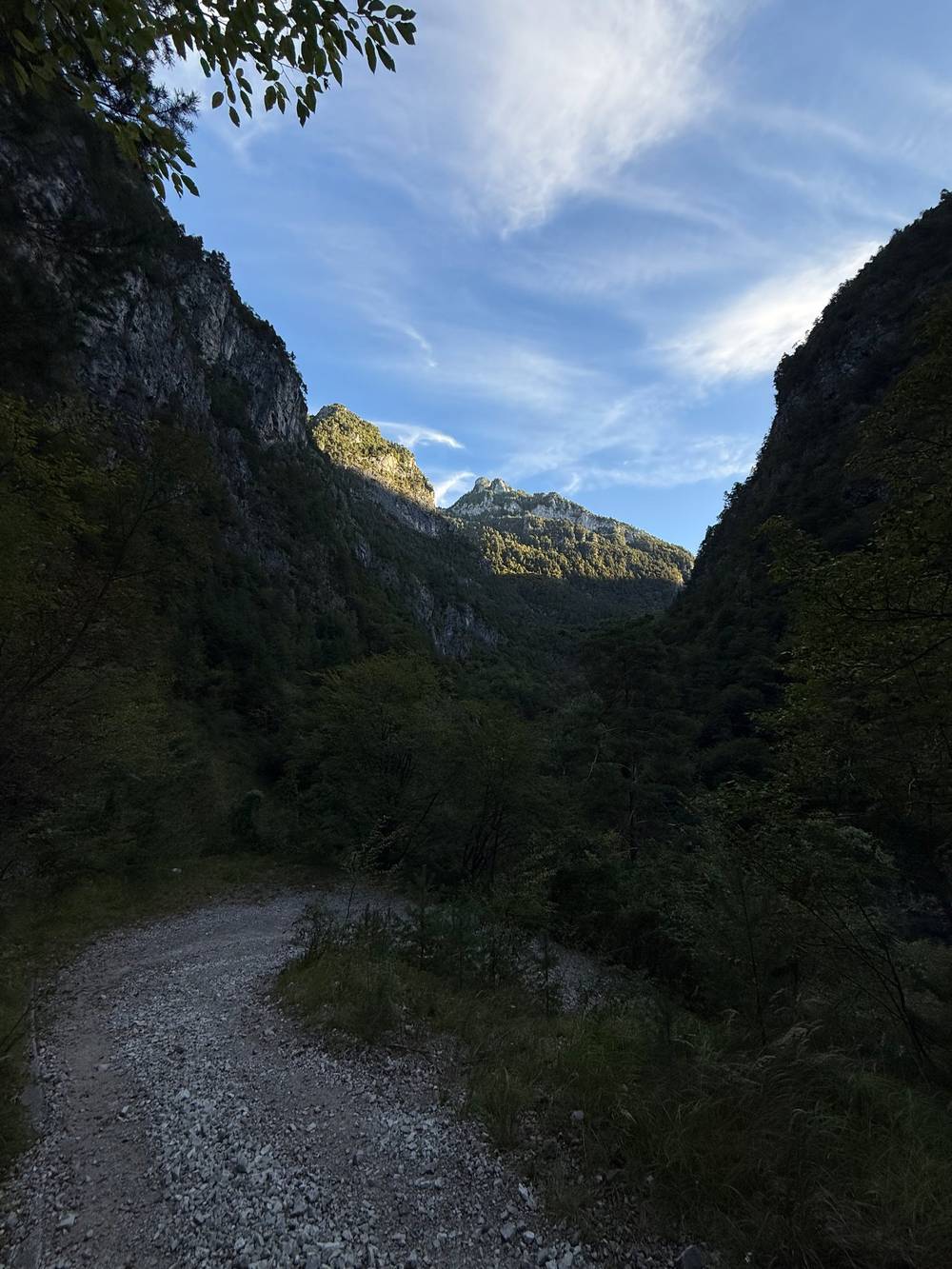
The gravel track down the valley on the morning of Day 7.
Newsletter
Get my letter
Get a short letter from me every couple of weeks: new trips, guides and what I'm building.
Free. Unsubscribe any time.
Details
The guide · Free · 59-page PDF + GPX files · 2027 season edition
Alta Via 1 Hiking Guide
7 days hut to hut through the Dolomites. Every page is below: read it here, or take it offline as a PDF with my GPX files (59-page PDF + GPX files, in one zip). No sign-up needed.
The route
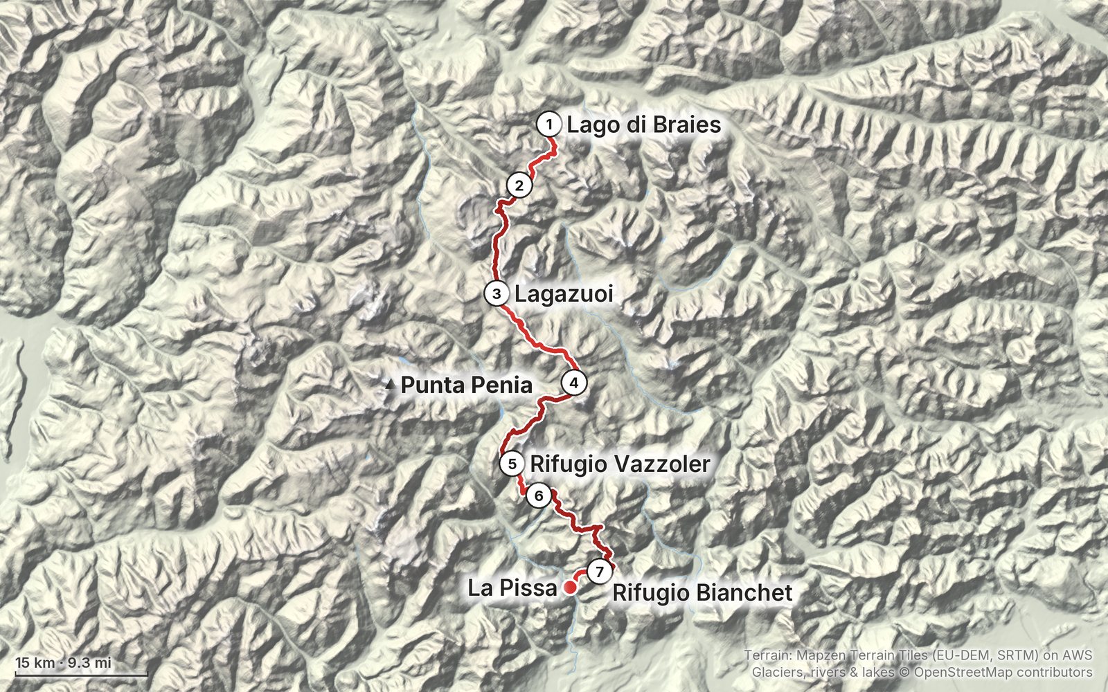
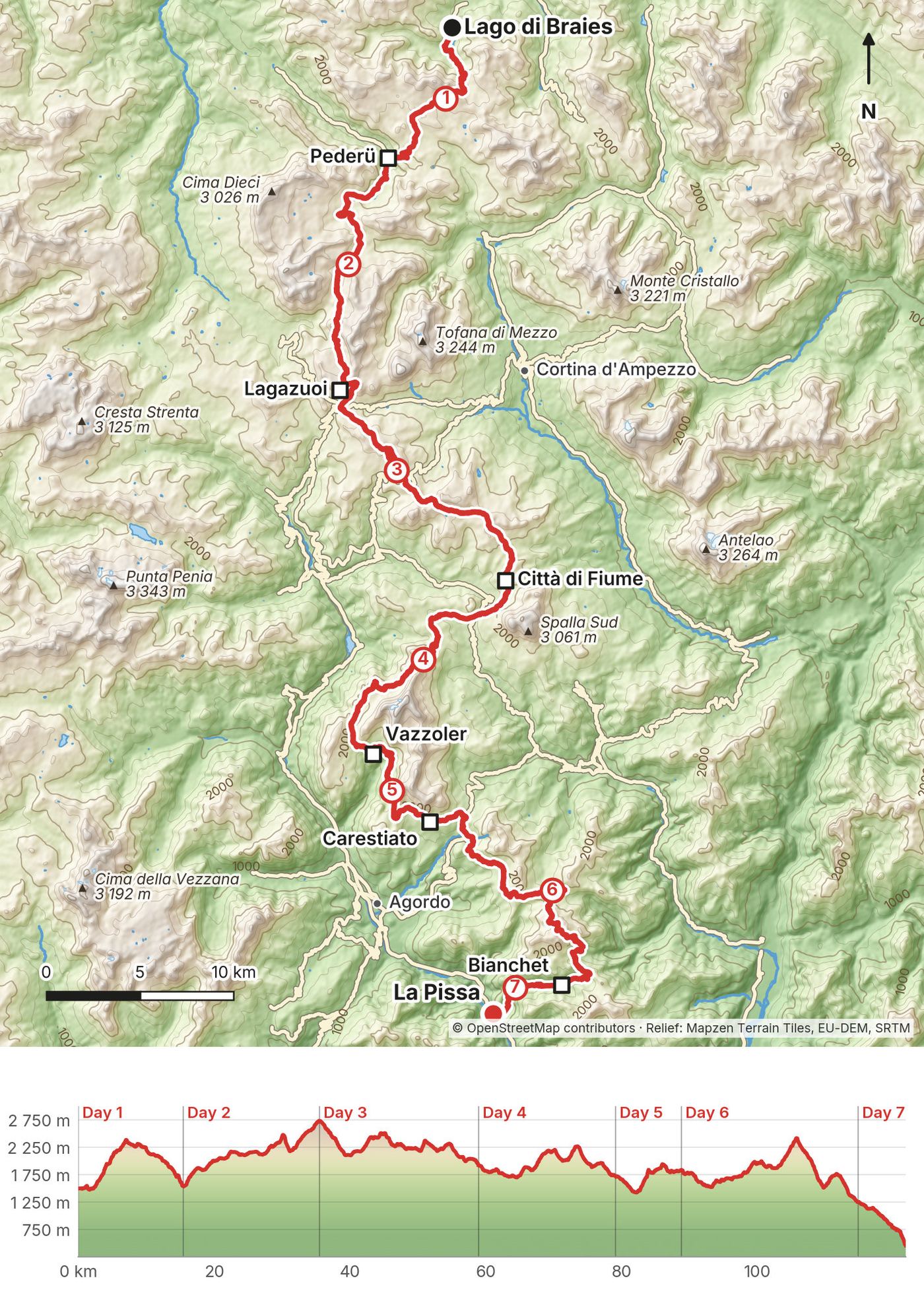
My GPS recording of 7 days on a relief map. The numbers are where each day starts; the red dot is the finish. The day maps are in the guide below, and the GPX files are a free download.
Elevation, start to finish: highest 8,960 ft (2,731 m), lowest 1,500 ft (456 m).
At a glance
- Days
- 7 days
- Distance
- 75 miles
- Climbing
- About 21,800 ft (6,650 m) up
- Season
- July to September
- Route
- Lago di Braies to La Pissa bus stop
Contents
- Welcome
- At a glance
- Straight answers
- When to go
- Booking the huts
- Getting there
- Day 1 Lago di Braies to Pederü
- Day 2 Pederü to Lagazuoi
- Day 3 Lagazuoi to Città di Fiume
- Day 4 Città di Fiume to Vazzoler
- Day 5 Vazzoler to Carestiato
- Day 6 Carestiato to Bianchet
- Day 7 Bianchet to La Pissa
- Other ways to do it
- Getting home
- What I paid
- The huts
- Gear for this route
- Weather and safety
- Using the GPX files
- Before you go, check these
- One-page trip sheet
- About this guide
Welcome
I hiked 75 miles alone on the Alta Via 1 in the Dolomites of Italy in September 2025. It took me seven days, from Lago di Braies to the La Pissa bus stop near Belluno. I slept in a hut every night and ate my way along the trail: pasta, strudel, espresso and beer. Some sections were crowded, and some I had all to myself.
Most people planning the Alta Via 1 spend hours piecing together routes, huts, buses and GPX files across dozens of websites. This guide puts everything I used in one place, so you can plan your own trip without joining a guided tour.
What's inside
- Straight answers to the questions people ask me most
- When to go, how to book the huts, and a booking email in English and Italian
- How I got from Venice to the trail and back, and the bus options for 2027
- All seven days: my notes, the trail, food, water and hut notes, where to bail out, a map, and links to that day in my films
- A 10-day plan and a short 4 to 5 day plan
- What I paid, the huts, the gear for this route (what I carried and filmed with), weather and safety
- One page of things to check before you go, and a printable trip sheet
How to use it offline
Save this PDF to your phone's Files or Books app before you leave home, not in a browser tab. Load the GPX files and download offline maps while you still have Wi-Fi. Each day starts on a new page, so you can jump straight to it on the trail. The film links need a connection; everything else works in airplane mode.
When I say "I," it's my own trip. Prices, bus times and hut dates change every year, so they're dated, and the checks are collected on one page: Before you go, check these.
At a glance
| Quick facts | |
|---|---|
| Distance | 75.4 miles (121.3 km) |
| Climbing | about 21,800 ft (6,650 m) up, 25,100 ft (7,650 m) down |
| Days | 7 hiking days, 6 nights in huts |
| Start | Lago di Braies, South Tyrol |
| Finish | La Pissa bus stop, on the road north of Belluno |
| Best months | July to September (huts open mid to late June until about September 20 to 27) |
| Difficulty | Moderate: a hut every night and no via ferrata on my route, but long days, a few loose passes and the steep scree and staircase below Forcella del Lago on Day 2 |
| Nearest airport | Venice Marco Polo (VCE) |
| Trip date | September 14 to 20, 2025, solo |
| Day | Route | Miles (km) | Up / down (ft) | Sleep |
|---|---|---|---|---|
| 1 | Lago di Braies to Pederü | 9.5 (15.3) | 3,346 / 3,185 | Pederü Berggasthaus |
| 2 | Pederü to Lagazuoi | 12.4 (20.0) | 5,479 / 1,556 | Rifugio Lagazuoi |
| 3 | Lagazuoi to Città di Fiume | 14.5 (23.3) | 2,967 / 5,594 | Rifugio Città di Fiume |
| 4 | Città di Fiume to Vazzoler | 12.5 (20.1) | 3,213 / 3,878 | Rifugio Vazzoler |
| 5 | Vazzoler to Carestiato | 6.0 (9.6) | 2,000 / 1,656 | Rifugio Carestiato |
| 6 | Carestiato to Bianchet | 16.1 (26.0) | 4,743 / 6,641 | Rifugio Furio Bianchet |
| 7 | Bianchet to La Pissa | 4.4 (7.0) | 55 / 2,602 | Home |
The numbers come from my own GPS recordings, measured the same way for every day. Apps count climbing differently, so the figures in my films and old posts are higher. The trail is marked with red and white paint and signed "Alta Via 1" at junctions; use the trail numbers in each day to check you're on the right branch.
Straight answers
How many days do I need? I did it in 7 days with 6 hut nights. My ideal version would have been a trail run with 25 to 30 mile days, because I kind of like to suffer a little bit, but that isn't most people. The plan I booked first was 10 days, like my booking service's standard trip. If you haven't done back-to-back mountain days with a pack, plan on 9 or 10 days. To add just one day, split Day 3 with a night at Nuvolau, or stop at Pramperet on Day 6. With only 4 or 5 days, do the northern half. All of these are in Other ways to do it.
When should I go? The huts open mid to late June and most close between about September 20 and 27. I went September 14 to 20: quiet in the south, some fog and rain, brown grass, and huts about to close. October brings the larch colors, but most huts have closed by then.
How do I get beds, and what if huts are full? Book months ahead. Some huts open next year's bookings in October or November, others in winter or early spring. Book each hut yourself or pay a service, like I did. If a hut is full, move your start date a day or two, join a waitlist, or use the backup hut listed for each night in Booking the huts.
Am I fit enough? I'd call the Alta Via 1 moderate. It's one of the most accessible hut to hut hikes in Europe and a great first hike in the Dolomites. Try this at home: hike 12 to 15 miles with 3,000 to 5,500 ft of climbing three days in a row, with the pack you'll bring. That's my Days 2 to 4. If you feel fine on the third morning and your knees handle the downhills, my 7-day plan will work. If not, take 9 or 10 days. My longest day was Day 6: 16.1 miles, 4,743 ft up and 6,641 ft down, the most descent of the trip. I enjoyed the Alta Via 2 a little more because it was tougher.
What will it cost? The company I booked through quoted me about €529 for hut beds and meals. It waived its own fee in exchange for a mention in my film, and my final 2025 hut total isn't on record. Add flights (about $550 from New York), buses (about $40 to $60) and a hotel at each end ($350). Booking my six huts yourself at 2026 prices is roughly €450 to €650 with dinner and breakfast, plus lunches and drinks. See What I paid.
Can I camp instead? No. Wild camping is prohibited in the Dolomiti Bellunesi National Park at the south end, and camping is restricted in the other protected areas the route crosses. You don't need a tent or sleeping bag, but bring a sleeping-bag liner.
Can I get a private room? Sometimes, for more money. Some huts have small rooms as well as dorms, but not all: Città di Fiume lists shared rooms only, and Nuvolau has no private rooms. At Vazzoler I had a top bunk in a four-person room.
Is there phone signal? Plan on little or none between huts, and don't count on it in an emergency (see Weather and safety). I made a custom route for each day in AllTrails, downloaded it for offline use and followed my location dot.
Is it OK to go solo? I hiked it alone. You notice being solo most at meals in the huts, but I met people along the way, from subscribers to another solo hiker on Day 2. After Passo Giau on Day 3 and for most of Day 6, I barely saw anyone.
Can I fly a drone? Drones have been banned since 2023 in the Fanes-Senes-Braies Nature Park (Days 1 and 2), and the Ampezzo Dolomites Nature Park requires written permission. The Dolomiti Bellunesi National Park has its own rules. National rules: ENAC and d-flight.it.
Cash or cards? Bring both, and more cash than you think: Vazzoler is cash only, Biella wants its tourist tax in cash, and card machines fail when the signal drops. There are no banks on the trail, so get euros in Venice or Cortina. An estimate from 2026 prices: about €550 to €750 covers every hut balance plus about €25 a day for lunch, drinks and showers.
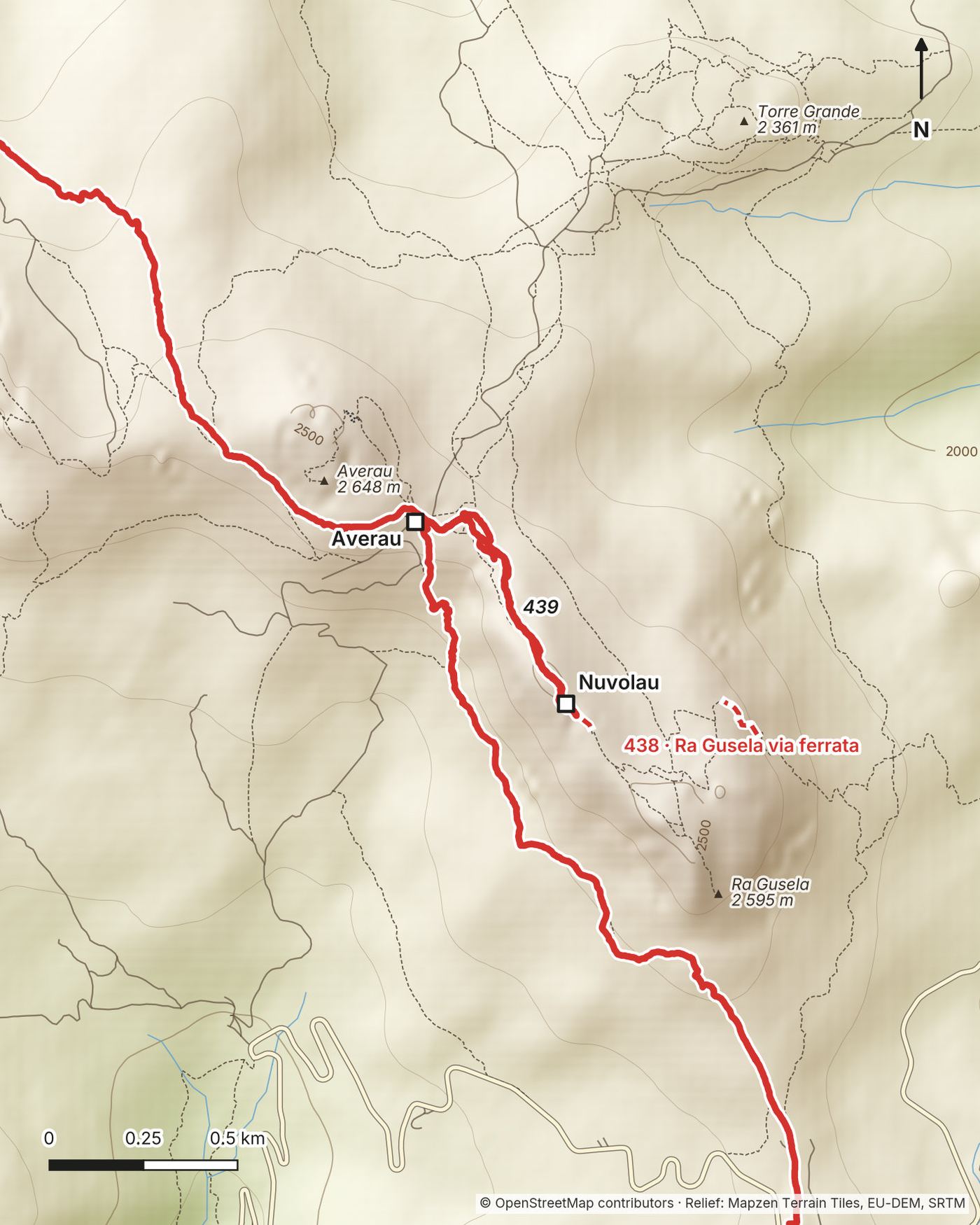
Do I need via ferrata gear? Not on my route. At Nuvolau, trail 438 is the Ra Gusela via ferrata, so go up and down trail 439 like I did. At the end, some tracks cross the Schiara on via ferrata; I walked down to La Pissa instead.
When to go
The season. Most huts open mid to late June and close between about September 20 and 27. In 2026, Città di Fiume was open June 13 to September 27, Vazzoler until September 26, and Nuvolau had beds June 20 to September 20. Lagazuoi stays open from June into October, and its cable car ran June 6 to October 18.
June. Quieter and greener, but snow can linger on the high passes. The park warns that snow is possible into June on Forcella de Zità, the last big pass on Day 6.
July. Everything is open and the days are long. Afternoon thunderstorms are common in the Dolomites in summer, so start early, like most hikers do, between 7:00 and 8:00.
August. The busiest month. It's Italian vacation season and the huts fill first. Places that were busy even in mid-September, like Lago di Braies, Forcella del Lago and Lago Coldai, get busier.
My September. Day 1 had perfect weather. Day 2 ended in fog at Lagazuoi, and Day 3 started with rain on the way down to Passo Falzarego. The climb to the last pass on Day 6 was by far the hottest part of the trip. At Passo Giau I noticed how brown the grass looked compared to photos I'd seen of the same pass in spring or winter. The south end was quiet; on Day 6 I barely saw anyone.
October. The larches turn gold, but most huts on the route have closed. Lagazuoi and its cable car are the exception.
The late-season catch. Huts close in the second half of September, and your whole chain has to line up. My booking service said mid-September was the latest start that would get me every hut in my plan. Closing dates are on Before you go, check these.
Booking the huts
How I booked
I booked through a service called Hut to Hut Hiking Dolomites. They made the reservations and gave me a simple itinerary showing where I'd stay each night, so I could focus on hiking and filming.
It still took a while. In December 2023 they quoted me a 9-day trip for September 2024. In March 2024 the plan was reworked into 9 hut nights after a mix-up with the last hut. In June 2024 I postponed, and by then the huts were sold out for that year anyway. In December 2024 they said mid-September was the latest start that would keep my huts, and I walked a shorter 7-day version in September 2025.
The company quoted me about €529 for hut beds and meals. Full disclosure: it waived its own fee in exchange for a mention in my film, so I only paid for huts and meals. My final 2025 total isn't on record. Their list price for the standard 10-day trip is from €1,790 per person (2026), so don't expect €529 from a service.
Service or do it yourself?
A service contacts every hut, re-plans the chain when one is full, and takes one payment. Hut to Hut Hiking Dolomites' 10-day trip starts at €1,790 per person (2026), about €200 per hut night. Doing it yourself, my six nights would cost about €450 to €650 at 2026 prices, or about €75 to €110 a night, and you handle each hut's deposit and rules. The Italian Alpine Club (CAI) booking site, prenotarifugi.cai.it, lets you request several of its huts in one go. Not every hut is on it, so book the rest by email or on their own sites. Contacts are in The huts.
When bookings open
Vazzoler opens 2027 bookings on November 1, 2026 at noon (moved from October 5), Carestiato on November 2, 2026 (online only), and Biella in November 2026. Coldai hadn't posted a 2027 date as of October 11, 2026. Nuvolau opened its 2026 bookings in February 2026. Most others open in winter or early spring. For July to September, book several months ahead. I first booked about nine months out.
When a hut is full
Move your start date a day or two, join a waitlist (people cancel), start midweek, or use a nearby hut. Never set out for a hut that has told you it's full.
| Night | My hut | Backup |
|---|---|---|
| 1 | Pederü | Biella (shorter Day 1) or Fanes (longer) |
| 2 | Lagazuoi | Fanes, then a longer Day 3 |
| 3 | Città di Fiume | Nuvolau (split Day 3) |
| 4 | Vazzoler | Coldai (shorter Day 4) |
| 5 | Carestiato | Pramperet (longer Day 5) |
| 6 | Bianchet | Pramperet or Pian de Fontana (split Day 6) |
Deposits, bank transfers and cash
Most huts want a deposit, often non-refundable: in 2026, 50% at Lagazuoi and Biella and €30 per person at Vazzoler. My own deposit through the service was 30% and could only be moved to another year.
Cancellation cover. When I booked, my service offered trip-cancellation cover for €49 or €149. Travel insurance with trip-cancellation cover is the other way to protect deposits you pay months ahead.
Some huts ask for a bank transfer (bonifico) and send an IBAN (account number) and a BIC or SWIFT code (bank code). From a US bank that's an international wire, which usually has a fee, so ask if they'll take a card instead. A deposit is part of the price: €30 down on a €100 night leaves €70 to pay at the hut. Carry cash for the balance, and save every confirmation offline.
Copy-and-paste booking email
English. Subject: Booking request, [number] beds, [date]
Hello, I'd like to book [number] beds for [number] people on the night of [day, date]. We are hiking the Alta Via 1 and will arrive on foot from [previous hut]. We would like half board (dinner and breakfast). Dietary needs: [none / vegetarian / gluten-free]. Could you please tell me the total price per person including the tourist tax, the deposit and how to pay it, your cancellation terms, whether you accept cards, and the latest arrival time? Name: [name]. Phone: [with country code]. Thank you very much!
Italiano. Oggetto: Richiesta di prenotazione, [numero] posti letto, [data]
Buongiorno, vorrei prenotare [numero] posti letto per [numero] persone per la notte di [giorno, data]. Stiamo percorrendo l'Alta Via 1 e arriveremo a piedi da [rifugio precedente]. Vorremmo la mezza pensione (cena e colazione). Esigenze alimentari: [nessuna / vegetariano / senza glutine]. Potreste indicarmi il prezzo totale a persona compresa la tassa di soggiorno, l'importo della caparra e come pagarla, le condizioni di cancellazione, se accettate carte e l'orario massimo di arrivo? Nome: [nome]. Telefono: [con prefisso internazionale]. Grazie mille, cordiali saluti.
Getting there
What I did
I flew from New York City to Venice. Round trip flights were just over $550. From Venice airport I immediately took a 2-hour FlixBus to Cortina d'Ampezzo for $16 and stayed the night at Hotel Pontechiesa for $150. The next morning I took a local bus from outside the Olympic ice stadium in Cortina to Lago di Braies. It took about 2 hours, and I paid on board with Apple Pay on my phone.
I absolutely recommend flying in and out of Venice and using the bus system. Arrive the day before you start.
Your options for 2027
Venice airport to Cortina. FlixBus and Cortina Express take about 2 to 2.5 hours. FlixBus was about $19 to $21 in 2026. In the June 2026 to June 2027 timetable, Cortina Express left the airport for Cortina (Piazzale Revis since October 2026) at 7:00, 11:20, 14:20, 17:20 and 19:00, plus a daily 14:20 straight to Dobbiaco, arriving 17:45.
Cortina to Dobbiaco. Bus 445 runs from Cortina (Scuole stop) to Dobbiaco in about 45 minutes (südtirolmobil). In 2026 it left Cortina daily at 8:05, 10:05, 13:05, 15:05, 17:05 and 19:05.
Dobbiaco to Lago di Braies. Bus 442 runs from the Dobbiaco bus station (Autostazione) to the lake in about 28 minutes. In 2026 the first bus left at 6:01 on weekdays and 7:01 daily, then about every half hour until 19:01, and at 20:01 (fewer buses after October 11). Example: the 8:05 bus 445 from Cortina connected with the 9:01 bus 442, at the lake at 9:29.
Lake buses in summer. In 2026, from July 1 to September 15, lake buses had to be booked and paid online in advance. The valley says the system returns in summer 2027, with details in spring 2027, at prags.bz. Outside those dates you can buy a ticket from the driver with cash. The easy version: Cortina Express to Dobbiaco, a night there, and bus 442 in the morning.
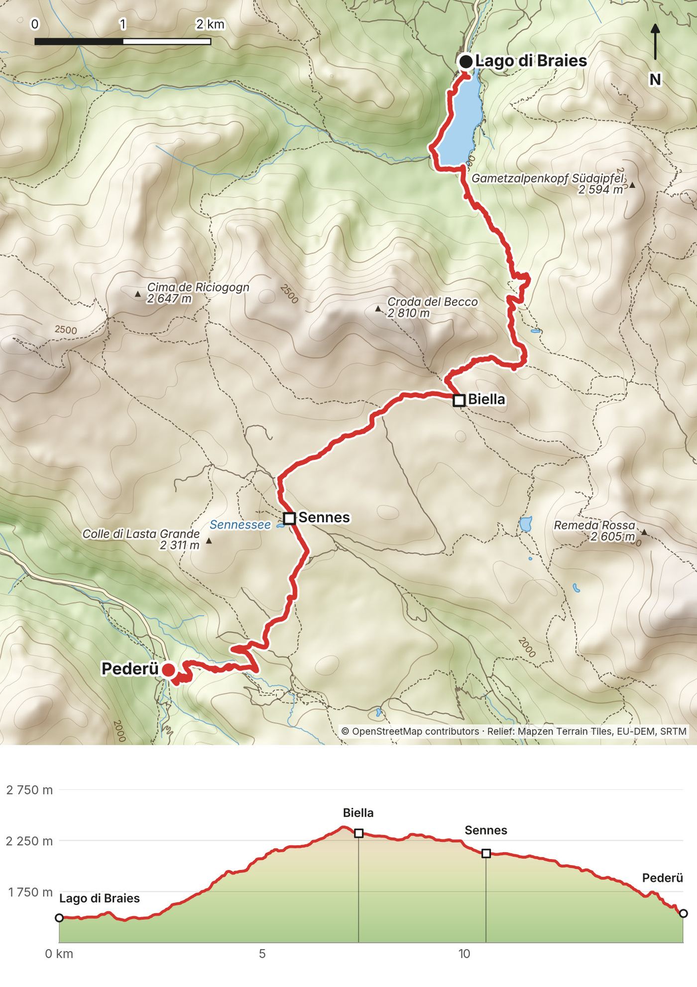
Day 1: Lago di Braies to Pederü
- Distance
- 9.5 mi (15.3 km)
- Climbing
- 3,346 ft (1,020 m)
- Descent
- 3,185 ft (971 m)
- Time to allow
- 6 to 7 hours (I took 5 hours with stops)
- Trails
- 1 to Rifugio Biella, 6 and 6A past the Sennes huts, 7A and 7 down to Pederü
- Sleep
- Pederü Berggasthaus, +39 0474 834316
- Food and water
- Carry water from the lake. Biella (4.5 mi) and the Sennes huts (6.5 mi) sell food and drinks.
- Hut notes
- Half board needs three nights, so book bed and breakfast and pay for dinner there. Cards accepted.
My day
I arrived at Lago di Braies with fresh legs and good weather. It was easily the busiest place I saw on the whole hike, with people waiting their turn to ride the wooden boats. There was no chance of me waiting in that line, so I walked past the crowds and started climbing.
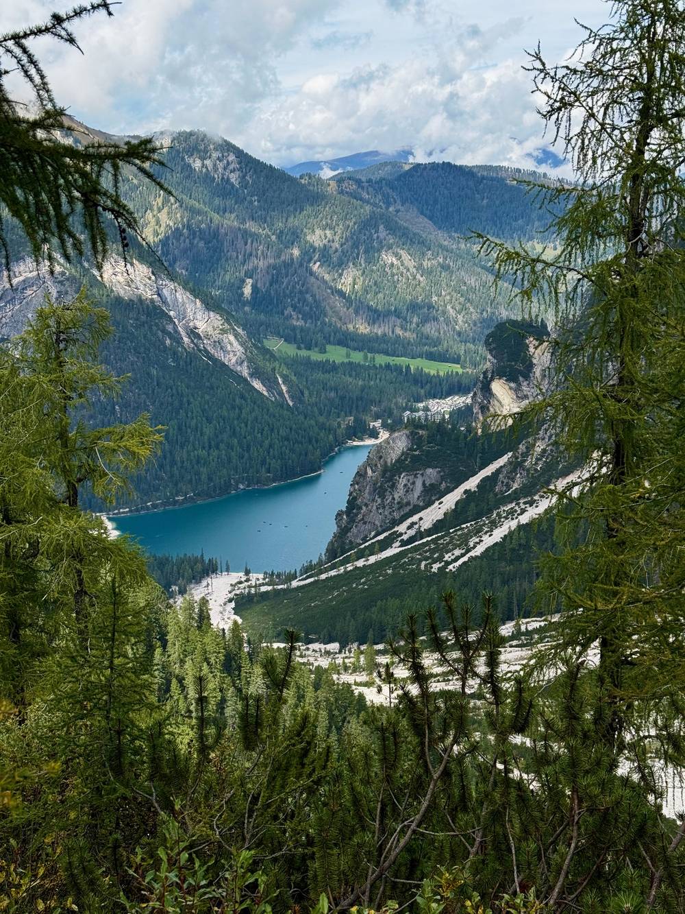
The early views back to the lake were some of the most dramatic of the trip, and up here I realized how tan and brown the shoulder season looks in northern Italy. After the pass I stopped at Rifugio Biella for a delicious vegetable soup and strudel. I reached Pederü just before sunset, changed out of my sun shirt, and had my first beer and pasta of the hike.
The trail
One big climb, one long descent. Trail 1 climbs about 3,130 ft (954 m) to Rifugio Biella, which is at 4.5 miles (7.3 km) on my GPS, just past the day's high point at about 7,800 ft (2,378 m). The local tourist office gives about 3.5 hours for this part. Then trails 6 and 6A run mostly downhill past the Sennes huts, at about 6.5 miles (10.4 km), and 7A and 7 drop to Pederü, a guesthouse at the end of a road.
If you need to get off
Before the pass, turn back to the lake. Biella is a hut if you've booked a bed. Pederü is at the end of a road up from San Vigilio di Marebbe; ask about a taxi or shuttle.
Watch this day
Narrated film, Day 1 · Ambient film, Day 1
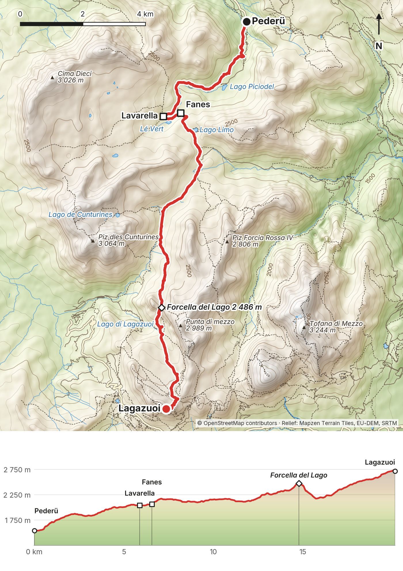
Day 2: Pederü to Lagazuoi
- Distance
- 12.4 mi (20.0 km)
- Climbing
- 5,479 ft (1,670 m)
- Descent
- 1,556 ft (474 m)
- Time to allow
- 8 to 9 hours (I took 7 hours 38 minutes)
- Trails
- 7 to the Fanes huts, 11 across the Fanes valley, 20B over Forcella del Lago, 20 and 401 up to Lagazuoi
- Sleep
- Rifugio Lagazuoi, +39 0436 867303
- Food and water
- Lavarella (3.6 mi) and Fanes (4 mi) sell food and drinks; fill your water there. Lago di Lagazuoi isn't drinking water.
- Hut notes
- Check-in closes at 18:30. 50% non-refundable deposit (2026). Hot showers cost extra.
My day
I packed up my 35L Hyperlite and started before the sun hit the valley. The early fog made layers of blue mountains. I stopped at a small hut for sausage, bread and an espresso while a chicken walked around my legs. The dirt road through the wide valley after that wasn't very enjoyable, but the mountains around it were beautiful.
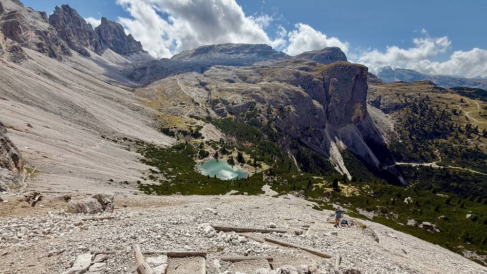
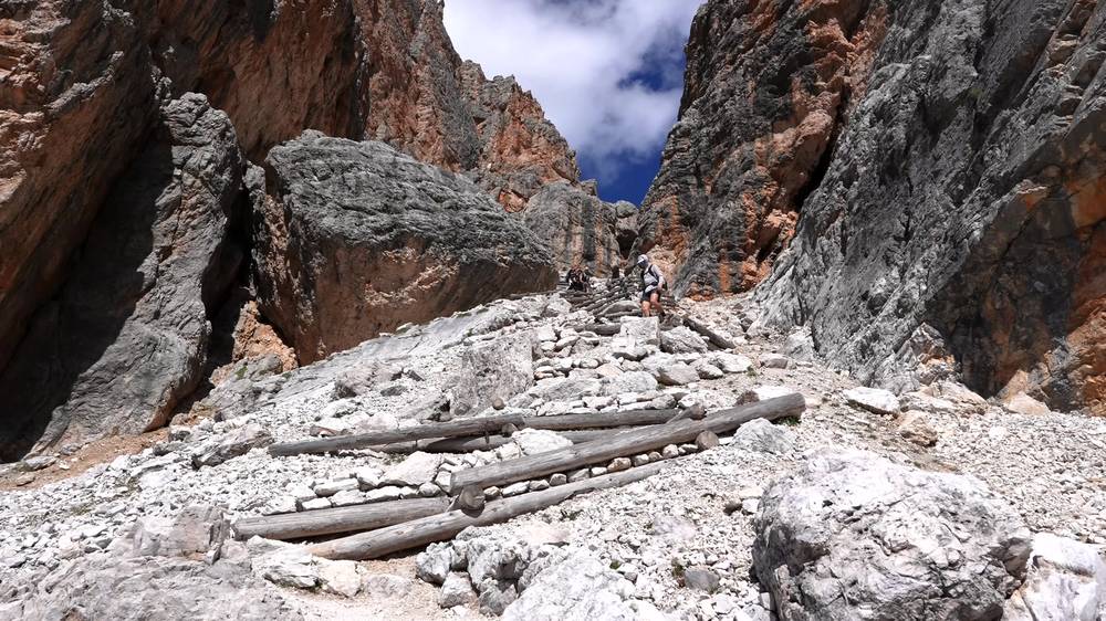
The climb to Forcella del Lago passed a ton of people, since it's a popular day hike. On the other side a steep, winding rock and wood staircase drops all the way down to Lago di Lagazuoi. It reminded me of Angels Landing in Zion, and it was a highlight of the Alta Via 1. It was hot, so I dipped my legs in the lake. This was my biggest climbing day, and it left my legs ready for rest. The last dirt ramp took me up into the clouds at Rifugio Lagazuoi, where I had a beer and kept checking whether the fog would lift.
The trail
From Pederü, trail 7 climbs to the Fanes huts: Lavarella at about 3.6 miles (5.8 km) and Fanes at about 4 miles (6.5 km). Trail 11 then crosses a wide valley on a dirt road, and trail 20B climbs to Forcella del Lago.
The descent from the pass is the steepest ground of the first half: loose scree and rock and timber steps. The Cortina tourist office rates its Fanes to Lagazuoi stage "for experts." Take it slowly, and don't start it in a storm. After the lake, trails 20 and 401 make a long climb to the hut, the highest night of the trip at about 8,950 ft (2,730 m) on my GPS.
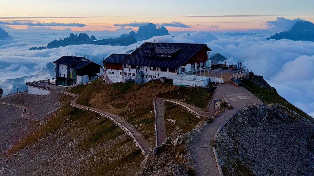
If you need to get off
Before the Fanes huts, walk back to Pederü. The Fanes and Lavarella huts are a place to stop early. Once over Forcella del Lago, keep going to Lagazuoi, where the cable car goes down to Passo Falzarego on the main road (June 6 to October 18 in 2026, 9:00 to 17:00).
Watch this day
Narrated film, Day 2 · Ambient film, Day 2
Day 3: Lagazuoi to Città di Fiume
- Distance
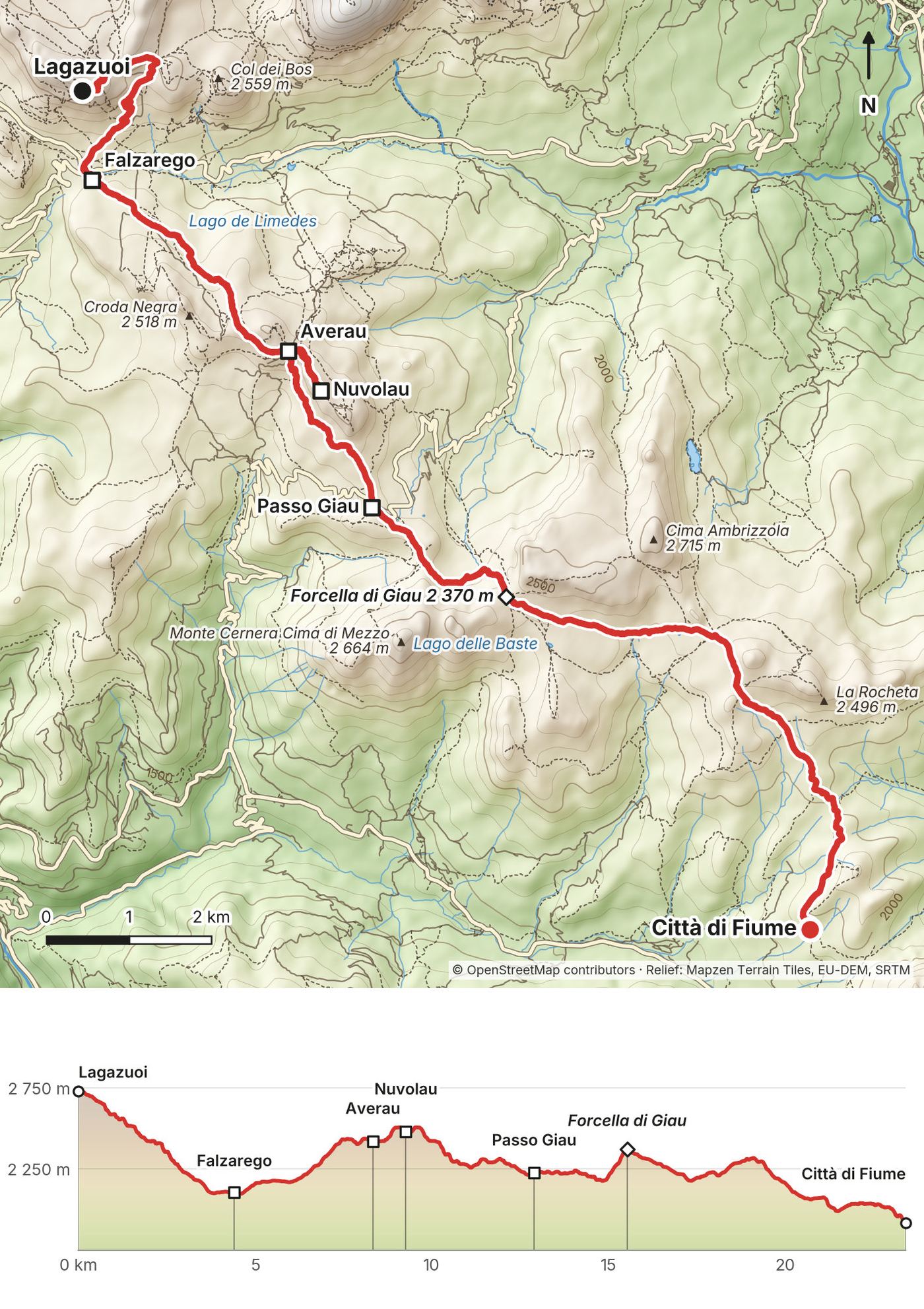
- 14.5 mi (23.3 km), with Nuvolau
- Climbing
- 2,967 ft (904 m)
- Descent
- 5,594 ft (1,705 m)
- Time to allow
- 8 to 9 hours (I took 8 hours 12 minutes)
- Trails
- 20/401 and 402 down to Passo Falzarego, 441 and 419 to Averau, 439 up and back to Nuvolau, 452 south to Passo Giau, 436, then 458/467 to Città di Fiume
- Sleep
- Rifugio Città di Fiume, +39 320 0377432
- Food and water
- Passo Falzarego, Averau and Nuvolau sell food and drinks. Nuvolau's tap water isn't drinkable; it sells bottled water.
- Hut notes
- Sleeping-bag liner required. Arrive by 17:30. Tap water not drinkable. Shared rooms only.
My day
The fog was lower in the morning, and a handful of us watched the sunrise from the hut on the cliff. I think I like mountain huts like this way more than fancy city hotels. The breakfast was exceptional. I found rain on the way down and waited it out with an espresso in the store at Passo Falzarego.
Rifugio Nuvolau was out of my way, but I wanted to make sure to stop. The tiny hut sits on a huge cliff that slopes up on one side, so hikers can walk up easily. It was busy, but I got some simple pasta, a salad and yet another espresso. Passo Giau had plenty of motorcyclists and brown grass. As soon as I left it the trail got incredibly quiet, and that stretch was very enjoyable. Having time to think and space away from people puts me into flow like nothing else. The last miles to Città di Fiume were on a road through the forest, which wasn't that interesting to film. Every hut had slippers to wear, but I regretted not bringing my own.
The trail
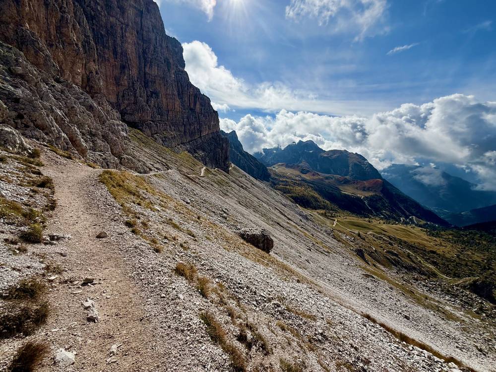
From Lagazuoi, trails 20/401 go to Forcella Travenanzes and 402 drops about 2,060 ft (630 m) to Passo Falzarego in 2.8 miles (4.5 km). You can ride the cable car down instead, but the first car is at 9:00. I walked.
From Falzarego, 441 and 419 lead to Rifugio Averau and 439 climbs to Nuvolau. I went up and back on 439. Trail 438 on the other side is the Ra Gusela via ferrata and needs via ferrata gear. Nuvolau is an exposed summit, so skip it if storms are building. From Averau, take 452 south to Passo Giau, then 436 and 458/467 to Città di Fiume.
If you need to get off
The Lagazuoi cable car and Passo Falzarego come first; line 52 runs from the pass to Cortina (see Getting home). Passo Giau is also on a road. If the day looks too long, book Nuvolau and split it.
Watch this day
Narrated film, Day 3 · Walking up to Nuvolau · Ambient film, Day 3
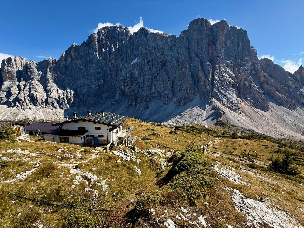
Day 4: Città di Fiume to Vazzoler
- Distance
- 12.5 mi (20.1 km), with Tissi
- Climbing
- 3,213 ft (979 m)
- Descent
- 3,878 ft (1,182 m)
- Time to allow
- 7.5 to 8.5 hours (I took 7 hours 31 minutes)
- Trails
- 472 to Passo Staulanza, a short road walk, 568 and 556 to Coldai, 560 under the Civetta, 563 up to Tissi, 560 down to Vazzoler
- Sleep
- Rifugio Vazzoler, +39 0437 1956619
- Food and water
- Coldai (about 6 mi) sells food and drinks; fill up on water there. Tissi (8.9 mi) sells food and drinks.
- Hut notes
- Cash only. €30 per person non-refundable deposit (2026).
My day
I usually like getting up early and starting before everyone else. After a very brief road walk past Rifugio Passo Staulanza, I found sheep dogs herding cows with bells, one of my favorite things to see. After a very steep climb I reached Rifugio Coldai for espresso and strudel. I hope you're seeing the pattern. I filled my filter water bladder and hiked up to Lago Coldai, with Monte Civetta towering overhead. It was crowded, so I breezed right through.
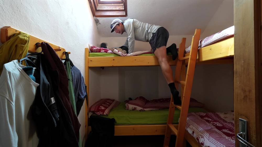
I had all the time in the world, so I did a side quest up to Rifugio Tissi, destroyed some soup and a delicious potato and egg dish, and walked up to the big cross at the edge of the cliff looking down on Alleghe. A dog welcomed me to Rifugio Vazzoler. My bed was a top bunk in a four-person room, and the place completely filled up.
The trail
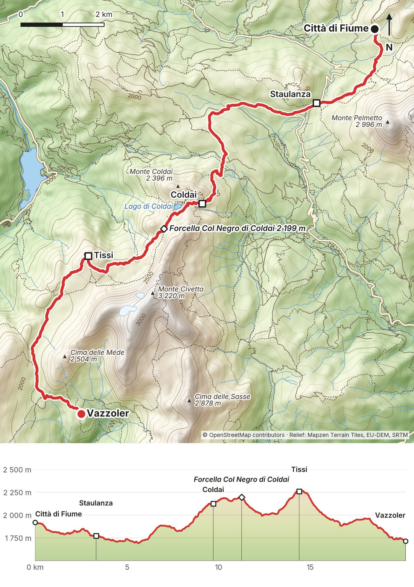
Take trail 472 around the west side of Monte Pelmo to Passo Staulanza, not 480 (the Gino Flaibani route). After a short road walk, 568 and 556 climb steeply to Rifugio Coldai at about 6 miles (9.7 km).
Past Lago Coldai, trail 560 runs under the huge wall of the Civetta. Trail 570 up there is an equipped route, so stay on 560. The side trip up 563 to Rifugio Tissi, at about 8.9 miles (14.3 km), is included in my numbers. From Tissi, 560 drops into pine forest to Vazzoler.
If you need to get off
Passo Staulanza is on a road. From Coldai, trails 556 and 564 go down to Palafavera on the road. Vazzoler's access road leads down toward Capanna Trieste and Listolade. Ask the hut to call a ride.
Watch this day
Narrated film, Day 4 · My bunk at Vazzoler · Ambient film, Day 4
Day 5: Vazzoler to Carestiato
- Distance
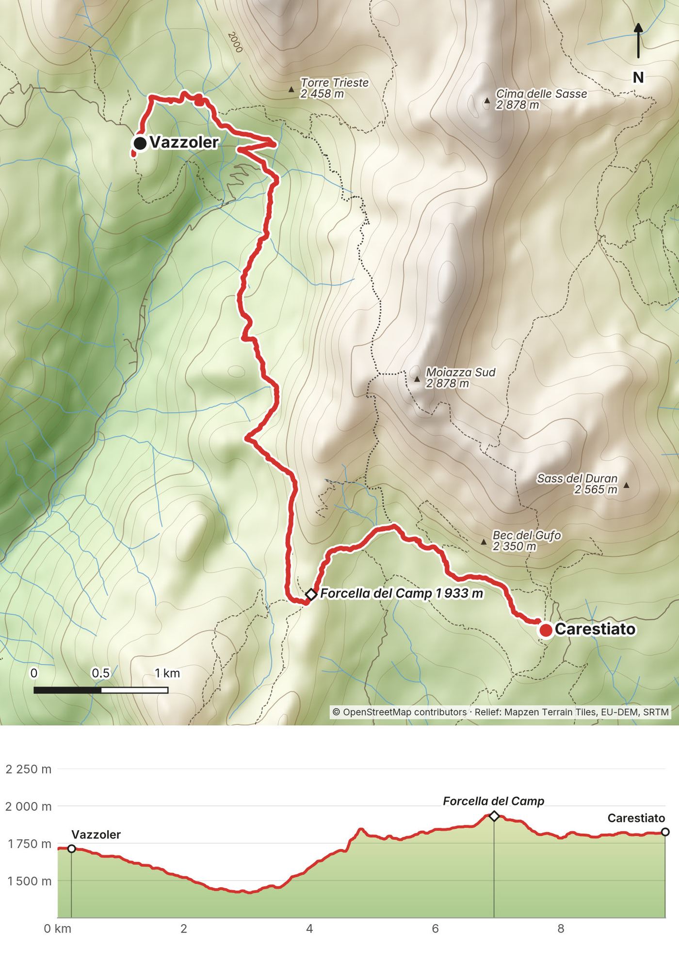
- 6.0 mi (9.6 km)
- Climbing
- 2,000 ft (610 m)
- Descent
- 1,656 ft (505 m)
- Time to allow
- 4 to 5 hours (I took 3 hours 36 minutes)
- Trails
- 555 access track, then 554 over Forcella del Camp to Carestiato
- Sleep
- Rifugio Carestiato, +39 0437 62949
- Food and water
- No hut on the way. Take lunch and water from Vazzoler.
- Hut notes
- A card holds the booking and you pay at check-in; bring cash in case the machine is down. Order a packed lunch for Day 6.
My day
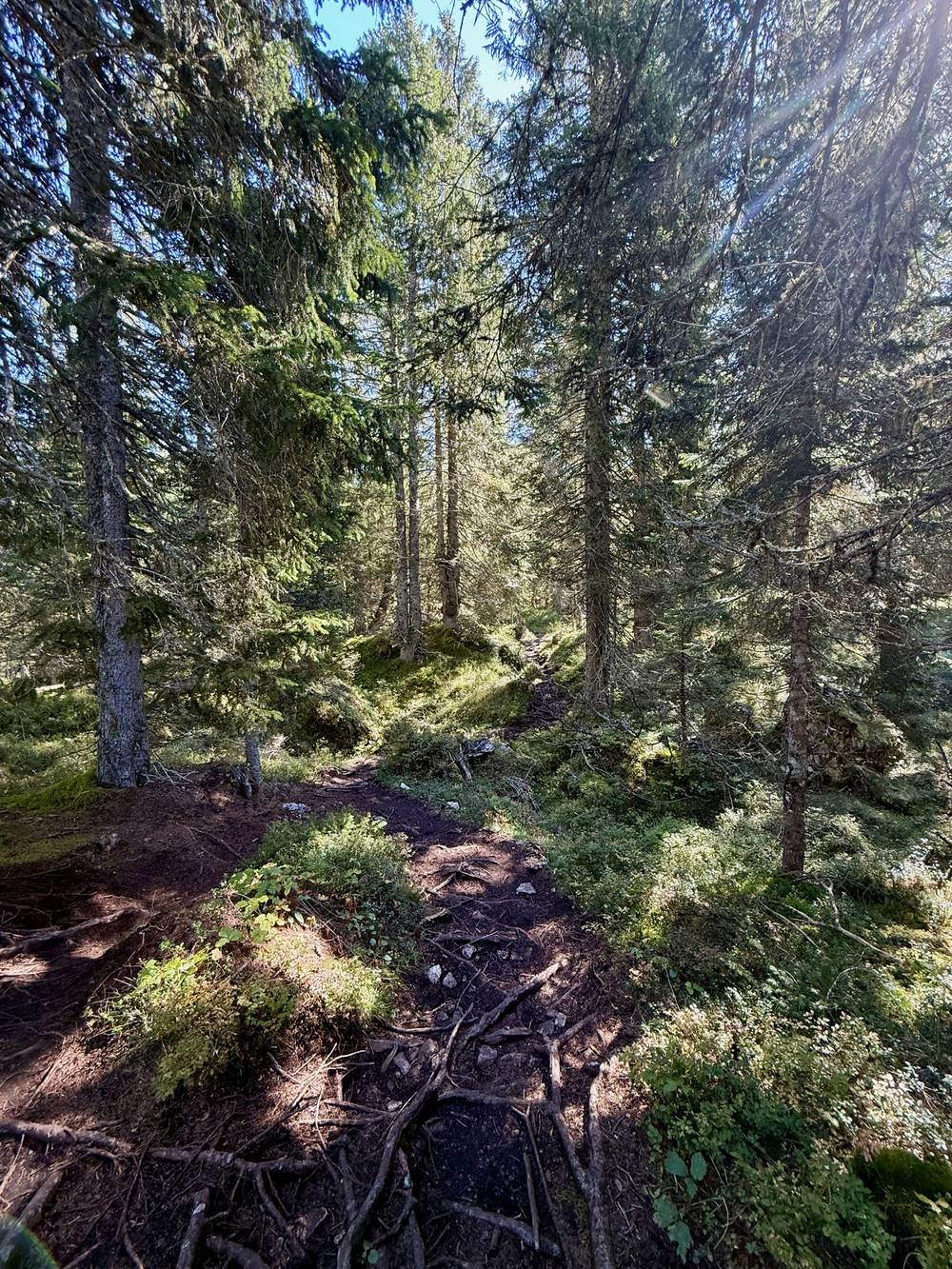
I killed as much time as I could before starting today's measly 6-mile hike. I knew going into this trip that this day might break me, having so little to hike and so little to do. It was mostly a relaxing walk through forest, and I crossed the day's pass with AirPods in.
I reached Rifugio Carestiato at lunchtime and had penne with red sauce, a salad and an early beer. The hut is lower and surrounded by pines, with enough cleared for a view out front. I spent the afternoon eating, drinking beer and watching the mountains while waiting for sunset.
The trail
Leave Vazzoler down the 555 access track, then turn onto 554 toward Forcella del Camp and Carestiato. It's short, but there's still scree, some traversing and a real climb. The Cortina tourist office gives about 4 hours.
At Carestiato, order a packed lunch for Day 6; I did, and I was glad. Use the afternoon to rest and decide whether tomorrow's long day is right for you.
If you need to get off
The Vazzoler access road leads down toward Capanna Trieste and Listolade. Carestiato is just above the road at Passo Duran.
Watch this day
Narrated film, Day 5 · Ambient film, Day 5
Day 6: Carestiato to Bianchet
- Distance
- 16.1 mi (26.0 km)
- Climbing
- 4,743 ft (1,446 m)
- Descent
- 6,641 ft (2,024 m)
- Time to allow
- 9 to 12 hours (I took 8 hours 28 minutes)
- Trails
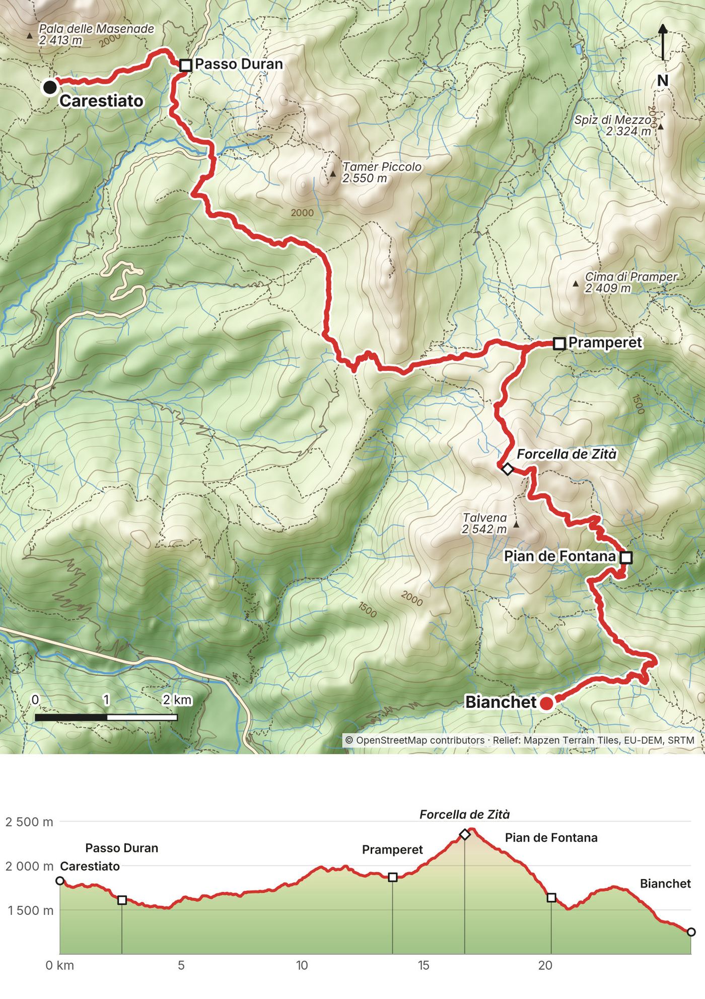
- 549 down to Passo Duran, a road walk, 543 to Pramperet, 514 over Van de Zità to Pian de Fontana, 518 down to Bianchet
- Sleep
- Rifugio Furio Bianchet, +39 0437 669226
- Food and water
- Pramperet (8.5 mi) and Pian de Fontana sell food and drinks. The trough outside Bianchet isn't drinking water.
- Hut notes
- €32 dorm bed (2026, non-member); ask for the price with meals. Pramperet and Pian de Fontana are the places to split the day.
My day
A silent, cloudless sunrise brought people out to the front fence, and having over 16 miles to hike put me in a great mood. I crushed the mile-long road walk at Passo Duran, and I barely saw anyone for hours. I'd bought a packed lunch at Carestiato, and a Coke and a sandwich slaps when you're this hungry. At Rifugio Pramperet I stopped for a second lunch: a pirate flag, strudel and a hut cat in the weeds.
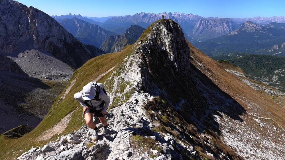
The climb to the last pass was by far the hottest part of the trip. The way down was super pleasant, with red flowers turning to green grass and then trees. I was ahead of schedule, so I stopped at Rifugio Pian de Fontana for a tall beer and, yes, pasta. I easily could have hiked out and caught an afternoon bus, but I had Bianchet booked. I kind of hate having reservations forcing me to stop for the day.
The trail
My longest day. Carestiato to Pramperet is about 8.5 miles (13.7 km), including the road walk from Passo Duran. Stay on the main Alta Via 1 line, not the Zoldana variant.
From Pramperet, trail 514 climbs over Van de Zità, the last big pass, at about 7,900 ft (2,410 m) on my GPS. It's rocky and steep, and the descent toward Pian de Fontana is steep and somewhat exposed. Snow can last into June. From Pian de Fontana, 514 goes on to Forcella La Varetta, then 518 drops to Bianchet. Don't carry on toward the Schiara; that's via ferrata.
The official times add up to about 12 hours before breaks (5 to Pramperet, 7 from Pramperet to Bianchet). It's also the most descent of any day. If this looks like too much, split it with a night at Pramperet or Pian de Fontana.
If you need to get off
Passo Duran, near the start, is the first road. From Rifugio Pramperet, trail 523 goes down Val Pramper to Forno di Zoldo in about 2 hours; ask the hut about a ride from the bottom. Past Pramperet, on 514, there's no quick way down, so decide there. Rifugio Pian de Fontana, after the pass, is a hut where you can stop.
Watch this day
Narrated film, Day 6 · Ambient film, Day 6
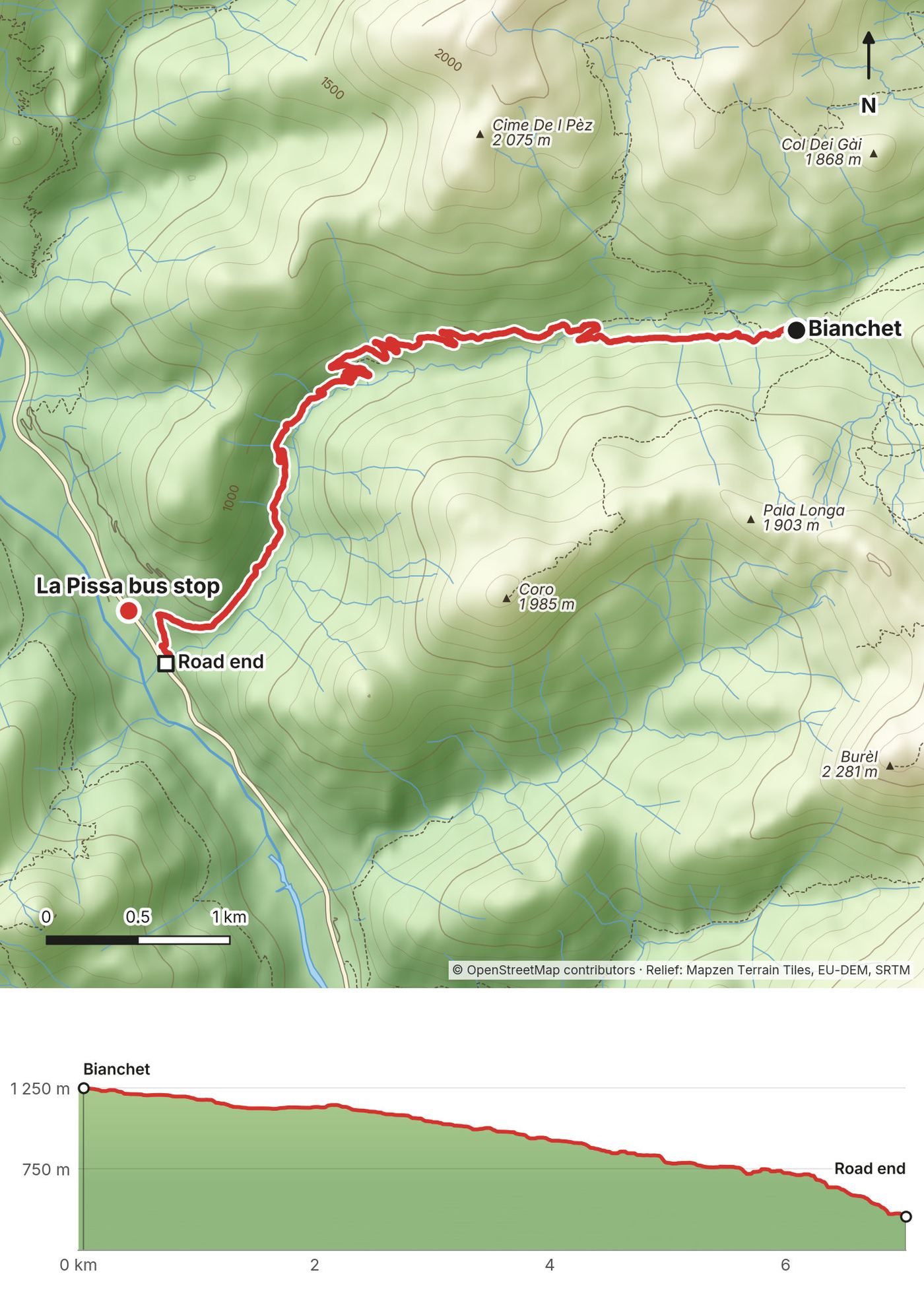
Day 7: Bianchet to La Pissa
- Distance
- 4.4 mi (7.0 km)
- Climbing
- 55 ft (17 m)
- Descent
- 2,602 ft (793 m)
- Time to allow
- about 2 hours plus the bus stop (I took 1 hour 21 minutes)
- Trails
- 503 down the Val Vescovà track, then a footpath to the road
- Sleep
- Home, or a hotel near Venice airport
- Food and water
- Eat breakfast and fill your water at Bianchet; there's nothing on the way.
- Hut notes
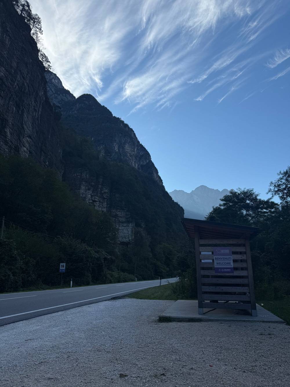
- No hut tonight. The La Pissa stop has a shelter on each side of the road; take the one for Belluno.
My day
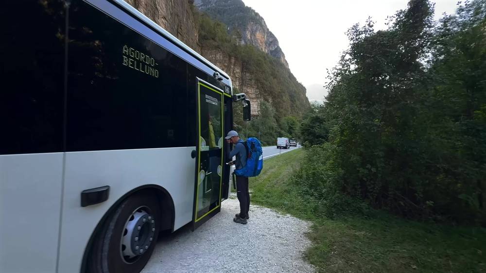
The owner of the hut had a little bus schedule posted on the wall, so my plan was to eat a super quick breakfast and hike down to catch the first bus to Belluno. The walk down was uneventful. I was happy to touch my final Alta Via 1 post and find the bus stop, a few minutes up the road at La Pissa, and I jumped on the number 1 bus to Belluno.
The trail
Trail 503 follows a gravel track down the Val Vescovà, then a footpath drops to the main road. It's all downhill. Trail 503 also continues into much harder terrain in the other direction, so make sure you're heading down the valley.
My GPS file ends where the trail meets the road. The La Pissa bus stop is about 350 m (0.2 miles) northwest, a few minutes' walk up the road. Know your bus and the one after it the night before. From September 10, line 1 doesn't run on Sundays. Times are in Getting home.
If you need to get off
The road is the exit. If you miss a bus, wait at La Pissa for the next one. Line 1 also stops at La Stanga, 2 minutes further toward Belluno, the name some older guides use for this finish.
Watch this day
Narrated film, Day 7 · How I got there and home · Ambient film, Day 7
Other ways to do it
I walked the 7-day plan, not these. The numbers come from splitting my GPS recordings at each hut.
The 10-day version I booked first
The plan with 9 hut nights that my booking service reworked in March 2024, before I postponed and later walked 7 days: the same trail, with extra nights at Biella, Nuvolau and Pramperet. I ate at all three but didn't sleep there.
| Day | Route | Miles (km) | Up / down (ft) |
|---|---|---|---|
| 1 | Lago di Braies to Biella | 4.5 (7.3) | 3,130 / 400 |
| 2 | Biella to Pederü | 4.9 (8.0) | 220 / 2,780 |
| 3 | Pederü to Lagazuoi | 12.4 (20.0) | 5,479 / 1,556 |
| 4 | Lagazuoi to Nuvolau | 5.7 (9.2) | 1,440 / 2,240 |
| 5 | Nuvolau to Città di Fiume | 8.8 (14.1) | 1,520 / 3,330 |
| 6 | Città di Fiume to Vazzoler | 12.5 (20.1) | 3,213 / 3,878 |
| 7 | Vazzoler to Carestiato | 6.0 (9.6) | 2,000 / 1,656 |
| 8 | Carestiato to Pramperet | 8.5 (13.7) | 2,130 / 2,010 |
| 9 | Pramperet to Bianchet | 7.6 (12.3) | 2,600 / 4,630 |
| 10 | Bianchet to La Pissa | 4.4 (7.0) | 55 / 2,602 |
It splits my two longest days but keeps one big one (Day 3, my Day 2). To even out the start, sleep at Fanes instead of Pederü. Nuvolau is small, with no showers or private rooms, and it and Pramperet close around September 20, so book them early.
A short trip: 4 or 5 days
Walk the northern half and finish at Passo Falzarego, on the road near Cortina.
| Day | Route | Miles (km) | Up / down (ft) |
|---|---|---|---|
| 1 | Lago di Braies to Biella | 4.5 (7.3) | 3,130 / 400 |
| 2 | Biella to Fanes | 9.0 (14.5) | 2,110 / 2,940 |
| 3 | Fanes to Lagazuoi | 8.4 (13.5) | 3,580 / 1,400 |
| 4 | Lagazuoi to Passo Falzarego | 2.8 (4.5) | about 0 / 2,060 |
On Day 4, walk down or ride the cable car, then take bus 52 to Cortina (times in Getting home). For a fifth day, sleep at Nuvolau (5.7 miles from Lagazuoi), then walk down 439 and 441 to Passo Falzarego (2.9 miles).
Getting home
What I did
I walked a few minutes up the road to the La Pissa bus stop and jumped on the number 1 bus, 30 minutes to Belluno. I grabbed a quick pizza and coffee at the Belluno station, then took the number 9 bus 30 minutes to Longarone, where I had a memorable beer at Bar Stazione. From there the Cortina Express ($16) took a little over an hour to Venice airport. I walked to a hotel near the airport ($200) and flew home the next morning. Don't book a flight for the day you finish.
Your options for 2027
La Pissa to Belluno. Dolomiti Bus line 1 takes 26 to 28 minutes to Belluno station. In summer 2026 (June 29 to September 9), buses left La Pissa for Belluno every day at 6:19, 9:42, 15:22 and 19:02, with more on weekdays and a 17:27 on Saturdays and holidays. The winter timetable (September 10, 2026 to June 8, 2027, revised from October 12) runs Monday to Saturday only, with no Sunday buses. It leaves La Pissa for Belluno at 6:02, 7:02, 7:57, 9:42, 11:22, 13:22, 13:45, 14:37, 15:37, 16:27, 17:27 and 18:37, plus 8:57, 10:32 and 17:24 on weekdays only and 12:47 on Saturdays only. Finishing on a September Sunday? Change your dates or ask Bianchet about a taxi. Timetables: dolomitibus.it.
Belluno to Longarone. Dolomiti Bus line 9, about 30 minutes. The train was replaced by buses for months in 2026 for works; check trenitalia.com.
Longarone to Venice airport. Cortina Express, about 1 hour 15 minutes. Until June 9, 2027, its Longarone stop is on the SP251 road, not at the train station. Coaches leave there daily at 8:45 (8:15 from October 1, 2026 to June 8, 2027), 10:30, 12:30, 15:45 and 17:30.
Passo Falzarego to Cortina (short trip). Dolomiti Bus line 52 takes about 35 minutes to the Cortina Scuole stop. From September 10 to October 4, 2026, it left the pass daily at 9:20, 11:20, 14:20, 16:20 and 18:20 (more buses in midsummer).
What I paid
| Item | What I paid |
|---|---|
| Flights, New York to Venice, round trip | just over $550 |
| FlixBus, Venice airport to Cortina | $16 |
| Hotel Pontechiesa, Cortina, 1 night | $150 |
| Huts through Hut to Hut Hiking Dolomites | quoted about €529 for beds and meals |
| Cortina Express to Venice airport | $16 |
| Hotel near Venice airport, 1 night | $200 |
| All buses, including the two above | about $40 to $60 |
| Two hut dinners, lunches, espresso, beer | extra |
| All in, approximately | about $1,550 plus trail food |
The total counts the €529 hut quote as about $600. The company waived its fee for a mention in my film, so a service would charge you more. My final 2025 hut total isn't on record.
Doing the huts yourself
| Night | Hut | 2026 price per person |
|---|---|---|
| 1 | Pederü | Ask for one night bed and breakfast; dinner extra |
| 2 | Lagazuoi | €121.50 (dorm, breakfast, dinner and tax) |
| 3 | Città di Fiume | €79.50 (half board and tax) |
| 4 | Vazzoler | about €60 to €80 half board (local range); cash only |
| 5 | Carestiato | about €60 to €80 half board (local range) |
| 6 | Bianchet | €32 dorm bed (non-member), plus meals |
The local range is the Belluno tourism office's 2026 figure for hut half board. My six nights come to roughly €450 to €650 (€75 to €110 a night) plus lunch and drinks, against about €200 a night for a service. CAI members pay less at CAI huts (Tissi, 2026: €60 half board, not €76).
The huts
How a hut night works. Rifugios have shared dorms, dinner and breakfast (mezza pensione, half board), drinks and lunch to buy, and bathrooms with running water, which isn't always drinking water. Most hikers start between 7:00 and 8:00, reach the next hut in the afternoon, relax outside, eat dinner together at a set time and go to bed early. Boots stay by the door, every hut I stayed at had slippers to borrow, and showers often cost extra.
Where I slept
Pederü Berggasthaus (night 1). +39 0474 834316, info@pederue.it, pederue.it. Half board needs three nights, so book bed and breakfast and pay for dinner. Cards accepted. I arrived just before sunset for my first beer and pasta.
Rifugio Lagazuoi (night 2). +39 0436 867303 or +39 340 7195306, info@rifugiolagazuoi.com, rifugiolagazuoi.com. Open June to October. 2026: €85 dorm bed and breakfast, €35 dinner, €1.50 tax; 50% non-refundable deposit. Shared bathrooms; hot showers extra. Check-in closes at 18:30. A special place to stay, and the breakfast was exceptional.
Rifugio Città di Fiume (night 3). +39 320 0377432, info@rifugiocittadifiume.it, rifugiocittadifiume.it. 2026: open June 13 to September 27; €78 half board plus €1.50 tax. Liner required, arrive by 17:30, tap water not drinkable, shared rooms only. Its site has conflicting cancellation terms, so get yours in writing.
Rifugio Vazzoler (night 4). +39 0437 1956619, rifugiovazzoler@gmail.com, rifugiovazzoler.com. 2026: open until September 26; 2027 bookings open November 1, 2026, at noon. Cash only. €30 per person non-refundable deposit; cancel within seven days and you can be charged the full half board. A hut dog, a top bunk in a four-person room, and a full house.
Rifugio Carestiato (night 5). +39 0437 62949, info@rifugiocarestiato.com, rifugiocarestiato.com. 2027 bookings open November 2, 2026, online only. A card holds the booking and you pay at check-in, so bring cash in case the machine is down. Penalties from 19 days before arrival. Pasta, salad and an early beer, with a view through the pines.
Rifugio Furio Bianchet (night 6). +39 0437 669226 or +39 335 6446975, rifugiobianchet@hotmail.com, CAI hut page. Open June to September. 2026: €32 dorm bed (non-member); ask for the price with meals. In 2025 the owner had the bus timetable on the wall. I took the top bunk by the window because I sleep hot.
Extra huts in the 10-day plan
Rifugio Biella. +39 335 1431251 (WhatsApp calls +39 349 2890550), info@rifugiobiella.com, rifugiobiella.it. 2026: €90 half board plus €1.50 tourist tax in cash; 50% non-refundable deposit. 2027 bookings open in November 2026, through its own site. My Day 1 soup and strudel stop.
Rifugio Nuvolau. +39 0436 867938 (answered in season), rifugionuvolau.it. 2026: beds June 20 to September 20; bookings opened in February. Tap water not drinkable, bottled for sale. No showers, no private rooms. My Day 3 lunch.
Rifugio Sommariva al Pramperet. +39 0437 1956153, rifugiosommarivaalpramperet.it. Listed as open June 20 to September 20. My Day 6 second lunch.
Other huts on the way
Rifugio Fanes (Day 2). +39 0474 453001, info@rifugiofanes.com, rifugiofanes.com. A backup if Pederü or Lagazuoi is full.
Rifugio Coldai (Day 4). +39 0437 482879, infocoldai@gmail.com, rifugiocoldai.com. Mid-June to the end of September; no 2027 booking date posted as of October 11, 2026. Espresso, strudel and a water refill.
Rifugio Pian de Fontana (Day 6). +39 0437 1956135 or +39 335 6096819. A tall beer and pasta after Van de Zità.
Gear for this route
Packing list for a hut trip
- Sleeping-bag liner (required at Città di Fiume; no sleeping bag needed)
- Hut slippers or light shoes, and earplugs
- Rain jacket and pants, warm layer, hat and gloves, sun hat, sunglasses, sunscreen
- Water bottles or a bladder, a filter or tablets, and snacks
- Headlamp, phone, power bank and a European plug adapter
- First-aid and blister kit, medications, toiletries, small towel, trash bag
- Euros in cash, a card, your passport, and confirmations saved offline
Paid links: I earn a commission if you buy through these links, at no extra cost to you. As an Amazon Associate I earn from qualifying purchases.
No tent, stove or sleeping bag on this route: every night is in a hut. Here's what I carried in 2025, what I'd add now, and the camera gear behind the film.
What I carried in 2025
- Pack: Hyperlite Mountain Gear Waypoint 35 (Hyperlite). 35 liters was plenty with a hut every night.
- Shoes: Oboz Katabatic LT Low GTX (Amazon). They were flawless, with zero blisters or grip issues over the entire 75 miles. Oboz sponsored my film of this trip.
- Sun shirt: PATH Projects Pyrenees T19 Hoodie (PATH Projects). The climb to the last pass on Day 6 was by far the hottest part of the trip.
- Fleece: Senchi Designs A90 Half Zip Hoodie. Great to have on the trail, and so cozy. Similar: PATH Projects Lomond Hoodie (PATH Projects).
- Puffy: Arc’teryx Cerium Hoody (Arc’teryx). For evenings outside the huts.
- Rain shell: Arc’teryx Beta AR Jacket (Arc’teryx). Day 2 ended in fog at Lagazuoi, and Day 3 started with rain.
- Shorts: Territory Run Co. Long Haul Short. I wore the same pair the entire hike. Similar: PATH Projects Sykes PX Short (PATH Projects).
- Socks: PATH Projects Joyner Crew Sock (PATH Projects). The same pair the entire hike, too.
- Headlamp: Nitecore NU20 Classic (Amazon)
- Power bank: Nitecore NB20000 (Amazon). Kept my phone and camera going between huts.
- Water: a filter water bladder. I filled it at Rifugio Coldai on Day 4.
What I'd add now
- Sleeping-bag liner: Naturehike ZY20 Sleeping Bag Liner (Amazon). Required at Città di Fiume, and most huts ask for one. Mine is 4.5 ounces and goes in the wash.
- Hut shoes: Crocs Classic Clog (Amazon). Every hut had slippers to borrow, but I regretted not bringing my own.
- Water filter: Katadyn BeFree AC · 1L (Amazon). Tap water isn't drinkable at Città di Fiume or Nuvolau. This is the filter I carry now.
- Navigation: AllTrails+ (AllTrails, 30% off). I loaded my own route for each day and downloaded it offline. Offline maps need the paid plan.
- Phone data: Airalo eSIM (Airalo, $3 off). Mobile data in Italy without a SIM swap. Expect little or no signal between huts.
Filming kit
What I filmed this trip with in 2025. My setup is smaller now (below). Check the drone rules in Straight answers before you fly: drones are banned in parts of this route.
- Camera: Sony ZV-E1 (Amazon)
- Lens: Sony FE PZ 16-35mm f/4 G (Amazon). That white mark in some shots is light hitting a ding on my lens from a fall in Pakistan.
- Drone: DJI Air 3 (Amazon), now the Air 3S. I used its 70 mm telephoto camera to compress the mountains behind a subject.
- Tripod: SmallRig Carbon Fiber Tripod (Amazon). For the walk-past shots: set it up, walk back, walk past, then go back for it.
- Tripod head: Joby BallHead 3K (now the 3K PRO) (Amazon). I swap the SmallRig's head for this one.
- Wrist strap: Peak Design Cuff Wrist Strap (Amazon)
What I film with now
Since September 2026 I film with a smaller setup: the Pocket 4 and the Mic 3 on the trail, and the Mini 5 Pro in the air.
- Camera: DJI Osmo Pocket 4 (Amazon)
- Mic: DJI Mic 3 · 1 TX + 1 RX (Amazon). It pairs with the Pocket 4.
- Drone: DJI Mini 5 Pro (Amazon)
Weather and safety
Storms. Afternoon thunderstorms are common in the Dolomites in summer. Start early, between 7:00 and 8:00, so you're over the high passes before storms build, and don't be on Nuvolau, Forcella del Lago or Van de Zità when thunder starts. A paid booking is never a reason to keep going. Call the next hut and change the plan.
Forecasts. Check each evening, and ask the hut staff about the passes ahead. Days 1 and 2 (Braies to Fanes): the South Tyrol forecast at meteo.provincia.bz.it. From Lagazuoi south: ARPAV Veneto and its Dolomiti mountain bulletin at meteo.arpa.veneto.it.
Emergencies. Plan on little or no phone signal between huts. 112 works anywhere in Italy. 118 reaches emergency medical and mountain rescue dispatch in the Veneto, which covers most of the route from Forcella del Lago south (CNSAS Veneto). Say where you are, what happened, how many people are hurt, and give a callback number. Install the 112 Where ARE U app, which can send your exact position when you call. Get travel insurance that covers mountain rescue and helicopter evacuation in Italy. If you have no signal, move higher or send someone to the next hut.
The steep and exposed places
None of my route needs via ferrata gear, but these spots need care:
- Forcella del Lago descent (Day 2): steep scree and a long rock and timber staircase.
- Nuvolau (Day 3): a rocky climb to an exposed summit hut. Use 439 both ways; 438 is via ferrata.
- The climb to Coldai (Day 4): very steep, on a good trail.
- Van de Zità and the descent to Pian de Fontana (Day 6): rocky, steep, somewhat exposed, and possibly snowy into June.
Going solo. Tell the huts if your plans change, and leave your itinerary with someone at home.
Using the GPX files
My own GPS recordings from September 2025, including the side trips to Nuvolau and Tissi.
| File | What it is |
|---|---|
| alta-via-1-day-1.gpx to day-7.gpx | One file per day |
| alta-via-1-full-route.gpx | All seven days, with waypoints for my huts, the start, Forcella del Lago, Passo Falzarego, Nuvolau and the La Pissa bus stop |
Load one day at a time. Day 7 ends where the trail meets the road, a few minutes from the La Pissa stop.
AllTrails. On a computer, sign in at alltrails.com, create a new map and use Import. It then shows up in the app on your phone. Offline use needs a paid plan. This is how I did it: a custom route for each day, downloaded offline.
Gaia GPS. Open the file from Files, email or AirDrop and choose Gaia GPS, or use Import on gaiagps.com. Download the map area offline.
Garmin. In Garmin Connect on the web, go to Training, Courses, Import. Save it as a course and send it to your watch.
Organic Maps (free). Download the offline maps for Trentino-Alto Adige and Veneto, then open the GPX file and choose Organic Maps. It works fully offline.
Before you leave, download offline maps for the whole route, turn on airplane mode, and check that each day and your location show up. On Day 1 a pair of hikers asked me if we were on the Alta Via 1, which means they didn't have a map downloaded. That seems wild.
If you use someone else's Alta Via 1 track, check the ending: some finish over the Schiara on via ferrata. The figures in this guide come from these files.
Before you go, check these
These change every year. Everything else in this guide stays the same.
Huts
- When each hut opens bookings (Vazzoler, Carestiato and Biella open 2027 bookings in November 2026; Coldai hadn't posted a date as of October 11, 2026)
- Opening and closing dates, especially after mid-September
- Your confirmations: price, meals, deposit, cancellation terms, latest arrival
- Which huts take cards and which are cash only
Buses
- Whether the lake buses (including 442 from Dobbiaco) must be booked online for your date at prags.bz (2027 details due in spring 2027)
- FlixBus and Cortina Express from Venice airport, and buses 445 and 442 to the lake
- Line 1 from La Pissa on your finishing day (no Sundays from September 10 in the 2026 to 2027 timetable)
- The Cortina Express stop at Longarone (on the SP251 road until June 9, 2027)
- Line 52 from Passo Falzarego to Cortina, if you do the short trip
Prices, conditions and your stuff
- Hut prices (this guide uses 2026 prices) and the Lagazuoi cable car dates
- The forecast each evening, snow on the passes in June, and drone rules if you're bringing one
- Offline files on your phone, travel insurance with mountain rescue, and euros in cash
One-page trip sheet
| Day | mi (km) | Sleep | Phone (+39) | Notes |
|---|---|---|---|---|
| 1 | 9.5 (15.3) | Pederü | 0474 834316 | B&B; dinner extra |
| 2 | 12.4 (20.0) | Lagazuoi | 0436 867303 | Check in by 18:30 |
| 3 | 14.5 (23.3) | Città di Fiume | 320 0377432 | Liner; arrive by 17:30 |
| 4 | 12.5 (20.1) | Vazzoler | 0437 1956619 | Cash only |
| 5 | 6.0 (9.6) | Carestiato | 0437 62949 | Order Day 6 lunch |
| 6 | 16.1 (26.0) | Bianchet | 0437 669226 | Ask about meals |
| 7 | 4.4 (7.0) | Home | Line 1 at La Pissa | |
| Total | 75.4 (121.3) | About 21,800 ft up |
Getting there
- Venice airport to Cortina: FlixBus or Cortina Express, about 2 to 2.5 hours (or Cortina Express 14:20 straight to Dobbiaco).
- Cortina (Scuole stop) to Dobbiaco: bus 445, 45 minutes. 2026: daily from 8:05.
- Dobbiaco bus station to Lago di Braies: bus 442, 28 minutes, from 6:01 weekdays, 7:01 daily. Book online July 1 to September 15 (2026 rule).
Getting home
- La Pissa to Belluno: line 1, 26 to 28 minutes. Summer 2026 daily at 6:19, 9:42, 15:22, 19:02. From September 10, Monday to Saturday only, from 6:02.
- Belluno to Longarone: bus 9, 30 minutes (the train only if it's running).
- Longarone (SP251 stop) to Venice airport: Cortina Express, 1 hour 15 minutes, at 8:45 (8:15 from October 1 to June 8), 10:30, 12:30, 15:45, 17:30.
Emergency: 112 anywhere, 118 for medical and mountain rescue in the Veneto.
About this guide
Alta Via 1 Hiking Guide: 7 days hut to hut through the Dolomites, by Kraig Adams. 2027 season edition, updated October 2026.
I hiked the Alta Via 1 alone from September 14 to 20, 2025, and made two films about it: Hiking 75 miles Alone on the Alta Via 1 Dolomites and the ambient footage version. Everything in first person comes from that trip. Hut, bus and park facts were checked in September 2026 and again on October 11, 2026, and anything that changes yearly is dated.
Updates and contact. If something has changed on the trail, or you spot a mistake, email me at kraig@kraigadams.com.
Paid links. The gear links in this guide are paid links: I earn a commission if you buy through them, at no extra cost to you. I booked my huts through Hut to Hut Hiking Dolomites, which waived its planning fee in exchange for a mention in my film.
Safety. Mountain hiking has real risks. This guide describes my trip and what I found, not current trail conditions. Trails, signs, huts, prices and timetables change. Check the weather, follow the signs and the advice of hut staff, and turn back when conditions aren't right. You're responsible for your own safety.
Copyright. © 2026 Kraig Adams. This guide, its photos and the GPX files are for your personal use. Please don't share or resell them.
Credits. Photos are mine, from my phone and my films. GPX files are my own recordings. Maps © OpenStreetMap contributors, openstreetmap.org/copyright (ODbL). Relief: Mapzen Terrain Tiles / EU-DEM, produced using Copernicus data funded by the EU; USGS SRTM/GMTED.
The details
- Format
- A 59-page PDF sized for a phone (A5, prints fine too) and a folder of GPX files, in one zip download.
- Edition
- 2027 season edition, updated October 2026.
- Questions
- Email kraig@kraigadams.com.
Questions
- How many days does the Alta Via 1 take?
- I did it in 7 days with 6 nights in huts, about 75 miles. If you haven't done back-to-back mountain days with a pack, plan on 9 or 10 days.
- When is the best time to hike the Alta Via 1?
- July to September. The huts open mid to late June and most close between about September 20 and 27. August is the busiest month, and I went September 14 to 20 when the south end was quiet.
- Where do you sleep on the Alta Via 1?
- In huts, every night. Wild camping is prohibited in the Dolomiti Bellunesi National Park and restricted in the other protected areas, so you don't need a tent. Book months ahead; some huts open next year's bookings in October or November.
- How do you get to the start of the Alta Via 1?
- Fly into Venice and take a bus to Cortina d'Ampezzo, about 2 hours. From Cortina, bus 445 goes to Dobbiaco and bus 442 to Lago di Braies. Arrive the day before you start.
- How do you get back from the end of the Alta Via 1?
- From the La Pissa bus stop, Dolomiti Bus line 1 goes to Belluno in about 26 minutes, line 9 or the train goes on to Longarone, and Cortina Express runs from Longarone to Venice airport.
Timeline · newest first
Published · September 25, 2026
Wrote the guide
The day-by-day guide to the route, made from my film, my GPS recording and my notes.
Published · January 24, 2026 · YouTube · 180,001 views
Published the film: Hiking 75 miles Alone on the Alta Via 1 Dolomites (Ambient Footage)
Published · January 20, 2026 · YouTube · 196,831 views
Published the film: Hiking 75 miles Alone on the Alta Via 1 Dolomites
On the trail · September 14, 2025
Day 7: Bianchet to La Pissa
The day in the guide: Day 7: Bianchet to La Pissa.
On the trail · September 14, 2025
Day 6: Carestiato to Bianchet
The day in the guide: Day 6: Carestiato to Bianchet.
On the trail · September 14, 2025
Day 5: Vazzoler to Carestiato
The day in the guide: Day 5: Vazzoler to Carestiato.
On the trail · September 14, 2025
Day 4: Città di Fiume to Vazzoler
The day in the guide: Day 4: Città di Fiume to Vazzoler.
On the trail · September 14, 2025
Day 3: Lagazuoi to Città di Fiume
The day in the guide: Day 3: Lagazuoi to Città di Fiume.
On the trail · September 14, 2025
Day 2: Pederü to Lagazuoi
The day in the guide: Day 2: Pederü to Lagazuoi.
On the trail · September 14, 2025
Day 1: Lago di Braies to Pederü
The day in the guide: Day 1: Lago di Braies to Pederü.
On the trail · September 14, 2025
The trip: Alta Via 1
Dolomites, Italy · 7 days · 75 miles