
Trip · Dolomites, Italy · July 2021
Alta Via 2
- Hiking
- Video
- Guide
- Photos
I went alone, in July 2021. 5 days, roughly 50 miles. My film of it is below, and my free guide to the route, day by day, is in Details.
Highlights
Milestone · August 7, 2021
Alta Via 2 - Hiking 5 Days Alone in the Dolomites, Italy

My film of the trip, published August 2021.
Milestone · September 26, 2026
The free guide
5 days hut to hut through the Dolomites. In July 2021 I spent five days hiking alone on the Alta Via 2 in the Dolomites, from La Villa in Alta Badia past the Sella group and the Marmolada to Passo Valles. This guide covers that section, not the whole route: day-by-day stats and maps, the huts, the buses in and out, and how to extend it to the full Alta Via 2. The route and GPX files are traced from OpenStreetMap, not my GPS recording. Every page is free to read in Details below, with the PDF and GPX download.
Story
Photos
Photos from the trip.
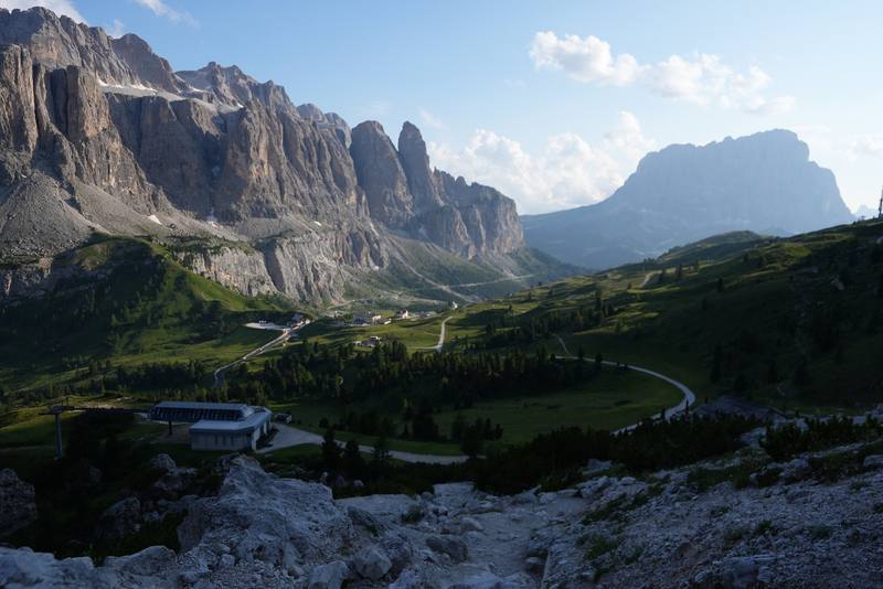
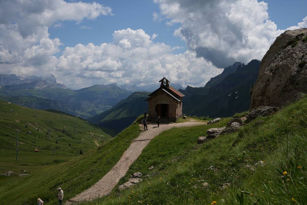
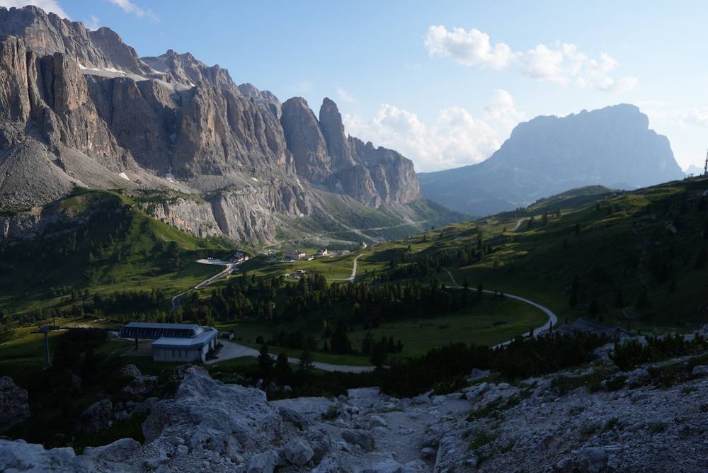
The Sella group from the Cir ridge at the end of Day 1. 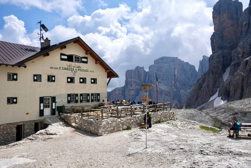
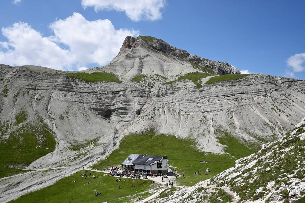
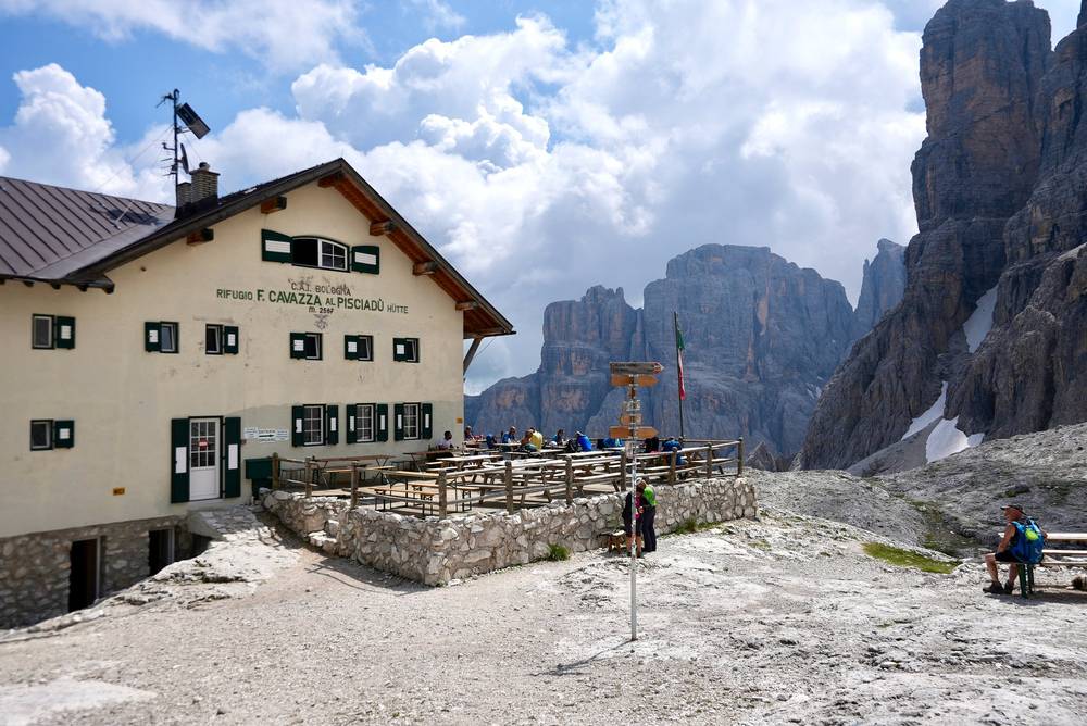
Rifugio Pisciadù, where I stopped for lunch on Day 2. 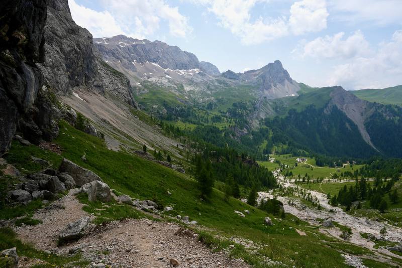
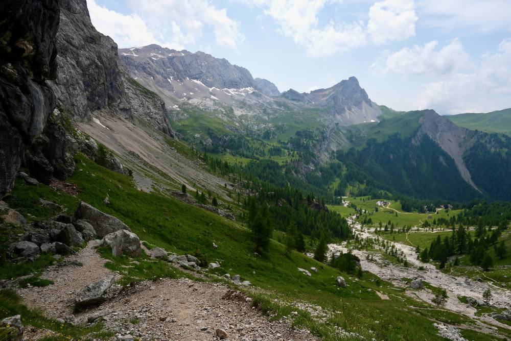
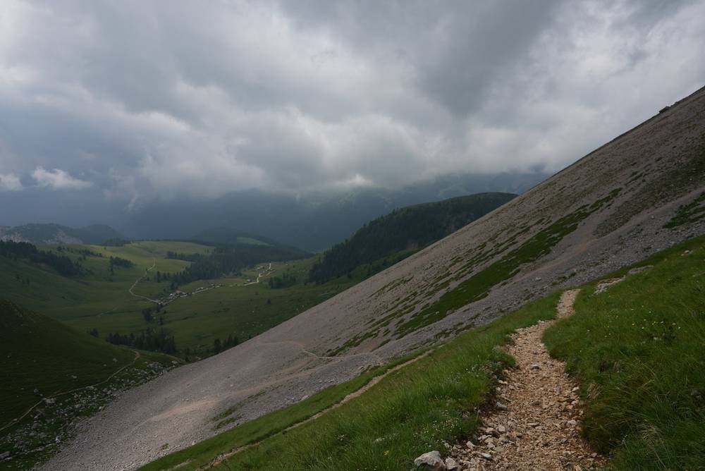
Val Contrin on the way down from Passo Ombretta to Rifugio Contrin. 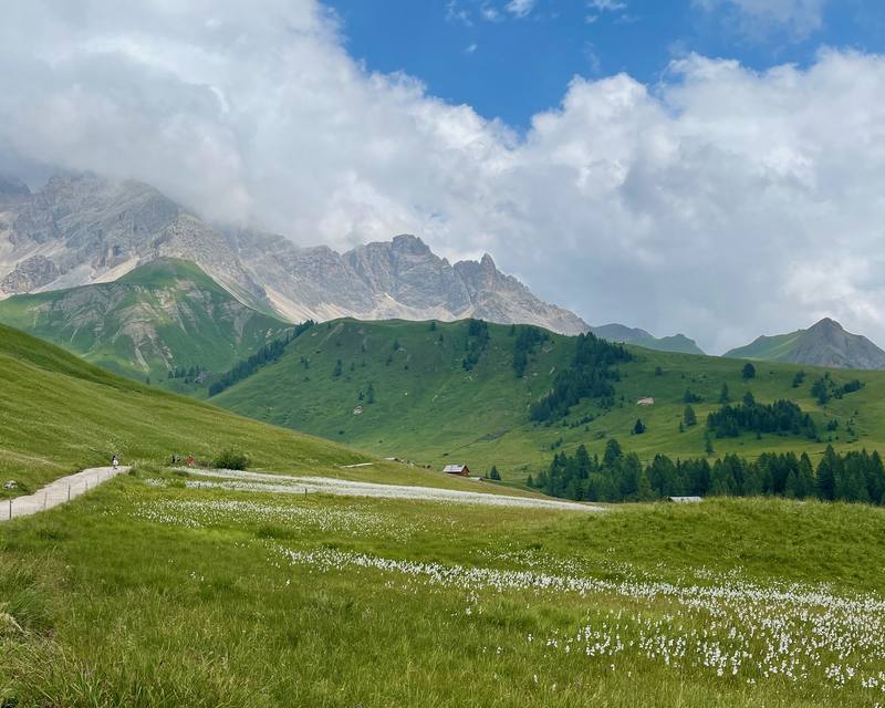
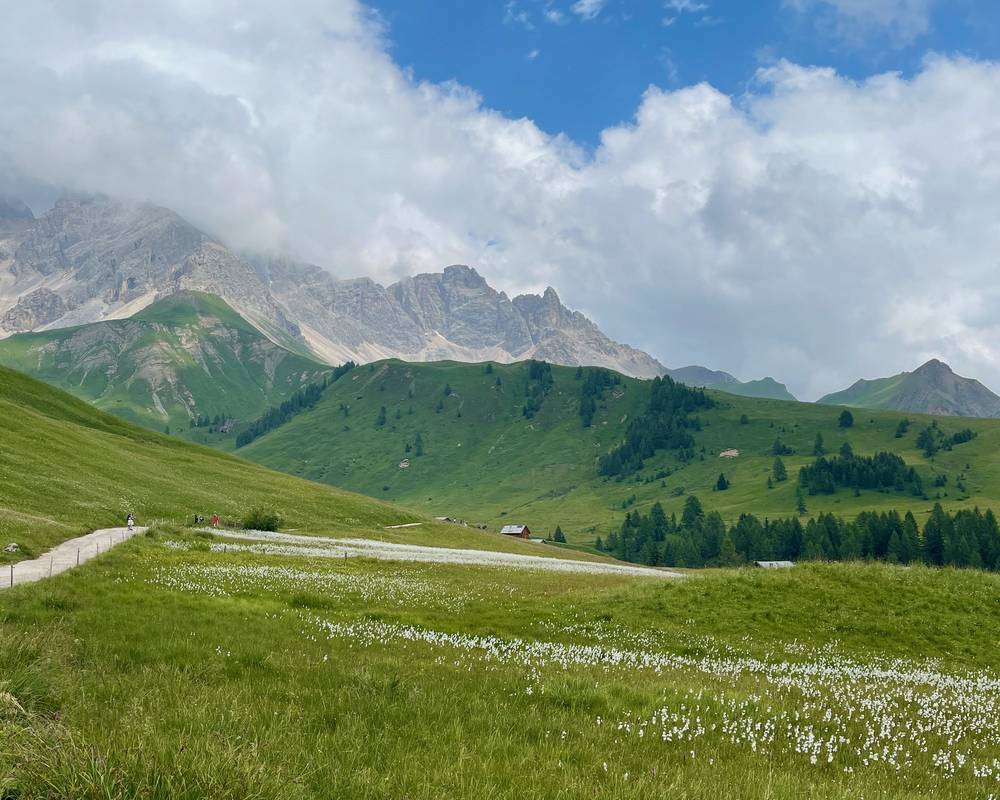
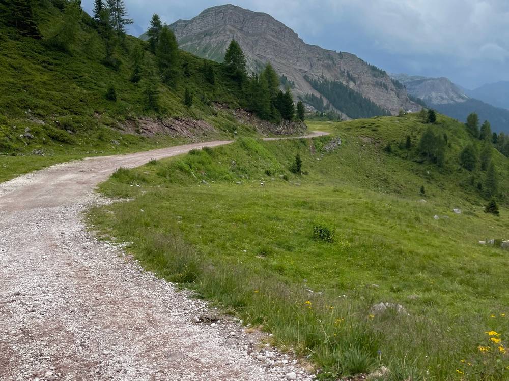
The meadows between Rifugio Fuciade and Passo San Pellegrino.
Newsletter
Get my letter
Get a short letter from me every couple of weeks: new trips, guides and what I'm building.
Free. Unsubscribe any time.
Details
The guide · Free · 60-page PDF + GPX files · 2027 season edition
Alta Via 2 Hiking Guide
5 days hut to hut through the Dolomites. Every page is below: read it here, or take it offline as a PDF with my GPX files (60-page PDF + GPX files, in one zip). No sign-up needed.
The route
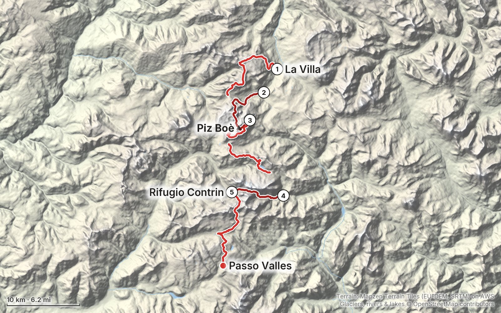
My GPS recording of 5 days on a relief map. The numbers are where each day starts; the red dot is the finish. The day maps are in the guide below, and the GPX files are a free download.
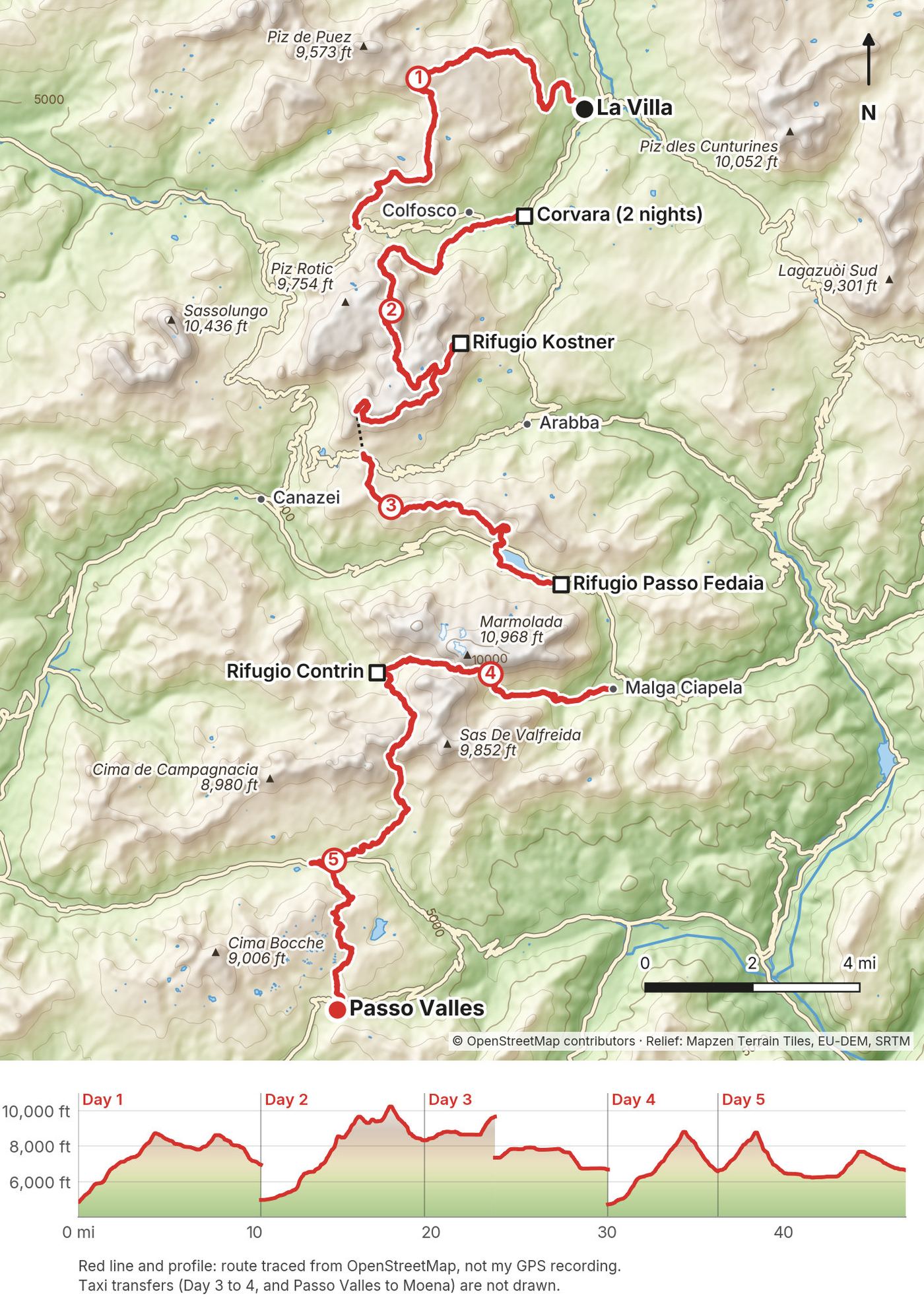
Elevation, start to finish: highest 10,330 ft (3,148 m), lowest 4,730 ft (1,442 m).
At a glance
- Days
- 5 days
- Distance
- about 47 miles
- Climbing
- About 22,000 ft (6,700 m) up
- Season
- July to mid-September
- Route
- La Villa and Corvara to Passo Valles
Contents
- Welcome
- At a glance
- Straight answers
- When to go
- Booking the huts
- Getting there
- Day 1 La Villa to Passo Gardena
- Day 2 Corvara to Rifugio Kostner
- Day 3 Rifugio Kostner to Passo Fedaia
- Day 4 Malga Ciapela to Rifugio Contrin
- Day 5 Rifugio Contrin to Passo Valles
- Other ways to do it
- Getting home
- What I paid
- The huts
- Gear for this route
- Weather and safety
- Using the GPX files
- Before you go, check these
- One-page trip sheet
- About this guide
Welcome
I spent five days hiking roughly 50 miles alone on the Alta Via 2 in the Italian Dolomites in late July 2021. I walked from Alta Badia past the Sella group and the Marmolada glacier to Passo San Pellegrino and on to Passo Valles, and slept in huts and hotels along the way. The days were full of alpine passes, minestrone soup lunches, limestone peaks, quiet valleys, espressos, grassy hillsides and lots of pasta.
This guide covers the section I walked, not the whole Alta Via 2. The official route runs from Bressanone (Brixen) to Feltre in 13 stages, about 112 miles (180 km). My five days are roughly the middle of it. If you're planning the full route, this guide still covers some of its best-known days, and I say where my line left the official one.
It was also the first hiking trip where I paid a company to book my huts, give me the itinerary and arrange taxis. Going forward, I'm planning my hikes myself. So this guide gives you what I did, and then what I'd do instead.
What's inside
- Straight answers to the questions people ask about this hike
- When to go, how to book the huts, and a booking email in English and Italian
- How I got from Venice to the trail and back out, and the options for 2027
- All five days: my notes, the trail, where to bail out, a map and elevation profile, and links to that day in my film
- Other ways to do it, including how to extend it to the full Alta Via 2
- Getting home from Passo Valles and San Pellegrino
- What I paid, the huts, the gear for this route (what I carried and filmed with), weather and safety
- One page of things to check before you go, and a printable trip sheet
About the route files. My original GPS recordings from this trip aren't available anymore. The GPX files and maps in this guide are a route traced from OpenStreetMap along the trails I used, placed with the locations of my photos and what I said in my film. It's close to what I walked, but it isn't my recording, and I say so wherever it matters.
How to use it offline. Save this PDF to your phone's Files or Books app before you leave home. Load the GPX files and download offline maps while you still have Wi-Fi. Each day starts on a new page. The film links need a connection; everything else works in airplane mode.
When I say "I," it's my own trip in 2021. Prices, bus times and hut dates change every year, so they're dated, and the checks are collected on one page: Before you go, check these.
At a glance
| Quick facts | |
|---|---|
| Section | The middle of the Alta Via 2, not the full route (Bressanone to Feltre) |
| Distance | about 47 miles (75.5 km) of walking, by the route trace. My film says roughly 50 miles |
| Climbing | about 22,000 ft (6,700 m) up, 14,000 ft (4,250 m) down, by the route trace |
| Days | 5 hiking days |
| Start | La Villa and Corvara, Alta Badia (South Tyrol) |
| Finish | Passo Valles, above Moena and Falcade (Trentino) |
| High point | Piz Boè, 10,341 ft (3,152 m) |
| Nights | Corvara hotel (2), Rifugio Kostner, Rifugio Passo Fedaia, Rifugio Contrin, then a hotel in Moena |
| Best months | July to mid-September |
| Difficulty | Pretty easy and not very challenging, in my words, but I hike for a living. Short cabled sections, one 10,000 ft summit and loose scree on two passes |
| Nearest airports | Venice Marco Polo (VCE); Innsbruck and Munich to the north |
| Trip date | July 21 to 25, 2021, solo |
| Day | Route | Miles (km) | Up / down (ft) | Sleep |
|---|---|---|---|---|
| 1 | La Villa to Passo Gardena | 10.3 (16.6) | 4,830 / 2,716 | Hotel in Corvara |
| 2 | Corvara to Rifugio Kostner | 9.3 (14.9) | 5,957 / 2,605 | Rifugio Kostner |
| 3 | Kostner to Passo Fedaia | 10.4 (16.7) | 3,380 / 2,710 | Rifugio Passo Fedaia |
| 4 | Malga Ciapela to Contrin | 6.2 (10.0) | 4,118 / 2,232 | Rifugio Contrin |
| 5 | Contrin to Passo Valles | 10.7 (17.2) | 3,750 / 3,690 | Hotel in Moena |
These figures come from the route trace, not a recording, so treat them as close, not exact. Day 3 leaves out the Sass Pordoi cable car, which I rode down. Day 4 starts after a taxi from Passo Fedaia down to Malga Ciapela. The climbing is bigger than the descent because I started low in Alta Badia and finished high on a pass.
Straight answers
Is this the whole Alta Via 2? No. The official Alta Via 2 runs from Bressanone to Feltre, about 112 miles (180 km). I asked an agency for an Alta Via 2 hike and they gave me a 50-mile section that didn't start at the official start. You could call it hiking half of the Alta Via 2. My section starts in Alta Badia and ends at Passo Valles, just before the route goes into the Pale di San Martino.
How do I extend it to the full Alta Via 2? Add the north end before Day 1 and the south end after Day 5. The official route has 13 stages (dolomiti.it). North: Bressanone (Brixen), on the Brenner railway, to Rifugio Città di Bressanone on the Plose, then Rifugio Genova, then Utia de Puez, where my Day 1 joins the line. That's three stages, about 35 miles (57 km). South: Passo San Pellegrino to Rifugio Volpi al Mulaz (Passo Valles is on this stage), then Rosetta, Treviso, Passo Cereda, Rifugio Boz, Rifugio Dal Piaz and down to Feltre, which has a train station. That's seven stages, about 58 miles (94 km). The south is harder than my section: it reaches the route's high point at Passo delle Farangole (9,619 ft, 2,932 m) and has equipped stretches and scrambling for experienced hikers. The table is in The full Alta Via 2.
How many days do I need? I did my section in 5 days. The agency first wanted to make those 50 miles a 7 or 8 day trip, and even after I asked for harder days it was still quite easy for me. I like to walk at least 20 miles a day when the terrain allows. If you haven't done back-to-back mountain days, plan 6 or 7 days for this section. The full route is 13 official stages.
Is it hard? For me it was pretty easy and not very challenging. But I hike for a living. The hard parts are the altitude and the steep bits: Val Setus has a cable-protected section, Piz Boè is over 10,000 ft (3,152 m), the way down to Kostner has a steep stretch with a metal rope, and Passo Ombretta and Passo delle Cirelle are loose, sandy zigzags. Try this at home: hike 10 miles with 5,000 ft of climbing, then do it again the next day with the pack you'll carry. If that feels fine, you're ready.
Do I need via ferrata gear? Not for my line. One Alta Via 2 variant crosses Forcella della Marmolada, over the glacier and down a via ferrata. I skipped it and went around by Malga Ciapela and Passo Ombretta instead. It was icy up there, and I probably would have needed more gear. Val Setus and the way down to Kostner have fixed cables on steep hiking trails. If steep, exposed ground makes you nervous, look at photos of Val Setus before you commit.
Did I use a company? Yes. Dolomite Mountains, a local agency in Alta Badia, booked my huts and hotels, gave me the route and booked taxis. They knew the area better than me, but they gave me easy days and taxis I didn't need. Next time I'll take an extra hour or two and plan everything myself. See Booking the huts.
Can I camp? Not on the high route. There's no wild camping, and I booked only huts and hotels. There are campsites in the valleys, and I didn't realize how many until I was there. Carrying a tent and dropping to a campsite some nights would have been fun. The park rules are in Weather and safety.
What will it cost? It was very expensive, probably the most expensive hike I've ever done. My Tour du Mont Blanc cost way less because I slept in my tent. The price of my agency package isn't in my records. Booking the huts yourself at 2026 prices, plan on roughly €70 to €100 a night with half board, plus lunches, drinks, the €18 Sass Pordoi cable car and your buses. See What I paid.
What about food? The huts give you breakfast and dinner with half board, and you don't pick what you eat. Lunch was always a blast because I could pick: pasta, strudel, minestrone, beer, espresso. I had strudel three or four times on this trip.
Cash or card? Bring euros. In 2021 some huts took cards, but more than half were cash only, especially the remote ones with no road.
Is there phone signal? Patchy. On Day 3 the hut where I stopped by Lago di Fedaia was the first Wi-Fi I'd had all day. Kostner had no Wi-Fi in 2026.
Is it crowded? Parts are packed. Sass Pordoi and the Viel dal Pan ridge had crowds, cyclists and families, and Fuciade was very busy, because roads and lifts reach them. Other parts, like the climb to Passo delle Cirelle, were very isolated. I saw maybe three or four people.
Can I fly a drone? Not everywhere. Drones are regulated in Italy and restricted in the nature parks this route crosses. See Weather and safety.
When to go
The huts on this section are open from about mid-June to mid or late September. In 2026 most of them opened between June 10 and June 20 and closed between September 20 and early October: Pisciadù from June 20 to the end of September, Boè from June 20 to September 27, Kostner from June 13 to October 4, Falier guaranteed from June 20 to September 20. The lifts in Alta Badia ran from June 13 to late September or early October.
I first wanted to start in late June 2021. I asked Dolomite Treks, a local company, about it. They told me late June was too early that year, with a risk of a lot of snow still on the high paths. I went in late July. Even then I hit snow and hail near the highest point of the hike on Day 2.
July has long days, flowers in the meadows and afternoon thunderstorms. I got a hailstorm on Day 2 and more hail at the end of Day 5.
August is the peak of the Italian summer holidays. The places you can reach by road or lift, like Passo Pordoi, Viel dal Pan and Fuciade, get very busy.
September is quieter, but huts start closing in the second half of the month, and the lifts close earlier.
If you want to see the whole route with no snow on the passes, aim for mid-July to early September.
Booking the huts
How I booked
In June 2021 I emailed Dolomite Treks about a custom self-guided Alta Via 2. They didn't run the AV2, but said I'd have no problem doing it on my own and could book the huts myself.
In the end I paid Dolomite Mountains, an agency in San Cassiano in Alta Badia, to book everything. It was the first hiking video trip I'd ever done that way. They sent me a PDF with the itinerary and the route in words: trail section names, distances and turns. I found that funny. You need to be looking at a map. So I made my own map from their itinerary in AllTrails, one color per day, and went over it with their representative when I checked into my hotel in Corvara.
They booked vouchers for every night: two nights at a hotel in Corvara, a dorm with half board at Rifugio Kostner, a single room with half board at Rifugio Passo Fedaia, a night at Rifugio Contrin, and a hotel in Moena. They also booked my taxis.
What I didn't like: they didn't understand that I was by myself, shooting a video, and wanted to hike from sunrise to sunset. They gave me easy days that ended early in valleys. They had me stay in the same Corvara hotel twice, which meant starting and ending in the same place. They booked taxis for connections I could have walked. And with half board, dinner and breakfast were picked for me. I'd rather have more control.
Service or do it yourself?
A service is worth it if you want someone else to handle every booking and you're happy with their pace. If you want to choose your days, sleep high, and walk the connections, book the huts yourself. That's what I'd do next time.
When and how to book
Every hut runs its own bookings, and each one works a little differently. In 2026: Utia de Puez and Rifugio Pisciadù took bookings only through their own online systems. Rifugio Boè, Capanna Piz Fassa and Forcella Pordoi took them by email. Kostner, Contrin and Falier took phone or email. Most ask for a deposit by bank transfer, usually €25 to €75 per person per night, and many deposits are non-refundable or refundable only well ahead. Book as early as you can for July and August, especially the small huts like Kostner and Forcella Pordoi, and Puez and Pisciadù, which sit on the busiest part of the route.
If a hut is full, look at the next one along the trail. On this section there's usually another hut or a hotel at a pass within an hour or two: Passo Gardena, Rifugio Boè or Forcella Pordoi, Passo Pordoi, Lago di Fedaia, Passo San Pellegrino. Don't walk to a hut that has told you it's full.
Cash, cards and what to bring
In 2021 more than half the huts I used were cash only. In 2026 several huts took cards, but many warned that card payment isn't guaranteed because the connection is unreliable, and some recommended cash. Bring enough euros for every night and lunch. Most huts require your own sleeping-bag liner, and some also ask for your own towel and slippers.
Copy-and-paste booking email
English
Hello, I would like to book [number] beds for [number] nights, arriving [date] and departing [date], with half board (dinner and breakfast). Dormitory is fine. I am hiking the Alta Via 2. Please tell me the price, the deposit and how to pay it, and the cancellation terms. Thank you, [name], [phone].
Italiano
Buongiorno, vorrei prenotare [numero] posti letto per [numero] notti, arrivo il [data], partenza il [data], con mezza pensione (cena e colazione). Va bene anche in camerata. Sto percorrendo l'Alta Via 2. Potete indicarmi il prezzo, la caparra e come pagarla, e le condizioni di cancellazione? Grazie, [nome], [telefono].
Getting there
What I did
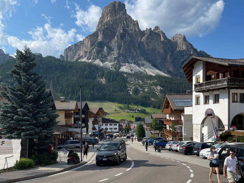
I flew into Venice and spent a night in the city. From Venice I booked a one-way bus to Cortina d'Ampezzo. It was about a 3-hour drive north and I think it cost about $30. In Cortina I asked around and found a bus that took about an hour to Corvara, the trailhead town. I checked into my hotel and met a representative of the agency there.
Looking back, it would have been easier to start in a town I could reach by train from Innsbruck, then take a bus or train straight back out at the end, so I wouldn't have to move luggage around.
Your options for 2027
Venice airport to Cortina. Cortina Express runs direct buses from Venice Marco Polo airport to Cortina d'Ampezzo in about 2 hours. The timetable valid from June 19, 2026 to June 9, 2027 lists five departures a day from the airport (7:00, 11:20, 14:20, 17:20 and 19:00) and five from Mestre station. Take an early one if you want to reach Alta Badia the same day. Fares are dynamic. ATVO and FlixBus also run Venice to Cortina.
Cortina to Corvara or La Villa in summer. There was no direct summer bus in 2026; the direct Cortina Express line to Corvara runs in winter only. Take Dolomitibus line 52 from Cortina to Passo Falzarego, then line 465 over Passo Valparola to San Cassiano, La Villa and Corvara. In 2026 line 52 ran June 8 to October 4, and line 465 ran from Passo Falzarego from June 17 to October 11, with fewer runs after early September.
By train from the north. Take the train on the Brenner line (Munich, Innsbruck, Bolzano) to Fortezza (Franzensfeste) and on to Brunico (Bruneck). Bus 460 runs from Brunico station through Val Badia to La Villa, Corvara and Colfosco about every 30 minutes, all year. Plan it at suedtirolmobil.info.
To start like I did, get off the bus in La Villa and walk from the church. To skip the Corvara nights, start the same way and sleep at Utia de Puez (see Sleep high instead of in Corvara).
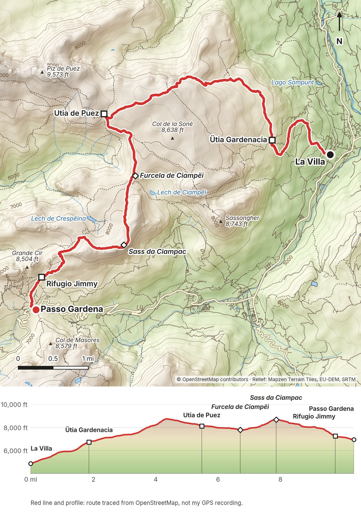
Day 1: La Villa to Passo Gardena
- Distance
- 10.3 mi (16.6 km)
- Climbing
- 4,830 ft (1,472 m)
- Descent
- 2,716 ft (828 m)
- Time to allow
- about 8 to 9 hours plus breaks (standard hiking-time estimate from the trace)
- Trails
- 11 up to Ütia Gardenacia, 11 and 1 across the Gardenaccia plateau to Utia de Puez, then 2 (the Alta Via 2) past Furcela de Ciampëi, Sass da Ciampac and the Cir ridge to Passo Gardena
- Sleep
- my hotel in Corvara (the Plans and Frara gondolas go down to Colfosco)
- Food and water
- Ütia Gardenacia, Utia de Puez, Rifugio Jimmy and Passo Gardena
My day
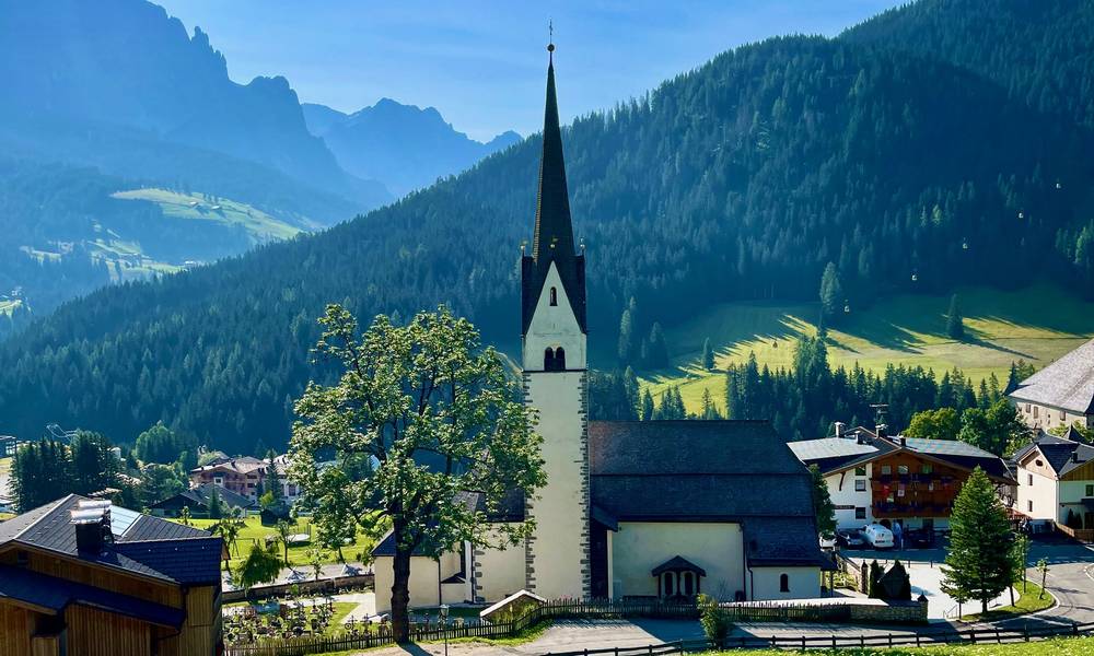
The agency had me take a taxi up the road to start, which was silly. I realized there's a beautiful path by the river, and I'd forgotten a piece of gear anyway, so I walked back, about an hour round trip. I started at the church in La Villa. It's a really beautiful church and a good spot to start the hike.
It's up, up, up through the trees to Ütia Gardenacia, where you start breaking out of the trees. It's a nice place for lunch, with good views. I had soup. Then up into a kind of rocky desert above the tree line, through a little slot with no views until the top. From there it's peaks in the distance and back down to Utia de Puez. The huts were packed in summer, but they churn through food and drinks quickly, so there's really no wait.
A spot near Puez was really beautiful, with the trail zigzagging on both sides. The agency's plan was to follow the valley all the way back down into Corvara. That would have been a quick, easy and kind of boring day. They told me not to, but I changed the route and went up to the peak where I got my walking-on-the-edge-of-the-world shot. The famous view of the Sella group was gorgeous with the sun getting low. It got even better coming down through the spiky Cir towers with the backlight. I passed a crucifix. I'm not used to seeing so many crosses on trails; it's an Italy hiking thing.
I had a quick drink at Rifugio Jimmy. I'd met a subscriber at lunch, and we met up again at the end. I just missed the last little gondola down by about 30 minutes, and walking all the way back to Corvara would have been a nightmare, so he and his family drove me down. Thank you. I got a little sunburnt. It was so much sun.
The trail
From the church in La Villa (about 4,860 ft, 1,480 m), trail 11 climbs through forest to Ütia Gardenacia (6,726 ft, 2,050 m). Above the hut the trail climbs a narrow, rocky gully onto the Gardenaccia plateau, a wide stony tableland at about 8,500 ft (2,600 m). Trail 1 crosses it west to Utia de Puez.
From Puez, follow trail 2, the Alta Via 2, south past Furcela de Ciampëi onto the Crespëina plateau. Trail 2A goes over Sass da Ciampac (8,750 ft, 2,667 m), the high point of my day, while trail 2 stays lower. The trail then drops through the Cir towers on stony switchbacks and a few steps to Rifugio Jimmy and Passo Gardena (6,960 ft, 2,121 m). It's a long day, and the plateau has no shade.
If you need to get off
From Furcela de Ciampëi, trails go down to Colfosco; that's the way the agency wanted me to go. Passo Gardena is on a road. Rifugio Jimmy sits at the top of the Plans and Frara gondolas, which go down to Colfosco; in 2026 they ran from June 13 to September 27, 8:30 to 17:30. That's the gondola I missed by about 30 minutes.
Watch this day
Film, Day 1 · My guide to Day 1 on the map
Day 2: Corvara to Rifugio Kostner
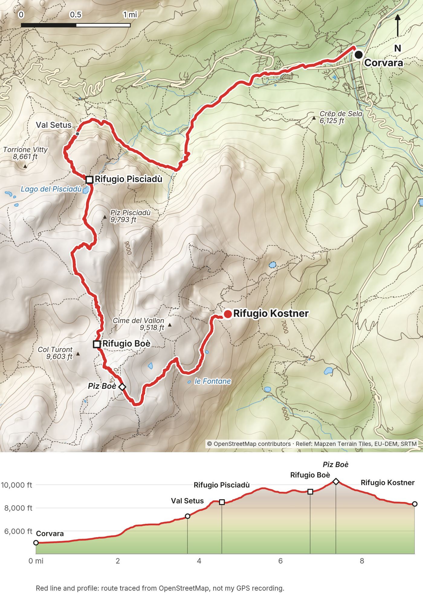
- Distance
- 9.3 mi (14.9 km)
- Climbing
- 5,957 ft (1,816 m)
- Descent
- 2,605 ft (794 m)
- Time to allow
- about 9 to 10 hours plus breaks (standard estimate from the trace)
- Trails
- through Colfosco, then 28, 651 and 29 to the foot of Val Setus, 666 (Alta Via 2) up Val Setus to Rifugio Pisciadù and across the Sella plateau to Rifugio Boè, up to Piz Boè, then 638 down to Rifugio Kostner
- Sleep
- Rifugio Kostner
- Food and water
- Rifugio Pisciadù, Rifugio Boè, Capanna Piz Fassa on the summit, Rifugio Kostner
My day
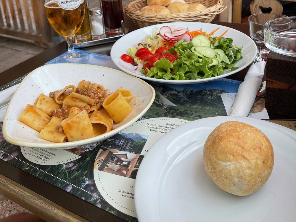
I finally got to walk to the trailhead. I took a nice stroll through sleepy Corvara in the morning, past campsites and people walking their dogs, and started climbing into a crazy beautiful mountain area. There was plenty of shade and it wasn't too hot. I climbed all the way up to Rifugio Pisciadù for lunch: pasta, beer and strudel.
That's when it got overcast. They'd said it was supposed to thunder that evening, so I was getting worried as I climbed toward the highest part of the hike. Of course it started hailing, and there was snow on the ground. Over the pass, fog and clouds blanketed everything, with almost zero visibility, and then it started to rain for real. I put the camera away in my waterproof bag and got out my umbrella. I am team umbrella.
I wasn't expecting Rifugio Boè. It looked new and was really well designed. I got a quick coffee and waited for the hail to stop. When it cleared I set off for Piz Boè, and about halfway up it started hailing and thundering right on top of me. It was so loud and so dangerous. I ran all the way back down to the hut, waited, and tried again. Just before the top I heard thunder in the distance again. The summit hut was a little, cramped place with a dog and people drinking beer. It would have been cool to sleep up there. I had a beer, pet the dog and waited for the hail to let up.
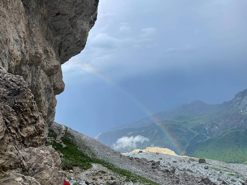
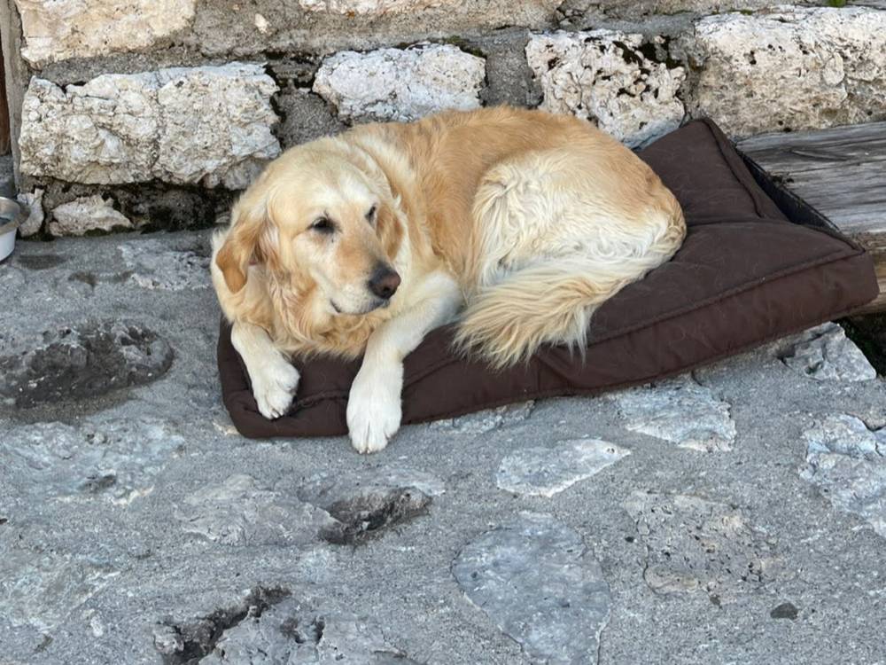
By 4 or 5 PM I had to go. I pretty much trail ran down. Halfway the thunder came back, and I hid under the largest rock I could find until it passed. The steep section with the metal rope was basically a river that day, with hail and the light fading. It was a miserable time. Then it stopped raining for a moment and there was a beautiful rainbow. I made it to Rifugio Kostner to dry out and eat. It's a beautiful place with a great view and a fat, sassy golden retriever.
The trail
From Corvara, walk through Colfosco and take trails 28, 651 and 29 west along the foot of the Sella walls to Val Setus. Trail 666, the Alta Via 2, climbs the steep, narrow gully. The top part has fixed cables and metal steps, renewed in June 2026. It's a steep, equipped hiking trail rather than a full via ferrata, but take it slowly when it's wet. Rifugio Pisciadù sits above a small lake at 8,488 ft (2,587 m).
The traced route follows Val Setus, the marked Alta Via 2 line. My photos place me above Colfosco in the morning but don't show which way I climbed to Pisciadù, so treat that part of the line as a best guess. The Brigata Tridentina via ferrata also ends at the hut; it needs via ferrata gear.
From Pisciadù, 666 climbs to the Sella plateau at about 9,500 ft (2,900 m) and crosses a stony landscape to Rifugio Boè (9,426 ft, 2,873 m). Piz Boè (10,341 ft, 3,152 m) is a short, rocky climb above the hut, with the little Capanna Piz Fassa on top. Trail 638 then drops east to Rifugio Kostner (8,366 ft, 2,550 m), with one steep stretch that has a metal rope to hold. Up here you're above 9,000 ft for hours, far from shelter except the huts. Don't go up if storms are building.
If you need to get off
From Rifugio Boè, trail 627 goes to Forcella Pordoi and the Sass Pordoi cable car down to Passo Pordoi, about an hour. From Kostner, the Vallon chairlift and the Boè gondola go down to Corvara in summer. In 2026 the Boè gondola ran June 13 to October 4, 8:30 to 17:30, and the Vallon chairlift 8:45 to 17:15.
Watch this day
Film, Day 2 · The storm, the hail and Kostner
Day 3: Rifugio Kostner to Passo Fedaia
- Distance
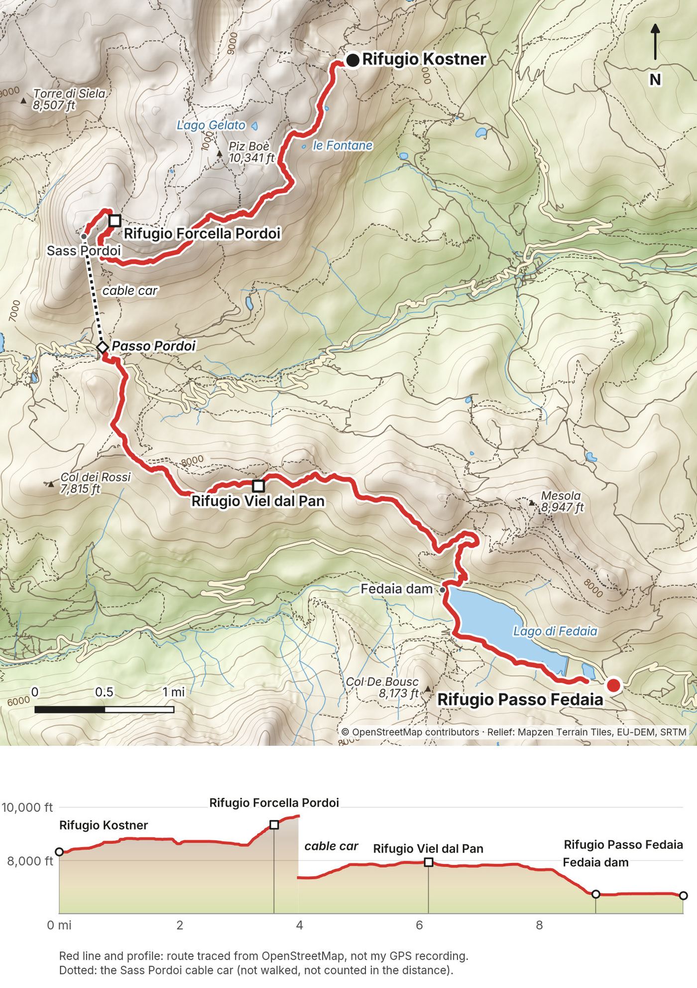
- 10.4 mi (16.7 km) of walking, plus the Sass Pordoi cable car down
- Climbing
- 3,380 ft (1,030 m)
- Descent
- 2,710 ft (826 m) on foot
- Time to allow
- about 7 hours plus breaks (standard estimate from the trace)
- Trails
- 638 and 626 west under Piz Boè, 627 up to Forcella Pordoi and Sass Pordoi, cable car to Passo Pordoi, then 601 (Alta Via 2) along the Viel dal Pan to Lago di Fedaia
- Sleep
- Rifugio Passo Fedaia
- Food and water
- Rifugio Forcella Pordoi, Sass Pordoi, Passo Pordoi, Rifugio Viel dal Pan, huts at Lago di Fedaia
My day
This was going to be one of the biggest and most beautiful days, and it was. It wasn't raining or hailing, it was just perfect. I'm so grateful I had good weather on this day. Breakfast came with a giant bowl of coffee. I started early feeling really good.
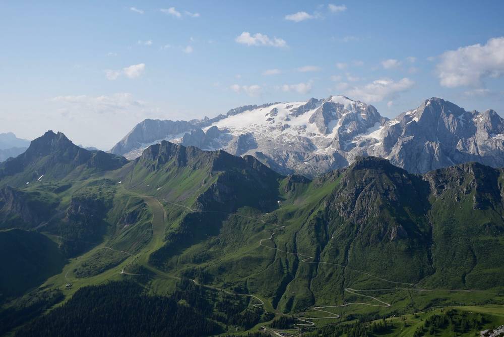
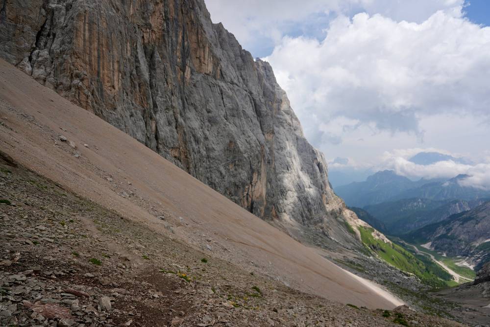
The first part runs along the cliffs below Piz Boè, with the Marmolada glacier across the valley. There were a couple of really rocky, loose, sandy spots that were difficult, and I got off trail a tiny bit here and there. This trail is probably maintained the least of the whole trip, likely because of rockfall every winter and spring.
Then I saw people zigzagging up to Forcella Pordoi and the Sass Pordoi cable car. If I have to go down this way anyway, why not go up and ride the cable car down? The views up there were really cool, and I could see Piz Boè, the peak I'd climbed in the storm the evening before. It was packed. In the Alps there are so many cable cars shuttling people to the top. I rushed through, took the cable car down, and started the best section of the hike in my opinion.
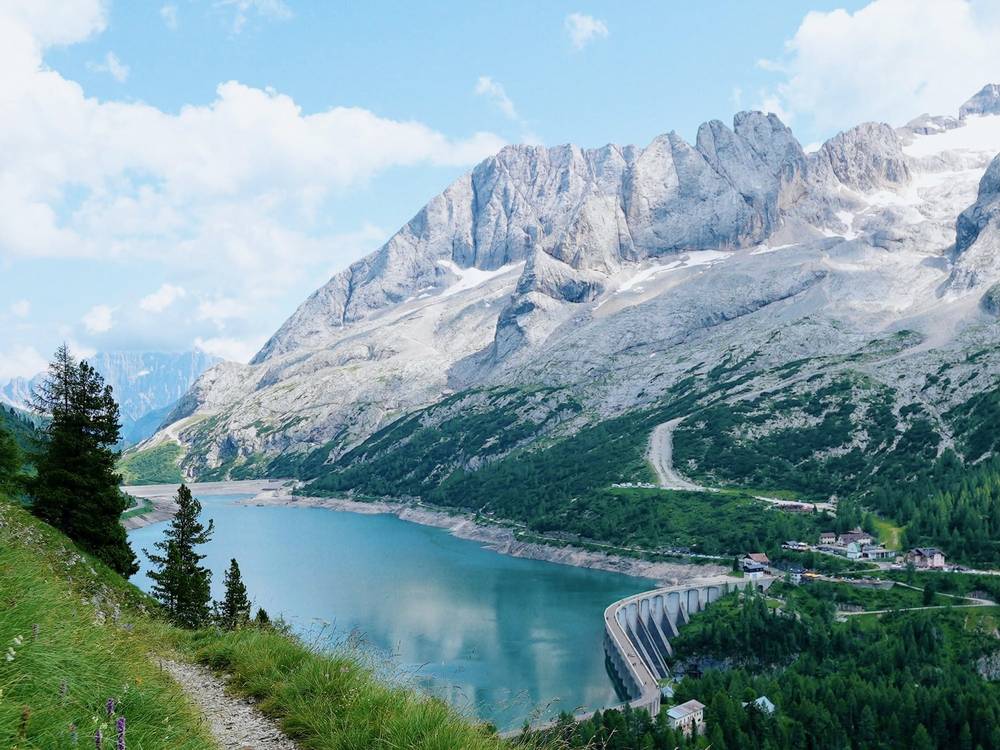
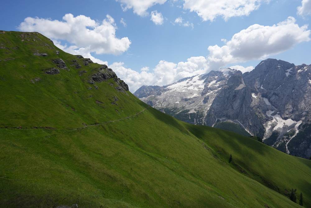
The ridge along the Viel dal Pan, with the Marmolada glacier in the distance and grassy hills, is amazing. It was packed, with a lot of cyclists and families, and people eating pizza. I stuck to the grassy trail right on the edge, with flowers and birds swooping in and out, and had strudel at Rifugio Viel dal Pan. Coming down, the reflections on Lago di Fedaia were gorgeous and the dam is interesting. I stopped at a hut by the lake with chickens running around and had my first Wi-Fi of the day.
I ended at Rifugio Passo Fedaia, on the road. In the film I called it "a truck stop Refugio" with "nothing pretty about this place. I don't recommend staying here." I got a shower, which was nice. A hut up on the ridge or by the lake would have been ten times better. Some subscribers saw me drinking a beer alone on the patio and came over to say hi, which was very nice.
The trail
From Kostner, trails 638 and 626 traverse west under the south face of Piz Boè at around 8,500 to 8,900 ft (2,600 to 2,700 m). It's rough, with scree and a few loose, sandy gullies, and it's easy to wander off the line in places. It joins trail 627, which zigzags up steep scree to Rifugio Forcella Pordoi (9,344 ft, 2,848 m). Sass Pordoi and the top of the cable car are a short walk above.
If you don't want the cable car, trail 627 goes down the same scree to Passo Pordoi. It's steep and loose. From Passo Pordoi (7,346 ft, 2,239 m), trail 601, the Alta Via 2, follows the Viel dal Pan along the grassy ridge south of the pass, past Rifugio Viel dal Pan. It's easy walking right along the edge of the ridge. Near the end, trail 601A and 698 drop to the Fedaia dam, and a road runs along the lake to Passo Fedaia.
The Sass Pordoi cable car ran from May 14 to November 1 in 2026, 9:00 to 17:00. A one-way ride was €18.
If you need to get off
Passo Pordoi is on the main road with buses in summer. The Viel dal Pan has no road, but it's never far from Pordoi or Fedaia. Passo Fedaia is also on a road. In summer 2026, bus 472 ran from Passo Pordoi to Passo Sella and Val Gardena one way and to Arabba and Corvara the other, bus 131 ran from Passo Fedaia to Penia and Canazei in Val di Fassa, and Dolomitibus line 54 ran from Lago di Fedaia down to Malga Ciapela (to September 9).
Watch this day
Film, Day 3 · My guide to the Marmolada ridge
Day 4: Malga Ciapela to Rifugio Contrin
- Distance
- 6.2 mi (10.0 km), after a taxi down to Malga Ciapela
- Climbing
- 4,118 ft (1,255 m)
- Descent
- 2,232 ft (680 m)
- Time to allow
- about 7 hours plus breaks (standard estimate from the trace)
- Trails
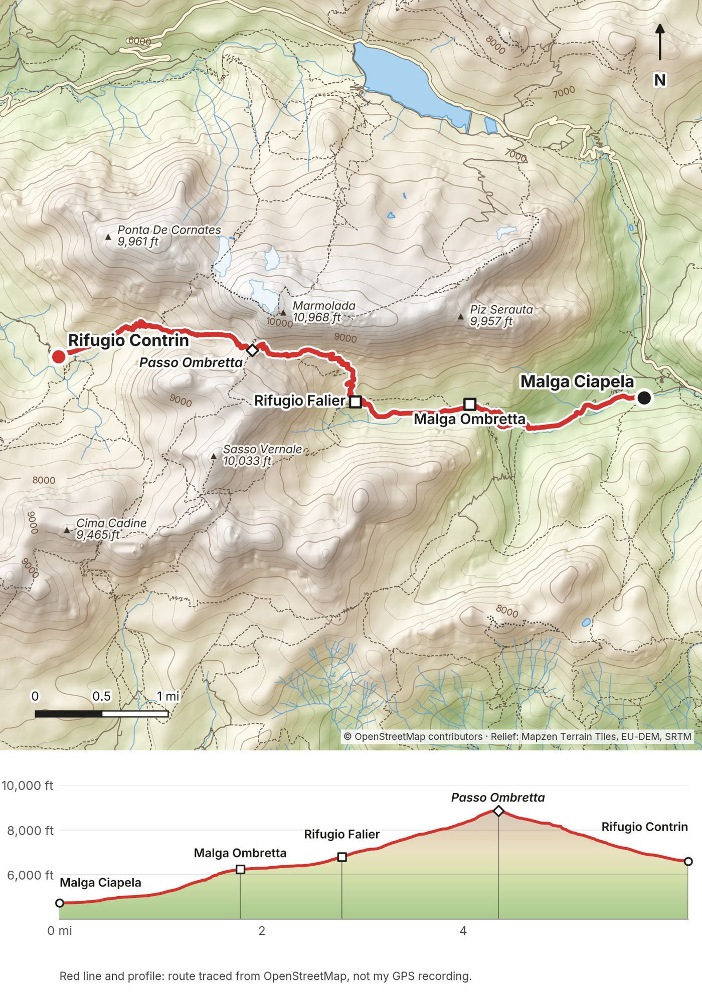
- 610 up Val Ombretta past Malga Ombretta and Rifugio Falier to Passo Ombretta, 610 and 606 (Alta Via 2) down Val Contrin
- Sleep
- Rifugio Contrin
- Food and water
- Malga Ombretta, Rifugio Falier, Rifugio Contrin
My day
It started with an early taxi down to Malga Ciapela. I could easily have walked. I think the official Alta Via 2 has you going over the pass by the Marmolada glacier, which would be intense. It was icy up there, and I probably would have needed more gear. So I didn't mind coming up this easier way. (That line, over Forcella della Marmolada, crosses the glacier and uses a via ferrata; see Other ways to do it.)
It was a shorter day but a lot of endless climbing through the woods. It wasn't very pretty and the light was weird. Part of it was a gravel road that looked like it was under construction. Then you come out of the woods into a meadow with an adorable little farm. There was a woman with a large, fluffy cat in the window. I wanted to get to know this cat.
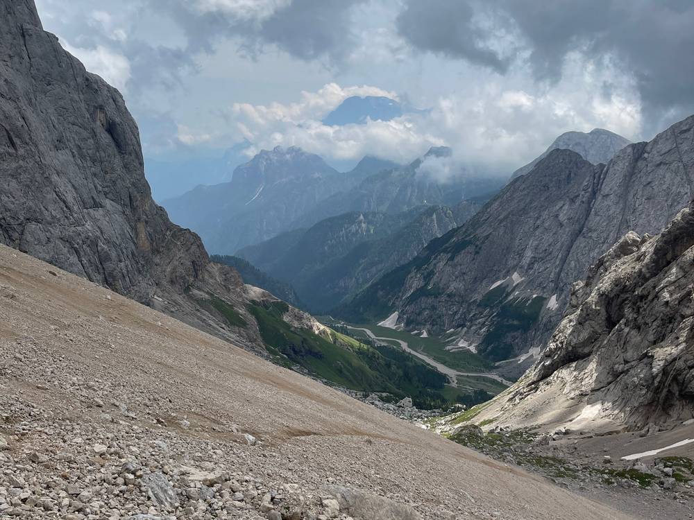
A short ridge walk took me to Rifugio Falier, a lovely hut with wonderful views, more isolated than most. The food was great, and there was a goat trying to eat things, including my hat. Then I zigzagged up and over Passo Ombretta. It got sandy and rocky, with not many people. The glacier was just on the other side of the ridge, and the rock wall was very dramatic. I trail ran all the way down, passing people, into the grassy valley to Rifugio Contrin.
It was a short day, and I had a lot of time to kill. I like hiking until sunset, because the light is beautiful and good for filming. You don't get that when you book short, easy days that end in valleys.
The trail
From Malga Ciapela (4,730 ft, 1,440 m), a road and then trail 610 climb Val Ombretta to Malga Ombretta and Rifugio Falier (6,804 ft, 2,074 m), right under the south face of the Marmolada. Above Falier the trail climbs steep scree and switchbacks to Passo Ombretta (8,865 ft, 2,702 m). Trail 610 then drops west to Val Rosalia, where it meets 606, the Alta Via 2 line coming down from Forcella della Marmolada, and continues to Rifugio Contrin (6,614 ft, 2,016 m).
In July 2022 part of the Marmolada glacier collapsed below Punta Rocca, on the north side above Lago di Fedaia. Trails on the glacier side were closed after the collapse, and in September 2026 path 606 from the Fedaia dam up to Forcella della Marmolada was still closed; only the Contrin side up to the forcella was open. My route on the south side, by Val Ombretta and Passo Ombretta, doesn't cross the glacier.
If you need to get off
Before Passo Ombretta, go back down Val Ombretta to Malga Ciapela, on the road with buses. From Contrin, a track goes down Val Contrin to Alba di Canazei in Val di Fassa, on bus line 101.
Watch this day
Film, Day 4 · My guide to the passes and huts
Day 5: Rifugio Contrin to Passo Valles
- Distance
- 10.7 mi (17.2 km)
- Climbing
- 3,750 ft (1,143 m)
- Descent
- 3,690 ft (1,125 m)
- Time to allow
- about 8 hours plus breaks (standard estimate from the trace)
- Trails
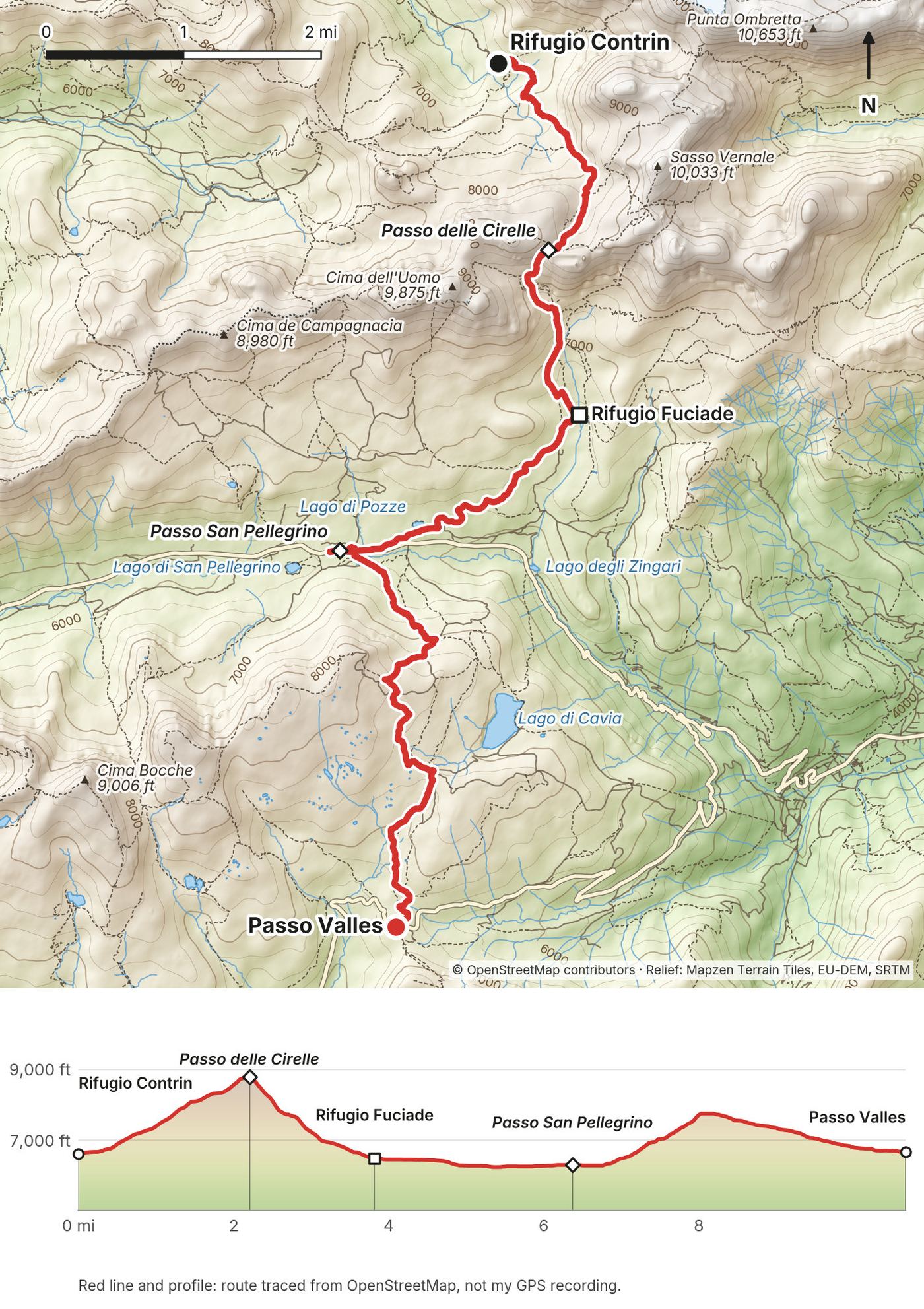
- 607 (Alta Via 2) over Passo delle Cirelle to Rifugio Fuciade, the Fuciade road to Passo San Pellegrino, then 658 (Alta Via 2) south to Passo Valles
- Sleep
- I took a taxi from Passo Valles to a hotel in Moena
- Food and water
- Rifugio Fuciade, Passo San Pellegrino, Passo Valles
My day
The last day was kind of a throwaway day, and a weird one to end on. I started early and went up, up, up. It's very isolated. I probably saw three or four people on the whole climb. It got cloudy and foggy at the top of the pass. It wasn't raining, but it was very sandy, very rocky, a crazy zigzag. I saw some mountain sheep.
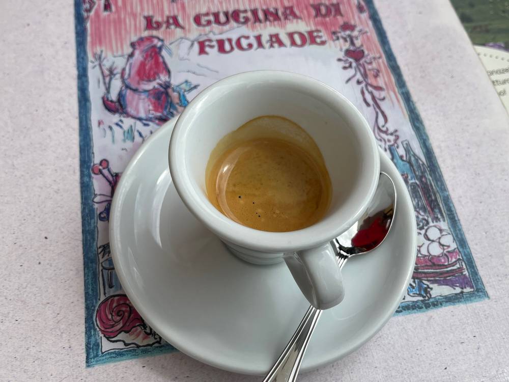
Coming down into the grassy area, there were so many flowers in the field leading to Rifugio Fuciade, and a nice little river. There's a road up to Fuciade with horses and carriages and lots of families, so it was very busy. The food there was great: the bread, the wine, the beer, the espressos. I had three espressos. Looking back up the valley from below the huts was gorgeous. This is so Dolomites. This is why you come and hike here.
After that it's pretty much a road through the trees. I stopped at a cute little hotel at Passo San Pellegrino with a pond full of tadpoles. I could have summited Col Margherita, but it started to rain. Honestly, it would have been better for me to end the hike there. I said forget it, I'll finish the hike. I walked in the rain, and part of the trail follows a ski slope, which is never fun. It was the hardest part of the whole trail to stay on. Other people were getting lost up there too. Then it was mostly a road down to Passo Valles, where it started hailing. Dolomites, baby.
At Passo Valles the peaks of the park ahead looked really cool. That's where the agency's plan ended. I'll just have to come back and do the second part of the Alta Via 2. I took a taxi to Moena.
The trail
From Rifugio Contrin, trail 607 climbs south through meadows and then long scree switchbacks to Passo delle Cirelle (8,803 ft, 2,683 m). It's loose and sandy near the top and can hold old snow early in the season. The descent south is steep scree at first, then grass and flowers down to Rifugio Fuciade (about 6,500 ft, 1,980 m).
From Fuciade, a gravel road leads west to Passo San Pellegrino (6,293 ft, 1,918 m), a ski area with hotels and a bus stop. Trail 658, the Alta Via 2, climbs south over the ski slopes toward Col Margherita and the Pradazzo area, then follows tracks and a gravel road down to Passo Valles (6,667 ft, 2,032 m). For me it was the hardest part of the whole trail to stay on, so follow your GPS here.
If you need to get off
Fuciade has a road down to Passo San Pellegrino. San Pellegrino is the obvious place to finish if the weather turns. Bus B123 runs from Passo San Pellegrino down to Moena in about 25 minutes. In 2026 it ran June 27 to September 20, eight times a day on working days, leaving the pass at 8:46, 9:46, 10:46, 11:46, 14:46, 15:46, 16:46 and 17:46: there's no bus between 11:46 and 14:46. I found no confirmed public bus from Passo Valles in 2026, so plan on a taxi from there.
Watch this day
Film, Day 5 · My guide to the San Pellegrino finish
Other ways to do it
I walked a five-day section built by an agency. Here's what I'd change, and how it fits into the full route.
Sleep high instead of in Corvara
The agency put me in the same Corvara hotel for the first two nights. If it were up to me, I'd have kept going into the mountains and tried to stay at a hut up high, or at least a hotel near Passo Gardena, instead of going back down to where I started. On this line that means Utia de Puez or Rifugio Frara. From Frara, Day 2 starts at Passo Gardena right at the foot of Val Setus; from Puez, you walk the Cir section down to Passo Gardena first. In 2026 Utia de Puez had 45 dorm beds, half board €90 (€72 for alpine club members), booked online only. Rifugio Frara at Passo Gardena is a small hotel with private rooms. Sleeping at Puez also puts you on the official Alta Via 2 stage from Puez to Pisciadù.
Walk the taxi gaps
I didn't need the taxis. On Day 1, walk from Corvara to La Villa by the river path instead. On Day 4, walk down from Passo Fedaia to Malga Ciapela, about 2,000 ft (600 m) lower, or take Dolomitibus line 54. I'd rather be self-supported and do the work myself.
The official line over Forcella della Marmolada
The Belluno tourism board describes three ways from the Marmolada to Fuciade: the original line from Malga Ciapela over Forca Rossa; the glacier variant over Forcella della Marmolada, which crosses the glacier on the Fedaia side and comes down a via ferrata toward Contrin; and a western bypass by Contrin and Passo delle Cirelle. My way was a mix: Malga Ciapela, Passo Ombretta, Contrin and Cirelle. The glacier variant needs glacier and via ferrata gear and experience, and in 2026 its Fedaia side (path 606 from the dam to Forcella della Marmolada) was still closed. Check the Val di Fassa trail-closure bulletin on fassa.com before you plan it. I skipped it.
Finish at San Pellegrino, or keep going
Passo San Pellegrino has hotels and buses. Honestly, it would have been better for me to end there. If you have more days, keep going south from Passo Valles into the Pale di San Martino, which is the second half of the Alta Via 2 and ends in Feltre. I haven't walked it.
The full Alta Via 2
The whole route runs from Bressanone to Feltre. I said in my film that if you can do the full 100 miles, I think that might be really cool, and if you can carry a tent and camp in the valleys some nights, I'd recommend that too. Official figures (dolomiti.it, rounded): 13 stages, about 112 miles (180 km) and 37,000 ft (11,300 m) of climbing, almost 80 hours of walking. Stages 8, 9, 11 and 12 include equipped stretches and climbing passages for experienced hikers (Passo delle Farangole, the Intaiada and Troi dei Caserìn paths). My Day 5 finished stage 6 at Passo San Pellegrino and walked the first part of stage 7 to Passo Valles.
| Stage | From to | km | Up / down (m) |
|---|---|---|---|
| 1 | Bressanone to Rif. Città di Bressanone | 27 | 1,900 / 435 |
| 2 | to Rif. Genova | 15 | 500 / 650 |
| 3 | to Utia de Puez | 15 | 850 / 670 |
| 4 | to Rif. Pisciadù (my Days 1 and 2) | 10 | 570 / 460 |
| 5 | to Rif. Castiglioni, Fedaia (my Days 2 and 3) | 19 | 750 / 1,280 |
| 6 | to Passo San Pellegrino (my Days 4 and 5) | 25 | 1,100 / 1,200 |
| 7 | to Rif. Volpi al Mulaz | 14 | 1,100 / 500 |
| 8 | to Rif. Rosetta | 8 | 760 / 750 |
| 9 | to Rif. Treviso | 14 | 720 / 1,600 |
| 10 | to Passo Cereda | 10 | 1,150 / 900 |
| 11 | to Rif. Boz | 14 | 1,200 / 600 |
| 12 | to Rif. Dal Piaz | 15 | 900 / 650 |
| 13 | to Feltre | 19 | not given / 1,670 |
Getting home
What I did
From Passo Valles I took a taxi to Moena, where the agency had booked a hotel. Early the next morning I took a very expensive taxi, about $120, through the mountains to Bolzano. From there the train to Munich took maybe 3 or 4 hours. Munich flights were very cheap, so I kept going past Innsbruck. I'd never been to Germany, so I stayed a night, walked around, drank coffee and ate Bavarian food before flying home.
Your options for 2027
From Passo San Pellegrino. Bus B123 goes to Moena in about 25 minutes (2026: June 27 to September 20, eight runs a day on working days). Dolomitibus line 2 goes the other way, down to Falcade.
From Passo Valles. I found no confirmed public bus in 2026. Book a taxi, or end at San Pellegrino.
Moena to Bolzano. Take Trentino Trasporti line 101 up Val di Fassa to Vigo di Fassa, then bus 180 over Passo Costalunga (Carezza) to Bolzano bus station, roughly every hour. Line 101 also goes down the valley toward Trento for trains.
From Bolzano. Trains on the Brenner line go north to Innsbruck and Munich about every two hours, and south to Verona, where you change for Venice.
There was no summer airport shuttle from Val di Fassa in 2026; the ski shuttle to Venice runs in winter only.
What I paid
This was very expensive, probably the most expensive hike I've done. The agency package covered my hut and hotel nights with half board and my taxis inside the trip. My trip records don't include the price of the package, so I can't give you that number.
| Item | 2021 cost |
|---|---|
| Bus, Venice to Cortina | about $30 |
| Bus, Cortina to Corvara | about an hour; price not recorded |
| Agency package: 2 nights hotel in Corvara, Kostner, Passo Fedaia, Contrin, hotel in Moena, all half board, plus taxis | not recorded in my notes |
| Lunches, drinks, espressos | paid as I went |
| Sass Pordoi cable car down | price not recorded |
| Taxi, Moena to Bolzano | about $120 |
| Train, Bolzano to Munich | price not recorded |
Doing the huts yourself
Booking the same kind of trip yourself at 2026 prices, half board (dinner, bed and breakfast) per person per night:
| Night | 2026 half board |
|---|---|
| Utia de Puez (instead of Corvara) | €90 dorm (€72 alpine club members) |
| Rifugio Kostner | ask the hut; price not published |
| Rifugio Passo Fedaia | €85 to €98 in rooms |
| Rifugio Contrin | €70 dorm, €85 to €98 in rooms |
| Rifugio Capanna Passo Valles | €49 to €57 dorm, €60 to €85 in rooms |
Some huts didn't state the year on their price pages. Plan on roughly €70 to €100 a night with half board, plus lunch and drinks at the huts, €18 for the Sass Pordoi cable car down, and your buses in and out.
The huts
Phone numbers, sites and 2026 details, checked in September 2026. Prices are per person per night with half board unless noted.
Where I slept
| Night | Place | Contact | 2026 notes |
|---|---|---|---|
| 1, 2 | Hotel La Tambra, Corvara (3-star hotel) | latambra.com | Booked by my agency. The same hotel both nights |
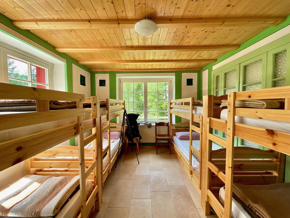
| 3 | Rifugio Kostner, 8,366 ft (2,550 m) | +39 333 875 9838, rifugiokostner.it | Open June 13 to October 4. 25 beds in doubles, a 4-bed room and dorms. Deposit €60 per night. Cash recommended. Own liner and towel. No Wi-Fi |
| 4 | Rifugio Passo Fedaia, at the road pass | +39 0437 722007, rifugiofedaia.com | Summer June to October. Rooms €85 to €98, dorm room only €30 to €35. Online booking |
| 5 | Rifugio Contrin, 6,614 ft (2,016 m) | +39 0462 601101, rifugiocontrin.it | Reopens in May 2027. Dorm bunk with blankets €70, rooms €85 to €98. Book by phone; non-refundable deposit |
| 6 | A hotel in Moena | Booked by my agency |
What I said about them: Kostner was a beautiful place with a great view and a fat golden retriever. Passo Fedaia I called "a truck stop Refugio" on the road, and staying up on the ridge or by the lake would have been ten times better. At Contrin I arrived early and had a lot of time to kill.
Huts on the way
| Hut | Contact | 2026 notes |
|---|---|---|
| Ütia Gardenacia, 6,726 ft (2,050 m) | +39 0471 840128, gardenacia.it | June 5 to October 5. Private rooms. 2027: June 5 to October 3, €102. Where I had lunch on Day 1 |
| Utia de Puez, 8,120 ft (2,475 m) | +39 0471 1727939, rifugiopuez.it | From June 4. Dorms only, 45 beds, €90 (€72 members). Online booking only. Liner, towel and slippers required. Water sold in bottles |
| Rifugio Jimmy, Passo Gardena | +39 0471 836776, jimmihuette.it | Day use only, from June 13, 9:00 to 17:00. Where I had a drink on Day 1 |
| Rifugio Frara, Passo Gardena | alpinhotelfrara.com | Small hotel, private rooms, bed only in summer |
| Rifugio Pisciadù, 8,488 ft (2,587 m) | +39 0471 836292, rifugiopisciadu.it | June 20 to end of September. Dorms, €85 (€68 members). Online booking. Cash and cards. Where I had lunch on Day 2 |
| Rifugio Boè, 9,426 ft (2,873 m) | rifugioboe.it, rifugioboe@gmail.com | June 20 to September 27. Rebuilt and reopened in summer 2021. Book by email |
| Capanna Piz Fassa, 10,341 ft (3,152 m) | +39 336 452523, rifugiocapannapizfassa.com | June 15 to end of September. €80 (€90 Saturdays). Email booking, €30 non-refundable deposit. Bring cash. Where I waited out the hail with a beer |
| Rifugio Forcella Pordoi, 9,344 ft (2,848 m) | +39 368 3557505, rifugioforcellapordoi.com | June 20 to September 30. 28 beds, €85. Email booking |
| Rifugio Viel dal Pan, 7,979 ft (2,432 m) | +39 339 3865241, rifugiovieldalpan.it | About June 20 to September 20. 23 beds in rooms. Where I had strudel on Day 3 |
| Rifugio Castiglioni Marmolada, at the Fedaia dam | +39 0462 601117, rifugiomarmolada.it | End of the official AV2 stage. Rooms and dorms. 2026 dates not confirmed |
| Rifugio Falier, 6,804 ft (2,074 m) | +39 0437 722005, rifugiofalier.altervista.org | From June 10, guaranteed June 20 to September 20. Rooms €90, dorm €80 (members €80 and €70). Email booking |
| Rifugio Fuciade, about 6,500 ft (1,980 m) | +39 0462 574281, fuciade.it | June 1 to October 4. Seven private rooms, €145 to €160 (2027: €155 to €160). Known for its food. Where I had lunch on Day 5 |
| Rifugio Capanna Passo Valles, 6,667 ft (2,032 m) | +39 0437 599136, passovalles.com | Summer June 13 to October 11. Rooms €60 to €85, dorm €49 to €57. Where my section ends |
Most huts require your own sleeping-bag liner. Several ask for your own towel and slippers, and a few sell drinking water only in bottles.
Gear for this route
Packing list for a hut trip
- Sleeping-bag liner (required in most huts), earplugs, hut slippers or light sandals if you like them
- Rain jacket, warm layer, hat and gloves. I got hail and snow in July
- Sun hat, sunglasses and sunscreen. I got sunburnt on Day 1
- Water bottles or a filter bottle, at least 1.5 liters of capacity
- Headlamp, small first-aid kit, blister care, a whistle
- Euros in cash, a card and your ID for hut check-in
- Phone with offline maps and the GPX files, and a battery pack
Paid links: I earn a commission if you buy through these links, at no extra cost to you. As an Amazon Associate I earn from qualifying purchases.
No tent, stove or sleeping bag on this route: every night is in a hut, with blankets. Here's what I carried in 2021, what I'd add now, and what I filmed with.
What I carried in 2021
- Pack: Hyperlite Mountain Gear Southwest 2400 (Hyperlite). The 2400 size.
- Sleeping-bag liner: a liner. The huts provide blankets.
- Water filter: Katadyn BeFree AC · 1L (Amazon). The BeFree filter bottle.
- Headlamp: an LED headlamp
- Sun hoodie: a sun hoodie and hiking shorts
- Puffy: Patagonia Nano Puff Jacket. I got hail and snow in July. Similar: Arc’teryx Atom SL Hoody (Arc’teryx).
- Rain jacket: The North Face Resolve 2. Similar: Arc’teryx Beta AR Jacket (Arc’teryx).
- Pants: Patagonia Terrebonne Joggers. Similar: PATH Projects Killam PX Pant (PATH Projects).
- Shoes: Brooks Cascadia 16 (Amazon), now the Cascadia 20. Trail runners, no boots.
- Umbrella: a trekking umbrella. I used it in the Day 2 storm. I am team umbrella, I love it, it's the best.
- Poles: trekking poles
- Battery: a 10,000 mAh battery
- Travel bag: Patagonia Black Hole Duffel · 40L. For the travel days.
What I'd add now
My current kit for what this route needs.
- Sleeping-bag liner: Naturehike ZY20 Sleeping Bag Liner (Amazon). Most huts require one. Mine is 4.5 ounces and goes in the wash.
- Hut shoes: Crocs Classic Clog (Amazon). Several huts ask you to bring your own slippers.
- Sun hoodie: PATH Projects Pyrenees T19 Hoodie (PATH Projects). I got sunburnt on Day 1.
- Umbrella: Six Moon Designs Silver Shadow Carbon (Amazon). Still team umbrella: summer afternoons here often bring storms.
- Headlamp: Nitecore NU20 Classic (Amazon)
- Power bank: Nitecore NB20000 (Amazon)
- Navigation: AllTrails+ (AllTrails, 30% off). Import my GPX files and download them offline. Offline maps need the paid plan.
- Phone data: Airalo eSIM (Airalo, $3 off). Mobile data in Italy without a SIM swap.
Filming kit
What I filmed this trip with in 2021: "the smallest kit that I can get the quality that I like." My setup is smaller now (below). Check the drone rules in Weather and safety before you fly: drones are banned in Puez-Odle and the other South Tyrol protected areas.
- Camera: Sony a7S III (Amazon)
- Lens: Sony FE 16-35mm f/4 ZA OSS (Amazon)
- Mic: Rode VideoMic NTG (Amazon). On top of the camera, for good audio.
- Drone: DJI Air 2S (Amazon), now the Air 3S
- Tripod: SIRUI carbon fiber tripod
- Tripod head: Joby BallHead 3K (now the 3K PRO) (Amazon). On the SIRUI tripod.
- Wrist strap: Peak Design Cuff Wrist Strap (Amazon)
What I film with now
Since September 2026 I film with a smaller setup: the Pocket 4 and the Mic 3 on the trail, and the Mini 5 Pro in the air.
- Camera: DJI Osmo Pocket 4 (Amazon)
- Mic: DJI Mic 3 · 1 TX + 1 RX (Amazon). It pairs with the Pocket 4.
- Drone: DJI Mini 5 Pro (Amazon)
Weather and safety
Summer afternoons in the Dolomites often bring thunderstorms. On Day 2 I had hail, snow, fog and thunder right on top of me near Piz Boè, over 10,000 ft (3,152 m), and I ran back down to the hut. Start early, be off the high ground and summits by early afternoon when storms are building, and wait them out in a hut. There are huts every few hours on this section.
Forecasts. This section crosses three provinces. Use the South Tyrol mountain weather for Days 1 and 2, Meteotrentino for Val di Fassa, Contrin and San Pellegrino, and ARPAV Dolomiti Meteo for Fedaia, Malga Ciapela and Val Ombretta. Ask at the hut every evening.
Emergencies. Call 112. It's the single emergency number in South Tyrol, Trentino and the Veneto, and mountain rescue calls are passed to the 118 rescue center. Give your location from your phone's map, or install the 112 Where ARE U app, which can send your exact position when you call. Plan on patchy signal between huts. Mountain rescue in Italy can be billed to you, so check that your travel insurance covers helicopter rescue.
Camping. Camping is banned in the South Tyrol nature parks, including Puez-Odle on Day 1. Trentino bans camping outside campsites, with narrow exceptions, and the Paneveggio-Pale di San Martino park at Passo Valles bans it too. Use the huts, or campsites in the valleys.
Drones. Drone flights have been banned in Puez-Odle and the other South Tyrol protected areas since January 2023. The Paneveggio-Pale di San Martino park at Passo Valles requires its authorization. Italy's no-fly zones are on the D-Flight map (d-flight.it).
The steep and exposed places
- Val Setus (Day 2): steep gully with fixed cables and steps near the top. Slippery when wet.
- Piz Boè (Day 2): a rocky summit over 10,000 ft. A bad place in a thunderstorm.
- Descent to Kostner (Day 2): a steep, cable-protected stretch that was a river when I did it in the rain.
- Traverse under Piz Boè and the climb to Forcella Pordoi (Day 3): rough, loose scree and sandy gullies; easy to lose the line in places.
- Passo Ombretta (Day 4): steep, loose scree zigzags.
- Passo delle Cirelle (Day 5): long, sandy, rocky zigzags; can hold snow early in the season.
- The ski slopes after Passo San Pellegrino (Day 5): not exposed, but hard to follow in fog.
Going solo
I hiked alone. On the busy days there are people everywhere; on the climb to Passo delle Cirelle I saw three or four people all morning. Tell someone your plan each day, and ask at the hut in the morning about the weather and the trail.
Using the GPX files
These files are a route traced from OpenStreetMap, not my recording. My original recordings from 2021 aren't available. Each day was rebuilt along the mapped trails I used, placed with the locations of my phone photos and what I said in my film. Elevations come from a terrain model, and the figures in this guide come from these files.
| File | What it is |
|---|---|
| alta-via-2-day-1.gpx to day-5.gpx | One file per day. Day 3 is in two parts; the gap is the Sass Pordoi cable car |
| alta-via-2-full-route.gpx | All five days, with waypoints for the huts, passes and lifts |
The taxis from Passo Fedaia to Malga Ciapela and from Passo Valles to Moena aren't drawn. On Day 2 the file climbs Val Setus, the Alta Via 2 line; my photos don't confirm which way I went up.
AllTrails. On a computer, sign in at alltrails.com, create a new map and use Import. It then shows up in the app on your phone. Offline use needs a paid plan.
Gaia GPS. Open the file from Files, email or AirDrop and choose Gaia GPS, or use Import on gaiagps.com. Download the map area offline.
Garmin. In Garmin Connect on the web, go to Training, Courses, Import. Save it as a course and send it to your watch.
Organic Maps (free). Download the offline maps for Trentino-Alto Adige and Veneto, then open the GPX file and choose Organic Maps. It works fully offline.
Before you leave, download offline maps for the whole route, turn on airplane mode, and check that each day and your location show up. The trails are well marked with red and white paint and numbered signs; use the trail numbers in each day to check you're on the right branch.
Before you go, check these
Things that change every year. Check them before you book and again a week before you go.
- Hut dates and bookings. Each hut's opening and closing dates, how it takes bookings (online, email or phone), the deposit and the cancellation terms. Puez and Pisciadù book online only.
- Prices. Half board, showers, liner rental, drinking water. Several huts didn't state the year on their price pages in 2026.
- Cash. Whether the huts you're staying at take cards. Bring euros anyway.
- Buses. Cortina Express from Venice; lines 52 and 465 from Cortina to Alta Badia; bus 460 from Brunico; B123 from San Pellegrino to Moena; line 101 and bus 180 from Val di Fassa to Bolzano. All have summer-only timetables.
- Passo Valles. Whether any bus runs in 2027. If not, book a taxi or end at San Pellegrino.
- Lifts. Sass Pordoi cable car, Plans and Frara gondolas at Passo Gardena, Boè gondola and Vallon chairlift, with their last runs of the day.
- Trail closures. Val Setus (path 666) was renewed in June 2026. Ask about the Marmolada glacier area and Passo Ombretta, and about snow on Passo delle Cirelle early in the season.
- Weather. The forecasts for all three provinces, every day.
- Rules. Drone and camping rules in the parks.
One-page trip sheet
| Day | Route | Miles (km) | Up / down (ft) | Sleep |
|---|---|---|---|---|
| In | Venice to Cortina, bus 52 and 465 to Corvara; or train to Brunico, bus 460 | Corvara | ||
| 1 | La Villa church, Ütia Gardenacia, Utia de Puez, Sass da Ciampac, Passo Gardena | 10.3 (16.6) | 4,830 / 2,716 | Corvara, or Utia de Puez |
| 2 | Corvara, Colfosco, Val Setus, Pisciadù, Boè, Piz Boè, Kostner | 9.3 (14.9) | 5,957 / 2,605 | Rifugio Kostner |
| 3 | Kostner, Forcella Pordoi, Sass Pordoi cable car, Viel dal Pan, Lago di Fedaia | 10.4 (16.7) | 3,380 / 2,710 | Rifugio Passo Fedaia or Castiglioni |
| 4 | Malga Ciapela, Val Ombretta, Falier, Passo Ombretta, Contrin | 6.2 (10.0) | 4,118 / 2,232 | Rifugio Contrin |
| 5 | Contrin, Passo delle Cirelle, Fuciade, Passo San Pellegrino, Passo Valles | 10.7 (17.2) | 3,750 / 3,690 | Moena, by taxi |
| Out | Bus B123 San Pellegrino to Moena (taxi from Passo Valles), line 101 and bus 180 to Bolzano, then train |
Emergency: 112.
Hut phones (2026): Puez +39 0471 1727939 · Pisciadù +39 0471 836292 · Kostner +39 333 875 9838 · Forcella Pordoi +39 368 3557505 · Passo Fedaia +39 0437 722007 · Falier +39 0437 722005 · Contrin +39 0462 601101 · Fuciade +39 0462 574281 · Passo Valles +39 0437 599136
About this guide
Alta Via 2 Hiking Guide: 5 days hut to hut through the Dolomites, by Kraig Adams. 2027 season edition, updated September 2026.
I hiked this section of the Alta Via 2 alone from July 21 to 25, 2021, and made a film about it: Alta Via 2 - Hiking 5 Days Alone in the Dolomites, Italy. Everything in first person comes from that trip, the film and my trip notes. Hut, lift, bus and park facts were checked in September 2026, and anything that changes yearly is dated.
Updates and contact. If something has changed on the trail, or you spot a mistake, email me at kraig@kraigadams.com.
Paid links. The gear links in this guide are paid links: I earn a commission if you buy through them, at no extra cost to you. I paid Dolomite Mountains for my 2021 bookings.
Safety. Mountain hiking has real risks. This guide describes my trip and what I found, not current trail conditions. Trails, signs, huts, prices and timetables change. Check the weather, follow the signs and the advice of hut staff, and turn back when conditions aren't right. You're responsible for your own safety.
Copyright. © 2026 Kraig Adams. This guide and its photos are for your personal use. Please don't share or resell them. The GPX track data is derived from OpenStreetMap and is available under the Open Database License (ODbL).
Credits. Photos are mine, from my phone and camera in July 2021. Routes and maps: © OpenStreetMap contributors, openstreetmap.org/copyright (ODbL); traced with BRouter. Relief and elevations: Mapzen Terrain Tiles / EU-DEM, produced using Copernicus data funded by the EU; USGS SRTM/GMTED.
The details
- Format
- A 60-page PDF sized for a phone (A5, prints fine too) and a folder of GPX files, in one zip download.
- Route data
- The route and GPX files are traced from OpenStreetMap along the trails I used, not a GPS recording.
- Edition
- 2027 season edition, updated September 2026.
- Questions
- Email kraig@kraigadams.com.
Questions
- How many days do I need for the Alta Via 2?
- I did my section, about 47 miles from La Villa to Passo Valles, in 5 days. If you haven't done back-to-back mountain days, plan 6 or 7 days for it. The full route from Bressanone to Feltre is 13 official stages.
- When is the best time to hike the Alta Via 2?
- July to mid-September. The huts open from about mid-June to mid or late September. I went in late July 2021 and still hit snow and hail near the high point, so aim for mid-July to early September for passes without snow.
- Where do you sleep on the Alta Via 2?
- In huts and hotels. My nights were two in a Corvara hotel, then Rifugio Kostner, Rifugio Passo Fedaia and Rifugio Contrin, and a hotel in Moena. There's no wild camping on the high route, but there are campsites in the valleys.
- How do you get to the start of the Alta Via 2 section?
- From Venice airport, Cortina Express runs to Cortina in about 2 hours, then in summer Dolomitibus lines 52 and 465 go on to La Villa and Corvara. From the north, take the Brenner railway to Brunico and bus 460 to La Villa.
- Do I need via ferrata gear for the Alta Via 2?
- Not for my line. I skipped the via ferrata over Forcella della Marmolada and went around by Malga Ciapela and Passo Ombretta. Val Setus and the way down to Kostner have fixed cables on steep hiking trails.
Timeline · newest first
Published · September 26, 2026
Wrote the guide
The day-by-day guide to the route, made from my film, my GPS recording and my notes.
Published · August 7, 2021 · YouTube · 2,516,540 views
Published the film: Alta Via 2 - Hiking 5 Days Alone in the Dolomites, Italy
On the trail · July 21, 2021
Day 5: Rifugio Contrin to Passo Valles
The day in the guide: Day 5: Rifugio Contrin to Passo Valles.
On the trail · July 21, 2021
Day 4: Malga Ciapela to Rifugio Contrin
The day in the guide: Day 4: Malga Ciapela to Rifugio Contrin.
On the trail · July 21, 2021
Day 3: Rifugio Kostner to Passo Fedaia
The day in the guide: Day 3: Rifugio Kostner to Passo Fedaia.
On the trail · July 21, 2021
Day 2: Corvara to Rifugio Kostner
The day in the guide: Day 2: Corvara to Rifugio Kostner.
On the trail · July 21, 2021
Day 1: La Villa to Passo Gardena
The day in the guide: Day 1: La Villa to Passo Gardena.
On the trail · July 21, 2021
The trip: Alta Via 2
Dolomites, Italy · 5 days · roughly 50 miles