
Trip · Khumbu, Nepal · October 2021
Everest Base Camp
- Hiking
- Video
- Guide
- Photos
I went, in October 2021. 9 days, about 52 miles. My film of it is below, and my free guide to the route, day by day, is in Details.
Highlights
Milestone · November 9, 2021
Hiking 50 miles to Everest Base Camp in Nepal

My film of the trip, published November 2021.
Also from this trip:
Milestone · September 28, 2026
The free guide
9 days on foot from Lukla to Everest Base Camp in Nepal. In late October 2021 I hiked to Everest Base Camp in Nepal: nine days on foot and about 52 miles from Lukla through Namche Bazaar, Khumjung, Tengboche, Pheriche and Gorak Shep to the Base Camp rock, with an evening walk up Kala Patthar to 17,600 feet. I walked it with a group of creators, Sherpa guides and porters while a TV show was being filmed. This guide has my GPS files, maps and notes for every day, the permits with 2026 fees, the flights to Lukla, the walk back down, and how to space your nights for the altitude. Every page is free to read in Details below, with the PDF and GPX download.
Story
Photos
Photos from the trip.
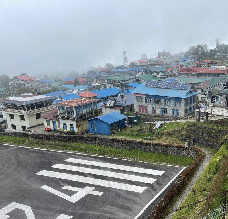
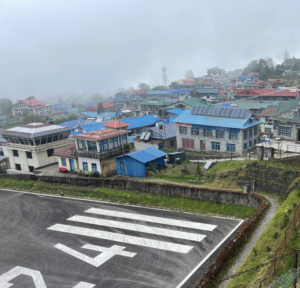
Lukla's airstrip and the town, on the afternoon Day 1 starts. 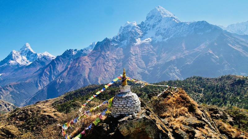
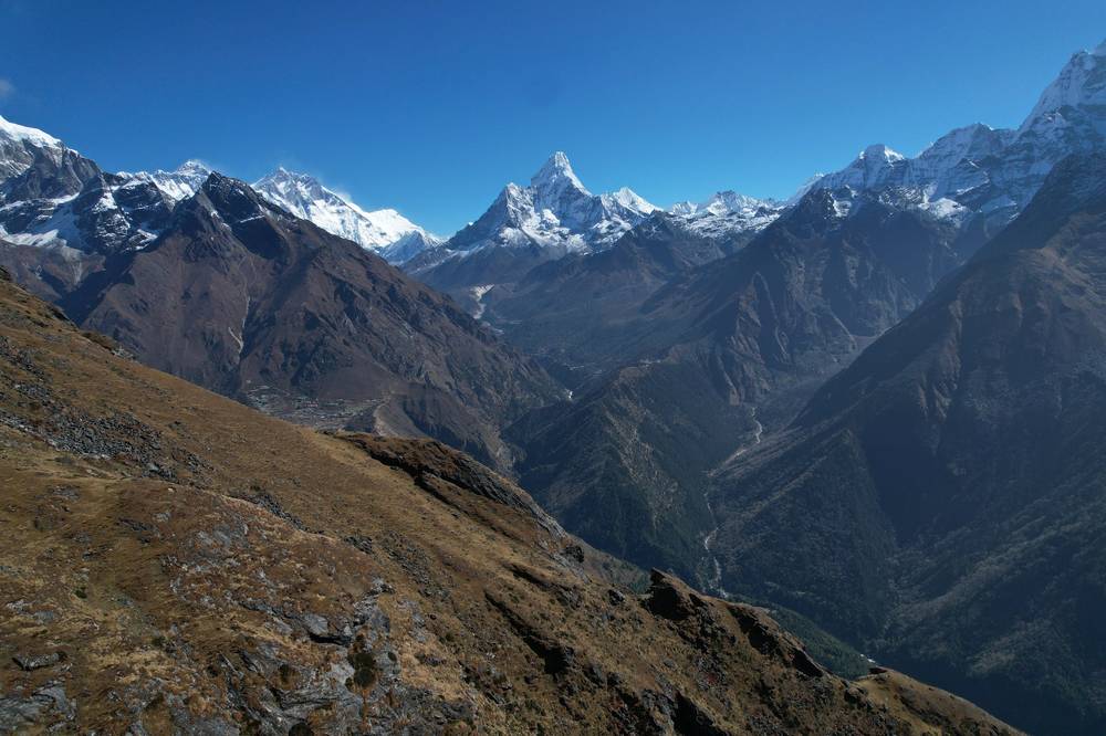
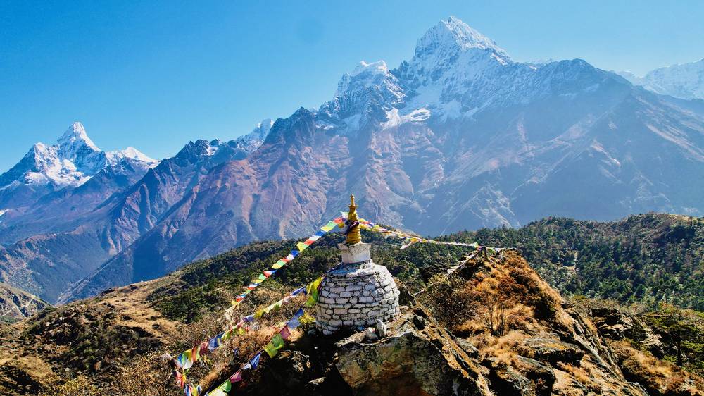
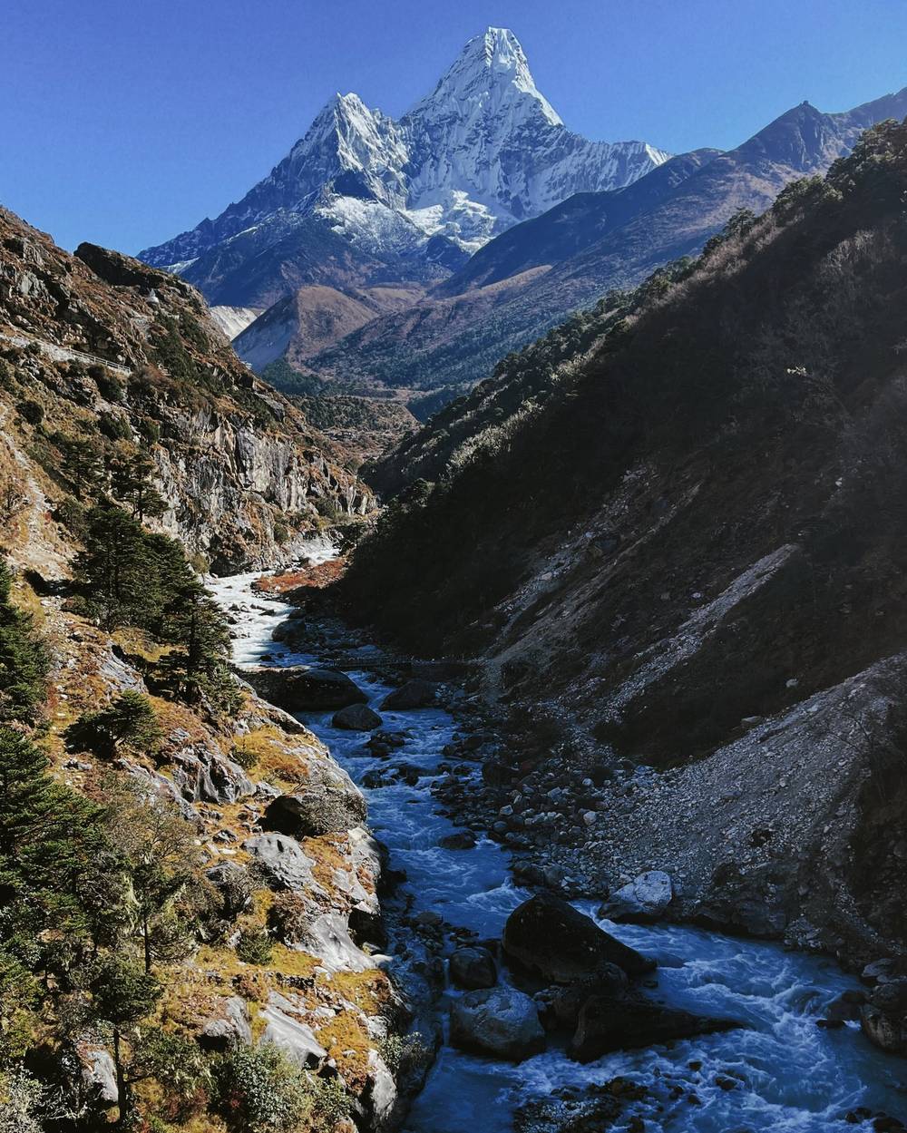
A stupa on the ridge above Khumjung on Day 4, with Ama Dablam on the left. 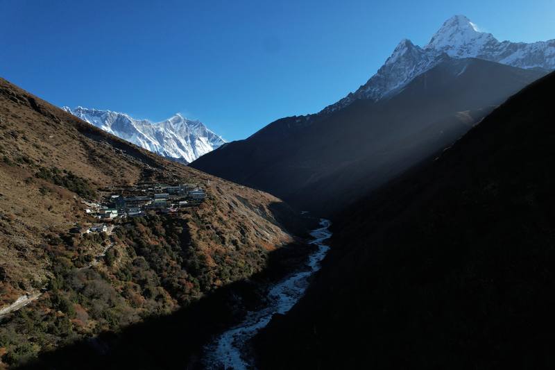
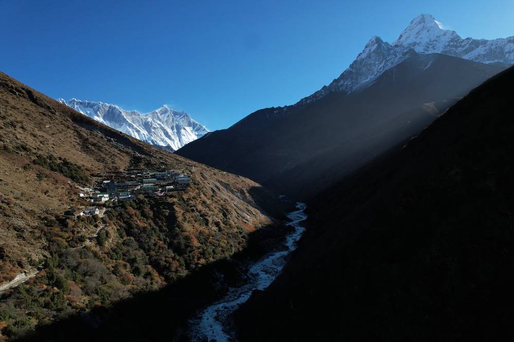
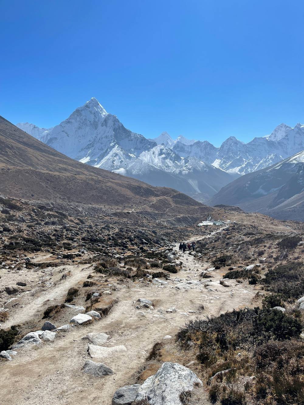
Ama Dablam and the valley below Pheriche on the morning of Day 6. 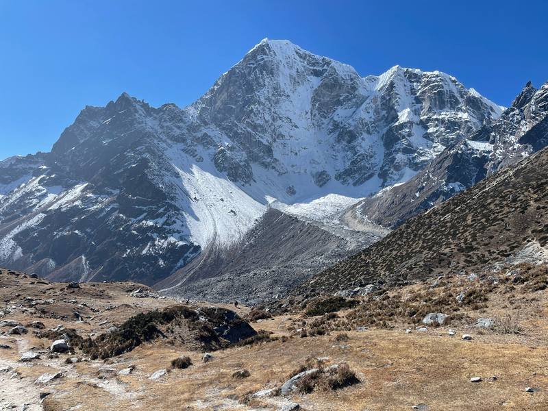
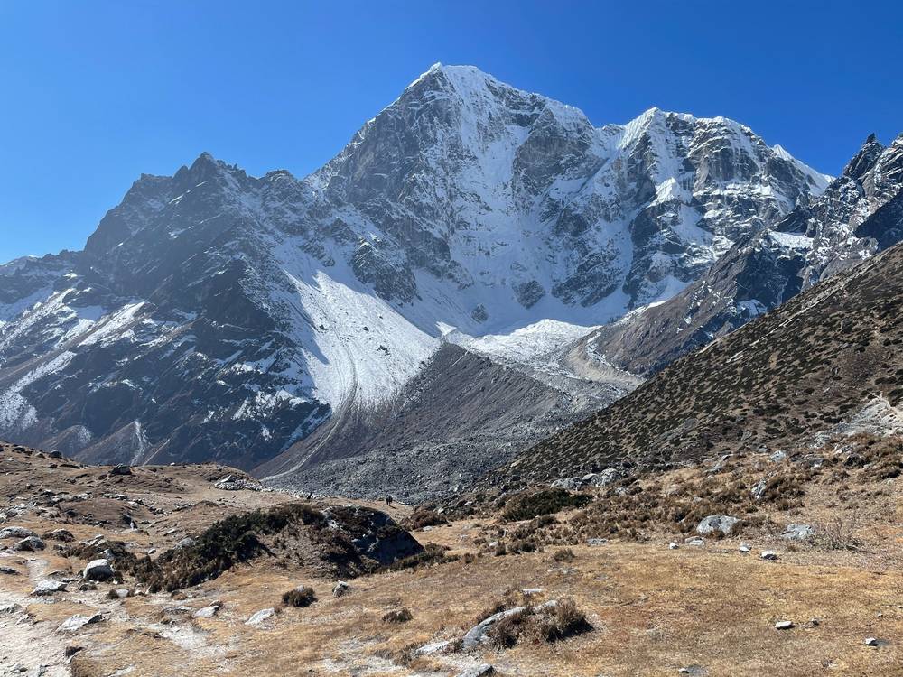
The peaks above Thukla on the way down on Day 9.
Newsletter
Get my letter
Get a short letter from me every couple of weeks: new trips, guides and what I'm building.
Free. Unsubscribe any time.
Details
The guide · Free · 62-page PDF + GPX files · 2027 season edition
Everest Base Camp Hiking Guide
9 days on foot from Lukla to Everest Base Camp in Nepal. Every page is below: read it here, or take it offline as a PDF with my GPX files (62-page PDF + GPX files, in one zip). No sign-up needed.
The route
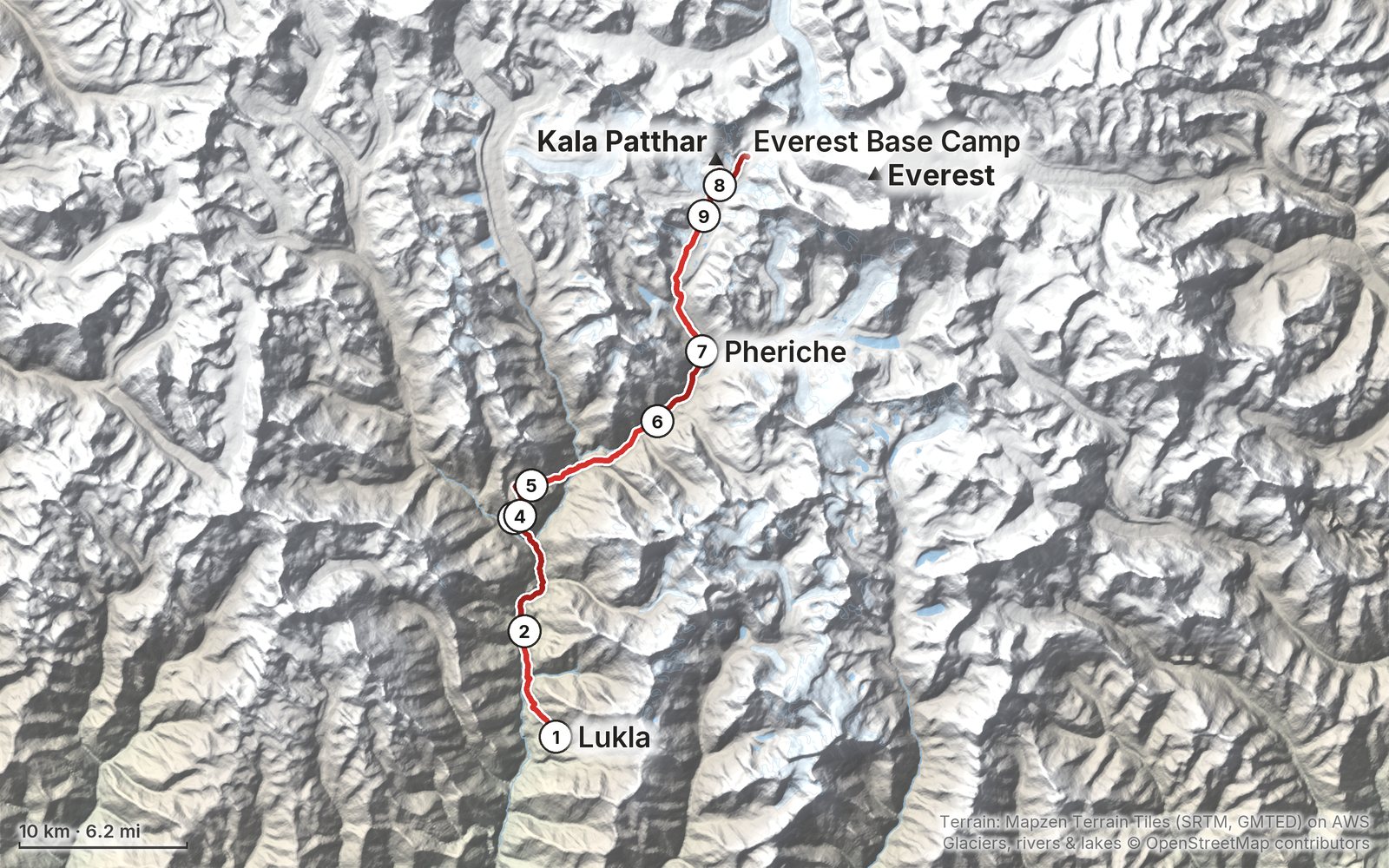
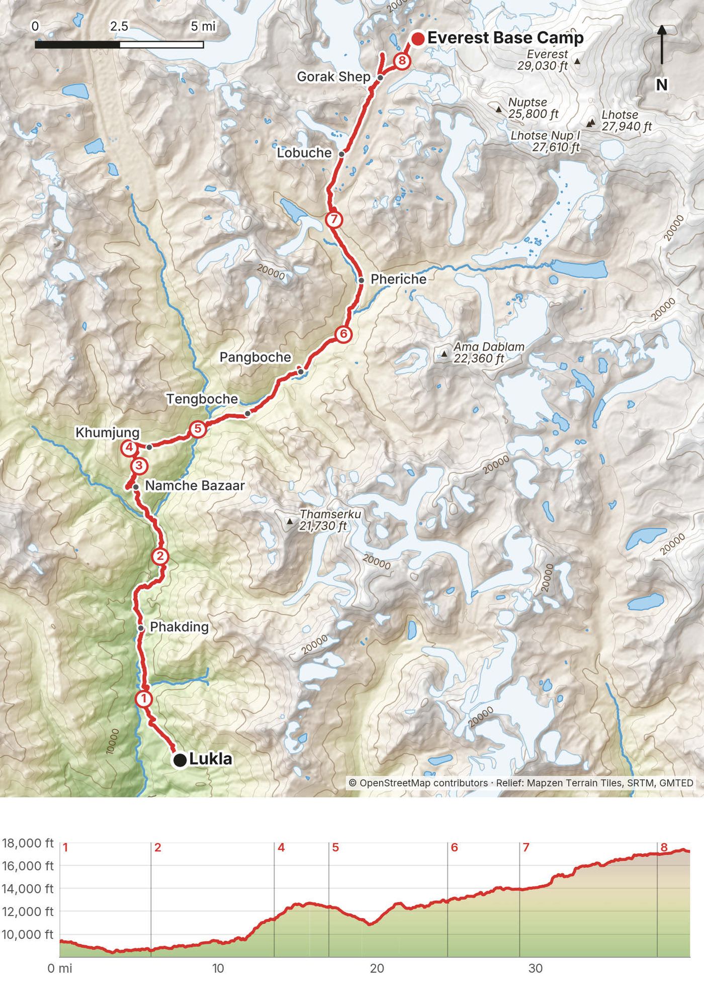
My GPS recording of 9 days on a relief map. The numbers are where each day starts; the red dot is the finish. The day maps are in the guide below, and the GPX files are a free download.
Elevation, start to finish: highest 17,620 ft (5,370 m), lowest 8,370 ft (2,551 m).
At a glance
- Days
- 9 days
- Distance
- 52 miles
- Climbing
- About 17,290 ft (5,271 m) up
- Season
- October to November or March to May
- Permit
- Sagarmatha National Park and the Khumbu municipality: NPR 3,000 each in 2026
- Route
- Lukla to Everest Base Camp on Day 8
Contents
- Welcome
- At a glance
- Straight answers
- How my trip worked
- Permits and fees
- When to go
- Altitude
- Getting there
- Day 1 Lukla to Phakding
- Day 2 Phakding to Namche Bazaar
- Day 3 Namche Bazaar to the Khumjung ridge
- Day 4 Namche Bazaar to Khumjung
- Day 5 Khumjung to Pangboche
- Day 6 Pangboche to Pheriche
- Day 7 Pheriche to Gorak Shep
- Day 8 Gorak Shep to Everest Base Camp
- Day 9 Gorak Shep to Pheriche
- Getting home
- Other ways to do it
- Teahouses, food and water
- Gear for this route
- Weather and safety
- Using the GPX files
- Before you go, check these
- One-page trip sheet
- About this guide
Welcome
In late October 2021 I went back to Nepal for my second trip there and hiked to Everest Base Camp. You start in the lush green valleys, work your way up past the alpine zone, and end up surrounded by glaciers and peaks, and of course Everest. Getting to see that for a moment in your life is enough to make the trek worth it. I highly recommend it.
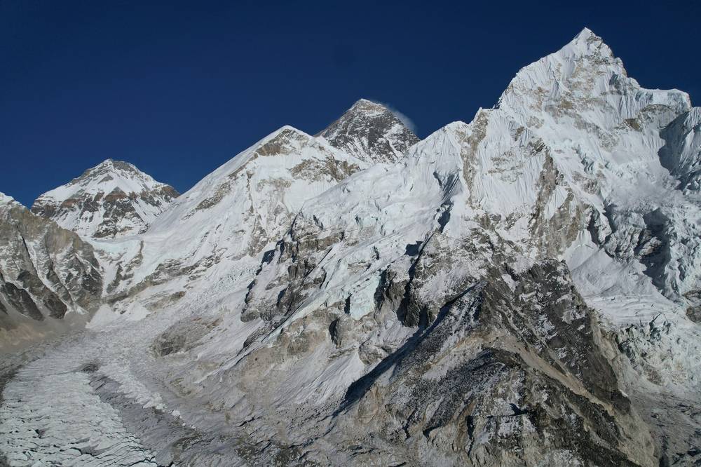
It wasn't a normal trip for me. I usually hike alone. This time I was invited by the World Vlog Challenge, and I walked with a small group of YouTubers from around the world, famous Sherpa guides, porters and yaks, and a TV crew filming a reality show. I signed an agreement not to talk about the show, so this guide doesn't. It's about the trail: nine days on foot from Lukla to Everest Base Camp, by way of Namche Bazaar, Khumjung, Tengboche, Pheriche and Gorak Shep, with an evening climb up Kala Patthar. At the end, the show flew us out by helicopter from Pheriche.
That's how this guide is built. You get my GPS files, maps, notes and film links for every day I walked, and plain facts for everything my trip didn't cover: the permits, the flights to Lukla, the walk back down, and how to space the nights so the altitude doesn't catch you. Where my trip was unusual, because of the show, I say so.
What's inside
- Straight answers to the questions people ask about Everest Base Camp
- How my trip worked, the permits and fees (with my 2021 receipts and the 2026 amounts), and what you need to arrange
- When to go, getting to Lukla, and a clear section on altitude, with every night's height from my GPS
- All nine days: my notes, the trail, where to get off, a map with an elevation profile, and links to that day in my film
- The walk back down, other ways to do it, teahouses and food, and the gear for this route (what I carried and filmed with)
- Weather and safety, one page of things to check before you go, and a printable trip sheet
How to use it offline
Save this PDF to your phone's Files or Books app before you leave home. Load the GPX files and download offline maps in Kathmandu, where the Wi-Fi is good. Each day starts on a new page. The film links need a connection; everything else works in airplane mode.
When I say "I," it's my own trip. Fees and rules change, so they're dated, and the checks are collected on one page: Before you go, check these.
At a glance
| Quick facts | |
|---|---|
| Distance | 52.6 miles (84.7 km) on foot over 9 days, Lukla to Everest Base Camp and back down to Pheriche |
| Climbing | about 17,290 ft (5,271 m) up and 11,510 ft (3,509 m) down |
| Start | Lukla, after a 30-minute flight from Kathmandu |
| Finish | Everest Base Camp on Day 8; I walked down to Pheriche and flew out by helicopter |
| High point | 17,618 ft (5,370 m) on my GPS, on the slope of Kala Patthar. Everest Base Camp: published 17,598 ft (5,364 m) |
| Highest night | Gorak Shep, 16,996 ft (5,181 m) on my GPS; published 16,942 ft (5,164 m) |
| Nights | 11, from October 23 to November 2, 2021: 10 in lodges and 1 in tents |
| How | A group trip run by a TV production, with guides, porters and yaks. I carried a day bag |
| When | October to November or March to May. I walked in late October |
| Permits | Sagarmatha National Park and the Khumbu municipality: NPR 3,000 each in 2026 |
| Difficulty | Not technical, but high: the last three nights are above 13,900 ft (4,240 m) |
| Base | Kathmandu |
| Day | Route | Miles (km) | Up / down (ft) | Night (ft) |
|---|---|---|---|---|
| 1 | Lukla to Phakding | 5.8 (9.3) | 860 / 1,618 | 8,576 |
| 2 | Phakding to Namche Bazaar | 7.8 (12.5) | 3,497 / 804 | 11,261 |
| 3 | Namche up to the ridge and back | 2.7 (4.4) | 1,277 / 95 | 11,261 |
| 4 | Namche Bazaar to Khumjung | 3.5 (5.6) | 1,572 / 580 | 12,388 |
| 5 | Khumjung to Pangboche | 7.5 (12.0) | 2,779 / 2,335 | 12,793 |
| 6 | Pangboche to Pheriche | 4.5 (7.3) | 1,621 / 592 | 13,920 |
| 7 | Pheriche to Gorak Shep, with Kala Patthar | 11.0 (17.7) | 4,599 / 1,501 | 16,996 |
| 8 | Gorak Shep to Everest Base Camp | 2.1 (3.3) | 431 / 210 | 16,996 |
| 9 | Gorak Shep to Pheriche, helicopter to Lukla | 7.9 (12.6) | 658 / 3,777 | Lukla |
The numbers come from my own GPS recordings, smoothed the same way for every day. On Days 3 and 8 I recorded only the way up; the walk back isn't in the numbers. I didn't walk on October 24 (a filming day) or October 29 (a second night in Pangboche).
Straight answers
Did you walk the whole way? Up, yes: every step from Lukla to Everest Base Camp, plus Kala Patthar. Down, only to Pheriche. The show flew us from Pheriche to Lukla by helicopter, and I wasn't going to turn that down. You'll most likely walk back to Lukla, the same way you came. See Getting home.
How many days do I need? My trip took two and a half weeks door to door from New York. The trek was eleven days from Lukla up to Base Camp and down to Pheriche, with two days of no walking, and I still skipped a night on the way up that most people spend at Lobuche or Dingboche. Plan on about 13 or 14 days for the round trip on foot from Lukla, plus spare days in Kathmandu for the Lukla flights. See Other ways to do it.
How hard is it? It's a full, robust trail, not a technical one: good paths, stone steps, suspension bridges and moraine. What makes it hard is the altitude. Knowing that, the name of the game is not getting altitude sickness: slow and steady. My biggest day was Day 7, Pheriche to Gorak Shep: 11.0 miles and about 4,600 ft of climbing on my GPS. Split it: to keep to the 500 m a night rule, sleep at Thukla and Lobuche on the way (see Altitude).
Do I need a guide? In 2021 I was with a group, guides and porters. The rule has changed since, and it's disputed: Nepal's Tourism Board says foreigners need a licensed guide and an agency TIMS card on the Everest Base Camp trek, while the Khumbu municipality says a guide isn't mandatory in its area and issues its own trek card to independent trekkers. See Permits and fees.
When should I go? October to November, or March to May. I went in late October: mostly clear, cold mornings, and the busy season on the trail.
Where do you sleep? In lodges (teahouses), every night except one. The village lodges have dining rooms with a stove and simple rooms. On my trip the show booked everything, so I can't tell you what it cost.
Can I see Everest? Yes, but not from Base Camp itself. My first view from the trail was coming up to Tengboche on Day 5. The best view is from Kala Patthar, the black hill above Gorak Shep. I walked up in the evening for the sunset on Everest: go do that.
Is Base Camp worth it? Honestly, Kala Patthar has the better views. Base Camp is a rock pile with prayer flags at the foot of the Khumbu Icefall, and when I was there it was busy with tourists. But you've got to touch that rock.
Will I get altitude sickness? I didn't. I'd had altitude sickness before, on Kilimanjaro, so this time I focused on sleep, taking my time, staying calm and eating. Above 17,000 ft I had the usual nose issues and coughing, but I felt strong. Read Altitude before you plan your nights.
What does it cost? The show paid for my trip, so my records only hold my two permit receipts: NPR 2,000 for the Khumbu fee and NPR 3,000 for the national park in 2021. Both are NPR 3,000 in 2026. See Permits and fees.
Phone, Wi-Fi and charging? Lodges sell Wi-Fi: I had an Everest Link Wi-Fi card in Pheriche. I brought extra drone batteries because I didn't know how much charging there would be. Bring a power bank.
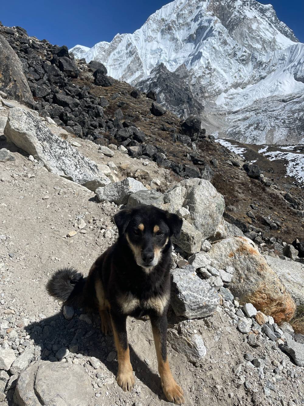
Dogs? Lots, and they're very used to hikers. Most live around the villages and lodges and do what they want. I met my first one about three minutes after getting off the plane in Lukla.
How my trip worked
The invitation. In 2020, after my Mardi Himal trek, someone saw me at the Kathmandu airport as I was leaving Nepal and invited me for a drink. He wanted to bring a group of creators to Nepal to hike to Everest Base Camp, film a show about it, and have us compete with vlogs. Two years later he made it happen. The World Vlog Challenge confirmed my place in August 2021, and I flew out on October 20.
The group. A handful of big YouTubers from India, the USA, Nepal, Colombia, Thailand and more, famous Sherpa guides with Everest records, porters and yaks, and a production crew. I think we were over a hundred people. We didn't all hike together: the talent walked with the Sherpas and guides, and everyone else went on ahead with the yaks and porters. Kami, who holds the record for Everest summits, walked with us, and people along the trail kept stopping him for selfies.
Bags. Everyone had a day bag, and a duffel with everything else went up the mountain with porters or yaks. The organizers also gave each of us a duffel of gear for the trek. I'm used to carrying everything on my back, so I had the lightest duffel. The morning after Day 1 my duffel hadn't arrived, and I spent the day without my contacts or glasses. Keep what you can't do without in your day bag.
The pace. I knew it would be slower than hiking alone: a long trek with altitude, a slow grind, and a team effort. The show stopped every day to film for hours, so there are long gaps between my recordings, and I often arrived late. When the guides had the "Kraig can hike" vibe, they gave me the green light to go ahead on my own: to Namche on Day 2, to Pangboche on Day 5, and to Gorak Shep on Day 7. I wanted to walk the whole way, do my thing and have a nice hike.
Food. Because the group was big, a lot of the food was catered: porridge and two boiled eggs for breakfast (two, no more), dal bhat, and lots of milk tea. When I hike alone, part of the fun is trying different places, so on Day 7, eating food I chose and paid for was nice.
What it cost me. The show paid for the whole thing. My records hold only my two permit receipts (below). There are no costs for flights, lodges or food in my records.
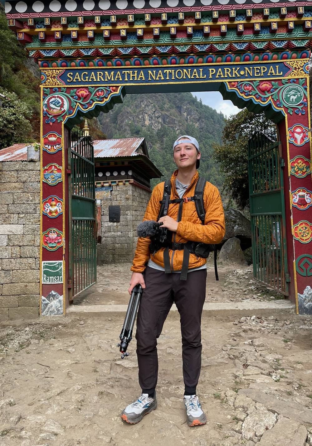
Permits and fees
My 2021 receipts
| Permit | Where | 2021 |
|---|---|---|
| Khumbu Pasang Lhamu Rural Municipality tourism fee | Issued October 23 (Day 1), stamped October 25 | NPR 2,000 per person per entry |
| Sagarmatha National Park entrance permit (foreigners) | Issued October 25 at the Jorsale post | NPR 3,000, including 13% VAT |
In 2026
- Sagarmatha National Park: NPR 3,000 a person per entry for foreigners (NPR 1,500 for SAARC nationals). Pay at the Tourist Service Center in Kathmandu or at the park entry point at Monjo and Jorsale. The Nepal Tourism Board's page doesn't mention VAT; my 2021 receipt included it in the NPR 3,000.
- Khumbu Pasang Lhamu Rural Municipality Trek-Card: NPR 3,000 for most foreigners (NPR 2,000 for SAARC and China), issued at the municipality's Tourist Information Center in Lukla in about 15 minutes with your passport and a photo.
- A guide and TIMS. Since March 31, 2023, the Nepal Tourism Board has required foreign trekkers in listed protected areas to go with a licensed guide and carry a TIMS card from a registered agency (NPR 2,000). Its list includes the Everest Base Camp trek. The Khumbu municipality rejected that for its area in 2023: it says a guide isn't mandatory in the Everest region and issues its own Trek-Card instead of TIMS. I found no formal settlement as of October 2026. Hiring a licensed guide through a registered agency is the safe choice; if you plan to go without one, check the rule close to your dates.
- Visa: tourist visa on arrival, US$30 for 15 days, US$50 for 30 days, US$125 for 90 days.
Carry your permits in your day bag; they're checked on the trail. (Checked October 1, 2026; sources in the guide's research notes.)
What you need to arrange
- Flights to Lukla, and spare days for them. See Getting there.
- The two permits above, and a guide through a registered agency if you want the rule settled for you.
- Lodges. In the busy season, book ahead or go with an agency that does.
- Porters or a light pack. On my trip porters and yaks carried the duffels. Without them, you carry everything, so pack light.
- Cash in rupees. There are ATMs in Lukla and Namche, but they can run out or refuse foreign cards, and there are none higher up. Lodges mostly take cash.
- Insurance. Make sure your policy covers trekking to at least 6,000 m (19,700 ft) and helicopter evacuation. Kala Patthar is above 5,500 m.
When to go
The Nepal Tourism Board's best seasons for the Everest region are October to November and March to May. December to February is cold with snow; June to September is the monsoon, with heavy rain, cloud and landslides.
I walked from October 23 to November 2. We had blue skies at Lukla on the first morning, gray skies by the afternoon, and then mostly clear, sunny days from Namche up, with mist in Khumjung on the afternoon of Day 4. There was old snow on the moraine around Lobuche and Gorak Shep, and the mornings up high were cold: at Gorak Shep on Day 8 I warmed up in the sun before starting. It was also the busy season, and Base Camp was crowded.
Altitude
This is the part of the trek to take seriously. Lukla is at about 9,400 ft (2,860 m), and my last three nights on the trek were at 13,920 ft (4,243 m) and above.
How I did it. I spent two nights in Namche and a night in Khumjung, and I didn't walk on October 24 or 29. Then, on Day 7, I skipped a day: I went from Pheriche straight to Gorak Shep, a jump of about 3,080 ft (940 m) in sleeping height, and walked up Kala Patthar that evening. I was experienced and felt great, and it's not what the rules of thumb say. Don't copy it: sleep at Thukla and Lobuche in between.
My nights (my GPS and published heights differ by up to about 90 m):
| Night after | Where | My GPS | Published |
|---|---|---|---|
| Day 1 | Phakding | 8,576 ft (2,614 m) | 2,610 m |
| Oct 24 | Tents (filming) | ||
| Days 2 and 3 | Namche Bazaar | 11,261 ft (3,432 m) | 3,440 m (low point) |
| Day 4 | Khumjung | 12,388 ft (3,776 m) | 3,790 m |
| Day 5 (and Oct 29) | Pangboche | 12,793 ft (3,899 m) | 3,985 m |
| Day 6 | Pheriche | 13,920 ft (4,243 m) | 4,240 to 4,371 m |
| Days 7 and 8 | Gorak Shep | 16,996 ft (5,181 m) | 5,164 m |
| Day 9 | Lukla (by helicopter) | 2,860 m |
The rules of thumb. The US CDC's current guidance (Yellow Book 2026): once above 3,000 m (9,800 ft), don't raise your sleeping height by more than 500 m (1,650 ft) a night, and add an extra night for every 1,000 m (3,300 ft) you gain. Applied to this trail, on my GPS heights: two nights in Namche (3,432 m), Khumjung (3,776 m) or Tengboche (3,859 m), Pangboche (3,899 m), two nights in Pheriche (4,243 m), Thukla (about 4,590 m), Lobuche (about 4,930 m), then Gorak Shep (5,181 m): every step under 500 m. Namche to Pangboche in one go is 545 m on the published heights. From Dingboche (published 4,410 m), Lobuche (4,910 to 4,940 m) is at the limit, so stop at Thukla there too.
The signs. Headache is the main symptom of acute mountain sickness, usually with loss of appetite, dizziness, tiredness or nausea. Confusion, stumbling or drowsiness, like being drunk, can mean HACE (swelling of the brain). Breathlessness at rest, a cough and chest congestion can mean HAPE (fluid in the lungs). Both are emergencies. Going down 300 m (1,000 ft) or more usually helps quickly. Ask your doctor about acetazolamide before you go.
Help on the trail. The Himalayan Rescue Association runs an aid post in Pheriche, staffed by volunteer doctors in the spring and autumn seasons, with daily talks on altitude sickness. I slept in Pheriche on Day 6.
Getting there
To Kathmandu. I flew from New York via Istanbul, where I had my Turkish coffee, thick and muddy. Kathmandu airport on arrival is a double diamond: customs, queues and finding your way. The organizers put us up at the Courtyard Marriott downtown, where we met the rest of the group and ate dal bhat. I arrived on October 21, two days before we flew to Lukla. Get your visa on arrival (see Permits and fees) and your rupees here.
To Lukla. On October 23 we met at about 5 a.m., drove to the little domestic airport in Kathmandu and flew to Lukla in a small plane. Lukla's airport is famous for its short, sloped runway with a cliff at the end. I don't think I'd ever landed at an airport in the mountains before. The flight from Kathmandu takes about 30 minutes.
That's not always how it works now. In the busy seasons, Nepal's Civil Aviation Authority moves most Lukla flights to Manthali airport in Ramechhap. You drive there from Kathmandu first, about 4 to 5 hours, often leaving in the middle of the night, then fly 15 to 20 minutes to Lukla. Lukla flights only go in good weather and are often delayed or cancelled, sometimes for days. Keep at least one or two spare days at each end.
Day 1: Lukla to Phakding
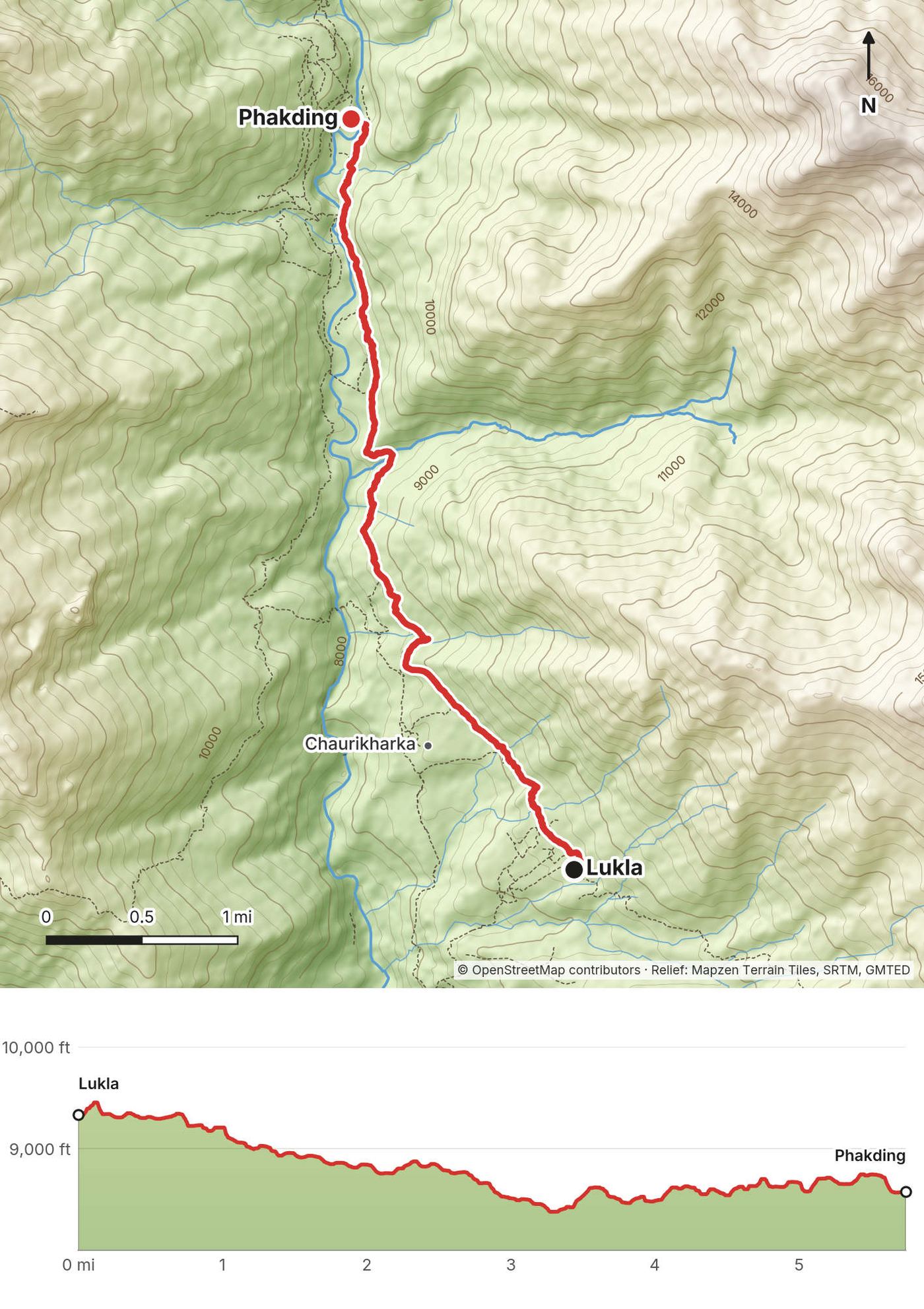
- Distance
- 5.8 mi (9.3 km)
- Climbing
- 860 ft (262 m)
- Descent
- 1,618 ft (493 m)
- Time I took
- 4.2 hours (2:49 to 7:00 p.m.), with long stops for filming
- High point
- 9,482 ft (2,890 m), at Lukla
- Sleep
- Phakding, 8,576 ft (2,614 m) on my GPS
- Terrain
- A stone path down through villages to the Dudh Kosi and along the river
My day
Day zero, day one, I don't know what you call it. It was almost 5 a.m., we were supposed to meet at five, and a lot of people were missing. We piled into a clown car full of influencers, went through security and flew to Lukla. Stepping off the tarmac we had beautiful blue skies, mountains all around us. About three minutes after getting off my plane I met my first dog, Luxie. Very good dog, about a 10 out of 10.
This is where the show started, and there are big gaps in my film because of it. We started hiking hours after we landed, and the skies had gone gray. Lukla to Phakding was our first little trek, mostly downhill, so very easy. The crew and the other creators were curious about how I shoot my hiking videos: find a spot, set up the tripod, frame it, walk past, walk back to grab it. We walked on the left side of the shrines and spun the prayer wheels, and I gave a kid a Kit Kat. We were filming, so it got dark before we arrived, and we rolled in with our headlamps.
The trail
From the airstrip the path heads north out of Lukla on stone paving, past lodges and shops, then drops through farms and villages toward the Dudh Kosi. My low point was the river at about 8,370 ft (2,550 m), 3.3 miles in. From there it's a gentle walk upstream to Phakding, which sits on both banks, with lodges on each side. It's the easiest day of the trek, and a good one to get used to walking at this height.
If you need to get off
You're a couple of hours below Lukla. Walk back up the way you came.
Watch this day
Film, Day 1 · Kathmandu · The companion film, where I talk through the trip
Day 2: Phakding to Namche Bazaar
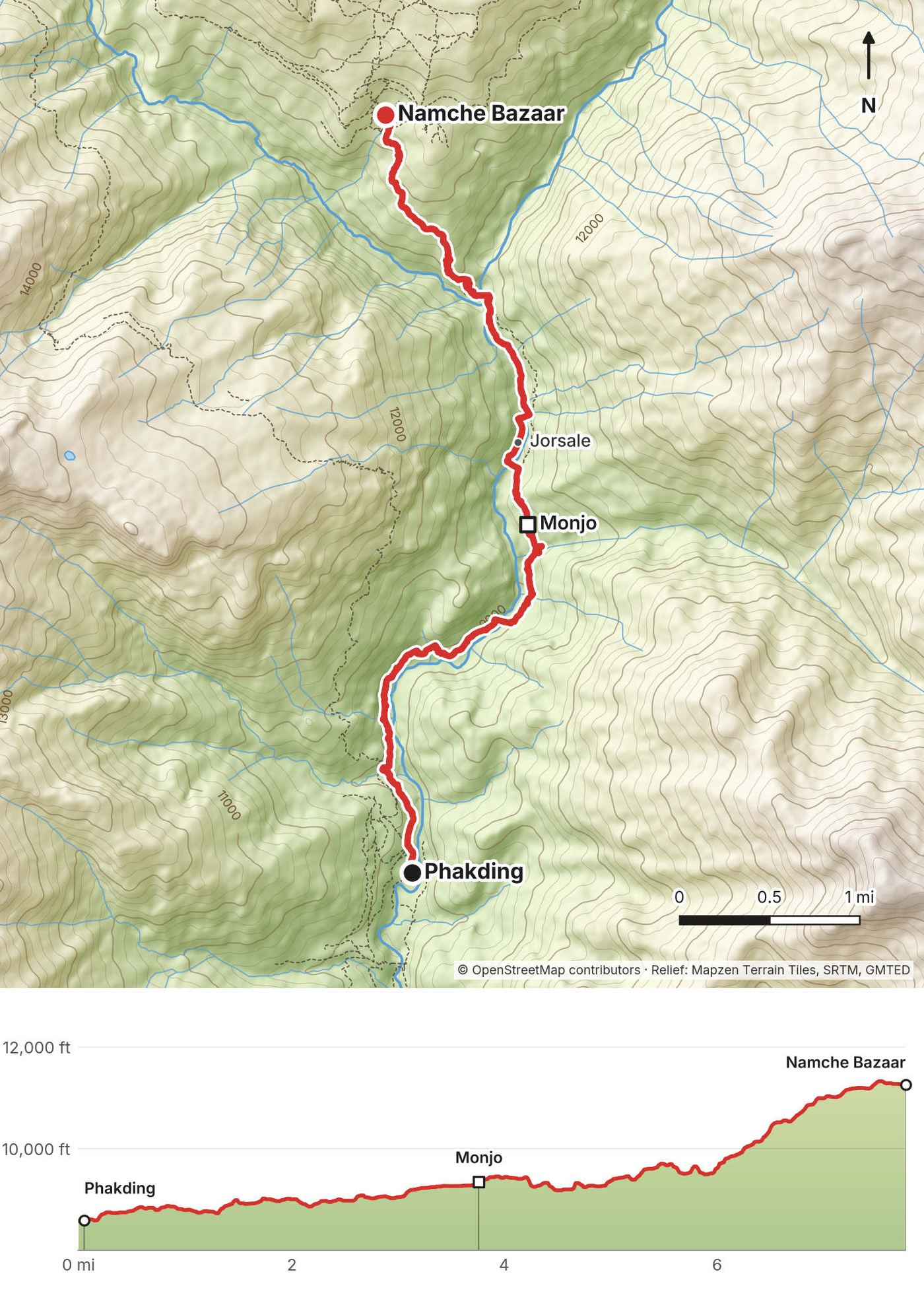
- Distance
- 7.8 mi (12.5 km)
- Climbing
- 3,497 ft (1,066 m)
- Descent
- 804 ft (245 m)
- Time I took
- 7.4 hours (11:07 a.m. to 6:34 p.m.), with filming stops; Namche at 6:20 p.m.
- High point
- 11,335 ft (3,455 m), in Namche
- Sleep
- Namche Bazaar, 11,261 ft (3,432 m) on my GPS
- Permits
- the Sagarmatha National Park gate and checkpoint at Monjo and Jorsale
- Terrain
- Up the river past Monjo, several suspension bridges, then the long, steep climb to Namche
My day
The morning after Day 1 was interesting. I didn't have my contacts or glasses, just my day bag: our duffels hadn't arrived. I spent the day not able to see much, stumbling around and filming. But I had porridge, so things were looking better. I didn't record any walking on October 24. It was a day of filming for the show, and that night we slept in tents.
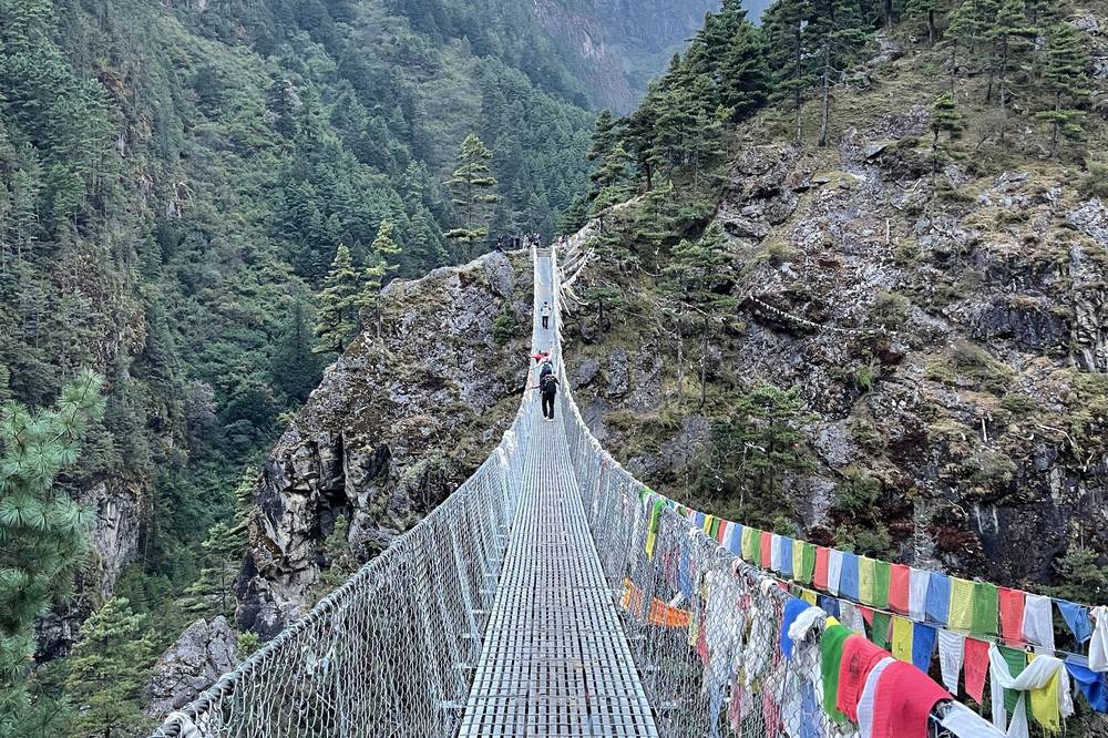
On October 25 we walked on up the valley. I took so many clips of the bridges and didn't use most of them. Dal bhat, again: a beautiful balance of everything you need. We filmed again, and it was getting dark by the time we reached the Hillary bridge, a really long, high bridge. I'd never been on anything like it.
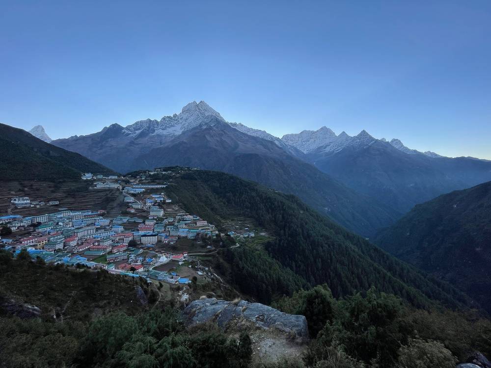
That was the first moment I got the green light to just go. I had AllTrails and knew exactly where I was going, and the Sherpas and guides had the "Kraig can hike" vibe. So I beast-moded up to Namche Bazaar and made it just at sunset. Everyone else was hiking in the cold and dark for a while. I followed a dog for a bit into town. Namche is nestled into a cup on the side of the mountain, and there are no roads: everything comes up on animals, on people's backs or by helicopter. I drank a lot of milk tea.
The trail
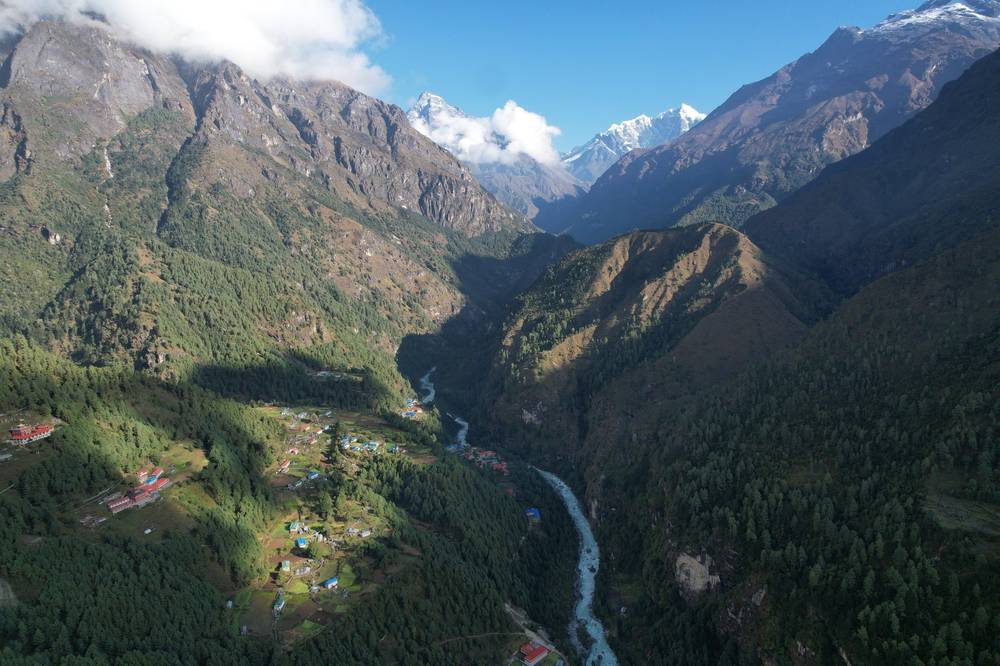
From Phakding the trail follows the Dudh Kosi upstream, crossing it on suspension bridges, through Benkar to Monjo, about 3.8 miles in. Just past Monjo is the Sagarmatha National Park gate and the checkpoint at Jorsale, where permits are checked. The path stays near the river to the Hillary bridge, the highest bridge on the trail, then climbs: about 1,700 ft (500 m) of steep switchbacks through forest to Namche. Take the climb slowly. It's the first big gain in height.
If you need to get off
Back down the valley to Phakding and Lukla, all on the main trail.
Watch this day
Day 3: Namche Bazaar to the Khumjung ridge
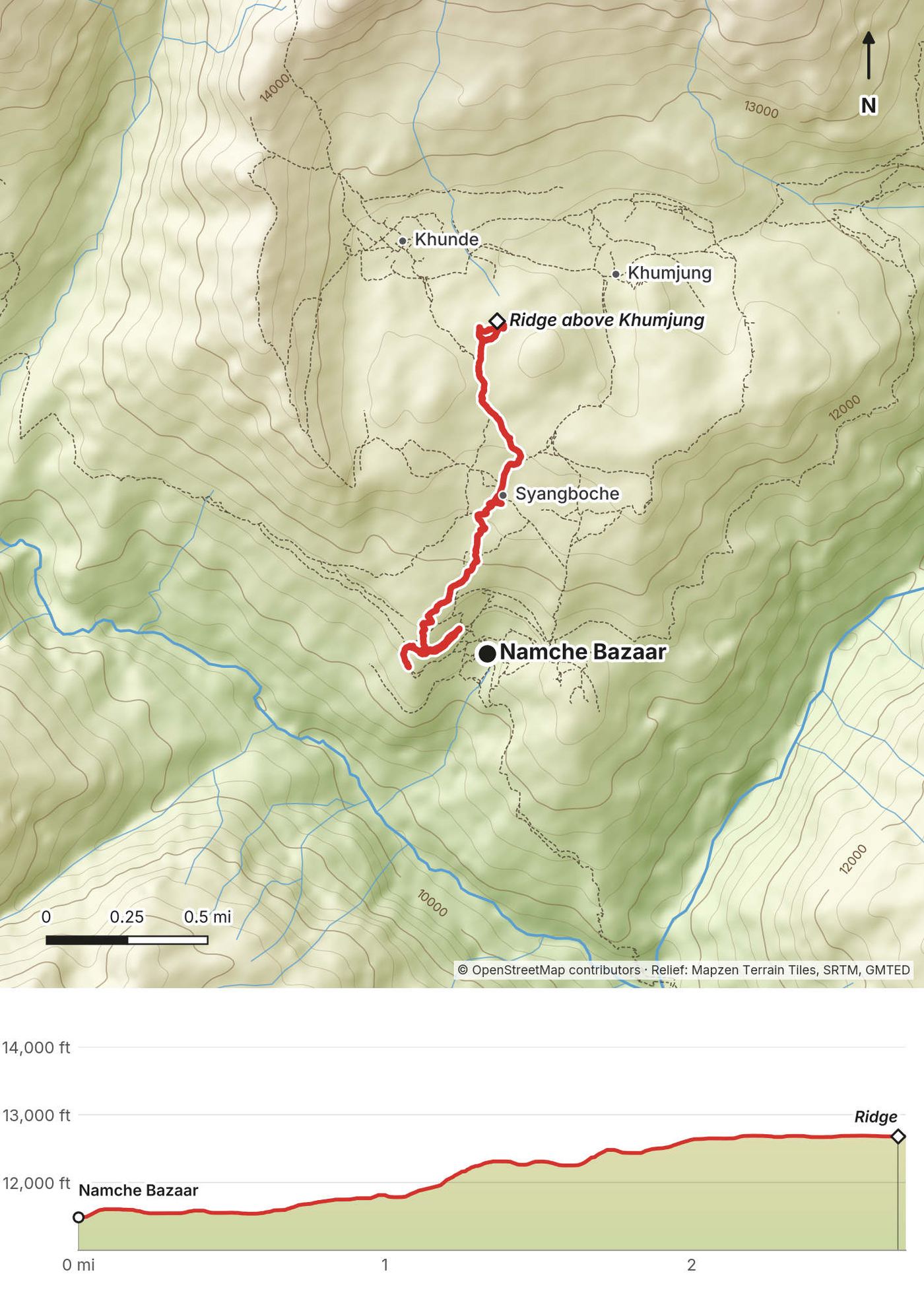
- Distance
- 2.7 mi (4.4 km), one way up; the walk down isn't recorded
- Climbing
- 1,277 ft (389 m)
- Descent
- 95 ft (29 m)
- Time I took
- 4.1 hours up (11:19 a.m. to 3:27 p.m.), with filming
- High point
- 12,693 ft (3,869 m), on the ridge between Syangboche and Khunde
- Sleep
- Namche Bazaar again, 11,261 ft (3,432 m)
- Terrain
- Steep paths and steps above Namche, then open ridges with big views
My day
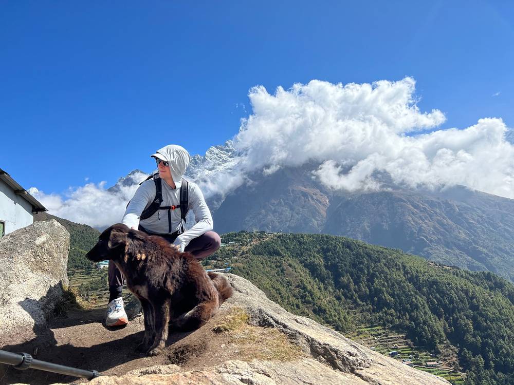
We hiked up above Namche Bazaar to shoot for the show, came back down and spent the night, then went back up the next day. A lot of extra time for the show, not my usual itinerary, but a good way to acclimatize: up high in the day, back down to sleep.
Breakfast was porridge and two boiled eggs. They limited us: two, no more. You can't have six eggs. Because we were such a big group, a lot of the food was catered.
The trail
From the top of Namche the path climbs steeply north, past the Syangboche airstrip, onto the open ridge between Syangboche, Khunde and Khumjung, at about 12,700 ft (3,870 m). It's the classic acclimatization walk from Namche. On a clear day you see Everest, Lhotse and Ama Dablam from up here. Walk back down the same way, or on to Khumjung and back to Namche by the lower path.
If you need to get off
You're above Namche: go back down.
Watch this day
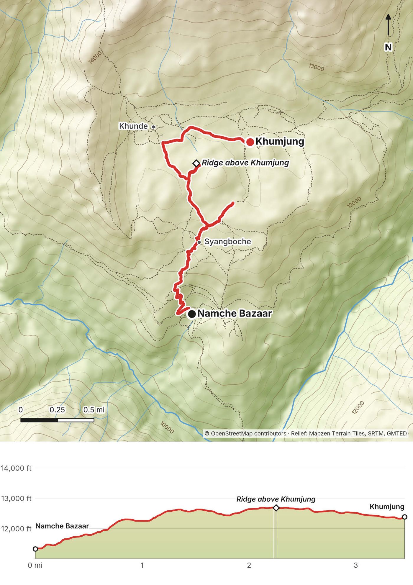
Day 4: Namche Bazaar to Khumjung
- Distance
- 3.5 mi (5.6 km), in two parts
- Climbing
- 1,572 ft (479 m)
- Descent
- 580 ft (177 m)
- Time I took
- 2.3 hours of walking (7:47 to 9:26 a.m. up the ridge, 1:54 to 2:34 p.m. to Khumjung)
- High point
- 12,691 ft (3,868 m), on the ridge again
- Sleep
- Khumjung, 12,388 ft (3,776 m) on my GPS
- Terrain
- The same steep climb out of Namche, then across the ridge and down into the Khumjung valley
My day
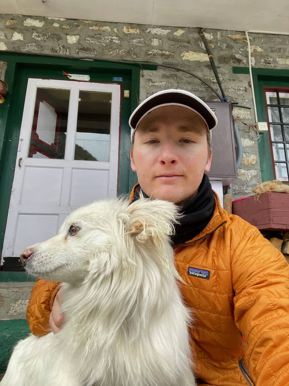
Back up to the ridge above Namche to film, and then on to Khumjung. It isn't on the usual Everest Base Camp route; it's just above it, a cool, weird little spot, very misty, with the mountains right there. People kept telling me that's where yetis live, and that the monastery had a yeti scalp, so I went to look for it. I didn't see it. In a lot of the teahouses there were photos on the wall of footprints in the snow: this is a yeti print right here. The lodge where we stayed had a dog called Underwear. Perfect name for this dog.
The trail
The morning is the Day 3 climb again, to the stupa and prayer flags on the ridge. From there a path drops gently east into the wide Khumjung valley, with its stone walls and fields, and the village below the peak of Khumbila. Khumjung and Khunde sit side by side. From Khumjung, paths lead back to Namche (one passes Hotel Everest View) or on down to the main trail toward Tengboche, which is where Day 5 goes.
If you need to get off
Namche is about an hour back over the ridge, and everything below it is on the main trail.
Watch this day
Day 5: Khumjung to Pangboche
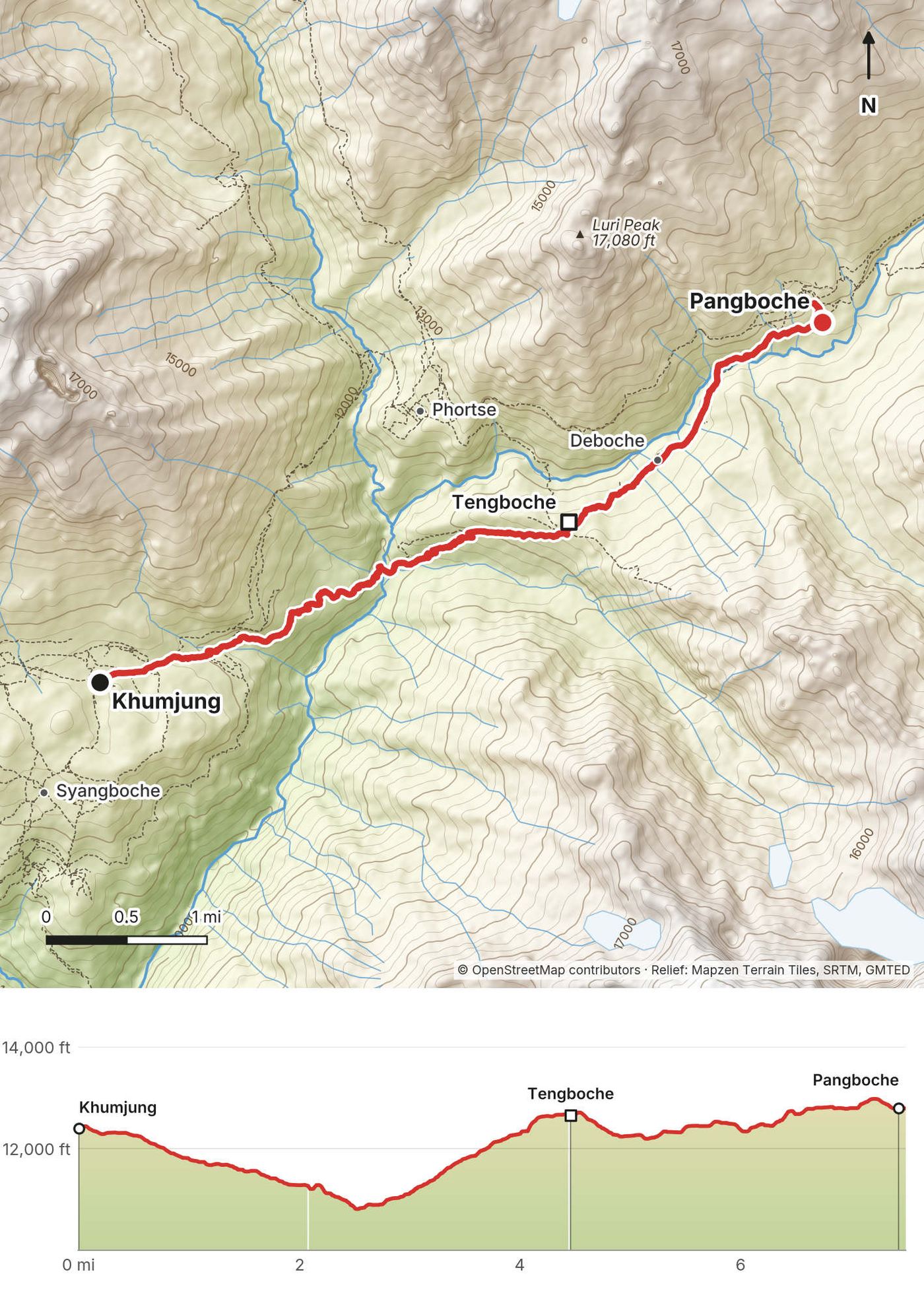
- Distance
- 7.5 mi (12.0 km)
- Climbing
- 2,779 ft (847 m)
- Descent
- 2,335 ft (712 m)
- Time I took
- 4.0 hours (6:15 to 10:16 a.m.)
- High point
- 12,981 ft (3,957 m), near Pangboche
- Low point
- 10,796 ft (3,291 m), the river at Phunki Thenga
- Sleep
- Pangboche, 12,793 ft (3,899 m) on my GPS
- Terrain
- A long descent to the river, the climb to Tengboche, then through forest to Pangboche
My day
A very special morning: I got the green light to set off early and hike all the way to our next stop on my own. Other people took other means, helicopters, to save time. I saw the route and thought I could crush it, so I woke up and set off alone, and I got there before everyone else.
I saw the national bird of Nepal, the danphe. I didn't know what it was; I thought it was a cool-looking pheasant, like a Pokémon. Coming up to Tengboche I had my first view of Everest from the ground: that little thing right there is the tallest mountain in the world. I made it to Pangboche. There are a lot of "boches" on this route, so it gets confusing. Up here I saw what I thought were satellite dishes, with kettles in them: they're solar cookers for boiling water. There's a lot of sunlight up there. The locals did a dance for us.
We stayed a second night in Pangboche. My GPS shows no walk on October 29.
The trail
From Khumjung the path contours east and drops a long way, through forest, to the Dudh Kosi at Phunki Thenga, about 10,800 ft (3,290 m). The climb that follows is the big one of the day: about 1,800 ft (550 m) up through forest to Tengboche, with its monastery on a saddle and Everest, Lhotse and Ama Dablam ahead. From Tengboche the trail drops through forest to Deboche, crosses the river, and climbs gently to Pangboche, the last big village before the high valleys. From Namche, most people join this trail below Tengboche by the main path instead of going through Khumjung.
If you need to get off
Down the way you came to the river, and back to Namche by the main trail (about the same distance as this day).
Watch this day
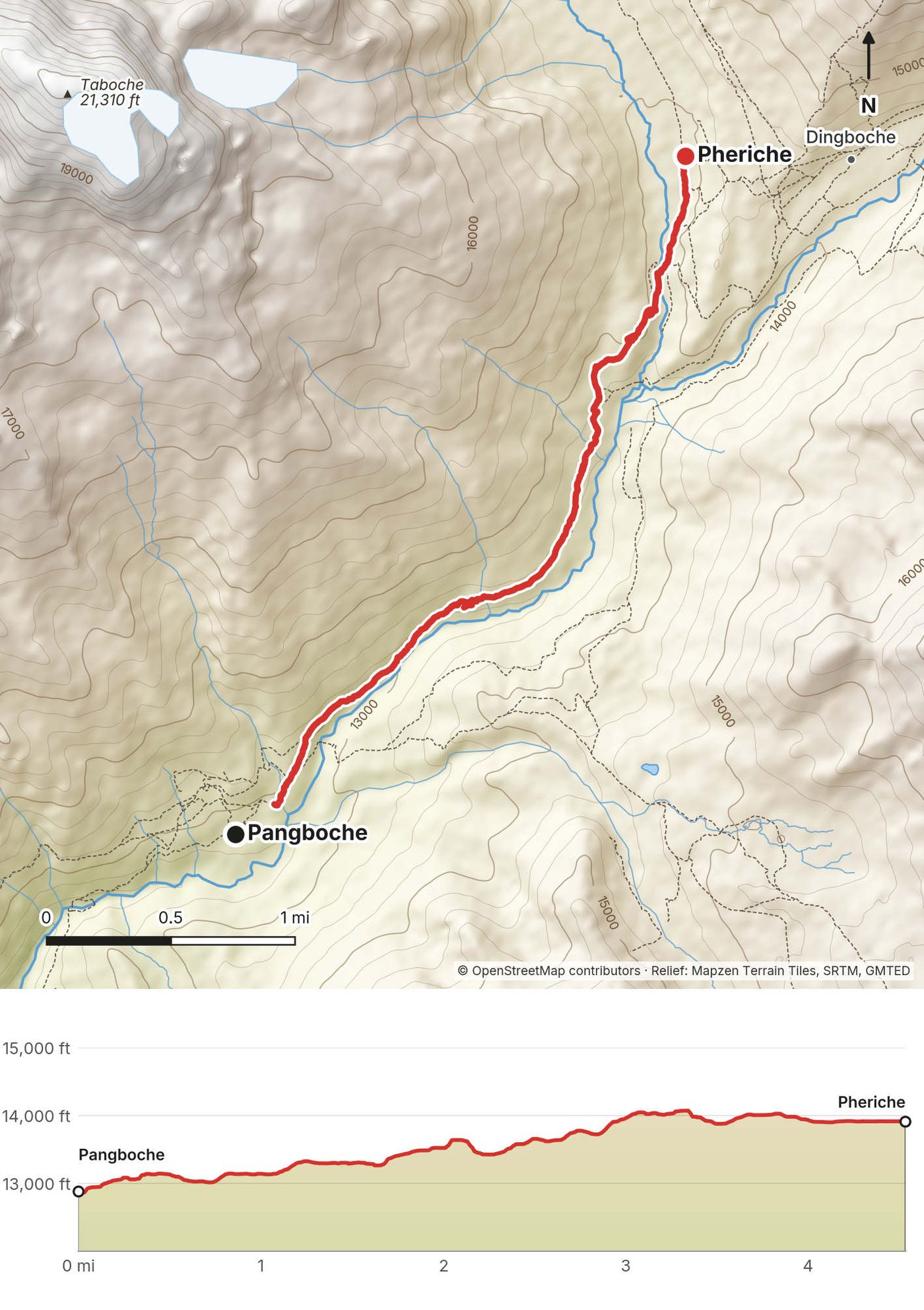
Day 6: Pangboche to Pheriche
- Distance
- 4.5 mi (7.3 km)
- Climbing
- 1,621 ft (494 m)
- Descent
- 592 ft (180 m)
- Time I took
- 3.2 hours (6:19 to 9:33 a.m.)
- High point
- 14,079 ft (4,291 m), on the rise about a mile before Pheriche
- Sleep
- Pheriche, 13,920 ft (4,243 m) on my GPS
- Terrain
- A good path up the valley above the tree line, yak pastures and stone walls
My day
A short morning up the valley, then some downtime in Pheriche. There were yaks grazing along the stone walls, and in Pheriche I had an Everest Link Wi-Fi card, the way you get online up here.
The trail
From Pangboche the path climbs gently along the valley side above the Imja Khola, with Ama Dablam across the river, past a few lodges at Somare. Above the tree line the trail splits: one branch climbs to Dingboche, in the Imja valley; mine crossed the stream and followed the Khumbu Khola into Pheriche, a line of lodges on a flat valley floor. Pheriche has the Himalayan Rescue Association's aid post. Dingboche, over the ridge, is where most itineraries spend two nights.
If you need to get off
Back down to Pangboche and Tengboche. If you're unwell, the aid post in Pheriche is the place to go first.
Watch this day
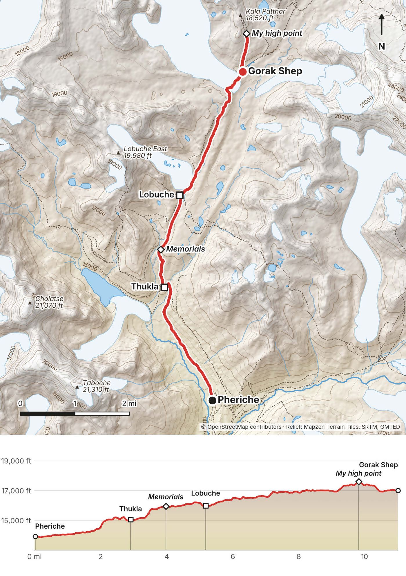
Day 7: Pheriche to Gorak Shep
- Distance
- 11.0 mi (17.7 km), including the walk up Kala Patthar
- Climbing
- 4,599 ft (1,402 m)
- Descent
- 1,501 ft (458 m)
- Time I took
- 9.3 hours (7:55 a.m. to 5:13 p.m.); Gorak Shep at 1:29 p.m.
- High point
- 17,618 ft (5,370 m) on my GPS, on the slope of Kala Patthar at 3:51 p.m.
- Sleep
- Gorak Shep, 16,996 ft (5,181 m) on my GPS
- On the way
- Thukla at 9:03 a.m., the memorials at 10:12, Lobuche at 10:39
- Terrain
- The valley floor, a steep climb to the memorials, then moraine beside the Khumbu Glacier
My day
After some downtime in Pheriche I got the green light to hike ahead of the team, past Lobuche and all the way up to Gorak Shep. It was ambitious: I was skipping a day of acclimatization. Over 10 miles with about 5,000 ft of climbing. A big day, and man, it was fun. It's so nice to hike on my own at my own speed and do some tough stuff. Amazing views, and I got to eat and spend my own money on the food I wanted. On the way to Lobuche I ran into a subscriber from New Jersey, who was on his way down from Base Camp.
Making my way up to Gorak Shep I got into the realm of 17,000 ft, which is a lot: Mount Whitney, the highest peak in the lower 48 states, which I've summited, is just over 14,000. I'd been sick at altitude before, on Kilimanjaro, so I felt more ready this time: getting sleep, taking my time, being calm and eating. I felt strong. You start to get nose issues and coughing, but it wasn't too bad.
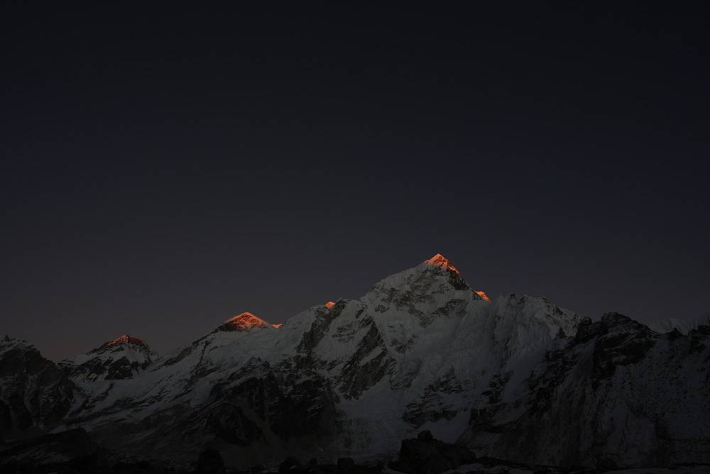
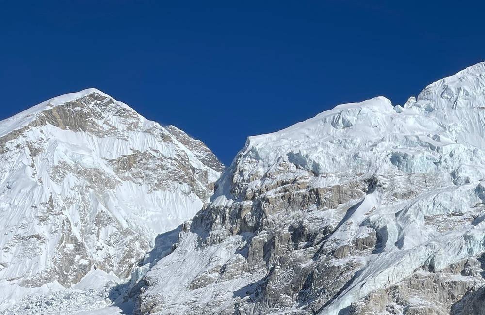
Gorak Shep is the last bit of civilization before Base Camp. People kept telling me the best view of Everest is from the sandy, rocky black hill next to it, Kala Patthar. That evening I set off very slowly up its slope to get views of the setting sun on Everest. In the film I said I reached 18,000 feet; my GPS says 17,618 ft (5,370 m), below the top. Either way, it was higher than I'd ever been. I felt fantastic, I got the shots, and it was nice to be alone up there. There was one person mountain biking. Wow.
The trail
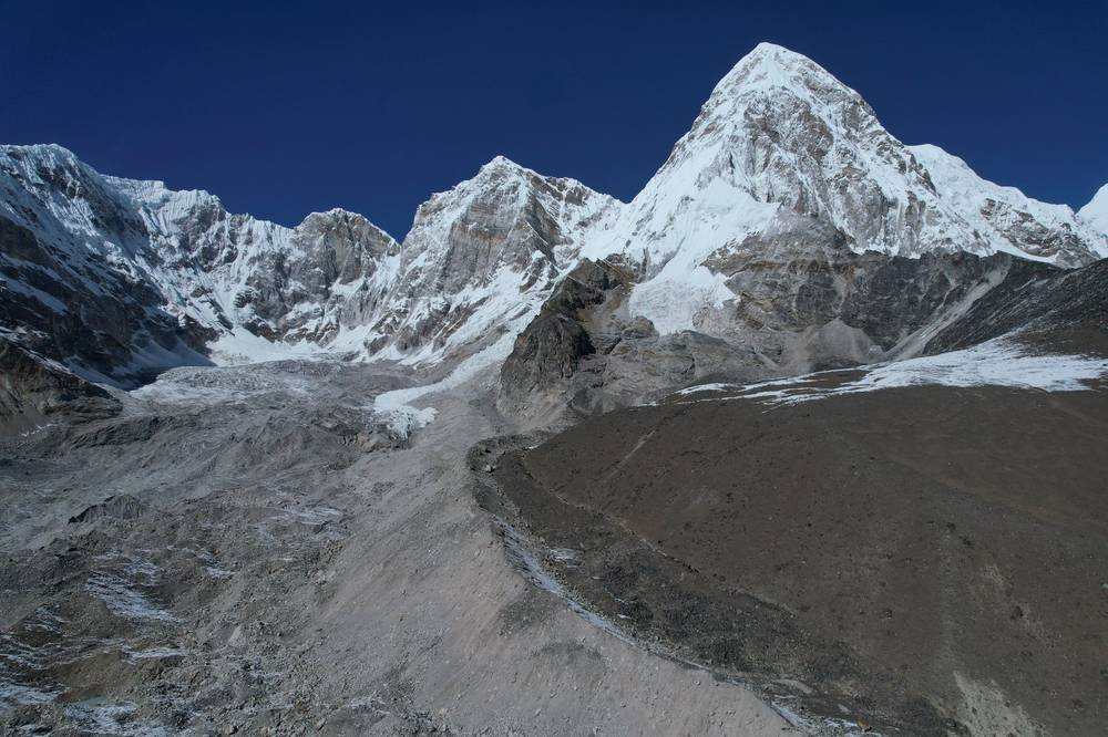
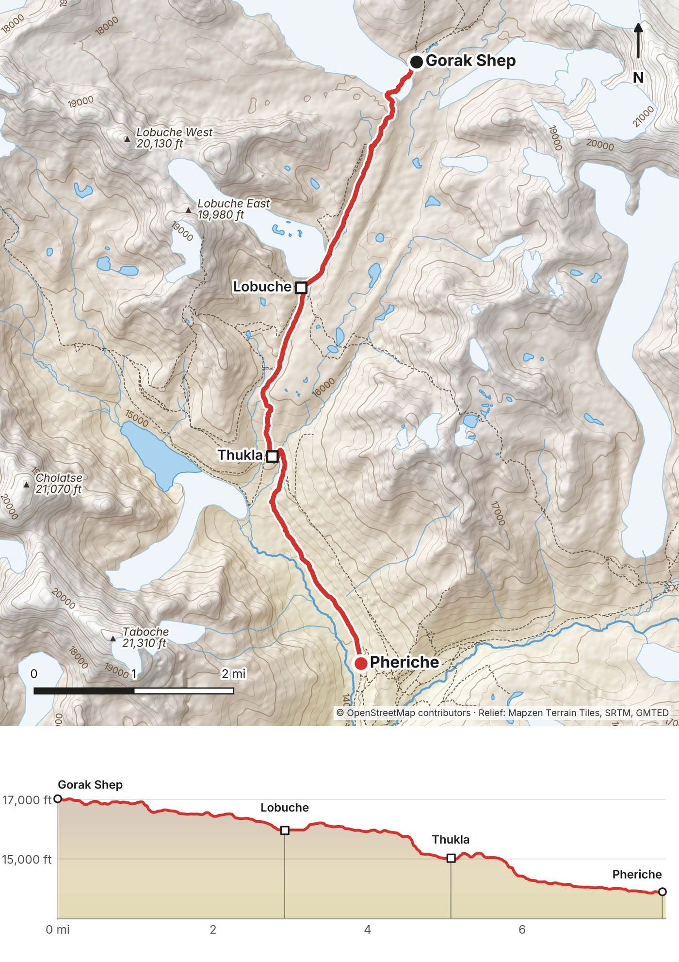
From Pheriche the path runs up the flat valley floor, then climbs to Thukla (Dughla), a couple of lodges by the stream. Above Thukla is the steepest climb of the upper trek, about 800 ft (250 m) up the end of the Khumbu Glacier's moraine to the memorials: stone cairns and prayer flags for climbers and Sherpas who died on Everest. The trail then follows the valley beside the moraine to Lobuche, a cluster of lodges, and on along the side of the Khumbu Glacier, up and down over rocks and old snow, to Gorak Shep, on a sandy flat at the foot of Kala Patthar.
Kala Patthar is the black hill above Gorak Shep. The path climbs steeply from the flat, and its top is published at about 5,545 to 5,645 m (18,190 to 18,520 ft). I turned around well below it. Go early in the evening for sunset or before dawn for sunrise, and take your time.
If you need to get off
Down. Lobuche, Thukla and Pheriche are all on the main trail. This is the day to turn back if you feel unwell: don't go higher with a headache that's getting worse.
Watch this day
Day 8: Gorak Shep to Everest Base Camp
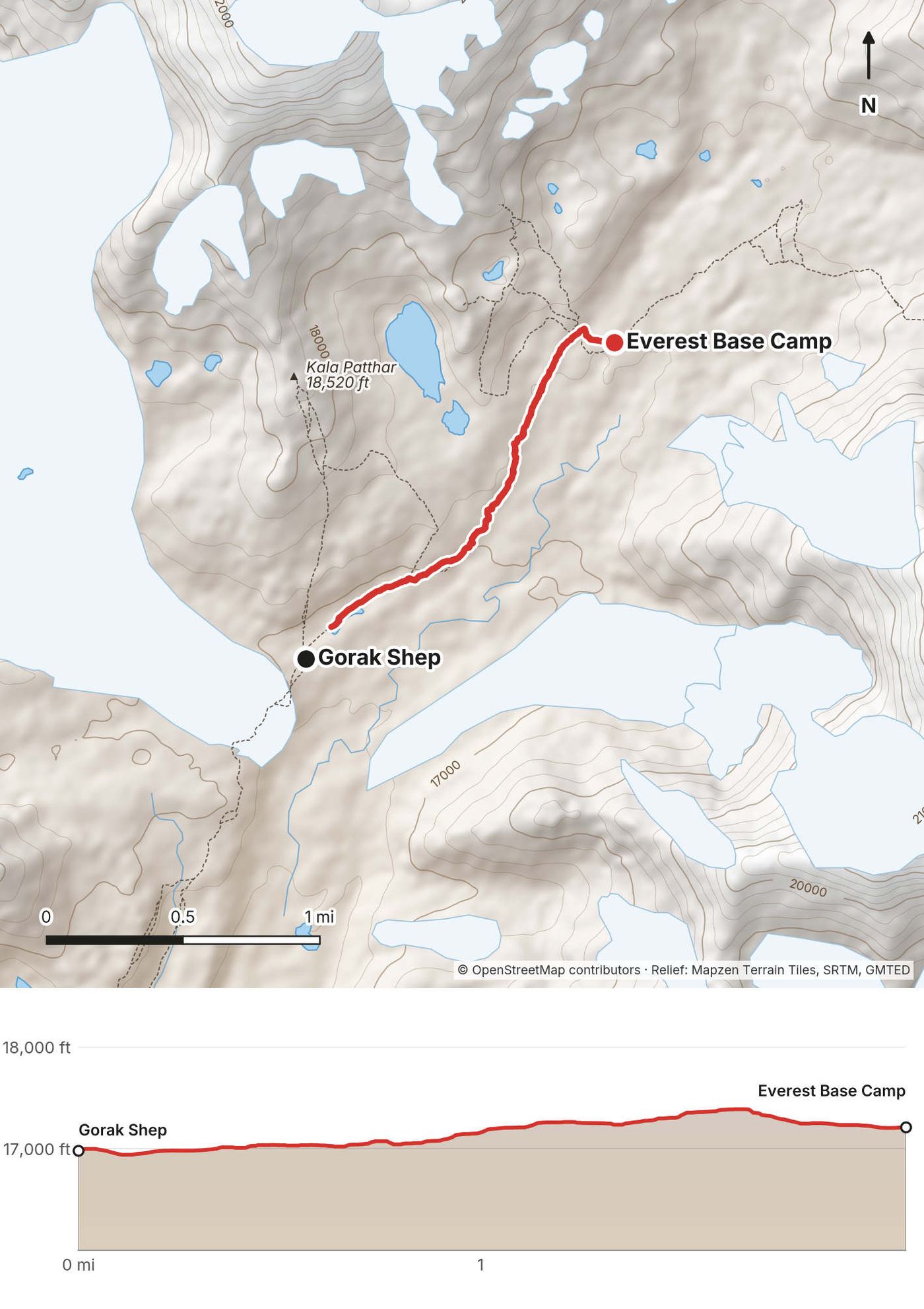
- Distance
- 2.1 mi (3.3 km), one way; the walk back isn't recorded
- Climbing
- 431 ft (131 m)
- Descent
- 210 ft (64 m)
- Time I took
- 2.1 hours (1:04 to 3:08 p.m.), with the crew
- High point
- 17,401 ft (5,304 m) on my GPS, on the moraine
- Base Camp
- 17,215 ft (5,247 m) on my GPS; published 17,598 ft (5,364 m)
- Sleep
- Gorak Shep, 16,996 ft (5,181 m)
- Terrain
- A rocky path along the moraine and onto the glacier
My day
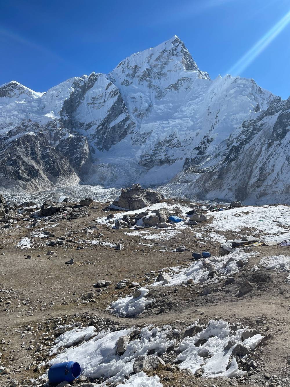
The next morning I woke up in Gorak Shep and had a nice little nap out in the sun, warming up and waiting for the crew. As soon as I saw them start to pass me I followed them to Everest Base Camp, where they set up the next shots for the show, and I touched the rock.
It was a bit chaotic. As I waited, more and more people showed up, general tourists, and it's not that interesting. Like I said, Kala Patthar has the better views, and I'd say that's the real end of the trek. Go do that. But you've got to touch that little rock. Not all of the other creators made it this far. I was the only contestant who hiked all the way to the end of the trail and all the way back down to Pheriche.
The trail
From Gorak Shep the path heads north along the crest and the side of the Khumbu Glacier's moraine, over rocks and patches of ice, then drops onto the glacier to the Base Camp rock, covered in prayer flags and graffiti, at the foot of the Khumbu Icefall. You can't see the top of Everest from here. The climbers' base camp, with its tents in spring, spreads out over the glacier beyond. It moves as the glacier moves, so the path and the rock change from year to year. It took me about 2 hours one way, walking with the crew. Walk back the same way.
If you need to get off
Back to Gorak Shep, then down to Lobuche and Pheriche.
Watch this day
Day 9: Gorak Shep to Pheriche
- Distance
- 7.9 mi (12.6 km)
- Climbing
- 658 ft (201 m)
- Descent
- 3,777 ft (1,151 m)
- Time I took
- 4.0 hours (8:06 a.m. to 12:08 p.m.)
- High point
- 17,034 ft (5,192 m), at Gorak Shep
- Finish
- Pheriche, 13,913 ft (4,241 m), then by helicopter to Lukla
- On the way
- Lobuche at 9:28 a.m., Thukla at 11:00
- Terrain
- Day 7 in reverse, all downhill after the moraine
My day
I hiked all the way back down to Pheriche, where helicopters came to pick us up. As much as I could, I did my own thing, but I was on their schedule: they were in charge and they were paying for the whole thing. I wasn't going to turn down a helicopter. Walking the same way back to Lukla would have been pretty much a trail run for me, and I wouldn't have filmed it. It was the first time I'd ever been in a helicopter. We flew back to Lukla, spent the night, and then took a plane back to Kathmandu. That was the end of my Everest Base Camp trek.
The trail
Down the way you came on Day 7: along the moraine to Lobuche, down past the memorials to Thukla, and out onto the valley floor to Pheriche. Most people go on down to Pangboche or Tengboche the same day or the next. From here, the walk back to Lukla follows Days 6, 5, 2 and 1 in reverse; see Getting home.
If you need to get off
You're heading the right way. The aid post in Pheriche is on the way.
Watch this day
Getting home
What I did. A helicopter from Pheriche to Lukla on November 2, arranged by the show, a night in Lukla, and a plane to Kathmandu the next day. I flew home on November 7.
What you'll most likely do. Walk. The way down is the way up, and my GPS files cover all of it: Pheriche to Pangboche (Day 6), Pangboche to Tengboche and the river (Day 5), then the main trail below Tengboche back to Namche, and Namche to Phakding and Lukla (Days 2 and 1). On my tracks, Namche to Lukla is about 13.5 miles (21.8 km). Going down is much quicker than coming up, but plan three or four days from Gorak Shep to Lukla (three if you climb Kala Patthar at dawn and walk down to Pheriche the same day), and a spare day or two in Lukla or Kathmandu for the flights.
Helicopters. Helicopters fly in and out of the upper Khumbu for rescues and charters. If you need one for a medical reason, your insurance should cover it: check that it covers helicopter evacuation at this height before you go.
Other ways to do it
A slower way up. If you space the nights the way the CDC's rule of thumb suggests (no more than 500 m higher a night, see Altitude), the way up looks like this: Phakding, two nights in Namche, Khumjung or Tengboche, Pangboche, two nights in Pheriche (or Dingboche), Thukla, Lobuche, then Gorak Shep, with Base Camp that afternoon and Kala Patthar the next morning before you start down. The days from Pheriche up are short; that's the point. That's ten days up and three or four down. My trip also had two nights in Namche and a night in Khumjung, but skipped the nights at Thukla and Lobuche.
Khumjung and Khunde. My route through Khumjung isn't the usual one, but it's a good acclimatization day from Namche: up past Syangboche to the ridge, down into Khumjung, and on to Tengboche the next morning.
Gokyo Lakes. A longer side trip up the next valley west, from Namche or across a pass from the Everest Base Camp side, to a chain of lakes and the viewpoint of Gokyo Ri. I haven't done it.
I walked the version in this guide. I haven't walked these other versions.
Teahouses, food and water
Lodges. Every village on the trail has lodges (teahouses) with a dining room, usually heated by a stove in the evening, and simple rooms. On my trip the show arranged all of them, so I can't give you names or prices. Lodges mostly take cash, and charge extra for hot showers, charging and Wi-Fi. Prices rise with altitude.
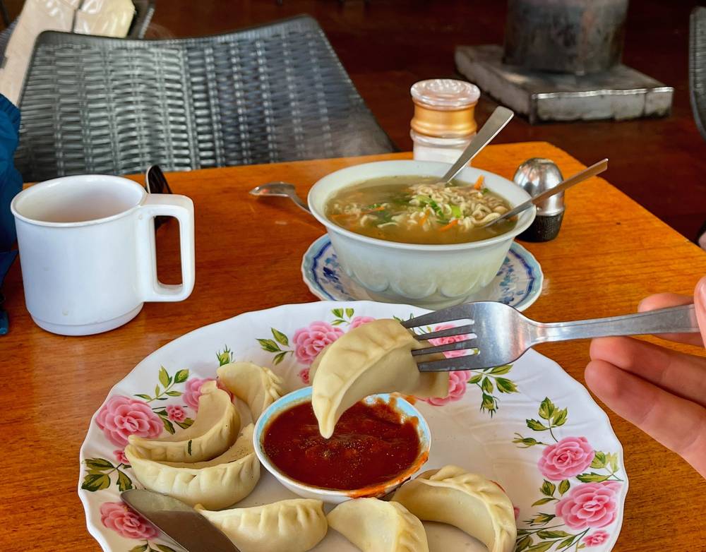
Food. Dal bhat, rice with lentil soup and vegetables, a beautiful balance of everything you need; porridge and eggs for breakfast; milk tea, lots of it (yak milk, maybe); and momos. With a big group, a lot of our food was catered, and people got tired of the same dal bhat over and over.
Water. The Khumbu has banned plastic bottles since January 1, 2020, though bottled water is still sold in places. Most lodges sell boiled or filtered water to refill your own bottle. Treat any tap or stream water yourself.
Gear for this route
What this trek needs
- Warm layers for below freezing, a down jacket, hat and gloves
- A sleeping bag for cold lodge rooms up high
- Sun protection: the sun is strong above the clouds
- A headlamp
- Water bottles and a way to treat water
- A power bank
- Cash in Nepali rupees
- Your permits, passport and insurance details
Paid links: I earn a commission if you buy through these links, at no extra cost to you. As an Amazon Associate I earn from qualifying purchases.
On this trek I walked with a day bag and porters or yaks carried a duffel. Here's what I carried in 2021, what I'd take now for the cold up high, and what I filmed with.
What I carried in 2021
My complete gear list for this trip was on LighterPack; my records don't hold it. This is what the record shows.
- Day bag: a day bag. Keep your glasses or contacts in it: the morning after Day 1 I had neither.
- Duffel: a duffel of trekking gear from the organizers. It went up on porters or yaks. I had the lightest duffel in the group.
- Jacket: a warm jacket with a hood. I wore it up high.
- Headlamp: a headlamp. I needed it on Day 1, when we arrived in Phakding after dark.
What I'd take now
- Day bag: Hyperlite Mountain Gear Waypoint 35 (Hyperlite). Porters or yaks carry the rest, so a day bag is all you wear.
- Sleeping bag: Hyperlite Mountain Gear 20° Mummy Bag (Hyperlite). Lodge rooms are cold up high.
- Down jacket: Arc’teryx Cerium Hoody (Arc’teryx). Mornings up high are below freezing.
- Base layer: PATH Projects Lynx PD Base Liner (PATH Projects)
- Hat: PATH Projects Hoyt Merino Beanie (PATH Projects)
- Gloves: Unigear Touchscreen Liner Gloves (Amazon)
- Sun hoodie: PATH Projects Pyrenees T19 Hoodie (PATH Projects). The sun is strong above the clouds.
- Cap: PATH Projects Muir Cap 2.0 (PATH Projects)
- Sunglasses: Goodr OG Sunglasses (Amazon)
- Headlamp: Nitecore NU20 Classic (Amazon)
- Water filter: Katadyn BeFree AC · 1L (Amazon). Plastic bottles are banned in the Khumbu: refill your own and treat any tap or stream water.
- Power bank: Nitecore NB20000 (Amazon). Lodges charge extra for charging.
- Navigation: AllTrails+ (AllTrails, 30% off). Import my GPX files and download them offline in Kathmandu. Offline maps need the paid plan.
- Phone data: Airalo eSIM (Airalo, $3 off). Mobile data without a SIM swap. Higher up, lodges sell Wi-Fi: I had an Everest Link card in Pheriche.
Filming kit
I brought my whole camera kit. Check the drone rules in Weather and safety before you fly: Nepal and the national park each need their own permission.
- Camera: Sony a7S III (Amazon). For my locked-down tripod shots.
- Lens: Sony FE 20mm f/1.8 G (Amazon). New on this trip, after the 16-35. A fixed prime: when I want a shot I just point and physically move instead of zooming.
- Drone: DJI Air 2S (Amazon), now the Air 3S. With extra batteries, because I didn't know how much charging there would be on the trek.
- Tripod: my tripod. I'd set it up, walk through the shot and come back for the camera.
- Phone: Apple iPhone 12 Pro Max
What I film with now
Since September 2026 I film with a smaller setup: the Pocket 4 and the Mic 3 on the trail, and the Mini 5 Pro in the air.
- Camera: DJI Osmo Pocket 4 (Amazon)
- Mic: DJI Mic 3 · 1 TX + 1 RX (Amazon). It pairs with the Pocket 4.
- Drone: DJI Mini 5 Pro (Amazon)
Weather and safety
Weather. In late October: mostly clear, sunny days, cold mornings up high, some cloud and mist lower down in the afternoons, and old snow on the moraine around Lobuche and Gorak Shep.
Altitude is the main risk. Read Altitude. Tell your guide or your group early if you feel unwell, and don't go higher with worsening symptoms.
Getting help. The trail is busy, and there's a lodge every hour or two. The Himalayan Rescue Association aid post in Pheriche treats altitude illness in the trekking seasons. Rescue from the upper Khumbu is by helicopter, and it's expensive: have insurance that covers helicopter evacuation, and carry the policy details. The US State Department also tells travelers to get insurance that covers medical evacuation.
Emergency numbers in Nepal (checked October 2026): 100 police, 1144 tourist police (toll free).
Yaks and porters. Yak trains and porters carry everything up this valley. Step to the uphill side of the path to let them pass, never the drop side, and wait off the path on the bridges.
Travel advice. The US State Department had Nepal at Level 2, exercise increased caution, in its advisory posted August 31, 2026. It has a separate Level 4 area on the Langtang side, not the Everest region.
Drones. I flew a drone on this trip. Flying one in Nepal needs registration and permission from the Civil Aviation Authority of Nepal and a security clearance from the Ministry of Home Affairs, and inside Sagarmatha National Park the park's permission too. Arrange it before you go, or leave it at home.
Using the GPX files
My own GPS recordings from October and November 2021, with all timestamps removed.
| File | What it is |
|---|---|
| everest-base-camp-day-01.gpx to everest-base-camp-day-09.gpx | One file per walking day, Day 1 (Lukla to Phakding) to Day 9 (Gorak Shep to Pheriche) |
| everest-base-camp-full-route.gpx | All nine days, with waypoints for the villages where I slept, Tengboche, the memorials, my Kala Patthar high point and the Base Camp rock |
A few stretches aren't recorded: the walk back down to Namche on Day 3 and back to Gorak Shep on Day 8. Day 3 and Day 4 go up the same ridge. Day 5 goes through Khumjung, not the main trail from Namche. Use the files with a current map, and follow the main path or your guide where they differ.
AllTrails. On a computer, sign in at alltrails.com, create a new map and use Import. It then shows up in the app on your phone. Offline maps need a paid plan.
Gaia GPS. Open the file from Files, email or AirDrop and choose Gaia GPS, or use Import on gaiagps.com. Download the map area offline.
Garmin. In Garmin Connect on the web, go to Training, Courses, Import. Save it as a course and send it to your watch.
Organic Maps (free). Download the offline map that covers Nepal's Everest region, then open the GPX file and choose Organic Maps. It works fully offline.
Before you leave Kathmandu, download offline maps for the whole valley, turn on airplane mode, and check that each day and your location show up.
Before you go, check these
These change from year to year; everything else in this guide stays the same. Checked October 1, 2026. Check them again when you book and the week you fly.
On the trail
- Sagarmatha National Park fee: NPR 3,000 a person in 2026. ntb.gov.np
- Khumbu Pasang Lhamu Trek-Card: NPR 3,000 in 2026, issued in Lukla. khumbupasanglhamumun.gov.np
- Whether a licensed guide and a TIMS card are required in the Everest region this season, and your lodges or agency for the busy season. ntb.gov.np
Getting there
- Whether Lukla flights leave from Kathmandu or from Manthali (Ramechhap) on your dates, and the drive to Manthali
- Nepal's visa on arrival: US$30, 50 or 125 for 15, 30 or 90 days. ntb.gov.np
- The US State Department's advice (Level 2, exercise increased caution, in October 2026). travel.state.gov
Health and safety
- A doctor's visit about altitude and acetazolamide; the CDC's guidance is in Altitude
- Insurance: make sure your policy covers trekking to at least 6,000 m (19,700 ft) and helicopter evacuation
- Whether the Pheriche aid post is open on your dates. himalayanrescue.org
Money and gear
- Nepali rupees from Kathmandu, warm layers for below freezing, a sleeping bag, and offline maps and the GPX files on your phone
One-page trip sheet
| Day | 2021 | From, to | mi (km) | Night, ft (m) |
|---|---|---|---|---|
| 1 | Oct 23 | Fly to Lukla, walk to Phakding | 5.8 (9.3) | 8,576 (2,614) |
| Oct 24 | No walk (filming) | tents | ||
| 2 | Oct 25 | Phakding to Namche Bazaar | 7.8 (12.5) | 11,261 (3,432) |
| 3 | Oct 26 | Namche to the ridge and back | 2.7 (4.4) up | Namche |
| 4 | Oct 27 | Namche to Khumjung | 3.5 (5.6) | 12,388 (3,776) |
| 5 | Oct 28 | Khumjung to Pangboche | 7.5 (12.0) | 12,793 (3,899) |
| Oct 29 | No walk | Pangboche | ||
| 6 | Oct 30 | Pangboche to Pheriche | 4.5 (7.3) | 13,920 (4,243) |
| 7 | Oct 31 | Pheriche to Gorak Shep | 11.0 (17.7) | 16,996 (5,181) |
| 8 | Nov 1 | To Base Camp and back | 2.1 (3.3) up | Gorak Shep |
| 9 | Nov 2 | Down to Pheriche, fly to Lukla | 7.9 (12.6) | Lukla |
| Total | 52.6 (84.7) | 17,290 ft up |
Permits (2026): Sagarmatha National Park NPR 3,000; Khumbu Trek-Card NPR 3,000 (Lukla). Guide and TIMS rule: check.
Altitude: no more than 500 m more sleeping height a night above 3,000 m, and an extra night every 1,000 m; go down for worsening symptoms, and at once for confusion, stumbling or breathlessness at rest.
Help: Himalayan Rescue Association aid post, Pheriche. Police 100, tourist police 1144.
About this guide
Everest Base Camp Hiking Guide: 9 days on foot from Lukla to Everest Base Camp in Nepal, by Kraig Adams. 2027 season edition, updated October 2026.
I walked to Everest Base Camp from October 23 to November 2, 2021, invited by the World Vlog Challenge, with a group of creators, guides and porters and a TV crew. The show later came out as The Challengers: Game of Himalayas. I made two films of the trip: Hiking 50 miles to Everest Base Camp in Nepal and Hiking to Everest Base Camp Trek (and being on a reality tv show). Everything in first person comes from that trip, my films, my GPS recordings, my photos and my permit receipts. Permits, flights and safety facts were checked in October 2026, and anything that changes is dated.
Updates and contact. If something has changed, or you spot a mistake, email me at kraig@kraigadams.com.
Paid links, no sponsors. The gear links in this guide are paid links: I earn a commission if you buy through them, at no extra cost to you. Nobody paid for a mention in this guide, and it isn't sponsored.
Safety. This is a high-altitude trek, with nights above 16,000 ft and help that may take time to arrive. This guide describes my trip and what I found, not current conditions. Rules, fees, flights and advice change. Acclimatize properly, follow local rules and your guide's decisions, and turn back when conditions aren't right. You're responsible for your own safety.
Copyright. © 2026 Kraig Adams. This guide, its photos and the GPX files are for your personal use. Please don't share or resell them.
Credits. Photos are mine, from my trip. The cover is from my film. GPX files are my own recordings. Maps © OpenStreetMap contributors, openstreetmap.org/copyright (ODbL). Relief: Mapzen Terrain Tiles, from SRTM and GMTED data.
The details
- Format
- A 62-page PDF sized for a phone (A5, prints fine too) and a folder of GPX files, in one zip download.
- Edition
- 2027 season edition, updated October 2026.
- Questions
- Email kraig@kraigadams.com.
Questions
- How many days do you need for the Everest Base Camp trek?
- I walked 9 days on foot from Lukla to Everest Base Camp in October 2021, 52.6 miles on my GPS up to Base Camp and down to Pheriche, and flew out by helicopter. I skipped a night most people spend at Lobuche or Dingboche. Plan on about 13 or 14 days for the round trip on foot from Lukla, plus spare days in Kathmandu for the Lukla flights.
- How high is Everest Base Camp?
- Everest Base Camp is published at 17,598 ft (5,364 m). My highest night was Gorak Shep, 16,996 ft (5,181 m) on my GPS, and my high point was 17,618 ft (5,370 m) on the slope of Kala Patthar. Lukla, where the trek starts, is about 9,400 ft (2,860 m).
- Do you need a guide for Everest Base Camp?
- It's disputed. Since March 31, 2023, the Nepal Tourism Board has required foreign trekkers on the Everest Base Camp trek to go with a licensed guide and carry an agency TIMS card. The Khumbu municipality says a guide isn't mandatory in its area and issues its own Trek-Card. I found no settlement as of October 2026; hiring a licensed guide through a registered agency is the safe choice.
- What permits do you need for Everest Base Camp?
- Two in 2026: the Sagarmatha National Park entrance permit, NPR 3,000 for foreigners, and the Khumbu Pasang Lhamu Rural Municipality Trek-Card, NPR 3,000 for most foreigners, issued in Lukla. In 2021 I paid NPR 3,000 and NPR 2,000. They're checked on the trail.
- How do you avoid altitude sickness on the Everest Base Camp trek?
- Go slowly. The CDC's guidance is not to raise your sleeping height by more than 500 m (1,650 ft) a night above 3,000 m, with an extra night for every 1,000 m. On this trail that means two nights in Namche and in Pheriche or Dingboche, and nights at Thukla and Lobuche before Gorak Shep. I went from Pheriche straight to Gorak Shep; don't copy that.
- When is the best time to hike to Everest Base Camp?
- October to November or March to May. December to February is cold with snow, and June to September is the monsoon. I walked in late October: mostly clear, cold mornings, and the busy season on the trail.
Timeline · newest first
Published · September 28, 2026
Wrote the guide
The day-by-day guide to the route, made from my film, my GPS recording and my notes.
Published · November 13, 2021 · YouTube · 209,834 views
Published the film: Hiking to Everest Base Camp Trek (and being on a reality tv show)
Published · November 9, 2021 · YouTube · 913,862 views
Published the film: Hiking 50 miles to Everest Base Camp in Nepal
On the trail · October 2021
Day 9: Gorak Shep to Pheriche
The day in the guide: Day 9: Gorak Shep to Pheriche.
On the trail · October 2021
Day 8: Gorak Shep to Everest Base Camp
The day in the guide: Day 8: Gorak Shep to Everest Base Camp.
On the trail · October 2021
Day 7: Pheriche to Gorak Shep
The day in the guide: Day 7: Pheriche to Gorak Shep.
On the trail · October 2021
Day 6: Pangboche to Pheriche
The day in the guide: Day 6: Pangboche to Pheriche.
On the trail · October 2021
Day 5: Khumjung to Pangboche
The day in the guide: Day 5: Khumjung to Pangboche.
On the trail · October 2021
Day 4: Namche Bazaar to Khumjung
The day in the guide: Day 4: Namche Bazaar to Khumjung.
On the trail · October 2021
Day 3: Namche Bazaar to the Khumjung ridge
The day in the guide: Day 3: Namche Bazaar to the Khumjung ridge.
On the trail · October 2021
Day 2: Phakding to Namche Bazaar
The day in the guide: Day 2: Phakding to Namche Bazaar.
On the trail · October 2021
Day 1: Lukla to Phakding
The day in the guide: Day 1: Lukla to Phakding.
On the trail · October 2021
The trip: Everest Base Camp
Khumbu, Nepal · 9 days · about 52 miles