
Trip · Grand Canyon, Arizona · October 2019
Grand Canyon rim to rim
- Hiking
- Video
- Guide
- Photos
I went alone, in October 2019. 2 days. My film of it is below, and my free guide to the route, day by day, is in Details.
Highlights
Milestone · November 15, 2019
Hiking the Grand Canyon Rim to Rim (20 miles in 2 days)

My film of the trip, published November 2019.
Milestone · October 1, 2026
The free guide
South Kaibab to North Kaibab in 2 days. At the end of October 2019 I hiked the Grand Canyon rim to rim: down the South Kaibab Trail to the Colorado River and a night at Bright Angel Campground, then up the North Kaibab Trail to the North Rim on Halloween. It's the trip from my film Hiking the Grand Canyon Rim to Rim. This guide has my GPS files, maps and notes for both days, the permit lottery and the park rules, the Hikers' Express and the shuttle between the rims, water, heat and when to go, and what I paid. Read this first: since an August 2026 flash flood the North Kaibab Trail and Phantom Ranch are closed, with no reopening date, and the guide starts with where things stand. Every page is free to read in Details below, with the PDF and GPX download.
Story
Photos
Photos from the trip.
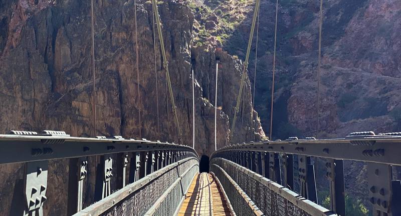
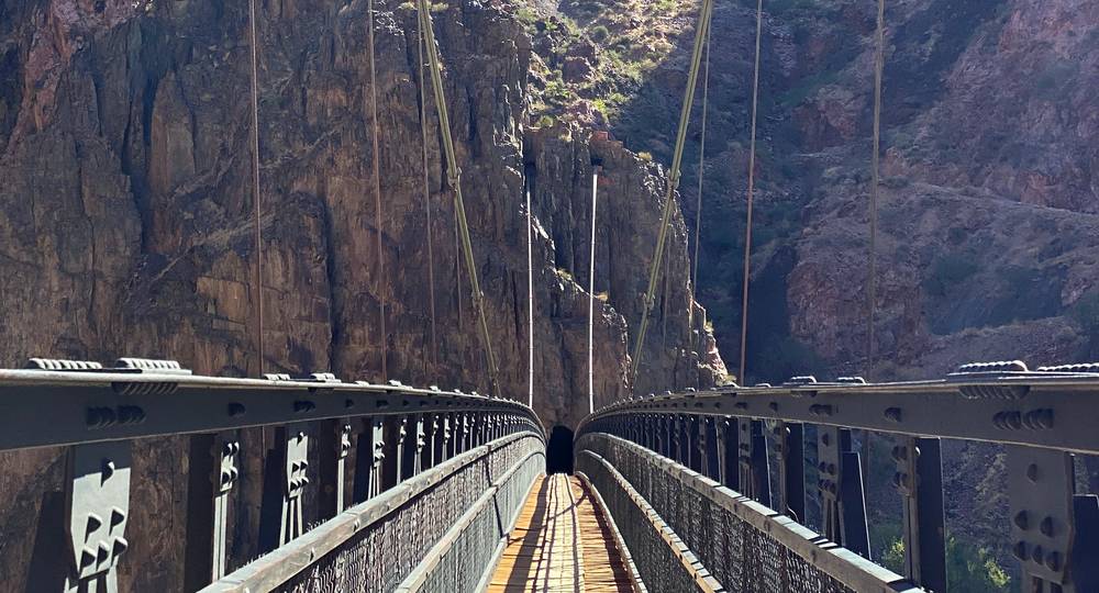
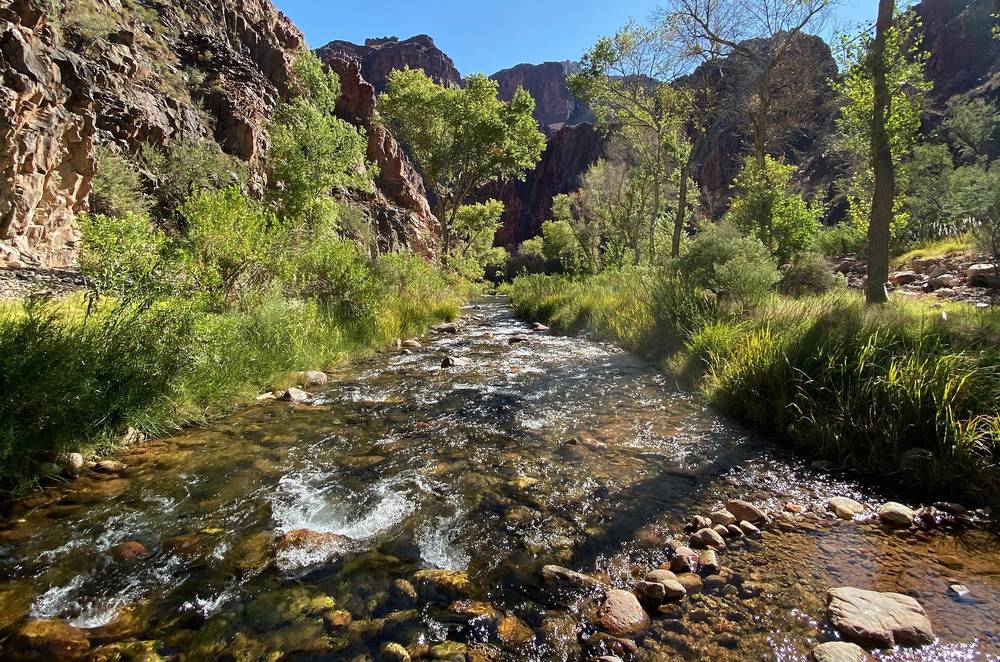
Looking back across the Black Bridge to the tunnel on the south side of the Colorado River, Day 1. 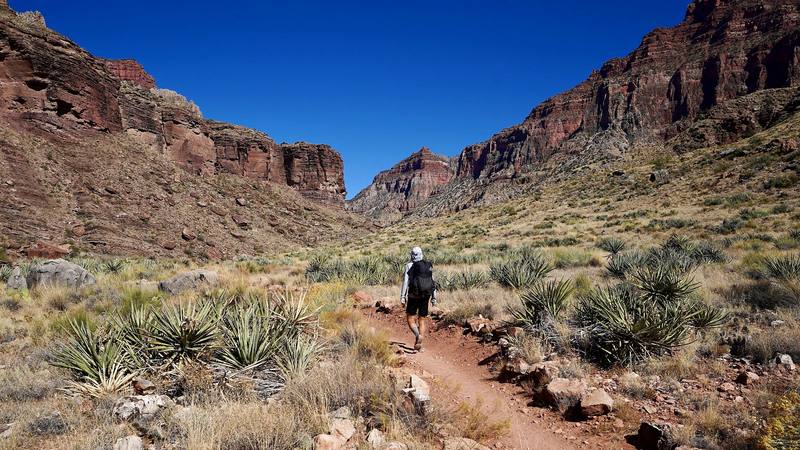
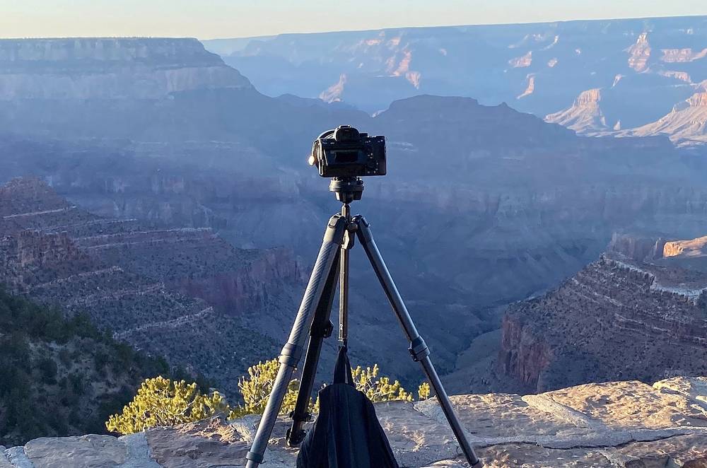
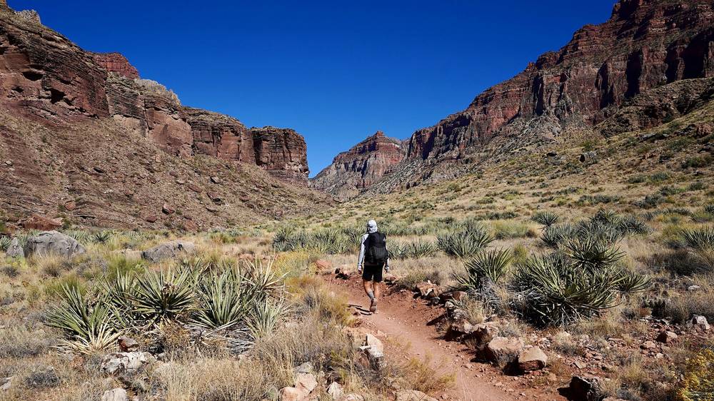
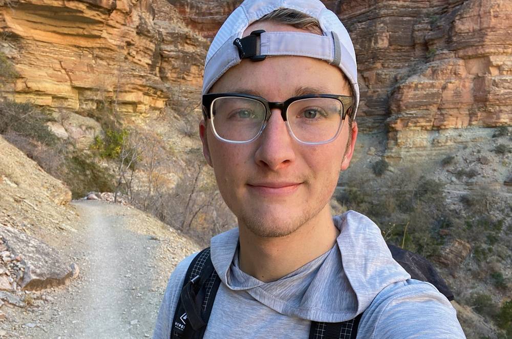
Me on the North Kaibab Trail just below Cottonwood Campground, Day 2, from my camera on its tripod.
Newsletter
Get my letter
Get a short letter from me every couple of weeks: new trips, guides and what I'm building.
Free. Unsubscribe any time.
Details
The guide · Free · 49-page PDF + GPX files · 2027 season edition
Grand Canyon Rim to Rim Hiking Guide
South Kaibab to North Kaibab in 2 days. Every page is below: read it here, or take it offline as a PDF with my GPX files (49-page PDF + GPX files, in one zip). No sign-up needed.
The route
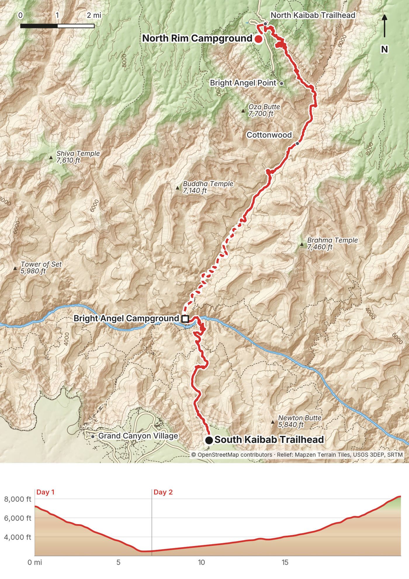
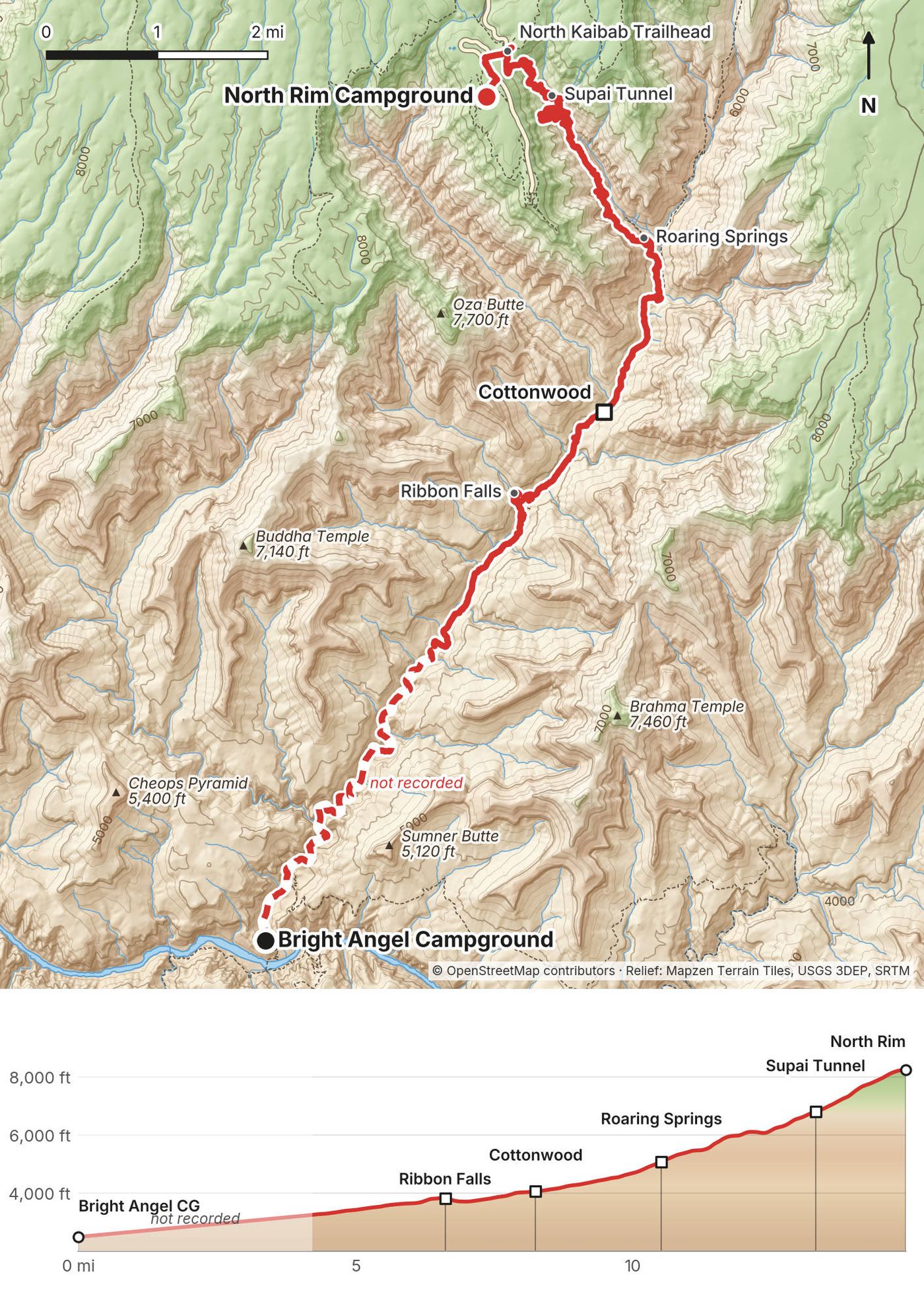
My GPS recording of 2 days on a relief map. The numbers are where each day starts; the red dot is the finish. The day maps are in the guide below, and the GPX files are a free download.
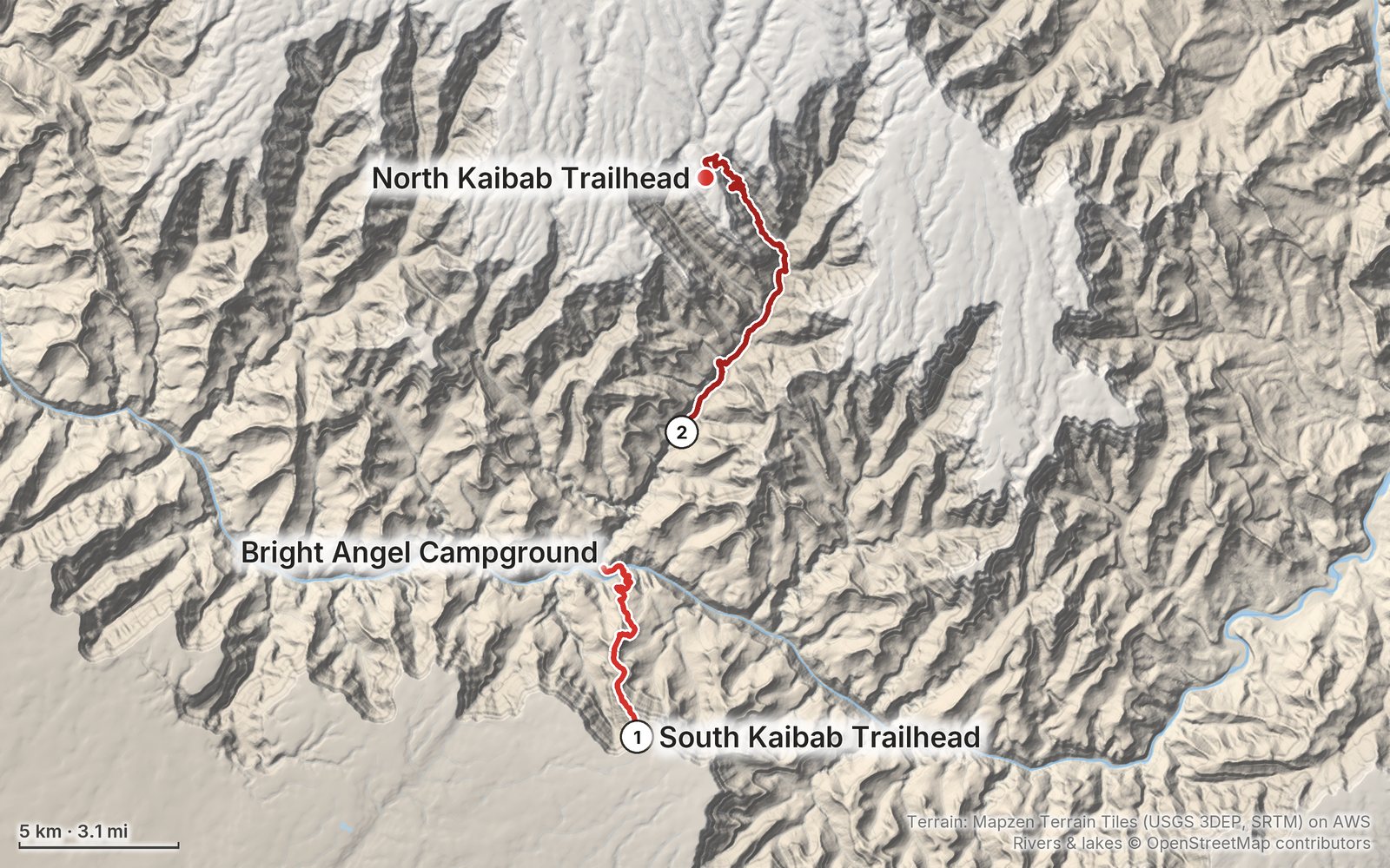
Elevation, start to finish: highest 8,340 ft (2,542 m), lowest 2,420 ft (738 m).
At a glance
- Days
- 2 days
- Distance
- 22 miles
- Climbing
- About 6,190 ft (1,890 m) up
- Permit
- A backcountry permit for every night below the rim, by lottery on Recreation.gov
Contents
- Welcome
- At a glance
- Is it open? (October 2026)
- Straight answers
- When to go
- Permits and rules
- Getting there
- Day 1 South Kaibab Trailhead to Bright Angel Campground
- Day 2 Bright Angel Campground to the North Rim
- The North Rim and the way back
- Other ways to do it
- Where I slept, food and water
- What I paid
- Gear for this route
- Weather and safety
- Using the GPX files
- Before you go, check these
- One-page trip sheet
- About this guide
Welcome
At the end of October 2019 I hiked the Grand Canyon rim to rim. It was my first time there. I went down the South Kaibab Trail from the South Rim to the Colorado River and spent a night at Bright Angel Campground. The next day, Halloween, I climbed the North Kaibab Trail to the North Rim, camped on the edge of the canyon, and took a shuttle back around to my car the day after. Two days, about 22 miles by my GPS, with part of Day 2 measured on the trail line. It's the trip from my film Hiking the Grand Canyon Rim to Rim (20 miles in 2 days).
The Grand Canyon is just a flat desert, nothingness, and then a negative mountain, just going down. It's the opposite of what I'm used to: going up, summiting, and then going down. It's like a mountain flipped upside down.
Read this first: the route is closed (October 2026). On August 29, 2026 a flash flood in Bright Angel Canyon destroyed nearly all the footbridges over Bright Angel Creek. Since then the whole North Kaibab Trail, Cottonwood Campground, Phantom Ranch with Bright Angel Campground, both bridges over the Colorado River and the South Kaibab Trail below the Tipoff have been closed, and the National Park Service (NPS) says there's no estimated reopening. You can't hike this route right now. This guide is for when it reopens: see Is it open? before you plan anything.
What's inside
- Where things stand in October 2026, and straight answers to the questions people ask about rim to rim
- When to go, the permit lottery and the park rules, and getting to the South Rim and the trailhead
- Both days: my notes, the trail, where to get off, a map with an elevation profile, and links to that day in my film
- The North Rim and the shuttle back, other ways to do it, where I slept, food and water, what I paid and gear for this route
- Weather and safety, one page of things to check before you go, and a printable trip sheet
How to use it offline
Save this PDF to your phone's Files or Books app before you leave home. Load the GPX files and download offline maps while you still have a signal on the South Rim: there's almost no signal in the canyon. Each day starts on a new page. The film links need a connection; everything else works in airplane mode.
When I say "I," it's my own trip. Rules, closures and fees change, so they're dated, and the checks are collected on one page: Before you go, check these.
At a glance
| Quick facts | |
|---|---|
| Distance | 21.9 miles (35.3 km) from trailhead to trailhead, with the side trip to Ribbon Falls. I called it "about 20 miles" in the film |
| Climbing | About 6,190 ft (1,890 m) up and 5,160 ft (1,570 m) down |
| Days | 2: 7.0 miles on Day 1, 14.9 on Day 2, then 0.7 to the North Rim Campground |
| Start | The South Kaibab Trailhead on the South Rim, 7,260 ft, reached only by the park's shuttle buses |
| Finish | The North Kaibab Trailhead on the North Rim, 8,241 ft. The rims are 212 miles apart by road |
| When | I went October 30 and 31, 2019 |
| Difficulty | A steep 4,800 ft descent with no water, then a 15-mile climb. Heat is the big danger from May to September |
| Permit | A backcountry permit for every night below the rim, by lottery on Recreation.gov. In October 2026 none are issued for this route |
| Day | Route | Miles (km) | Up / down (ft) | Sleep |
|---|---|---|---|---|
| 1 | South Kaibab Trailhead to Bright Angel Campground | 7.0 (11.3) | 61 / 4,783 | Bright Angel Campground |
| 2 | Bright Angel Campground to the North Kaibab Trailhead | 14.9 (24.0) | 6,124 / 375 | North Rim Campground |
Distances and climbing are from my own GPS, smoothed the same way every day; part of Day 2 is measured on the trail line (see Using the GPX files). Heights of trailheads, campgrounds and the river are NPS's figures.
Is it open? (October 2026)
Checked on the NPS and Recreation.gov pages on October 1, 2026.
Closed, with no reopening date. Since the August 29, 2026 flash flood, NPS has closed the South Kaibab Trail below the Tipoff, the Black Bridge and the Silver Bridge over the Colorado River, the River Trail east of the River Resthouse, all of Phantom Ranch (Bright Angel Campground, the canteen and the cabins), and the whole North Kaibab Trail from the North Rim to Phantom Ranch, including Cottonwood Campground. In NPS's words: "There is no estimated reopening of these closure areas at this time." That's every part of this route below the Tipoff.
What happened. The flood "destroyed" nearly all the footbridges over Bright Angel Creek, which the North Kaibab Trail follows from Roaring Springs down to the Colorado River. Two hikers died in it. A second flood came down the canyon on September 16. The 2025 Dragon Bravo Fire had already burned much of the North Rim and the top of the Bright Angel Creek watershed, and NPS warns that floods near the burn scar "can happen in a matter of minutes."
A closure was planned anyway. Before the flood, NPS had announced that a section of the North Kaibab Trail between Redwall Bridge and Cottonwood Campground would close from October 15, 2026 through about February 2027 for the waterline project, and that traditional rim to rim "will not be possible beginning October 15, 2026." NPS hasn't said how the flood changes that schedule.
Permits. Recreation.gov's permit page says Bright Angel and Cottonwood campgrounds are "CLOSED indefinitely" and that permits for areas reached by the North Kaibab Trail "will NOT be available through permit lotteries until further notice." The 2027 lottery dates are posted for the rest of the park.
Water and lodging. Every water tap in the inner canyon is off. The South Rim is under emergency water restrictions: the park's lodges stopped taking overnight guests on August 31, 2026 (Xanterra's closure runs through at least October 31), and Mather Campground is dry camping only. NPS hopes to have South Rim water back around Thanksgiving 2026.
The North Rim. The 2025 fire destroyed the Grand Canyon Lodge, the North Rim Visitor Center and many cabins. In 2026 the North Rim is open for day use, with no lodging and no drinking water; the North Rim Campground ran June 1 to October 15. NPS expects services to come back gradually "in future seasons (2027–2028 and beyond)."
The shuttle between the rims. The Trans-Canyon Shuttle says its service "has been suspended until further notice due to Park closures."
What's still open. The South Kaibab Trail to the Tipoff, the Tonto Trail from the Tipoff to Havasupai Gardens, the Bright Angel Trail to the River Resthouse, the trail to Plateau Point, and Havasupai Gardens Campground (by permit). See While the corridor is closed.
What to do. Before you plan dates, read NPS's Key Hiking Messages page (nps.gov/grca, Plan Your Visit) and the North Rim status page. When the North Kaibab Trail and Bright Angel Campground reopen, the permit lottery is about four months before your start month (see Permits and rules). Everything else in this guide (the route, the days, the climb, what I'd carry) will still hold, but every date, price and timetable in it needs checking again.
Straight answers
How many days do I need? I did it in two. I was supposed to stay at Cottonwood Campground on the way up the second day, but I felt like I could do the whole hike in two days instead of three, so I went up to the North Rim. Three days, with a night at Cottonwood, is the gentler plan. See Other ways to do it.
How hard is it? It was about 20 miles, but a lot of elevation, as I put it in the film: there was 5,500 ft of elevation gain going up from the middle, where the Colorado River is. By my GPS, with part of Day 2 measured on the trail line, it was about 4,780 ft down in 7 miles on Day 1 and about 6,120 ft up in 14.9 miles on Day 2. NPS tells hikers to plan on taking twice as long to hike up as it took to hike down.
Do I need a permit? Yes, for every night you camp below the rim. Day hikes don't need one. Permits go by lottery on Recreation.gov about four months ahead, and since the August 2026 flood none are issued for Bright Angel or Cottonwood campgrounds. I got mine in person on the South Rim the day before I started, in 2019, and paid $26. See Permits and rules.
Is there water on the trail? Not on the South Kaibab Trail, ever. On the North Kaibab Trail there are taps at Cottonwood, Supai Tunnel and the North Kaibab Trailhead from about mid-May to mid-October, and at Manzanita, Bright Angel Campground and Phantom Ranch all year, when the pipeline is working. In October 2026 every one of them is off. Carry a filter every time. See Where I slept, food and water.
When should I go? I'd suggest going when I went, in the autumn, when it's not as hot: you'll face about 100° temperatures at the bottom in summer, which can be quite dangerous. The North Rim side is only open in season (normally mid-May to mid-October for services). See When to go.
Which way should I go? I went south to north: down the South Kaibab, up the North Kaibab. The other way round, you go down the long trail and climb out on the steep one, which has no water. See Other ways to do it.
How do I get back to my car? The rims are 212 miles apart by road, about 4.5 hours. I took a shuttle from the North Rim back to my car on the South Rim: about $80 and four hours in 2019. In October 2026 the Trans-Canyon Shuttle is suspended. See The North Rim and the way back.
Can I stay at Phantom Ranch? Its cabins are booked by lottery 15 months ahead (the dorms were bookable directly through August 2027), and it's closed in October 2026. A backcountry permit isn't needed if you stay there. I camped at Bright Angel Campground and walked over for a beer.
Can I bring my dog? No. Pets aren't allowed anywhere below the rim (service animals are; check in with the Backcountry Information Center first).
Can I fly a drone? No. Drones are banned everywhere in the park. I tried to find a spot outside the national park to fly mine on the edge, but there was such high wind that the battery was struggling to fly.
When to go
Autumn. I went the last days of October. The hike was cold, especially at night on the rim, where the temperature dropped to an insane 6 degrees, as I wrote in the film's description; the day before, on the South Rim, it was freezing and windy. The North Rim was surprisingly pleasant, even though it was one of the last days it was open: the whole place was closing down.
Average temperatures (NPS, °F high / low). These are NPS's monthly averages for the rims and the inner canyon near Phantom Ranch, in the shade.
| Month | South Rim | Inner canyon | North Rim |
|---|---|---|---|
| April | 60 / 32 | 82 / 56 | 53 / 29 |
| May | 70 / 39 | 92 / 63 | 62 / 34 |
| June | 81 / 47 | 101 / 72 | 73 / 40 |
| July | 84 / 54 | 106 / 78 | 77 / 46 |
| August | 82 / 53 | 103 / 75 | 75 / 45 |
| September | 76 / 47 | 97 / 69 | 69 / 39 |
| October | 65 / 36 | 84 / 58 | 59 / 31 |
| November | 52 / 27 | 68 / 46 | 46 / 24 |
Summer. NPS urges caution for all hikers from May through September and says not to hike between 10 a.m. and 4 p.m. In the sun it can be 15 to 20°F hotter than these shade figures. Four hikers died of apparent heat illness on the inner-canyon trails in June 2026, two of them on the North Kaibab Trail.
The North Rim season. In a normal year the North Rim's services run from May 15 to October 15, and Highway 67 to the North Rim stays open until November 30 or the first big snow. From December 1 to May 14 the road is closed. The North Kaibab Trail's water taps are on from about mid-May to mid-October. So a rim to rim that ends with a car, a campground or a shuttle on the North Rim fits between mid-May and mid-October.
Monsoon. Thunderstorms and flash floods are most likely from mid-July to early September, though floods can come any time of year. The August 2026 flood came in that season.
Winter. The top of the South Kaibab Trail (the Chimney) is north-facing and holds ice all winter; carry traction. The North Rim is closed.
Daylight. In mid-October the sun rises about 6:35 a.m. and sets about 5:53 p.m.; by mid-November it's about 7:05 a.m. and 5:21 p.m. Arizona doesn't change its clocks.
Permits and rules
These are the NPS rules for the backcountry of Grand Canyon National Park, checked on the park's own pages and Recreation.gov on October 1, 2026.
Backcountry permit. You need one for every night you camp below the rim, and you must carry it, printed, in plain view on your pack or tent. Day hikes, and nights in the Phantom Ranch cabins or dorms, don't need one. Permits are first offered through an early access lottery on Recreation.gov: you apply in a window that ends on the 1st of the month four months before your start month (for example, January 1 for May starts), up to 750 applicants get a booking time, and on the 1st of the next month whatever is left opens to everyone. Each person can send one application per lottery, and the trip leader must be 18 or older.
2027 lottery windows for the North Rim season (posted on Recreation.gov in October 2026; each closes at 5 p.m. Arizona time): May starts, December 16, 2026 to January 1, 2027; June, January 13 to February 1; July, February 15 to 28; August, March 16 to April 1; September, April 13 to May 3; October, May 12 to June 1, 2027. Remember that in October 2026 none are issued for Bright Angel or Cottonwood campgrounds (see Is it open?).
Fees (2026). $10 per permit or lottery application, plus $15 per person per night below the rim and $4 per person per night above it. The $10 isn't refundable; the nightly fees are, until 30 days before your start. If a closure stops you from using your permit, NPS says you can ask for a refund.
Last-minute permits. Normally none are held back for Bright Angel Campground; one site for up to four people at Cottonwood is released at the North Rim Backcountry Information Center in season. In 2026 walk-up permits are only for one night at Havasupai Gardens, March 1 to November 30, and not guaranteed. In 2019 I walked into the Backcountry Information Center on the South Rim the day before my hike and came out with my permit; that won't work for Bright Angel Campground now.
Campground rules. At most two nights per campground per trip (four from November 15 to February 28). Camp only in the corridor's campgrounds, in one site. Every site has a picnic table, a pole for your pack and a metal food can, and using the can is mandatory. Hammocks aren't allowed at Bright Angel Campground. Quiet hours are 8 p.m. to 6 a.m.
Groups. Small groups are 1 to 6 people and large groups 7 to 11; no more than 11 can camp together. A non-commercial group of 12 to 30 doing an extended day hike below the rim needs a special use permit.
The North Rim Campground. No backcountry permit is needed there from May 15 to October 15; it's a regular campground, by reservation on Recreation.gov. Camping anywhere on the North Rim from October 16 to May 14 needs a backcountry permit.
Other rules. No campfires below the rim (stoves are fine). No pets below the rim. No drones anywhere in the park. Carry out all trash and toilet paper. No soap in the creeks, no feeding wildlife, no rolling rocks, no cutting switchbacks.
On the trail. Mules have the right of way: follow the wrangler's directions, or step to the side of the trail away from the edge and stand still and quiet. Hikers going uphill have the right of way over those going down.
Park entrance (2026). $35 per car for 7 days, or $20 per person on foot or bike; the America the Beautiful pass is $80 a year for US residents. Since January 1, 2026, non-US residents aged 16 and over pay an extra $100 each to enter, unless they have the $250 nonresident annual pass. The entrance stations don't take cash.
Getting there
My way in, 2019. I flew from New York to Flagstaff, rented a car at the airport for a week, and drove about an hour and a half up to the South Rim. I'd reserved a few days at Mather Campground. I camped there for a couple of days, charged batteries, bought groceries, and got my backcountry permit so that I could spend a night down in the canyon. I also scouted the rim for places to film timelapses. It was freezing and windy, and I lost my right contact lens that morning, so I wore my glasses for the whole trip.
The morning of the hike. I got up super early, parked my car at the Backcountry Office parking lot, and took the Hikers' Express shuttle with about a dozen other people to the South Kaibab Trailhead. I was walking by 8:28.
Flying (2026). Flagstaff Pulliam Airport (FLG) has American Airlines flights from Phoenix and Dallas–Fort Worth. Phoenix and Las Vegas have far more flights. By NPS's figures, the South Rim is 81 miles and about 90 minutes from Flagstaff, an hour from Williams, about four hours (231 miles) from Phoenix and 278 miles from Las Vegas.
Without a car (2026). Groome Transportation runs three times a day from Flagstaff (with stops at the Flagstaff Amtrak station and, on two runs, the airport) to Maswik Lodge in Grand Canyon Village, by reservation, from $49 plus an $8 park entry fee; it connects with its shuttles from Phoenix Sky Harbor Airport. The Grand Canyon Railway runs daily from Williams to the village (9:30 a.m., arriving 11:45 a.m.; in November and December 8:30 a.m., arriving 10:45 a.m.; 2026). Amtrak's Southwest Chief stops in Flagstaff.
Parking for overnight hikers. Park in Lot D at the Backcountry Information Center, near Maswik Lodge: NPS sends overnight hikers there, and it often has space when other lots are full. You can't drive to the South Kaibab Trailhead; the road is closed to private cars.
The Hikers' Express. A free, one-way early bus to the South Kaibab Trailhead. In fall 2026 (September 12 to November 30) it left Bright Angel Lodge at 6, 7 and 8 a.m., stopping at the Backcountry Information Center 10 minutes later and the Visitor Center 20 minutes later, and reached the trailhead 30 minutes after it left. In 2026 it ran at 8 and 9 a.m. in winter, 6, 7 and 8 a.m. in spring, and 4, 5 and 6 a.m. in summer. NPS posts each season's times about two weeks before it starts. The Kaibab Rim (Orange) Route bus also goes to the trailhead from the Visitor Center, a 9-minute ride, from 6 a.m. in fall and 5 a.m. in summer (2026).
The Backcountry Information Center is near Maswik Lodge, open daily from 8 a.m. to noon and 1 to 5 p.m. Its phone (928-638-7875) is for information only, weekdays; NPS says email (grca_bic@nps.gov) is the best way to ask.
Where to stay on the South Rim (2026). Mather Campground is open all year: $30 a night, by reservation on Recreation.gov up to six months ahead from March 1 to November 30, with 15 first-come sites sold at 8 a.m., and a $6 per person site for hikers and cyclists. Xanterra's and Delaware North's lodges in the village book up well ahead, and Tusayan, 7 miles south, has hotels. In October 2026 the lodges are closed to overnight guests and Mather is dry camping only (see Is it open?).
Groceries and showers. Canyon Village Market at Market Plaza is open all year. Camper Services by Mather Campground normally has pay showers and a laundromat (closed in October 2026 by the water restrictions).
Day 1: South Kaibab Trailhead to Bright Angel Campground
- Distance
- 7.0 mi (11.3 km)
- Climbing
- 61 ft (19 m)
- Descent
- 4,783 ft (1,458 m)
- Time I took
- 4.4 hours (8:28 a.m. to 12:51 p.m.), about 3.9 of them moving
- High point
- The South Kaibab Trailhead, 7,260 ft (2,213 m)
- Low point
- The Colorado River, about 2,480 ft (756 m)
- On the way
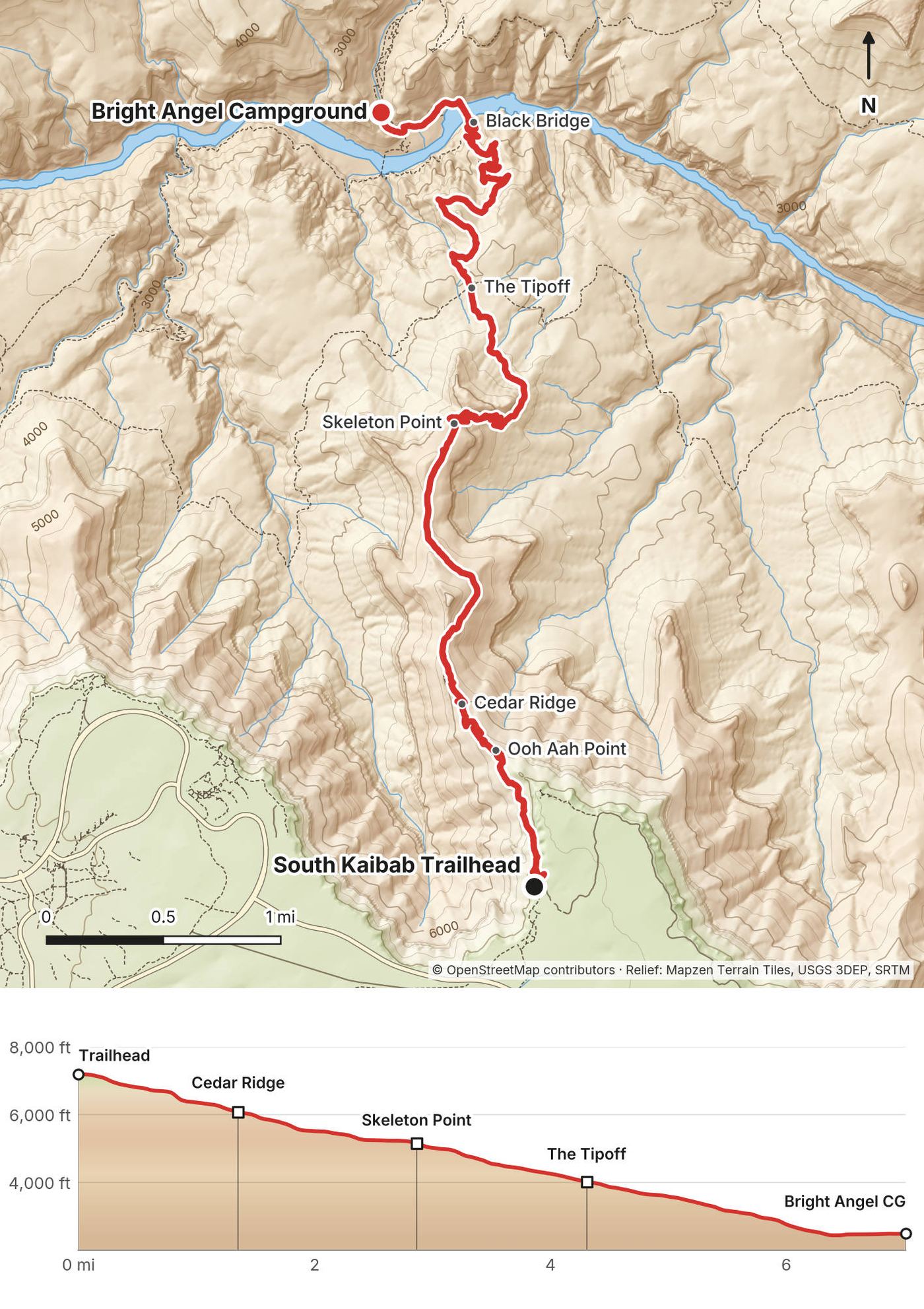
- Ooh Aah Point (mile 0.9), Cedar Ridge (1.4), Skeleton Point (2.9), the Tipoff (4.3), the tunnel and the Black Bridge (6.3), Bright Angel Campground (7.0)
- Sleep
- Bright Angel Campground, 2,480 ft (756 m)
- Food and water
- None on the trail. Water at Bright Angel Campground when it's on
My day
I took the Hikers' Express to the trailhead and started down a little before 8:30. The trail sign at the top says it plainly: no water on the trail. The descent was quick, but it had some of the best views of the hike, and the switchbacks were impressive.
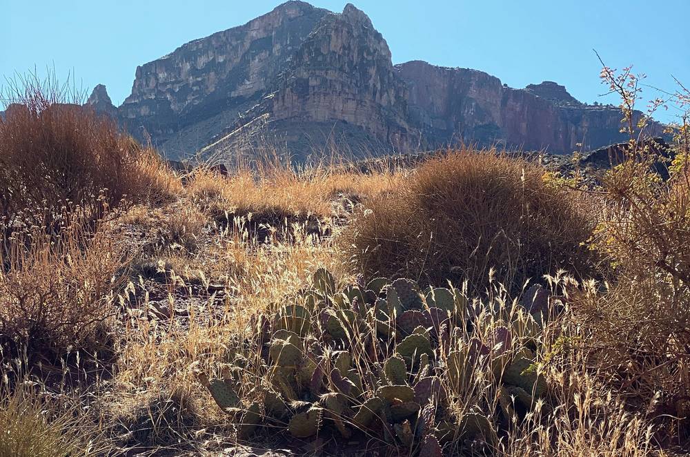
I was at Ooh Aah Point at about 9, Cedar Ridge at 9:20, Skeleton Point at about 10 and the Tipoff before 11. Below the Tipoff the trail drops into the inner gorge. I went through the tunnel and over the Black Bridge at about noon and was at Bright Angel Campground by 1.
After setting up my tent I walked over to the famous Phantom Ranch for a beer. They have a steak dinner you can reserve ahead of time. It was like $60, and I regret not doing it; it probably would have been worth it. They had their own specialty beer, so I had that instead. Maybe next time. Spending the night at Bright Angel Campground at the bottom of the Grand Canyon, along the Colorado River, was really nice because they have Phantom Ranch: they've got food and water you can pay for.
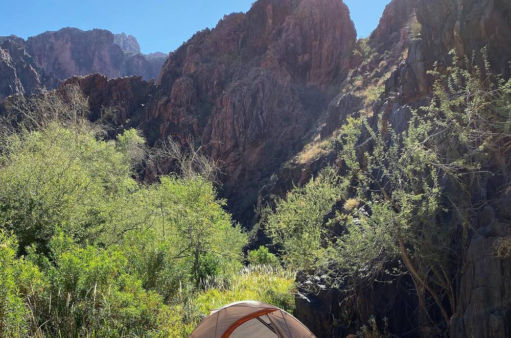
In the afternoon I went down to the river, and in the evening I cooked ramen on my stove.
The trail
The trailhead. The South Kaibab Trailhead is near Yaki Point, 7,260 ft. There's water at the trailhead when it's on (in 2026, from a tank by the restrooms); after that there's none until the bottom. Fill up: NPS says to take at least 4 liters in hot weather.
Down the top. The trail starts with tight north-facing switchbacks (the Chimney, which holds ice in winter), then traverses to Ooh Aah Point (mile 0.9 on my GPS), the first big view of the canyon, and follows the ridge down to Cedar Ridge (mile 1.4; NPS says 1.5), where there are pit toilets but no water or emergency phone. There's almost no shade on this trail.
Skeleton Point. From Cedar Ridge the trail traverses below O'Neill Butte to Skeleton Point (mile 2.9; NPS 3.0). A short spur west gives the first view of the Colorado River and the Phantom Ranch area. Then the trail goes straight off the end of the point, blasted into the cliffs, and switchbacks down to the Tonto Platform.
The Tipoff. At mile 4.3 (NPS 4.4) the trail reaches the edge of the inner gorge at the Tipoff, about 4,000 ft. There are pit toilets and an emergency phone, no water. The Tonto Trail crosses here: 4.6 miles west to Havasupai Gardens. In October 2026 the South Kaibab Trail is closed below this point.
To the river. Below the Tipoff the trail switchbacks down through the dark rock of the inner gorge to a short tunnel and the Black Bridge (the Kaibab Suspension Bridge) over the Colorado River (mile 6.3). On the north bank it follows the river to the mouth of Bright Angel Creek and up the creek to Bright Angel Campground (mile 7.0), half a mile north of the river. Phantom Ranch is less than half a mile farther up the creek.
If you need to get off
There's no easy way out of the South Kaibab Trail: up is the only way back, and there's no water. At the Tipoff, the Tonto Trail goes west 4.6 miles to Havasupai Gardens (a campground, a ranger station and, normally, water all year; off in October 2026) and the Bright Angel Trail, 4.5 miles more to the South Rim. The emergency phones are at the Tipoff and, at the bottom, at Bright Angel Campground and Phantom Ranch. NPS reminds hikers that fatigue is not an emergency.
Watch this day
Film, Day 1 · How I did it (behind the scenes)
Day 2: Bright Angel Campground to the North Rim
- Distance
- 14.9 mi (24.0 km), with the side trip to Ribbon Falls
- Climbing
- 6,124 ft (1,867 m)
- Descent
- 375 ft (114 m)
- Time I took
- 6.9 hours from mile 4.2 (9:43 a.m.) to the trailhead (4:34 p.m.)
- High point
- The North Kaibab Trailhead, 8,241 ft (2,512 m)
- On the way
- Ribbon Falls (mile 6.6), Cottonwood (8.2), Manzanita (9.8), the Roaring Springs junction (10.5), Supai Tunnel (13.3), the trailhead (14.9)
- Sleep
- The North Rim Campground, 0.7 mi on, about 8,200 ft
- Food and water
- Bright Angel Creek (treat it). Taps at Cottonwood and Supai Tunnel in season, Manzanita all year; off in 2026
My day
I actually did this hike on Halloween, October 31st, and a couple of people were really into it. One guy had a pumpkin. In the morning I got my food out of the campsite's metal can, made oatmeal and packed up. My GPS recording starts about 4.2 miles up the canyon, at 9:43; I didn't record the first part.
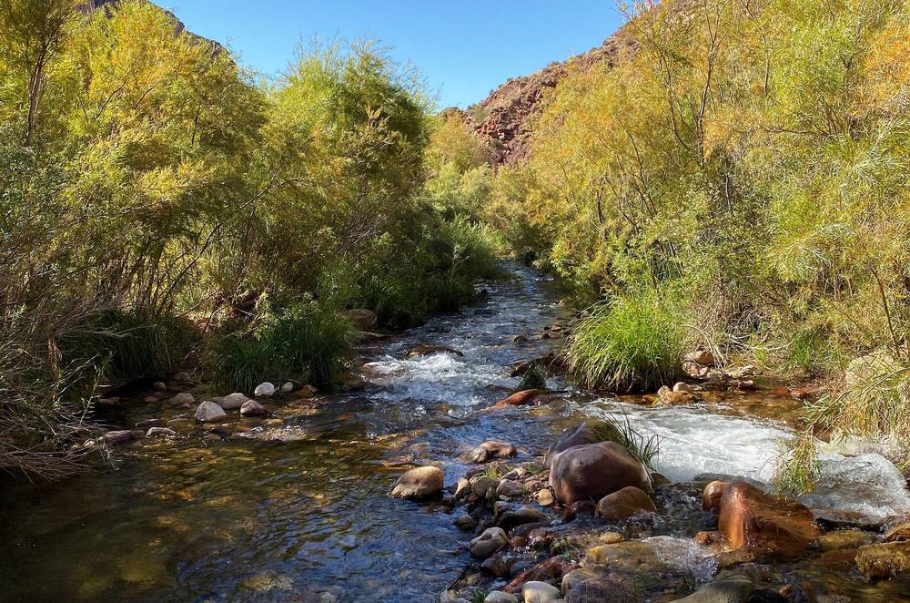
At Ribbon Falls I took my shoes off and waded Bright Angel Creek to the falls. It was cold. I filled my water at the tap at Cottonwood Campground at about 12:20. I was supposed to stay at Cottonwood, but I felt like I could do the whole hike in two days instead of three, so I kept going up to the North Rim.
Above Manzanita the trail turns up Roaring Springs Canyon, under red cliffs. I was at Supai Tunnel at about 3:15, the Coconino Overlook at 4, and the North Kaibab Trailhead at 4:34.
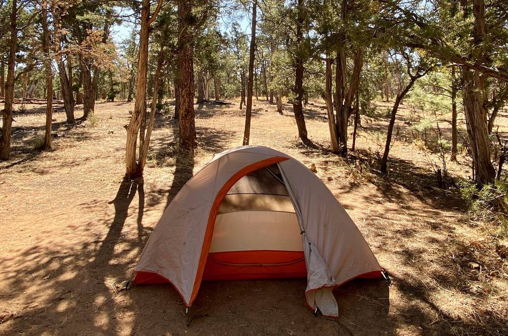
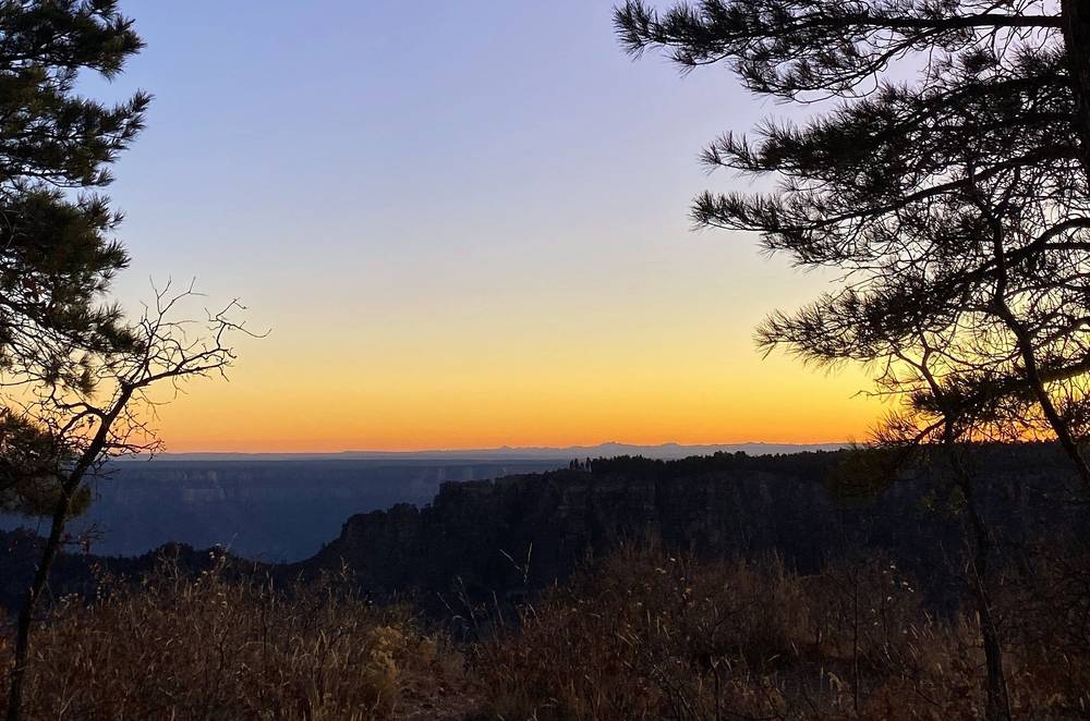
I made the hike up and out and spent that night at the North Rim Campground. The entire place was closing down when I visited, but that meant I was basically alone and able to snag the absolute best campsite, on the edge overlooking the canyon.
The trail
Up Bright Angel Creek. From Bright Angel Campground the trail goes north past Phantom Ranch and up Bright Angel Canyon beside the creek, a narrow canyon of dark rock where the trail crosses the creek on footbridges. The Aug 29, 2026 flood destroyed nearly all of those bridges; expect the trail to be rebuilt differently when it reopens. The Clear Creek Trail leaves to the east about 0.8 miles up; stay on the North Kaibab Trail.
Ribbon Falls. About 5.6 miles up from the campground by NPS's figures (8.4 miles below the North Rim; about mile 6.2 on my line), a side trail crosses Bright Angel Creek to Ribbon Falls, a waterfall in a grotto on the west side of the creek. My side trip there and back was about 0.6 miles. NPS removed the Ribbon Falls footbridge after it was damaged, and its trail page (updated March 2025) asks hikers to stay on the North Kaibab Trail until a new one is built. Check before you go, and don't ford the creek when it's high.
Cottonwood Campground. At mile 8.2 on my track (NPS: 7.2 miles from Bright Angel Campground, 6.8 below the North Rim), about 4,080 ft. It has toilets, an emergency phone and, from about mid-May to mid-October, drinking water.
Manzanita and Roaring Springs. At Manzanita (mile 9.8, about 4,600 ft) there's a ranger station and a rest area with a toilet, shaded benches, an emergency phone and, normally, water all year. About 0.7 miles on, a side trail goes to Roaring Springs (NPS: a 20-minute detour, no water there). Roaring Springs is where Bright Angel Creek starts, gushing out of the cliff. From here the North Kaibab Trail leaves the creek and climbs Roaring Springs Canyon, in places on a half tunnel blasted out of the Redwall cliffs. There's no creek water above this point.
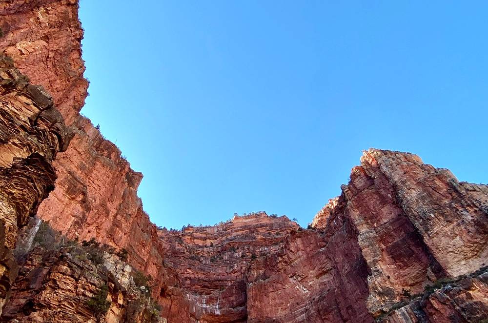
Redwall Bridge and Supai Tunnel. The trail crosses Roaring Springs Canyon on the Redwall Bridge (mile 12.4, about 6,040 ft) and switchbacks up through the red cliffs to Supai Tunnel (mile 13.3; NPS: 1.7 miles below the rim, 6,800 ft), with vault toilets, water in season and no emergency phone.
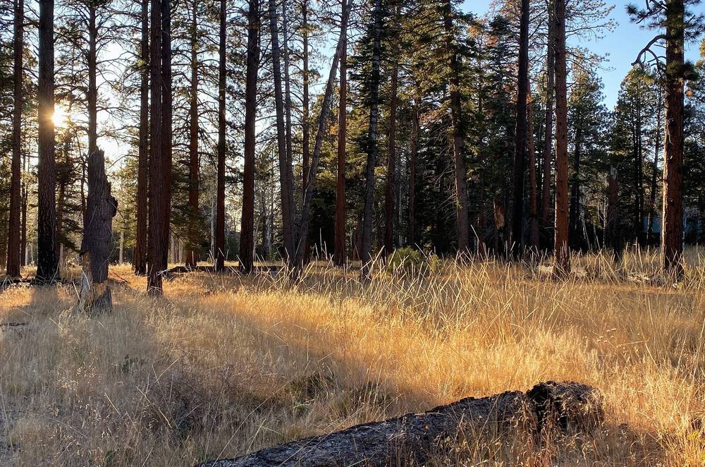
To the rim. Above Supai Tunnel the trail climbs through the forest past the Coconino Overlook (mile 14.2) to the North Kaibab Trailhead (mile 14.9, 8,241 ft). Since the 2025 fire, this top stretch runs through the Dragon Bravo burn scar, where NPS warns of debris flows, rockfall, flash floods and falling trees. From the trailhead I walked 0.7 miles along the road to the North Rim Campground.
If you need to get off
On this side the only way out is up, or back down to Bright Angel Campground. Cottonwood Campground is the place to stop if you're slow or hot, but you need a permit for it. There are emergency phones at Phantom Ranch, Bright Angel Campground, Cottonwood and Manzanita, and none at Roaring Springs or Supai Tunnel. In summer, NPS says hiking the whole North Kaibab Trail in a day is not recommended, because it's very hard to avoid the heat of the day; start before dawn.
Watch this day
Film, Day 2 · The North Rim · How I did it (behind the scenes)
The North Rim and the way back
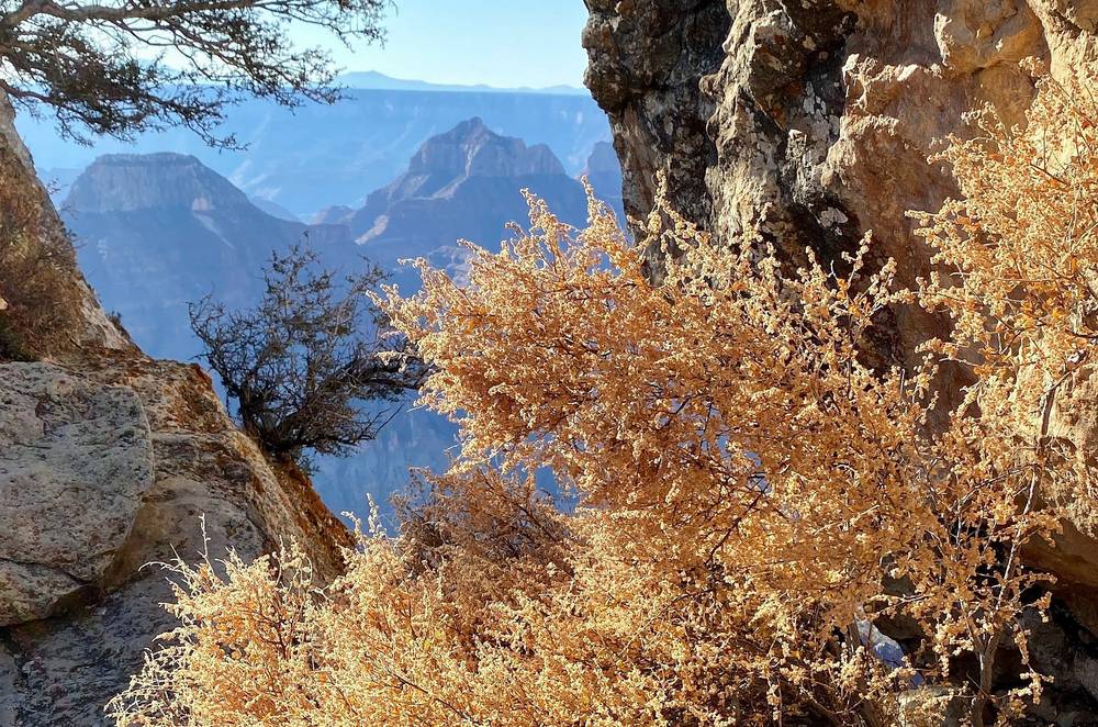
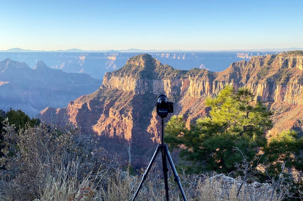
My morning on the North Rim. In the morning I set up my camera on the rim at my campsite and walked out to Bright Angel Point. Then I spent a good amount of time at the campground just chilling, waiting for my 2 o'clock shuttle back over to the South Rim. The weather was great and there was no one there. It was really, really nice, and I think it was worth it. It would have been pointless to go back: it would have been redundant to film, and I was pretty tired. It's a lot of up and down.
The shuttle. I took a shuttle from the North Rim back to my car on the South Rim. It cost about $80 and took four hours.
The Trans-Canyon Shuttle (2026). It's suspended until further notice because of the park closures. Its 2026 schedule had runs from the North Kaibab Trailhead to the South Rim at 6 a.m., noon and 5 or 6 p.m., stopping at Kaibab Lodge and Jacob Lake; it no longer stops at the old Grand Canyon Lodge, which burned. The trip takes 4 to 5.5 hours, reservations are required (928-638-2820), and it doesn't refund cancellations. I couldn't confirm its 2026 fare. It recommends that hikers who might not finish by 6 p.m. go north to south instead, because the South Rim pickup is later in the evening.
Other shuttles. NPS's 2026 list of companies allowed to carry passengers in the park includes several with North Rim pickups: Backcountry Found, Rim2RimShuttle.com, Kaibab Express, Hermosa Tours, and Arizona Personalized Tours and Transportation. NPS says the list isn't complete.
Driving. The rims are about 212 miles and 4.5 hours apart: out the South Rim's East Entrance to Cameron, north on Highway 89, west on 89A to Jacob Lake, and south on Highway 67. In 2026 there's no fuel in the park on the North Rim (the gas station closed September 19); the North Rim Country Store outside the park and Jacob Lake, about 45 miles north of the rim, have it.
On the North Rim (2026). No lodging, no drinking water and no visitor center. The General Store sold food and bottled water until October 15, and the campground ran June 1 to October 15, with no water or showers. The Bright Angel Point Trail is closed. Outside the park, Kaibab Lodge (4 miles north of the entrance station, May 15 to November 15) and Jacob Lake Inn (31 miles north of the entrance station, open all year) have rooms.
Other ways to do it
Three days: a night at Cottonwood
My original plan. Day 1 the same; Day 2 from Bright Angel Campground to Cottonwood Campground, 7.2 miles and about 1,600 ft up (NPS); Day 3 from Cottonwood to the North Rim, 6.8 miles and about 4,160 ft up. It needs a permit for both campgrounds and spreads the big climb over two days.
North to south
Down the North Kaibab Trail and up the South Kaibab or the Bright Angel Trail. You'd descend the long way and climb out the steep way. NPS says hiking up the South Kaibab Trail in summer is extremely strenuous and potentially dangerous: intense heat, little shade and no water. The Trans-Canyon Shuttle suggests this direction if you're not sure you'll finish by 6 p.m., because its South Rim pickup is later.
Out on the Bright Angel Trail
From Bright Angel Campground, the Bright Angel Trail is 9.5 miles to the South Rim (NPS) by the Silver Bridge and the River Trail, past Havasupai Gardens and two resthouses with seasonal water. It's longer than the South Kaibab, with more water and some shade, and its trailhead is a short walk from the Backcountry Information Center parking. In October 2026 it's open only from the rim to the River Resthouse.
Rim to rim in a day
People do it. NPS says hiking the whole North Kaibab Trail in a day is not recommended, especially in summer, and that it does not recommend going from a rim to the river and back in a day. A non-commercial group of 12 to 30 needs a special use permit, and commercial guides may not lead rim-to-river-to-rim day hikes.
While the corridor is closed
In October 2026 the open trails below the South Rim are the South Kaibab to the Tipoff, the Tonto Trail between the Tipoff and Havasupai Gardens, the Bright Angel Trail to the River Resthouse, and the Plateau Point trail. Down the South Kaibab to the Tipoff (4.4 miles), west on the Tonto Trail to Havasupai Gardens (4.6 miles) and up the Bright Angel Trail (4.5 miles) is about 13.5 miles by NPS's figures, with a night at Havasupai Gardens Campground if you have a permit. There's no water in the inner canyon in October 2026.
In 2020 I came back and hiked the Tonto Trail between Hermits Rest and the Bright Angel Trailhead: that's my film Hiking the Grand Canyon Tonto Trail.
Where I slept, food and water
Where I slept
| Night | Where | Height |
|---|---|---|
| Before the hike | Mather Campground, South Rim (a few nights) | |
| 1 | Bright Angel Campground (Day 1 mile 7.0) | 2,480 ft (756 m) |
| 2 | North Rim Campground, a site on the rim | about 8,200 ft (2,500 m) |
Bright Angel Campground. 30 small group sites and 2 large, beside Bright Angel Creek half a mile north of the Colorado River. Normally it has a ranger station, an emergency phone, drinking water all year and toilets. Every site has a table, a pack pole and a metal food can. No hammocks. Closed in October 2026.
Cottonwood Campground. A small campground 6.8 miles below the North Rim, with toilets, an emergency phone and drinking water from about mid-May to mid-October. Closed in October 2026.
The North Rim Campground. About 8,200 ft, by reservation on Recreation.gov, with a few walk-up sites. In 2026 it was run by Aramark from June 1 to October 15, with no water, showers or laundry. Some of its sites are on the rim.
Phantom Ranch. Cabins and men's and women's dorms. Cabins go by Xanterra's lottery: you enter between the 1st and 25th of the month 15 months before the month you want. The hiker dorms reopened for direct booking for stays up to August 2027, and the lottery takes over again from September 2027; for a 2027 trip, check Xanterra's availability for leftover space and cancellations. Posted rates: dorm beds $90 a night (2026) and $100 (2027), a cabin for two $226.39, the steak dinner $67.42, breakfast $34.14, plus tax. Closed through at least October 31, 2026.
Food
All my own, carried in my pack, except for the beer. The film shows ramen and coffee on my stove at Bright Angel Campground and oatmeal the next morning. At night everything went in the site's metal can: rock squirrels are the main cause of animal bites in the park. NPS suggests eating about twice what you normally would, with salty snacks.
Phantom Ranch Canteen. Normally hikers can buy snacks and drinks, including beer and wine (three alcoholic drinks per person), at its side window, and sack lunches; meals are only for guests with a reservation. Its posted hours disagree from page to page, and it's closed in October 2026: check before you count on it.
Water
When the pipeline works. NPS's normal pattern: no water anywhere on the South Kaibab Trail (only at the trailhead); water all year at Bright Angel Campground, Phantom Ranch and, by NPS's North Kaibab bulletin, Manzanita; and from about mid-May to mid-October at Cottonwood Campground, Supai Tunnel and the North Kaibab Trailhead. NPS says these taps "should be considered a gift and not relied upon": the pipeline can break any time of year.
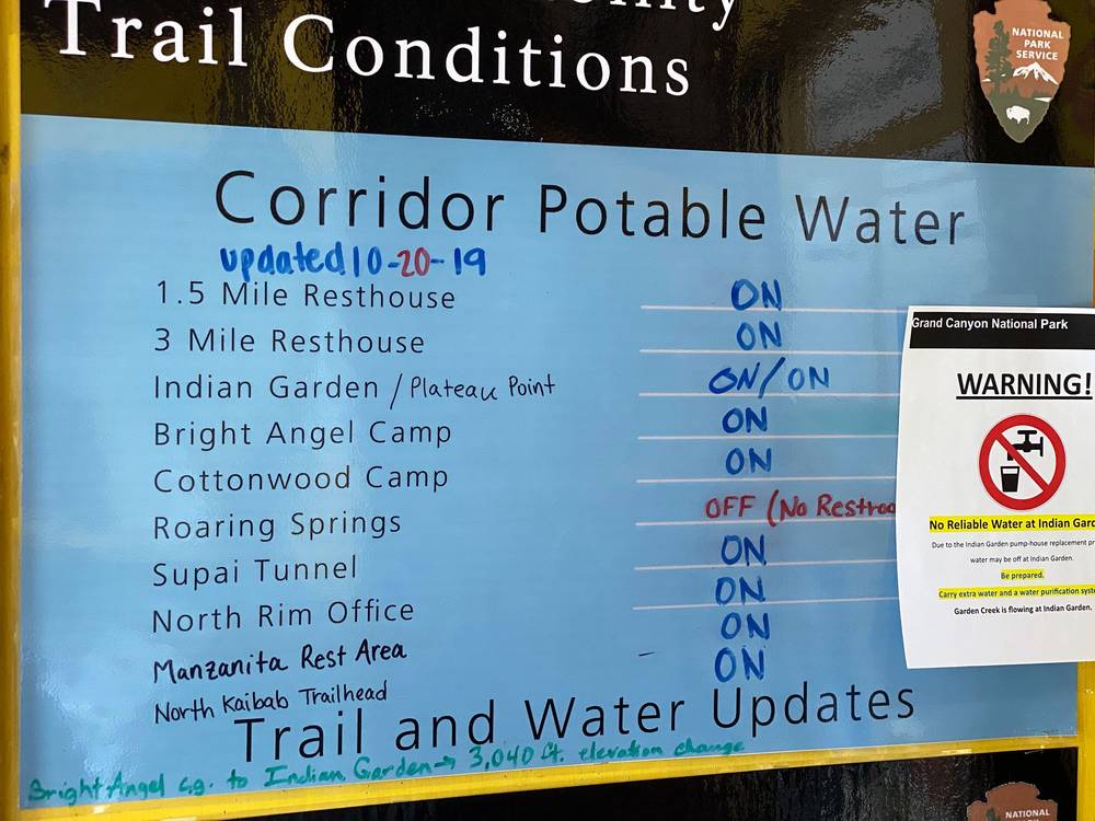
In October 2026. Every tap in the inner canyon is off, and the North Rim has no drinking water at all. Only the South Kaibab and Bright Angel trailheads have water, from tanks.
Creek water. From the river up to Roaring Springs the North Kaibab Trail is never far from Bright Angel Creek. Treat everything. NPS's method is a filter of 1 micron or finer and then bleach or iodine, or boiling. NPS also warns that cyanobacteria have been found in Bright Angel Creek and around Phantom Ranch, that ordinary backpacking filters don't remove their toxins, and that you shouldn't collect water near visible mats of them.
How much. NPS says about a gallon (4 liters) a day per person in warm months; drink when you're thirsty, and eat salty food. I carried a water bladder and a Sawyer filter.
Toilets and waste
There are toilets at the trailheads, Cedar Ridge, the Tipoff, Bright Angel Campground, Phantom Ranch, Cottonwood, Manzanita and Supai Tunnel. Pack out everything, toilet paper included. Away from toilets, dig a hole 6 inches deep at least 200 feet from water, the trail and camp.
What I paid
| Item | What I paid |
|---|---|
| Backcountry permit, bought at the South Rim the day before (2019) | $26 |
| Shuttle from the North Rim back to my car on the South Rim (2019) | About $80 |
| Phantom Ranch steak dinner | I didn't have it. It was about $60 |
| Beer at Phantom Ranch | Not in my records |
| Flight to Flagstaff and a week's rental car | Not in my records |
| Mather Campground and the North Rim Campground | Not in my records |
For your budget (2026). Backcountry permit: $10, plus $15 per person per night below the rim (one person, one night at Bright Angel Campground: $25). Park entrance: $35 per car, or $20 per person on foot; non-US residents add $100 each. Mather Campground: $30 a night. Groome from Flagstaff to the South Rim: from $49 plus $8 park entry. Phantom Ranch steak dinner: $67.42 plus tax. The Trans-Canyon Shuttle's fare wasn't published while it was suspended.
Gear for this route
What this route needs
- At least 4 liters of water capacity, a filter and chemical treatment as a backup
- Salty snacks and more food than you think
- A headlamp: NPS says not to rely on your phone as a light
- Trekking poles for the long descent
- Sun protection: a hat, a sun hoodie and sunscreen
- Warm layers for the rims: in late October the nights on the rim are below freezing
- Traction for the top of the South Kaibab from late fall to spring
- A stove (no campfires), your printed permit, a map and the GPX files
Paid links: I earn a commission if you buy through these links, at no extra cost to you. As an Amazon Associate I earn from qualifying purchases.
Here's what I carried in October 2019, what I'd take now, and what I filmed with.
What I carried in 2019
From my film's original gear list. I found a scale right before I started: my pack was about 26 or 27 pounds with water and food and everything. At the end I weighed it again, and it was around 20 or 21.
- Pack: Hyperlite Mountain Gear Southwest 2400 (Hyperlite)
- Tent: REI Passage 1. Similar: NEMO Hornet Elite OSMO 1P (Amazon).
- Sleeping bag: NEMO Siren 45 (Amazon). On the rim the temperature dropped to an insane 6 degrees.
- Liner: Outdoor Vitals Sleeping Bag Liner (Amazon)
- Mat: an inflatable mat. Similar: Therm-a-Rest NeoAir XLite NXT (Amazon).
- Pillow: Klymit Pillow X (Amazon)
- Stove: Jetboil MiniMo (Amazon). No campfires below the rim; stoves are fine.
- Spoon: TOAKS Titanium Long Handle Spoon (Amazon)
- Food bags: LOKSAK OPSAK bags (Amazon)
- Water: Platypus Platy 2L (Amazon)
- Water filter: Sawyer Micro Squeeze (Amazon). I filled my water at the tap at Cottonwood Campground on Day 2.
- Hat: ZOWYA Sport Cap (Amazon)
- Sun hoodie: Amazon Essentials Quick-Dry Tech Hoodie (Amazon)
- Pants: REI Sahara convertible pants. Similar: PATH Projects Killam PX Pant (PATH Projects).
- Socks: FEIDEER hiking socks (Amazon)
- Shoes: Columbia Crestwood (Amazon). At Ribbon Falls I took them off and waded Bright Angel Creek.
- Headlamp: SLONIK rechargeable headlamp (Amazon)
- Battery: mophie Power Boost XXL. Similar: Nitecore NB20000 (Amazon).
What I'd take now
My current kit for what this route needs: a big descent and climb, little shade, and cold rims.
- Poles: Black Diamond Alpine Carbon Z Poles (Amazon). For the long descent of the South Kaibab and the climb out.
- Water filter: Katadyn BeFree AC · 1L (Amazon). Carry at least 4 liters, and chemical treatment as a backup.
- Sun hoodie: PATH Projects Pyrenees T19 Hoodie (PATH Projects). There's almost no shade on the South Kaibab.
- Hat: PATH Projects Muir Cap 2.0 (PATH Projects)
- Puffy: Arc’teryx Cerium Hoody (Arc’teryx). In late October the nights on the rim are below freezing.
- Traction: Yatta Life Ice Spikes (Amazon). The top of the South Kaibab (the Chimney) holds ice from late fall to spring.
- Tent: NEMO Hornet Elite OSMO 1P (Amazon)
- Sleeping bag: Hyperlite Mountain Gear 20° Mummy Bag (Hyperlite)
- Sleeping pad: Therm-a-Rest NeoAir XLite NXT (Amazon)
- Stove: Jetboil Stash (Amazon)
- Headlamp: Nitecore NU20 Classic (Amazon). NPS says not to rely on your phone as a light.
- Power bank: Nitecore NB20000 (Amazon)
- Navigation: AllTrails+ (AllTrails, 30% off). Import my GPX files and download them offline on the South Rim: there's almost no signal in the canyon. Offline maps need the paid plan.
Filming kit
What I filmed this trip with in 2019. My setup is smaller now (below). Check the drone rules in Permits and rules before you fly.
- Camera: Sony a7 III (Amazon)
- Lens: Sony FE 16-35mm f/2.8 GM (Amazon)
- Mic: Rode VideoMic Pro+ (Amazon)
- Tripod: Peak Design Travel Tripod. Similar: SmallRig Carbon Fiber Tripod (Amazon).
- Clip: Peak Design Capture Clip
- Drone: DJI Mavic 2 Pro. No longer made. I only tried to fly it outside the park.
- Phone: Apple iPhone 11 Pro
- Also: AirPods
What I film with now
Since September 2026 I film with a smaller setup: the Pocket 4 and the Mic 3 on the trail, and the Mini 5 Pro in the air.
- Camera: DJI Osmo Pocket 4 (Amazon)
- Mic: DJI Mic 3 · 1 TX + 1 RX (Amazon). It pairs with the Pocket 4.
- Drone: DJI Mini 5 Pro (Amazon)
Weather and safety
Emergencies. Call 911. Leave the park's dispatch number, 928-638-7805, with someone at home. There are emergency phones at the Tipoff, Bright Angel Campground, Phantom Ranch, Cottonwood and Manzanita (and on the Bright Angel Trail), and none at Cedar Ridge, Skeleton Point, Roaring Springs or Supai Tunnel. Your phone will probably not work in the canyon. NPS says rescue is not guaranteed and can take hours or days: be ready to get yourself out.
Heat. This is what kills people here. From May to September NPS says to plan your day so you're not hiking between 10 a.m. and 4 p.m., and in summer to start the North Kaibab well before dawn. The inner gorge between Cottonwood and Bright Angel Campground is low and hot from early morning; NPS compares it to an oven. Eat salty food and drink when you're thirsty: NPS warns that drinking lots of water while losing salt in sweat causes hyponatremia (low blood sodium).
Flash floods. They can come at any time of year, from storms you can't see, and the Bright Angel Creek watershed burned in 2025, which makes floods faster and bigger. In the August 29, 2026 flood two hikers died in Bright Angel Canyon. NPS's advice: if you hear a roar, get to higher ground at once; face upstream in or near a creek and have a way out; never camp in a dry wash. Sign up for the park's GCRIVERALERTS texts, and check the National Weather Service's flash flood risk page for the Dragon Bravo burn scar.
Cold. The rims are below freezing on many nights in spring and fall, and NPS says hypothermia can happen at 50°F. Carry a warm layer and a rain jacket even when it's hot at the bottom.
Ice. The top quarter mile of the South Kaibab (the Chimney) holds ice all winter. Carry traction in winter and early spring.
Cliffs and mules. In the Redwall above Roaring Springs, and below Skeleton Point on the South Kaibab, the trail is blasted into the cliffs, with long drops. When mules come, step to the side away from the edge and stand still.
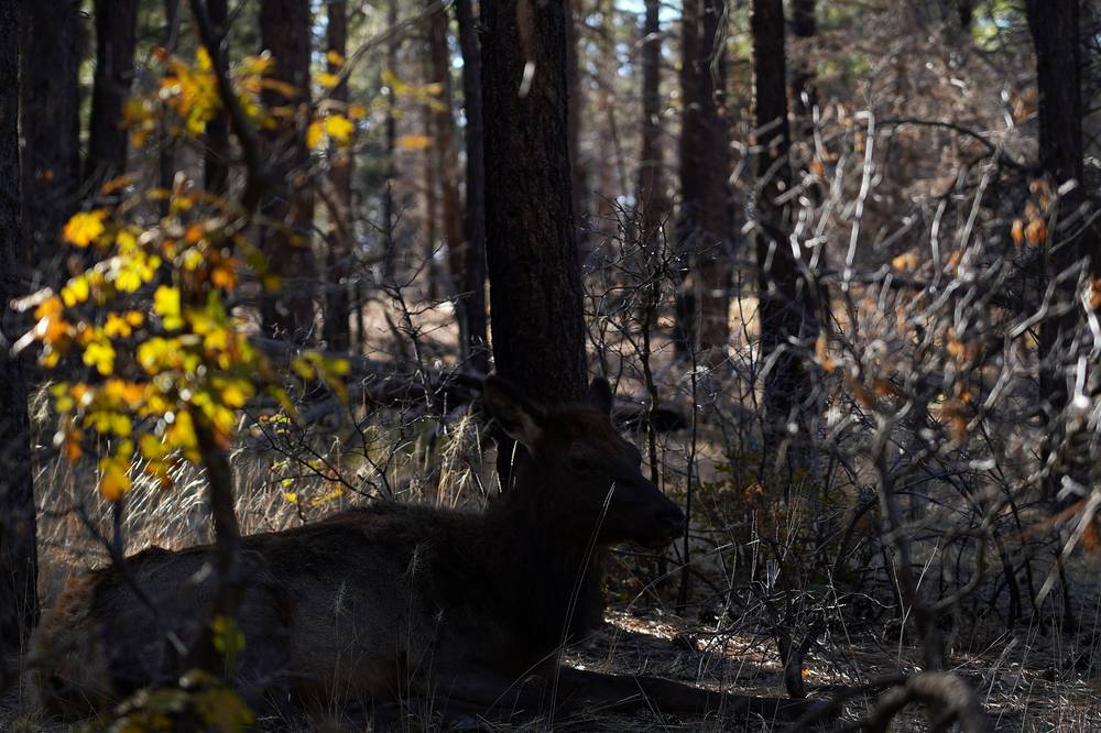
Wildlife. Keep all food in the metal cans and never feed animals: rock squirrels bite. On the rims you'll see elk; give them room.
Leave a plan with someone at home: your route, your camps and when you'll be out.
Using the GPX files
My own GPS recordings, with all timestamps removed.
| File | What it is |
|---|---|
| grand-canyon-rim-to-rim-day-1.gpx | Day 1: South Kaibab Trailhead to Bright Angel Campground, 7.0 mi |
| grand-canyon-rim-to-rim-day-2.gpx | Day 2: from 4.2 miles up the North Kaibab Trail to the North Kaibab Trailhead and the North Rim Campground, 12.7 mi recorded |
| grand-canyon-rim-to-rim-full-route.gpx | Both days in one file, with waypoints for the places in this guide |
The tracks show where I actually went, thinned to a point every 15 m: a record of my trip, not official trail lines. Day 1 reads 7.0 miles, the same as NPS's figure.
Day 2 has two gaps in the record. My recording starts about 4.2 miles up from Bright Angel Campground (a waypoint marks where), and between Manzanita and Supai Tunnel, in the cliffs of Roaring Springs Canyon, the phone's position wandered off the trail: the track reads 4.9 miles there where the trail is about 3.5 (NPS: 3.7), and its heights jump where it strays onto the cliffs. So this guide measures those two stretches on the trail line, with heights from a straight line between my GPS heights (the start) and from the USGS terrain model (Manzanita to Supai Tunnel), and uses my track everywhere else: 14.9 miles and about 6,120 ft of climbing. Follow the trail, not my line, in that stretch.
AllTrails: on alltrails.com, create a new map and use Import (offline maps need a paid plan). Gaia GPS: open the file on your phone and choose Gaia GPS, or Import on gaiagps.com. Garmin: Garmin Connect on the web, Training, Courses, Import, then send it to your watch. Organic Maps (free): download the offline map for Arizona, then open the GPX file with it.
Before you go, check these
These change every year, and in 2026 and 2027 they're changing fast. Everything else in this guide stays the same.
Is it open?
- NPS's Key Hiking Messages page: trail closures, the bridges and which water taps are on (nps.gov/grca)
- NPS's North Rim status page: the season, the campground, the store, fuel and water
- Recreation.gov's Grand Canyon backcountry permit page: whether Bright Angel and Cottonwood campgrounds are back in the lottery, and the lottery dates
Getting there and back
- The Hikers' Express times for your season (posted about two weeks before it starts)
- A shuttle between the rims: whether the Trans-Canyon Shuttle is running, its fare and times, or another company on NPS's list
- Park entrance fees, and the nonresident fee if you're not a US resident
- Mather Campground, the North Rim Campground, and Phantom Ranch if you want a meal or a bed
Conditions
- The forecast for Phantom Ranch and the rims, the flash flood risk for the Dragon Bravo burn scar (weather.gov), and GCRIVERALERTS
Your stuff
- Your printed permit, at least 4 liters of water capacity, a filter and a backup, salty food, a headlamp, warm layers
- Offline maps and the GPX files on your phone
One-page trip sheet
| Day | mi (km) | From, to | Sleep | Notes |
|---|---|---|---|---|
| 1 | 7.0 (11.3) | South Kaibab Trailhead to Bright Angel Campground | Bright Angel Campground | No water. Cedar Ridge 1.4, Skeleton Point 2.9, the Tipoff 4.3, Black Bridge 6.3 |
| 2 | 14.9 (24.0) | Bright Angel Campground to the North Kaibab Trailhead | North Rim Campground | Ribbon Falls 6.6, Cottonwood 8.2, Manzanita 9.8, Supai Tunnel 13.3 |
| Total | 21.9 (35.3) | About 6,190 ft up, 5,160 ft down |
Trails: South Kaibab Trail · North Kaibab Trail
Places: South Kaibab Trailhead · Ooh Aah Point · Cedar Ridge · Skeleton Point · the Tipoff · the Black Bridge · Bright Angel Campground · Phantom Ranch · Ribbon Falls · Cottonwood Campground · Manzanita · Roaring Springs · Redwall Bridge · Supai Tunnel · Coconino Overlook · North Kaibab Trailhead · North Rim Campground
Status (October 2026): the route is closed below the Tipoff and on the whole North Kaibab Trail, with no reopening date. Check NPS first.
Permit (2026): a backcountry permit for every night below the rim, by lottery on Recreation.gov four months ahead; $10 plus $15 per person per night. Two nights at most per campground.
Rules: no campfires, pets or drones; food in the metal cans; pack out everything; mules and uphill hikers have the right of way. No hiking 10 a.m. to 4 p.m. in summer.
Water (normal years): none on the South Kaibab; Bright Angel Campground and Manzanita all year; Cottonwood, Supai Tunnel and the North Rim mid-May to mid-October. Always carry a filter.
Getting back: 212 miles by road between the rims; book a shuttle.
Emergency: 911. Park dispatch 928-638-7805.
About this guide
Grand Canyon Rim to Rim Hiking Guide: South Kaibab to North Kaibab in 2 days, by Kraig Adams. 2027 season edition, updated October 2026.
I hiked it on October 30 and 31, 2019, and made a film about it: Hiking the Grand Canyon Rim to Rim (20 miles in 2 days). Everything in first person comes from that trip: the film and its descriptions, my GPS recordings and my photos. Rules, access and safety facts were checked on October 1, 2026, the month after the flood that closed the route, and anything that changes yearly is dated.
Updates and contact. If something has changed, or you spot a mistake, email me at kraig@kraigadams.com.
Paid links, no sponsors. The gear links in this guide are paid links: I earn a commission if you buy through them, at no extra cost to you. Nobody paid for a mention in this guide, and it isn't sponsored.
Safety. The Grand Canyon has real risks: extreme heat, flash floods, cliffs, long climbs with little water, cold rims and slow rescues. This guide describes my trip and what I found, not current conditions. Trails, bridges, water and rules change, and in 2026 they changed a lot. Check with the park, and turn back when conditions aren't right. You're responsible for your own safety.
Copyright. © 2026 Kraig Adams. This guide, its photos and the GPX files are for your personal use. Please don't share or resell them.
Credits. Photos are mine, from my trip; the cover is my film's YouTube thumbnail. GPX files are my own recordings. Maps © OpenStreetMap contributors, openstreetmap.org/copyright (ODbL). Relief: Mapzen Terrain Tiles, from USGS 3DEP and SRTM. Rules, closures and park facts from the National Park Service, Recreation.gov and the park's concessioners.
The details
- Format
- A 49-page PDF sized for a phone (A5, prints fine too) and a folder of GPX files, in one zip download.
- Edition
- 2027 season edition, updated October 2026.
- Questions
- Email kraig@kraigadams.com.
Questions
- Is the Grand Canyon rim to rim open?
- Not in October 2026. After the August 29, 2026 flash flood in Bright Angel Canyon, the park closed the whole North Kaibab Trail, Phantom Ranch with Bright Angel Campground, both bridges over the Colorado River and the South Kaibab Trail below the Tipoff, with no estimated reopening. Check the park's Key Hiking Messages page before you plan.
- How long is the Grand Canyon rim to rim?
- My South Kaibab to North Kaibab hike was 21.9 miles from trailhead to trailhead, with the side trip to Ribbon Falls: 7.0 miles down to Bright Angel Campground on Day 1 and 14.9 miles up to the North Rim on Day 2. That's about 4,780 ft down and 6,120 ft up. I called it about 20 miles in my film.
- Do you need a permit to hike rim to rim?
- You need a backcountry permit for every night you camp below the rim, by lottery on Recreation.gov about four months ahead; in 2026 it was $10 plus $15 per person per night. Day hikers don't need one. Since the August 2026 flood, no permits are issued for Bright Angel or Cottonwood campgrounds.
- Is there water on the rim to rim trail?
- None on the South Kaibab Trail. In a normal year there's water all year at Bright Angel Campground and Phantom Ranch, and from about mid-May to mid-October at Cottonwood, Manzanita, Supai Tunnel and the North Kaibab Trailhead. In October 2026 every tap in the inner canyon is off. Always carry a way to treat creek water.
- How do you get back after hiking rim to rim?
- The rims are about 212 miles apart by road, about 4.5 hours. I took a shuttle from the North Rim back to my car on the South Rim in 2019: about $80 and four hours. In October 2026 the Trans-Canyon Shuttle is suspended until the park reopens.
- When is the best time to hike rim to rim?
- I went at the end of October and would suggest the autumn, when it's not as hot: the inner canyon averages over 100°F from June to August. The North Rim's services normally run from May 15 to October 15, and its road closes from December 1 to May 14.
Timeline · newest first
Published · October 1, 2026
Wrote the guide
The day-by-day guide to the route, made from my film, my GPS recording and my notes.
Published · November 15, 2019 · YouTube · 517,857 views
Published the film: Hiking the Grand Canyon Rim to Rim (20 miles in 2 days)
On the trail · October 2019
Day 2: Bright Angel Campground to the North Rim
The day in the guide: Day 2: Bright Angel Campground to the North Rim.
On the trail · October 2019
Day 1: South Kaibab Trailhead to Bright Angel Campground
The day in the guide: Day 1: South Kaibab Trailhead to Bright Angel Campground.
On the trail · October 2019
The trip: Grand Canyon rim to rim
Grand Canyon, Arizona · 2 days