
Trip · Yosemite, California · July 2023
Half Dome, again
- Hiking
- Video
- Guide
- Photos
I went with friends, in July 2023. 2 days. My film of it is below, and my free guide to the route, day by day, is in Details.
Highlights
Milestone · August 30, 2023
Hiking Half Dome in Yosemite with Henry Golding
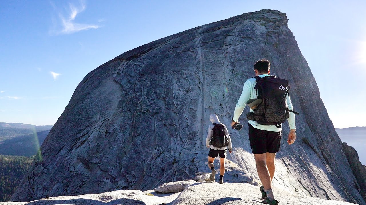
My film of the trip, published August 2023.
Milestone · October 10, 2026
The free guide
Glacier Point to Half Dome and the Mist Trail in 2 days, Yosemite. In July 2023 I hiked Half Dome over two days: from Glacier Point down the Panorama Trail to a camp in Little Yosemite Valley, up the cables to the summit in the evening light, and down past the falls to Yosemite Valley the next morning. It's the trip from my film Hiking Half Dome in Yosemite with Henry Golding, and I first climbed the cables in 2019. This guide has my GPX files, maps and notes for both days, how the Half Dome and wilderness permits work in 2026, the cables, getting to Glacier Point, other ways to do it, costs, heat and storm safety, and a trip sheet. Every page is free to read in Details below, with the PDF and GPX download.
Story
Photos
Photos from the trip.
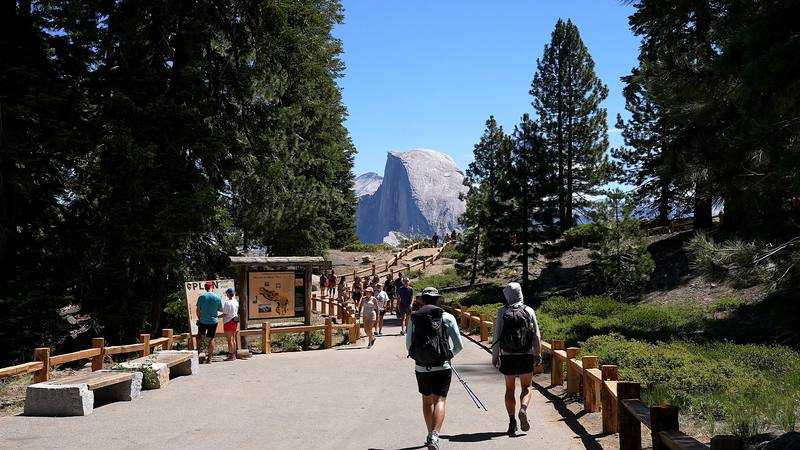
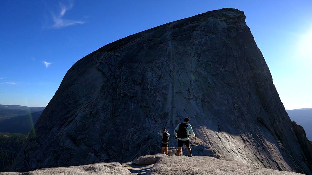
Half Dome from Glacier Point, where Day 1 starts. 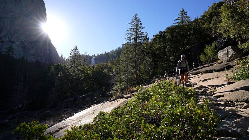
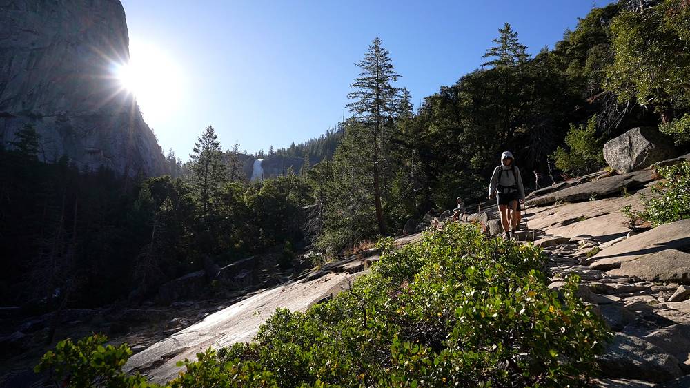
Walking down past the falls, Day 2.
Newsletter
Get my letter
Get a short letter from me every couple of weeks: new trips, guides and what I'm building.
Free. Unsubscribe any time.
Details
The guide · Free · 40-page PDF + GPX files · 2027 season edition
Half Dome Hiking Guide
Glacier Point to Half Dome and the Mist Trail in 2 days, Yosemite. Every page is below: read it here, or take it offline as a PDF with my GPX files (40-page PDF + GPX files, in one zip). No sign-up needed.
The route
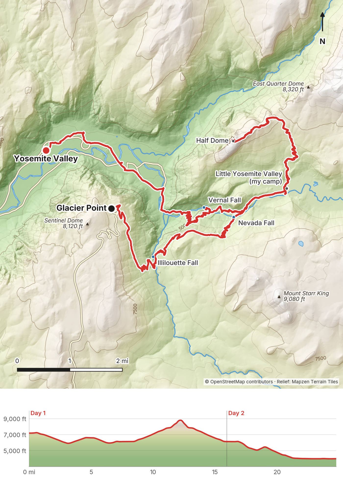
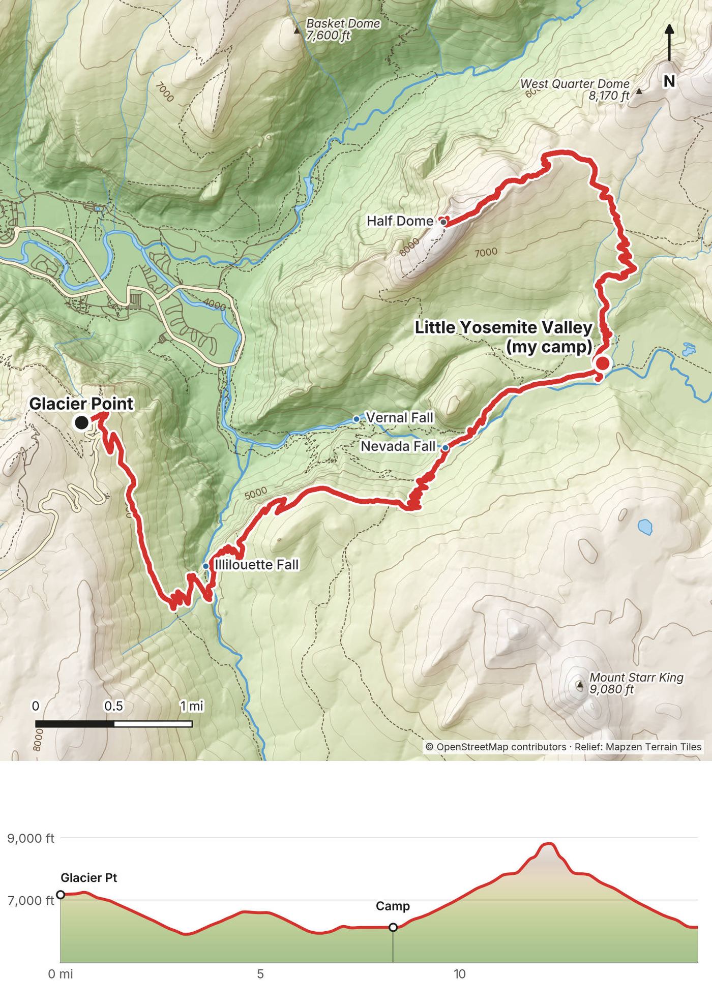
My GPS recording of 2 days on a relief map. The numbers are where each day starts; the red dot is the finish. The day maps are in the guide below, and the GPX files are a free download.
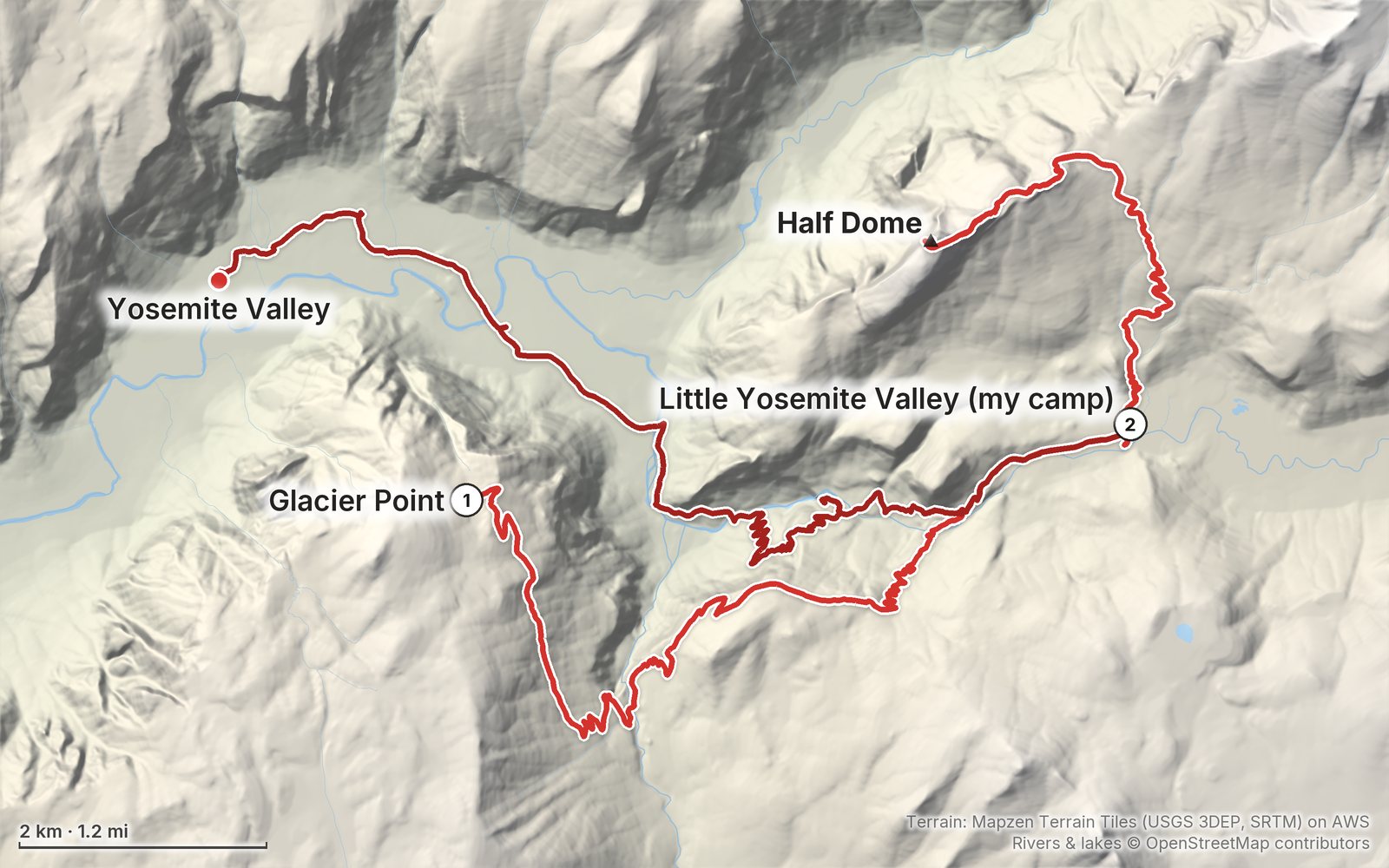
Elevation, start to finish: highest 8,830 ft (2,690 m), lowest 3,970 ft (1,210 m).
At a glance
- Days
- 2 days
- Distance
- 24.8 miles
- Climbing
- About 4,130 ft (1,260 m) up
- Route
- Glacier Point to Yosemite Valley
Contents
- Welcome
- At a glance
- Is it open? (October 2026)
- Straight answers
- Permits
- When to go
- Getting there
- Day 1 Glacier Point to Little Yosemite Valley and Half Dome
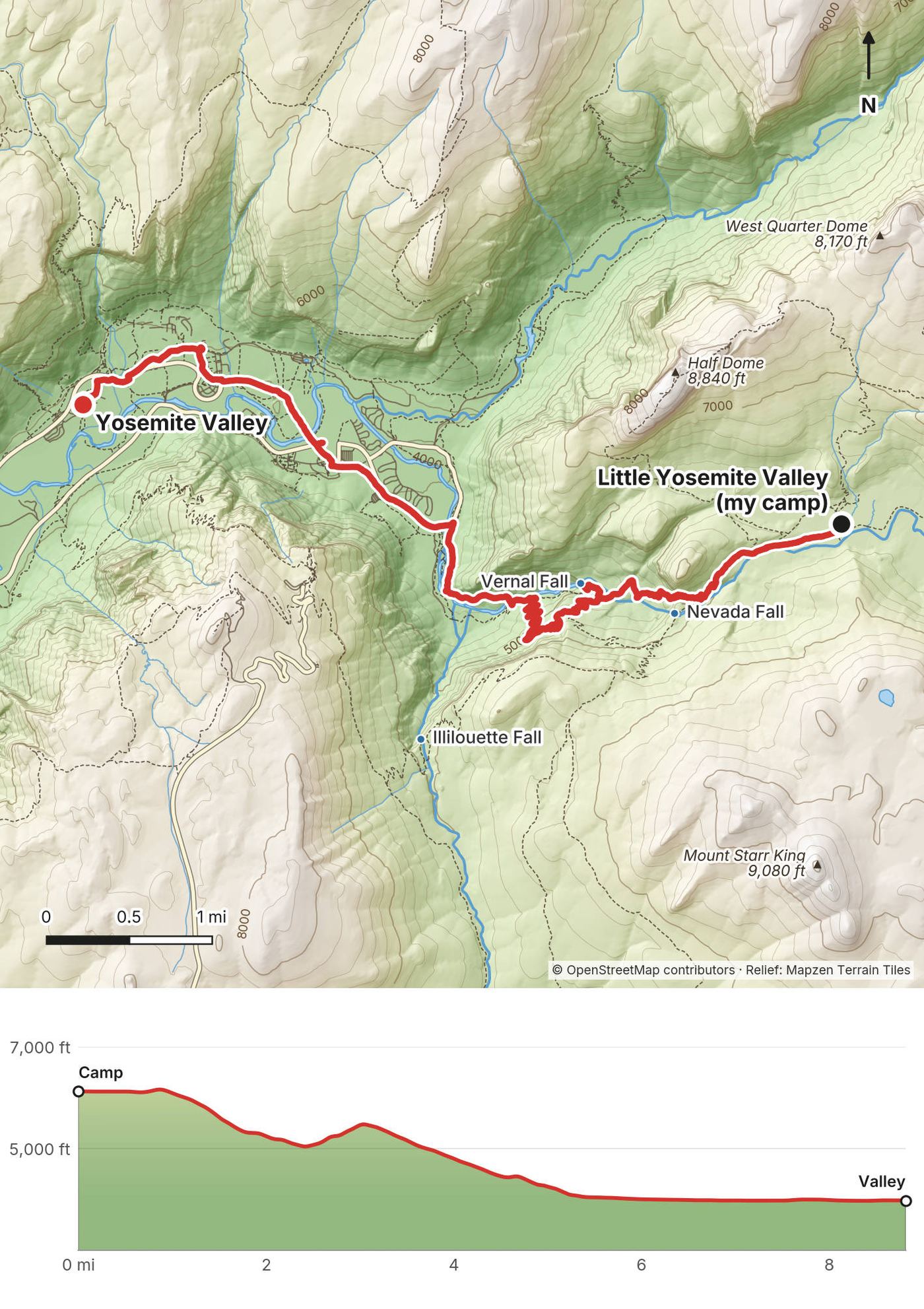
- Day 2 Little Yosemite Valley to Yosemite Valley
- Other ways to do it
- The cables
- Where I slept, food and water
- What it costs
- Gear for this route
- Weather, heat and safety
- Using the GPX files
- Before you go, check these
- One-page trip sheet
- About this guide
Welcome
At the end of July 2023 I hiked to the top of Half Dome in Yosemite National Park, California, over two days with Henry Golding. We started at Glacier Point, walked down the Panorama Trail past Illilouette Fall and Nevada Fall to the backpackers' camp in Little Yosemite Valley, and set up our tents. That evening we climbed the sub-dome and the cables and stood on the summit in the evening light, with the sun going down, then came back to camp by headlamp. The next morning we walked down past Nevada Fall and Vernal Fall to Yosemite Valley. By my GPS it was 24.8 miles (39.9 km) in two days. It's the trip from my film Hiking Half Dome in Yosemite with Henry Golding.
It was a heat wave. In the film I said, "The main characteristic of this day of hiking was the heat. It was hot." My note on the day said: "Super hot mid-day so we did a sunset summit of Half Dome. Had the cables to ourselves and had a nice time sleeping at Little Yosemite Camp below."
I'd climbed the cables once before, in June 2019, up the Mist Trail from the Valley. That trip is in my film Hiking the Half Dome Cables in Yosemite, and it's in this guide too.
Good to know first (October 2026). You need a Half Dome permit whenever the cables are up, seven days a week. Backpackers add it to their wilderness permit, and the first night on this route must be at the Little Yosemite Valley camp. The cables normally go up the Friday before Memorial Day and come down the day after the second Monday in October. In October 2026 the Mist Trail between the John Muir Trail junction and the top of Vernal Fall was open only Fridays to Sundays and holidays (and Monday to Thursday from 3:30 p.m. to 7 a.m.) for repairs. See Is it open? and Permits.
What's inside
- Where things stand in October 2026, straight answers, permits, when to go and getting there
- Both days: my notes, the route, where to turn back, maps with elevation profiles, and links to my films
- Other ways to do it, the cables, where I slept, food and water, costs and gear for this route
- Heat, storms and safety, a page of checks before you go, and a printable trip sheet
How to use it offline
Save this PDF to your phone's Files or Books app before you leave home. Load the GPX files and download offline maps before you drive into the park: don't count on a phone signal on the trail. Each day starts on a new page. The film links need a connection; everything else works in airplane mode.
When I say "I," it's my own trip. Rules and prices change, so they're dated, and the checks are collected on one page: Before you go, check these. Times are Pacific Daylight Time. Heights are in feet, with metres in brackets.
At a glance
| Quick facts | |
|---|---|
| Distance | 24.8 miles (39.9 km) over 2 days by my GPS, including the climb from camp to the summit and back |
| Climbing | About 4,130 ft (1,260 m) up and 7,340 ft (2,240 m) down, by my GPS |
| Days | 2, with one night in Little Yosemite Valley |
| Start | Glacier Point, 7,186 ft (2,190 m) by my GPS |
| Finish | Yosemite Valley, near Yosemite Valley Lodge, 3,977 ft (1,212 m) by my GPS |
| High point | The summit of Half Dome, 8,826 ft (2,690 m) by my GPS. OpenStreetMap gives 2,694 m (8,839 ft) |
| The cables | Two steel cables up the last 400 feet of rock to the summit (NPS) |
| Camp | The Little Yosemite Valley campground, the only place to camp between Glacier Point and Happy Isles |
| Water | Summer taps at Glacier Point and the Vernal Fall footbridge; treat streams |
| Rules (2026) | A wilderness permit, a Half Dome permit when the cables are up, a bear canister, park entry |
| Day | Route | Miles (km) | Up / down (ft) | Sleep |
|---|---|---|---|---|
| 1 | Glacier Point to Little Yosemite Valley, then up Half Dome and back | 16.0 (25.7) | 3,676 / 4,734 | Tent, Little Yosemite Valley, 6,127 ft |
| 2 | Little Yosemite Valley to Yosemite Valley | 8.8 (14.2) | 456 / 2,606 | Off the trail |
Is it open? (October 2026)
Checked on the National Park Service (NPS) pages for Yosemite on October 10, 2026. The conditions page was dated October 9.
The cables. "The Half Dome cables are up for the season," the NPS conditions page said on October 9, 2026. They normally come down the day after the second Monday in October: October 13 in 2026. For 2027 the same rule gives the Friday before Memorial Day (May 28, 2027) to October 12, 2027, but the NPS hadn't announced 2027 dates. With the cables down you can't climb Half Dome the normal way.
The Mist Trail. Through October 2026 the Mist Trail from its junction with the John Muir Trail to the top of Vernal Fall was open Fridays to Sundays and on holidays, and Monday to Thursday only from 3:30 p.m. to 7 a.m. (when safe), for repair work (NPS, October 10, 2026). At other times the John Muir Trail is the way to the top of Vernal Fall. The NPS also has a Mist Trail corridor rehabilitation project; no 2027 closures had been announced in October 2026: check before you go.
Glacier Point Road. Closed briefly on October 9, 2026 for smoke and firefighting (the Dome Fire, northeast of Wawona), and open again on Saturday, October 10. It's usually open from late May into October or November, and overnight parking along it is banned from October 15.
Park entry. Yosemite had no timed-entry reservation system in 2026. Nothing was announced for 2027.
Fire. Fire restrictions were in place below 8,000 feet in October 2026.
Straight answers
Do I need a permit? Yes, two for this route: a wilderness permit for the night in Little Yosemite Valley, and a Half Dome permit for the cables, which backpackers add to the wilderness permit. See Permits.
How hard is it? The miles are fine. The cables are the hard part: two steel cables up a steep granite slope, with wooden boards to stand on. In my 2019 film I said, "I'll be honest, I was a little nervous to climb this." If you're scared of heights, walk up the sub-dome first and decide there.
How far is it? By my GPS, 24.8 miles (39.9 km): 16.0 on Day 1, with the climb from camp to the summit and back, and 8.8 on Day 2. My film's chapters say 16 and 9 miles.
How many days? Two for me. Many people do Half Dome as one long day hike from the Valley instead: the NPS says 14 to 16 miles and 10 to 12 hours. See Other ways to do it.
Do I need gloves? The NPS says many people find sturdy gloves very helpful. "Gloves are an absolute must," I said in 2019. Carry them out with you.
Is there water? Streams and the Merced River, all needing treatment, and in summer drinking water at the Glacier Point trailhead and the Vernal Fall footbridge. See Where I slept, food and water.
Can I camp anywhere? No. Between Happy Isles and Glacier Point you can camp only in the Little Yosemite Valley campground.
Do I need a bear canister? Yes. Canisters are required for food storage everywhere in Yosemite's wilderness, and hanging food isn't allowed.
Is there a phone signal? Don't count on it. Hikers report little or none below the falls and some at the sub-dome and summit (as reported).
Permits
Checked on the NPS pages on October 10, 2026. My trip was in 2023, and the rules then may have been different.
The Half Dome permit
You need one to go past the base of the sub-dome whenever the cables are up, seven days a week. Rangers check them there: in 2019 a ranger checked mine before the sub-dome steps. The permit holder or the alternate must be with the whole group.
- Preseason lottery. Apply March 1 to 31 (eastern time); results by email in mid-April. $10 to apply, plus $10 per person if you win. That was the 2026 pattern; expect March 2027 and confirm on Recreation.gov.
- Daily lottery. A smaller number of permits two days ahead. Apply from midnight to 4 p.m. Pacific time.
- The daily cap. At most 300 hikers a day: about 225 day hikers and 75 backpackers.
- Backpackers. If your wilderness permit starts at an eligible trailhead, you can add the Half Dome permit when you pick up the wilderness permit: "You do not need to reserve this in advance; you can simply add it upon request" (NPS). The quota is about 75 a day, at $10 a person, and it's valid for all the dates of your wilderness permit. (That NPS page was last updated in 2024: recheck it.)
The wilderness permit
Required for any night in the wilderness, including Little Yosemite Valley, even with a Half Dome permit.
- Trailheads for this route. Glacier Point to Little Yosemite Valley (my start) and Happy Isles to Little Yosemite Valley are both "Half Dome eligible." Either way, your first night must be at the Little Yosemite Valley campground, which needs no other reservation. Quotas on the NPS page in October 2026: Glacier Point 6 by lottery and 4 first-come; Happy Isles 15 by lottery and 10 first-come.
- Reservations. 60 percent of each trailhead's quota goes by a weekly lottery 24 weeks ahead; the other 40 percent opens on Recreation.gov 7 days ahead at 7 a.m. Pacific, and the latest you can book is 3 days before (NPS, 2026). Little Yosemite Valley trailheads are "the most difficult to obtain" (NPS).
- Walk-ups. From late April to mid-October the NPS says, "Do not arrive at Yosemite expecting to get a walk-up wilderness permit." From late October to mid-April you can get one the day before or the day of.
- Pickup. At a wilderness center, 8 a.m. to 5 p.m. "After-hours permits are not available."
- Fee. $10 per application (the lottery or reservation fee), plus $5 a person when you get the permit, not refundable (NPS, 2026).
How I got mine
In 2023 I was trying online while I hiked elsewhere on the same trip. In the film: "I was online trying to get all the reservations we needed: Camp 4 overnight, backcountry permits and Half Dome permits for both of us." Then the walk-up line worked. "The next morning we woke up early to wait in line at the ranger's office to try to get whatever walk-up permits we could manage." We got what we wanted: "we got the Half Dome cable permits as well as the entry and exit that we wanted and a backcountry permit to sleep at Little Yosemite." That was luck in peak season, and the NPS now says plainly not to count on it. Apply ahead.
Other rules
Bear canisters. Required for food storage in all of Yosemite's wilderness. Toiletries, sunscreen, drinks and trash go in it too. You can rent one; see What it costs. In 2019 I rented one.
Campfires. Not above 9,600 feet. Below that only in existing fire rings, and check the year's fire restrictions (in place below 8,000 feet in October 2026).
Camping. At least 100 feet from water and trails, and only in the Little Yosemite Valley campground between Happy Isles and Glacier Point. Pets and wheeled vehicles aren't allowed in the wilderness.
When to go
My trips. July 26 and 27, 2023, in a heat wave, and June 2019, after a winter of "record amounts of snowfall," as I said in that film, with the falls full.
The cables season. Normally the Friday before Memorial Day to the day after the second Monday in October. Outside it there's no normal way up.
Summer. July and August are hot, often over 90°F in the Valley, with afternoon thunderstorms (as reported). In 2023 "Yosemite was having like 100-degree temperature days," and on the drive in I was "seeing 92, 93, 94 degree temperatures." We swam, rested through the afternoon and climbed in the evening.
Early summer. In June the falls are at their biggest and the Mist Trail is soaking. In 2019: "You're gonna get wet."
September. Often named the best month for fewer people (as reported). The cables are still up until mid-October.
Fire and smoke. In 2023 the Pika Fire changed our plans: "part of the North Rim trail was on fire," I said in the film, and from the summit "we could actually see some of the smoke from the wildfire." Smoke closed Glacier Point Road in October 2026 too. Check conditions the day before.
Daylight. We were on the summit from 7:10 to 7:32 p.m. by my GPS in late July. Sunset that day was about 8:14 p.m. and it was dark by about 8:45, so we walked the last of the way to camp by headlamp, arriving at 9:02 p.m.
Getting there
To Yosemite Valley. I flew into San Francisco (SFO), rented a car and drove in, stopping for groceries on the way. Without a car, YARTS buses run to the Valley all year on Highway 140 from Merced, where Amtrak's San Joaquins trains stop, and in summer on Highway 41 from Fresno. Amtrak tickets to Merced or Fresno can include the YARTS leg. From Merced: $22 one way, $44 round trip, plus $1 (2026); winter times run to May 28, 2027.
Entry. $35 a car for 7 days, or $20 a person on foot, by bike or by bus, in 2026. Non-US residents 16 and over pay an extra $100 each unless they have an annual or America the Beautiful pass. No cash.
Up to Glacier Point. We drove up Glacier Point Road and started from the Glacier Point parking lot. That leaves a car at Glacier Point when you finish in the Valley, and there's no shuttle between them. With one car, take the Glacier Point Tour bus up instead and leave the car in the Valley: in 2026 it ran May 9 to October 12 from the Yosemite Valley Lodge lobby at 8:30 a.m. and 1:30 p.m., $28.50 one way for adults 13 and over and $18.25 for children 2 to 12. Pick up the ticket at the Lodge front desk 15 minutes before. Book with the park's lodging company, Travel Yosemite. Overnight parking at Glacier Point is allowed while the road is open, but not from October 15 (NPS).
Parking for backpackers in the Valley. Wilderness permit holders park in the trailhead lot just past Curry Village. There's no overnight parking at Happy Isles. Take all food and scented things out of the car.
The Valley shuttle. Shuttle buses run around the east Valley from about 7 a.m. to 10 p.m., every 8 to 22 minutes (2026). Happy Isles, the start of the Mist Trail, is stop 16.
The night before. Both times I slept at Camp 4, the walk-in campground in the Valley. In 2023: "There are bear storage boxes to keep all of your stuff." In 2026 Camp 4 was by reservation on Recreation.gov a week ahead (April 15 to November 29), $10 a person a night; 2027 wasn't announced yet. Or use the Backpackers Campground behind North Pines: $8 a person in 2026, for wilderness permit holders the night before and the night after their trip, no parking at the site, vault toilets and no drinking water (water at North Pines). It's open about mid-April to early October.
Day 1: Glacier Point to Little Yosemite Valley and Half Dome
- Distance
- 16.0 mi (25.7 km)
- Climbing
- 3,676 ft (1,121 m)
- Descent
- 4,734 ft (1,443 m)
- Time I took
- 9 hours 54 minutes (11:08 a.m. to 9:02 p.m.), about 7 of them moving
- High point
- the summit of Half Dome, 8,826 ft (2,690 m) by my GPS, at 7:28 p.m., mile 12.3
- On the way
- the Panorama Trail, Illilouette Creek, Panorama Point, Nevada Fall, Little Yosemite Valley, the sub-dome, the cables
- Sleep
- my tent in the Little Yosemite Valley campground, 6,127 ft (1,867 m)
- Water
- Illilouette Creek, a stream on the Panorama Trail, the Merced River at camp; treat it
My day
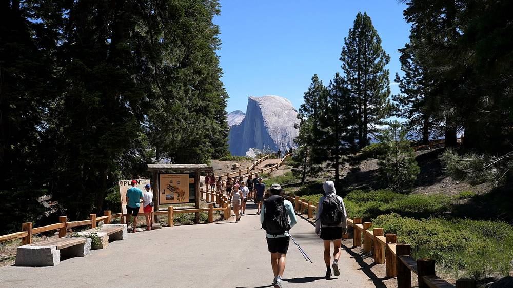
We drove up to Glacier Point on Wednesday, July 26, 2023, with our permits from that morning, and started walking at 11:08 a.m. by my GPS. Half Dome was right there across the valley.
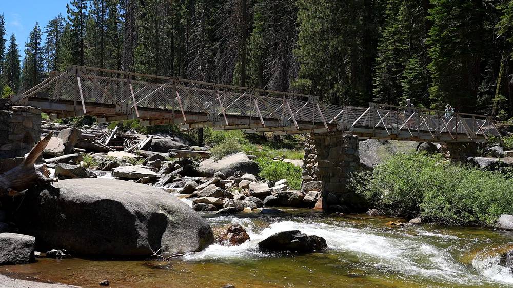
The Panorama Trail drops through dry, open forest with views back to Half Dome, then switchbacks down to Illilouette Creek. We stopped there for a few minutes, at about mile 3.2, and crossed the wooden bridge. Somewhere on this stretch we stopped at a small stream to filter water.
From the creek the trail climbs again, past Panorama Point at about mile 3.9, then runs along the slope above the Merced, with Liberty Cap ahead. We reached Nevada Fall at mile 6.6 at 2:04 p.m. A deer was walking through the forest near the trail.
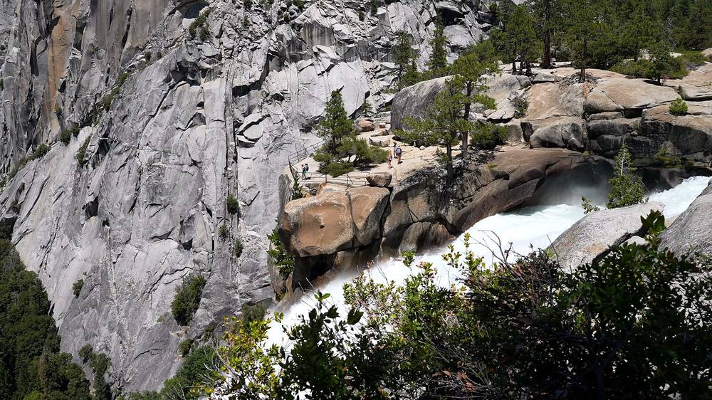
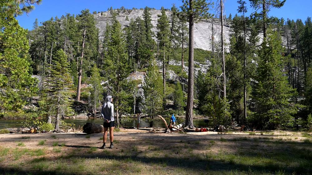
We got to the Little Yosemite Valley camp at 2:36 p.m., mile 8.0, set up the tents and went into the river. "Like, normally it's just too cold to go into rivers and streams, but this was much needed," I said in the film. I filtered water from the Merced, washed my hair in it, and we ate dinner on a log: chili mac for me.
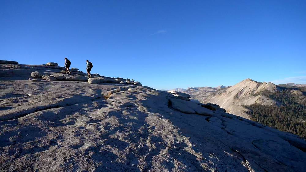
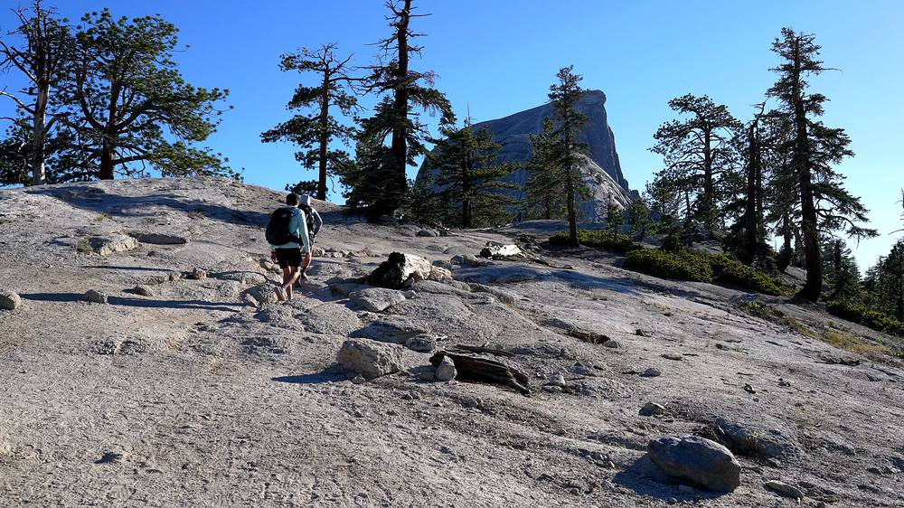
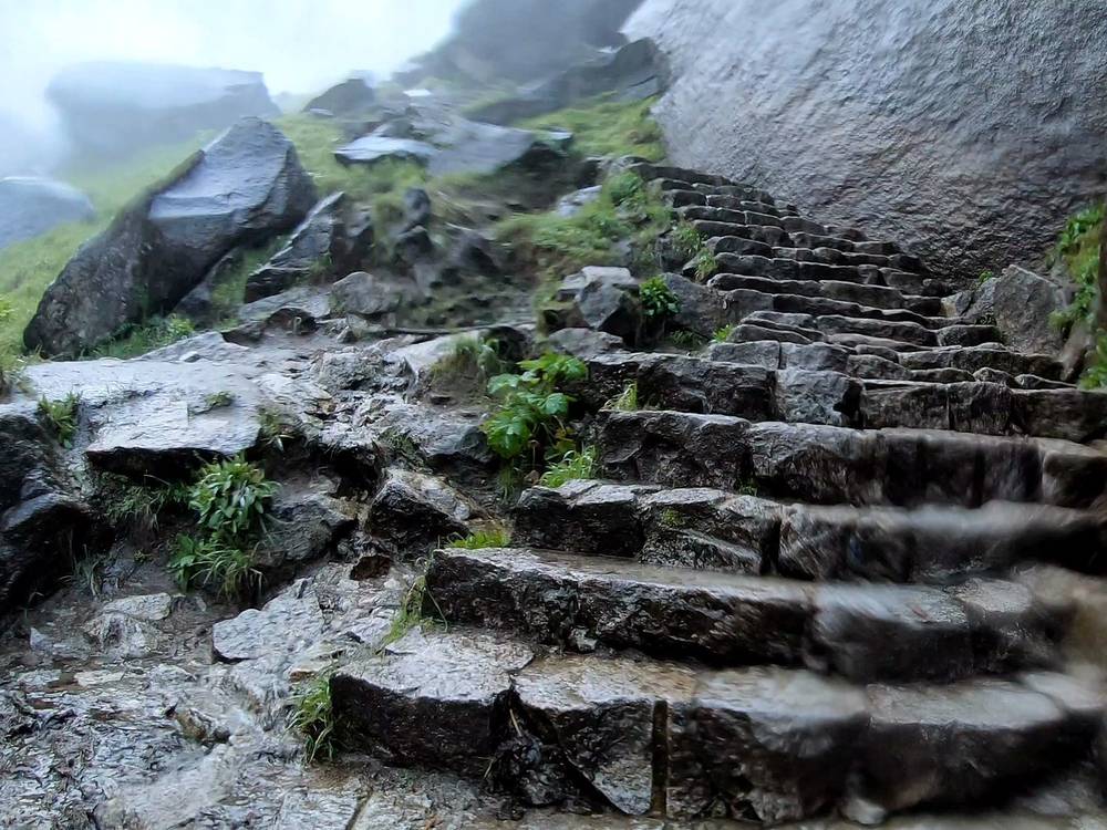
Just before 5 p.m. we left camp with light packs for Half Dome. The trail climbs through forest, then out onto granite, to the foot of the sub-dome, where stone steps go straight up the rock. We were on top of the sub-dome at 6:45 p.m. and looked across at the cables. Then we put on gloves and climbed them, about 15 minutes by my GPS, resting on the boards. There was one other person up there.
We stood on the summit from 7:10 to 7:32 p.m. by my GPS, with the sun going down, and went out onto the Diving Board, the ledge at the summit's edge. "I've never seen the cables empty like this and it was really nice because we could go our own speed and take our time," I said in the film. We went down the cables and ran down the trail at dusk, and the last part was by headlamp. I was back at camp at 9:02 p.m.
The route
Glacier Point. Start at the Glacier Point parking lot. My track starts at 7,186 ft (2,190 m).
The Panorama Trail. The NPS gives it as 8.2 miles (13.2 km) one way from Glacier Point to Happy Isles, with a 3,200-foot (975 m) net descent and an 800-foot climb after Illilouette Creek. You leave it above Nevada Fall. By my GPS: the trail passes near Washburn Point at about mile 1.3, then drops to the low point at Illilouette Creek (about 5,900 ft, about mile 3.2), then up past Panorama Point (about mile 3.9) to about 6,600 ft near mile 4.8, then down to Nevada Fall (mile 6.6).
Nevada Fall to Little Yosemite Valley. From the top of Nevada Fall the John Muir Trail climbs a little, then runs nearly flat along the Merced into Little Yosemite Valley. Camp is at mile 8.0 by my GPS, 6,127 ft (1,867 m).
Little Yosemite Valley to the sub-dome. About 3.5 miles and 2,240 ft (680 m) up by my GPS, through forest and onto open granite. It's steady climbing. My track passes 8,000 ft at about mile 11.5.
The sub-dome. Steep stone steps cut into the granite. This is where rangers check Half Dome permits. OpenStreetMap gives its top as 2,564 m (8,412 ft).
The cables. From the saddle below the sub-dome, two cables run up the last 400 feet to the summit (NPS). See The cables.
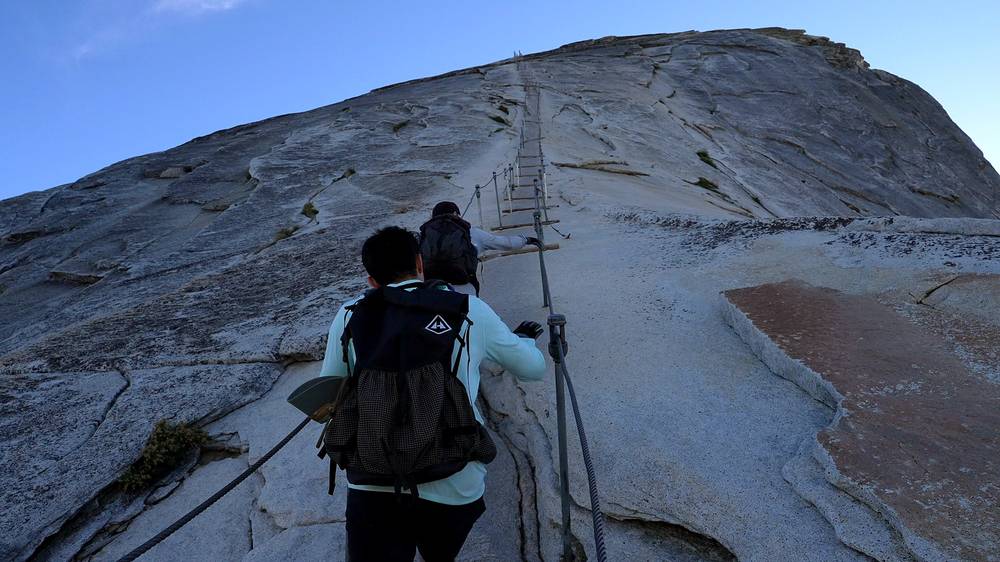
The summit. A broad, gently rounded top. My GPS high point was 8,826 ft (2,690 m) at mile 12.3. From camp to the summit was about 4 miles by my GPS; back down was 3.7.
Where to turn back
The top of the sub-dome. Look at the sky and at the cables from there. If there's any chance of a storm, rain, or wet rock, or anyone in your group isn't sure about the cables, this is where you stop: it's a great view on its own, and the way back is easy.
Watch this day
Glacier Point and the Panorama Trail (from 0:30) · The sub-dome and the cables (from 3:11) · The summit and the Diving Board (from 5:58)
Day 2: Little Yosemite Valley to Yosemite Valley
- Distance
- 8.8 mi (14.2 km)
- Climbing
- 456 ft (139 m)
- Descent
- 2,606 ft (794 m)
- Time I took
- 3 hours 49 minutes (7:17 to 11:06 a.m.), about 3.5 of them moving
- High point
- 6,170 ft (1,881 m) by my GPS, just out of camp
- On the way
- Nevada Fall, the Mist Trail, Emerald Pool and the top of Vernal Fall, Clark Point, the John Muir Trail, Happy Isles, Curry Village
- Sleep
- off the trail
- Water
- the Merced River; the fountain at the Vernal Fall footbridge in summer
My day
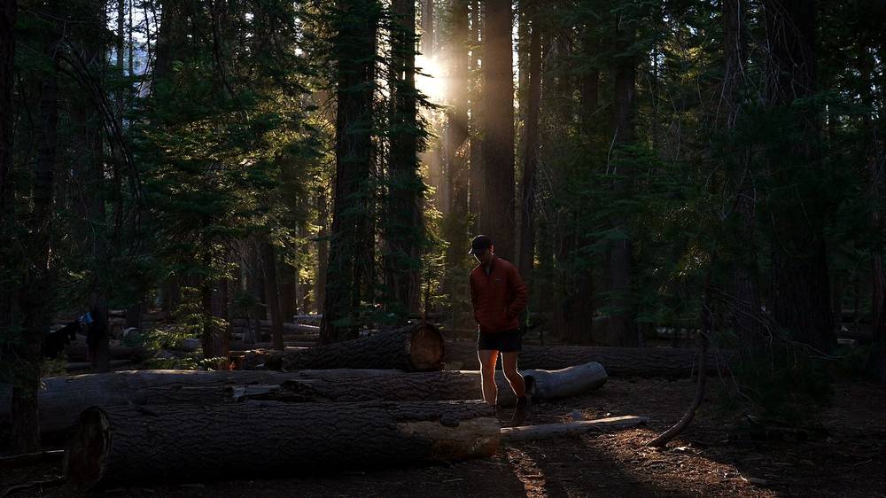
I woke up to sun coming through the trees in Little Yosemite Valley on Thursday, July 27, 2023, and we made coffee. "Coffee does make you feel half human," I said. I'd had "super ambitious plans to do a summit of Clouds Rest the next morning and then head out, but we decided with the heat and just being tired that we would just head back down to the valley." We packed up and left at 7:17 a.m.
We walked back past Nevada Fall, at about mile 1.5, and down the Mist Trail's granite steps beside the fall to the top of Vernal Fall, at mile 2.4 and 8:24 a.m. By my GPS I didn't go down the steps beside Vernal Fall that morning: from the top of the fall my track climbs to Clark Point (mile 3.1, 8:49 a.m.) and takes the John Muir Trail down to the footbridge and Happy Isles, at about mile 5.3.
From Happy Isles we walked along the Valley floor, with Half Dome behind us, past Curry Village to Yosemite Valley Lodge, where my GPS stopped at 11:06 a.m. We celebrated with a drink at the Lodge.
The route
Little Yosemite Valley to Nevada Fall. Back the way you came on Day 1, about 1.5 miles along the Merced.
Down the Mist Trail. From the top of Nevada Fall the Mist Trail goes down steep granite steps beside the fall to Emerald Pool and the Silver Apron, above Vernal Fall. My track reaches the top of Vernal Fall at mile 2.4, 5,031 ft (1,533 m).
Vernal Fall to the Valley. Two ways down. The Mist Trail goes straight down the wet stone steps beside Vernal Fall to the footbridge: short, steep and soaked in early summer. The way I took this time: from the top of Vernal Fall a short connector climbs to Clark Point, where the John Muir Trail comes down in switchbacks to join the Mist Trail above the footbridge: longer but drier. The NPS gives the Mist Trail as about 2.5 miles and the John Muir Trail as about 4 miles one way between Happy Isles and Nevada Fall (NPS, 2026).
Happy Isles to Yosemite Valley Lodge. About 3.4 miles on the Valley floor by my GPS, or take the shuttle from Happy Isles (stop 16).
Where to turn back
Not much to decide on this day: it's downhill all the way. If the Mist Trail steps are closed (Monday to Thursday daytimes in October 2026) or too wet, take the John Muir Trail from the top of Nevada Fall, or from the top of Vernal Fall as I did.
Watch this day
The morning in Little Yosemite Valley (from 7:06) · Down past the falls (from 7:44) · The Mist Trail in full spray, 2019 (from 0:45)
Other ways to do it
The classic day hike from Happy Isles
Up the Mist Trail past Vernal and Nevada Falls, through Little Yosemite Valley and up the sub-dome and the cables, and back the same day. The NPS gives 14 to 16 miles round trip, about 4,800 feet of climbing and 10 to 12 hours, and suggests a firm turnaround time such as 3:30 p.m. You need a Half Dome permit from one of the lotteries, but no wilderness permit. Start at first light: the shuttle starts about 7 a.m., and Happy Isles is about half a mile from the day-use parking lot.
Happy Isles up and back over two days
The same as the day hike, with a night in Little Yosemite Valley on a wilderness permit from Happy Isles (15 lottery and 10 first-come places a day in 2026). Backpackers add the Half Dome permit at pickup. My 2019 trip started this way: from Camp 4 up the Mist Trail on what I called in that film a "two-day hike."
Glacier Point and the Panorama Trail, my way
What this guide follows. It starts high, so Day 1 is mostly downhill to camp, and the Panorama Trail has the best views of Half Dome on the whole route. You need a ride or the bus to Glacier Point, and its wilderness quota is small: 6 by lottery and 4 first-come in 2026.
The John Muir Trail instead of the Mist Trail
Longer, drier and less steep, with the view from Clark Point. Use it in early summer when the Mist Trail is a waterfall, when the Mist Trail is closed for repairs, or on the way down if your knees don't like wet stone steps.
Clouds Rest. I planned to add the summit of Clouds Rest on the second morning and dropped it because of the heat. I haven't hiked it, so this guide doesn't describe it.
The cables
What they are. Two steel cables up the last 400 feet of granite to the summit (NPS). In my 2019 film I described it as "about a 50-degree grade with wooden supports every 10 to 20 feet to rest and maintain your balance." That grade is my own estimate; the NPS pages I read don't give one.
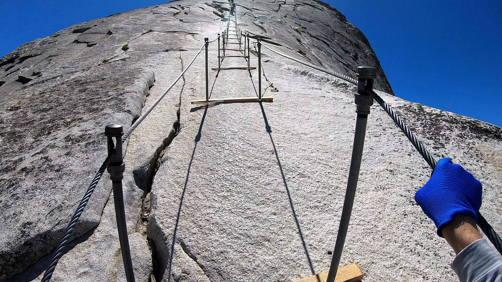
How it went in 2023. We had them nearly to ourselves in the evening, and it took us about 15 minutes up by my GPS. We pulled with our arms, stepped from board to board and rested on the boards.
How it went in 2019. It was the middle of the day in June, with snow patches on the summit and lots of people. "I'll be honest, I was a little nervous to climb this, especially with so many people to pass, but I powered through and loved the experience." On the way down I said, "All I want is chili," and then, "Chili and coffee."
Gloves. "Gloves are an absolute must," I said in 2019. The NPS says sturdy gloves help a lot, and asks you to pack them out: gloves left at the base pile up.
Never when wet. "The leading cause of fatal falls from the cable route is being on the cables when the rock and/or cables are wet" (NPS). Don't go up if it's raining, if the rock is wet, or if storms are around. "The summit of Half Dome is a dangerous place during a lightning storm" (NPS).
Crowds. In 2019 there were "so many people to pass." In 2023, in the evening, we had them nearly to ourselves. The permit cap is 300 hikers a day.
Coming down. Take it as slowly as going up, with both hands on the cables.
Where I slept, food and water
Where I slept
| Night | Where | Height |
|---|---|---|
| Before | Camp 4, Yosemite Valley | |
| 1 | My tent in the Little Yosemite Valley campground | 6,127 ft (1,867 m) |
| 2 | Off the trail |
Little Yosemite Valley. The backpackers' campground in the forest beside the Merced, the only place you may camp on this route. We swam in the river in the afternoon. It has a composting toilet and shared food lockers, but no drinking water: treat the river water. Fires are allowed only in the two communal fire rings just outside the campground, when fire rules allow (NPS page last updated 2021). Carry a bear canister anyway.
Camp 4. The walk-in campground in the Valley, where I stayed before both trips, with bear boxes for food.
The Backpackers Campground. For wilderness permit holders, the night before and after: $8 a person in 2026. See Getting there.
Lodges. Curry Village and Yosemite Valley Lodge are in the Valley. I couldn't confirm 2026 prices; reported tent-cabin prices range from about $130 to $200 a night (as reported).
Food and water
Food. I stopped at a grocery store on the drive in: "a lot of fruits and vegetables, chips and nuts." At camp I had chili mac, and coffee in the morning. Everything with a smell goes in your bear canister.
Water. In summer the NPS lists drinking water at the Glacier Point trailhead and at the Vernal Fall footbridge (May to October); there's none at Little Yosemite Valley. Treat all river and stream water. Day hikers should carry at least a gallon (4 litres), the NPS says. We filtered at a stream on the Panorama Trail and at the Merced in camp. "The BeFree water bottle filter that I use now is just a must have," I said in the film. There's no water between Little Yosemite Valley and the summit: fill up in camp.
What it costs
For your budget (2026 prices), one person, two days, from the Valley.
| Item | US$ |
|---|---|
| Park entry, a car for 7 days (or $20 a person without a car) | 35 |
| Half Dome permit, added to a wilderness permit | 10 |
| Wilderness permit, $10 per permit plus $5 a person | 15 |
| Glacier Point Tour bus, one way, adult | 28.50 |
| Backpackers Campground, the night before | 8 |
| Bear canister rental, a week (plus a $95 refundable deposit) | 5 |
| Food for 2 days (a rough allowance) | 40 |
| Total | about 140 |
Extras. Through the preseason or daily lottery instead: $10 to apply plus $10 a person if you win. Non-US residents 16 and over: $100 extra entry each. A night in a lodge or tent cabin in the Valley. I didn't keep a list of what I spent in 2023.
Bear canisters. The Yosemite Conservancy rents them for $5 a week with a $95 deposit. The NPS says rentals are at the Valley Welcome Center; the Conservancy names a wilderness center. Ask when you pick up your permit.
Gear for this route
What this route needs
- Your wilderness permit with the Half Dome permit on it, and photo ID
- A bear canister, a tent, a sleeping bag and a stove
- Water treatment and enough bottles for the dry climb from camp to the summit
- Gloves with good grip for the cables
- A headlamp, even if you plan to be back by dark
- A warm layer for the summit, which is often 15 to 20°F cooler than the Valley and windy (NPS)
- Sun protection for the exposed granite
- The GPX files, offline maps and a backup battery
Paid links: I earn a commission if you buy through these links, at no extra cost to you. As an Amazon Associate I earn from qualifying purchases.
I have no full gear list for this trip, so here's what my films show I had, what I'd take now, and what I filmed with.
What I carried in 2023
From my films.
- Pack: my Hyperlite pack. Henry used the same one. On the climb to the summit we left the heavy stuff at camp.
- Shelter: a tent
- Stove: Jetboil stove. For chili mac and morning coffee. Similar: Jetboil Stash (Amazon).
- Water: Katadyn BeFree AC · 1L (Amazon). "The BeFree water bottle filter that I use now is just a must have," as I said in the film.
- Sun hoodie: a sun hoodie. "Just simple wind and sun protection built in to one shirt," as I said in the film.
- Cables: gloves. For the cables, both trips. "Gloves are an absolute must," I said in 2019.
- Light: headlamps. For the walk back to camp after sunset.
- Bear canister: a bear canister. Required. In 2019 I rented one.
- Navigation: Strava. It recorded both days.
What I'd take now
What I'd bring for this route from my current kit.
- Pack: Hyperlite Mountain Gear Southwest 2400 (Hyperlite)
- Tent: NEMO Hornet Elite OSMO 1P (Amazon). For Little Yosemite Valley.
- Sleeping bag: Hyperlite Mountain Gear 20° Quilt (Hyperlite)
- Sleeping pad: Therm-a-Rest NeoAir XLite NXT (Amazon)
- Headlamp: Nitecore NU20 Classic (Amazon)
- Sun hoodie: PATH Projects Pyrenees T19 Hoodie (PATH Projects)
- Warm layer: Arc’teryx Cerium Hoody (Arc’teryx). For the summit.
- Power bank: Nitecore NB20000 (Amazon)
- Navigation: AllTrails+ (AllTrails, 30% off). Load my GPX files and download offline maps before you drive into the park. Offline maps need the paid plan.
Filming kit
What I filmed these trips with. My setup is much smaller now (below).
- Camera: my camera, on a tripod even on the summit. On the Mist Trail in 2019 I put it in a plastic produce bag against the spray.
What I film with now
Since September 2026 I film with a smaller setup: the Pocket 4 and the Mic 3 on the trail.
- Camera: DJI Osmo Pocket 4 (Amazon)
- Mic: DJI Mic 3 · 1 TX + 1 RX (Amazon). It pairs with the Pocket 4.
- Tripod: SmallRig Carbon Fiber Tripod (Amazon)
Weather, heat and safety
Emergencies. Call 911. Don't count on a signal below the falls.
Storms. Thunderstorms are most common in the afternoon. "The summit of Half Dome is a dangerous place during a lightning storm" (NPS). If you see clouds building, don't go up the sub-dome. Never climb the cables when the rock or the cables are wet: the NPS says that's the leading cause of fatal falls there.
Heat. In July 2023 we had 100-degree days in the Valley. We rested in camp through the hottest hours and climbed in the evening. If you do the same, know you'll come down in the dark: we left the summit at 7:32 p.m. and the last stretch was by headlamp. Do it only with clear skies, headlamps and a camp below, not as a day hiker far from the Valley.
Turnaround times. The NPS suggests a firm turnaround such as 3:30 p.m. for day hikers. Set one and keep it.
Wet steps. The Mist Trail is slick with spray in early summer. In 2019 it was "a water park ride that you rush through, but you enjoy the whole time." Go slowly on the stone steps.
Rivers. The Merced runs between and over the falls. Swim only in calm water, well away from them.
Smoke. Wildfire smoke closed Glacier Point Road in October 2026 and changed our plans in 2023. Check the NPS conditions page the day before.
Bears. Use the canister and the bear boxes. Keep food out of the tent.
Using the GPX files
My own GPS recordings, with all timestamps removed.
| File | What it is |
|---|---|
| half-dome-day-1-glacier-point-to-half-dome-and-little-yosemite-valley.gpx | Day 1: Glacier Point to my camp in Little Yosemite Valley, up to the summit of Half Dome and back to camp, 16.0 mi |
| half-dome-day-2-little-yosemite-valley-to-yosemite-valley.gpx | Day 2: Little Yosemite Valley past Nevada Fall and Vernal Fall to Yosemite Valley Lodge, 8.8 mi |
| half-dome-full-route.gpx | Both days in one file, with waypoints for Glacier Point, the summit, my camp and the end in Yosemite Valley |
The tracks show where I went, including walking around camp. On Day 2 the track goes down the Mist Trail to the top of Vernal Fall, then up to Clark Point and down the John Muir Trail. Follow the trail on the ground. The heights are from my recordings.
AllTrails: on alltrails.com, create a new map and use Import (offline maps need a paid plan). Gaia GPS: open the file on your phone and choose Gaia GPS, or Import on gaiagps.com. Garmin: Garmin Connect on the web, Training, Courses, Import, then send it to your watch. Organic Maps (free): download the offline map for California, then open the GPX file with it.
Before you go, check these
These change every year. Everything else in this guide stays the same.
Is it open?
- The NPS Yosemite conditions page: the cables, the Mist Trail repairs, Glacier Point Road, fires and smoke
- The 2027 cables dates
- Any 2027 park entry reservation system
Permits
- The Half Dome preseason lottery in March, or the daily lottery two days ahead
- Your wilderness permit: 24 weeks ahead, or about a week ahead, from Glacier Point or Happy Isles
- The wilderness permit fee on Recreation.gov ($10 plus $5 a person in 2026)
Getting there
- The Glacier Point Tour bus: 2027 dates, times and price
- YARTS times and fares if you're coming without a car
- Where you'll park overnight (the lot past Curry Village)
Your stuff
- A bear canister (rent one or bring your own), gloves, a headlamp and water treatment
One-page trip sheet
| Day | mi (km) | From, to | Sleep | Notes |
|---|---|---|---|---|
| 1 | 16.0 (25.7) | Glacier Point to Little Yosemite Valley, Half Dome and back | Tent, Little Yosemite Valley, 6,127 ft | Illilouette Creek mi 3.2, Panorama Point mi 3.9, Nevada Fall mi 6.6, camp mi 8.0, sub-dome mi 11.8, summit 8,826 ft mi 12.3, back at camp mi 16.0 |
| 2 | 8.8 (14.2) | Little Yosemite Valley to Yosemite Valley | Off the trail | Nevada Fall mi 1.5, top of Vernal Fall mi 2.4, Clark Point mi 3.1, Happy Isles mi 5.3, Yosemite Valley Lodge mi 8.8 |
| Total | 24.8 (39.9) | About 4,130 ft up, 7,340 ft down |
Miles and climbing are from my GPS.
Places: Glacier Point, 7,186 ft · Illilouette Creek · Panorama Point · Nevada Fall · Little Yosemite Valley camp · the sub-dome and its steps · the cables, the last 400 ft · Half Dome summit, 8,826 ft by my GPS · Vernal Fall · Clark Point · Happy Isles · Yosemite Valley Lodge
Status (October 2026): cables up until October 13, 2026; Mist Trail from the John Muir Trail junction to the top of Vernal Fall open Fridays to Sundays and holidays, Monday to Thursday 3:30 p.m. to 7 a.m. (repairs); no timed entry in 2026.
Permits: wilderness permit (first night at Little Yosemite Valley) with the Half Dome permit added at pickup, $10 a person; or the Half Dome lotteries (March, and two days ahead). Wilderness centers 8 a.m. to 5 p.m.
Rules: bear canister; camp only in Little Yosemite Valley campground; no fires above 9,600 ft; never on the cables when wet or with storms around.
Water: treat river and stream water; drinking water at Glacier Point and the Vernal Fall footbridge in summer; none between camp and the summit.
Emergency: 911. Don't count on a phone signal.
About this guide
Half Dome Hiking Guide: Glacier Point to Half Dome and the Mist Trail in 2 days, Yosemite, by Kraig Adams. 2027 season edition, updated October 2026.
I hiked it on July 26 and 27, 2023, and made a film about it: Hiking Half Dome in Yosemite with Henry Golding. I first climbed the cables in June 2019: Hiking the Half Dome Cables in Yosemite. Everything in first person comes from those trips: the films and their descriptions, my GPS recordings and my notes. Rules, access and safety facts were checked on October 10, 2026, and anything that changes yearly is dated. My 2023 film calls the way down the Mist Trail; my GPS shows I took the Mist Trail as far as the top of Vernal Fall and the John Muir Trail from Clark Point, and this guide follows the GPS.
Updates and contact. If something has changed, or you spot a mistake, email me at kraig@kraigadams.com.
Paid links, no sponsors. The gear links in Gear for this route are paid links: I earn a commission if you buy through them, at no extra cost to you. Nobody paid for a mention in this guide.
Safety. This route has real risks: the cables, lightning, wet granite, heat, fast rivers and no phone signal. This guide describes my trips, not current conditions. Check conditions before you go, and turn back when they aren't right. You're responsible for your own safety.
Copyright. © 2026 Kraig Adams. This guide, its photos and the GPX files are for your personal use. Please don't share or resell them.
Credits. The cover is my film's YouTube thumbnail. GPX files are my own recordings. Maps © OpenStreetMap contributors, openstreetmap.org/copyright (ODbL). Relief: Mapzen Terrain Tiles. Facts from the National Park Service (Yosemite National Park), Travel Yosemite, YARTS, the Yosemite Conservancy and the businesses named.
The details
- Format
- A 40-page PDF sized for a phone (A5, prints fine too) and a folder of GPX files, in one zip download.
- Edition
- 2027 season edition, updated October 2026.
- Questions
- Email kraig@kraigadams.com.
Questions
- Do you need a permit to hike Half Dome?
- Yes, whenever the cables are up, seven days a week. Get one in the preseason lottery in March or the daily lottery two days ahead ($10 to apply plus $10 a person), or, as a backpacker, add it to your wilderness permit at pickup for $10 a person. The NPS allows at most 300 hikers a day (as of October 2026).
- How long is the Half Dome hike?
- The NPS gives 14 to 16 miles round trip from Yosemite Valley with about 4,800 feet of climbing. My two-day route from Glacier Point, with a night in Little Yosemite Valley, was 24.8 miles (39.9 km) by my GPS.
- When are the Half Dome cables up?
- Normally from the Friday before Memorial Day to the day after the second Monday in October (NPS). In 2026 they came down on October 13; 2027 dates weren't announced in October 2026.
- Can you hike Half Dome in two days?
- Yes. With a wilderness permit from Glacier Point or Happy Isles you spend the first night in the Little Yosemite Valley campground and climb Half Dome from there. I did it from Glacier Point in July 2023 and reached the summit in the evening light, as the sun went down.
- Do you need gloves for the Half Dome cables?
- The NPS says many people find sturdy gloves very helpful, and asks you to pack them out. I used them both times I climbed the cables.
- Is the Mist Trail open?
- In October 2026 the Mist Trail to the top of Vernal Fall was open Fridays to Sundays and on holidays, for repair work; the John Muir Trail is the way around it. Check the NPS conditions page before you go.
Timeline · newest first
Published · October 10, 2026
Wrote the guide
The day-by-day guide to the route, made from my film, my GPS recording and my notes.
Published · August 30, 2023 · YouTube · 338,323 views
Published the film: Hiking Half Dome in Yosemite with Henry Golding
On the trail · July 2023
Day 2: Little Yosemite Valley to Yosemite Valley
The day in the guide: Day 2: Little Yosemite Valley to Yosemite Valley.
On the trail · July 2023
Day 1: Glacier Point to Little Yosemite Valley and Half Dome
The day in the guide: Day 1: Glacier Point to Little Yosemite Valley and Half Dome.
On the trail · July 2023
The trip: Half Dome, again
Yosemite, California · 2 days