
Trip · Cordillera Blanca, Peru · June 2021
Laguna 69
- Hiking
- Video
- Guide
- Photos
I went, in June 2021. 2 days, about 14 miles. My film of it is below, and my free guide to the route, day by day, is in Details.
Highlights
Milestone · June 22, 2021
Hiking to Laguna 69 in Peru

My film of the trip, published June 2021.
Milestone · October 3, 2026
The free guide
Huaraz to the lake by Refugio Perú in 2 days, or in a day. In June 2021 I hiked to Laguna 69 in Peru's Cordillera Blanca. After a few days in Huaraz getting used to the altitude, I walked up the Llanganuco valley to Refugio Perú, slept at the stone hut at about 15,320 ft, and crossed a high shoulder the next morning to come down to the lake from above. It's the trip from my film Hiking to Laguna 69 in Peru. Since 2026 Laguna 69 is visited only through an agency authorized by the park, so this guide tells my trip and how to do it now, as a day hike or the same two-day loop: my GPX files, maps and notes for both days, the 2026 rules and tickets, getting to Huaraz, acclimatizing, Refugio Perú, costs, altitude and safety, and a trip sheet. Every page is free to read in Details below, with the PDF and GPX download.
Story
Photos
Photos from the trip.
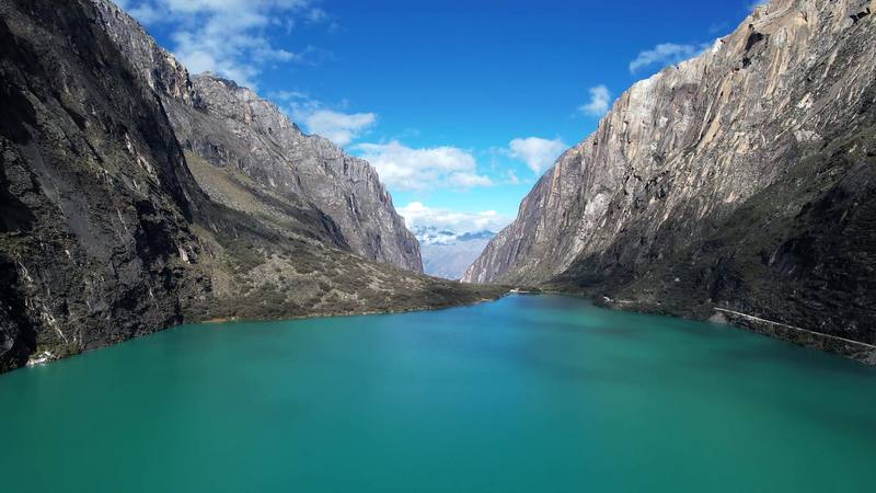
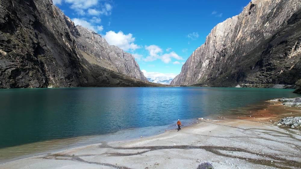
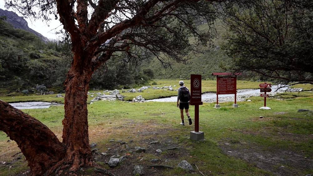
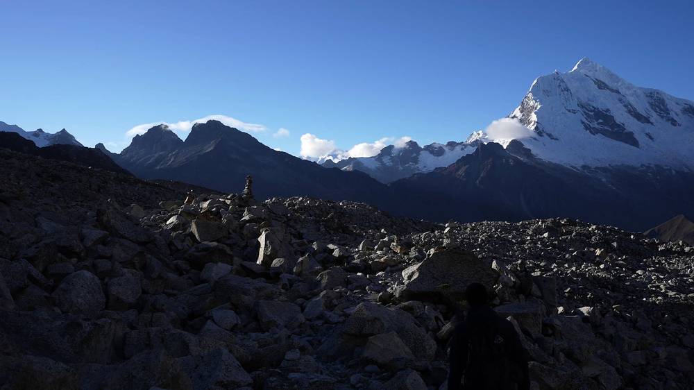
Chinancocha, the first Llanganuco lake, where Day 1 starts. 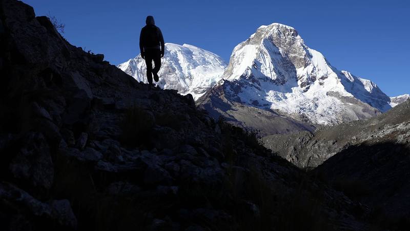
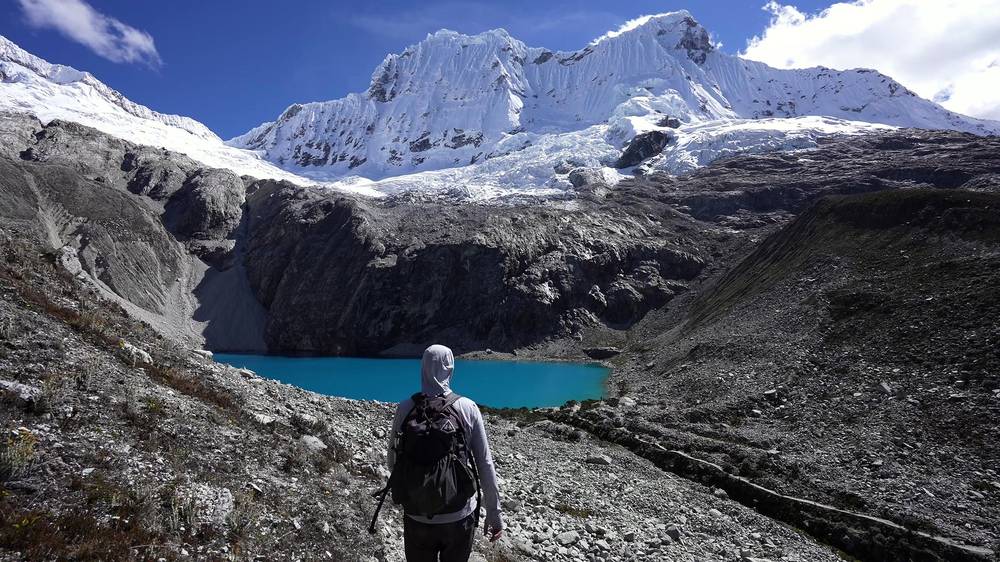
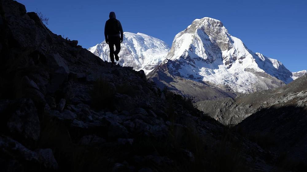
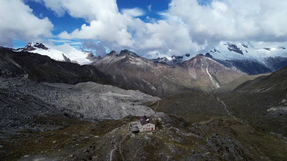
On the shoulder between Refugio Perú and Laguna 69, Day 2.
Newsletter
Get my letter
Get a short letter from me every couple of weeks: new trips, guides and what I'm building.
Free. Unsubscribe any time.
Details
The guide · Free · 41-page PDF + GPX files · 2027 season edition
Laguna 69 Hiking Guide
Huaraz to the lake by Refugio Perú in 2 days, or in a day. Every page is below: read it here, or take it offline as a PDF with my GPX files (41-page PDF + GPX files, in one zip). No sign-up needed.
The route
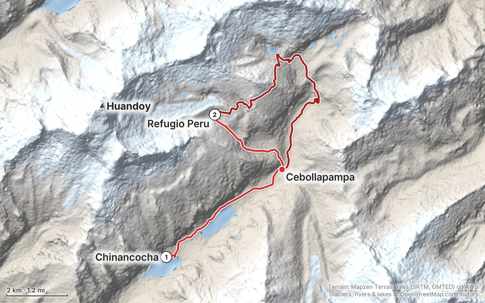
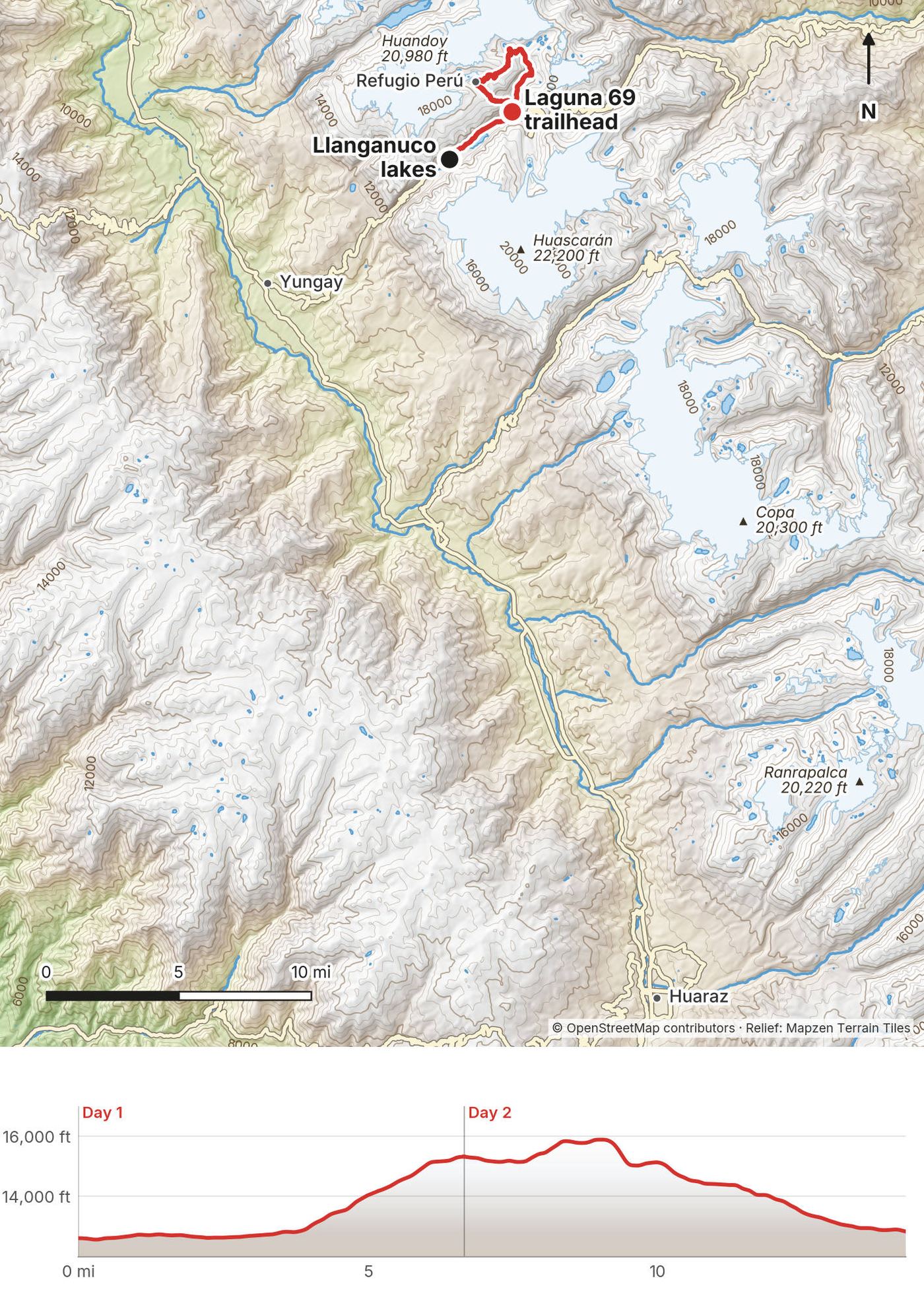
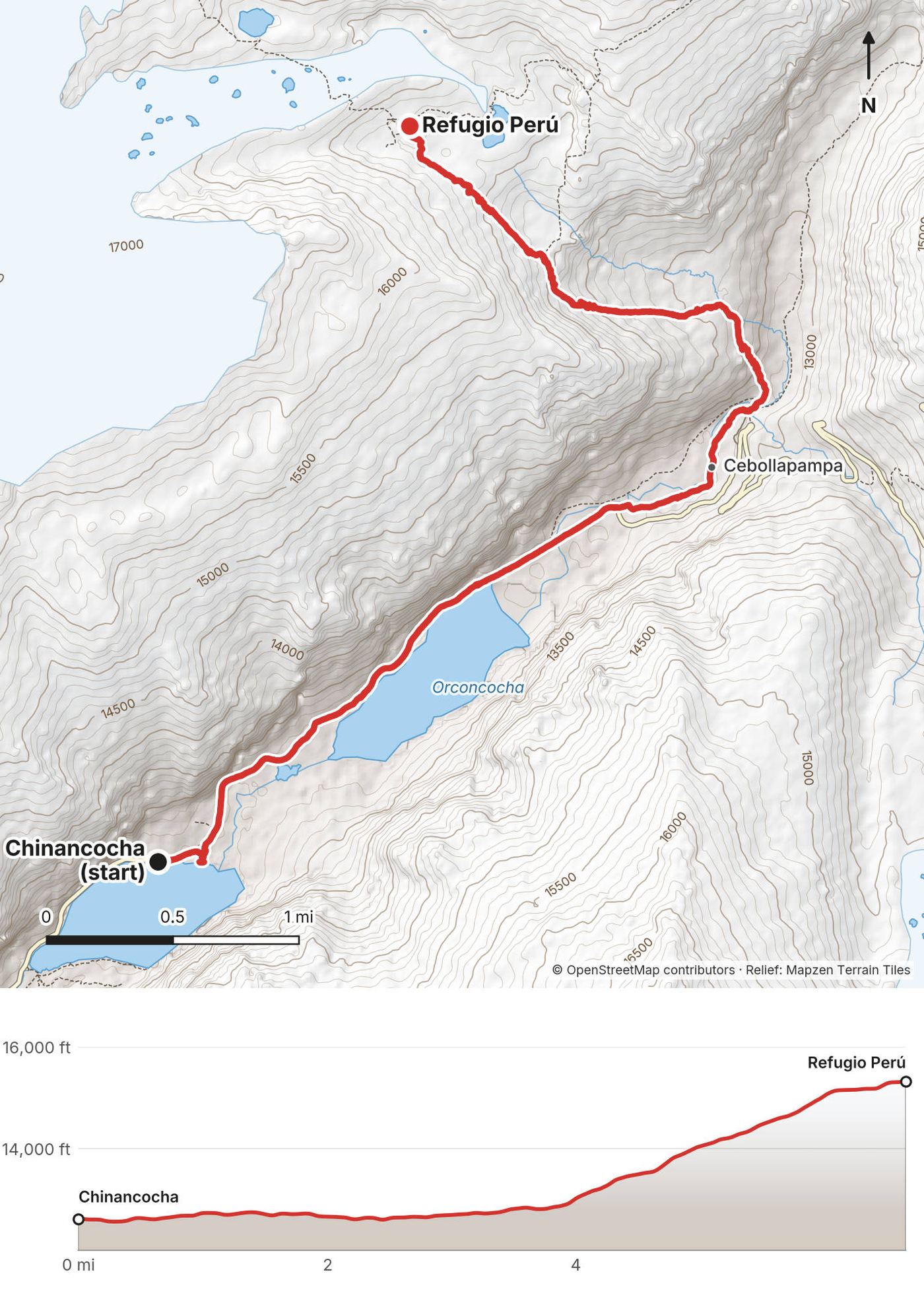
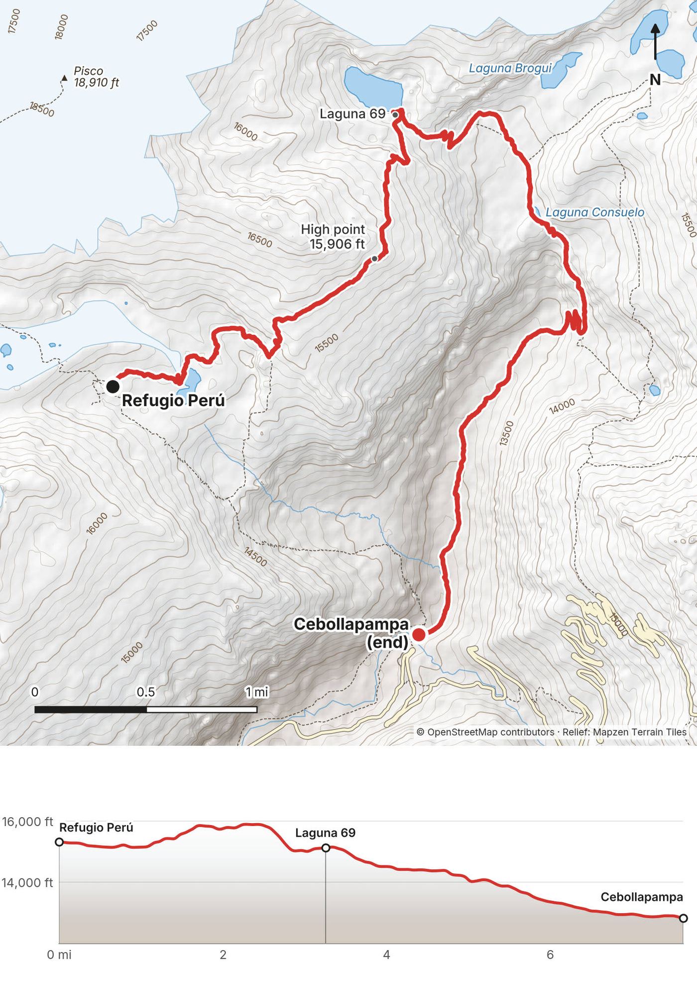
My GPS recording of 2 days on a relief map. The numbers are where each day starts; the red dot is the finish. The day maps are in the guide below, and the GPX files are a free download.
Elevation, start to finish: highest 15,910 ft (4,848 m), lowest 12,560 ft (3,827 m).
At a glance
- Days
- 2 days or 1
- Distance
- 14.3 miles
- Climbing
- About 4,140 ft (1,260 m) up
- Route
- The road above Chinancocha to the Cebollapampa trailhead
Contents
- Welcome
- At a glance
- Is it open? (October 2026)
- Straight answers
- When to go
- The rules and the agencies
- Getting there
- Huaraz and acclimatizing
- Day 1 Chinancocha to Refugio Perú
- Day 2 Refugio Perú to Laguna 69 and Cebollapampa
- Laguna 69 as a day hike
- Other ways to do it
- Where I slept, food and water
- What it costs
- Gear for this route
- Altitude and safety
- Using the GPX files
- Before you go, check these
- One-page trip sheet
- About this guide
Welcome
In June 2021 I hiked to Laguna 69 in Peru's Cordillera Blanca. I flew from New York to Lima, took the night bus up to Huaraz, spent a few days there getting used to the altitude, and then rode an early shuttle into Huascarán National Park. Instead of the usual day trip up to the lake and back, I made it two days: I walked up the Llanganuco valley to Refugio Perú, a stone mountain hut at about 15,320 ft (4,670 m), slept there, and crossed over a high shoulder the next morning to come down to Laguna 69 from above. About 14.3 miles (23 km) over two days by my GPS. It's the trip from my film Hiking to Laguna 69 in Peru.
It was my fourth time in Peru. I went alone, and it was the highest I'd ever hiked.
Good to know first (October 2026). You can't walk in on your own anymore. Since February 9, 2026, Huascarán National Park only lets you into Laguna 69 and the Nevado Pisco circuit (which includes Refugio Perú) through a travel agency that holds a contract with SERNANP, the park service. The agency buys your ticket. In 2021 I also booked my shuttle through an agency, but then I walked alone. This guide tells my 2021 trip as I did it, and how to do the day hike or the same two-day loop now, through an authorized agency. A forest fire in the Llanganuco valley also stopped visits on October 4 and 5, 2026. See Is it open?.
What's inside
- Where things stand in October 2026, and straight answers to the questions people ask about Laguna 69
- When to go, the rules and the agencies, getting to Huaraz, and acclimatizing there
- Both days of my loop: my notes, the route, where to turn back, maps with elevation profiles, and links to that day in my film
- Laguna 69 as a day hike, other ways to do it, the hut, food and water, what it costs, gear for this route
- Altitude and safety, one page of things to check before you go, and a printable trip sheet
How to use it offline
Save this PDF to your phone's Files or Books app before you leave home. Load the GPX files and download offline maps while you still have Wi-Fi in Huaraz: don't count on a phone signal past the Llanganuco lakes. Each day starts on a new page. The film links need a connection; everything else works in airplane mode.
When I say "I," it's my own trip. Rules and prices change, so they're dated, and the checks are collected on one page: Before you go, check these. Times are Peru time (UTC-5, no daylight saving). Prices are in Peruvian soles (S/) with US dollars at about S/3.44 to the dollar (October 3, 2026).
If you want a bigger trek from Huaraz, I have guides for the Santa Cruz Trek and the Huayhuash Circuit, the trek I'd planned to do on this trip.
At a glance
| Quick facts | |
|---|---|
| Distance | 14.3 miles (23 km) over 2 days by my GPS |
| Climbing | About 4,140 ft (1,260 m) up and 3,900 ft (1,190 m) down, by my GPS |
| Days | 2: about 5 and 6 hours, with long stops |
| Start | The road above Chinancocha, the first Llanganuco lake, about 12,600 ft (3,845 m), about 3 hours by road from Huaraz (about 10,000 ft) |
| Finish | The Cebollapampa trailhead, about 12,830 ft (3,910 m), the start of the usual Laguna 69 day hike |
| High point | 15,906 ft (4,848 m) by my GPS, on the shoulder between Refugio Perú and Laguna 69 on Day 2 |
| Sleep | Refugio Perú, about 15,320 ft (4,670 m), a staffed hut with bunks and meals, open May 1 to September 30. Laguna 69 is at about 15,090 ft (4,600 m) |
| Difficulty | Good trails made hard by the altitude: you sleep above 15,000 ft |
| Rules (2026) | Book through an agency with a SERNANP contract; park ticket S/60 (S/30 for the day hike) |
| Day | Route | Miles (km) | Up / down (ft) | Sleep |
|---|---|---|---|---|
| 1 | Chinancocha to Refugio Perú | 6.7 (10.7) | 3,012 / 309 | Refugio Perú, about 15,320 ft |
| 2 | Refugio Perú to Laguna 69 and Cebollapampa | 7.6 (12.3) | 1,123 / 3,586 | Huaraz |
Is it open? (October 2026)
Checked on SERNANP's pages for Huascarán National Park, its press notes, Andina (Peru's state news agency) and local news, on October 3, 2026.
Open, through an authorized agency. Laguna 69 is open, apart from the fire closure of early October 2026 below. Since August 18, 2025, tourism on the Laguna 69 and Nevado Pisco circuits can only be run by companies with a SERNANP contract (55 had signed in August 2025, more since). Since February 9, 2026, those agencies are also the only ones who can buy the digital tickets, so you can't just turn up at the control post and pay, the way people used to. The park's own page now says that visiting the park requires an operator authorized by SERNANP. No official text I found says whether a guide must walk with you the whole way, or only that you book through the agency; press reports describe the groups as accompanied by accredited guides. Ask your agency.
Refugio Perú and my loop. The park lists Pisco base camp, the hut and the option to go on to Laguna 69 as part of its Nevado Pisco route, so my two-day loop falls under the same agency rule (that's my reading; no notice spells it out). Ticket sales for the Pisco circuit started on April 1, 2026. The hut's own page still says you don't need an agency to stay there; with the 2026 rule, don't count on it. The hut is open May 1 to September 30, so the 2026 season is over; check the 2027 dates.
Nevado Pisco, the mountain. From December 2025 to March 31, 2026 the park stopped climbing and high-mountain activity in the range because of glacier retreat and crevasses, but said plainly that this didn't stop hiking on the authorized trails or visits to the lakes. In March 2026 Pisco's summit was still listed as temporarily restricted. Hiking to the hut was never named as closed.
Work on the trail. In May 2026 the park started about six months of work on the Laguna 69 trail: parking at Yuracorral, bigger toilets at Cebollapampa, signs, trail and footbridge repairs and viewpoints. It said it would set entry and exit times while the work goes on.
The road. The road from Yungay up through Llanganuco and over to Yanama (AN-106) is being rebuilt in three sections. I found no full closure, but expect delays on the drive.
Fire. On October 2, 2026 a forest fire spread from the buffer zone into the Llanganuco valley, and rangers and the local community were fighting it. Because of the smoke, the park stopped visits between the Llanganuco control post and Chinancocha, and to Laguna 69, on October 4 and 5, 2026, and said it would review the situation after that (SERNANP, as reported by Andina on October 4). Check before you go.
Straight answers
Can I still do it alone? Not the way I did. Since February 9, 2026, only agencies with a SERNANP contract can buy Laguna 69 and Pisco tickets, and rangers at Llanganuco, Chinancocha and Cebollapampa register everyone who goes in. The Llanganuco lakes themselves (Chinancocha) are still sold directly to visitors, online or at the control post; only Laguna 69 and Pisco need an agency. In 2025 and 2026 the park opened sanction cases against an agency and against visitors who broke the rules.
Day hike or two days? Most people do Laguna 69 as a day trip from Huaraz: a 5 a.m. pickup, about 3 hours on the road, about 3 hours up, an hour at the lake and 2 hours down, back in town in the evening. I made it two days with a night at Refugio Perú, and I think that was a great idea: the second morning, on the exposed shoulder between the hut and the lake, gave me a lot of beautiful views, and I came down to the lake instead of always climbing toward it. As I said in the film: if you want to do Laguna 69, just add on another half day. See Laguna 69 as a day hike.
How hard is it? The trails are good. The altitude is what makes it hard. The day hike climbs about 2,300 ft to a lake at about 15,090 ft. My loop sleeps at about 15,320 ft and crosses 15,906 ft. I had some altitude sickness at the hut, took Advil, and felt fine in the morning, but I was going very slowly on every climb.
How far is it? My loop was 14.3 miles (23 km) by my GPS: 6.7 miles on Day 1 and 7.6 on Day 2. The day hike is about 8.3 miles (13.4 km) round trip by my GPS (my walk down from the lake, doubled); others give 13.8 to 14 km.
How much time in Huaraz first? At least two or three nights, with a day hike up high. I spent a few days in Huaraz before I went. See Huaraz and acclimatizing.
Can I swim in the lake? No. Swimming is banned, there's a sign at the lake, and in February 2026 a visitor who swam faced a fine of up to S/55,000.
Can I fly a drone? Not without a SERNANP permit. In February 2026 the park filed a criminal complaint against a visitor who flew drones at Laguna 69 without one.
Can I bring my dog? No. Pets are banned in the park.
What does it cost? In 2026, a Laguna 69 day tour is about S/50 to 80 ($15 to $23), plus the S/30 park ticket for foreigners. A two-day trip with the hut through an agency is about $175 to $520 a person, depending on group size, plus the S/60 ticket. See What it costs.
Is there a phone signal? Plan as if there's none past the lakes. The hut has a radio.
When to go
June. I went in early June 2021. All of the mornings were exceptionally clear. We got a few clouds, usually at night, but almost every morning it was crystal clear, with beautiful sunrises.
The best months. The dry season is May to September, and June to August is almost rainless. The rain builds from October and peaks from December to March. The park recommends May to October; Refugio Perú is open May 1 to September 30.
Weather. Huaraz, about 10,000 ft (3,050 m), is mild all year: highs about 72 to 76 °F (22 to 24 °C). In June the nights drop to about 41 °F (5 °C). Average monthly rain in Huaraz (Senamhi, 1991 to 2020):
| Month | High / low (°C) | Rain (mm) |
|---|---|---|
| January | 22 / 8 | 101 |
| March | 22 / 9 | 151 |
| May | 23 / 7 | 34 |
| June | 23 / 5 | 4 |
| July | 23 / 4 | 3 |
| August | 24 / 5 | 3 |
| September | 24 / 6 | 20 |
| November | 23 / 7 | 70 |
Up at the lake and the hut, about 5,000 ft higher, it's roughly 18 °F (10 °C) colder: cool days in strong sun, and nights below freezing. Clouds build in the afternoon, so start early.
Holidays. Llanganuco is busiest at Peru's national holidays: over 14,500 people came in the five days of Fiestas Patrias at the end of July 2026, about 80% of them Peruvian. Go on a weekday if you can, and get to the lake early.
Light. Huaraz is near the equator, so the days are about 12 hours long all year: sunrise about 6 a.m. and sunset about 6 p.m.
The rules and the agencies
These were checked on SERNANP's Huascarán National Park pages and its press notes on October 3, 2026.
An authorized agency. Since February 9, 2026 you visit Laguna 69 and the Nevado Pisco circuit (which includes Refugio Perú) only through an agency with a current SERNANP contract; the agency buys your digital ticket. The park's public list of authorized operators is a 2022 file, so ask your agency to show you its contract, or email the park: pnhuascaran@sernanp.gob.pe.
Tickets. For foreigners, S/30 for 1 day and S/60 for 2 to 3 days. Many day tours don't include it: you pay it to the agency. Peruvians pay less, with a special Laguna 69 rate. Children under 5 enter free.
Register. Everyone is registered at the control posts. Rangers work at the Llanganuco post, Chinancocha and Cebollapampa, and Cebollapampa has cameras. Respect the entry and exit times: outside them the accesses can be closed.
At the lake. No swimming or wading. The park's sign says so, and the fine can reach S/55,000.
Other rules. No dogs or other pets. No drones without a SERNANP permit. No campfires, no hunting, no cutting plants. Stay on the signed trails. Carry out all your trash or use the bins at the control posts, and bring reusable bottles and bags: no single-use plastic.
Camping. You can't camp at the lake. The park lists Pisco base camp, near the hut, as a camping place on the Pisco route; under the 2026 rule that also goes through an agency.
The park office. Jr. Federico Sal y Rosas 555, Huaraz.
Getting there
My way in, 2021. I flew from New York to Lima, about 9 hours and about $500 one way. At the airport I took about 400 soles out of an ATM, then took a taxi, about $10, to the Plaza Norte bus terminal. (In 2021 they asked you to wear two masks and a face shield on the bus; none of that applies now.) The bus left at 9 p.m., I slept most of the way, and I woke up to a sunrise in Huaraz. It was about $10 or $11 one way.
Lima airport. Lima's new airport terminal opened on June 1, 2025. Use one of the official taxi companies with desks right outside the baggage hall. Cruz del Sur leaves from its own terminal on Javier Prado, not from Plaza Norte.
By bus. Lima to Huaraz takes about 7.5 to 8.5 hours. Cruz del Sur runs 8 buses a day, 9:30 a.m. to 10:45 p.m., from S/87 (about $25; its own timetable, September 2026). Other companies run from about S/40 to 90, many from the Plaza Norte terminal (as reported). The night buses save a hotel night; the US State Department allows its own staff to take commercial night buses to Huaraz, and the UK says to use only reputable companies.
By air. LATAM flies Lima to Huaraz's airport at Anta, about 13 miles (20 km) north of town, about 14 times a week, about an hour, from about S/190 ($55) one way (as reported, 2026). Anta is at about 9,100 ft (2,773 m): flying gets you to altitude even faster than the bus.
To the trailhead. In 2021 I booked a shuttle through a trekking agency in Huaraz: about $15 one way, leaving at 5 a.m., about 2.5 hours. The agency took care of the entrance fee. We stopped for a quick breakfast on the way, and I shared a coffee and tea with a hiker and subscriber I'd met the day before. Then the bus drove through the gorge at the entrance to the park, a massive slot between rock walls. It reminded me of a Peruvian Yosemite. In 2026 this is what the agency does for you: hotel pickup at about 4:15 to 5 a.m. and about 3 hours on the road, with a photo stop at the Llanganuco lakes.
Getting back. At Cebollapampa I paid someone about $10 or $12 to drive me back to Huaraz. I found no 2026 price for that; on an agency trip the ride back is included.
Huaraz and acclimatizing
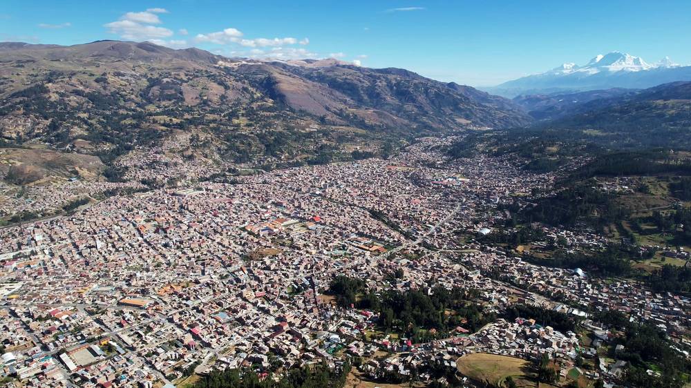
Huaraz is considered the hiking and trekking capital of Peru. It sits at about 10,000 ft (3,050 m), so if you live at sea level you're going to feel that change.
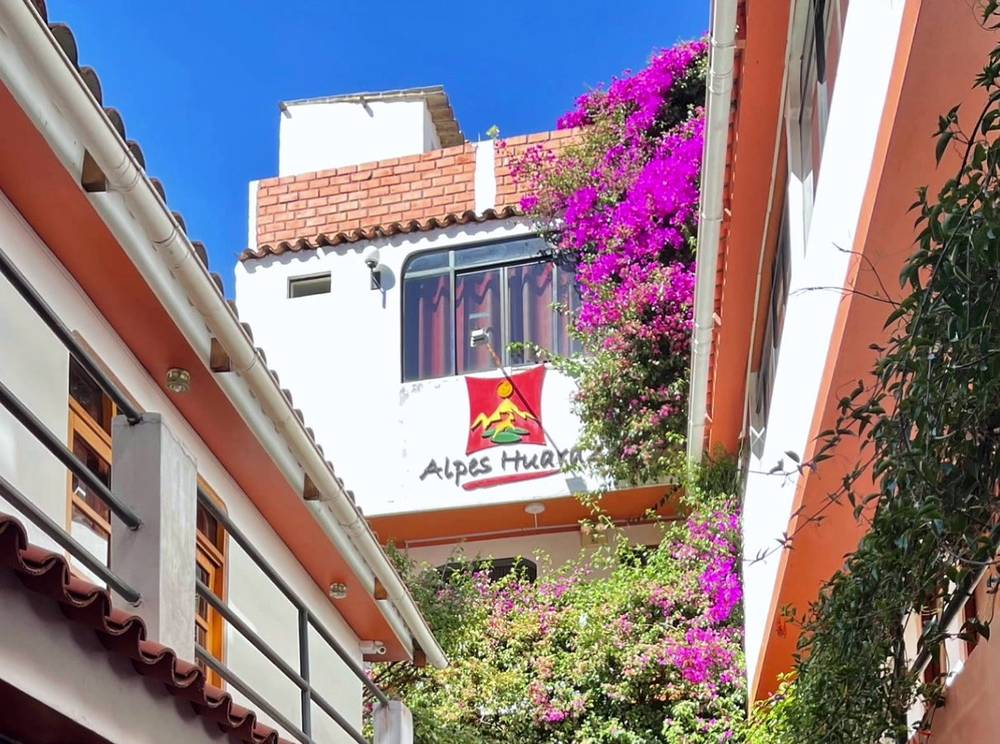
Where I stayed. My favorite place to stay in Huaraz is Alpes Huaraz, a hostel near the center. In 2021 I paid about $18 a night for my own private room, with coffee in the morning, and there were two adorable little kittens hanging out in the lobby. The hostel has a wonderful roof, and I did a couple of workouts up there. In 2026 hostel dorm beds in Huaraz are about $7 to $9 and private rooms about $19 to $27 (as reported).
My change of plan. I went to Huaraz intending to do the Huayhuash Circuit, a really big trek in a different range. But because of COVID they weren't really allowing solo travelers then, so I did this instead, and went back to the Huayhuash the next year. In 2021 the town was nearly empty of foreigners.
Acclimatizing. I spent a few days in Huaraz before the hike, getting used to the altitude. The US CDC's guidance (Yellow Book, April 2025): above 3,000 m (9,850 ft), don't raise your sleeping height by more than 500 m (1,650 ft) a day, and allow an extra night for every 1,000 m (3,300 ft) you gain. My loop sleeps about 1,600 m above Huaraz, so take it seriously:
- Day 1 in Huaraz: rest. Walk around town, drink water, sleep.
- Day 2: Laguna Wilcacocha, in the Cordillera Negra across the valley: about 7 miles (11 km) and 2,000 ft (600 m) of climbing, to about 12,250 ft (3,725 to 3,750 m) (as reported).
- Day 3: Laguna Churup, about 14,600 ft (4,450 m), from Pitec, about 3 hours up and 2 down with a short scramble near the top; S/30 park ticket, cash, at Pitec (as reported). The 2026 agency-only ticket rule names Laguna 69 and Pisco, not Churup, and people still buy the Churup ticket at Pitec (as reported). The park's page says all visits should go through an authorized operator, so ask in Huaraz before you go.
- Day 4: Laguna 69 as a day hike. For the two-day loop with the hut, add one more day before it.
In town. The iPerú tourist office is on the Plaza de Armas. The Casa de Guías, the mountain guides' association, is on Parque Ginebra, a block away; gear rental shops are around the same square. Bring cash in soles for the hut, snacks and tips.
Day 1: Chinancocha to Refugio Perú
- Distance
- 6.7 mi (10.7 km)
- Climbing
- 3,012 ft (918 m)
- Descent
- 309 ft (94 m)
- Time I took
- 5 hours (9:01 a.m. to 2:02 p.m.), about 3.8 of them moving
- High point
- about 15,320 ft (4,670 m) at Refugio Perú
- On the way
- Orconcocha (mile 1.6), the Cebollapampa trailheads (mile 3.3 to 3.7), the climb to the hut (from mile 3.7)
- Sleep
- Refugio Perú, about 15,320 ft (4,670 m)
- Water
- streams on the climb; the hut
My day
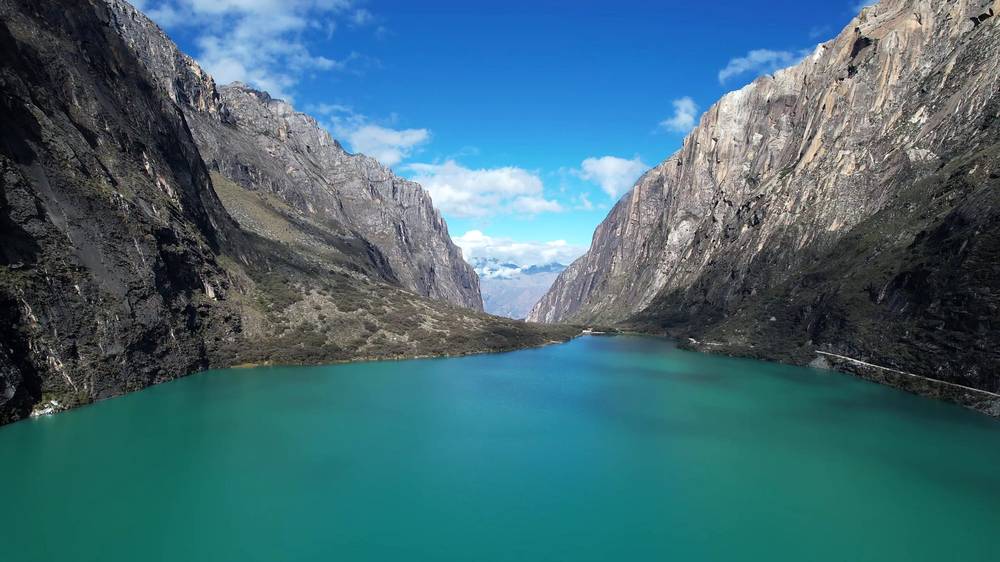
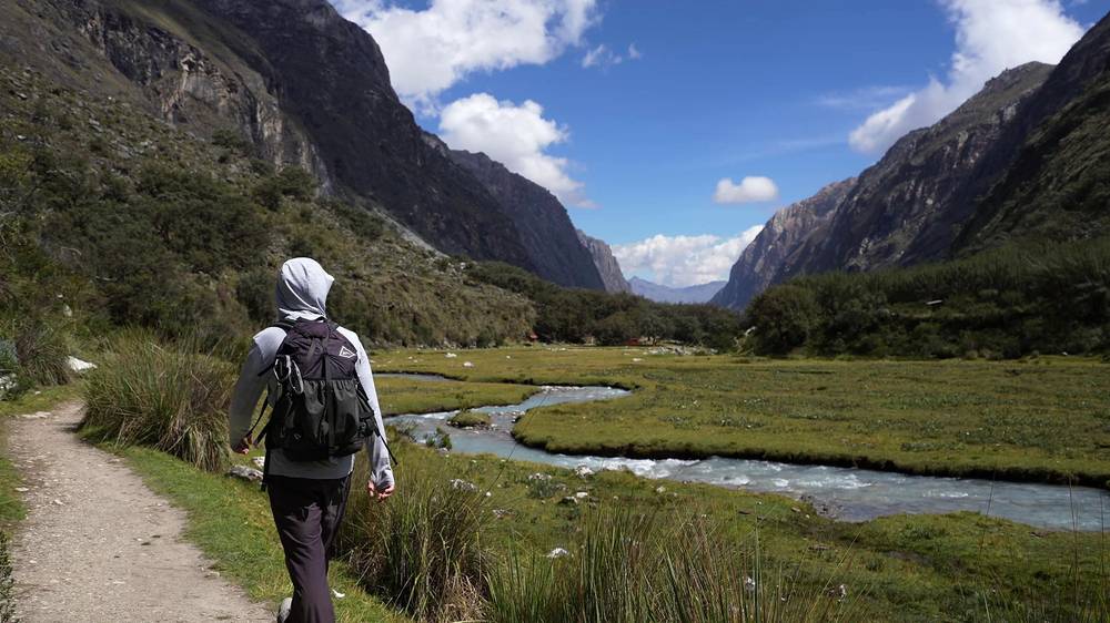
The bus stopped at the first lake, Chinancocha, and we took some photos. I decided to hop off and let the bus keep going without me, because I just wanted to walk and take my time getting up to the trailhead. I parted ways with the group and started off on my own at about 9 a.m.
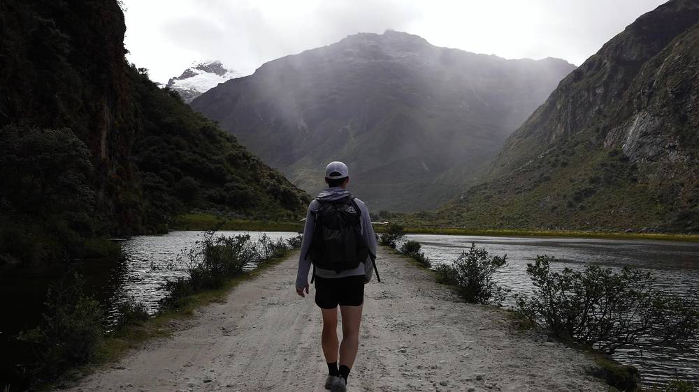
I walked the road up the valley past the second lake, Orconcocha, under the walls of the gorge. Look up as you go: the massive peak above the lakes is Huascarán, the highest in the area and in Peru, at 22,205 ft (6,768 m). You can see it in the distance from Huaraz too, which shows how massive it is.
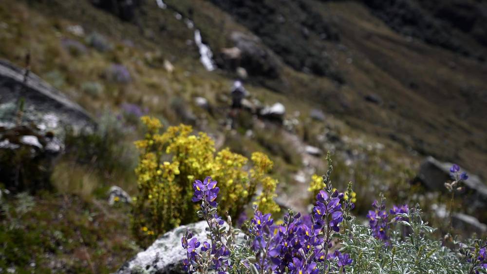
At about 10:30 I reached the trailheads at Cebollapampa and turned up the valley toward the hut. It wasn't too bad coming up this hill: a lot of elevation in a short amount of time, but I had the entire day to do it, so I took my time. Wildflowers, cows on the slopes, a stone gate on the trail. I stopped a few times on the way up.
I got to Refugio Perú at 2:02 p.m. Inside, I put my shoes on the shelf, made a hot drink and put my sleeping bag on a bunk upstairs. Dinner, a bed and breakfast cost about $25 in total, and it was totally worth it. I loved it up there: amazing views, and a couple of times I heard loud noises, looked up at the mountain and saw little avalanches in the distance. The mountains are so big that the snow seems to fall slowly. It shows you the scale of what you're looking at.
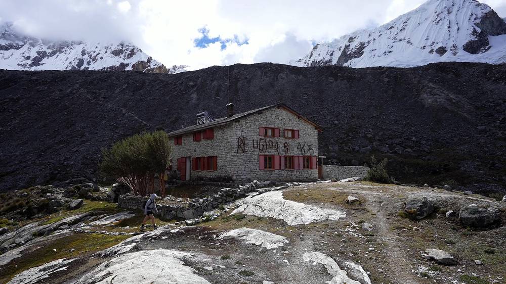
Spending the night at the hut, I was at about 15,000 feet, higher than the highest point in the lower 48 states: in my last film I'd summited Mount Whitney, and here I was sleeping higher than that peak. I definitely had some altitude sickness. I just took it easy and took some Advil. Two climbers were the only other people staying there; I played chess with one of them and lost twice.
The route
The Llanganuco lakes. The road climbs the Llanganuco gorge from the park's control post to Chinancocha, about 12,600 ft (3,845 m), then runs along the north shore of Orconcocha, about 12,660 ft (3,860 m), at mile 1.6. It's almost flat: about 500 ft of climbing in the first 3.6 miles, on a dirt road with cars and buses.
Cebollapampa. At mile 3.3 the road reaches the flat valley at Cebollapampa, about 12,830 ft (3,910 m), where the Laguna 69 trail starts. My route to the hut leaves the valley floor at about mile 3.7.
The climb to the hut. From there it's a steady climb on a clear trail, 2,500 ft in 3 miles: up a rocky valley through grass and wildflowers, then onto the open moraine slopes below Pisco. The hut sits on a rocky shoulder at mile 6.7, with glaciers above it.
On an agency trip you usually start at Cebollapampa instead of Chinancocha. By my GPS it's about 3 miles and 2,500 ft from where the trail leaves the valley floor to the hut; the hut's own page says about 2.5 hours on foot from Cebollapampa.
Where to turn back
The road to Cebollapampa is the easy part: you can wait for a bus or walk back down anytime. On the climb, if anyone has a bad headache, nausea or dizziness, go down: that's the only treatment that works, and the valley floor is 2,500 ft below the hut. Don't push on to sleep at 15,320 ft with symptoms.
Watch this day
Getting to the trailhead (from 3:25) · Day 1: Chinancocha to Refugio Perú (from 4:31)
Day 2: Refugio Perú to Laguna 69 and Cebollapampa
- Distance
- 7.6 mi (12.3 km)
- Climbing
- 1,123 ft (342 m)
- Descent
- 3,586 ft (1,093 m)
- Time I took
- about 6 hours (7:09 a.m. to 1:03 p.m.), about 4.2 of them moving, with about an hour at the lake
- High point
- 15,906 ft (4,848 m) by my GPS, at mile 2.3
- On the way
- the high point (mile 2.3), Laguna 69 (about mile 2.9 to 3.5), the Laguna 69 trail down to Cebollapampa
- Sleep
- Huaraz
- Water
- streams below the lake; carry enough for the morning
My day
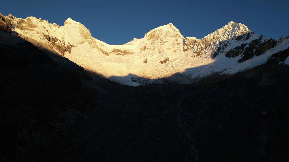
I felt fine in the morning. I woke up early, had a quick breakfast and a hot drink, and left the hut at 7:09. The sun came up over the ridges and lit the snow on the peaks.
The route climbs across boulder fields and past a gray lake below the glaciers, onto a very exposed, ridge-like shoulder with big views in every direction. I was going very slowly on the inclines. At 9:14 I reached the top, 15,906 ft by my GPS. In the film I called it 16,000 feet: the highest I'd ever been hiking, and I was feeling it.
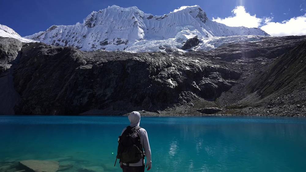
Then I saw the lake. It was great coming down to it instead of just always coming up. I reached the shore at about 10 a.m. and stayed about an hour, taking a little nap and just resting by the turquoise water. If you wake up early and reach the lake in the morning, you'll be there before most of the people, who arrive in the afternoon.
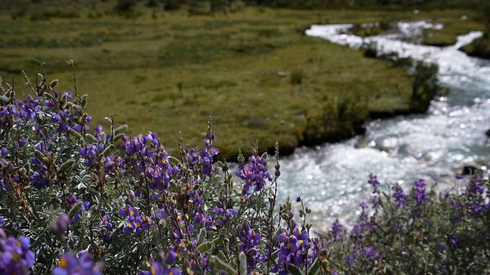
At about 11:10 I started down the usual Laguna 69 trail: down the steep valley, past a small lake, a waterfall, cows, and lupines along a stream. I stopped to rest on a bench under a tree, and reached the road at Cebollapampa at 1:03 p.m. I paid someone about $10 or $12 to take me back to Huaraz.
The route
The hut to the high point. From the hut the trail heads east across the slope, dips a little, then climbs through boulder fields and past a gray glacial lake to the shoulder that separates the hut's valley from Laguna 69's. The top is at mile 2.3, 15,906 ft (4,848 m) by my GPS. It's a trail, not a climb, but it's rocky, exposed and steep in places, and the highest point of the trip.
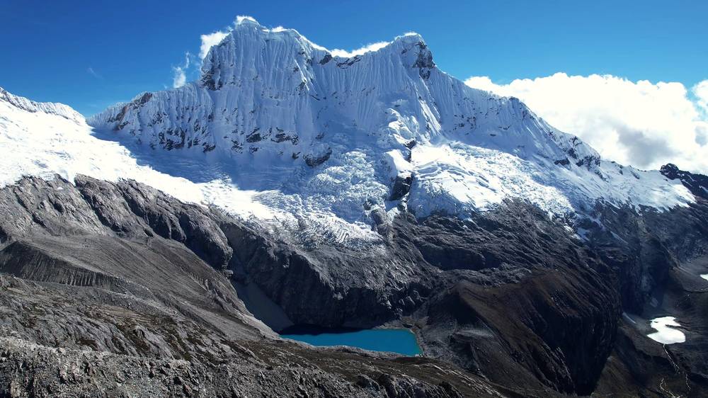
Down to Laguna 69. From the shoulder the trail drops about 800 ft to the lake, at about 15,090 ft (4,600 m), reached at about mile 2.9. The lake sits in a basin under the ice of Chacraraju (about 20,050 ft, 6,112 m) and Nevado Pisco.
The Laguna 69 trail down. From the lake the main trail goes down 4.2 miles (6.7 km) and about 2,270 ft to Cebollapampa by my GPS: steep switchbacks to a flat upper valley with a small lake, then more switchbacks down to the valley floor and along the stream to the road. This is the trail day hikers walk up.
Where to turn back
If you wake at the hut with a bad headache, nausea or dizziness, don't go up to the shoulder: go back down the way you came to Cebollapampa, 3 miles and 2,500 ft below. On the shoulder, the weather can turn; if clouds hide the route, go back to the hut. Once you've reached the lake, the only way out is down the main trail, which is busy and clear.
Watch this day
Day 2: Refugio Perú to Laguna 69 (from 8:15) · How I did it, with the route map (from 14:39)
Laguna 69 as a day hike
Most people visit Laguna 69 in one day from Huaraz, and in 2026 that's the simplest way to go: an agency tour.
The day (as reported, 2026). Pickup at your hotel at about 4:15 to 5 a.m.; about 3 hours on the road through Yungay and up the Llanganuco gorge, with a photo stop at the lakes; about 3 hours up, 30 to 60 minutes at the lake, about 2 hours down; back in Huaraz at about 6 or 6:30 p.m.
The trail. It's the second half of my Day 2, the other way: from Cebollapampa, about 12,830 ft (3,910 m), along the valley floor, up switchbacks to a flat upper valley with a small lake and a waterfall, then up the last steep switchbacks to the lake at about 15,090 ft (4,600 m). By my GPS that's 4.2 miles (6.7 km) and about 2,270 ft each way, so about 8.3 miles (13.4 km) round trip with about 2,300 ft (700 m) of climbing. Others give 13.8 to 14 km and 700 to 740 m.
Tips. Acclimatize first: the lake is about 5,100 ft above Huaraz. Go slowly on the last switchbacks, where most people struggle. Bring lunch, water, sun protection and a warm layer: nothing is sold on the trail, though a community group sells food and drinks at Cebollapampa. Watch the agency's turnaround time, and leave the lake in time to make it.
Other ways to do it
My loop, with an agency
My two days, from Llanganuco to Refugio Perú and over to Laguna 69: agencies sell it as Pisco base camp to Laguna 69, usually starting at Cebollapampa, with transport, a guide, the hut night with dinner and breakfast, and packed lunches. About $175 a person in a group of four to six to $520 for one person in 2026 (as reported), plus the S/60 park ticket.
Two days with a tent
Some agencies sell a camping version: from Chinancocha to a camp near Laguna 69, then over a high pass back down to Cebollapampa. One quoted S/360 to S/840 a person in 2026, by group size (as reported), with tents, meals, a guide and transport.
Climb Nevado Pisco
The climbers at the hut got up at midnight to summit Pisco, the mountain right above it. By the time I was waking up and starting toward the shoulder, they were at the summit. It's a glacier climb with a certified mountain guide, starting from the hut or base camp. In March 2026 its summit was still listed as temporarily restricted: ask the park and the Casa de Guías.
The Santa Cruz Trek
A three- to four-day trek across the range from Vaquería, over the Punta Unión pass at about 15,600 ft, down to Cashapampa; the road to Vaquería continues past the Llanganuco lakes. My guide: Santa Cruz Trek Hiking Guide.
The Huayhuash Circuit
The trek I'd come to do in 2021, in the Cordillera Huayhuash south of Huaraz, all the way around the range: eleven days for me. I went back and did it with a group in 2022. My guide: Huayhuash Circuit Hiking Guide.
Where I slept, food and water
Where I slept
| Night | Where | Height |
|---|---|---|
| Before | Alpes Huaraz, a private room, a few nights | about 10,000 ft (3,050 m) |
| 1 | Refugio Perú (Day 1 mile 6.7), a bunk in a dorm room | about 15,320 ft (4,670 m) |
| After | Huaraz | about 10,000 ft |
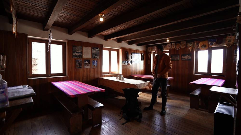
Refugio Perú. A big stone hut with red shutters, run by Refugios Andinos, part of the charity Operación Mato Grosso. It has dorm rooms with bunks, a wood-paneled dining room, meals, hot drinks, toilets, a hot shower, a first-aid kit and a radio (its own page). Open May 1 to September 30. In 2026, per night: bed only S/80, bed and breakfast S/120, bed with dinner and breakfast S/180, all plus 18% sales tax (S/212, about $62, for dinner, bed and breakfast). In 2021 I paid about $25 for all three. Contact: refugiosandinos@hotmail.com, +51 982 364 801. With the 2026 rule your agency books it.
Food and water
Food. At the hut I had dinner, soup and then steak and fries, and breakfast in the morning. On the trail, carry your own snacks and lunch from Huaraz: there's nothing to buy between Cebollapampa and the lake, except food and drinks at Cebollapampa itself.
Water. Streams run on the climb to the hut and in the valley below the lake. Treat all of it: cows graze in the valleys. Fill up at the hut before the climb to the shoulder.
What it costs
What I paid in 2021:
| Item | Cost |
|---|---|
| Flight, New York to Lima | About $500 one way |
| Taxi, Lima airport to the Plaza Norte bus terminal | About $10 |
| Night bus, Lima to Huaraz | About $10 to $11 |
| Alpes Huaraz, a private room | About $18 a night |
| Agency shuttle to Llanganuco, with the park entrance | About $15 one way |
| Refugio Perú, dinner, bed and breakfast | About $25 |
| A ride from Cebollapampa back to Huaraz | About $10 to $12 |
For your budget (as checked in October 2026, at S/3.44 to the dollar):
| Item | Cost |
|---|---|
| Bus, Lima to Huaraz | About S/40 to 90 ($12 to $26); Cruz del Sur from S/87 |
| Flight, Lima to Huaraz (LATAM) | From about S/190 ($55) one way |
| Huaraz hostel | About $7 to $9 a dorm bed, $19 to $27 a private room (as reported) |
| Laguna 69 day tour | About S/50 to 80 ($15 to $23), more on holidays (as reported) |
| Park ticket, foreigners | S/30 ($9) for 1 day; S/60 ($17) for 2 to 3 days |
| Refugio Perú, dinner, bed and breakfast | S/212 ($62) with tax |
| Two-day agency trip with the hut | About $175 to $520 a person by group size, plus the park ticket (as reported) |
A day hike with a few nights in Huaraz comes to about $75 to $200 for one person, before flights; the two-day loop with the hut through an agency, about $250 to $750. Carry cash in soles.
Gear for this route
What this hike needs
- A booking with a SERNANP-authorized agency, and your park ticket
- Warm layers, a hat and gloves: it's below freezing at night at the hut, and cold in the early morning
- Rain gear, even in the dry season
- Sunscreen, sunglasses and a sun hat: the sun at 15,000 ft burns fast
- A sleeping bag for the hut (ask the hut or your agency whether it provides bedding)
- Snacks and lunch, at least 2 liters of water and water treatment
- Basic medicine for headaches, and a talk with your doctor about altitude medicine
- The offline map and GPX files, a charged phone and a backup battery
- Cash in soles
Paid links: I earn a commission if you buy through these links, at no extra cost to you. As an Amazon Associate I earn from qualifying purchases.
I have no full gear list for this trip, so here's what my film shows I had, what I'd take now, and what I filmed with.
What I carried in 2021
From my film. No brands, so no links.
- Pack: a daypack-sized backpack. For the night at the hut.
- Sleep: my sleeping bag. For a bunk at the hut.
- Warm layers: a puffy jacket and a beanie, and a hooded layer on the trail. For the evening and the early morning.
- Sun: a cap
- Water: a water bottle
- Navigation: the AllTrails app. It recorded both days.
- Medicine: Advil. I needed it at the hut.
What I'd take now
What I'd bring for this hike from my current kit.
- Pack: Hyperlite Mountain Gear Waypoint 35 (Hyperlite)
- Sleeping bag: Hyperlite Mountain Gear 20° Mummy Bag (Hyperlite). Below freezing at night at the hut.
- Puffy: Arc’teryx Cerium Hoody (Arc’teryx). For the hut.
- Rain shell: Arc’teryx Beta AR Jacket (Arc’teryx). Even in the dry season.
- Sun hoodie: PATH Projects Pyrenees T19 Hoodie (PATH Projects). Strong sun at 15,000 ft.
- Water: Katadyn BeFree AC · 1L (Amazon). At least 2 liters, and treat it.
- Poles: Black Diamond Alpine Carbon Z Poles (Amazon). For the steep switchbacks below the lake.
- Power bank: Nitecore NB20000 (Amazon)
- Navigation: AllTrails+ (AllTrails, 30% off). Load my GPX files and download the offline map in Huaraz. Offline maps need the paid plan.
- Phone data: Airalo eSIM (Airalo, $3 off). Data in Lima and Huaraz.
Filming kit
What I filmed this trip with in 2021. My setup is much smaller now (below).
- Camera: Sony a7S III (Amazon)
- Lens: a Sony 16-35mm f/4
- Tripod: a tripod
What I film with now
Since September 2026 I film with a smaller setup: the Pocket 4 and the Mic 3 on the trail.
- Camera: DJI Osmo Pocket 4 (Amazon)
- Mic: DJI Mic 3 · 1 TX + 1 RX (Amazon). It pairs with the Pocket 4.
- Tripod: SmallRig Carbon Fiber Tripod (Amazon)
Altitude and safety
Altitude. This is the real risk. You arrive in Huaraz at about 10,000 ft; the lake is about 15,090 ft, the hut about 15,320 ft and the shoulder 15,906 ft. Altitude sickness feels like a hangover, with a headache first, usually 2 to 12 hours after you arrive. Never go up to sleep higher with symptoms, however minor. Going down 1,000 ft or more brings relief. Confusion or loss of balance, or breathlessness at rest with a cough, are signs of the dangerous kinds (cerebral and pulmonary edema): go down at once and get help. The CDC strongly encourages acetazolamide, a prescription drug, when you go up to sleep this much higher in one day, as on the loop; talk to your doctor.
Coca. Agencies in Huaraz will offer you coca tea for the altitude. The US State Department tells US travelers not to use coca products: they're a controlled substance and can interact with medicines.
Cold and sun. Frost at night, and strong sun all day. Cover up and use sunscreen.
On the trail. The trails are clear but rocky, and the shoulder on Day 2 is exposed. Watch your footing on the steep switchbacks below the lake, especially coming down. Stay back from the glaciers above the hut: I saw small avalanches from there.
Emergencies. Police 105, ambulance 106, fire 116. There's no reliable signal past the lakes. The hut has a radio, the rangers at Cebollapampa and Llanganuco can help, and the police high-mountain rescue unit works in the Cordillera Blanca. The hut and its radio are only there May 1 to September 30. Rescues are usually carried out on foot, because much of the range is out of a helicopter's reach. Get travel insurance that covers trekking above 15,000 ft, rescue and medical evacuation.
Safety in Peru. The US State Department rates Peru Level 2, "Exercise increased caution" (September 2026); the Áncash region isn't on its do-not-travel list. Road blockades (paros) happen without warning: in September 2026 one closed the road south of Huaraz for a day. Leave a spare day before your flight home.
Using the GPX files
My own GPS recordings, with all timestamps removed.
| File | What it is |
|---|---|
| laguna-69-day-1.gpx | Day 1: from the road above Chinancocha past Orconcocha to Cebollapampa, then up to Refugio Perú, 6.7 mi |
| laguna-69-day-2.gpx | Day 2: Refugio Perú over the shoulder to Laguna 69, then down the Laguna 69 trail to Cebollapampa, 7.6 mi |
| laguna-69-full-route.gpx | Both days in one file, with waypoints for the start, Orconcocha, Cebollapampa, Refugio Perú, the high point, Laguna 69 and the finish |
For the day hike, use the second half of Day 2 (from Laguna 69 to Cebollapampa), walked the other way.
The tracks show where I actually went in 2021. Trails change, and the park is repairing this one in 2026: follow the signs and your guide. The heights are from AllTrails' terrain model.
AllTrails: on alltrails.com, create a new map and use Import (offline maps need a paid plan). Gaia GPS: open the file on your phone and choose Gaia GPS, or Import on gaiagps.com. Garmin: Garmin Connect on the web, Training, Courses, Import, then send it to your watch. Organic Maps (free): download the offline map for Peru, then open the GPX file with it.
Before you go, check these
These change every year. Everything else in this guide stays the same.
Is it open?
- With your agency or the park (pnhuascaran@sernanp.gob.pe): that it holds a SERNANP contract for Laguna 69 (and Nevado Pisco, for the hut), and whether a guide walks with you
- Entry and exit times at Cebollapampa, and whether the 2026 trail works are finished
- The park ticket price: S/30 for 1 day, S/60 for 2 to 3 days in 2026
- Refugio Perú's 2027 season and prices (refugiosandinos@hotmail.com)
- The Llanganuco road works, and any fire, landslide or blockade news
Getting there
- Your bus or flight to Huaraz, and a spare day before your flight home
- At least two or three nights in Huaraz before the hike, with an acclimatization hike
Your stuff
- Warm layers, rain gear, sun protection and water treatment
- A sleeping bag for the hut, if it isn't provided
- Offline maps and the GPX files on your phone, and cash in soles
- Travel insurance that covers trekking at this height and rescue
One-page trip sheet
| Day | mi (km) | From, to | Sleep | Notes |
|---|---|---|---|---|
| 1 | 6.7 (10.7) | Chinancocha to Refugio Perú | Refugio Perú, about 15,320 ft | Road past Orconcocha to Cebollapampa (3.3); the climb from 3.7, 2,500 ft in 3 miles |
| 2 | 7.6 (12.3) | Refugio Perú to Laguna 69 and Cebollapampa | Huaraz | High point 15,906 ft at 2.3; Laguna 69 at about 2.9; 4.2 miles down to the road |
| Total | 14.3 (23.0) | About 4,140 ft up, 3,900 ft down |
Day hike: Cebollapampa to Laguna 69 and back, about 8.3 mi (13.4 km), about 2,300 ft up.
Miles, climbing and heights on my route are from my GPS. Peak heights on the maps are OpenStreetMap's.
Places: Huaraz, about 10,000 ft · Yungay · the Llanganuco control post · Chinancocha, about 12,600 ft · Orconcocha, about 12,660 ft · Cebollapampa, about 12,830 ft · Refugio Perú, about 15,320 ft · the high point, 15,906 ft · Laguna 69, about 15,090 ft
Status (October 2026): open, only through an agency with a SERNANP contract. Refugio Perú open May 1 to September 30.
Rules: an authorized agency, a park ticket, no swimming, no dogs, no drones without a permit, no fires, no camping at the lake, carry out your trash.
Water: streams and the hut. Treat it.
Emergency: police 105, ambulance 106. No reliable signal past the lakes; the hut has a radio.
About this guide
Laguna 69 Hiking Guide: Huaraz to the lake by Refugio Perú in 2 days, or in a day, by Kraig Adams. 2027 season edition, updated October 2026.
I hiked it alone on June 12 and 13, 2021, and made a film about it: Hiking to Laguna 69 in Peru. Everything in first person comes from that trip: the film and its description, and my GPS recordings. Rules, access and safety facts were checked on October 3, 2026, and anything that changes yearly is dated.
Honestly. I walked this loop on my own in 2021, with only my shuttle booked through an agency. Since 2026 you go through an authorized agency. It's the same route and the same places.
Updates and contact. If something has changed, or you spot a mistake, email me at kraig@kraigadams.com.
Paid links, no sponsors. The gear links in this guide are paid links: I earn a commission if you buy through them, at no extra cost to you. Nobody paid for a mention in this guide, and it isn't sponsored.
Safety. Laguna 69 has real risks: altitude, cold, strong sun, rocky trails and little phone signal. This guide describes my trip, not current conditions. Go with an authorized agency, acclimatize, check with the park, and turn back when you or the conditions aren't right. You're responsible for your own safety.
Copyright. © 2026 Kraig Adams. This guide, its photos and the GPX files are for your personal use. Please don't share or resell them.
Credits. Photos are frames from my film; the cover is my film's YouTube thumbnail. GPX files are my own recordings. Maps © OpenStreetMap contributors, openstreetmap.org/copyright (ODbL). Relief: Mapzen Terrain Tiles. Facts from SERNANP and Huascarán National Park, Senamhi, the US CDC and State Department, the UK Foreign Office, Refugios Andinos and the businesses named.
The details
- Format
- A 41-page PDF sized for a phone (A5, prints fine too) and a folder of GPX files, in one zip download.
- Edition
- 2027 season edition, updated October 2026.
- Questions
- Email kraig@kraigadams.com.
Questions
- Can you hike Laguna 69 without a tour in 2026?
- Not on your own. Since February 9, 2026, Huascarán National Park only lets visitors into Laguna 69 and the Nevado Pisco circuit through travel agencies with a SERNANP contract, which buy the digital tickets. A day tour from Huaraz is the simplest way to go.
- How much does it cost to visit Laguna 69?
- In 2026 a day tour from Huaraz is about S/50 to 80 (about $15 to $23), and foreigners pay the S/30 park ticket on top (S/60 for a 2 to 3 day visit). A two-day trip with a night at Refugio Perú runs about $175 to $520 a person through an agency, depending on group size.
- How long is the Laguna 69 hike?
- By my GPS the trail from the Cebollapampa trailhead to the lake is 4.2 miles (6.7 km) each way, about 8.3 miles round trip with about 2,300 ft of climbing, to about 15,090 ft (4,600 m). Most people take about 3 hours up and 2 down.
- How high is Laguna 69 and do I need to acclimatize?
- The lake is at about 15,090 ft (4,600 m), about 5,100 ft above Huaraz. Spend at least two or three nights in Huaraz first, with an acclimatization hike such as Laguna Wilcacocha or Laguna Churup.
- Can you stay overnight near Laguna 69?
- Yes, at Refugio Perú, a staffed hut at about 15,320 ft below Nevado Pisco, open May 1 to September 30. In 2026 a night with dinner and breakfast was S/212 with tax. You can't camp at the lake, and since 2026 the hut route also goes through an authorized agency.
- When is the best time to hike Laguna 69?
- The dry season, May to September, with June to August almost rainless. The rains run from October to April. Start early: clouds build in the afternoon.
- Can you swim in Laguna 69?
- No. Swimming is banned and there's a sign at the lake; in 2026 a visitor who swam faced a fine of up to S/55,000. Drones need a SERNANP permit and dogs aren't allowed.
Timeline · newest first
Published · October 3, 2026
Wrote the guide
The day-by-day guide to the route, made from my film, my GPS recording and my notes.
Published · June 22, 2021 · YouTube · 347,509 views
Published the film: Hiking to Laguna 69 in Peru
On the trail · June 2021
Day 2: Refugio Perú to Laguna 69 and Cebollapampa
The day in the guide: Day 2: Refugio Perú to Laguna 69 and Cebollapampa.
On the trail · June 2021
Day 1: Chinancocha to Refugio Perú
The day in the guide: Day 1: Chinancocha to Refugio Perú.
On the trail · June 2021
The trip: Laguna 69
Cordillera Blanca, Peru · 2 days · about 14 miles