
Trip · Hong Kong · January 2020
MacLehose Trail
- Hiking
- Video
- Guide
- Photos
I went with friends, in January 2020. 5 days, about 71 miles on my GPS. My film of it is below, and my free guide to the route, day by day, is in Details.
Highlights
Milestone · February 2, 2020
Hiking 60 miles on the MacLehose Trail in Hong Kong

My film of the trip, published February 2020.
Milestone · September 30, 2026
The free guide
5 days across Hong Kong, from Sai Kung to Tuen Mun. In January 2020 my friend Ryan and I hiked the whole MacLehose Trail across Hong Kong: from Pak Tam Chung around High Island Reservoir, along the beaches of Sai Kung, over Ma On Shan, Lion Rock and Tai Mo Shan to Tuen Mun, camping four nights. 71 miles on foot on my GPS. It's the trip from my film Hiking 60 miles on the MacLehose Trail in Hong Kong. This guide has my GPS files, maps and notes for every day, every official campsite on the route and where you can't camp, the buses at every section end, water, and what changed by 2026. Every page is free to read in Details below, with the PDF and GPX download.
Story
Photos
Photos from the trip.
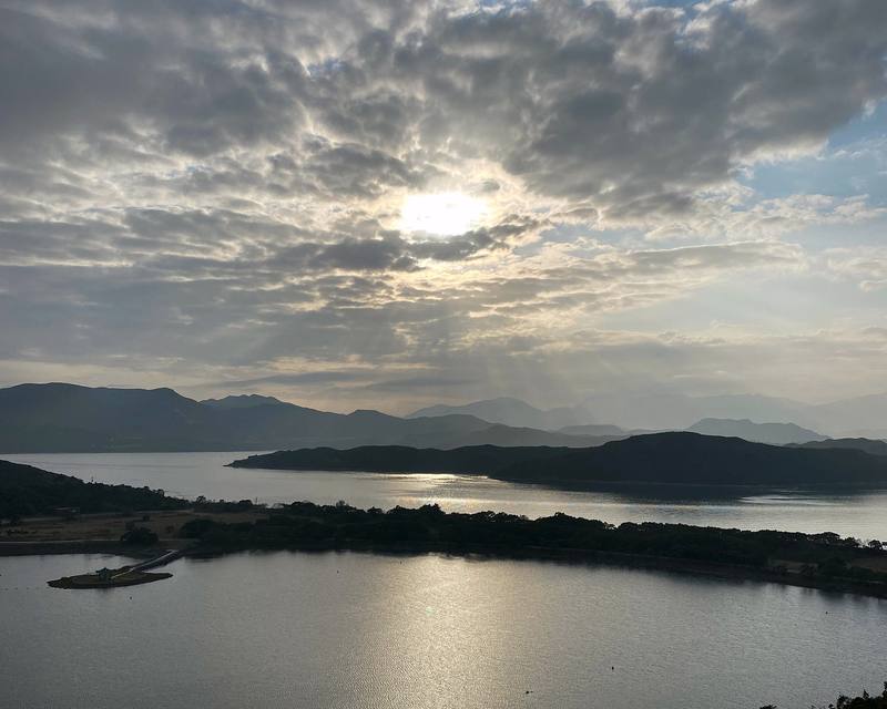
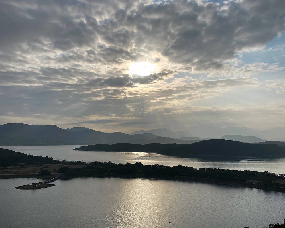
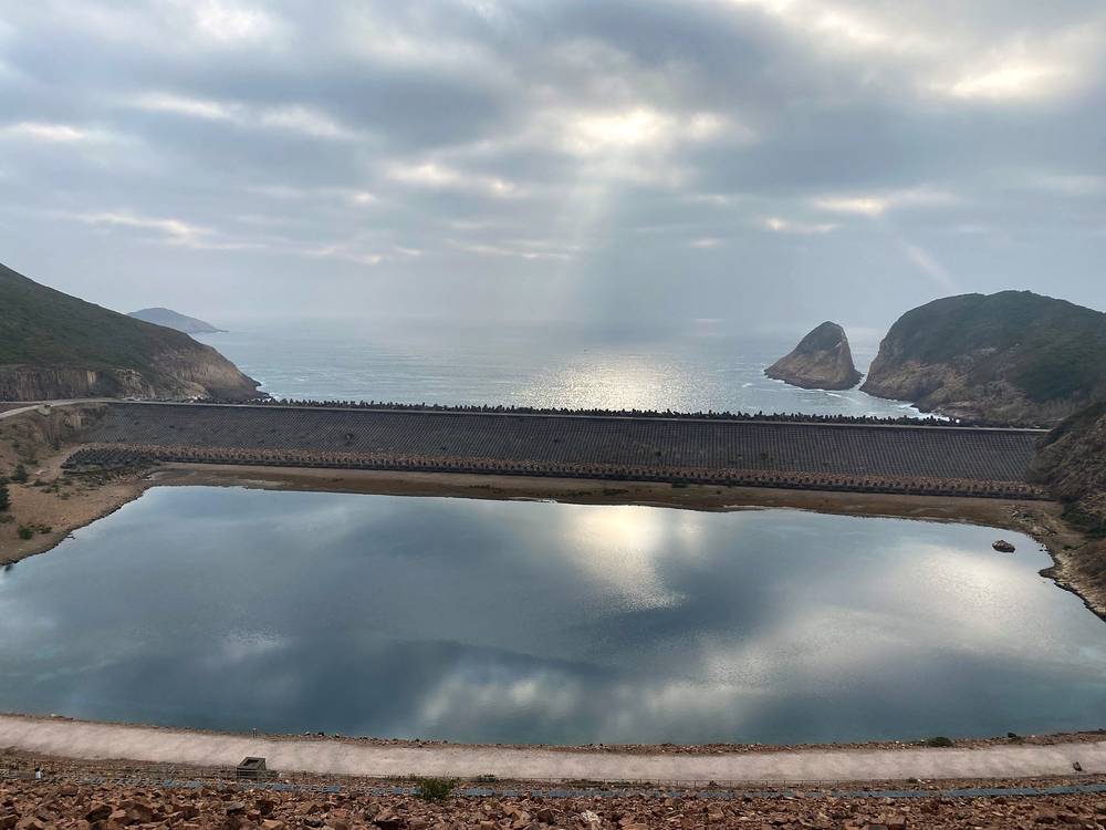
High Island Reservoir from the road on Section 1, late on Day 1. 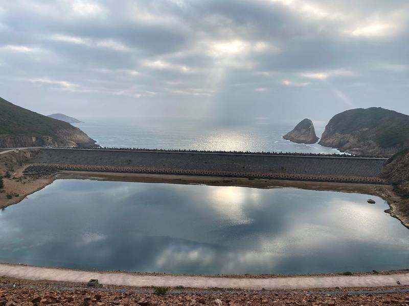
The East Dam of High Island Reservoir, early on Day 2. 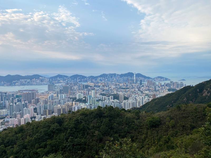
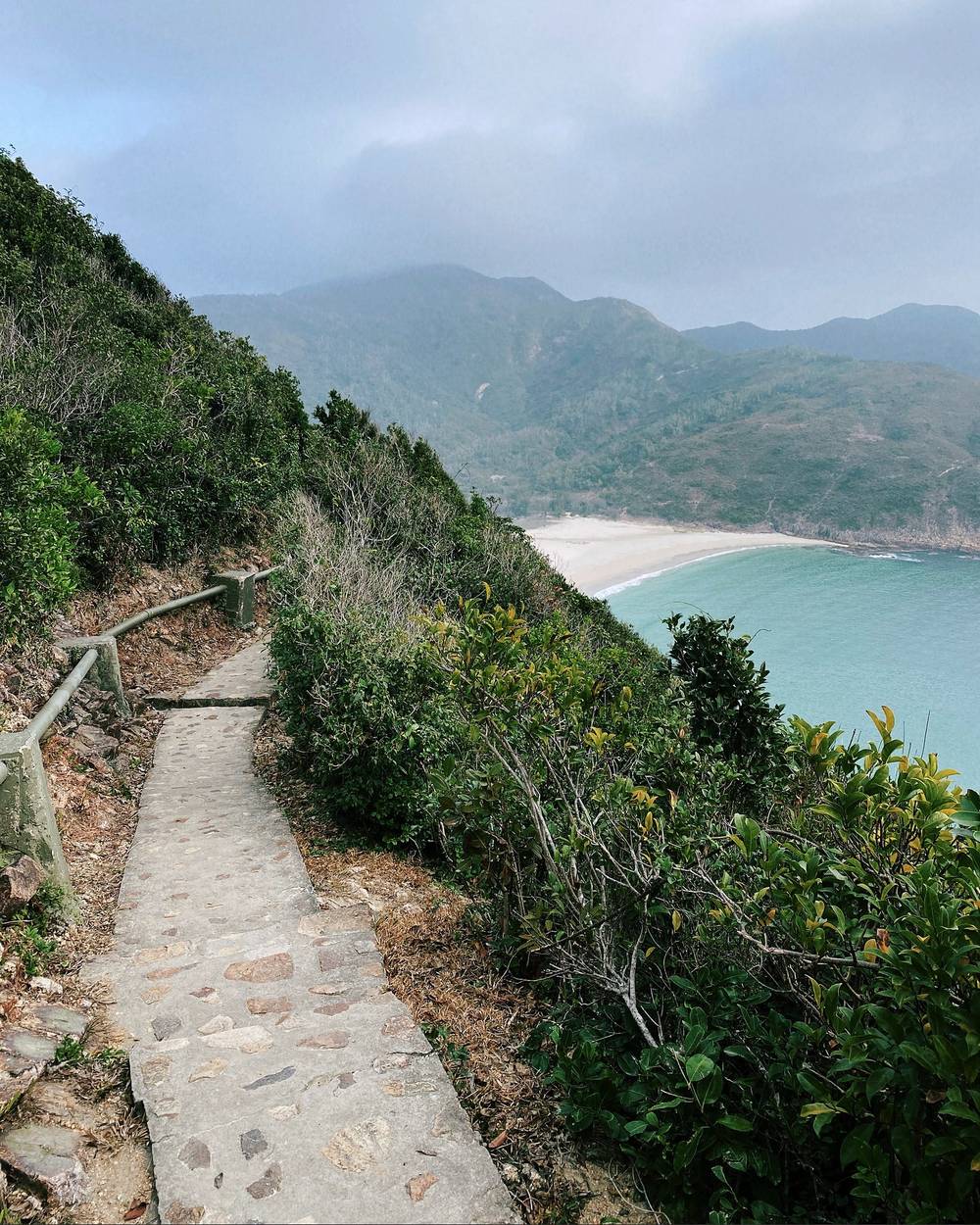
Kowloon from the ridge by Lion Rock, early on Day 4. 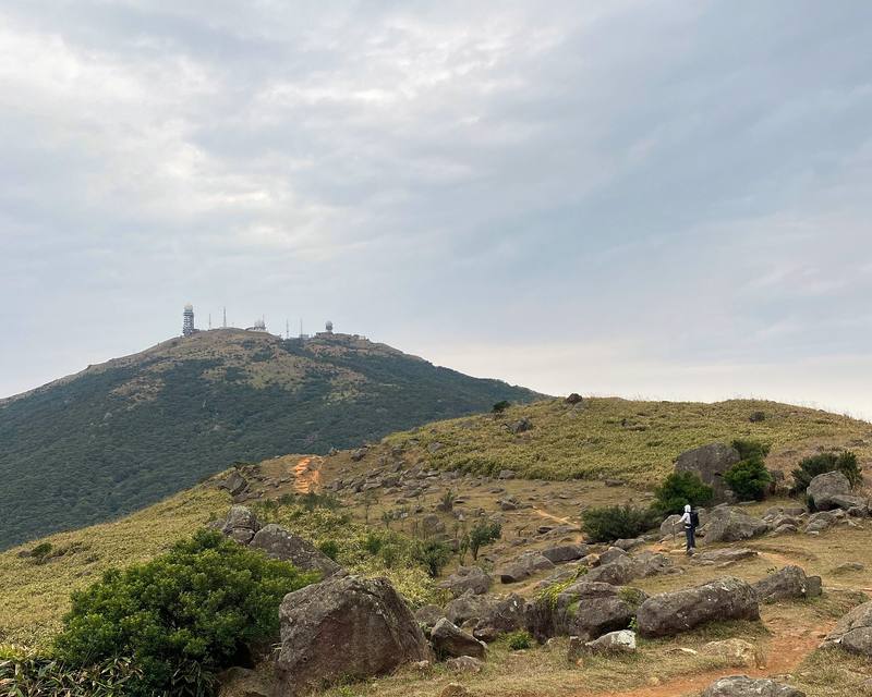
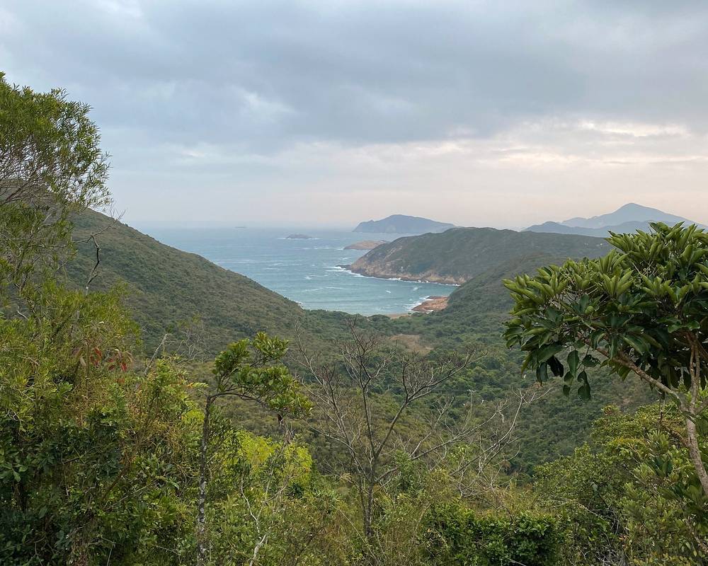
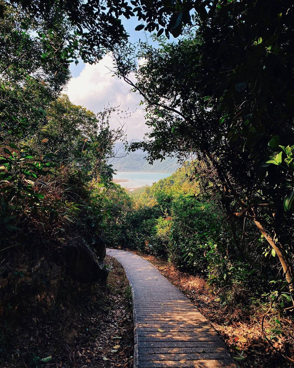
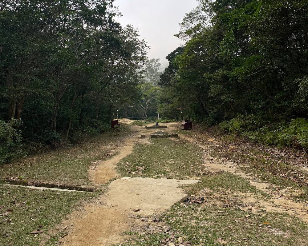
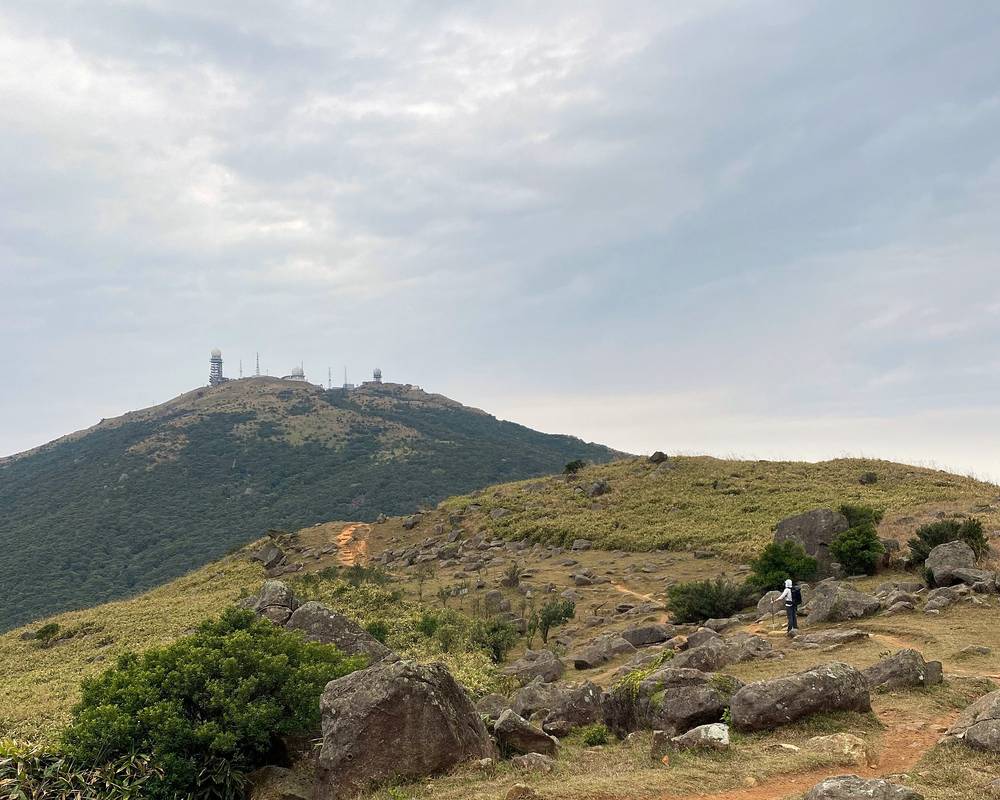
The path toward Tai Mo Shan, the morning of Day 5.
Newsletter
Get my letter
Get a short letter from me every couple of weeks: new trips, guides and what I'm building.
Free. Unsubscribe any time.
Details
The guide · Free · 53-page PDF + GPX files · 2027 season edition
MacLehose Trail Hiking Guide
5 days across Hong Kong, from Sai Kung to Tuen Mun. Every page is below: read it here, or take it offline as a PDF with my GPX files (53-page PDF + GPX files, in one zip). No sign-up needed.
The route
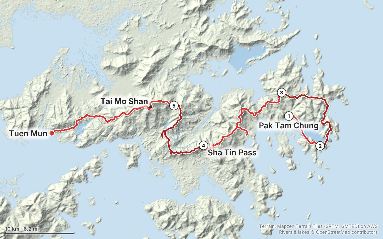
My GPS recording of 5 days on a relief map. The numbers are where each day starts; the red dot is the finish. The day maps are in the guide below, and the GPX files are a free download.
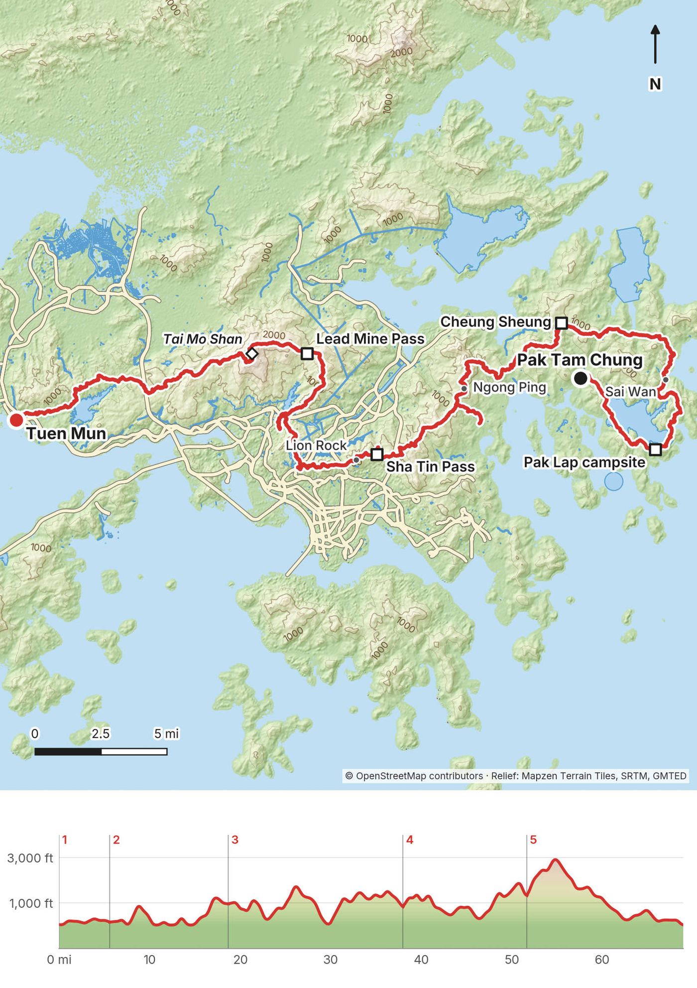
Elevation, start to finish: highest 3,040 ft (927 m), lowest sea level.
At a glance
- Days
- 5 days
- Distance
- 71 miles
- Climbing
- About 15,300 ft (4,660 m) up
- Season
- October to March, the cool, dry season
- Route
- Pak Tam Chung to Tuen Mun
Contents
- Welcome
- At a glance
- Straight answers
- When to go
- Planning the nights
- Getting there
- Day 1 Pak Tam Chung to Pak Lap campsite
- Day 2 Pak Lap to Cheung Sheung
- Day 3 Cheung Sheung over Ma On Shan to Sha Tin Pass
- Day 4 Sha Tin Pass to Lead Mine Pass
- Day 5 Lead Mine Pass to Tuen Mun
- Getting home
- Other ways to do it
- Where I slept, food and water
- What I paid
- Gear for this route
- Weather and safety
- Using the GPX files
- Before you go, check these
- One-page trip sheet
- About this guide
Welcome
In January 2020 my friend Ryan and I hiked the whole MacLehose Trail across Hong Kong, from Pak Tam Chung in Sai Kung to Tuen Mun: about 71 miles on foot on my GPS, camping four nights, with a break in the city for Lunar New Year. It's the trip from my film Hiking 60 miles on the MacLehose Trail in Hong Kong.
The MacLehose Trail is an interesting hike because it connects a number of different sections: park walking paths, village roads, and ridges overlooking the massive city of Kowloon. One day you're on the beaches of Sai Kung; a few days later you're on Lion Rock, looking down on Kowloon.
What's inside
- Straight answers to the questions people ask about this trail
- When to go, where you can camp (and where you can't), and how to sleep in the city instead
- Getting to Pak Tam Chung, and the buses at every section end
- All five days: my notes, the trail, where to get off, a map with an elevation profile, and links to that day in my film
- Other ways to do it, where I slept, food and water, what I paid and gear for this route
- Weather and safety, one page of things to check before you go, and a printable trip sheet
How to use it offline
Save this PDF to your phone's Files or Books app before you leave home. Load the GPX files and download offline maps while you still have Wi-Fi. Each day starts on a new page. The film links need a connection; everything else works in airplane mode.
When I say "I" or "we," it's our own trip. Campsites, buses and rules change, so they're dated, and the checks are collected on one page: Before you go, check these.
At a glance
| Quick facts | |
|---|---|
| Distance | 71.4 miles (114.9 km) on foot over 5 days on my GPS, with my detours. The official trail is 100 km (62 miles) in 10 sections |
| Climbing | about 15,300 ft (4,660 m) up and 16,620 ft (5,070 m) down |
| Days | 5 walking days, January 22 to 28, 2020, with 2 days off in the city in the middle; 4 nights camping |
| Start | Pak Tam Chung, Sai Kung (bus stop and visitor center) |
| Finish | Tuen Mun, in the New Territories |
| High point | Tai Mo Shan, Hong Kong's highest mountain, 957 m (3,140 ft); my GPS read 3,042 ft (927 m) where the trail passes below the summit, Day 5 |
| When | October to March, the cool, dry season. I walked in late January |
| Difficulty | Clear, signed paths, roads and lots of stairs, with a numbered post every 500 m. Hot and humid outside winter |
| Base | Kowloon or Hong Kong Island; buses reach every section end |
| Trip | My friend Ryan and I, carrying our own camping gear. No permits or bookings needed for the trail |
| Day | Route | Miles (km) | Up / down (ft) | Sleep |
|---|---|---|---|---|
| 1 | Pak Tam Chung to the Pak Lap campsite | 5.8 (9.4) | 716 / 611 | Pak Lap campsite |
| 2 | Pak Lap to Cheung Sheung | 14.2 (22.8) | 3,165 / 2,368 | Cheung Sheung campsite |
| 3 | Cheung Sheung over Ma On Shan to Sha Tin Pass (two parts) | 19.3 (31.0) | 4,193 / 5,583 | Kowloon for two nights, then near Sha Tin Pass |
| 4 | Sha Tin Pass to Lead Mine Pass | 14.2 (22.9) | 4,195 / 3,755 | Lead Mine Pass campsite |
| 5 | Lead Mine Pass over Tai Mo Shan to Tuen Mun | 17.9 (28.8) | 3,032 / 4,307 | Kowloon |
The numbers come from my own GPS recordings, smoothed the same way for every day. The film calls it 60 miles, and the official trail is 62; my 71.4 miles include my detours: down off Ma On Shan to the Sai Kung road for the holiday, up to the top of Lion Rock, and down to shops in Kwai Chung for supplies. Apps count climbing differently on all those stairs.
Straight answers
How many days do I need? We walked five days, with a two-day break in the middle for Lunar New Year. Strong hikers do it faster, and many people walk it a section or two at a time, going home to the city at night: buses reach almost every section end. AFCD, the parks department, adds up to about 37 hours of walking for the 10 sections. See Other ways to do it.
What's it like? Not what I expected. I had done some research, and there weren't too many videos. The trail is more a collection of smaller trails, almost like state park trails, connected with roads and pavement and sidewalks and stairs. The first section is a paved road around a reservoir. Then come the beaches of Sai Kung, the long ridges over Ma On Shan, Lion Rock above Kowloon, and Tai Mo Shan.
How hard is it? The paths are clear and signed, but there are a lot of steps and steep climbs. AFCD rates Sections 2 and 4 "Very Difficult" and calls Section 3 one of the top three in difficulty. In heat and humidity it's much harder; we went in January.
Do I need a permit or a guide? No. The trail is free and open, with no permit or booking. Camping is free too, but only at AFCD's designated campsites; one of them, Twisk, now needs a booking. See Planning the nights.
Can I camp anywhere? No. In Hong Kong's country parks you may camp only at designated campsites. There's no campsite on Sections 5, 6 or 10. Our third night, near Sha Tin Pass, wasn't at a campsite; don't copy that one. See Planning the nights.
Is there water and food? Some. Village restaurants and kiosks at Sai Wan, Ham Tin and Cheung Sheung, filling stations at a few points in Sai Kung and Shing Mun, and the city a short detour away. Long stretches have nothing. See Where I slept, food and water.
Will I see other people? Yes, lots on weekends and holidays, especially at the East Dam, the Sai Kung beaches and Lion Rock. Weekdays are much quieter.
Is there phone signal? Often, because the city is close, but not everywhere. Hong Kong's telecom regulator warns of blind spots in the country parks.
When to go
October to March. Hong Kong's Observatory says November and December have "pleasant breezes, plenty of sunshine and comfortable temperatures. Many people regard these as the best months of the year." January and February are cooler and cloudier, with frost at times on high ground. March and April bring fog. May to August are hot and humid, and May to November is typhoon season, most likely July to September. The rainy season is April to September.
What I got. Late January. The first afternoon was cloudy over the reservoir. Day 2 started overcast at the East Dam and turned to hazy sun on the beaches. Day 3 was misty in the woods on Ma On Shan, and the city was in haze from Tate's Cairn. The morning on Lion Rock was clear, with clouds over Kowloon, and the last day was hazy sunshine down to the beach in Tuen Mun.
Avoid these days. The Oxfam Trailwalker runs the whole trail on November 20 to 22, 2026, with a new 20 km event on Sections 9 and 10 on November 21. The East Dam and the Sai Kung beaches are packed on Hong Kong public holidays and the mainland's Golden Weeks (May 1 to 5 and October 1 to 7). In 2026 AFCD asked for a free, real-name booking (through Klook) to enter the Po Pin Chau section by the East Dam from 9 a.m. to 5 p.m. on set peak dates (September weekends and October 1 to 7); check hiking.gov.hk for the 2027 dates. The trail itself needs no booking.
Warnings. The Observatory issues rainstorm warnings (amber, red, black), typhoon signals, a Very Hot Weather Warning and Fire Danger Warnings. Under a Black Rainstorm warning, AFCD tells everyone to leave the country parks or take shelter. Hill fires are most likely in the dry autumn and winter; fires are allowed only in the pits at barbecue sites and campsites.
Planning the nights
Where you can camp. Only at AFCD's designated campsites (Country Parks Regulations: no tent "except ... in a designated camping site"). They're free and first come, first served, except Twisk, which needs a booking on camping.gov.hk. A stay can't be longer than seven nights in a row, and you can't leave things to hold a spot. These are the ones on or by the trail (AFCD, 2026):
| Campsite | Section | Water | Toilets |
|---|---|---|---|
| Yuen Ng Fan (Nam Fung Wan) | 1, above the road by the West Dam | Stream, seasonal | Dry pits |
| Pak Lap | 1, by the road near the East Dam | Stream, seasonal | Portable |
| Long Ke Wan | end of 1, above the beach | Stream, seasonal | Dry pits (a new toilet being built since July 2025) |
| Sai Wan | 2, on the beach | Tap | Flushing |
| Ham Tin Wan | 2, on the beach | Tap | Flushing, 200 m away |
| Pak Tam Au | end of 2 | Stream, seasonal | Dry pits |
| Cheung Sheung | 3, on the plateau | Stream, seasonal | Outhouse |
| Shui Long Wo | start of 4 | Stream, seasonal | Dry pits, mobile toilet |
| Ngong Ping (Ma On Shan) | 4 | Stream, seasonal | Dry pits |
| Lead Mine Pass | end of 7 | Tap | Flushing |
| Rotary Park | by Route Twisk, end of 8 | Tap | Flushing |
| Twisk | start of 9 (booking needed) | Tap | Mobile toilets |
| Ho Pui | near 9 | Stream, seasonal | Mobile toilets |
| Tin Fu Tsai | end of 9 | Stream, seasonal | Mobile toilets |
There's none on Sections 5, 6 or 10. On AFCD's list, "Tai Long Wan Campsite" is on Lantau, not the Tai Long Wan bay in Sai Kung; there, use Sai Wan or Ham Tin Wan. At Sai Wan, AFCD warns about high tide on the beach, and the southern beach by the restaurants is closed to camping.
Our nights. Pak Lap, Cheung Sheung, near Sha Tin Pass, and Lead Mine Pass. The Sha Tin Pass night wasn't at a campsite. If you want to camp the whole way, the gap is between Ngong Ping (partway along Section 4) and Lead Mine Pass (end of Section 7), about 27 km (17 miles) by the official sections; the alternatives are a long day or a night in the city.
Sleeping in the city. Most section ends have a bus. Many people walk Sections 4 to 7 as day hikes from a hotel and camp only in Sai Kung and on Tai Mo Shan. We spent two nights in a hotel in Tsim Sha Tsui, Kowloon, in the middle. See each day's "If you need to get off" for the buses.
Getting there
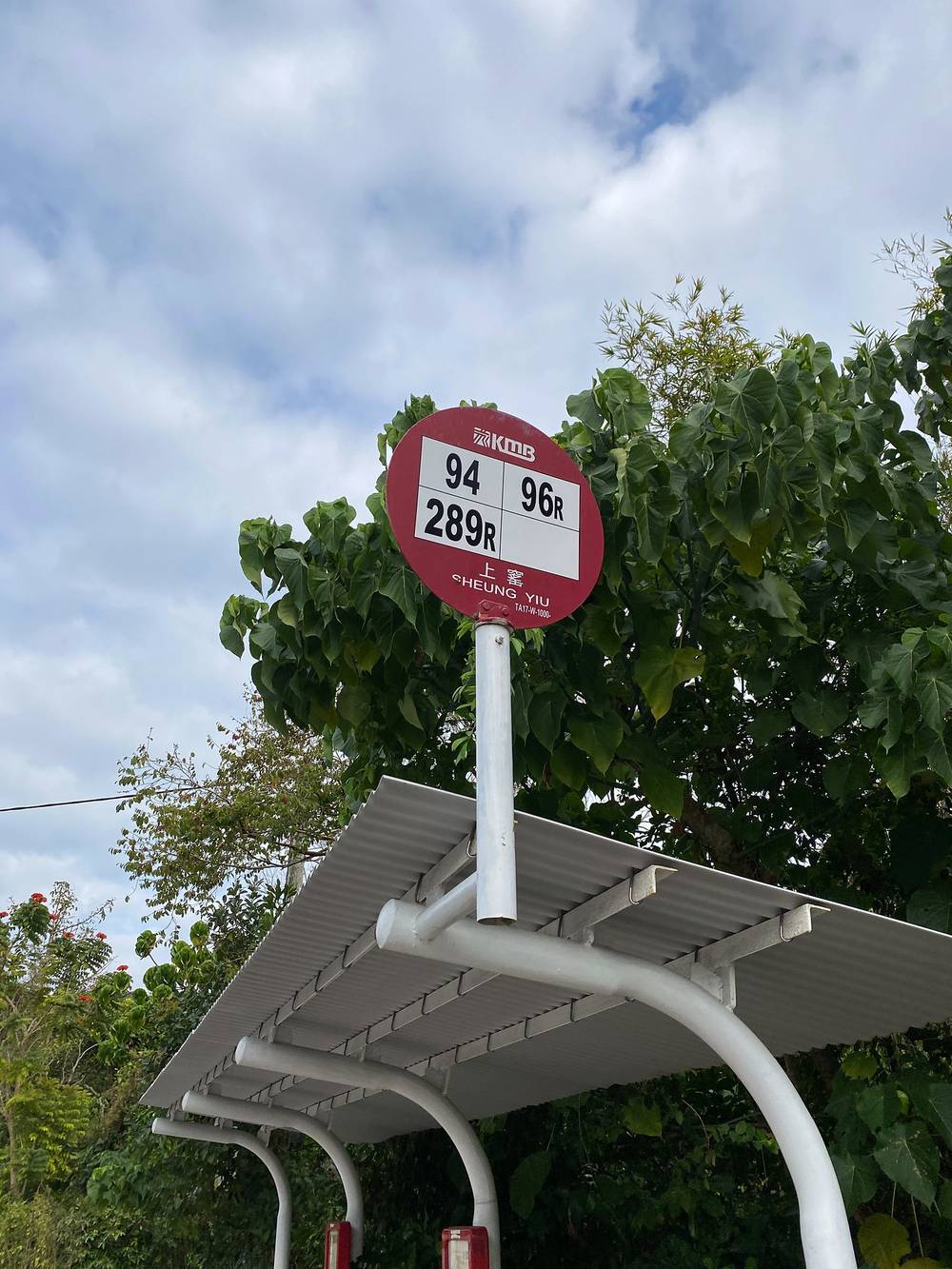
What I did. I flew into Hong Kong from Kilimanjaro on January 21, 2020, and met up with Ryan. I took the Airport Express into the city (HK$115). The next afternoon we started from the bus stop at Pak Tam Chung, where the 94, 96R and 289R buses stop, at 3:40 p.m.
The route today (2026).
- Into the city. The Airport Express runs from the airport to Kowloon and Hong Kong stations.
- To Sai Kung town. By bus or minibus from the MTR, or a taxi. Plan the ride on HKeMobility.
- Sai Kung to Pak Tam Chung. KMB bus 94 runs every day from Sai Kung, from 5:45 a.m. on weekdays (6 a.m. Saturdays, 7 a.m. Sundays and public holidays) to 9:50 p.m. On Saturdays, Sundays and public holidays, 96R also runs from Diamond Hill MTR, and 289R from Sha Tin. Green minibuses 7 (to Hoi Ha) and 9 (to Lady MacLehose Holiday Village) stop there too. Get off at Pak Tam Chung.
Private cars can't go past the barrier at Pak Tam Chung. AFCD says to check transport on the Transport Department's HKeMobility app before you set off.
At Pak Tam Chung. The Sai Kung Country Park Visitor Centre is open 9:30 a.m. to 4:30 p.m., closed on Tuesdays (except public holidays) and the first two days of Lunar New Year (its exhibition was closed for maintenance in 2026). There's a kiosk and a water filling station. Distance post M001 is the start.
Entering Hong Kong. US passport holders can stay 90 days without a visa (Immigration Department, 2026). Get an Octopus card for the buses and minibuses: a Tourist Octopus is HK$39 with no deposit, or put one on your phone with the Octopus App for Tourists. Carry some coins for minibuses too.
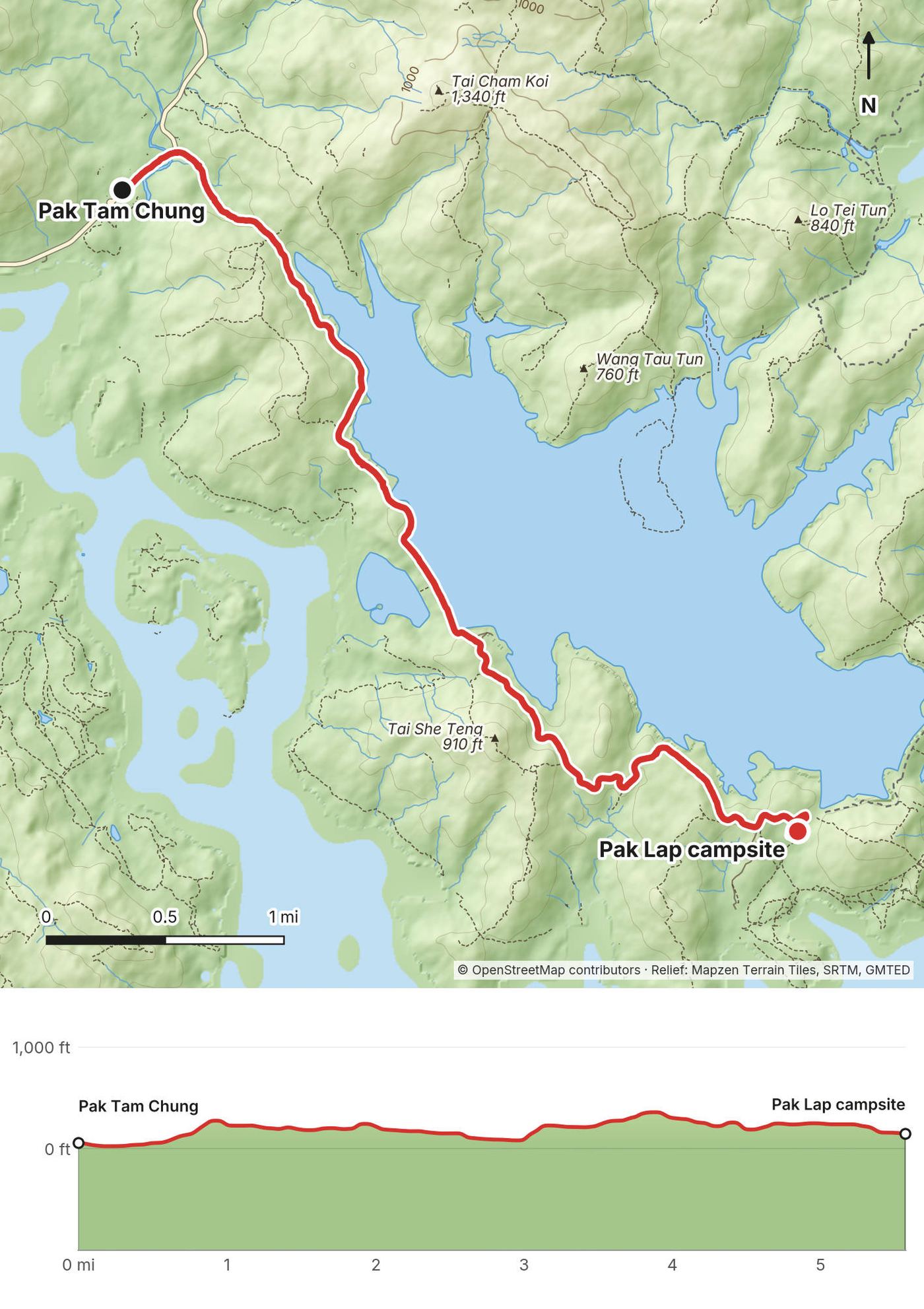
Day 1: Pak Tam Chung to Pak Lap campsite
- Distance
- 5.8 mi (9.4 km)
- Climbing
- 716 ft (218 m)
- Descent
- 611 ft (186 m)
- Time I took
- 3 hours (3:41 to 6:39 p.m.), an afternoon start
- High point
- 392 ft (120 m), on the road around the reservoir
- On the way
- Pak Tam Chung, Yuen Ng Fan viewpoint (mile 2.0), High Island viewpoint (mile 3.9)
- Section
- most of Section 1 (Pak Tam Chung to Long Ke, 10.6 km)
- Sleep
- The Pak Lap campsite, by the road near the East Dam, 150 ft (46 m)
- Food and water
- The kiosk and filling station at Pak Tam Chung. Nothing after it
My day
We started late, at 3:40 in the afternoon, from the bus stop at Pak Tam Chung. Section 1 is a paved road: it follows the reservoir road from the visitor center along the edge of the water, past the Yuen Ng Fan viewpoint at mile 2 and the High Island viewpoint at mile 3.9.
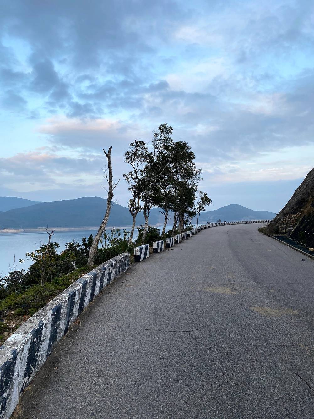
It was cloudy, with the sun breaking through over the water. At about 6 p.m. we reached the Pak Lap campsite, beside the road near the East Dam, and that was our first night.
The trail
The whole day is on Man Yee Road and Tai Mong Tsai Road, the narrow paved road around High Island Reservoir, closed to private cars past Pak Tam Chung. It's easy walking, up and down a little along the shore of the reservoir, with taxis and minibuses on it on weekends. The Pak Lap campsite sits beside the road above Pak Lap village, about half a mile short of the East Dam.
Section 1 continues over the East Dam and up and over the hill to Long Ke, which I walked first thing on Day 2. The East Dam is the busiest place on the trail on holidays. The rock columns of Po Pin Chau are by the dam; in 2026 that viewing path needs a free booking on peak days, and part of the seating at the East Dam end has been closed since August 2026.
If you need to get off
Walk back along the road to Pak Tam Chung for buses 94 and 96R. On Saturdays, Sundays and public holidays, green minibus 9A runs between the East Dam and Pak Tam Chung (about 9:30 a.m. to 7 p.m.).
Watch this day
Getting to the trailhead · Overview from above · Film, Day 1
Day 2: Pak Lap to Cheung Sheung
- Distance
- 14.2 mi (22.8 km)
- Climbing
- 3,165 ft (965 m)
- Descent
- 2,368 ft (722 m)
- Time I took
- 8.6 hours (8:07 a.m. to 4:45 p.m.), with an hour at Sai Wan
- High point
- 1,323 ft (403 m), the climb from Pak Tam Au
- On the way
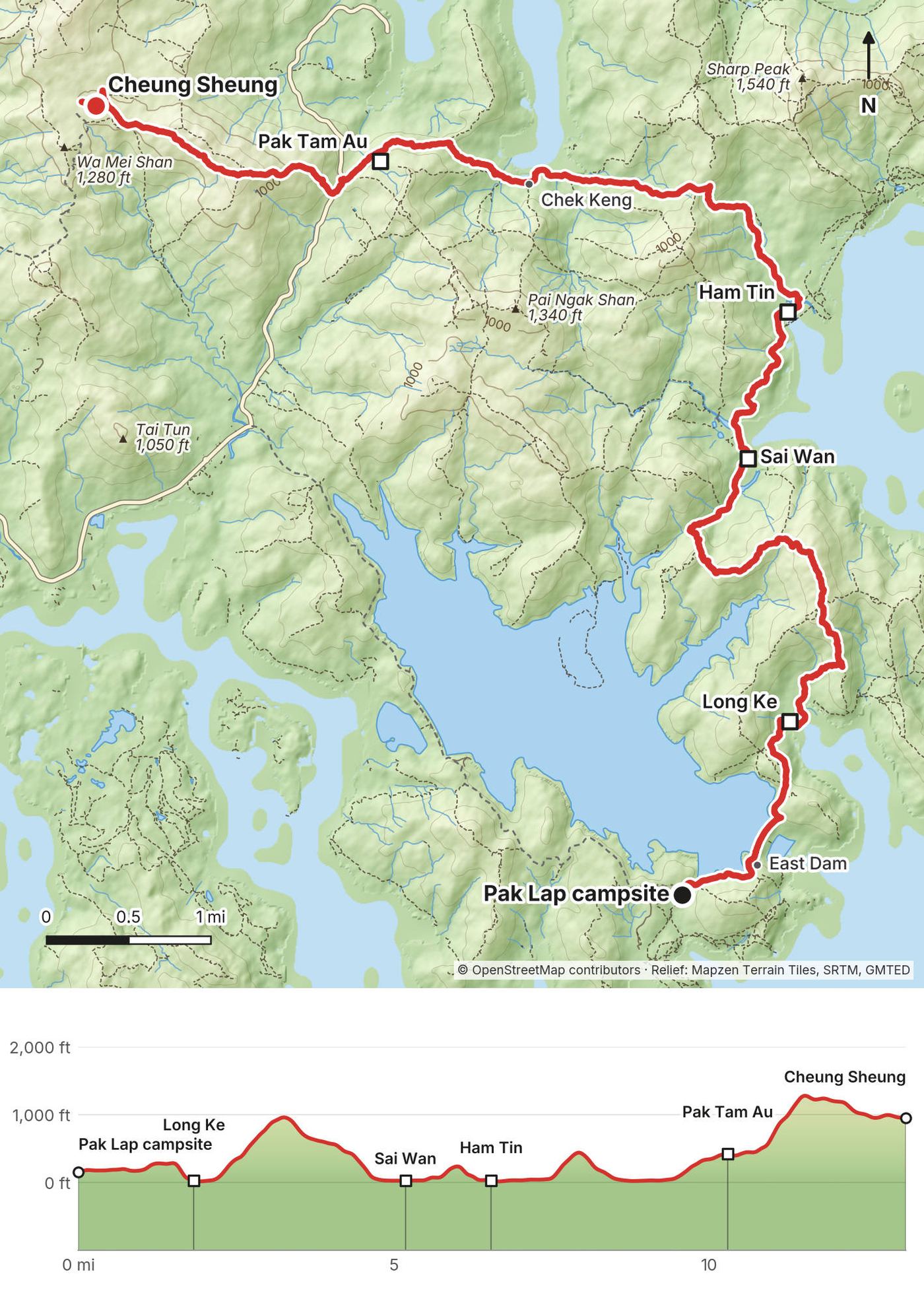
- East Dam, Long Ke (mile 2), Sai Wan (5), Ham Tin (6.4), Chek Keng (9), Pak Tam Au (10.8)
- Section
- end of 1, all of 2 (13.5 km), start of 3
- Sleep
- Cheung Sheung campsite, 955 ft (291 m)
- Food and water
- Sai Wan and Ham Tin; tap at Pak Tam Au
My day
We left the campsite at 8:07 a.m. and crossed the East Dam at 8:20, with the reservoir on one side and the open sea on the other. Then the path climbed over the hill and dropped down toward the beach at Long Ke.
From Long Ke we went over the next hills to Sai Wan, the first village with restaurants, and got there just before 11. We stopped for an hour.
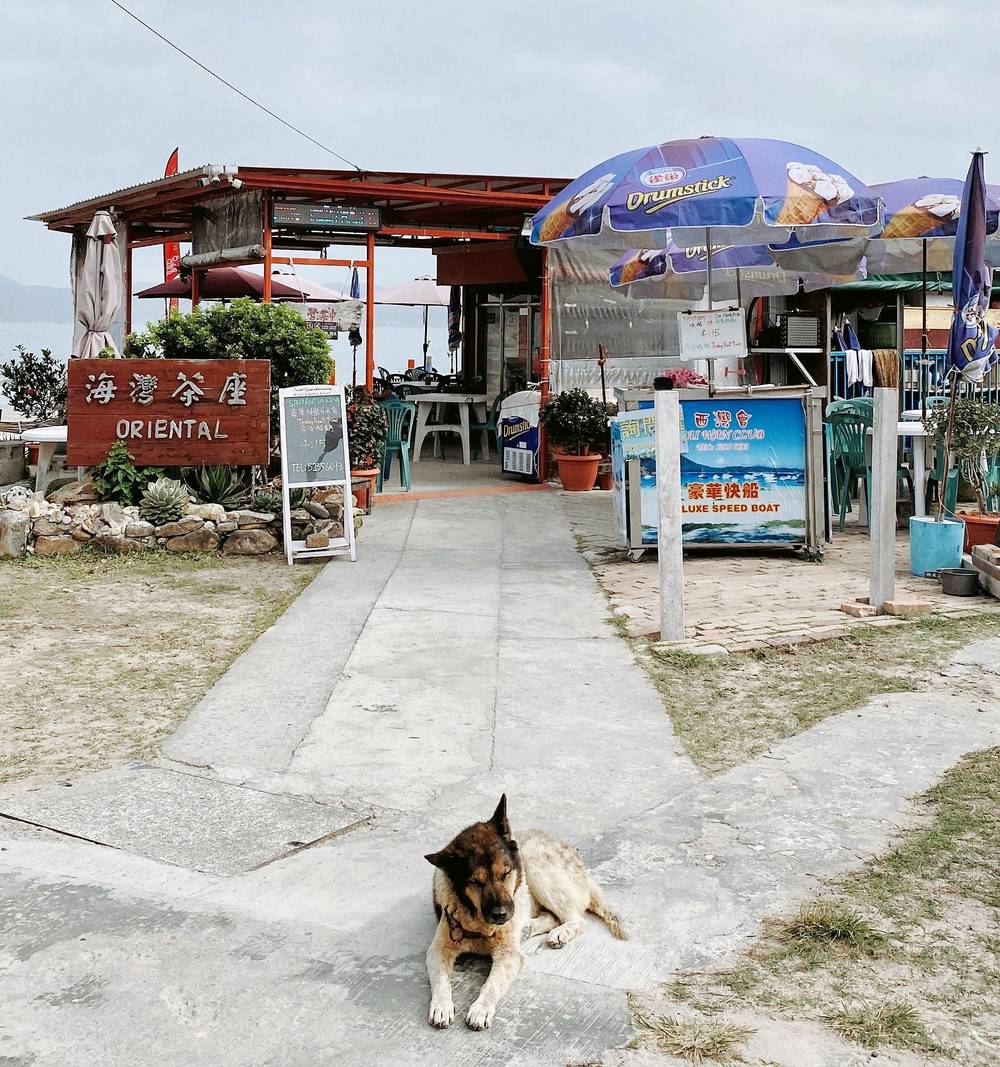
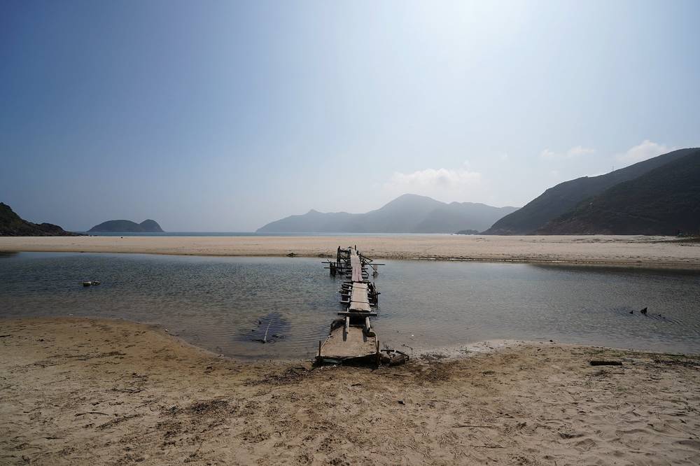
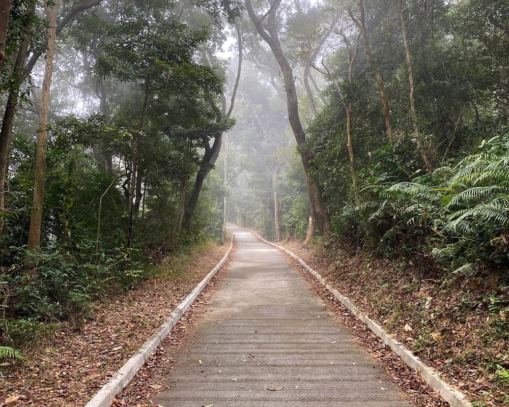
After lunch: the beach at Ham Tin, where in 2020 a wooden footbridge crossed the creek on the sand, and Tai Long. Then the trail turns inland and becomes a paved path through the woods, around the inlet at Chek Keng, to the road at Pak Tam Au at about 3:30.
From Pak Tam Au it's a long climb up stone steps to the Cheung Sheung plateau. We reached the campsite at 4:45, our second night.
The trail
From Pak Lap the road reaches the East Dam, then Section 1 climbs over a hill on a paved path and comes down to Long Ke Wan. Since July 2025 a new toilet is being built at the Long Ke Wan campsite, with a diversion near distance post M021: follow the signs on site.
Section 2 is AFCD's "Very Difficult" section, 13.5 km: from Long Ke over the shoulder of Sai Wan Shan (314 m) to Sai Wan, along the beaches of Ham Tin and Tai Long Wan, past Tai Long village, then inland past Chek Keng to Pak Tam Au. Much of it is paved path and steps. Sai Wan and Ham Tin have restaurants and stores, and AFCD campsites with taps and flushing toilets.
Section 3 starts at Pak Tam Au with a steep climb on steps to the Cheung Sheung plateau. AFCD says this section "is definitely one of the top three in terms of difficulty."
Sharp Peak, the pointed hill above Ham Tin, is a popular side trip, but AFCD lists it among Hong Kong's high-risk spots. We didn't climb it.
If you need to get off
At Sai Wan, a path leads to Sai Wan Pavilion on the road, where the NR29 minibus runs to Sai Kung town (a few times a day; check the 2026 times). At Pak Tam Au, the end of Section 2, buses 94 and 96R and minibus 7 stop on the road.
Watch this day
Day 3: Cheung Sheung over Ma On Shan to Sha Tin Pass
- Distance
- 19.3 mi (31.0 km), in two parts
- Climbing
- 4,193 ft (1,277 m)
- Descent
- 5,583 ft (1,702 m)
- Time I took
- 8 hours on Jan 24 3.6 on Jan 26
- High point
- 1,787 ft (545 m), the pass on Ma On Shan
- On the way
- Kei Ling Ha (mile 4), Ngong Ping (8.7), Gilwell, Tate's Cairn
- Section
- end of 3, all of 4 (12.7 km), start of 5
- Sleep
- Kowloon (2 nights), then near Sha Tin Pass
- Food and water
- Tap at Kei Ling Ha; none on Section 4
My day
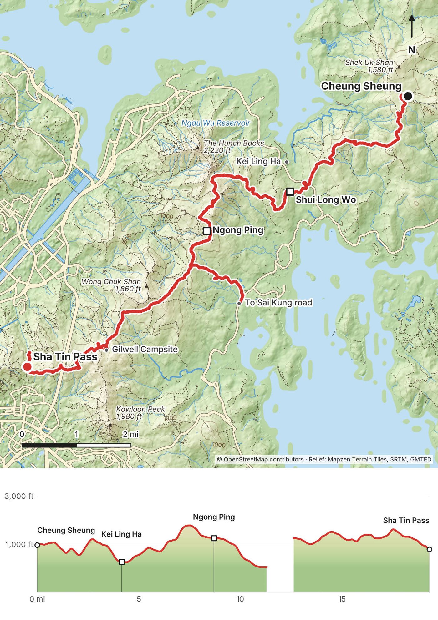
This day is in two parts. On January 24, the eve of Lunar New Year, we left Cheung Sheung at 7:54 and came down through the woods to Sai Sha Road at Kei Ling Ha, the end of Section 3, at about 10:40. We stopped there for an hour.
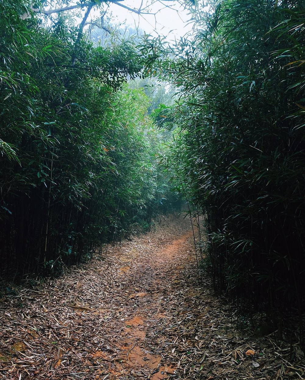
Section 4 climbs from Shui Long Wo through woods and bamboo, and it was misty. We got up to the Ngong Ping plateau, below Ma On Shan, at 2:30. From there we walked on along the trail for a while, then left it on a path down to the main road at Tai Chung Hau, near Sai Kung town, at 3:53, and went into the city for two nights.
On January 26 we had dim sum in Sai Kung, went back up to Ngong Ping (I didn't record that walk), and started again at 2:20 p.m. We passed the Gilwell scout campsite at about 4 and Tate's Cairn at 4:45, with the city in haze below, and came down to Sha Tin Pass at 5:40.
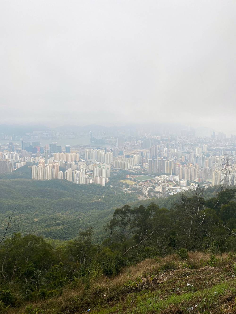
We slept near Sha Tin Pass that night. It isn't one of AFCD's campsites, and camping outside them isn't allowed in the country parks, so plan this night differently (see Planning the nights).
The trail
The rest of Section 3 comes down from Cheung Sheung through the woods to Sai Sha Road at Kei Ling Ha, with a filling station at the barbecue site there. Since November 2025 a side path near distance post M062 has been closed after a landslide; stay on the signed MacLehose.
Section 4, AFCD's other "Very Difficult" section, 12.7 km, climbs from Shui Long Wo to a pass on the shoulder of Ma On Shan (AFCD: 555 m), then crosses the Ngong Ping plateau, passes below Buffalo Hill, goes by the Gilwell Campsite and along the rocky "Great Wall" before Tate's Cairn. AFCD lists the Tiu Shau Ngam area on Ma On Shan and the cliff at Fei Ngo Shan (Kowloon Peak) as high-risk spots; stay on the trail. Section 4 ends at Tate's Cairn, on Fei Ngo Shan Road, and Section 5 starts down the road to Sha Tin Pass.
The Ngong Ping campsite is the last one before Lead Mine Pass.
If you need to get off
At Kei Ling Ha (Shui Long Wo bus stop), buses 99 and 299X run to Sai Kung and Sha Tin. From the Ngong Ping plateau I walked down to Tai Chung Hau on Hiram's Highway, by Sai Kung: 2.8 miles and an hour and 20 minutes from the campsite, the last 1.6 miles off the trail on a path down. From Tate's Cairn there's no transport: walk Fei Ngo Shan Road and Clear Water Bay Road about 45 minutes to the Anderson Road stop (buses 91, 91M, 92 and 96R, minibus 73). From Sha Tin Pass, the road goes down to Tsz Wan Shan.
Watch this day
Day 3, to Ngong Ping · Day 3, Ngong Ping to Sha Tin Pass
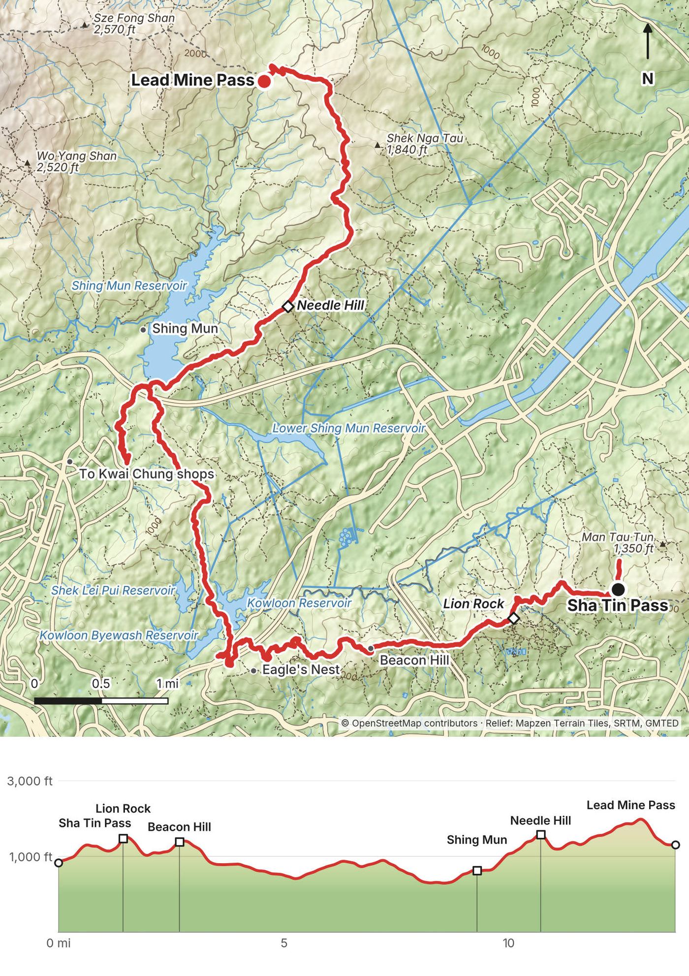
Day 4: Sha Tin Pass to Lead Mine Pass
- Distance
- 14.2 mi (22.9 km), with detours
- Climbing
- 4,195 ft (1,279 m)
- Descent
- 3,755 ft (1,144 m)
- Time I took
- 8.8 hours (7:59 a.m. to 4:44 p.m.)
- High point
- 2,044 ft (623 m), Grassy Hill
- On the way
- Lion Rock (mile 1.4), Beacon Hill (2.4), Kam Shan, Shing Mun (7.5), Needle Hill
- Section
- most of 5, all of 6 and 7
- Sleep
- Lead Mine Pass campsite, 1,310 ft (399 m)
- Food and water
- Taps at Shing Mun and Kowloon Hill; shops in Kwai Chung
My day
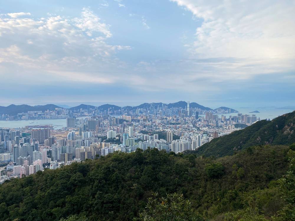
We left Sha Tin Pass at 8 a.m. and climbed to Lion Rock. We went up to the top and spent 25 minutes there, with all of Kowloon below us.
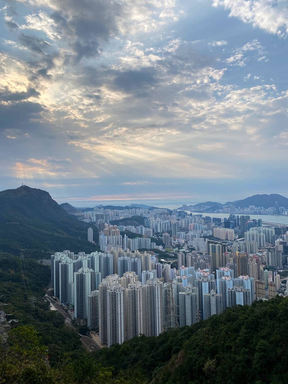
Then along the ridge to Beacon Hill at 9:45, and on through the woods past Eagle's Nest and Kam Shan, where the monkeys live.
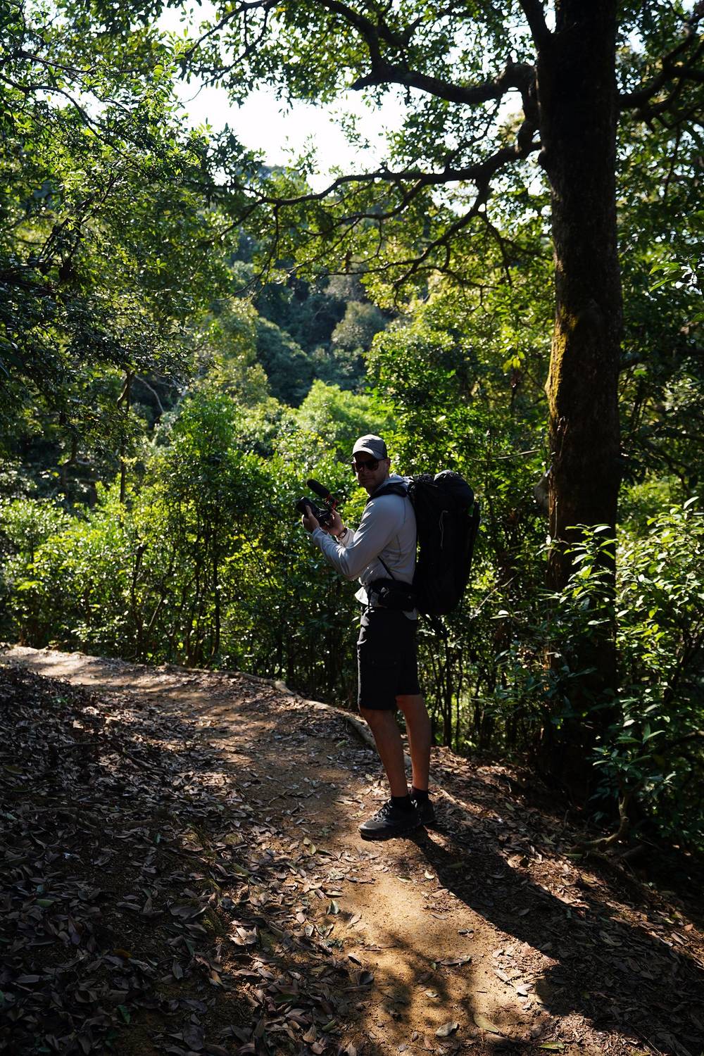
At the Shing Mun barbecue area, at about 1 p.m., we left the trail and walked down to the shops on the edge of Kwai Chung for supplies, half an hour, and walked back up. Then Shing Mun Reservoir, Needle Hill and Grassy Hill, to the campsite at Lead Mine Pass at 4:30, our fourth night.
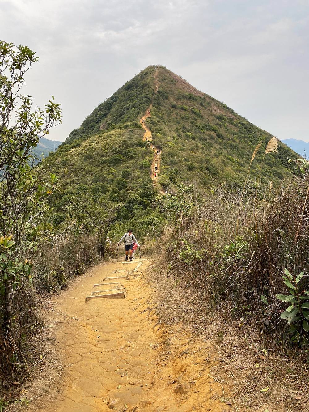
The trail
Section 5 runs from Tate's Cairn past Sha Tin Pass, across Lion Rock and Beacon Hill, down to Tai Po Road (10.6 km). The trail goes below the summit of Lion Rock; the top is a short side path. AFCD lists Lion Rock Peak among its high-risk spots: stay away from the edges.
Section 6 is the shortest and easiest (AFCD), 4.6 km from Tai Po Road through Kam Shan to Shing Mun. AFCD says you'll see macaques "roaming in groups on the way." Don't feed them or eat in front of them: feeding any wild animal anywhere in Hong Kong is illegal, with a HK$5,000 fixed fine. In 2024 a man was badly hurt by a B virus infection after being wounded by monkeys at Kam Shan; get medical help after any bite or scratch.
Section 7 goes around Shing Mun Reservoir and climbs Needle Hill (532 m), "over a thousand steps within 1.7 kilometres" (AFCD), then Grassy Hill (647 m), and comes down to Lead Mine Pass. In 2026 some forest tracks in Shing Mun Country Park are closed to vehicles for slope repairs; walkers can pass with care.
If you need to get off
At Tai Po Road (Shek Lei Pui Reservoir bus stop), buses 72 and 81. At Shing Mun (Pineapple Dam), green minibus 82 runs to Tsuen Wan, or walk 20 minutes to the Ho Fung College bus stop. From Lead Mine Pass there's no road: walk the Wilson Trail about 1.5 hours down to Yuen Tun Ha for minibuses 23K and 23S to Tai Po.
Watch this day
Day 5: Lead Mine Pass to Tuen Mun
- Distance
- 17.9 mi (28.8 km)
- Climbing
- 3,032 ft (924 m)
- Descent
- 4,307 ft (1,313 m)
- Time I took
- 7 hours (8:23 a.m. to 3:23 p.m.)
- High point
- 3,042 ft (927 m) on my GPS, below the summit of Tai Mo Shan
- On the way
- Tai Mo Shan (mile 3), Route Twisk (mile 5.4), Tin Fu Tsai (mile 9.2), Tai Lam Chung Reservoir
- Section
- Sections 8 (9.7 km), 9 (6.3 km) and 10 (Tin Fu Tsai to Tuen Mun, 15.6 km)
- Sleep
- Kowloon, by bus
- Food and water
- Taps at the Rotary Park and Twisk campsites by Route Twisk. Nothing on Section 10
My day
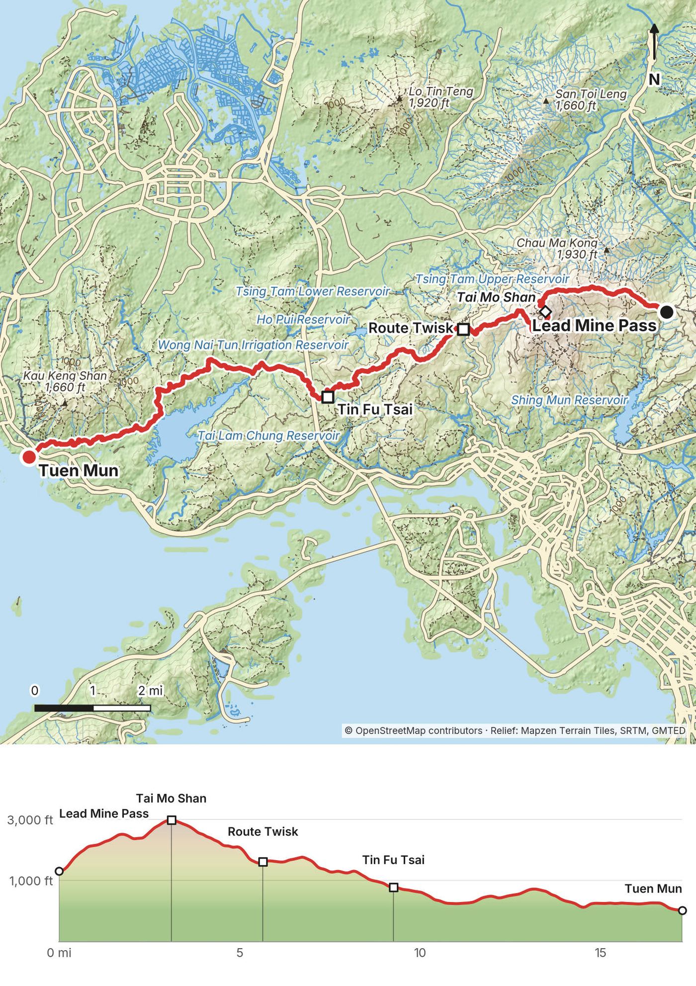
We left Lead Mine Pass at 8:23 and climbed Tai Mo Shan, Hong Kong's highest mountain. The trail goes around below the summit, which has domes and masts on top; we were at the high point of the day at about 10.
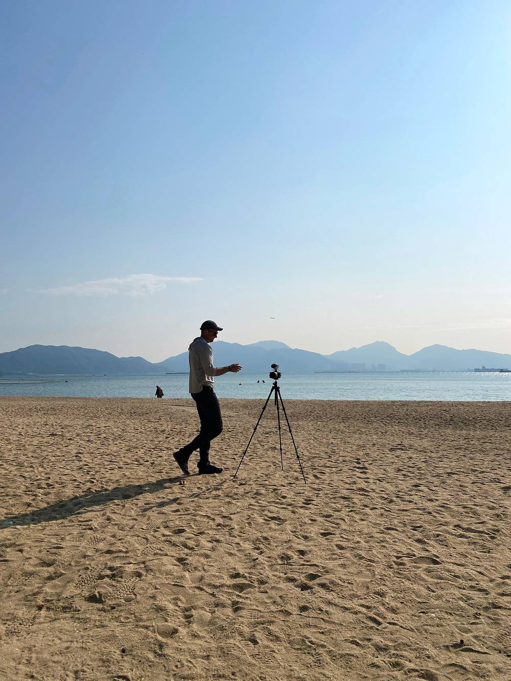
From the viewpoints we came down to Route Twisk at about 11, then through Tai Lam Country Park, past Tin Fu Tsai at 12:24 and Tai Lam Chung Reservoir. The last section is long and gentle. We reached the end of the trail in Tuen Mun at 3 p.m. and kept walking to the beach nearby.
The trail
Section 8 starts with "600 upward steps" from Lead Mine Pass (AFCD), then climbs the side of Tai Mo Shan, 957 m, on paths and the summit road, and comes down to Route Twisk (9.7 km). The trail doesn't go to the summit itself. Tai Mo Shan is often in cloud and can be cold and windy in winter; AFCD warns of frost and hypothermia from November to February. The Tai Mo Shan Visitor Centre at Route Twisk has been closed for renovation since July 1, 2026.
Section 9 is easy, 6.3 km through Tai Lam Country Park to Tin Fu Tsai. At its start, the Twisk campsite has toilet works going on (since October 2025).
Section 10 is the longest, 15.6 km: past Tai Lam Chung Reservoir and on to the end at Hoh Fuk Tong, Tuen Mun. The Oxfam Trailwalker finishes at Harrow International School in Tuen Mun.
If you need to get off
At Route Twisk (the Tai Mo Shan Country Park stop), bus 51 to Tsuen Wan: every 15 to 30 minutes on weekend days, only hourly on weekdays. From Tin Fu Tsai there's no road: walk about 1.5 hours down to Sham Tseng for buses on Castle Peak Road.
Watch this day
Getting home
What I did. We finished in Tuen Mun at 3 in the afternoon and walked on to the beach nearby. That night I was back in Kowloon, and the next evening I went up to The Peak. The day after, I flew to Kathmandu.
The way back today. From the end of Section 10 at Hoh Fuk Tong, walk to the Hoh Fuk Tong College bus stop (buses 53, 67M, 67X and 261), Pui To light rail station, or Tuen Mun MTR station. The MTR Tuen Ma line runs into Kowloon. For the airport, buses run from Tuen Mun too; check HKeMobility.
Other ways to do it
I walked the five days in this guide. These are other ways to use it, and I didn't do them.
All ten sections, camping
The official sections end where AFCD put them: Long Ke, Pak Tam Au, Kei Ling Ha, Tate's Cairn, Tai Po Road, Shing Mun, Lead Mine Pass, Route Twisk, Tin Fu Tsai and Tuen Mun. If you want to camp every night, the campsites fit like this: Long Ke Wan or Sai Wan, then Pak Tam Au or Cheung Sheung, then Ngong Ping (Ma On Shan), then a long day of Sections 4 to 7 to Lead Mine Pass, then Twisk (booked) or Tin Fu Tsai. Or break the long day with a night in the city.
A section at a time from the city
Most section ends have a bus (see each day). Sections 4 to 7 work well as day hikes from a hotel in Kowloon, and Sections 9 and 10 make an easy last day. Weekdays are quieter, but some buses (96R, 289R, minibus 9A, and many of bus 51's runs) are for weekends and holidays only.
The Lantau Trail
After this trip I said I wanted to come back to Hong Kong for the other trail, the Lantau Trail, on the island with the airport, which might be a little more nature focused. I went back in January 2025 and hiked on Lantau: Hiking in Hong Kong.
Where I slept, food and water
Where I slept
| Night | Where | My GPS |
|---|---|---|
| January 21 | Kowloon | |
| January 22 | Pak Lap campsite (AFCD), Section 1 | 150 ft (46 m) |
| January 23 | Cheung Sheung campsite (AFCD), Section 3 | 955 ft (291 m) |
| January 24 and 25 | A hotel in Tsim Sha Tsui, Kowloon (Lunar New Year) | |
| January 26 | Near Sha Tin Pass (not a campsite; don't copy this one) | 778 ft (237 m) |
| January 27 | Lead Mine Pass campsite (AFCD), end of Section 7 | 1,310 ft (399 m) |
| January 28 | Kowloon |
Ryan and I carried our own camping gear. The campsites are free and first come, first served (Twisk needs a booking). See Planning the nights for all of them.
Water
AFCD says not to drink untreated stream water, and most of the campsites' water is a seasonal stream. AFCD's filling stations on the trail are at Pak Tam Chung (Section 1), Pak Tam Au (Section 2), the Sai Sha Road barbecue site at Kei Ling Ha (Section 3), and the Shing Mun barbecue site and Cheung Yuen Road at Kowloon Hill (Section 6). There are none on Sections 4, 5 or 7 to 10. Campsites with taps: Sai Wan, Ham Tin Wan, Lead Mine Pass, Rotary Park and Twisk; filter or boil it anyway. Carry plenty: on Sections 4, 5 and 8 you'll climb a lot with nothing on the way.
Food
Village restaurants and stores at Sai Wan and Ham Tin, a store at Cheung Sheung (AFCD says it opens on holidays), a store at Sha Tin Pass, a kiosk at Pak Tam Chung, and shops a detour away in Kwai Chung (Day 4) and Sai Kung town (Day 3). We ate lunch at Sai Wan on Day 2 and dim sum in Sai Kung on Lunar New Year's weekend. Bring what you need for the nights: there's nothing at Pak Lap, Ngong Ping or Lead Mine Pass.
What I paid
My records for this trip are my photos and receipts.
| Item | What I paid in 2020 |
|---|---|
| Airport Express into the city (single) | HK$115 |
| Campsites | Free |
| The trail | Free |
| Flights, the hotel in Kowloon, buses, food | Not in my records |
For your budget (2026). The trail and campsites are free (Twisk needs a free booking). A Tourist Octopus card is HK$39 with no deposit; load it for buses, minibuses and the MTR. Budget for meals at the village restaurants and a hotel in the city if you break the walk.
Gear for this route
What this trail needs
- A tent, sleeping bag and stove if you camp (fires only in campsite pits)
- Lots of water capacity, and a filter or tablets
- Sun protection and a light rain jacket; warm layers for Tai Mo Shan in winter
- A headlamp: in January it's dark soon after 6 p.m.
- An Octopus card and some coins for buses
- Offline maps with the GPX files, and a charged phone with the HKSOS app
Paid links: I earn a commission if you buy through these links, at no extra cost to you. As an Amazon Associate I earn from qualifying purchases.
My 2020 kit is from my film's original description and my photos. Here's what I carried, what I'd take now, and what I filmed with.
What I carried in 2020
From my film's gear list. Ryan and I carried our own camping gear; the list doesn't name a tent or a stove.
- Pack: Hyperlite Mountain Gear Southwest 2400 (Hyperlite)
- Sleeping bag: UGQ Bandit quilt. Similar: Hyperlite Mountain Gear 20° Quilt (Hyperlite).
- Liner: Outdoor Vitals Sleeping Bag Liner (Amazon)
- Headlamp: SLONIK rechargeable headlamp (Amazon). In January it's dark soon after 6 p.m.
- Sun hoodie: Amazon Essentials Quick-Dry Tech Hoodie (Amazon)
- Gore-Tex shell: The North Face Dryzzle jacket. Similar: Arc’teryx Beta AR Jacket (Arc’teryx).
- Puffy: Patagonia Nano Puff Jacket. Similar: Arc’teryx Cerium Hoody (Arc’teryx).
- Sweater: Amazon Essentials crewneck fleece sweatshirt (Amazon)
- Pants: zip-off pants. Similar: PATH Projects Killam PX Pant (PATH Projects).
- Shorts: THE II BRO compression shorts (Amazon)
- White hat: ZOWYA running cap (Amazon)
- Sunglasses: Warby Parker Barkley sunglasses. Similar: Goodr OG Sunglasses (Amazon).
- Socks: DG Hill merino wool hiking socks (Amazon). Two pairs.
- Shoes: Brooks Cascadia 13 (Amazon), now the Cascadia 20
- Navigation: the AllTrails app. It recorded each day.
What I'd take now
What I'd add for this trail from my current kit.
- Tent: NEMO Hornet Elite OSMO 1P (Amazon). If you camp: the campsites are free, first come, first served.
- Sleeping pad: Therm-a-Rest NeoAir XLite NXT (Amazon)
- Stove: Jetboil Stash (Amazon). Fires only in the campsite pits.
- Water filter: Katadyn BeFree AC · 1L (Amazon). AFCD says not to drink untreated stream water: filter or boil even the campsite taps.
- Sun hoodie: PATH Projects Pyrenees T19 Hoodie (PATH Projects). Heat is the biggest danger outside winter.
- Power bank: Nitecore NB20000 (Amazon). Keep the phone charged for the HKSOS app.
- Navigation: AllTrails+ (AllTrails, 30% off). Load my GPX files and download offline maps while you still have Wi-Fi. Offline maps need the paid plan.
- Phone data: Airalo eSIM (Airalo, $3 off). Data for the buses and the HKSOS app without a SIM swap.
Filming kit
What I filmed this trip with in 2020. My setup is much smaller now (below).
- Camera: Sony a7 III (Amazon)
- Lens: Sony FE 16-35mm f/2.8 GM (Amazon)
- Batteries: Sony NP-FZ100 batteries (Amazon). Four of them.
- Mic: Rode VideoMic NTG (Amazon)
- Tripod: Manfrotto Element Traveller Small tripod (Amazon)
- Strap: Peak Design camera strap (Amazon)
- Drone: DJI Mavic 2 Pro. With two extra batteries. No longer made. Similar: DJI Mini 5 Pro (Amazon).
- Phone: an iPhone 11 Pro and a phone battery
What I film with now
Since September 2026 I film with a smaller setup: the Pocket 4 and the Mic 3 on the trail, and the Mini 5 Pro in the air.
- Camera: DJI Osmo Pocket 4 (Amazon)
- Mic: DJI Mic 3 · 1 TX + 1 RX (Amazon). It pairs with the Pocket 4.
- Drone: DJI Mini 5 Pro (Amazon)
- Tripod: SmallRig Carbon Fiber Tripod (Amazon)
Weather and safety
Emergency numbers (2026). Call 999 or 112. Tell them the number on the nearest distance post: the MacLehose has posts M001 to M200, about every 500 m, and AFCD publishes a grid reference for each. The Hong Kong Police "HKSOS" app sends your location to the 999 center. A 112 call works on any mobile network that has signal there.
Heat. The biggest danger outside winter. AFCD says to avoid hiking on very hot, humid, windless days; watch for the Very Hot Weather Warning, carry more water than you think, and start early.
Storms, cold and fog. Leave or take shelter under a Black Rainstorm warning or a typhoon signal. Winter can be cold and windy on Tai Mo Shan; March and April bring fog. Streams flood fast; don't walk in them. Landslides close paths after heavy rain: AFCD posts closures on hiking.gov.hk.
Wildlife. Macaques at Kam Shan and Shing Mun, wild pigs around barbecue sites: keep food away, don't feed them (illegal, HK$5,000 fixed fine), keep your distance. Venomous snakes include kraits, cobras and bamboo snakes, more active from spring to autumn; if bitten, keep still and get to a hospital. Also mosquitoes, ticks and hornets.
High-risk spots. AFCD's list includes Sharp Peak (above Ham Tin), the Tiu Shau Ngam area on Ma On Shan, the cliff at Fei Ngo Shan, Lion Rock Peak, and Tai Shing Stream in Shing Mun. Stay on the trail and off the edges.
Hill fires. Fires only in the pits at barbecue sites and campsites. Watch the fire danger signs at park entrances, especially in autumn and winter.
Going with someone. AFCD recommends hiking in a group. I walked with Ryan. If you go alone, leave a plan with someone, and know the bus at the next section end.
Using the GPX files
My own GPS recordings from January 22 to 28, 2020, with all timestamps removed.
| File | What it is |
|---|---|
| maclehose-day-1.gpx | Day 1: Pak Tam Chung to the Pak Lap campsite |
| maclehose-day-2.gpx | Day 2: Pak Lap to Cheung Sheung |
| maclehose-day-3.gpx | Day 3: Cheung Sheung to Ngong Ping and down to the Sai Kung road, then Ngong Ping to Sha Tin Pass (two tracks) |
| maclehose-day-4.gpx | Day 4: Sha Tin Pass to Lead Mine Pass, with Lion Rock's top and the detour to Kwai Chung |
| maclehose-day-5.gpx | Day 5: Lead Mine Pass over Tai Mo Shan to Tuen Mun |
| maclehose-trail-full-route.gpx | All five days, with waypoints for the campsites and places in this guide |
My recordings keep a point every 10 m or so. They include my detours off the trail; on the maps, the dashed line is the official trail where I left it. AFCD's Enjoy Hiking site (hiking.gov.hk) also has an official GPX file for each section.
AllTrails: on alltrails.com, create a new map and use Import (offline maps need a paid plan). Gaia GPS: open the file on your phone and choose Gaia GPS, or Import on gaiagps.com. Garmin: Garmin Connect on the web, Training, Courses, Import, then send it to your watch. Organic Maps (free): download the offline map for Hong Kong, then open the GPX file with it.
Before you start, download offline maps for the whole route, turn on airplane mode, and check that each day and your location show up.
Before you go, check these
These change every year. Everything else in this guide stays the same.
The trail
- Closures and diversions on AFCD's notice board at hiking.gov.hk (in 2026: a diversion at Long Ke Wan near M021, works at Twisk, a closed side path near M062)
- The Oxfam Trailwalker dates (November 20 to 22 in 2026) and Hong Kong public holidays
- Whether you need a Po Pin Chau booking if you visit it from the East Dam on a peak day
Campsites
- Which campsites you'll use each night; none on Sections 5, 6 or 10
- A booking on camping.gov.hk if you'll stay at Twisk
- Water at the campsites: seasonal streams can dry up
Getting there and back
- Bus and minibus times on HKeMobility or the KMB app, especially the weekend-only ones (96R, 289R, 9A) and bus 51 at Route Twisk
- An Octopus card, and a passport valid for your stay (US: 90 days visa-free)
Conditions and your stuff
- The Observatory's forecast and warnings: rainstorm, typhoon, Very Hot Weather, Fire Danger
- Enough water for Sections 4, 5 and 8
- Offline maps and GPX files on your phone, and the HKSOS app
One-page trip sheet
| Day | mi (km) | From, to | Sleep | Notes |
|---|---|---|---|---|
| 1 | 5.8 (9.4) | Pak Tam Chung to Pak Lap | Pak Lap campsite | Bus 94 to Pak Tam Chung. Road around High Island Reservoir |
| 2 | 14.2 (22.8) | Pak Lap to Cheung Sheung | Cheung Sheung campsite | East Dam, Long Ke, Sai Wan, Ham Tin, Pak Tam Au. Food at Sai Wan and Ham Tin |
| 3 | 19.3 (31.0) | Cheung Sheung over Ma On Shan to Sha Tin Pass | My break: Kowloon | Kei Ling Ha, Ngong Ping campsite, Tate's Cairn. No water on Section 4 |
| 4 | 14.2 (22.9) | Sha Tin Pass to Lead Mine Pass | Lead Mine Pass campsite | Lion Rock, Beacon Hill, monkeys at Kam Shan, Shing Mun, Needle Hill |
| 5 | 17.9 (28.8) | Lead Mine Pass to Tuen Mun | City | Tai Mo Shan, Route Twisk, Tai Lam. Bus or MTR from Tuen Mun |
| Total | 71.4 (114.9) | About 15,300 ft up. Official trail 100 km |
Campsites (AFCD, free): Yuen Ng Fan · Pak Lap · Long Ke Wan · Sai Wan · Ham Tin Wan · Pak Tam Au · Cheung Sheung · Shui Long Wo · Ngong Ping · Lead Mine Pass · Rotary Park · Twisk (booking) · Ho Pui · Tin Fu Tsai. None on Sections 5, 6, 10.
Water stations (AFCD): Pak Tam Chung · Pak Tam Au · Sai Sha Road (Kei Ling Ha) · Shing Mun · Kowloon Hill.
Emergency: 999 or 112 · give the nearest distance post (M001 to M200) · HKSOS app
About this guide
MacLehose Trail Hiking Guide: 5 days across Hong Kong, from Sai Kung to Tuen Mun, by Kraig Adams. 2027 season edition, updated September 2026.
I hiked the MacLehose Trail with my friend Ryan from January 22 to 28, 2020, and made a film about it: Hiking 60 miles on the MacLehose Trail in Hong Kong. The film has no narration, so everything in first person comes from that trip as my GPS recordings, my photos, the film's original description, my own route map and what I said about the trip afterward record it. Campsite, transport and safety facts were checked in September 2026 on AFCD's, the Observatory's and the transport operators' own pages, and anything that changes yearly is dated.
Updates and contact. If something has changed, or you spot a mistake, email me at kraig@kraigadams.com.
Paid links, no sponsors. The gear links in Gear for this route are paid links: I earn a commission if you buy through them, at no extra cost to you. Nobody paid for a mention in this guide.
Safety. The MacLehose Trail has real risks: heat, storms and typhoons, steep stairs, cliffs, cold on the high ground in winter, and wildlife. This guide describes my trip and what I found, not current conditions. Trails, rules, campsites and timetables change. Check AFCD's notices, the Observatory and the buses, and turn back when conditions aren't right. You're responsible for your own safety.
Copyright. © 2026 Kraig Adams. This guide, its photos and the GPX files are for your personal use. Please don't share or resell them.
Credits. Photos are mine, from my trip; the cover is my film's YouTube thumbnail. GPX files are my own recordings. Maps © OpenStreetMap contributors, openstreetmap.org/copyright (ODbL). Relief: Mapzen Terrain Tiles, from SRTM and GMTED. Section lengths, campsites and trail notices from Hong Kong's Agriculture, Fisheries and Conservation Department (AFCD); weather from the Hong Kong Observatory.
The details
- Format
- A 53-page PDF sized for a phone (A5, prints fine too) and a folder of GPX files, in one zip download.
- Edition
- 2027 season edition, updated September 2026.
- Questions
- Email kraig@kraigadams.com.
Questions
- How many days does the MacLehose Trail take?
- I walked it in 5 days in January 2020, with two days off in the city in the middle, camping four nights. The official trail is 100 km in 10 sections, and the parks department adds up to about 37 hours of walking. Many people walk it a section or two at a time from the city, because buses reach almost every section end.
- Can you camp on the MacLehose Trail?
- Yes, but only at the parks department's (AFCD) designated campsites, which are free. On or by the trail they include Pak Lap, Long Ke Wan, Sai Wan, Ham Tin Wan, Pak Tam Au, Cheung Sheung, Shui Long Wo, Ngong Ping, Lead Mine Pass, Rotary Park, Twisk, Ho Pui and Tin Fu Tsai. Twisk needs a booking. There is no campsite on Sections 5, 6 or 10.
- Where does the MacLehose Trail start and finish?
- It starts at Pak Tam Chung in Sai Kung, reached by bus 94 from Sai Kung town (and 96R and 289R on weekends and holidays), and finishes at Tuen Mun, near buses, the light rail and Tuen Mun MTR station.
- Is there water on the MacLehose Trail?
- Only in places. AFCD's filling stations are at Pak Tam Chung, Pak Tam Au, Sai Sha Road at Kei Ling Ha, Shing Mun and Kowloon Hill, and there are village restaurants at Sai Wan and Ham Tin. There are none on Sections 4, 5 or 7 to 10, so carry plenty and treat stream water.
- When is the best time to hike the MacLehose Trail?
- October to March, the cool and dry season. The Hong Kong Observatory calls November and December the best months of the year; May to September is hot, humid and rainy, with typhoons most likely from July to September. I went in late January.
- How long is the MacLehose Trail?
- 100 km (62 miles) by the official sections. My GPS read 71.4 miles because of my detours: down to the Sai Kung road for Lunar New Year, up to the top of Lion Rock, and down to shops in Kwai Chung.
Timeline · newest first
Published · September 30, 2026
Wrote the guide
The day-by-day guide to the route, made from my film, my GPS recording and my notes.
Published · February 2, 2020 · YouTube · 345,095 views
Published the film: Hiking 60 miles on the MacLehose Trail in Hong Kong
On the trail · January 2020
Day 5: Lead Mine Pass to Tuen Mun
The day in the guide: Day 5: Lead Mine Pass to Tuen Mun.
On the trail · January 2020
Day 4: Sha Tin Pass to Lead Mine Pass
The day in the guide: Day 4: Sha Tin Pass to Lead Mine Pass.
On the trail · January 2020
Day 3: Cheung Sheung over Ma On Shan to Sha Tin Pass
The day in the guide: Day 3: Cheung Sheung over Ma On Shan to Sha Tin Pass.
On the trail · January 2020
Day 2: Pak Lap to Cheung Sheung
The day in the guide: Day 2: Pak Lap to Cheung Sheung.
On the trail · January 2020
Day 1: Pak Tam Chung to Pak Lap campsite
The day in the guide: Day 1: Pak Tam Chung to Pak Lap campsite.
On the trail · January 2020
The trip: MacLehose Trail
Hong Kong · 5 days · about 71 miles on my GPS