
Trip · Annapurna region, Nepal · February 2020
Mardi Himal
- Hiking
- Video
- Guide
- Photos
I went alone, in February 2020. 4 days, about 32 miles. My film of it is below, and my free guide to the route, day by day, is in Details.
Highlights
Milestone · February 8, 2020
Hiking Alone in Nepal

My film of the trip, published February 2020.
Also from this trip:
Milestone · September 29, 2026
The free guide
4 days on the ridge below Machapuchare in Nepal. In February 2020 I hiked the Mardi Himal Trek in Nepal alone: four days and about 32 miles from Kande up through the forest to Low Camp and High Camp, onto a snowy ridge below Machapuchare, Fishtail Mountain, and down to Sidhing. A white dog named Ghost walked with me most of the way. This guide has my GPS files, maps and notes for every day, the permits and the guide rule in 2026, getting from Kathmandu to Pokhara and the trailhead, the jeep home, and what the teahouses cost me. Every page is free to read in Details below, with the PDF and GPX download.
Story
Photos
Photos from the trip.
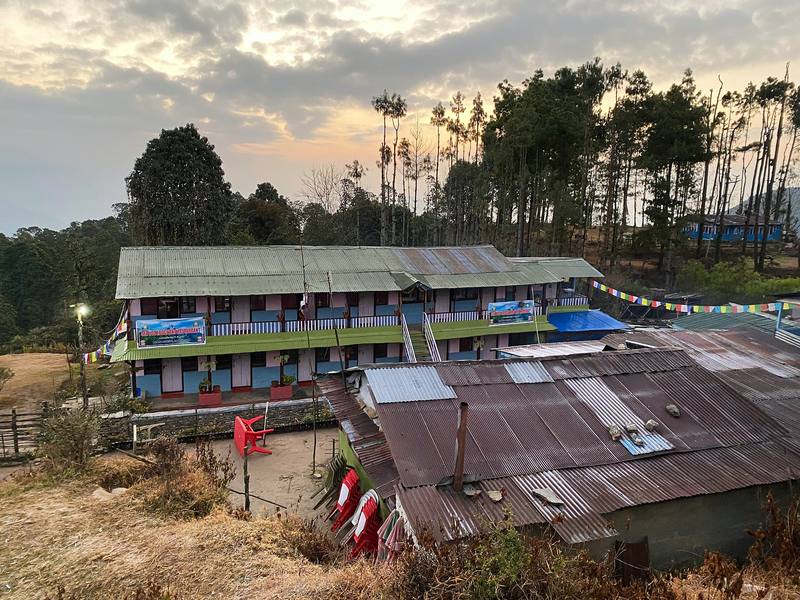
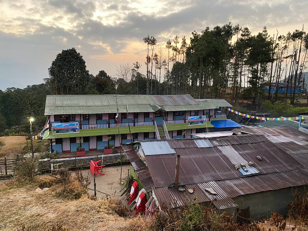
Lodges at Pothana at dawn, where Day 1 ends. 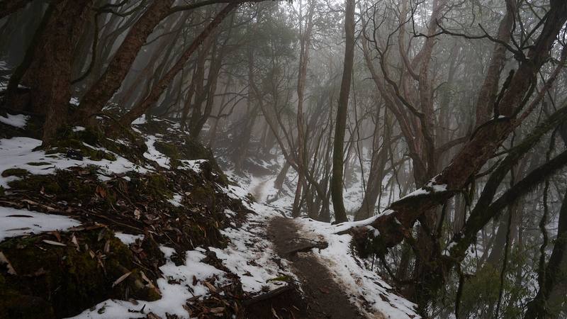
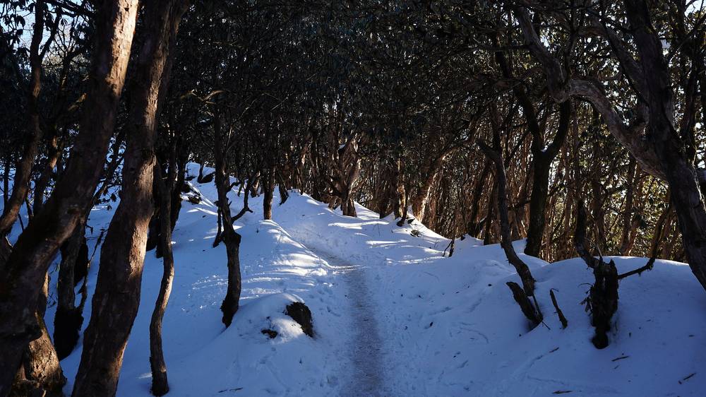
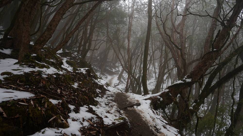
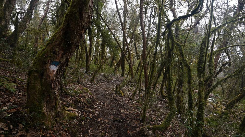
Snow in the forest below Low Camp on the afternoon of Day 2. 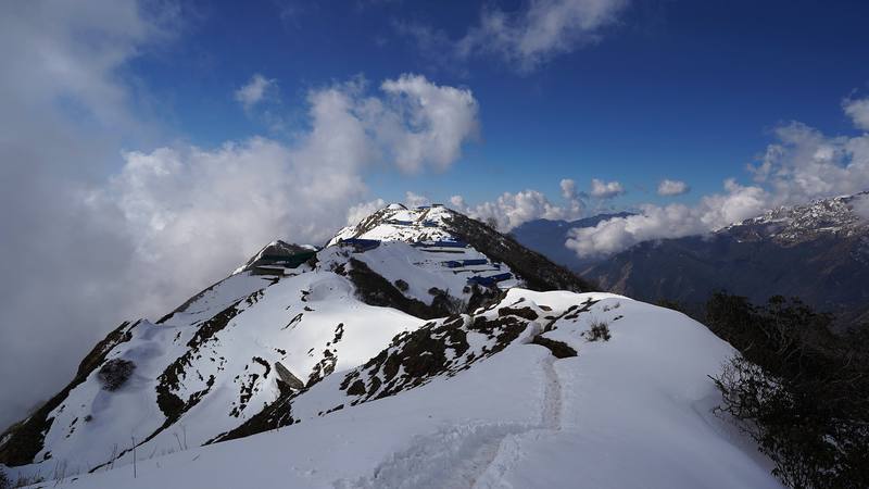
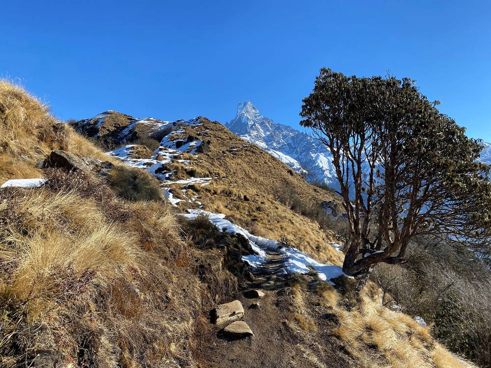
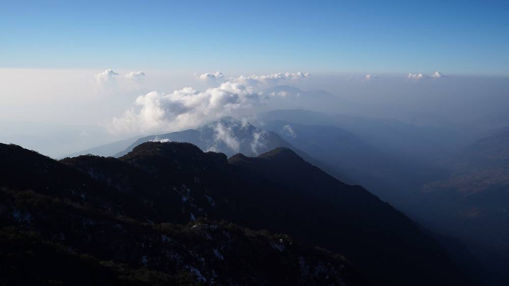
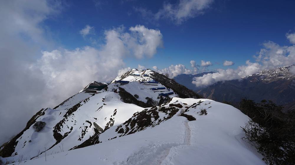
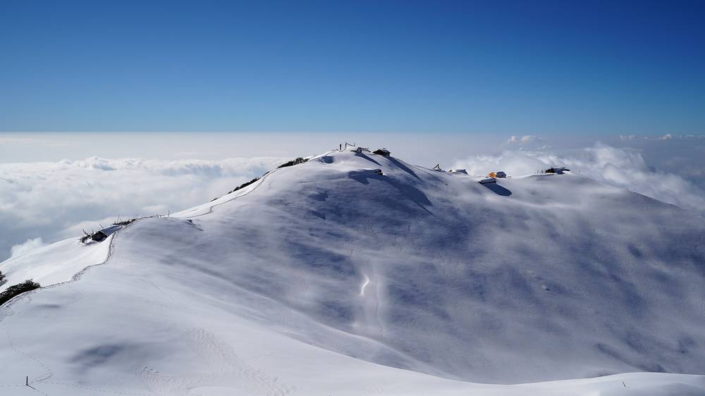
The snowy ridge at High Camp on the morning of Day 3. 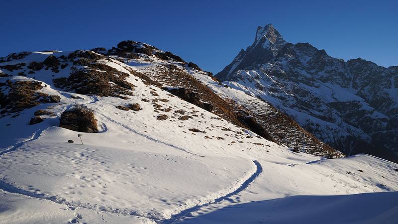
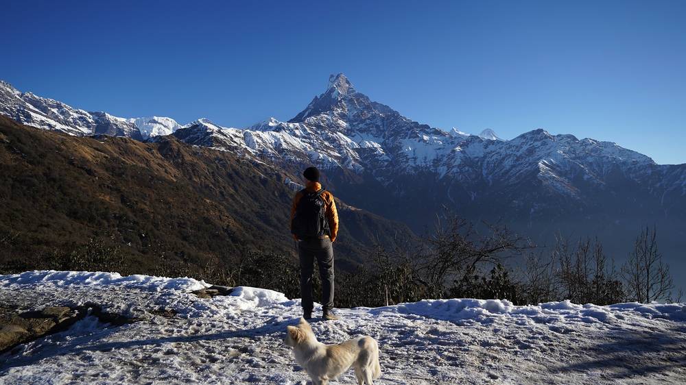
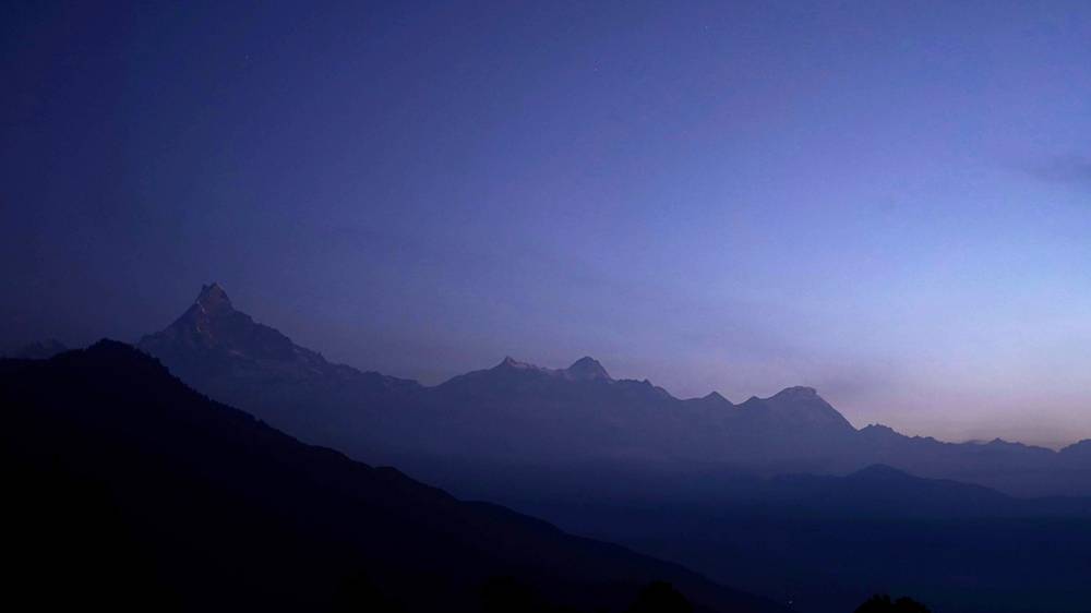
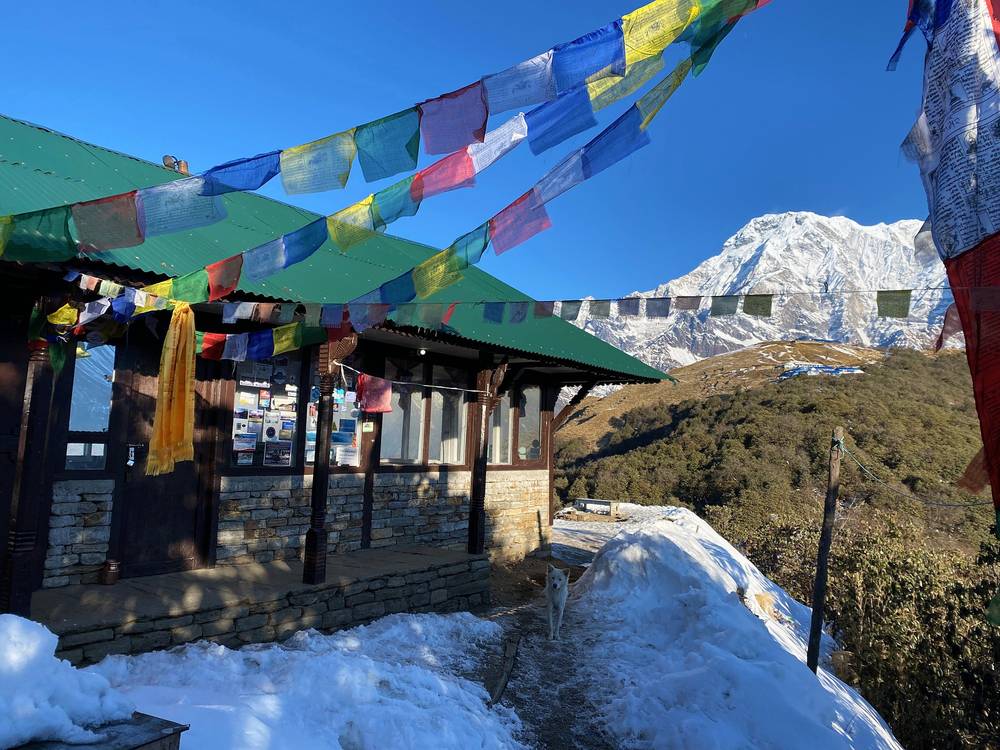
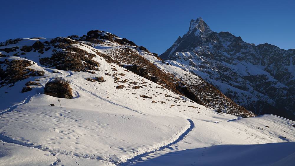
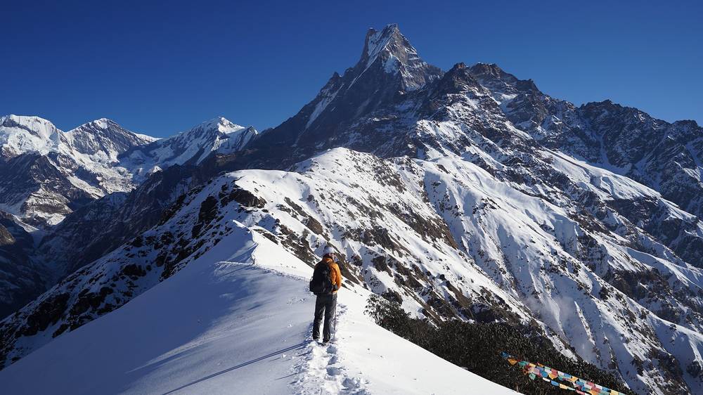
The ridge above High Camp at sunrise on Day 4, with Machapuchare.
Newsletter
Get my letter
Get a short letter from me every couple of weeks: new trips, guides and what I'm building.
Free. Unsubscribe any time.
Details
The guide · Free · 49-page PDF + GPX files · 2027 season edition
Mardi Himal Hiking Guide
4 days on the ridge below Machapuchare in Nepal. Every page is below: read it here, or take it offline as a PDF with my GPX files (49-page PDF + GPX files, in one zip). No sign-up needed.
The route
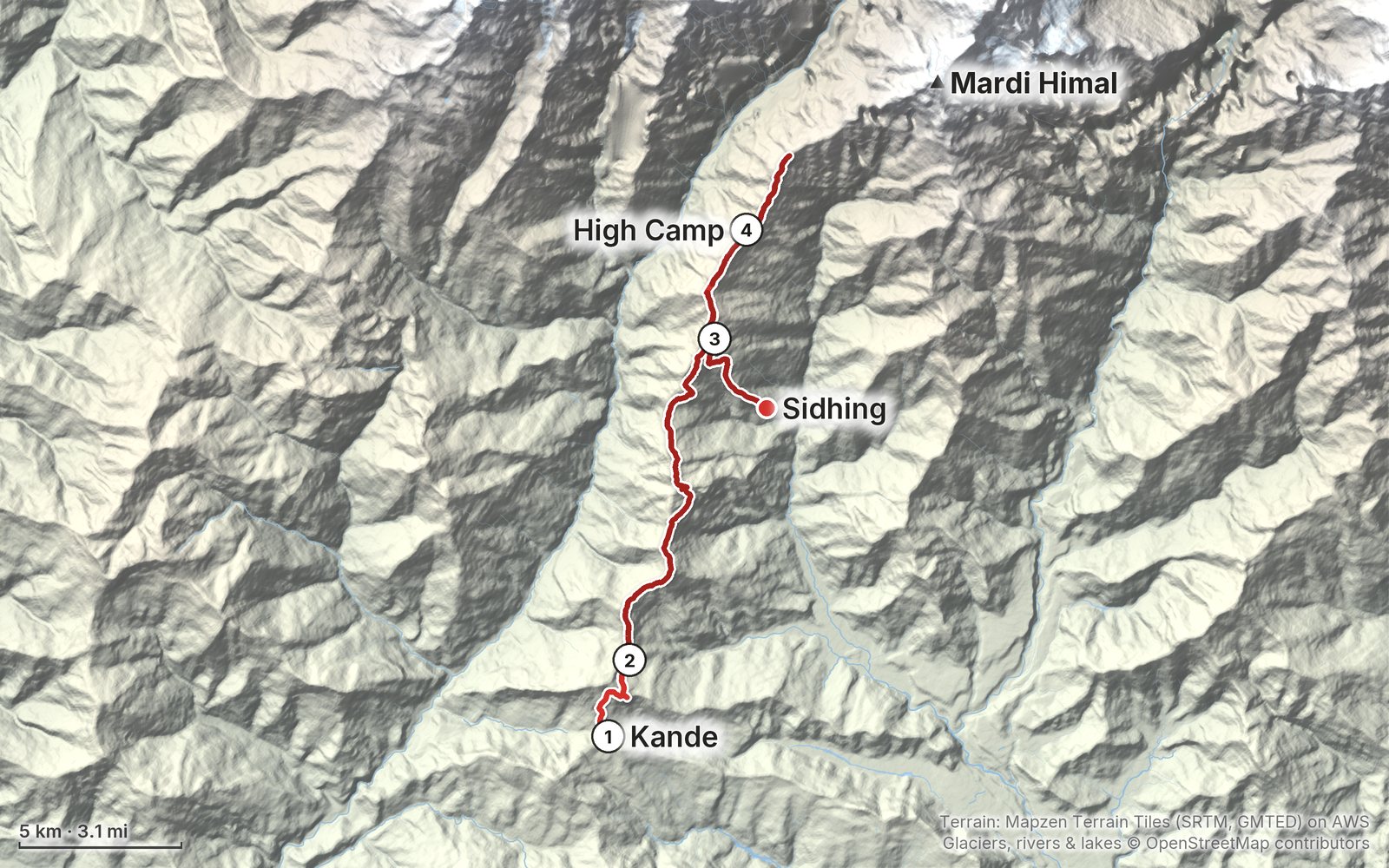
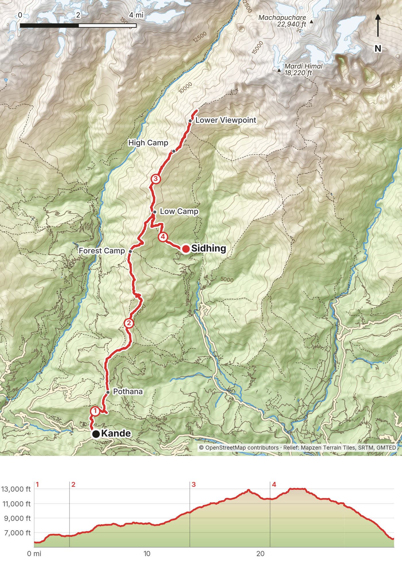
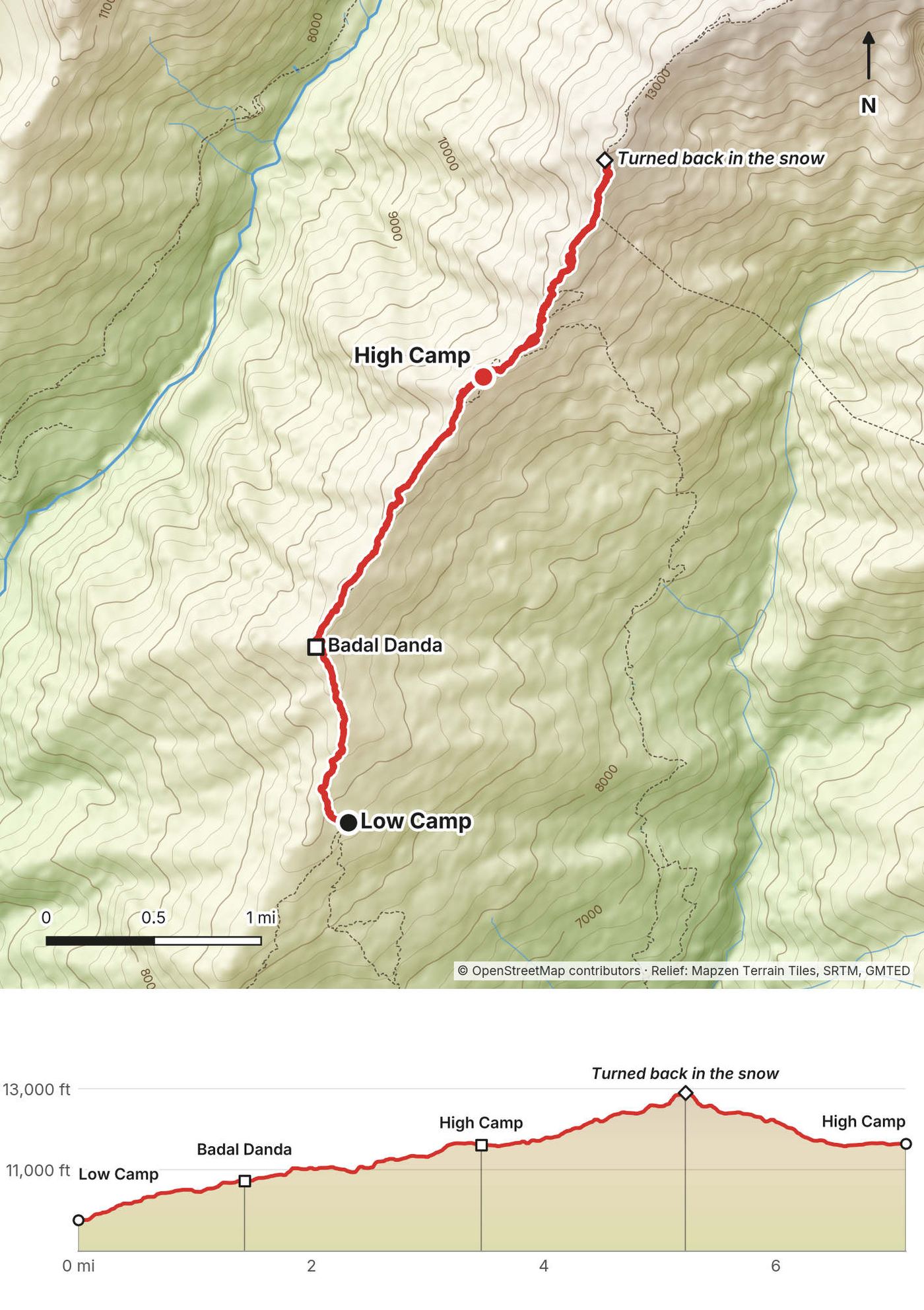
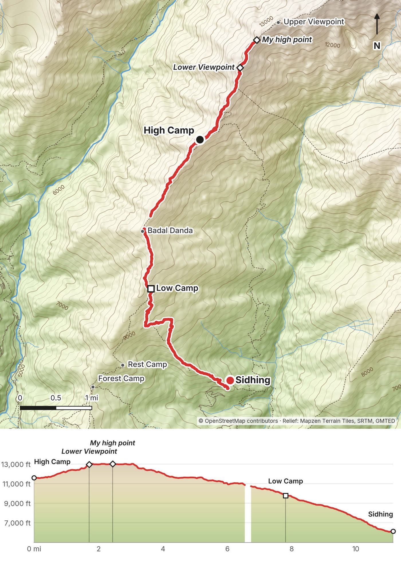
My GPS recording of 4 days on a relief map. The numbers are where each day starts; the red dot is the finish. The day maps are in the guide below, and the GPX files are a free download.
Elevation, start to finish: highest 13,060 ft (3,979 m), lowest 5,610 ft (1,709 m).
At a glance
- Days
- 4 days
- Distance
- 32 miles
- Climbing
- About 10,580 ft (3,225 m) up
- Season
- March to May or September to November
- Nights
- 3 in teahouses
- Permit
- Annapurna Conservation Area (ACAP): NPR 3,000 in 2026
- Route
- Kande to Sidhing
Contents
- Welcome
- At a glance
- Straight answers
- Permits and fees
- When to go
- Getting there
- Day 1 Kande to Pothana
- Day 2 Pothana to Low Camp
- Day 3 Low Camp to High Camp
- Day 4 High Camp to Sidhing
- Getting home
- Other ways to do it
- Teahouses, food and water
- What I paid
- Gear for this route
- Weather and safety
- Using the GPX files
- Before you go, check these
- One-page trip sheet
- About this guide
Welcome
In early February 2020 I hiked the Mardi Himal Trek in Nepal's Annapurna region, alone and without a guide. It was my first time in Nepal. I'd come to hike the Annapurna Circuit, but there had been a tragic avalanche in the region a week or two before I arrived, so I looked for something else and found Mardi Himal. From what I saw, it's probably one of the best short treks in Nepal.
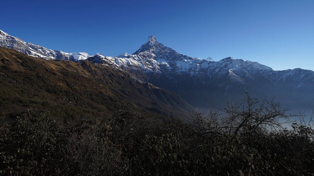
It's a ridge hike, which is one of the best kinds, because you get constant views on both sides. As you go up the ridge you're walking toward a really steep peak called Fishtail Mountain, Machapuchare, and once you get out of the forest into the alpine zone there are snow-capped mountains left and right. Views for days. The teahouses take care of your food and your bed, so you can leave the tent and stove at home.
I took the bus from Pokhara to Kande in the afternoon and walked to Pothana, which I call day zero. Then I walked three full days: Pothana to Low Camp, Low Camp to High Camp, and High Camp to the viewpoint and all the way down to Sidhing, where I caught a jeep back to Pokhara. My film has four chapters and I made four GPS recordings, so this guide has four days. A white dog I named Ghost walked with me for most of it.
What's inside
- Straight answers to the questions people ask about Mardi Himal
- The permits and the guide rule in 2026, when to go, and getting from Kathmandu to Pokhara and the trailhead
- All four days: my notes, the trail, where to get off, a map with an elevation profile, and links to that day in my films
- Getting home from Sidhing, other ways to do it, teahouses and food, what I paid and the gear for this route (what I carried and filmed with)
- Weather and safety, one page of things to check before you go, and a printable trip sheet
How to use it offline
Save this PDF to your phone's Files or Books app before you leave home. Load the GPX files and download offline maps in Pokhara, where the Wi-Fi is good. Each day starts on a new page. The film links need a connection; everything else works in airplane mode.
When I say "I," it's my own trip in 2020. Fees and rules have changed since, so they're dated, and the checks are collected on one page: Before you go, check these.
At a glance
| Quick facts | |
|---|---|
| Distance | 31.8 miles (51.2 km) over 4 days, Kande to High Camp, the ridge above it, and down to Sidhing |
| Climbing | about 10,580 ft (3,225 m) up and 9,800 ft (2,988 m) down |
| Start | Kande, an hour by bus from Pokhara |
| Finish | Sidhing, 2 to 4 hours by jeep from Pokhara (2 to 2.5 hours for me in 2020) |
| High point | 13,055 ft (3,979 m) on my GPS, on the ridge beyond the Lower Viewpoint. The Upper Viewpoint is published at about 4,200 m (13,780 ft) and Base Camp at 4,500 m (14,760 ft) |
| Highest night | High Camp, 11,644 ft (3,549 m) on my GPS |
| Nights | 3 in teahouses: Pothana, Low Camp and High Camp |
| How | Solo, without a guide (in 2020, before the guide rule) |
| When | March to May or September to November. I went in early February, with snow above Low Camp |
| Permits | Annapurna Conservation Area (ACAP): NPR 3,000 in 2026. Officially also a licensed guide and an agency TIMS card. A local municipality fee of NPR 500 is collected on the trail |
| Difficulty | A steady climb on good trail, then snow and ice on the ridge in winter. Not technical |
| Base | Pokhara |
| Day | Route | Miles (km) | Up / down (ft) | Night (ft) |
|---|---|---|---|---|
| 1 | Kande to Pothana | 3.1 (5.0) | 1,176 / 285 | 6,543 |
| 2 | Pothana to Low Camp | 10.6 (17.1) | 4,356 / 1,135 | 9,755 |
| 3 | Low Camp to High Camp, and up toward the viewpoint | 7.1 (11.5) | 3,310 / 1,446 | 11,644 |
| 4 | High Camp to the viewpoint, then down to Sidhing | 10.9 (17.6) | 1,740 / 6,936 | Pokhara |
The numbers come from my own GPS recordings, smoothed the same way for every day. Nights are the heights where my recordings ended.
Straight answers
How many days do I need? I did it in three days, plus an afternoon from Kande to Pothana. If I wasn't making a video the whole time, I probably could have done it in two. You can also stretch it out and spend a whole week on the mountain, stopping at every camp. Add at least a day in Pokhara at each end.
How hard is it? For most of the hike you're going up, and it gets a little steep toward the end. The trail is well built, with stone steps through a lot of the forest. On my trip the hard part was the snow and ice above Low Camp in February. I didn't feel any altitude sickness at all, and I felt really good for this hike.
How high does it go? In my guide video I said you go above 14,000 feet. That's true if you go on to Mardi Himal Base Camp, published at 4,500 m (14,760 ft). I didn't: my GPS topped out at 13,055 ft (3,979 m), on the ridge past the Lower Viewpoint. If you're not used to altitude, this gives you a taste of it. See Weather and safety.
Do I need a guide? In 2020 I went solo and unguided. I saw a couple of people on the trail with guides, and that's totally fine: it helps to speak the language, get advice along the way, and support the local economy. I personally love the challenge of figuring things out myself and going at my own pace. The rule has changed since: Nepal's Tourism Board now lists Mardi Himal among the treks that need a licensed guide. See Permits and fees.
Is the trail easy to follow? Yes. It's very well marked, with white and blue paint on the trees as you go. I had an offline map on my phone, but honestly I didn't need it. I still like to see where I am and what's coming up in elevation. With your phone in airplane mode, the GPS still works.
When should I go? The official best seasons are March to May and September to November. I went in early February: colder and snowier, but fewer people, and that's a trade-off I like. I got clear skies every morning, and around noon the clouds always showed up.
Where do you sleep? In teahouses. I paid NPR 300 (about $3) a night for a room with two single beds, pillows and blankets. The rule is that you eat where you sleep. See Teahouses, food and water.
What does it cost? I spent about $200 on the trek, not counting getting to Nepal and to Pokhara. That includes the permits and insurance. I bought whatever food and drinks I wanted; you could do it for about half. See What I paid.
What about the dog? A white dog found me at breakfast in Pothana and followed me for days. I named him Ghost. He lives on the mountain, and has probably gone up and down this trail hundreds of times. If you feed him, he'll probably follow you. I did, so he followed me. Taking him home would have been ridiculous: he's his own dog. See Day 2.
Phone and charging? My phone worked offline for the map. I carried a battery pack and extra camera batteries, and five camera batteries were more than enough for three days of filming.
Permits and fees
My 2020 permits
In 2020 I needed two permits for this trek, the Annapurna Conservation Area permit and a TIMS card, and together they cost about $50. I got them at the tourism office in Pokhara, the morning I took the bus to Kande. I needed four square photos for them. I'd had mine shot and printed in Hong Kong, but you could get them taken right at the office, and there were photo studios all around. I didn't realize you had to have travel insurance to get the permits, so I got on the Wi-Fi and bought it online right there, for about $50 or $60. You keep the permits in your passport and carry them on the trek. There's a checkpoint near Pothana: they looked at my permit, stamped it, and within ten seconds I was back on the trail.
In 2026 (checked September 29)
- Annapurna Conservation Area permit (ACAP): NPR 3,000 for foreigners, NPR 1,000 for SAARC nationals. Buy it online at epermit.ntnc.org.np (card, plus 2.9%) or in cash with your passport at a counter; in Pokhara, at the Nepal Tourism Board office at Damside. A permit issued at a checkpoint costs double. Also carry NPR 500 for the local municipality's fee on the trail.
- A licensed guide and a TIMS card. Under a provision in force since March 31, 2023, the Nepal Tourism Board requires foreign trekkers in listed areas to go with a licensed guide and carry a TIMS card issued through a registered agency (NPR 2,000). Its list names the Mardi Himal Trek. Unlike in the Everest region, no local authority on the Annapurna side has publicly rejected the rule. News reports in 2024 said it wasn't enforced on Mardi Himal, and there's no official notice either way. Plan on a licensed guide through a registered agency.
- Insurance. In 2020 I needed insurance to get my permits (the old TIMS form asked for the policy). The current permit pages don't require it, but get a policy that covers trekking to 4,500 m (14,760 ft) and helicopter evacuation.
When to go
The Nepal Tourism Board gives the best seasons for the Annapurna region as March to May and September to November. Spring brings the rhododendron forest into bloom, roughly March and April. December to February is winter: cold, with snow on the ridge. June to September is the monsoon, with heavy rain, cloud, and landslides that can cut the roads to Pokhara.
I did this trek in early February. It's a little colder, and there's a bit more snow than usual, but that's a trade-off I like if it means fewer people. I like a quieter trail. Even in winter I ran into some of the same people every day and chatted with other hikers in the teahouses. I've seen photos of the months with flowers, and they look beautiful, and I think the most popular time is probably October.
I got clear skies every morning. The weather in the mountains is a little unpredictable, but at about noon the clouds always showed up, and it was overcast from then on. That makes for lazy evenings, because it's not fun to hike when you can't see anything. Most of my hiking took place from about 6 a.m. to noon every day. Plan your days the same way.
It was cold at night, but in the teahouses you sleep in your sleeping bag with a big blanket over the top, so it wasn't an issue. On the ridge there was snow from about Low Camp up, and deep, untracked snow beyond the viewpoint.
Getting there
Kathmandu to Pokhara. Most travelers arrive in Kathmandu, where you can get a tourist visa on arrival (US$30, 50 or 125 for 15, 30 or 90 days in 2026). From there you need to get to Pokhara. There are two options: fly, or take a bus. In 2020 the bus was about $10 and took six hours. I flew, and it was about $100 each way. In 2026 the flight takes 25 to 30 minutes (Buddha Air, Yeti Airlines and Shree Airlines fly it), and tourist buses usually take 7 to 9 hours. Pokhara's new international airport opened in January 2023 and now takes most domestic flights.
The road in 2026. The Trishuli river washed away the Prithvi Highway at Krishnabhir, between Kathmandu and Pokhara, on August 30, 2026. It reopened on September 17, but after more rain in late September it was one way only again (September 29). Check the road before you book a bus, or fly.
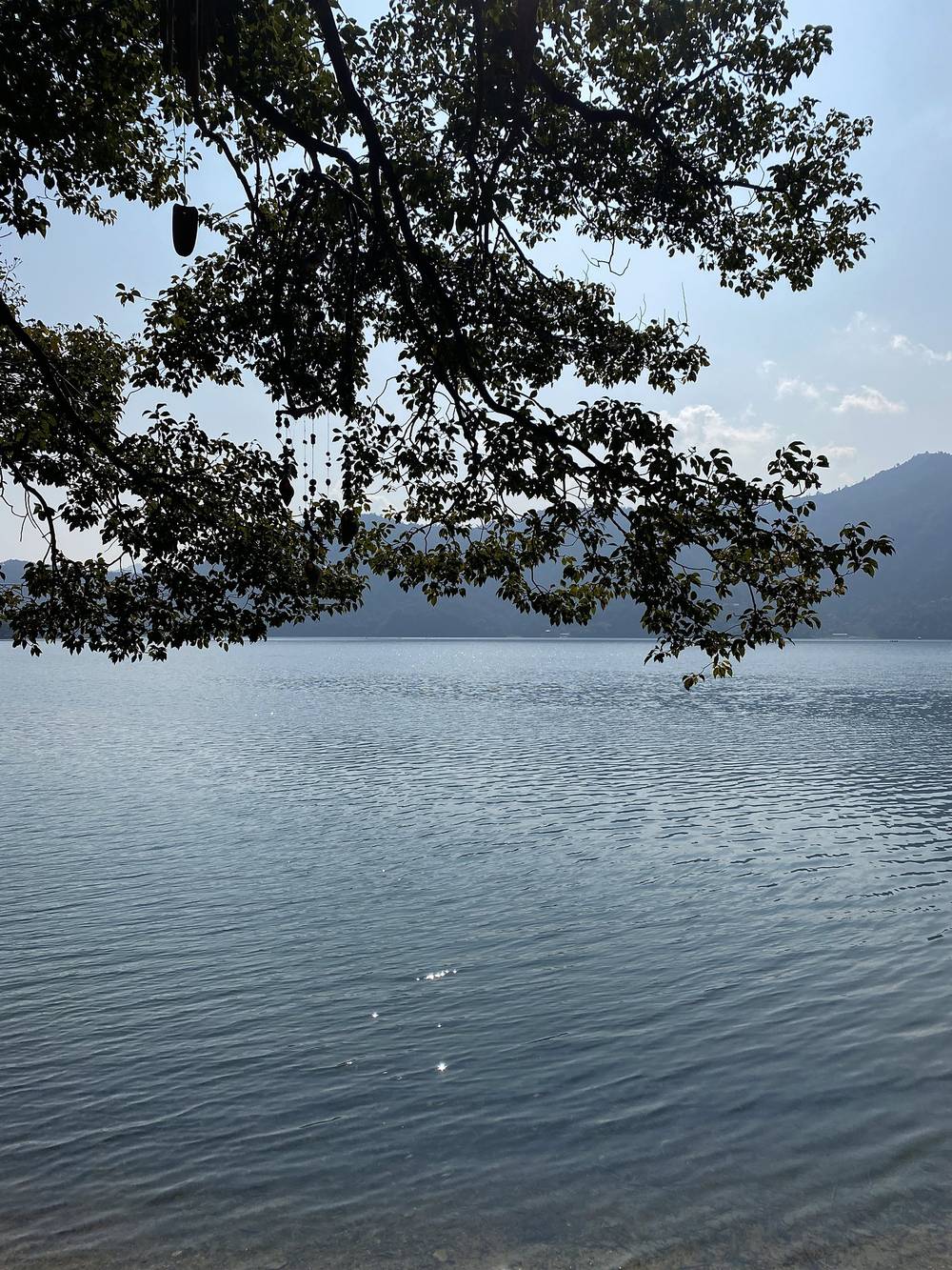
Pokhara. Pokhara is a big city, but there's a lovely lakeside district for tourists, a mile or two of restaurants, cafes and tourism agencies, everything you might need. I had a few days before and after my trek, and I just ate and drank my way through the city. The Lan Hua Chinese restaurant is supposedly one of the oldest in town, and it was some of the best Chinese food I've ever had. Most of the coffee shops have good coffee, cheap prices, Wi-Fi and lots of space. I liked White Rabbit; Himalayan Java is like the Starbucks of Nepal; and Crazy Gecko is a little out of town, on the lake. I stayed at Hotel Mountain View, and the man who runs it was super helpful: he's the one who suggested I hike Mardi Himal. Those are 2020 names; I haven't checked them since.
Pokhara to Kande. I took a taxi to the city bus station, about $3, and at the bus station you just ask for the place you're going. My bus was right there. Kande was another $3 and about an hour. It's very easy to find the trailhead: I opened my map app and found exactly where the trail starts, right at the stop. In 2026 local buses to Kande leave Baglung Bus Park about every 30 minutes and cost about NPR 110 to 150; a taxi is about NPR 2,000 to 2,500. In late September 2026 floods cut the Pokhara to Baglung highway at Sahasradhara in Parbat, beyond Kande; the Kande stretch wasn't reported damaged, but check that buses are running.
Snacks. I got about $250 in rupees out of the ATM before the trek, which is a lot of 1,000-rupee bills and more than enough. In town I bought cashews, almonds, Kit Kats, Snickers and some apples. But you can buy all of those at the trailhead when you get off the bus, and there are lots of snacks at the teahouses at similar prices. Tree nuts like cashews are my favorite: they don't spoil, and if you're hungry on the trail, a handful gets you through the next hour.
Day 1: Kande to Pothana
- Distance
- 3.1 mi (5.0 km)
- Climbing
- 1,176 ft (358 m)
- Descent
- 285 ft (87 m)
- Time I took
- 1.6 hours (3:12 to 4:48 p.m.)
- High point
- 6,748 ft (2,057 m), near Australian Camp
- Sleep
- Pothana, 6,543 ft (1,994 m) on my GPS
- Permits
- the ACAP checkpoint near Pothana
- Terrain
- Stone steps and a forest path up from the road, then an easy walk along the hillside
My day
What I call day zero is getting to the trailhead. I usually don't like to wake up early. I take my time, get out to the trailhead, walk to a place to sleep, and the next full day is the first day of hiking. I'd got my permits in Pokhara that morning and took the bus to Kande. I hopped off by myself at the trailhead.
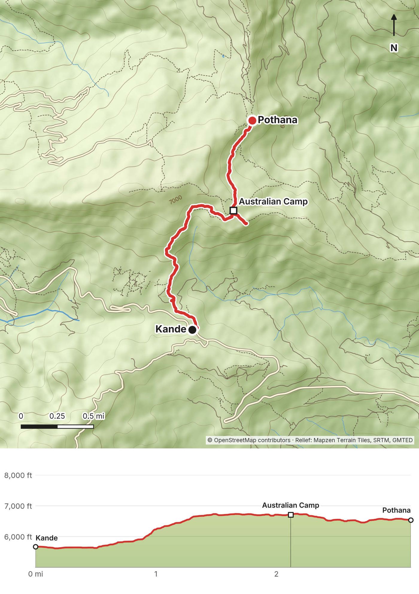
I hiked about three miles in an hour to Pothana and passed right through Australian Camp. It felt kind of boring, and it was a little overcast, so it wasn't good for filming. There was a checkpoint where they wanted to see my permit.
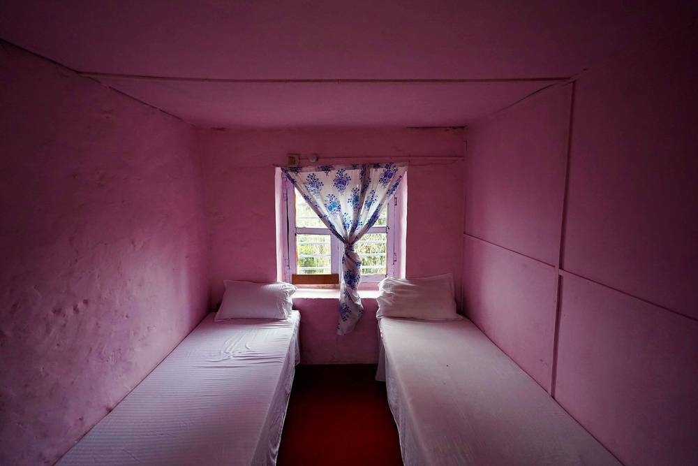
When you arrive at a camp where you're going to spend the night, it's a little awkward, because there are a few options: here, maybe six or seven teahouses. I like to walk around, get a sense of the place, and pick one. They're all kind of the same, I guess. I picked the one I liked because there was a dog running around. My room cost three dollars: two single beds with pillows and blankets, and lovely pink walls. For dinner I had chicken curry with rice for six dollars and a big beer, also six dollars. I really liked the gold-colored plates the kitchens used.
The trail
From the bus stop at Kande, on the Pokhara to Baglung road, the path climbs straight up through forest and terraces on stone steps, about 1,000 ft (300 m) in the first 2 miles. Australian Camp sits on an open shoulder at about 2,045 m, with lodges and wide views north when it's clear. From there the path runs gently along the hillside and down a little to Pothana, a cluster of lodges in the pines. The ACAP checkpoint is near Pothana. Carry your permit where you can reach it.
If you need to get off
Walk back down to Kande and the road, about an hour. Dhampus, a village with a road, is also close.
Watch this day
Film, Day 1 · Getting to the trailhead, in my guide video · Teahouses and the first night
Day 2: Pothana to Low Camp
- Distance
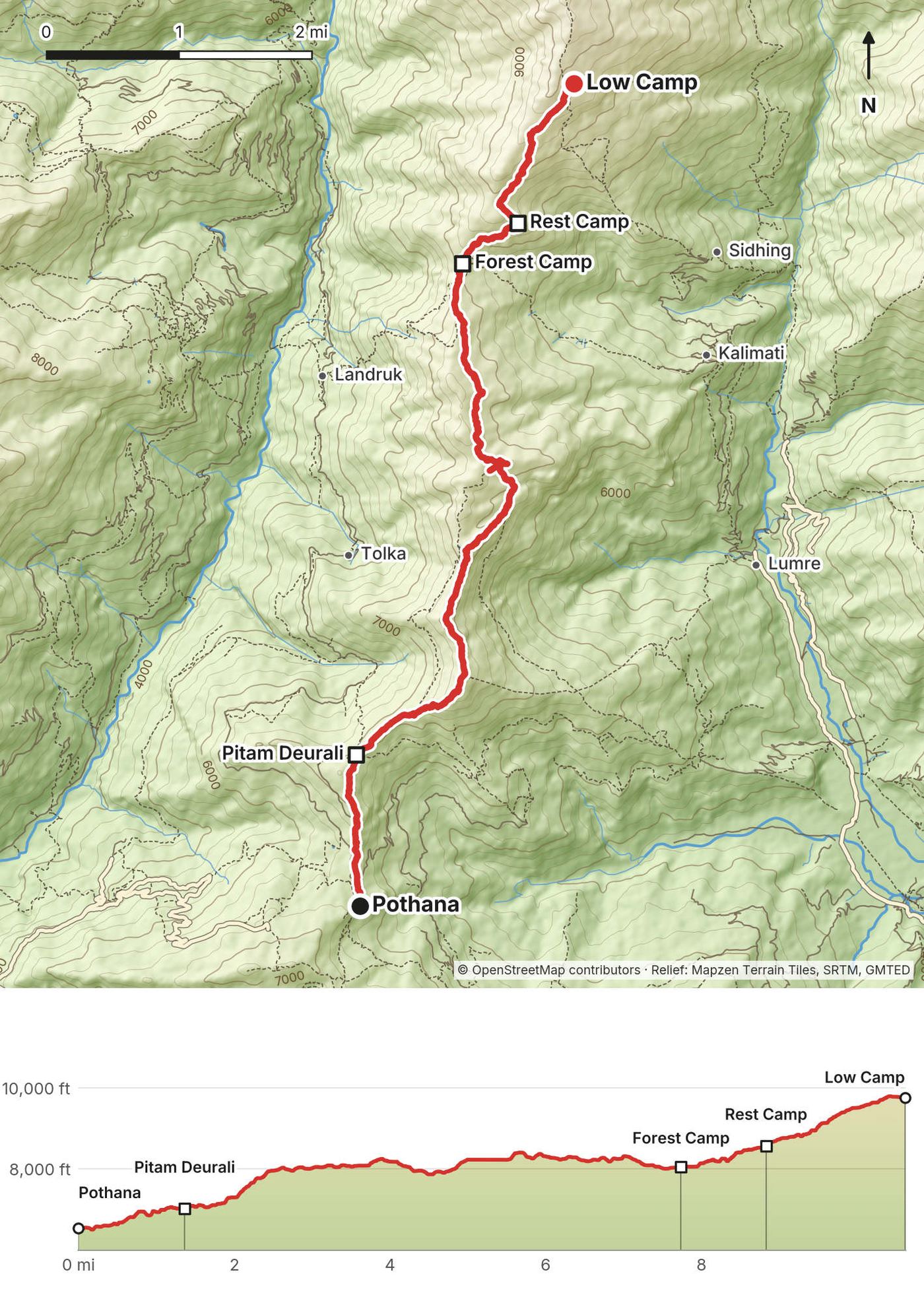
- 10.6 mi (17.1 km)
- Climbing
- 4,356 ft (1,328 m)
- Descent
- 1,135 ft (346 m)
- Time I took
- 6.9 hours (7:15 a.m. to 2:10 p.m.), with an hour for lunch
- High point
- 9,794 ft (2,985 m), at Low Camp
- Sleep
- Low Camp, 9,755 ft (2,973 m) on my GPS
- On the way
- Pitam Deurali at 7:56 a.m., Forest Camp 11:09 a.m. to 12:17 p.m., Low Camp at 1:55 p.m.
- Terrain
- Forest the whole way, dark mud and moss, stone steps, and patches of snow near the top
My day
I woke up at six and had breakfast at 6:30. I ordered what they called a heavy breakfast, with a bunch of things. My favorite was the porridge, with honey and bananas: it's just so good in the morning. The teahouse marks down whatever you buy during your stay, and you pay before you head out. My bill for the night was NPR 2,350.
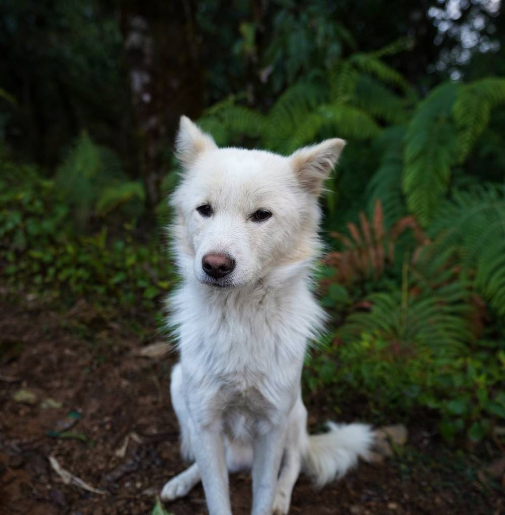
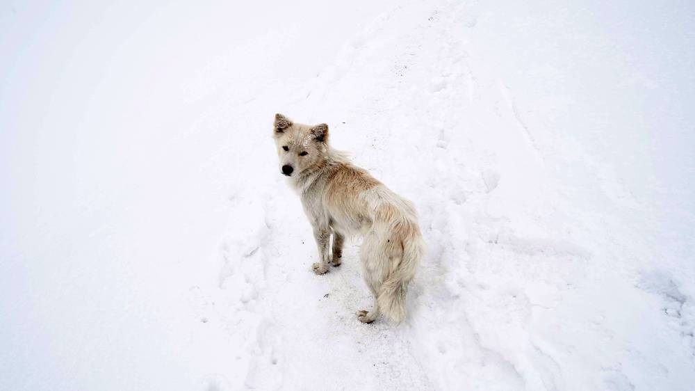
During breakfast a little white dog showed up and sat next to me. When I headed out, he followed me, for a while. I named him Ghost because he looked like a tiny direwolf: I'm a Game of Thrones fan, and that's what Jon Snow named his. He'd follow behind me, then scout ahead whenever there was someone else on the trail. He liked to keep moving, so every time I stopped to set up a shot, walked past it and went back for the camera, he got super confused and threw me a little shade. I did feed him, so that explains why Ghost followed me for days. He showed affection, wanted to be petted, and acted almost like a pet with no owner, much calmer than the stray dogs I've seen in cities.
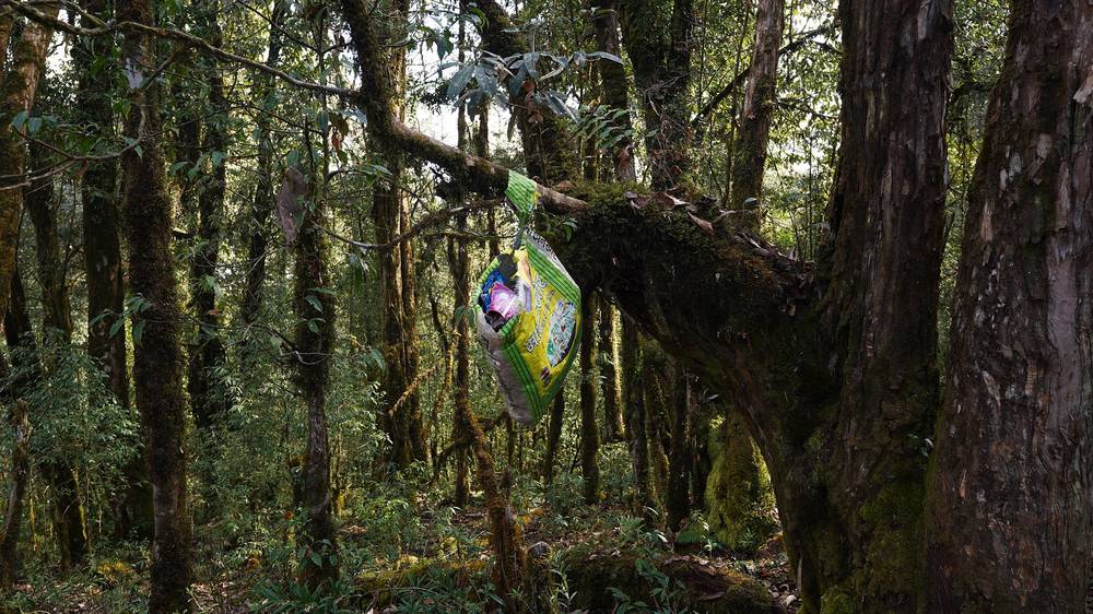
The path was beautiful: dark brown mud, really green mossy trees, and eventually patches of snow. It was much cleaner than I'm used to. There were bags hanging for trash along the way, and I think that made people throw less trash on the trail. I spotted a couple of guides with their own trash bags hanging off their packs, filled with trash. I'm always going to respect anyone who helps clean up nature. I met two hikers from the UK and saw them at each camp after that, all the way to the top. I stopped for coffee, 100 rupees, about a dollar.
At Forest Camp a woman ushered us to her table and wanted us to eat lunch at her place, which we did. We ordered dal bhat, the Nepali dish that's kind of a meme at this point: "dal bhat power, 24 hour." It's all you can eat: rice, potatoes, a soup, chili, and she kept putting more on our plates. We gave some to Ghost. Sitting in the sun with a Coke, it was a really good lunch, about eight dollars for the dal bhat and the Coke. All in all I hiked about 10 miles in five or six hours to Low Camp.
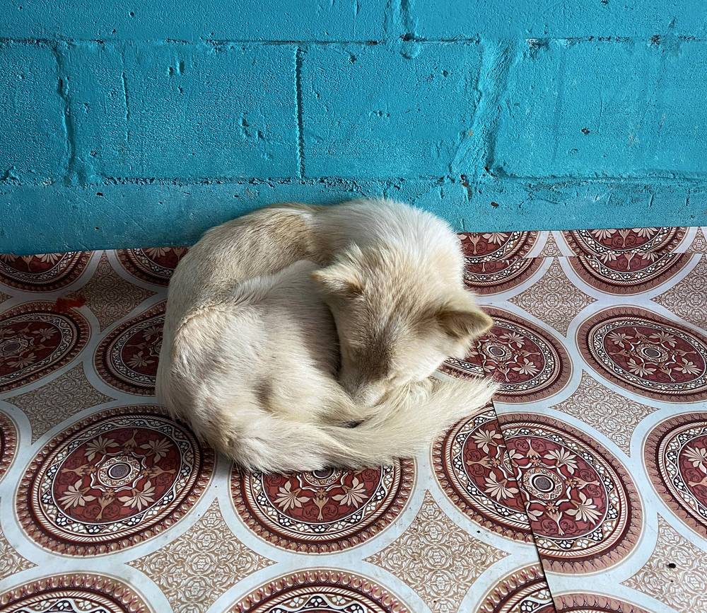
For dinner I had coffee, a beer, and mixed macaroni, big pieces of macaroni with cheese and vegetables, very tasty, then noodle soup with veggies, more tea, and a refill of my water. Because it was overcast, I had time to chill and walk around and talk to other hikers. Every so often the clouds parted, and especially at sunset, the peaks lit up orange. If you spot that through the window, you hop out and take photos, and then it disappears as quickly as it appeared. It was colder up here, and Ghost wanted to sleep in the bed where it was warmer, with his muddy paws. Eventually I let him have one bed, with pillows and blankets around him, and slept in the other.
The trail
From Pothana the path runs north through forest to Pitam Deurali, where the Mardi Himal trail leaves the main path to Landruk and turns up the ridge. From here it's forest nearly all the way: rhododendron and oak, moss, stone steps and mud, climbing steadily along the crest of the ridge with a few short descents. Forest Camp (also called Kokar), about 2,440 to 2,550 m, has a few lodges and is the usual lunch stop, 7.7 miles from Pothana on my GPS. Rest Camp is a little higher. The last hour to Low Camp is the steepest part of the day, and in February it had snow in the shade. Low Camp, about 2,970 m, sits just below the top of the forest. There's no water to count on between the lodges; buy it at each stop.
If you need to get off
Back down the ridge the way you came, to Pitam Deurali and Pothana. From Forest Camp, a trail also drops east to Sidhing, where jeeps go to Pokhara (the way I went down on Day 4).
Watch this day
Film, Day 2 · Pothana to Low Camp, in my guide video · The white dog story
Day 3: Low Camp to High Camp
- Distance
- 7.1 mi (11.5 km), including my walk toward the viewpoint and back
- Climbing
- 3,310 ft (1,009 m)
- Descent
- 1,446 ft (441 m)
- Time I took
- 6.7 hours (6:58 a.m. to 1:41 p.m.); High Camp at 10:25 a.m.
- High point
- 12,920 ft (3,938 m) on my GPS, at 12:09 p.m., just below the Lower Viewpoint, where I turned back in the snow
- Sleep
- High Camp, 11,644 ft (3,549 m) on my GPS
- On the way
- Badal Danda at 8:14 a.m.
- Terrain
- Snow and ice in the last of the forest, then an open ridge of grass and rock with snow
My day
I had a light breakfast of porridge and paid my bill. All in all, I spent about $28 at Low Camp. Then I made my way into the next section of the hike. I started running into snow and ice on the path, so I put on my microspikes. If you go in February, you absolutely need them, because it gets pretty slippery. Plus the crunchy sound of them on the ice sounds really cool.
Eventually you get out of the forest and the great views start. At Badal Danda I had a coffee that cost 170 rupees, a little more. The higher you go on the trek, the more you pay for the same thing. I hiked about 3.5 miles in three hours to High Camp. I ran into a couple of other hikers I knew there, and I bought tea for everyone, about three dollars.
We still had a good view of the ridge and the mountain, so we decided to try to go to the end, to the viewpoint. It was about noon. About halfway up the clouds rolled in and it got super overcast, and going a little higher it started to snow quite a bit, into a pretty nasty, blizzardy whiteout. I took out my trekking poles, ate a quick snack, and decided to rush back down to High Camp, mainly because Ghost was getting cold and didn't look like he was having fun. He was licking his paws because they were cold.
Ghost didn't have a good night. He was struggling to eat. I gave him a bunch of stuff, and he just tried to stay warm, practically sleeping under the stove. When I went to bed he didn't follow me, and I didn't see him the next morning. That evening was lazy again: I sat around chatting with other people in the teahouse, tried to stay warm, and had coffee, a beer, mixed macaroni again, a Coke and ramen, and went to bed.
The trail
Above Low Camp the trail climbs through the last of the rhododendron forest, then comes out onto the open crest of the ridge. Badal Danda ("cloud ridge"), about 3,210 m, has lodges and the first big views: Machapuchare ahead, the Annapurna range to the west, and the valleys on both sides. From Badal Danda the ridge climbs steadily over grass and rock to High Camp, about 3,540 m, the highest lodges on the trek. Above High Camp the path keeps to the crest, steeper now, to the Lower Viewpoint, a tea hut at about 3,960 m. In winter it's snow and ice all the way. The ridge is broad in most places but drops steeply on both sides higher up; in cloud and snow, turn back, as I did.
If you need to get off
Down the ridge to Low Camp, then Forest Camp and Pothana, or from Low Camp east down to Sidhing and the jeeps (the Day 4 descent).
Watch this day
Film, Day 3 · Low Camp to High Camp, in my guide video · Turning back in the storm
Day 4: High Camp to Sidhing
- Distance
- 10.9 mi (17.6 km)
- Climbing
- 1,740 ft (530 m)
- Descent
- 6,936 ft (2,114 m)
- Time I took
- 8.4 hours (6:45 a.m. to 3:08 p.m.), including an hour back at High Camp
- High point
- 13,055 ft (3,979 m) on my GPS, at 9:09 a.m., on the ridge beyond the Lower Viewpoint
- Low point
- 6,080 ft (1,853 m), at Sidhing
- On the way
- Lower Viewpoint 8:11 to 8:39 a.m., back at High Camp 10:57 a.m. to 12:02 p.m., Low Camp at 1:23 p.m.
- Terrain
- Deep snow on the ridge, then snow, ice and mud down through the forest to farmland
My day
The next morning I planned on "summiting," even though it's not really a summit, just getting to the high point of the ridge. Some people left in the dark. I feel that's a bit unnecessary. I went at sunrise and hiked to the viewpoint, which I think is a good finishing point for the hike. If you get to the viewpoint, good job, you made it. There's a hut, a great 360-degree view of everything, and we had great weather, very clear. You can even buy coffee or tea up there, about three dollars. That was the climax of the trip: coffee went from one dollar to two, and now three. Very expensive.
Nobody had hiked past the viewpoint that morning, so I broke trail and headed out along the ridge, sometimes falling into deep snow. Eventually I reached a point that was very steep on both sides, and I got a little scared. I'm a little afraid of heights, and once I get into that mindset I don't want to go any further. So I felt good about my hike, and I turned back to High Camp, taking a moment to soak in the view and look up at Fishtail Mountain. It's actually a sacred mountain: you're not allowed to climb it, and supposedly no one has ever been to the top. That's a humbling, inspiring thing to stop and think about. (People watching those clips on the ridge think Ghost came back, because they see a white pup. That was a different dog, a lot plumper than Ghost.)
Back at High Camp I settled my bill and went down to Sidhing, about three hours. I basically trail ran most of it, because I wasn't shooting: I put my camera and tripod away and just used my trekking poles. The path was very icy and really fun to slide down, and it's beautiful to go from the ridge to snowy forest to green forest and the valley. Halfway down, I ran into Ghost. He was going back up, so he must have gone down that morning and come back up with a group of hikers. I stopped and said hi, and he definitely recognized me. Then I said goodbye, and he followed them up the mountain. He made new friends. That's the ending of Ghost's story. If you do this hike, he might still be there.
Before the bottom, I broke my trekking pole: I put it into a crack and the bottom snapped. In Sidhing a bunch of people were ready to drive hikers out in jeeps. I wasn't going to pay for a whole jeep by myself, so I waited for other people to show up so we could share. I bought a beer for seven dollars, and eventually we filled a jeep. I paid ten dollars for my seat, which was good, because it was a two to two-and-a-half-hour drive through the mountains, crazy rivers and passes, all the way to Pokhara.
The trail
From High Camp the path climbs the crest of the ridge again, past the Day 3 turnaround, to the Lower Viewpoint and its tea hut, about 3,960 m and 1.8 miles from High Camp on my GPS. This is where I had my coffee. The usual trail goes on up the ridge to the Upper Viewpoint (about 4,200 m) and on to Mardi Himal Base Camp (4,500 m); in early February nobody had been past the tea hut, and I turned around in deep snow about half a mile beyond it, at 3,979 m on my GPS. Take the ridge above High Camp seriously in snow: it narrows, and the sides are steep.
The way down retraces the ridge past High Camp and Badal Danda to Low Camp. Just below Low Camp, the trail to Sidhing branches east off the main ridge and drops steeply through the forest, about 3,600 ft (1,100 m) in about 3 miles, to the farmland and the village of Sidhing, about 1,900 m, where the road ends. It was icy at the top in February, then mud.
If you need to get off
Down. High Camp, Badal Danda and Low Camp are all on the way. Sidhing has jeeps; the other way down from Low Camp is the Day 2 trail to Pothana and Kande.
Watch this day
Film, Day 4 · The viewpoint and the descent to Sidhing, in my guide video · Seeing Ghost again
Getting home
What I did. At Sidhing, jeeps wait for hikers. I waited until there were enough people to share a jeep, paid ten dollars for my seat in 2020, and rode two to two and a half hours back to Pokhara.
In 2026. Trekking sources give a private jeep from Sidhing to Pokhara at about US$70 to 100 and 3 to 4 hours on a rough gravel road; sharing brings the cost per seat down. The cheaper option is to walk about 3 hours down past Kalimati to Lumre and take a shared jeep or bus from there. You can also walk out the way you came, from Low Camp down the Day 2 trail to Pitam Deurali and on to Kande or Dhampus, both on roads.
Back to Kathmandu. Fly from Pokhara (25 to 30 minutes) or take a tourist bus (7 to 9 hours in normal conditions). Keep a spare day: flights are weather-dependent, and roads close after heavy rain.
Other ways to do it
Slower. You can stretch this trail out and spend a whole week up on the mountain. If you're feeling the altitude, or getting winded going uphill all day, take your time and stop at every camp: Pothana, Forest Camp, Low Camp, Badal Danda and High Camp all have lodges.
On to the Upper Viewpoint and Base Camp. In good conditions, most people go on from the Lower Viewpoint to the Upper Viewpoint (about 4,200 m) and some to Mardi Himal Base Camp (4,500 m), then back to High Camp or further down the same day. It's a long day from High Camp; leave early and set a turnaround time. In December 2023 a solo trekker went missing after leaving High Camp alone before dawn for Base Camp. Don't go beyond the viewpoints alone, in cloud or in fresh snow.
Start from Dhampus. A road reaches Dhampus, east of Australian Camp, and trails join the route at Australian Camp and Pothana. A rough jeep road also reaches Pitam Deurali.
Down another way. Instead of Sidhing, walk back down the ridge to Forest Camp and Pitam Deurali, or continue from Pitam Deurali to Landruk and the Modi Khola valley.
I walked the version in this guide. I haven't walked these other versions.
Teahouses, food and water
Teahouses. Every stop has a few lodges; at Pothana there were six or seven. They're kind of all the same, so walk around and pick one you like. The basic rule is that if you sleep at one, you eat there too: they don't want you eating at different teahouses. My room in 2020 was NPR 300, about $3. Mornings and evenings you spend in the dining room, where there are other people to chat with, and you can sleep ten or twelve hours. Whatever you buy goes on your bill, and you pay before you leave.
Staying warm. I slept inside my silk liner, to keep my sleeping bag clean, inside a down quilt rated to about 20°F, with the teahouse's big blanket over the top. Even though it got very cold at night, that was more than enough. The dining room at Low Camp had a wood stove.
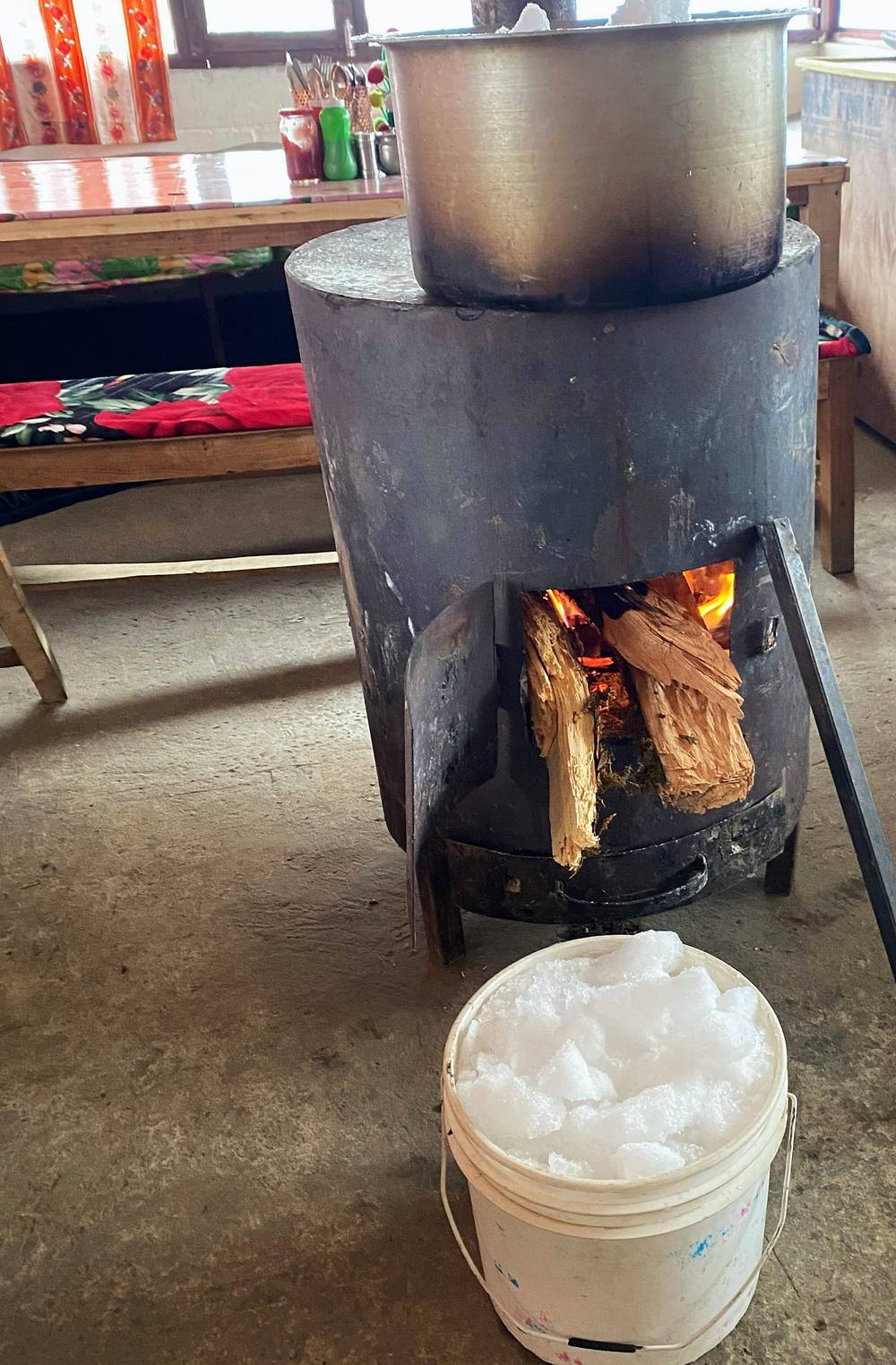
Food. The food is probably the most expensive thing you'll buy on this hike, and prices go up the higher you go. What I had: a heavy breakfast with porridge, honey and bananas; dal bhat, all you can eat; chicken curry with rice; mixed macaroni with cheese and vegetables; noodle soup with veggies; ramen; coffee, tea, Coke and beer. The teahouses sell snacks too.
Water. I had a water bottle I reused from the hotel, and it was more than I needed, because there are so many teahouses and drinks to buy. I only sipped water between camps and bought refills: "filter water" was NPR 200 on my Low Camp bill. Treat any tap or stream water yourself.
Toilets. Bring your own toilet paper and keep it dry in a plastic bag. The outhouses are holes in the ground, and most don't have toilet paper, though the teahouses sell it.
What I paid
My costs from February 2020, from my guide video and the two teahouse bills I photographed. Prices have gone up since; the 2026 permit fees are in Permits and fees.
| What | 2020 |
|---|---|
| Flights, Kathmandu to Pokhara and back | about $100 each way |
| Two permits (ACAP and TIMS) | about $50 |
| Travel insurance, bought online for the permits | about $50 to $60 |
| Taxi to the bus station, bus to Kande | about $3 each |
| Pothana: room, chicken curry, beer, breakfast | NPR 2,350 (about $20) |
| Low Camp: room, meals, drinks, water | NPR 2,890 on the bill (I remembered it as $28) |
| High Camp | not in my records |
| Coffee | NPR 100 low down, NPR 170 at Badal Danda, about $3 at the viewpoint |
| Beer at Sidhing | about $7 |
| Shared jeep, Sidhing to Pokhara | $10 a seat |
All in. I spent about $200 on this trek, not counting airfare, including the permits and insurance. I got about $250 out of the ATM before the trek and it was more than enough. I spent whatever I wanted on food and drinks: if you drink water and skip the candy bars and coffee, you could probably cut that in half.
Gear for this route
What this trek needs
- Microspikes from December to March, and trekking poles
- Warm layers, a down jacket, hat and gloves, and a sleeping bag or quilt for cold rooms
- A rain shell, sun protection and sunglasses for the snow
- A headlamp, a water bottle and a way to treat water
- Toilet paper, a power bank and cash in Nepali rupees
- Your permits, passport and insurance details
Paid links: I earn a commission if you buy through these links, at no extra cost to you. As an Amazon Associate I earn from qualifying purchases.
Teahouses every night, but February cold and snow on the ridge. Here's what I carried in 2020, what I'd take now, and what I filmed with.
What I carried in 2020
- Pack: Hyperlite Mountain Gear Southwest 2400 (Hyperlite). The 2400 size.
- Quilt: a down quilt rated to about 20°F. Similar: Hyperlite Mountain Gear 20° Quilt (Hyperlite).
- Liner: a silk sleeping-bag liner
- Microspikes: microspikes. Very necessary in February. Similar: Yatta Life Ice Spikes (Amazon).
- Poles: trekking poles. Helpful for descending. Similar: Black Diamond Alpine Carbon Z Poles (Amazon).
- Headlamp: a rechargeable headlamp
- Water: a reused water bottle
- Sun: a sun hoodie, a white hat and sunglasses
- Rain shell: a Gore-Tex shell
- Warm layers: a winter hat, gloves, a sweater and a neck scarf. Keeping my neck warm is major.
- Puffy: Patagonia Nano Puff Jacket. My orange one, light and so warm. Similar: Arc’teryx Atom SL Hoody (Arc’teryx).
- Pants: zip-off pants
- Socks: two pairs of merino wool socks. I wore them the whole time.
- Shoes: Brooks trail runners. People always ask why I don't wear hiking boots. I love trail running shoes; whatever works for you works. Similar: Brooks Cascadia 17 (now the Cascadia 20) (Amazon).
What I'd take now
My current kit for what this trek needs.
- Microspikes: Yatta Life Ice Spikes (Amazon). From December to March, for the icy sections above High Camp.
- Poles: Black Diamond Alpine Carbon Z Poles (Amazon)
- Quilt: Hyperlite Mountain Gear 20° Quilt (Hyperlite). For cold teahouse rooms.
- Liner: Naturehike ZY20 Sleeping Bag Liner (Amazon)
- Down jacket: Arc’teryx Cerium Hoody (Arc’teryx)
- Rain shell: Arc’teryx Beta AR Jacket (Arc’teryx)
- Sun hoodie: PATH Projects Pyrenees T19 Hoodie (PATH Projects)
- Sunglasses: Goodr OG Sunglasses (Amazon). For the glare off the snow.
- Winter hat: PATH Projects Hoyt Merino Beanie (PATH Projects)
- Gloves: Unigear Touchscreen Liner Gloves (Amazon)
- Headlamp: Nitecore NU20 Classic (Amazon)
- Water filter: Katadyn BeFree AC · 1L (Amazon). Bring a way to treat water.
- Power bank: Nitecore NB20000 (Amazon)
- Navigation: AllTrails+ (AllTrails, 30% off). Import my GPX files and download them offline: in cloud the ridge is easy to lose. Offline maps need the paid plan.
- Phone data: Airalo eSIM (Airalo, $3 off). Mobile data in Nepal without a SIM swap.
Filming kit
What I filmed this trip with in 2020. My setup is smaller now (below). Check the drone rules in Weather and safety before you fly: Nepal needs registration and clearance, and the Annapurna Conservation Area its own approval.
- Camera: Sony a7 III (Amazon). With four extra batteries.
- Lens: Sony FE 16-35mm f/2.8 GM (Amazon)
- Wrist strap: Peak Design Cuff Wrist Strap (Amazon)
- Tripod: Manfrotto Element tripod
- Drone: DJI Mavic 2 Pro. With two extra batteries. No longer made.
- Phone: Apple iPhone 11 Pro. With a battery pack.
- Mic: Rode VideoMic Pro. It stopped working a few hours in, because the camera's audio port broke, so I used the camera's own microphone.
What I film with now
Since September 2026 I film with a smaller setup: the Pocket 4 and the Mic 3 on the trail, and the Mini 5 Pro in the air.
- Camera: DJI Osmo Pocket 4 (Amazon)
- Mic: DJI Mic 3 · 1 TX + 1 RX (Amazon). It pairs with the Pocket 4.
- Drone: DJI Mini 5 Pro (Amazon)
Weather and safety
Weather. In early February I had clear mornings and cloud from about noon, and it snowed hard on the ridge above High Camp on the afternoon of Day 3. Start early, be at the high point in the morning, and don't be up on the ridge in the afternoon cloud.
The ridge in snow. Above High Camp the ridge narrows and drops steeply on both sides, and in cloud it's easy to lose the way. I turned back twice: once in a whiteout, once where the ridge got steep in deep snow. Turn around when it doesn't feel right. Microspikes and poles make the icy sections safe to walk.
Altitude. My highest night was High Camp at 11,644 ft (3,549 m) on my GPS, and my high point 13,055 ft (3,979 m). I didn't feel any altitude sickness. If you go on to Base Camp at 4,500 m (14,760 ft), take it slowly. A headache with loss of appetite, dizziness, tiredness or nausea can be acute mountain sickness; confusion, stumbling or breathlessness at rest are emergencies. Going down usually helps quickly. There's no Himalayan Rescue Association aid post on this route.
Solo. In December 2023 a solo trekker went missing after leaving High Camp alone before dawn for Base Camp. In 2026 a trekker alone at the Upper Viewpoint was found dead below a cliff (May), and three got lost near Badal Danda (August). Stay on the marked trail, and tell your teahouse where you're going and when you'll be back.
Getting help. Rescue from the ridge is by helicopter, and the US Embassy puts helicopter rescues in Nepal at typically $3,000 to $10,000: have insurance that covers helicopter evacuation, and carry the policy details. Tourist Police: 1144 (toll free), or 061-462761 in Pokhara. Police: 100.
Drones. I flew a drone on this trip. Flying one in Nepal needs registration with the Civil Aviation Authority of Nepal and clearance from the Ministry of Home Affairs, and not within 5 km of an airport (which includes much of Pokhara) without permission. In the Annapurna Conservation Area you also need ACAP's approval. Arrange it before you go, or leave the drone at home.
Using the GPX files
My own GPS recordings from February 3 to 6, 2020, with all timestamps removed.
| File | What it is |
|---|---|
| mardi-himal-day-01.gpx to mardi-himal-day-04.gpx | One file per day, Day 1 (Kande to Pothana) to Day 4 (High Camp to Sidhing) |
| mardi-himal-full-route.gpx | All four days, with waypoints for the lodge stops, the Lower and Upper Viewpoints, my high point and Sidhing |
Day 3 goes up toward the viewpoint and back to High Camp. Day 4 goes up the ridge, back down it to Low Camp, then east to Sidhing, and has a short gap below Badal Danda where my recording paused. My tracks stop short of the Upper Viewpoint and Base Camp. Use the files with a current map, and follow the marked trail where they differ.
AllTrails. On a computer, sign in at alltrails.com, create a new map and use Import. It then shows up in the app on your phone. Offline maps need a paid plan.
Gaia GPS. Open the file from Files, email or AirDrop and choose Gaia GPS, or use Import on gaiagps.com. Download the map area offline.
Garmin. In Garmin Connect on the web, go to Training, Courses, Import. Save it as a course and send it to your watch.
Organic Maps (free). Download the offline map that covers Nepal's Gandaki region, then open the GPX file and choose Organic Maps. It works fully offline.
Before you leave Pokhara, download offline maps for the whole ridge, turn on airplane mode, and check that each day and your location show up.
Before you go, check these
These change from year to year; everything else in this guide stays the same. Checked September 29, 2026. Check them again when you book and the week you go.
Permits and the guide rule
- ACAP permit: NPR 3,000 a person in 2026, double at a checkpoint. epermit.ntnc.org.np
- The Machhapuchhre Rural Municipality trekking fee (NPR 500 since November 2023), paid in cash on the trail
- Whether a licensed guide and an agency TIMS card are required and checked on Mardi Himal this season. ntb.gov.np
Getting there
- The Kathmandu to Pokhara road (the Prithvi Highway was one way only in late September 2026), or a flight
- Buses from Baglung Bus Park to Kande, and the jeep road and prices from Sidhing
- Nepal's visa on arrival: US$30, 50 or 125 for 15, 30 or 90 days. ntb.gov.np
- The US State Department's advice (Level 2, exercise increased caution, in September 2026). np.usembassy.gov
On the ridge
- Snow above Low Camp from about December to March (microspikes), and the weather forecast for the high day
- Insurance covering trekking to 4,500 m (14,760 ft) and helicopter evacuation
Money and gear
- Nepali rupees from Pokhara, warm layers, and offline maps and the GPX files on your phone
One-page trip sheet
| Day | 2020 | From, to | mi (km) | Night, ft (m) |
|---|---|---|---|---|
| Feb 3 | Permits in Pokhara, bus to Kande | |||
| 1 | Feb 3 | Kande to Pothana | 3.1 (5.0) | 6,543 (1,994) |
| 2 | Feb 4 | Pothana to Low Camp | 10.6 (17.1) | 9,755 (2,973) |
| 3 | Feb 5 | Low Camp to High Camp, toward the viewpoint | 7.1 (11.5) | 11,644 (3,549) |
| 4 | Feb 6 | High Camp to the viewpoint, down to Sidhing | 10.9 (17.6) | Pokhara |
| Total | 31.8 (51.2) | 10,580 ft up |
Stops: Kande, Australian Camp, Pothana (ACAP checkpoint), Pitam Deurali, Forest Camp, Rest Camp, Low Camp, Badal Danda, High Camp, Lower Viewpoint (tea hut), Upper Viewpoint, Base Camp. Down: Low Camp to Sidhing.
Permits (2026): ACAP NPR 3,000 (double at a checkpoint). Municipality fee NPR 500 in cash on the trail. Guide and TIMS rule: check.
Getting there: bus from Baglung Bus Park, Pokhara, to Kande, about 1 hour. Getting home: jeep from Sidhing to Pokhara, 2 to 4 hours.
Help: Tourist Police 1144, Pokhara 061-462761. Police 100.
About this guide
Mardi Himal Hiking Guide: 4 days on the ridge below Machapuchare in Nepal, by Kraig Adams. 2027 season edition, updated September 2026.
I hiked the Mardi Himal Trek alone from February 3 to 6, 2020. I made two films of the trip: Hiking Alone in Nepal and How to Hike the Mardi Himal Trek in Nepal, where I talk through the whole trek. Everything in first person comes from that trip, my films, my GPS recordings, my photos and my teahouse bills. Permits, transport and safety facts were checked in September 2026, and anything that changes is dated.
Updates and contact. If something has changed, or you spot a mistake, email me at kraig@kraigadams.com.
Paid links, no sponsors. The gear links in this guide are paid links: I earn a commission if you buy through them, at no extra cost to you. Nobody paid for a mention in this guide, and it isn't sponsored.
Safety. This is a mountain trek, with a high, exposed ridge that can be snowbound and in cloud, and help that may take time to arrive. This guide describes my trip and what I found, not current conditions. Rules, fees, roads and advice change. Follow local rules and your guide's decisions, and turn back when conditions aren't right. You're responsible for your own safety.
Copyright. © 2026 Kraig Adams. This guide, its photos and the GPX files are for your personal use. Please don't share or resell them.
Credits. Photos are mine, from my trip. The cover is from my film. GPX files are my own recordings. Maps © OpenStreetMap contributors, openstreetmap.org/copyright (ODbL). Relief: Mapzen Terrain Tiles, from SRTM and GMTED data.
The details
- Format
- A 49-page PDF sized for a phone (A5, prints fine too) and a folder of GPX files, in one zip download.
- Edition
- 2027 season edition, updated September 2026.
- Questions
- Email kraig@kraigadams.com.
Questions
- How many days does the Mardi Himal Trek take?
- I walked it in 4 days: an afternoon from Kande to Pothana, then three full days, 31.8 miles with 3 nights in teahouses. You can also stretch it out to a week and stop at every camp. Add at least a day in Pokhara at each end.
- When is the best time to hike Mardi Himal?
- March to May or September to November. I went in early February, with snow above Low Camp, clear mornings and cloud from about noon. From about December to March you need microspikes on the ridge.
- Where do you sleep on the Mardi Himal Trek?
- In teahouses. I slept at Pothana, Low Camp and High Camp and paid NPR 300 (about $3) a night for a room in 2020. The rule is that you eat where you sleep.
- Do you need a guide and a permit for Mardi Himal?
- You need the Annapurna Conservation Area permit, NPR 3,000 in 2026, and it costs double at a checkpoint. The Nepal Tourism Board also lists Mardi Himal among the treks that need a licensed guide and an agency TIMS card. I went solo in 2020, before that rule.
- How do you get to the start of the Mardi Himal Trek?
- From Kathmandu, fly to Pokhara in 25 to 30 minutes or take a tourist bus, usually 7 to 9 hours. Local buses to Kande leave Pokhara's Baglung Bus Park about every 30 minutes and take about an hour. At the end, I shared a jeep from Sidhing back to Pokhara.
Timeline · newest first
Published · September 29, 2026
Wrote the guide
The day-by-day guide to the route, made from my film, my GPS recording and my notes.
Published · February 13, 2020 · YouTube · 354,037 views
Published the film: How to Hike the Mardi Himal Trek in Nepal
Published · February 8, 2020 · YouTube · 1,412,706 views
Published the film: Hiking Alone in Nepal
On the trail · February 2020
Day 4: High Camp to Sidhing
The day in the guide: Day 4: High Camp to Sidhing.
On the trail · February 2020
Day 3: Low Camp to High Camp
The day in the guide: Day 3: Low Camp to High Camp.
On the trail · February 2020
Day 2: Pothana to Low Camp
The day in the guide: Day 2: Pothana to Low Camp.
On the trail · February 2020
Day 1: Kande to Pothana
The day in the guide: Day 1: Kande to Pothana.
On the trail · February 2020
The trip: Mardi Himal
Annapurna region, Nepal · 4 days · about 32 miles