
Trip · Sierra Nevada, California · April 2021
Mount Whitney
- Hiking
- Video
- Guide
- Photos
I went alone, in April 2021. 2 days, about 21 miles. My film of it is below, and my free guide to the route, day by day, is in Details.
Highlights
Milestone · April 26, 2021
Summiting Mt Whitney in California

My film of the trip, published April 2021.
Milestone · October 2, 2026
The free guide
Whitney Portal to the highest point in the lower 48 in 2 days. In April 2021 I hiked Mount Whitney, 14,505 ft, the highest point in the lower 48 states: up from Whitney Portal to Trail Camp for the night, then the 99 switchbacks, Trail Crest and the ridge to the summit, and all the way back down to my car the same day. It's the trip from my film Summiting Mt Whitney in California. This guide has my GPX files, maps and notes for both days, the permit lottery and the off-season permits in 2026, the rules, getting to Whitney Portal, snow and gear by month, altitude, and a trip sheet. Every page is free to read in Details below, with the PDF and GPX download.
Story
Photos
Photos from the trip.
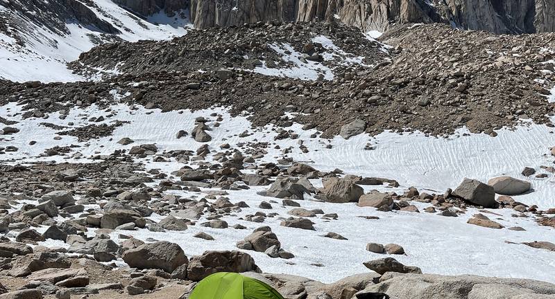
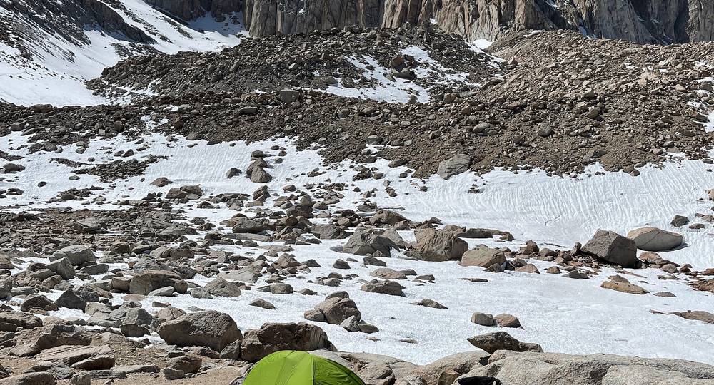
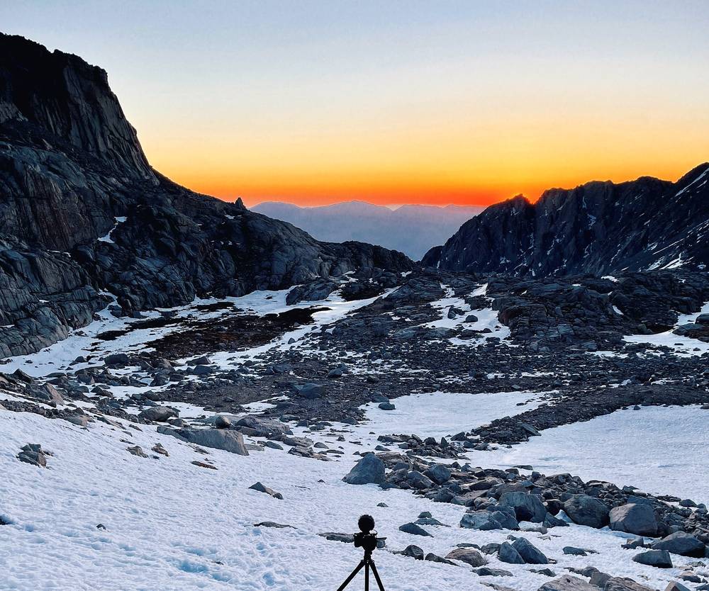
My tent at Trail Camp under the needles, Day 1, 2:25 p.m. 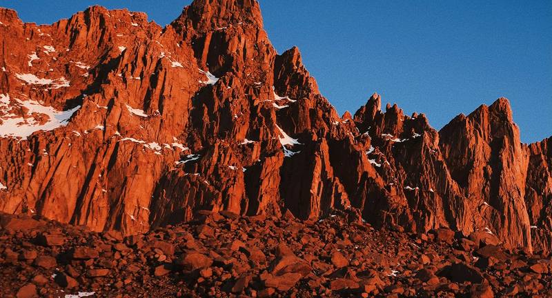
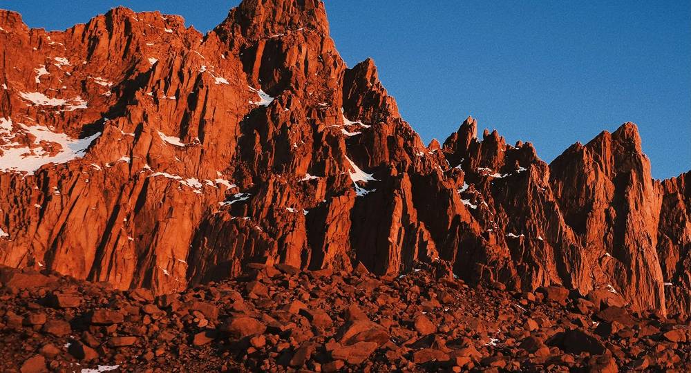
The first sun on the needles above Trail Camp, Day 2, 6:09 a.m.
Newsletter
Get my letter
Get a short letter from me every couple of weeks: new trips, guides and what I'm building.
Free. Unsubscribe any time.
Details
The guide · Free · 41-page PDF + GPX files · 2027 season edition
Mount Whitney Hiking Guide
Whitney Portal to the highest point in the lower 48 in 2 days. Every page is below: read it here, or take it offline as a PDF with my GPX files (41-page PDF + GPX files, in one zip). No sign-up needed.
The route
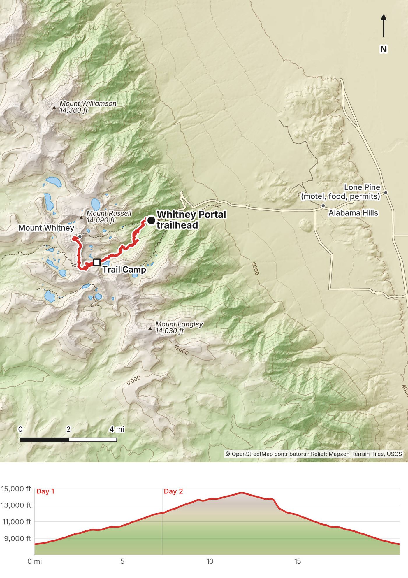
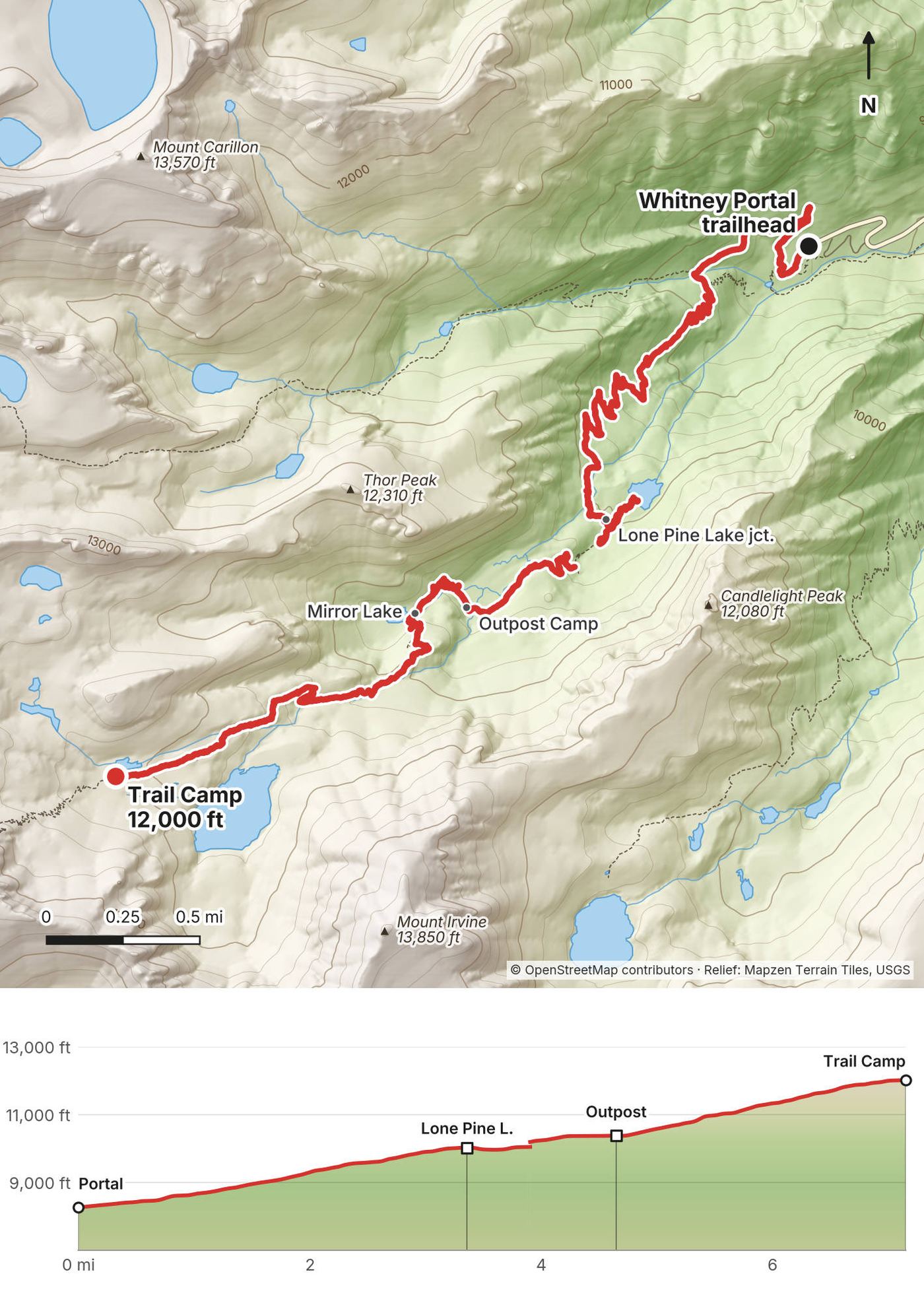
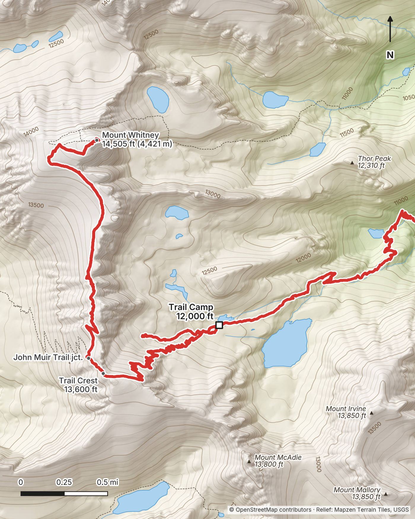
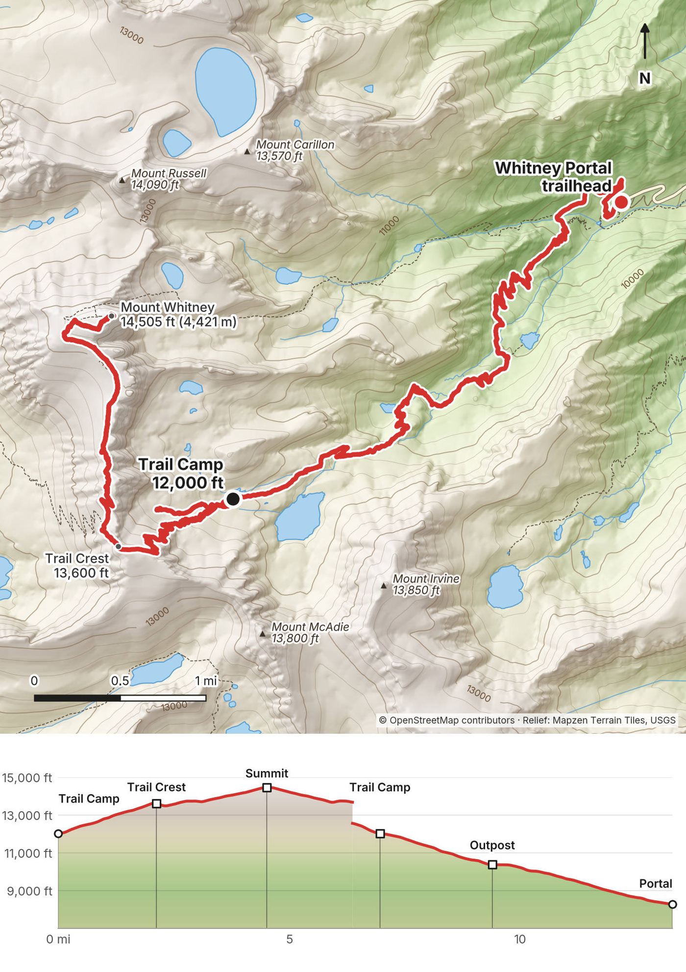
My GPS recording of 2 days on a relief map. The numbers are where each day starts; the red dot is the finish. The day maps are in the guide below, and the GPX files are a free download.
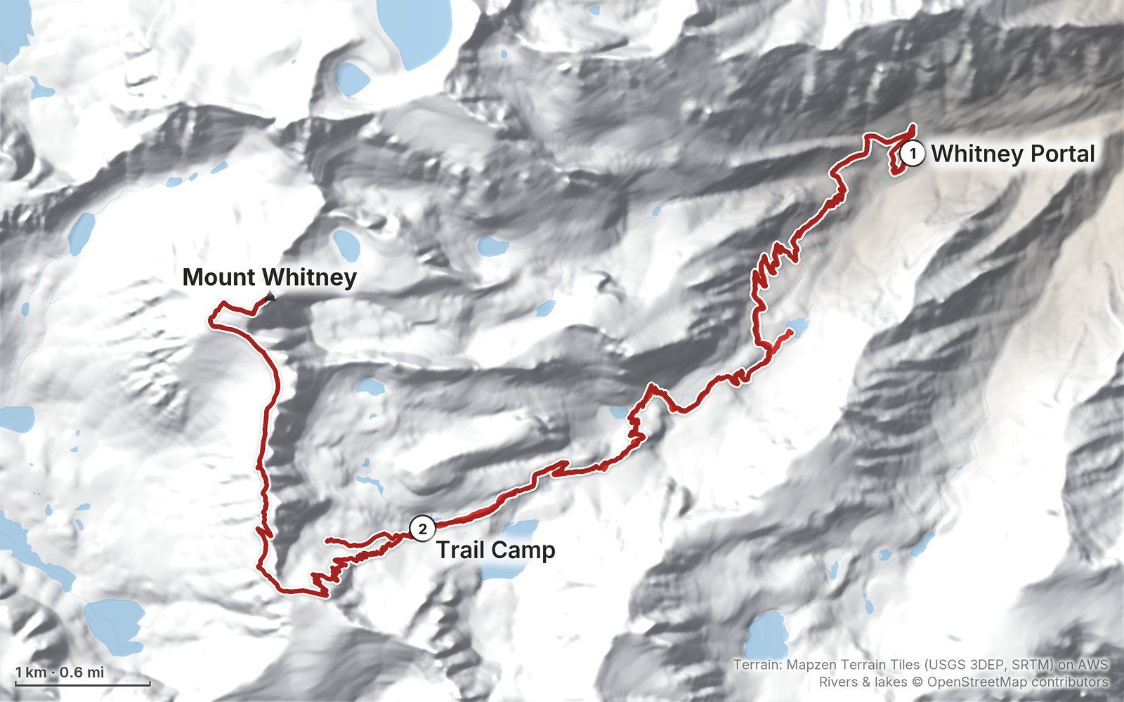
Elevation, start to finish: highest 14,480 ft (4,414 m), lowest 8,270 ft (2,520 m).
At a glance
- Days
- 2 days
- Distance
- 20.8 miles
- Climbing
- About 6,500 ft (1,980 m) up
- Nights
- Trail Camp, about 12,000 ft (3,660 m), about 6 miles up
- Permit
- Required all year
- Start and end
- Whitney Portal
Contents
- Welcome
- At a glance
- Is it open? (October 2026)
- Straight answers
- When to go
- Permits and the rules
- Getting there
- Day 1 Whitney Portal to Trail Camp
- Day 2 Trail Camp to the summit and down to Whitney Portal
- Other ways to do it
- Where I slept, food and water
- What it costs
- What I carried
- Weather, altitude and safety
- Using the GPX files
- Before you go, check these
- One-page trip sheet
- About this guide
Welcome
In April 2021 I hiked Mount Whitney, the highest point in the lower 48 states, 14,505 ft (4,421 m), on the Mount Whitney Trail from Whitney Portal. I flew from New York to Las Vegas, drove through Death Valley to the small town of Lone Pine, and did it in two days: up to Trail Camp, about 12,000 ft, on the first day, where I slept to get used to the altitude, then up the switchbacks to Trail Crest, along the back of the ridge to the summit, and all the way back down to my car on the second. About 20.8 miles by my GPS: 7.3 on the first day and 13.6 on the second. It's the trip from my film Summiting Mt Whitney in California.
I went before May 1, outside the permit lottery season, with snow still on the upper mountain. That made the permit easy and the switchbacks harder.
Good to know first (October 2026). The trail and Whitney Portal Road are open. You need a permit for any visit, day or overnight, all year. From May 1 to November 1 the permits go by a lottery you enter in February. Outside that season there's no quota, but there's usually snow and ice above Trail Camp, and the road is gated below the trailhead for the winter. See Is it open?.
What's inside
- Where things stand in October 2026, and straight answers to the questions people ask about Whitney
- When to go, the permit lottery and the off-season permits, the rules, and getting to Whitney Portal
- Both days: my notes, the trail, where to turn back, maps with elevation profiles, and links to that day in my film
- Other ways to do it, where I slept, food and water, what it costs, what I carried
- Weather, altitude and safety, one page of things to check before you go, and a printable trip sheet
How to use it offline
Save this PDF to your phone's Files or Books app before you leave home. Load the GPX files and download offline maps in Lone Pine; there's little or no signal on most of the trail. Each day starts on a new page. The film links need a connection; everything else works in airplane mode.
When I say "I," it's my own trip. Rules, quotas and fees change, so they're dated, and the checks are collected on one page: Before you go, check these. Times are Pacific time.
At a glance
| Quick facts | |
|---|---|
| Distance | 20.8 miles (33.5 km) by my GPS. The official figure is 10.7 miles each way, 21.4 round trip |
| Climbing | About 6,500 ft (1,980 m) up and 6,510 ft (1,985 m) down |
| Days | 2: 7.3 miles on Day 1, 13.6 on Day 2 |
| Start and finish | Whitney Portal, 8,360 ft (2,550 m), 13 miles up the road from Lone Pine |
| High point | Mount Whitney, 14,505 ft (4,421 m), the highest point in the lower 48 states |
| Sleep | Trail Camp, about 12,000 ft (3,660 m), about 6 miles up |
| Difficulty | A long, steady climb on a good trail, then thin air, the 99 switchbacks and a rocky ridge. Snow and ice turn it into a mountaineering route |
| Permits (2026) | Required all year. Lottery for May 1 to November 1; $15 per person plus a $6 reservation fee |
| Day | Route | Miles (km) | Up / down (ft) | Sleep |
|---|---|---|---|---|
| 1 | Whitney Portal to Trail Camp | 7.3 (11.7) | 3,793 / 45 | Trail Camp, about 12,000 ft |
| 2 | Trail Camp to the summit and back down to Whitney Portal | 13.6 (21.8) | 2,707 / 6,468 |
Distances and climbing are from my GPS, which reads long on the switchbacks (11.8 miles to the summit against the official 10.7). The Portal, Trail Crest and summit heights are official; the others are "about."
Is it open? (October 2026)
Checked on the Inyo National Forest's, recreation.gov's, Sequoia and Kings Canyon National Parks' and Inyo County's own pages on October 2, 2026.
Open. The Inyo National Forest listed no closure on the Mount Whitney Trail, and Inyo County's road status page (August 11, 2026) showed Whitney Portal Road open all the way up. Hikers reported the trail clear of snow from top to bottom at the end of September 2026.
The road was closed for 17 months. Hurricane Hilary washed out Whitney Portal Road in August 2023. It reopened on January 25, 2025, as reported. If you read old trip reports from 2024, that's why they talk about the road being closed.
Every winter the road is gated. The upper road isn't plowed. It's gated below the switchbacks from about mid-November and usually reopens by late April. In 2026 the last gate, near the trailhead, opened on April 25, as reported. For an April trip like mine, check the road first: you may have to walk up from a lower gate.
Snow. The Forest Service says the trail is usually fairly free of snow from late June to mid-October. Before and after that, expect snow and ice above Trail Camp. See When to go.
The Whitney Zone order. The permit rule for the Whitney Zone is a Forest Service order that runs from June 18, 2025 to June 18, 2027. A renewal is expected; check that it's still in force.
What to do. Check the Inyo National Forest's alerts page and Inyo County's road status page the week before, and call the Eastern Sierra Interagency Visitor Center in Lone Pine, (760) 876-6200, about the snow.
Straight answers
How many days do I need? Two is what I did: up to Trail Camp on the first day, the summit and all the way down on the second. With a day permit you do it all in one long day. With the drive, I spent four days: in on the first, hike for two, out on the fourth.
How hard is it? Day 1 was pretty easy, even though it's pretty much a staircase up, up, up: about 3,800 ft of climbing over 7.3 miles by my GPS, on a good trail. Day 2 was much harder: the switchbacks to Trail Crest, the ridge to the summit at over 13,000 ft, where the last hour is false summits, and then more than 6,400 ft down to the car. If you're thinking about doing this hike, I'd say you should have some experience first.
Do I need a permit for a day hike? Yes. It's unusual to need a permit for day hikes, but this is so popular that it's required. From May 1 to November 1 you need to win the lottery in February or pick up a leftover date. See Permits and the rules.
Do I need crampons and an ice axe? It depends on the month and the snow year. In late April 2021 I wore microspikes. Some people were wearing crampons, and I felt that was probably overkill, but it totally depends on the snow level that year. The national park says ice axes and crampons are needed in spring and early summer, and microspikes aren't enough on steep, continuous snow. Hikers have died on the snowy switchbacks, including in October 2025, as reported. In a typical summer, about July to September, most people need neither, but an early storm can ice the switchbacks in any month, so check conditions the week before you go.
Can I sleep near the top? Not on the summit. Trail Camp, at about 12,000 ft, is the highest usual camp, and Outpost Camp, at about 10,400 ft, the lower one. Camping in the stone hut on the summit isn't allowed.
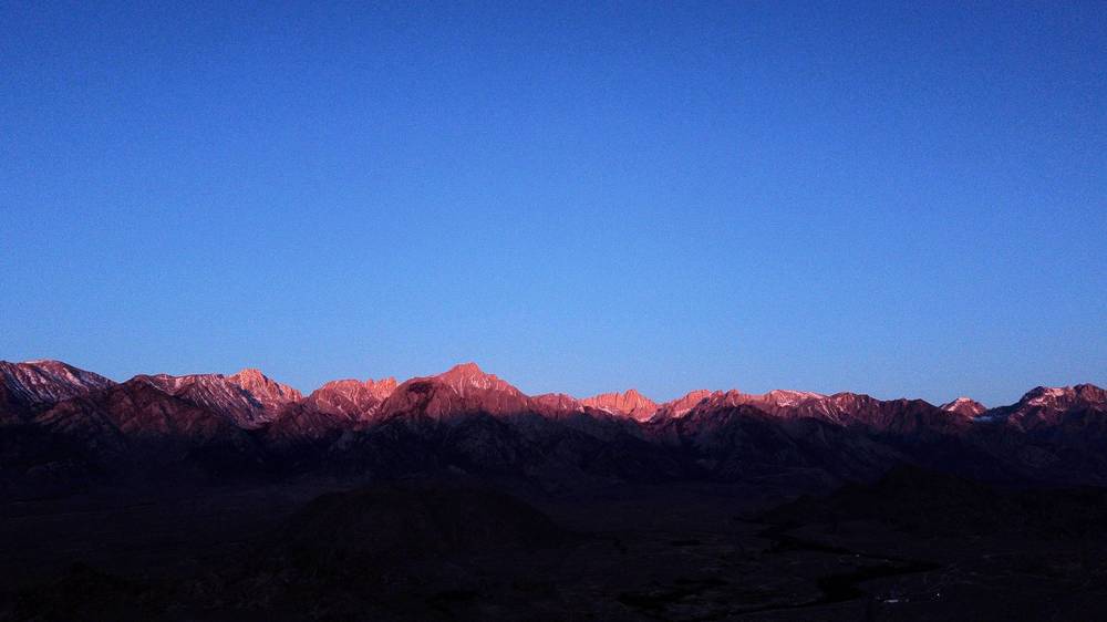
Can I fly a drone? Not on the trail. It's wilderness, and the summit is in Sequoia National Park, which bans them too. I flew my drone in the Alabama Hills below the mountains instead; the Bureau of Land Management now asks for a drone permit there.
Can I bring my dog? Only on the Forest Service part of the trail, below Trail Crest. Dogs aren't allowed into Sequoia National Park, so not to the summit.
Is there a phone signal? Not reliably. Reports say there's some on the summit and parts of the switchbacks, best on Verizon, and none to count on at Trail Camp. Carry a satellite messenger or a phone with satellite SOS.
When to go
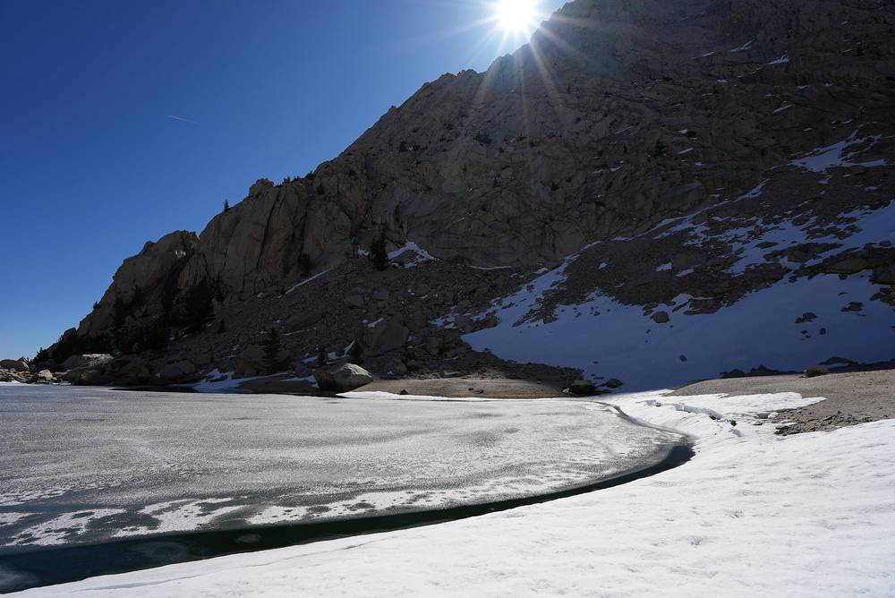
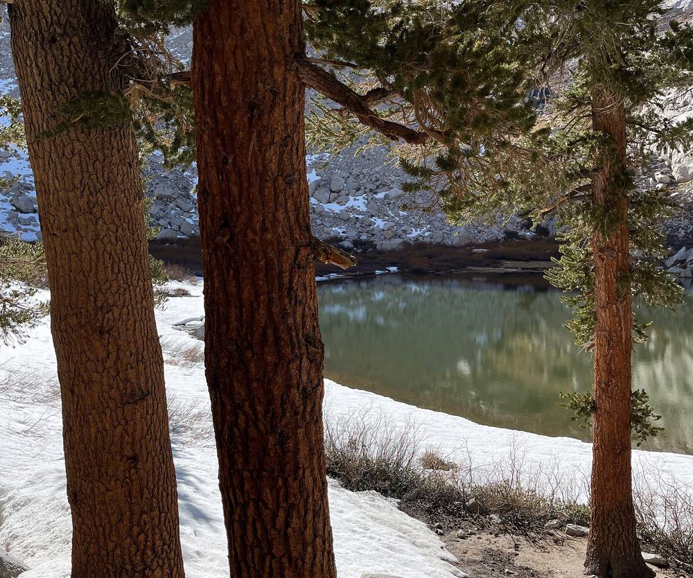
Late April. I hiked on April 22 and 23, a week before the lottery season started on May 1. Lone Pine Lake was frozen, there was snow on the trail from there up, and snow on the switchbacks, where I wore microspikes. The days were clear and sunny. At night at Trail Camp I had all my jackets on, my warm sleeping bag and hand warmers in the foot box, and I was still pretty cold.
Summer. July to September is when the trail is usually snow-free and when most people go. It's also the lottery season and the season for afternoon thunderstorms: a hiker was killed by lightning on the summit in 1904, which is why the stone hut was built. Start early and be off the summit by early afternoon.
Late spring and autumn. May, June and October bring snow and ice in some years and not others. The first autumn snow can come in October, and in a big snow year the switchbacks above Trail Camp can be snowed in well into June.
Winter. From about November to April it's a winter mountaineering trip: snow, ice, short days and the road gated miles below the trailhead.
Near the summit (estimated normals for about 13,600 ft, 1991 to 2020, from PRISM as published on Wikipedia; add wind chill):
| Month | High / low °F (°C) | Precipitation, in |
|---|---|---|
| January | 25 / 6 (-4 / -14) | 8.4 |
| February | 23 / 3 (-5 / -16) | 8.9 |
| March | 26 / 5 (-3 / -15) | 5.8 |
| April | 31 / 8 (-1 / -13) | 3.9 |
| May | 39 / 13 (4 / -11) | 1.9 |
| June | 49 / 22 (9 / -6) | 0.5 |
| July | 55 / 27 (13 / -3) | 0.3 |
| August | 55 / 27 (13 / -3) | 0.2 |
| September | 50 / 24 (10 / -4) | 0.3 |
| October | 42 / 19 (6 / -7) | 1.9 |
| November | 32 / 12 (0 / -11) | 2.5 |
| December | 24 / 6 (-4 / -14) | 7.9 |
Trail Camp is about 1,600 ft lower than this, so a few degrees warmer. Lone Pine, at about 3,700 ft, is far warmer: hot in summer, mild by day in winter.
Permits and the rules
These were checked on the Inyo National Forest's and recreation.gov's own pages on October 2, 2026, unless I say otherwise.
A permit, all year. You need a wilderness permit for any visit to the Mount Whitney Zone, day or overnight, in every season. Day-use and overnight permits are different permits, and you can't get day permits for consecutive days.
The lottery (May 1 to November 1). In this season the Forest Service allows 100 day hikers and 60 overnight hikers a day. Apply on recreation.gov (permit 445860) from February 1 to March 1; the results are posted on March 15. If you win, you must pay and confirm by 9 p.m. Pacific time on April 21. Leftover dates go on sale first come, first served at 7 a.m. Pacific time on April 22, and cancellations come back onto the calendar within a day. Expect the same dates for 2027; they weren't announced yet.
Outside the lottery (November 2 to April 30). There's no quota. Permits open on recreation.gov two weeks before your trip.
How I did it, 2021. Before May 1, all I had to do was reserve a backcountry campsite on recreation.gov. I booked one night at Trail Camp, then sent an email to a ranger, who confirmed my entry and exit points and where I was spending the night, and made sure I knew the rules about the bear can and packing out waste. I printed the permit and brought it with me. Today the official pages describe only booking online and printing it yourself; I found no mention of a ranger email.
Fees (2026). $6 per permit to reserve, plus $15 per person for the Whitney Zone. No refunds, no rain checks, no discounts.
Print it. Print your permit from 7 days before your trip, sign it, and carry it. The deadline is noon the day before for a day permit, and 10 a.m. on your start day for an overnight permit; if you don't print it in time, you're counted as a no-show and it's cancelled. Groups are 15 people at most, and only the leader or alternate named on the permit can use it.
Pack out your waste. Everyone has to carry out their solid human waste in a pack-out kit (a WAG bag). They're free with the permit, at the visitor center in Lone Pine all year and at the trailhead in summer. The Forest Service's trail brochure says to put used kits only in the bin by the trailhead toilets, and not to keep them in your bear can.
Bear cans. Store your food and trash in a bear-resistant canister on the trail. Bears live in these mountains, and you protect your food to protect them. I rented one for two days at Elevation in Lone Pine. Use the bear lockers at the trailhead for anything left in your car.
Other rules. No campfires at any elevation. No camping at Mirror Lake or Trailside Meadow; camp at least 100 ft from water. No drones. No dogs past Trail Crest. No camping or staying the night in the summit hut.
Getting there
My way in, 2021. I flew from New York all the way to Las Vegas, the biggest airport close to Lone Pine. It was still a four-hour drive through the desert, through Death Valley National Park, over to Lone Pine. In town I got dinner at the Mt. Whitney Restaurant, which has good burgers, stayed at the Mt. Whitney Motel, two stars, less than $100 a night, very cheap and easy, and went to Elevation, a store for hikers that has everything you might need, including bear can rentals.
On the first morning I took my time. I went over to the Alabama Hills, the rocks just outside Lone Pine where films like Iron Man were shot, and got some drone shots. Once I was ready, I drove up to Whitney Portal, parked my car and started the hike.
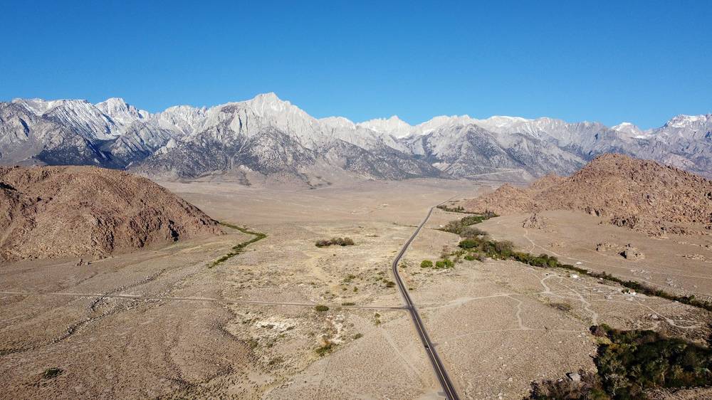
Driving (2026). Lone Pine is on US-395. Whitney Portal Road runs west from US-395 in town, about 13 miles up to the trailhead, past the turnoff for the Alabama Hills' Movie Road. Parking at the trailhead is limited. Rough drive times: Las Vegas about 4 hours through Death Valley (fill up in Pahrump; there's little fuel until Lone Pine, and it's expensive), Los Angeles about 3.5 to 4 hours, Reno about 4.5 to 5 hours, Mammoth Lakes about 1 hour 45 minutes. Death Valley is extremely hot in summer: carry water.
Without a car. Eastern Sierra Transit runs a daily bus between Reno and Lone Pine ($59 in 2026) and connects Lone Pine with Mammoth and Lancaster. Nothing runs up to Whitney Portal: you need a car, a private shuttle (about $80 for the first person and $25 for each extra, as reported in 2024) or a ride.
The visitor center. The Eastern Sierra Interagency Visitor Center is on US-395 at the junction with Highway 136, about a mile south of Lone Pine, open daily from 8:30 a.m. to 4:30 p.m. It has the free waste kits and rents bear cans.
Sleep high the night before. I came from sea level in New York, slept in Lone Pine and then went straight to sleep at 12,000 ft. Coming from sea level was definitely a disadvantage. A night or two at about 8,000 ft first helps a lot: Whitney Portal Campground is at about 8,100 ft, just below the trailhead ($34 a night in 2026, reservable on recreation.gov, open from about late May; it closes October 26 in 2026).
Day 1: Whitney Portal to Trail Camp
- Distance
- 7.3 mi (11.7 km)
- Climbing
- 3,793 ft (1,156 m)
- Descent
- 45 ft (14 m)
- Time I took
- 5.1 hours (8:06 a.m. to 1:14 p.m.), about 4.6 of them moving
- High point
- Trail Camp, about 12,000 ft (3,660 m)
- On the way
- the Lone Pine Lake turnoff (mile 3.4), the Whitney Zone sign (3.8), Outpost Camp (4.8), Mirror Lake (5.2)
- Sleep
- Trail Camp, about 12,000 ft
- Water
- lakes and streams up to Trail Camp; treat it all
My day
I started recording at Whitney Portal at 8:06 a.m. after my morning in the Alabama Hills. Even though it was pretty much a staircase up, up, up, Day 1 was pretty easy. I got a late start and had the entire day just to get to Trail Camp. My pack was about 22 pounds plus the camera, pretty light for an overnight.
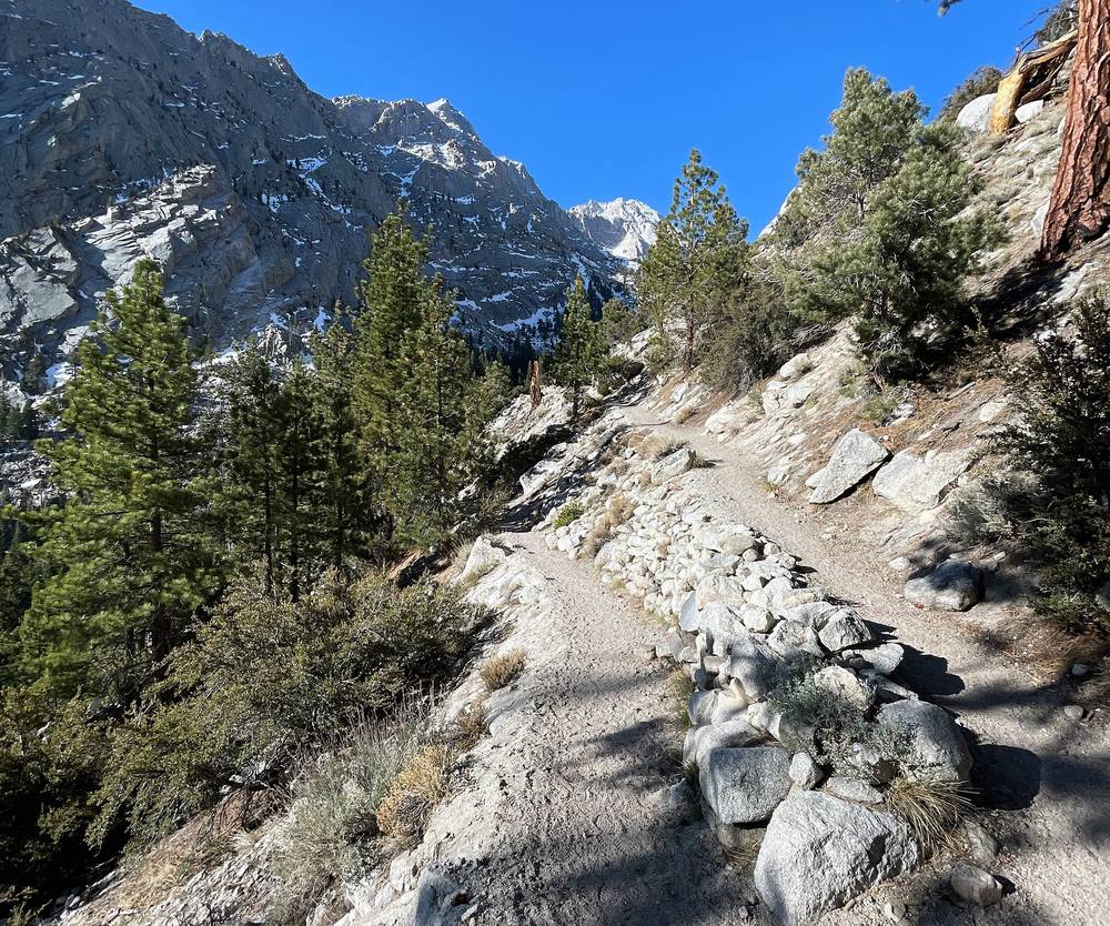
The trail climbs out of the pines with views back east over the Owens Valley. Fighter jets were flying all around the valley that day. I walked out to Lone Pine Lake, still frozen, at about 10 a.m., and passed the sign for the Whitney Zone just after it.
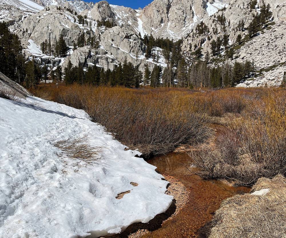
I passed Outpost Camp at 10:45 and Mirror Lake at 11:08, then climbed above the trees onto the granite.
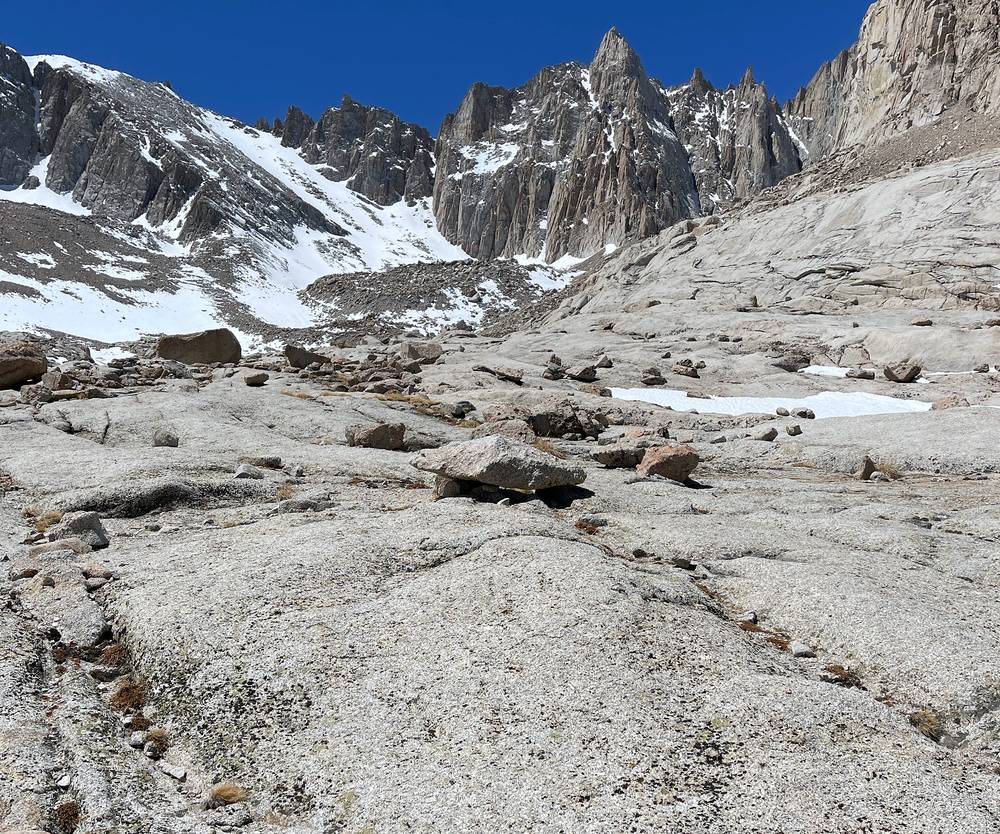
I got to Trail Camp at 1:14 p.m. and had plenty of time to just relax and get used to the altitude, eat and drink. I pitched my tent among the rocks below the needles, cooked on my stove, and I think I slept 12 or 13 hours.
The trail
Whitney Portal. The trailhead, 8,360 ft (2,550 m), has toilets, bear lockers, a store and cafe in season, and the bin for used waste kits. The trail starts at the big sign by the end of the road.
To Lone Pine Lake. The trail climbs in long switchbacks out of the pines and onto open, sunny slopes. At mile 3.4 by my GPS, about 10,000 ft, a short side trail goes down to Lone Pine Lake (the Forest Service puts the lake about 2.5 miles from the trailhead). By the order's description of the Zone, the lake itself is just outside it.
The Whitney Zone. At mile 3.8 by my GPS a sign marks the start of the Zone. From here you need a Whitney permit.
Outpost Camp. At mile 4.8 by my GPS (3.8 miles from the trailhead by the Forest Service's count), about 10,400 ft, Outpost Camp is the lower of the two usual camps, in Bighorn Park, a flat meadow with a waterfall nearby.
Mirror Lake to Trail Camp. Mirror Lake, at mile 5.2, about 10,600 ft, is a small lake in the last trees; no camping here. Above it the trail leaves the trees and climbs the granite, past Trailside Meadow (also no camping), to Trail Camp. Consultation Lake is just off the trail below it.
Trail Camp. At mile 7.3 by my GPS (6 miles by the Forest Service's count), about 12,000 ft, Trail Camp is a field of tent spots among the boulders by a small lake, above tree line and exposed to wind. The 99 switchbacks climb the wall above it to the west. It's the last reliable water before the summit once the snow melts: the Forest Service says to take 3 liters from here.
Where to turn back
The only way off is back down the way you came. From Outpost Camp the Portal is about 4 miles and 2,000 ft down. Turn back if the altitude is hitting you badly (a headache that gets worse, vomiting, confusion), if a storm is coming, or if the snow is more than your gear and experience can handle. The trail is in shadow and refreezes in the afternoon, so don't start the climb above Outpost Camp late in a snowy season.
Watch this day
Day 1 · The route and how I planned it (from 7:35)
Day 2: Trail Camp to the summit and down to Whitney Portal
- Distance
- 13.6 mi (21.8 km)
- Climbing
- 2,707 ft (825 m)
- Descent
- 6,468 ft (1,971 m)
- Time I took
- 12.4 hours (5:52 a.m. to 6:19 p.m.), about 8.0 of them moving
- High point
- Mount Whitney, 14,505 ft (4,421 m)
- On the way
- Trail Crest (mile 2.1), the John Muir Trail junction (2.3), the summit (4.5), back at Trail Camp (7.2)
- Finish
- Whitney Portal, 8,360 ft (2,550 m)
- Water
- carry it from Trail Camp; above it there's none once the snow melts
My day
I was up before sunrise to watch the first light hit the needles above Trail Camp. I started recording at 5:52 a.m.
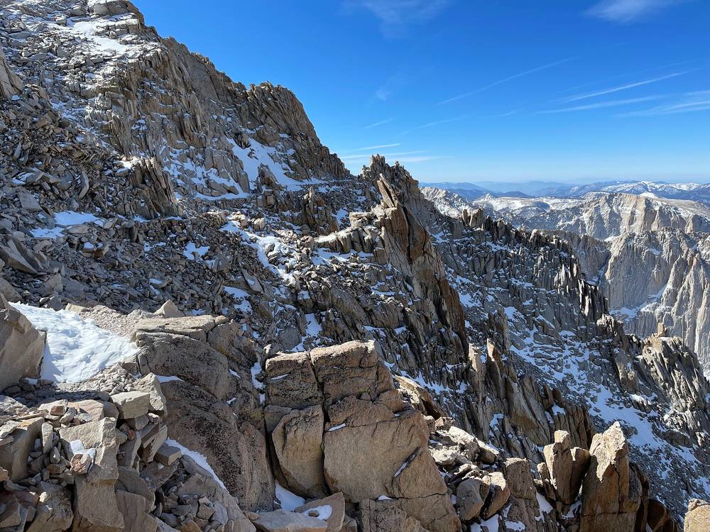
Right above camp are all the switchbacks: people call them the 99 switchbacks. I didn't count them, but it definitely felt like a hundred. I was wearing microspikes. Some people go straight up the snow slope beside them with ice axes when the switchbacks are snowed in. I reached Trail Crest, 13,600 ft, at 8:23.
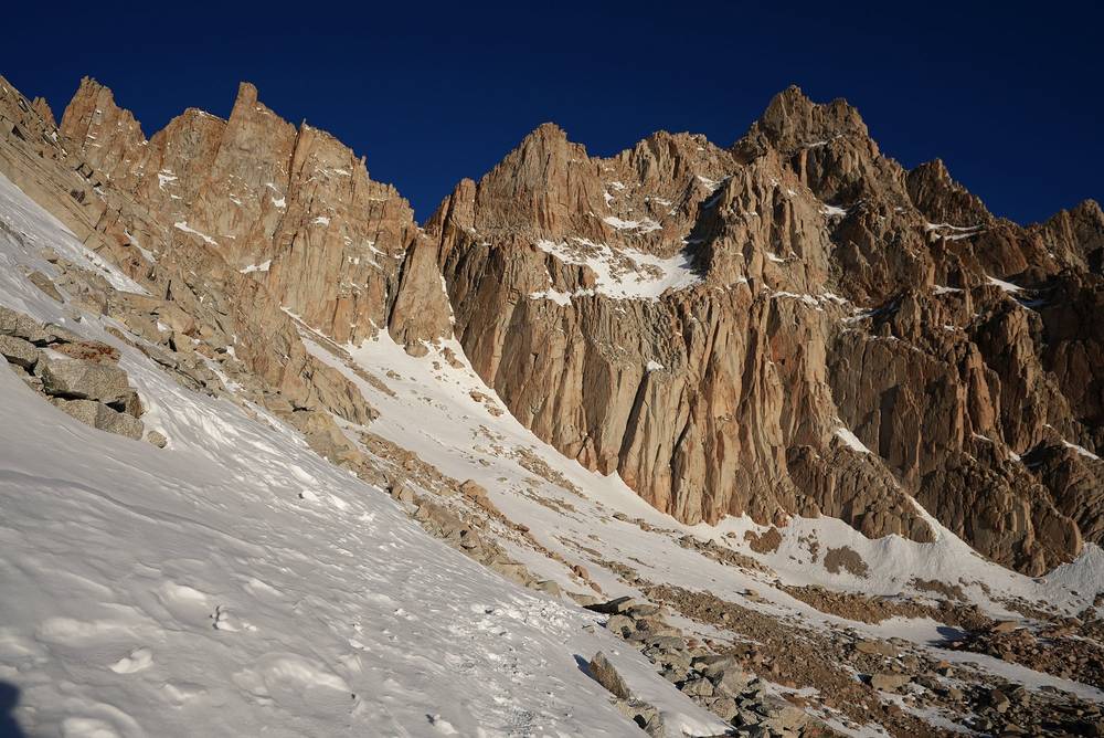
Over the saddle, along the back side of the ridge, it completely changes. It's so smooth and different compared to the steep, jagged drop-off on the other side. It was really cool looking back and taking photos of the sawtooth needles from that angle. Once you start to come up on the last point, that section takes forever: it's a false summit for the last hour. I reached the top at 11:06 a.m. and stayed until 11:42, with crazy views 360 degrees all around.
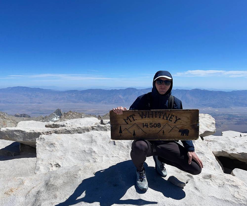
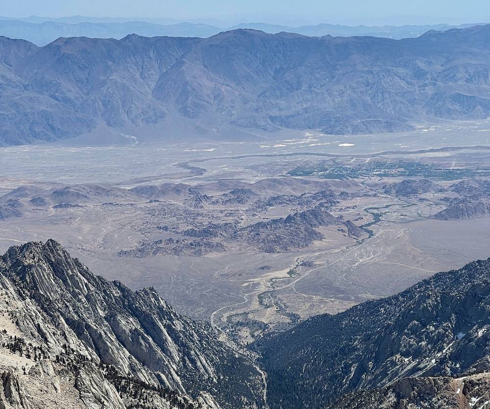
I made it back down to Trail Camp in the early afternoon (my recording paused from 1 p.m. on the switchbacks and started again at 2:31), packed up my tent, and left at 3:40. Then I spent the next two or three hours just huffing all the way back down to my car, past Mirror Lake and Outpost Camp, and reached it at 6:19 p.m. I drove back into town, got some food, stayed at a hotel and had a nice shower, then drove back to Las Vegas the next day.
The trail
The 99 switchbacks. From Trail Camp the trail climbs about 1,600 ft in tight switchbacks up the wall to Trail Crest, about 2 miles. Partway up, a section with a cable handrail often holds ice, as reported. The Forest Service warns that from the cables to Trail Crest a slip or fall can be fatal. When they're snowed in, climbers use the chute, a steep snow slope beside them, with ice axe and crampons. Don't cut the switchbacks.
Trail Crest. At 13,600 ft, the crest is the boundary of Sequoia National Park: you cross from the east side to the west, with the whole Sierra in front of you. No dogs past here.
The John Muir Trail junction. A little past Trail Crest, at mile 2.3 by my GPS, the John Muir Trail joins from the west. The John Muir Trail ends on the summit, so from here you share the trail with people finishing it.
Along the ridge. The last 2 miles or so, from the junction, run along the west side of the crest, below the needles. Then the trail climbs the summit's broad, rocky slope. It's not technical, but it's slow at this altitude.
The summit. 14,505 ft (4,421 m). There's a stone hut, built in 1909 after a hiker was killed by lightning up here; it's not a lightning shelter, and you can't sleep in it. On my trip a wooden sign was on the summit rocks.
Down to the Portal. It's the same trail back over Trail Crest, down the switchbacks to Trail Camp, then the Day 1 trail down to Whitney Portal: about 9 miles and over 6,000 ft down from the summit. Sliding down the snow from Trail Crest isn't a safe option, an older Forest Service brochure says; people have been hurt and killed doing it.
Where to turn back
The way off is back the way you came. Set a turnaround time before you leave camp and keep it; I found no official one, but the common practice is to be on top by noon or 1 p.m. and to turn around at the first thunder. Turn back below the switchbacks if they're icy and you don't have crampons, an ice axe and the skill to use them, and turn back anywhere if the altitude is getting worse: descent is the only treatment. The summit and the ridge are no place to be in a storm.
Watch this day
Day 2 · The switchbacks and the ridge (from 10:47)
Other ways to do it
In one day
Most permits are day permits (100 a day in the lottery season, against 60 overnight): Whitney in one very long day, about 21 to 22 miles round trip and over 6,000 ft up and down, starting well before dawn. Day hikers take about 12 to 16 hours, as reported. It's harder on the altitude, since you don't sleep up high first, so spend a night or two at around 8,000 ft before.
Three days
With an overnight permit you can sleep at Outpost Camp on the first night and Trail Camp on the second, which spreads the climbing and gives your body more time at altitude. Lone Pine Lake and Consultation Lake are also allowed camps.
The Mountaineers Route
A shorter, much steeper route up the north fork of Lone Pine Creek and the chute on the east face. It's in the Whitney Zone and needs the same permit, plus scrambling and, in snow, ice axe and crampon skills. I didn't do it.
From the west
Long trips like the John Muir Trail finish on Whitney from the west and walk out to Whitney Portal. They need a permit from where they start, with "Mt Whitney (Trail Crest Exit)" as the exit.
Where I slept, food and water
Where I slept
| Night | Where | Height |
|---|---|---|
| Before | The Mt. Whitney Motel in Lone Pine | about 3,700 ft |
| 1 | My tent at Trail Camp (Day 1 mile 7.3) | about 12,000 ft (3,660 m) |
| After | A hotel in Lone Pine | about 3,700 ft |
Trail Camp. Tent spots among the boulders and snow, with the needles above. I had all my jackets, my warm sleeping bag and hand warmers in its foot box, and I was still pretty cold that night. Bring a tent or shelter that can take the wind up there.
Food and water
What I ate. I bought food at Elevation in Lone Pine and cooked on a small stove at Trail Camp. My food went in the rented bear can.
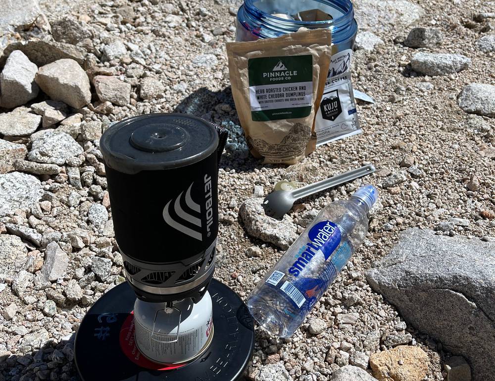
Water. There's water in lakes and streams up to Trail Camp; treat or filter it all. Above Trail Camp there's no water once the snow melts, so take about 3 liters from there for the summit. In spring the lakes and the Trail Camp tarn can be frozen, so bring a stove that can melt snow.
After. Back in town I got food, a shower and a bed. The Whitney Portal Store at the trailhead sells burgers and breakfast in season (from about May to October) and has a pay shower, as reported.
What it costs
I didn't keep a full list of what this trip cost me. The motel was less than $100 a night, and I rented the bear can for two days.
For your budget (2026, US dollars):
| Item | Cost |
|---|---|
| Permit, overnight or day | $15 per person, plus $6 per permit |
| Waste kits | Free with the permit |
| Bear can rental at Elevation | About $5 for 24 hours, $7.50 for 48, as reported |
| A motel in Lone Pine | About $80 to $160 a night, as reported |
| Whitney Portal Campground | $34 a night per site |
| A rental car from Las Vegas, 4 days | About $200 to $350 plus taxes (estimate) |
| Gas, Las Vegas to Lone Pine and back with the Portal runs | About $85 (estimate) |
That's roughly $550 to $950 for one person for three nights from Las Vegas, before food and flights, or about $300 to $500 each for two sharing the car and the room. Permits can't be refunded.
What I carried
From my film and photos (I have no full gear list for this trip):
- Pack: about 22 pounds plus the camera, for one night
- Sleeping: a small one-person tent, my warm sleeping bag and hand warmers for its foot box
- Clothes: all my jackets; it was cold at night even so
- Snow: microspikes on the switchbacks
- Food: a small stove and the rented bear can
- Camera: a Sony A7S III with its standard picture profile, a tripod for the sunrise at Trail Camp, and a drone, which I flew only in the Alabama Hills. My full gear kit is on kraigadams.com
- Navigation: the AllTrails app, which recorded both days
What this hike needs:
- Your permit, printed and signed, and the free waste kits
- A bear can, warm layers, a hat, gloves, sun protection and a headlamp
- About 3 liters of water from Trail Camp, a filter, and a stove that can melt snow in spring
- In snow: crampons, an ice axe, a helmet and the experience to use them (microspikes only for patches late in the season)
- A satellite messenger or a phone with satellite SOS
Weather, altitude and safety
Emergencies. Call 911. Inyo County Search and Rescue answers about 50 calls a year, most of them on the Whitney Trail in summer. There's little or no signal on most of the trail, so carry a satellite messenger and leave your plan with someone.
Altitude. Coming from sea level in New York was definitely a disadvantage: the altitude above 13,000 ft is going to hit you a lot harder than coming from somewhere like Colorado. That's why I spent the night halfway up. Even so, I went from a night in Lone Pine, about 3,700 ft, to a night at 12,000 ft, a much bigger jump than doctors advise. The CDC says two or three nights at 8,000 to 9,000 ft before going higher is strongly protective. Watch for headache, dizziness and nausea, and go down if it gets worse.
Snow and ice. Steep snow on the switchbacks and around Trail Crest is the biggest danger outside summer. Some of the edges are pretty steep, and if you fall, you might be falling for a while. Deaths were reported on snow or ice in January 2025, October 2025 on the switchbacks, and January 2026. If there's snow, it's going to require some patience: step carefully, use crampons and an ice axe, and turn back if it's beyond you.
Lightning. July and August bring afternoon thunderstorms. The summit, the ridge and Trail Crest are exposed, and the summit hut isn't safe in lightning. Be off the top by early afternoon and turn around at the first thunder.
Cold and wind. Even on a sunny April day it was cold at Trail Camp at night. The summit averages below freezing at night in every month of the year.
The long way down. The descent from the summit to the Portal is over 6,000 ft. Save energy and daylight for it: I reached the car at 6:19 p.m.
Using the GPX files
My own GPS recordings, with all timestamps removed.
| File | What it is |
|---|---|
| mount-whitney-day-1.gpx | Day 1: Whitney Portal to Trail Camp, 7.3 mi |
| mount-whitney-day-2.gpx | Day 2: Trail Camp to the summit and back down to Whitney Portal, 13.6 mi |
| mount-whitney-full-route.gpx | Both days in one file, with waypoints for the places in this guide |
The tracks show where I actually went: a record of my trip, not an official trail line. They include my walk out to Lone Pine Lake on Day 1, and on Day 2 the trail between Trail Crest and the Portal appears twice. My app paused twice: briefly before the Whitney Zone sign on Day 1, and from 1 p.m. to 2:31 p.m. on the switchbacks on Day 2, so there's a gap in the track there. Each gap starts a new track segment, and my mileage counts a straight line across it.
AllTrails: on alltrails.com, create a new map and use Import (offline maps need a paid plan). Gaia GPS: open the file on your phone and choose Gaia GPS, or Import on gaiagps.com. Garmin: Garmin Connect on the web, Training, Courses, Import, then send it to your watch. Organic Maps (free): download the offline map for California, then open the GPX file with it.
Before you go, check these
These change every year. Everything else in this guide stays the same.
Permits
- The lottery on recreation.gov (permit 445860), February 1 to March 1, results March 15, pay by April 21; or leftover dates from 7 a.m. on April 22; or, outside the season, booking two weeks ahead
- Print and sign your permit by the deadline (noon the day before for a day permit, 10 a.m. on the day for overnight)
- That the Whitney Zone order has been renewed after June 18, 2027
Is it open?
- The Inyo National Forest's alerts page and Inyo County's road status page for Whitney Portal Road
- The snow on the switchbacks, from the visitor center, (760) 876-6200
- The forecast for the summit area (forecast.weather.gov) for thunderstorms and wind
Getting there
- Your car or shuttle to the Portal, and your bed in Lone Pine or at Whitney Portal Campground
Your stuff
- Bear can, waste kits, warm layers, a headlamp, water treatment, and snow gear if there's snow
- Offline maps and the GPX files on your phone, and a satellite messenger
One-page trip sheet
| Day | mi (km) | From, to | Sleep | Notes |
|---|---|---|---|---|
| 1 | 7.3 (11.7) | Whitney Portal to Trail Camp | Trail Camp, about 12,000 ft | Lone Pine Lake turnoff 3.4, Whitney Zone 3.8, Outpost Camp 4.8, Mirror Lake 5.2 |
| 2 | 13.6 (21.8) | Trail Camp to the summit and down to Whitney Portal | Trail Crest 2.1, JMT junction 2.3, summit 4.5, Trail Camp 7.2 | |
| Total | 20.8 (33.5) | About 6,500 ft up, 6,510 ft down |
Miles are from my GPS, which reads long; officially it's 10.7 miles from the Portal to the summit.
Places: Lone Pine · the Alabama Hills · Whitney Portal, 8,360 ft · Lone Pine Lake · Outpost Camp · Mirror Lake · Trail Camp, about 12,000 ft · the 99 switchbacks · Trail Crest, 13,600 ft · the John Muir Trail junction · Mount Whitney, 14,505 ft
Status (October 2026): open; Whitney Portal Road open. The road is gated in winter, and there's snow above Trail Camp outside about late June to mid-October.
Permits (2026): required all year (recreation.gov, 445860). Lottery Feb 1 to Mar 1 for May 1 to Nov 1; off-season booking 2 weeks ahead. $15 per person plus $6. Print it.
Rules: pack out your waste, bear can, no fires, no drones, no dogs past Trail Crest, no camping at Mirror Lake or Trailside Meadow.
Altitude: a night or two at about 8,000 ft first; go down if it gets worse.
Emergency: 911 · visitor center (760) 876-6200.
About this guide
Mount Whitney Hiking Guide: Whitney Portal to the highest point in the lower 48 in 2 days, by Kraig Adams. 2027 season edition, updated October 2026.
I hiked it alone on April 22 and 23, 2021, and made a film about it: Summiting Mt Whitney in California. Everything in first person comes from that trip: the film and its description, my GPS recordings and my photos. Permits, access and safety facts were checked on October 2, 2026, and anything that changes yearly is dated.
Updates and contact. If something has changed, or you spot a mistake, email me at kraig@kraigadams.com.
No affiliate links. There are none in this guide, and nobody paid for a mention in it.
Safety. Mount Whitney has real risks: altitude, snow and ice, steep drops, lightning, cold and a very long day. This guide describes my trip, not current conditions. Check with the Forest Service, and turn back when conditions aren't right. You're responsible for your own safety.
Copyright. © 2026 Kraig Adams. This guide, its photos and the GPX files are for your personal use. Please don't share or resell them.
Credits. Photos are mine, from the trip, some from my drone; the cover is my film's YouTube thumbnail. GPX files are my own recordings. Maps © OpenStreetMap contributors, openstreetmap.org/copyright (ODbL). Relief: Mapzen Terrain Tiles, from USGS elevation data. Facts from the Inyo National Forest, recreation.gov, Sequoia and Kings Canyon National Parks, Inyo County, the Bureau of Land Management, the CDC, Eastern Sierra Transit and the businesses named.
The details
- Format
- A 41-page PDF sized for a phone (A5, prints fine too) and a folder of GPX files, in one zip download.
- Edition
- 2027 season edition, updated October 2026.
- Questions
- Email kraig@kraigadams.com.
Questions
- Is Mount Whitney open?
- Yes, in October 2026: the Inyo National Forest listed no trail closure and Whitney Portal Road was open all the way up. The road is gated below the trailhead in winter, and outside about late June to mid-October there's snow and ice above Trail Camp.
- How long is the Mount Whitney hike?
- Officially 10.7 miles each way from Whitney Portal, 21.4 round trip, with over 6,000 ft of climbing. My GPS recorded 20.8 miles over two days: 7.3 to Trail Camp, then 13.6 to the summit and back down to the Portal.
- Do you need a permit to hike Mount Whitney?
- Yes, for day hikes and overnight trips, all year. From May 1 to November 1 permits go by a lottery on recreation.gov (apply February 1 to March 1; leftover dates from April 22). From November 2 to April 30 there's no quota and you book two weeks ahead. $15 per person plus a $6 reservation fee.
- Do you need crampons for Mount Whitney?
- It depends on the month. From about late June to mid-October you usually need neither crampons nor an ice axe. In spring, early summer and late autumn the Forest Service and the national park say ice axe and crampons; I wore microspikes in late April 2021 in a light snow year.
- Can you hike Mount Whitney in one day?
- Yes: most permits are day permits. It's about 21 to 22 miles round trip with over 6,000 ft up and down, and day hikers take about 12 to 16 hours. Spend a night or two at around 8,000 ft first for the altitude.
- How much does it cost to hike Mount Whitney?
- The permit is $15 per person plus $6. Waste kits are free, a bear can rents for about $5 a day in Lone Pine, and Whitney Portal Campground is $34 a night. A three-night trip from Las Vegas by car comes to roughly $550 to $950 for one person before food, flights not included.
Timeline · newest first
Published · October 2, 2026
Wrote the guide
The day-by-day guide to the route, made from my film, my GPS recording and my notes.
Published · April 26, 2021 · YouTube · 282,862 views
Published the film: Summiting Mt Whitney in California
On the trail · April 2021
Day 2: Trail Camp to the summit and down to Whitney Portal
The day in the guide: Day 2: Trail Camp to the summit and down to Whitney Portal.
On the trail · April 2021
Day 1: Whitney Portal to Trail Camp
The day in the guide: Day 1: Whitney Portal to Trail Camp.
On the trail · April 2021
The trip: Mount Whitney
Sierra Nevada, California · 2 days · about 21 miles