
Trip · Kenai Peninsula, Alaska · May 2020
Across the Kenai Peninsula
- Hiking
- Video
- Guide
- Photos
I went alone, in May 2020. 5 days, about 90 miles by my GPS. My film of it is below, and my free guide to the route, day by day, is in Details.
Highlights
Milestone · May 31, 2020
Hiking 100 miles Alone in Alaska

My film of the trip, published May 2020.
Milestone · September 29, 2026
The free guide
5 days alone from Hope to Seward, Alaska. In May 2020 I hiked alone across Alaska's Kenai Peninsula for five days, from Hope over Resurrection Pass, through Cooper Landing, along the Russian Lakes and down the Resurrection River Trail to Exit Glacier Road near Seward. About 90 miles on foot, camping and one night in a public use cabin. It's the trip from my film Hiking 100 miles Alone in Alaska. This guide has my GPS files, maps and notes for every day, the cabins and campsites with 2026 prices, bears and river crossings, and how to get to Hope and home from Seward. Every page is free to read in Details below, with the PDF and GPX download.
Story
Photos
Photos from the trip.
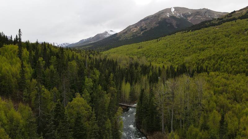
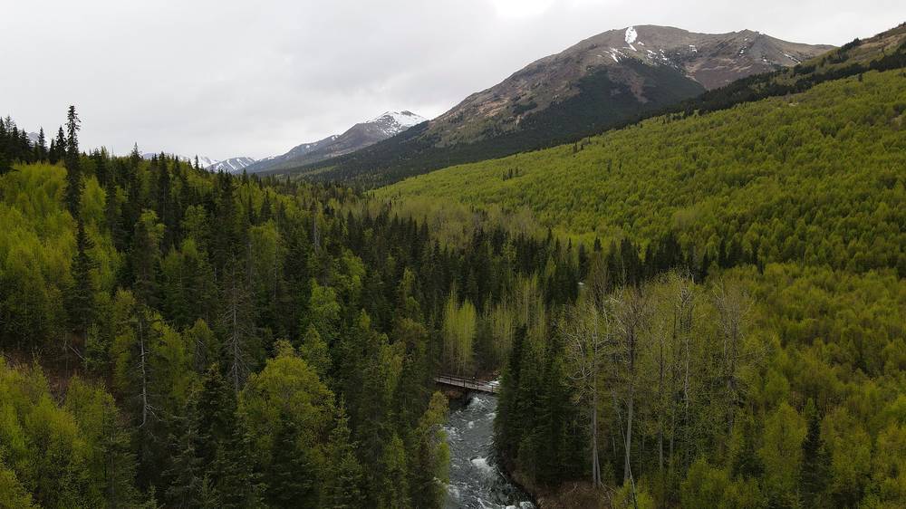
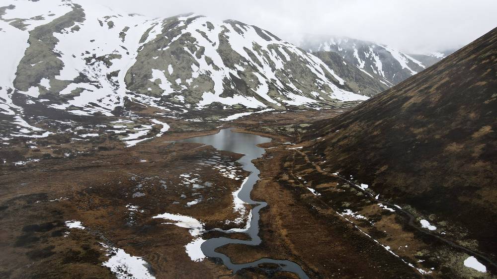
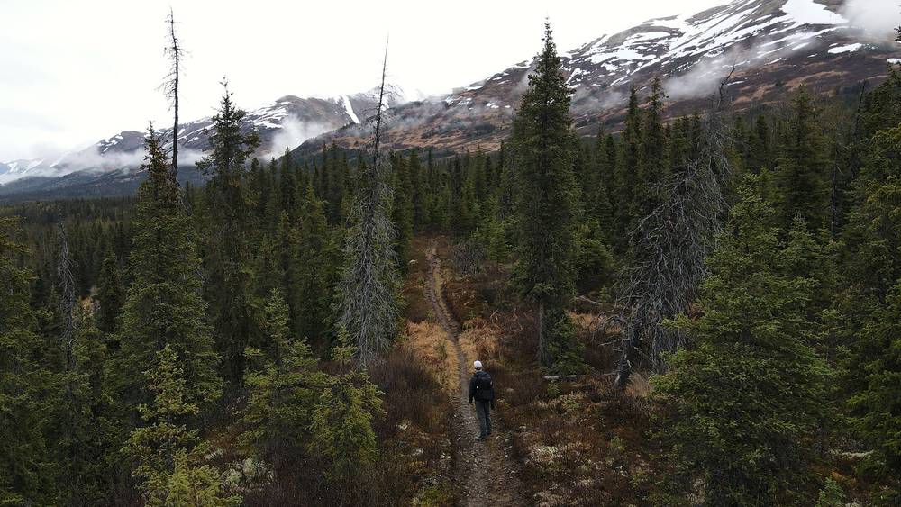
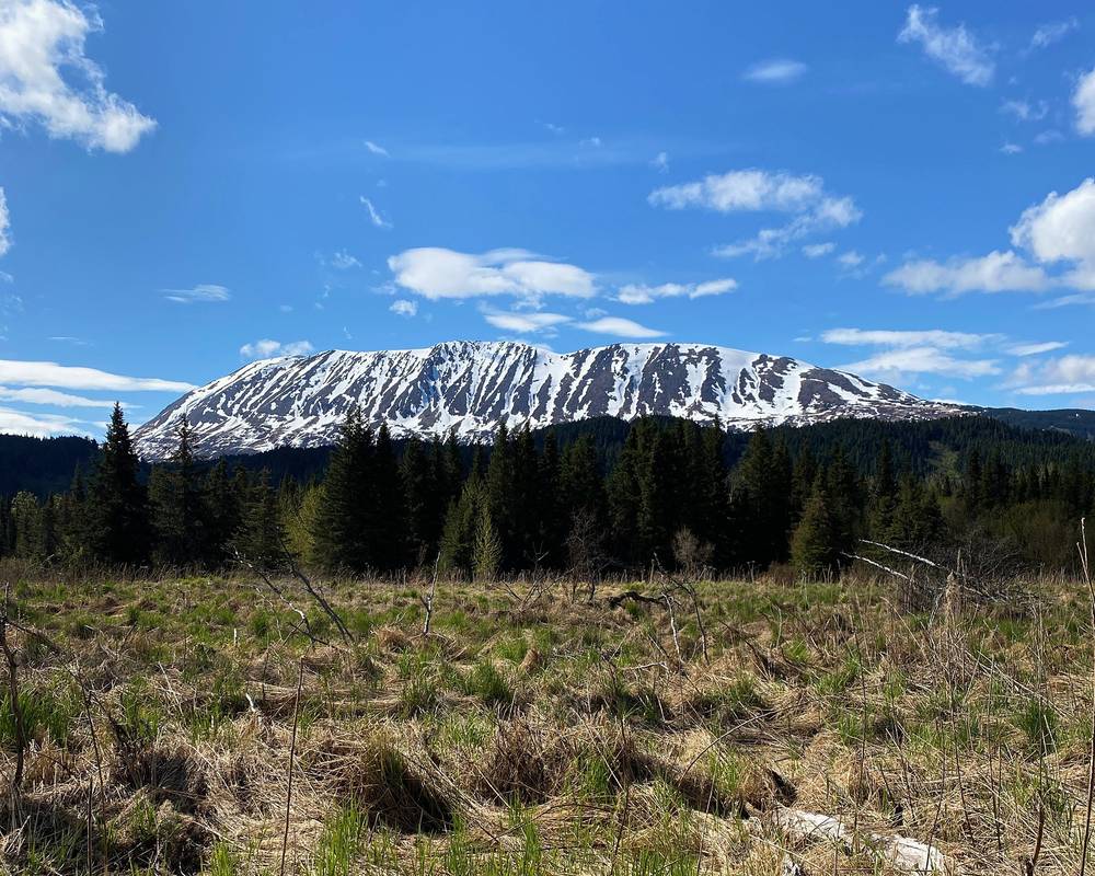
The Resurrection Creek valley on Day 1. 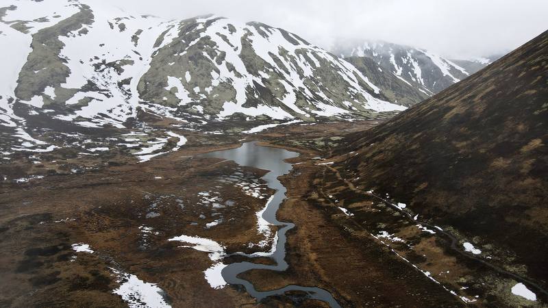
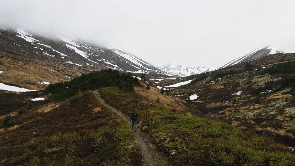
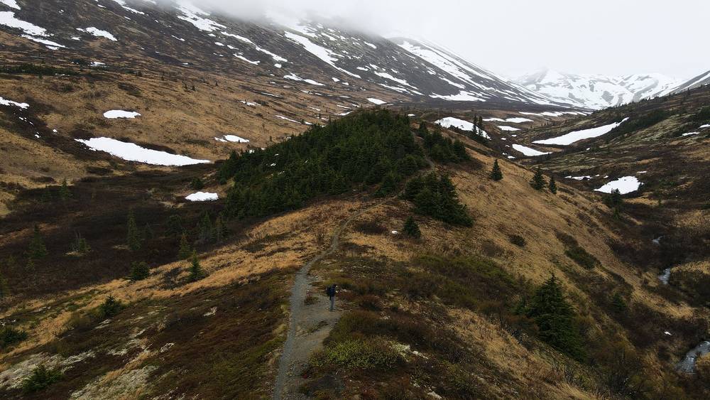
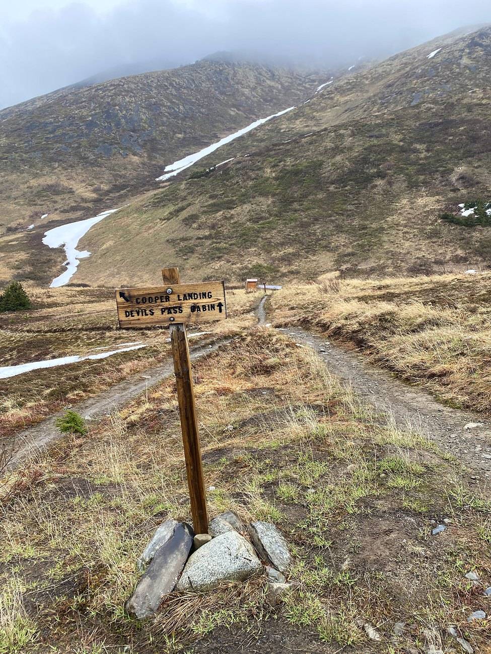
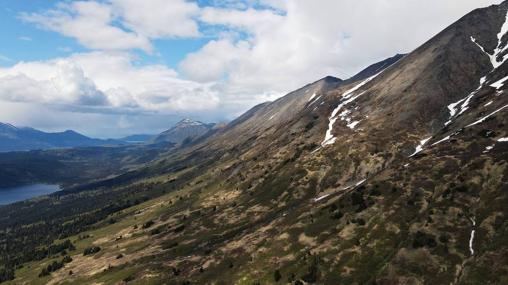
The valley just south of Resurrection Pass, Day 2. 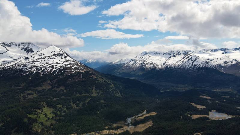
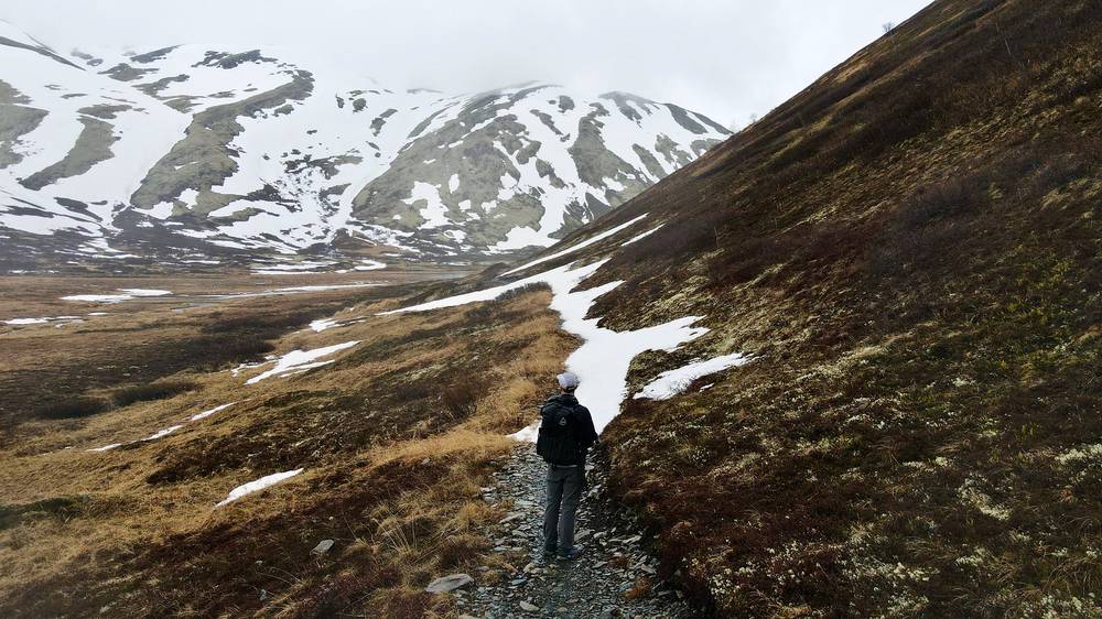
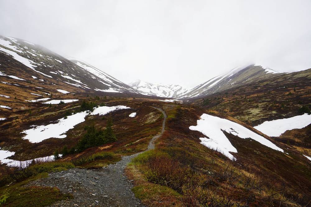
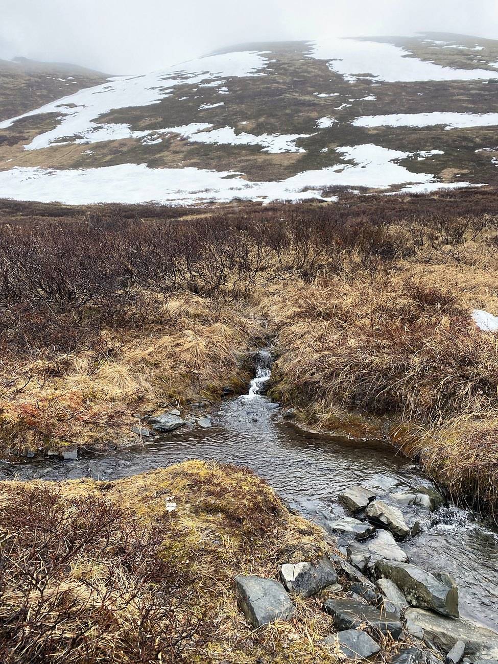
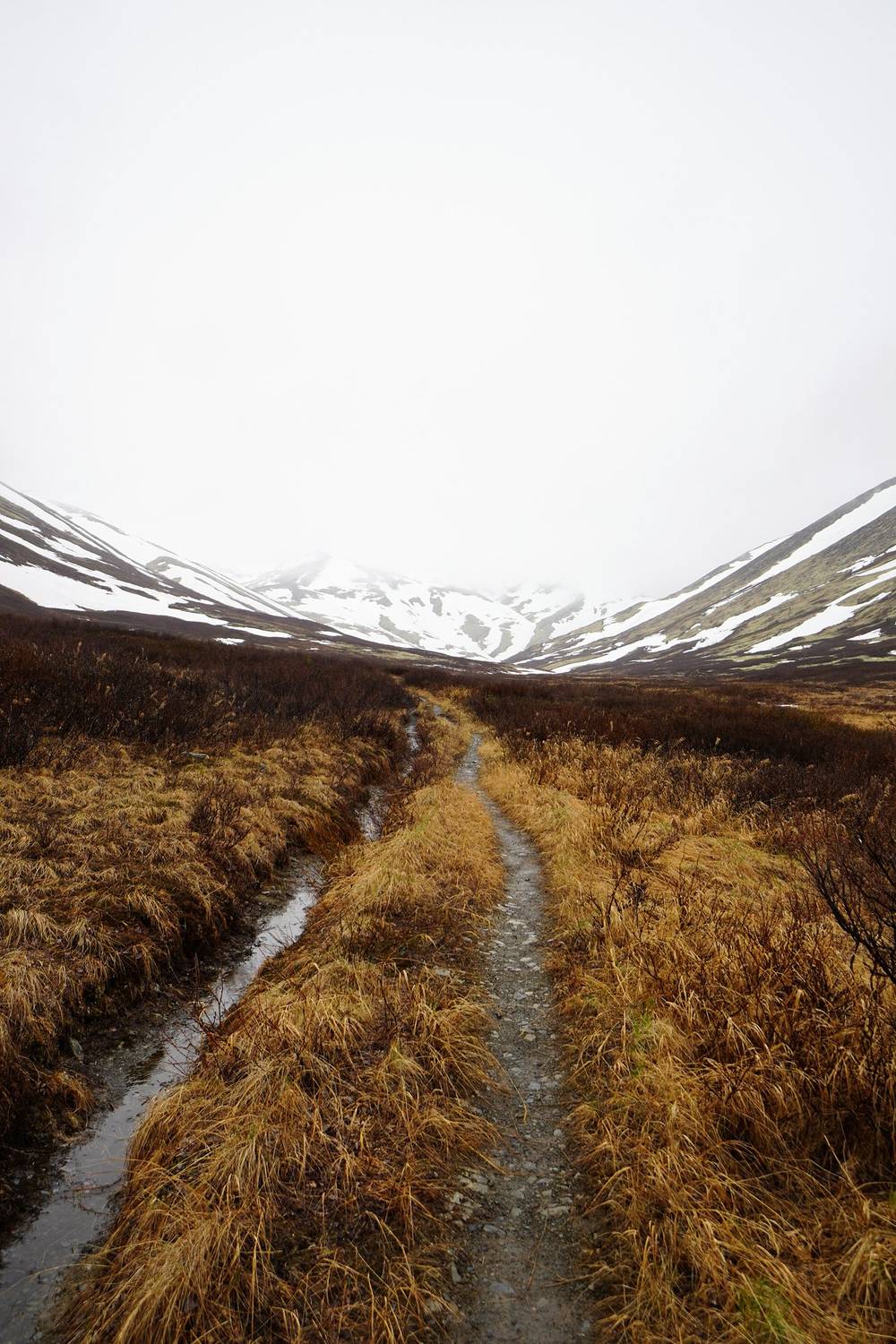
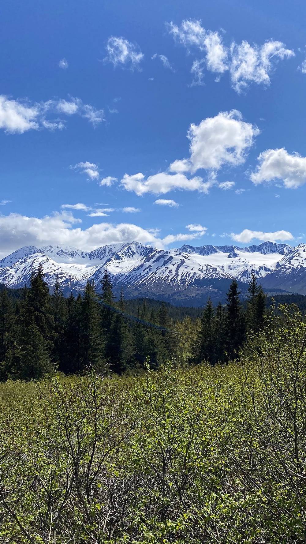
Snowy peaks above the Resurrection River Trail, Day 4. 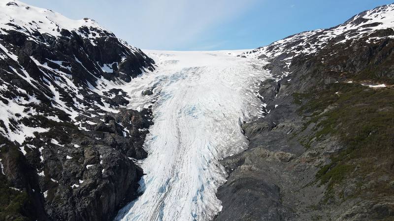
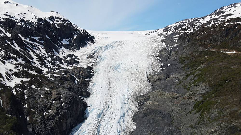
Exit Glacier from above, near the end of Day 5.
Newsletter
Get my letter
Get a short letter from me every couple of weeks: new trips, guides and what I'm building.
Free. Unsubscribe any time.
Details
The guide · Free · 59-page PDF + GPX files · 2027 season edition
Resurrection Pass Hiking Guide
5 days alone from Hope to Seward, Alaska. Every page is below: read it here, or take it offline as a PDF with my GPX files (59-page PDF + GPX files, in one zip). No sign-up needed.
The route
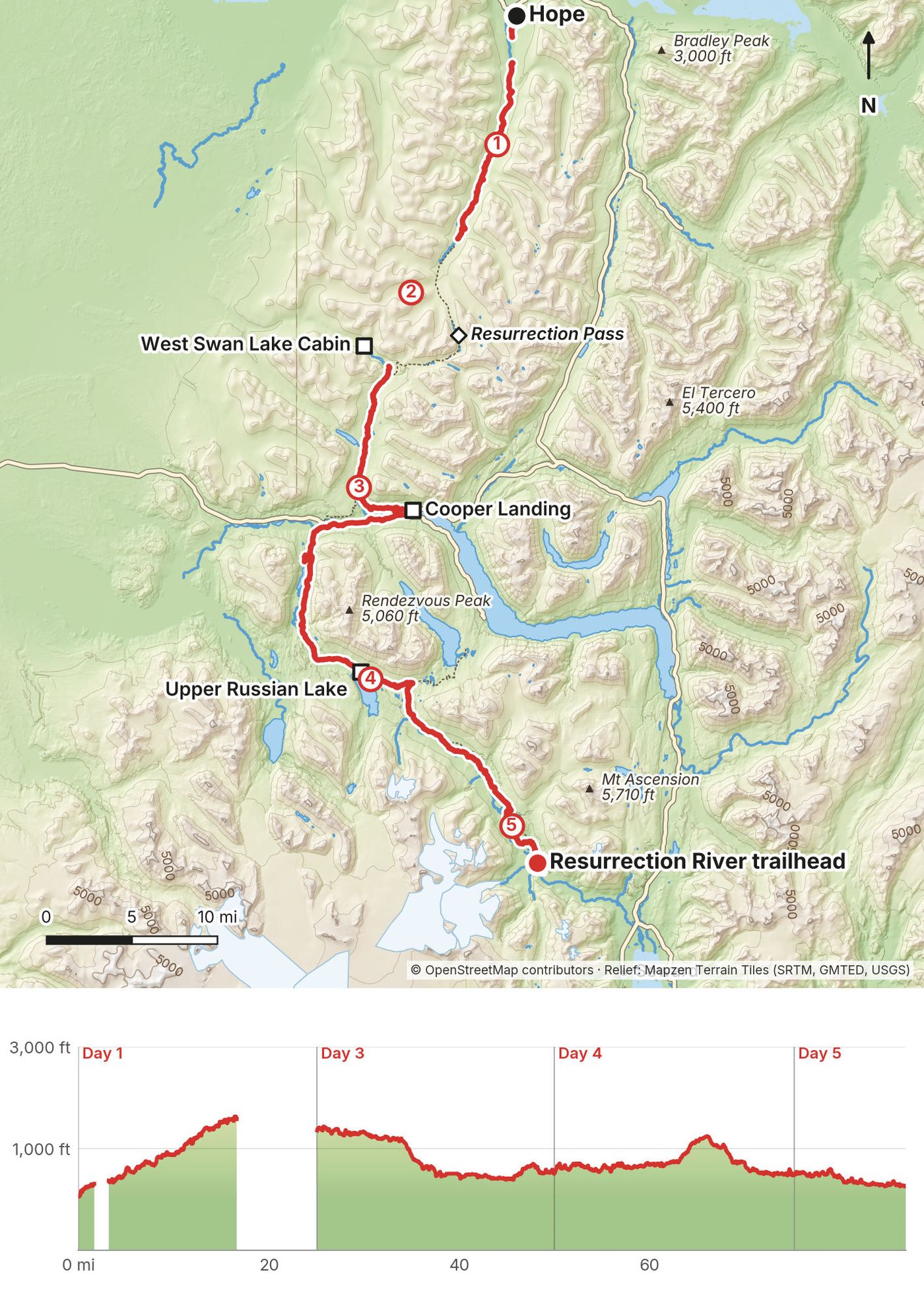
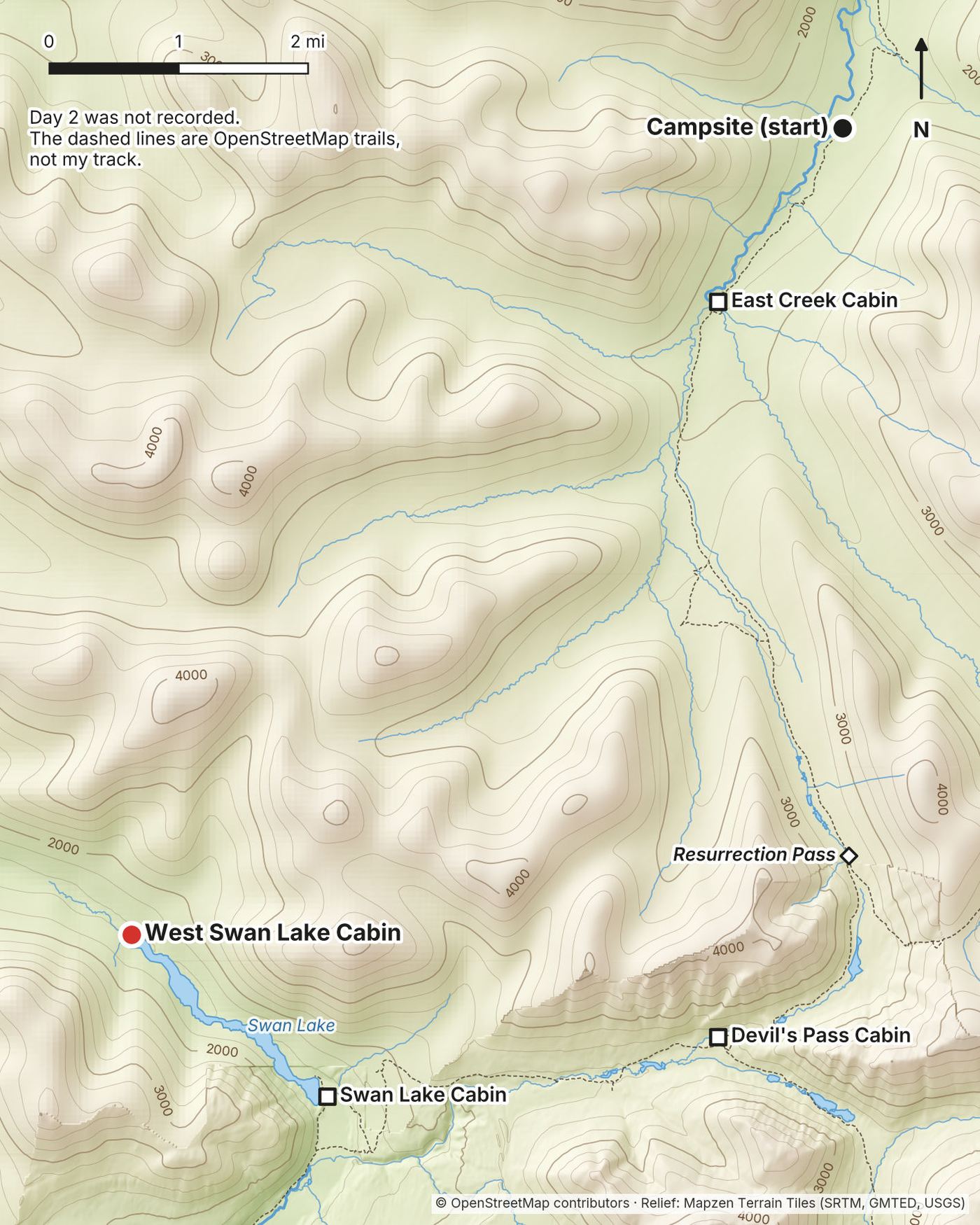
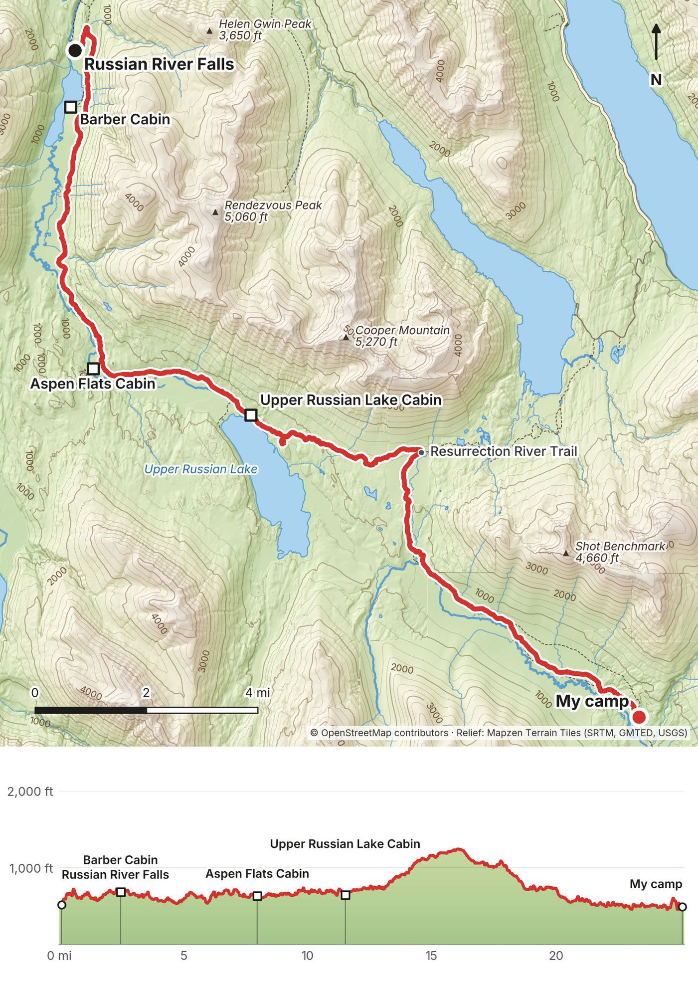
My GPS recording of 4 days on a relief map. The numbers are where each day starts; the red dot is the finish. The day maps are in the guide below, and the GPX files are a free download.
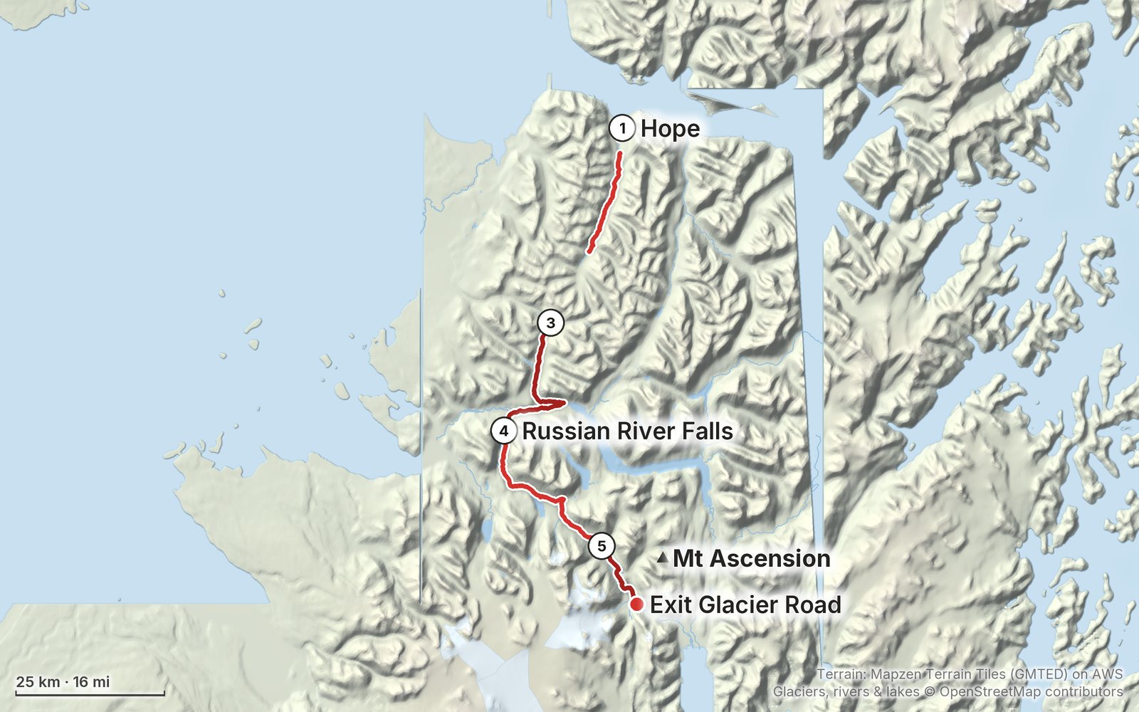
Elevation, start to finish: highest 1,640 ft (501 m), lowest 50 ft (14 m).
At a glance
- Days
- 5 days
- Distance
- about 90 miles
- Climbing
- About 6,500 ft (1,980 m) up
- Season
- June to September
- Route
- Hope to Resurrection River trailhead on Exit Glacier Road
Contents
- Welcome
- At a glance
- Straight answers
- When to go
- The cabins and camping
- Getting there
- Day 1 Hope to Fox Creek
- Day 2 Fox Creek over Resurrection Pass to West Swan Lake
- Day 3 West Swan Lake to Russian River Falls
- Day 4 Russian River Falls to the Resurrection River
- Day 5 Resurrection River to Exit Glacier Road
- Getting home
- Other ways to do it
- Food and water
- What I paid
- Gear for this route
- Bears
- Weather and safety
- Using the GPX files
- Before you go, check these
- One-page trip sheet
- About this guide
Welcome
In May 2020 I spent five days hiking alone across Alaska's Kenai Peninsula, from the little town of Hope to the edge of Seward. I walked the Resurrection Pass Trail, then added the Russian Lakes Trail and a wilderness trail, the Resurrection River Trail, that brings you down toward the glacier near Seward. A pilot, Jon, flew me to Hope in his two-seater plane. I camped, stayed one night in a public use cabin across a lake, and stopped halfway in Cooper Landing to eat and resupply.
The film of this trip is "Hiking 100 miles Alone in Alaska." It's a silent film, so this guide takes my own words from the podcast I recorded a few days after the hike, and the facts from my GPS. The Resurrection Pass Trail on its own is about 38 miles. My version, Hope to Seward, was about 90 miles on foot.
What's inside
- Straight answers to the questions people asked me about this hike
- When to go, the cabins and campsites, and the rules on these trails
- Getting to Hope, and home from Seward
- All five days: my notes, the trail, where to get off, a map with an elevation profile, and links to that day in my film
- Other ways to do it, from the classic 38-mile trail to a slower Hope to Seward
- Food and water, bears, what I paid, the gear for this route (what I carried and filmed with), weather and safety
- One page of things to check before you go, and a printable trip sheet
How to use it offline
Save this PDF to your phone's Files or Books app before you leave home. Load the GPX files and download offline maps while you still have Wi-Fi. Each day starts on a new page, so you can jump straight to it. The film links need a connection; everything else works in airplane mode.
When I say "I," it's my own trip. Cabin prices, rules and timetables change, so they're dated, and the checks are collected on one page: Before you go, check these.
At a glance
| Route | Hope to Exit Glacier Road near Seward, on the Resurrection Pass, Russian Lakes and Resurrection River trails, Chugach National Forest |
| Distance | 76.9 miles (123.7 km) recorded on 4 days, plus about 13 miles on Day 2 that I didn't record: about 90 miles on foot |
| Climbing | about 6,500 ft (1,980 m) up on the 4 recorded days, plus the climb to Resurrection Pass on Day 2 |
| Days | 5 walking days: 3 nights in my tent, 1 in a public use cabin |
| Start | Hope (I flew in to the Hope airstrip) |
| Finish | Resurrection River trailhead on Exit Glacier Road, about 11 road miles from Seward |
| Highest point | Resurrection Pass, about 2,600 ft (official figure), Day 2 |
| When | June to September. Snow can lie in the pass into early June |
| Difficulty | Easy to moderate on the Resurrection Pass and Russian Lakes trails; hard on the Resurrection River Trail: brush, lost trail, unbridged fords |
| Nearest airport | Anchorage (ANC) |
| Trip date | May 23 to 27, 2020, solo |
| Day | Route | Miles (km) | Up / down (ft) | Sleep |
|---|---|---|---|---|
| 1 | Hope to Fox Creek | 14.9 (24.0) | 2,263 / 743 | Campsite past Fox Creek Cabin |
| 2 | Over Resurrection Pass to West Swan Lake | about 13 (21), not recorded | not recorded | West Swan Lake Cabin |
| 3 | West Swan Lake to Russian River Falls | 24.9 (40.0) | 1,458 / 2,316 | Campsite near Russian River Falls |
| 4 | Russian River Falls to the Resurrection River | 25.3 (40.7) | 2,021 / 2,064 | My tent beside the trail |
| 5 | Resurrection River to Exit Glacier Road | 11.8 (19.0) | 745 / 969 | Seward |
The numbers come from my own GPS recordings, smoothed the same way for every day. Two short car rides (Day 1 and the end of Day 5) and the rowing across Swan Lake are left out. Day 2 was not recorded; its 13 miles are measured on the map (OpenStreetMap). My film's title says 100 miles; my GPS and the map say about 90 on foot.
Straight answers
Is it really 100 miles? My film says 100. My GPS says 76.9 miles on the four days I recorded, and Day 2, which I didn't record, is about 13 more on the map. So about 90 miles on foot, plus rowing across a lake twice. The Resurrection Pass Trail by itself is 38.4 miles (the official figure). I added the Russian Lakes Trail and the Resurrection River Trail to reach Seward.
How many days? I did it in five, with long days: my recorded days took 5 to 12 hours. In late May the days are very long, so I was able to hike for longer periods of time. The Forest Service gives 2 to 4 days each for the north half of the Resurrection Pass Trail and for the Russian Lakes Trail, and about 10 hours for the Resurrection River Trail, so a week is a comfortable Hope to Seward. See Other ways to do it.
Do I need a permit? The Forest Service trail pages list no hiking permit for these trails. You need a reservation for any public use cabin, and you can't camp within 300 feet of a cabin you haven't reserved. See The cabins and camping.
Is it hard? The Resurrection Pass Trail is wide, because it's a mountain bike trail too, and I passed more mountain bikers than hikers. The Forest Service calls it easy to moderate in summer. The Russian Lakes Trail is similar. The Resurrection River Trail is different: I lost the trail a few times, bushwhacked, and crossed rivers, the last one up to my chest. It's the hard part. See Days 4 and 5.
What about bears? I saw them. The first one was about a hundred yards down the trail, rubbing and scratching on a tree. I stopped and started talking to it, it looked at me, spooked and ran down the trail. Another circled the cabin and followed me along the shore while I rowed. I carried bear spray, cooked away from my tent, and kept all food and anything that smells out of the tent, in the bear boxes at the campsites that had them. See Bears.
Can I sleep in cabins the whole way? Not on the Resurrection River Trail. There are eight public use cabins on the Resurrection Pass Trail and three more on the Russian Lakes Trail, each booked on recreation.gov up to 180 days ahead, so book early or mix cabins and campsites. I stayed in one.
Is there water? Plenty. It had been raining in the first couple of days, so all the streams were full, and I carried just a half-liter bottle and filled up as I went. The Forest Service says to filter or boil all surface water.
Where can I buy food? Only in Cooper Landing, where the trail meets the Sterling Highway, about halfway. I stopped at Wildman's there. Carry everything else from Anchorage.
Can I bike it? Mountain bikes are allowed on the Resurrection Pass and Russian Lakes trails, and a lot of people ride them. The Forest Service doesn't recommend the Resurrection River Trail for bikes.
Can I bring my dog? The Resurrection River Trail isn't recommended for dogs, pets aren't allowed on trails in Kenai Fjords National Park, and near the Russian River they must be on a 6-foot leash in summer. Check before you bring one.
Can I do it alone? I did. I passed mountain bikers on the first half, and on the Resurrection River Trail I hadn't seen anyone in a full day or two. If you go alone, leave your plan with someone at home, and carry a satellite messenger: I can't tell you where there's phone signal.
Why is your film silent? My audio jack broke right before my Iceland film, so I used only the camera's microphone and decided not to talk. That's how the silent film started. On this trip I had a good microphone again, so you hear footsteps, wind, birds and water.
When to go
June to September, or late May if you don't mind snow. The Forest Service says there's heavy snow in Resurrection Pass into early June, and snow on the upper Russian Lakes Trail into early June. The Russian Lakes and Resurrection River trails are recommended May to October. Motorized use is closed on these trails from May 1 to November 30, so summer is foot, bike and (from July 1) horse traffic only.
What I got. I walked May 23 to 27, 2020, over Memorial Day weekend. It had been raining in the first couple of days. It rained when I went over the pass, but it still looked pretty, with the brown grass and the white snow, and it rained that evening at the cabin. The last two days were sunny. The snow in the pass was patchy enough to walk through in late May.
Light. At Cooper Landing the sun rose at about 4:50 a.m. and set at about 11 p.m. on May 25, 2020 (computed). In late June it's up for about 19 hours. That's a blessing and a curse: I had very long days, but I got almost no sunrise or sunset, because I couldn't match my sleep to it.
Salmon season. The Russian River draws anglers, and bears, in salmon season: the Forest Service highlights early August to late September there, and from June 1 to October 1 special food and pet rules apply near it (see The cabins and camping).
Bugs. I didn't record anything about bugs on this trip. Bring a head net for summer anyway.
The cabins and camping
The public use cabins
The Forest Service rents small log cabins along these trails. Book them on recreation.gov or at 1-877-444-6777, up to 180 days ahead; a service fee is added. Check-in and check-out are at noon. There's no water, electricity, mattress or bedding, and no cut firewood is promised. At most 8 people per cabin, and on this district at most 3 nights in a row from May 15 to August 31.
The 300-foot rule. Until at least January 2028 you can't camp or stay overnight within 300 feet of a public use cabin unless you're in the party that booked it (Forest Order 10-04-00-24-05). No cutting standing trees within 150 feet of a cabin.
The cabin I stayed in. West Swan Lake Cabin, on night 2. It was about $80 in 2020, sleeps four or five, and had so much firewood, a wood stove and its own boat. It was so nice to have a fire to dry out, because it was raining that evening. It's a fly-in cabin, which I didn't realize: the Forest Service lists floatplane access in summer and no trail. I got there by rowing a boat across Swan Lake (see Day 2). Don't plan on that: the cabin boats are for the people who book those cabins. If you want a cabin in this stretch, Swan Lake Cabin is right on the trail.
| Cabin | Trail | 2026 price | Sleeps | Boat |
|---|---|---|---|---|
| Caribou Creek | Resurrection Pass, mile 7 from Hope | $75 | 6 | |
| Fox Creek | Resurrection Pass, mile 11.5 | $75 | 6 | |
| East Creek | Resurrection Pass, mile 14.5 | $75 | 6 | |
| Devil's Pass | near the Devil's Pass Trail junction | $75 | 6 | |
| Swan Lake | Resurrection Pass, 12.8 mi from the south end | $75 | 6 | rowboat |
| West Swan Lake | no trail: floatplane in summer | $60 | 6 | rowboat |
| Juneau Lake | Resurrection Pass, 9.5 mi from the south end | $75 | up to 8 | canoe |
| Romig | Resurrection Pass, 9 mi from the south end | $75 | 6 | canoe |
| Trout Lake | 0.5 mi spur, 7.2 mi from the south end | $75 | 6 | rowboat |
| Barber | Russian Lakes, 3.4 mi from the campground | $75 | 6 | boat |
| Aspen Flats | Russian Lakes, 9 mi from the campground | $60 | 6 | |
| Upper Russian Lake | Russian Lakes, 12 mi from the campground | $75 | 4 | rowboat |
Prices and distances are from the Forest Service cabin pages (2026). In 2025 the Forest Service proposed a single $75 year-round rate for these cabins, so check the price on recreation.gov when you book. An older Forest Service source lists a free, first-come Resurrection River Cabin about 7 miles up the Resurrection River Trail from its trailhead; I couldn't confirm it's still there.
Camping
The Forest Service maps show designated campsites along the Resurrection Pass Trail (on the north half at miles 4.1, 5.3, 7.1, 9.7, 12.6 and 14.6 from the north trailhead) and on the Russian Lakes Trail (miles 2.3, 3.3, 6.2, 8.3, 11.9, 16.9 and 19.0 from the Russian River end), many with a bear box and a backcountry toilet. So many people were commenting about the bear box at the campsite in my film. That's just what it is: a steel box to keep your food from bears.
| Night | Where I slept |
|---|---|
| May 23 | A campsite with a bear box and a fire ring, about a mile past Fox Creek Cabin |
| May 24 | West Swan Lake Cabin |
| May 25 | The campsite near Russian River Falls, mile 2.3 of the Russian Lakes Trail |
| May 26 | My tent beside the Resurrection River Trail (not a designated campsite) |
| May 27 | Seward, then back to Seldovia by plane |
Fires. It was so nice to be able to build fires. In Yosemite and most other parks you can't. I made them in the fire rings at the campsites and in the cabin stove. No fire restriction was posted on the Chugach National Forest in September 2026, but that changes in a dry summer: check akfireinfo.com before you go.
Near the Russian River (2026: the alert says June 1 to October 1; the order's text says from May 1). In Russian River Campground and within 150 yards of the Russian Lakes Trail, the falls trail and the Russian River, keep food and anything that smells within 3 feet of you, or in a vehicle, a hard-sided camper or a certified bear-resistant container, and keep pets on a 6-foot leash. Fines go up to $5,000. My Day 3 campsite is inside this area.
Russian River Campground (2026). Russian River Campground is open mid-May to September 30. Trailhead parking is $14 per vehicle for 12 hours, free for Russian Lakes cabin permit holders. The campground was closed for construction in fall 2025 and spring 2026 (both over).
Kenai Fjords National Park. Land west of the Resurrection River is in the national park. Its rules: food in a bear-resistant container, a hard-sided building or vehicle, or hung 10 feet up and 4 feet out; registration for backcountry trips is recommended, not required; no pets on trails.
Getting there
What I did. I didn't have a plan to come to Alaska, especially with the lockdown and everything going on. But a pilot with his own plane and channel, Jon, reached out: he was flying up from Florida to Alaska in his two-seater and asked if I wanted to join him. We linked up in Seattle and hopscotched up the coast through Canada, like a road trip in the sky. I stayed in Seldovia, a very small town on the southern tip of the Kenai Peninsula, before and after the hike. The morning of the hike we took off from Soldotna in Jon's tiny plane, under mostly overcast skies, and landed on the small strip at Hope. I got out, he took off, and I walked the road to the trailhead. A man in a pickup truck with the most adorable white fluffy dog picked me up and brought me about a mile down the road, just out of courtesy. That's just the way things happen in Alaska.
By road (2026). Hope is at the end of the Hope Highway, which leaves the Seward Highway at mile 56.7, about 88 road miles from Anchorage. The north trailhead is at Hope Highway mile 15: turn south on Resurrection Creek Road and drive 4 miles to the parking area. From the Hope airstrip it's about 3.2 miles on that road (my GPS). The research for this guide found no scheduled bus to Hope, so plan a car, a ride or a drop-off.
The south end. If you start or end at the other end of the Resurrection Pass Trail, its trailhead is on the Sterling Highway at mile 53.2, near Cooper Landing. The Alaska Bus Company's Anchorage to Seward buses stop in Cooper Landing and take Sterling Highway pickups by phone (907-299-6806; $79 to $119 one way, no 2026 dates shown).
Shopping. There's nowhere to buy food on the trail until Cooper Landing, so shop in Anchorage. Buy stove fuel and bear spray there too, rather than flying with them (airlines restrict both).
Day 1: Hope to Fox Creek
- Distance
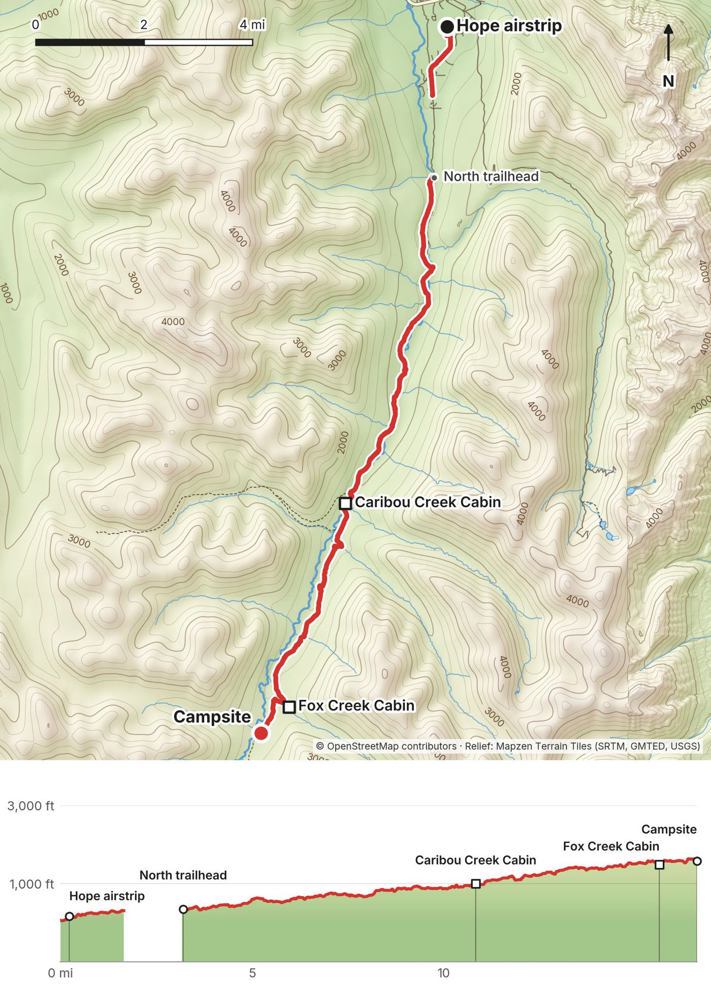
- 14.9 mi (24.0 km)
- Climbing
- 2,263 ft (690 m)
- Descent
- 743 ft (226 m)
- Time I took
- 5.3 hours, 4.4 of them moving (2:04 to 7:23 p.m., after the flight)
- High point
- 1,645 ft (501 m), at my camp
- Trail
- Resurrection Creek Road, then the Resurrection Pass Trail from the north trailhead
- Sleep
- A campsite with a bear box, about a mile past Fox Creek Cabin
- Cabins on the way
- Caribou Creek (mile 7.5 of the trail by my GPS), Fox Creek (mile 12.3)
- Food and water
- Nothing to buy after Hope. Streams all day.
My day
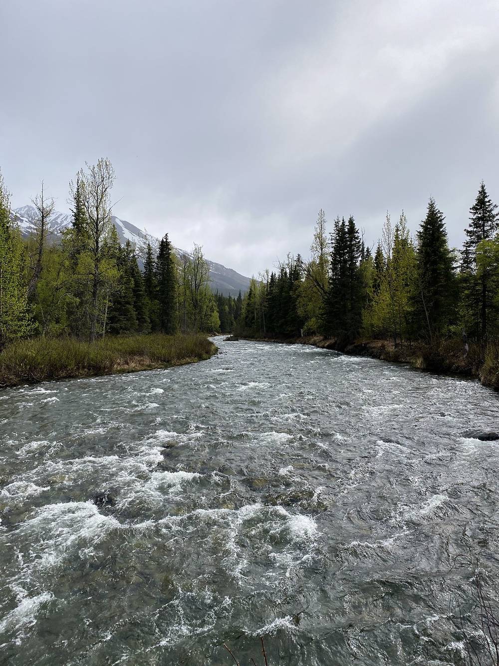
We landed on the gravel strip at Hope in Jon's plane, I got out, and he took off. I started walking the road to the trailhead, and the man in the pickup gave me a ride for the middle part (the GPS files leave that out). The trail climbs gently up the Resurrection Creek valley through spruce and birch, with the creek rushing beside it. I filled my water at the streams.
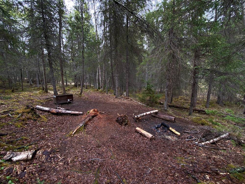
I walked past Caribou Creek Cabin and Fox Creek Cabin and camped at a campsite about a mile further on, with a bear box. I made a fire in the fire ring, cooked, and set up my tent. It was around 7:30 in the evening and still full daylight.
The trail
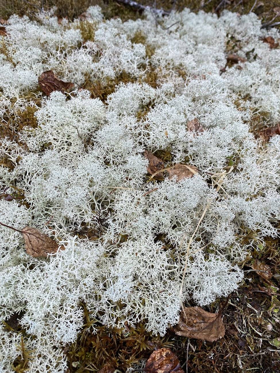
From the Hope airstrip my track follows Resurrection Creek Road south for 1.7 miles to the north trailhead parking (with the ride in the middle). The trail itself starts at about 345 ft and climbs so gently you barely notice it: 1,645 ft at my camp after 13 miles. It's wide and smooth, built for bikes and horses as well as hikers, mostly in forest with the creek below. Caribou Creek Cabin is at mile 9.2 of my day (mile 7 on the Forest Service's count from the trailhead) and Fox Creek Cabin at mile 14.0 (their mile 11.5). My GPS reads a bit longer than the official figures all the way along.
The Forest Service notes two major avalanche chutes at miles 9.6 and 10, a winter hazard. Designated campsites on this stretch are at miles 4.1, 5.3, 7.1, 9.7, 12.6 and 14.6 from the trailhead (Forest Service).
If you need to get off
Walk back down the valley: the whole day is on one trail and one road back to Hope. The cabins are shelter only if they're yours for the night.
Watch this day
Film, Day 1 · The flight into Hope and the road · Camp and the fire
Day 2: Fox Creek over Resurrection Pass to West Swan Lake
- Distance
- about 13 mi (21 km) on the map, not recorded, plus rowing across Swan Lake
- Climbing
- not recorded (camp about 1,650 ft, pass about 2,600 ft)
- Descent
- not recorded (Swan Lake about 1,400 ft by my Day 3 GPS)
- Time I took
- about 8 a.m. to 3 p.m., the rowing included (from my photos)
- High point
- Resurrection Pass, about 2,600 ft (official figure)
- Trail
- Resurrection Pass Trail over the pass, past the Devil's Pass Trail junction, to the east end of Swan Lake
- Sleep
- West Swan Lake Cabin (no trail to it)
- Food and water
- Nothing to buy. Streams and snowmelt.
My day
I didn't record this day. The AllTrails link on Day 2 in my film's description is the same as Day 1's, and there's no Day 2 track in this guide or its GPX files. What's here comes from the film, my photos (which have their own GPS positions) and my podcast.
I climbed out of the trees onto open tundra and patches of snow. It rained when I went over the main pass, but it still looked pretty with the brown grass and the white snow. I was prepared for the rain. If it does rain, it's not the end of the world. My photos put me about a mile past camp at 8:40 a.m., in the snow north of the pass at 10 a.m., just south of the pass at 11:30 a.m., and near the east end of Swan Lake at 1 p.m.
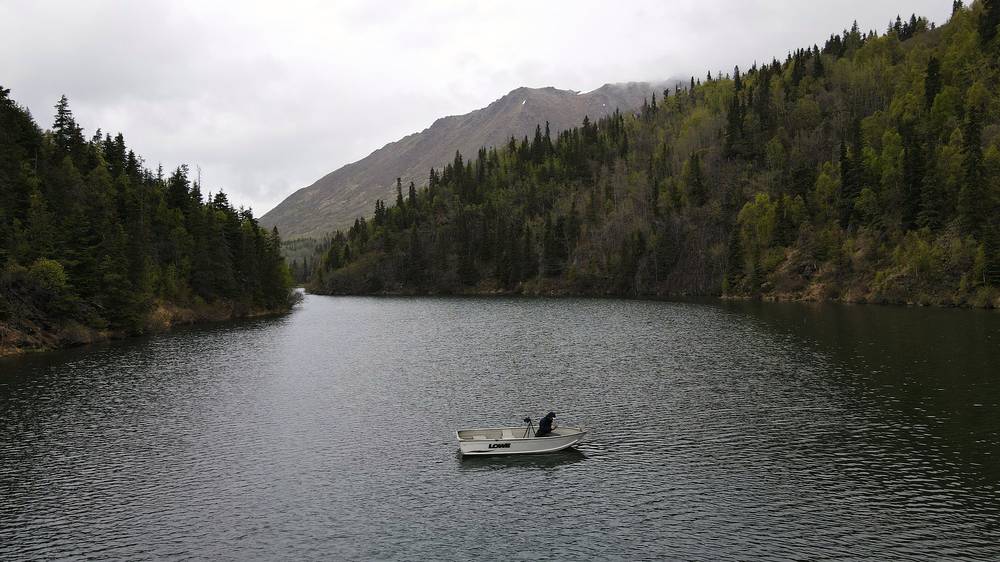
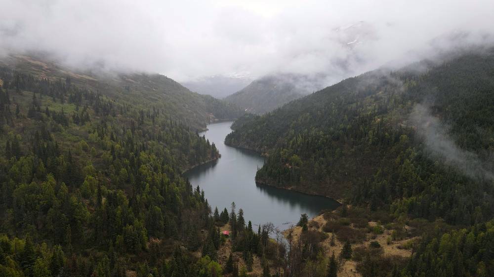
At Swan Lake the people on the east side of the lake told me a couple before me had tried to walk to West Swan Lake Cabin and came up against a cliff they couldn't get through. I said I'd take a boat. The oar attachment was missing on one side and the fix on it was broken, so one of them helped me flip the boat, and I rowed with one oar up front, like a canoe. It took about an hour and a half to go one way. As you can see in the film, I zigzagged the entire way. The bear I saw at the cabin also followed me along the shore while I was rowing, so I kept to the opposite side, because bears are really good swimmers.
The cabin had so much firewood, and finally getting the fire going to dry out was the best part of the day. It was raining that evening. The bear came to the cabin, rubbing its back on the trees, and circled it a couple of times and went underneath it at one point before it went off along the other side of the lake. The close shots in the film are through the cabin window. The film shows me cooking a Mountain House meal in the cabin.
The trail
From my camp the Resurrection Pass Trail passes East Creek Cabin, then climbs above the trees into open country to the pass, about 6.7 miles from camp on the map. The Forest Service says there's heavy snow in the pass into early June. South of the pass the trail drops past the junction with the Devil's Pass Trail (Devil's Pass Cabin is near it) and follows the valley west to Swan Lake, about 13 miles from my camp. Swan Lake Cabin is on the trail at the east end of the lake.
West Swan Lake Cabin is at the far west end of the lake, about 2 miles by water (my Day 3 GPS). There's no trail to it; the Forest Service lists floatplane access in summer.
If you need to get off
The Devil's Pass Trail leaves the Resurrection Pass Trail south of the pass and runs east about 10 miles to its own trailhead on the Seward Highway (Forest Service: 31.7 miles in all from Hope that way). Otherwise continue south to the Sterling Highway (Day 3) or go back to Hope.
Watch this day
Film, Day 2 · Over the pass in the snow · Rowing to the cabin · The bear at the cabin
Day 3: West Swan Lake to Russian River Falls
- Distance
- 24.9 mi (40.0 km) walked, after 2.0 mi (3.2 km) rowing
- Climbing
- 1,458 ft (444 m)
- Descent
- 2,316 ft (706 m)
- Time I took
- 10.9 hours walking, 6.9 of them moving, 2.5 hours at Wildman's (8:19 a.m. to 7:14 p.m., after rowing from 7:01)
- High point
- 1,453 ft (443 m), just south of Swan Lake
- Trail
- Resurrection Pass Trail to the Bean Creek Trail, roads through Cooper Landing, the Sterling Highway, then the Russian Lakes Trail
- Sleep
- The campsite near Russian River Falls, mile 2.3 of the Russian Lakes Trail
- Food and water
- Wildman's in Cooper Landing (my halfway stop). Streams on the trail.
My day
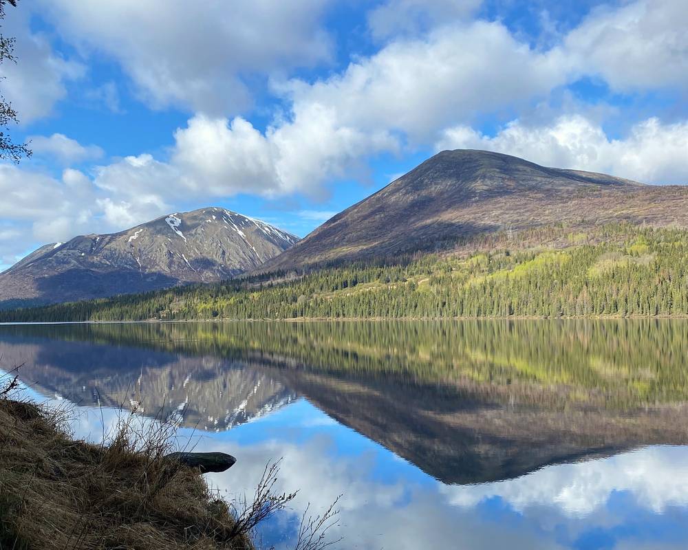
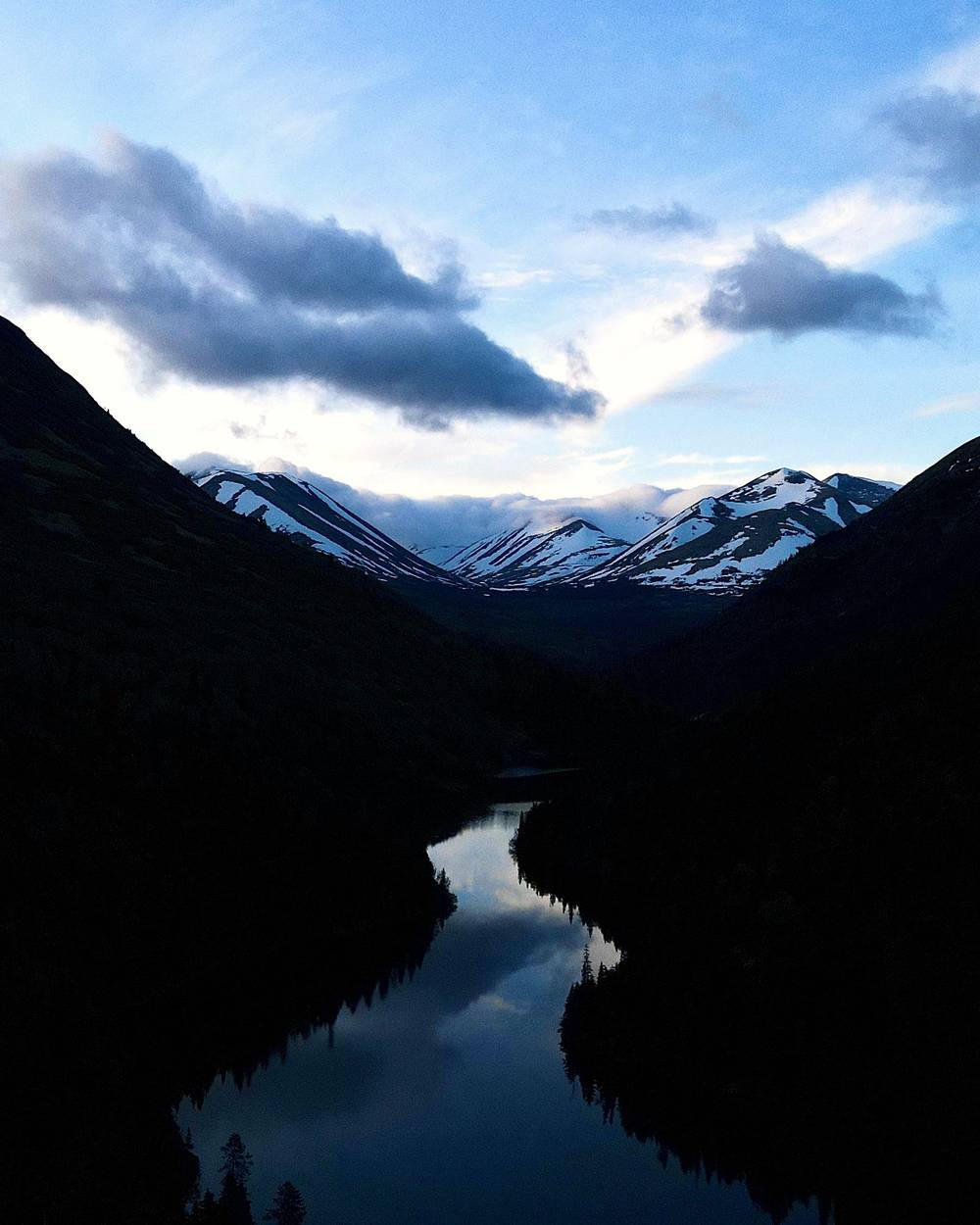
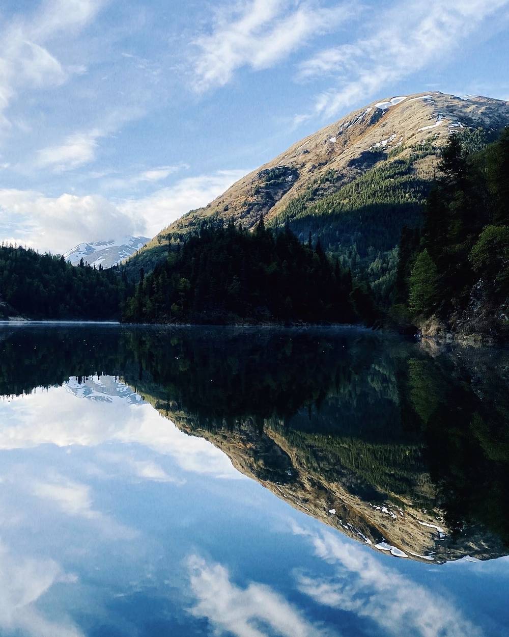
The next morning the water was so clear and reflective in the morning light, the sun was coming out, and a couple of beavers were playing in the water alongside me, with loons swimming alongside too. It was a really peaceful time. I rowed back to the east end of the lake in about an hour and a quarter and started walking south past Juneau Lake.
The true halfway point of the hike was a lovely little rest stop in Cooper Landing called Wildman's. I had such a good burger, free Wi-Fi, outlets to charge my drone, camera and other batteries, and supplies for the next leg. It was Memorial Day, so it was very busy, with so many people coming up for ice cream, food and coffee, and I got to pet all the dogs as they came in because I was out on the porch. I was there from about 1 to 3:40 p.m.
After that I had to walk on the side of the road for a few miles to get to the next trailhead, which always sucks, but I made quick work. I didn't try to hitchhike; I was being a little stubborn and wanted to do it on my own. I reached the Russian Lakes Trail at 5:30 p.m. and camped near Russian River Falls.
The trail
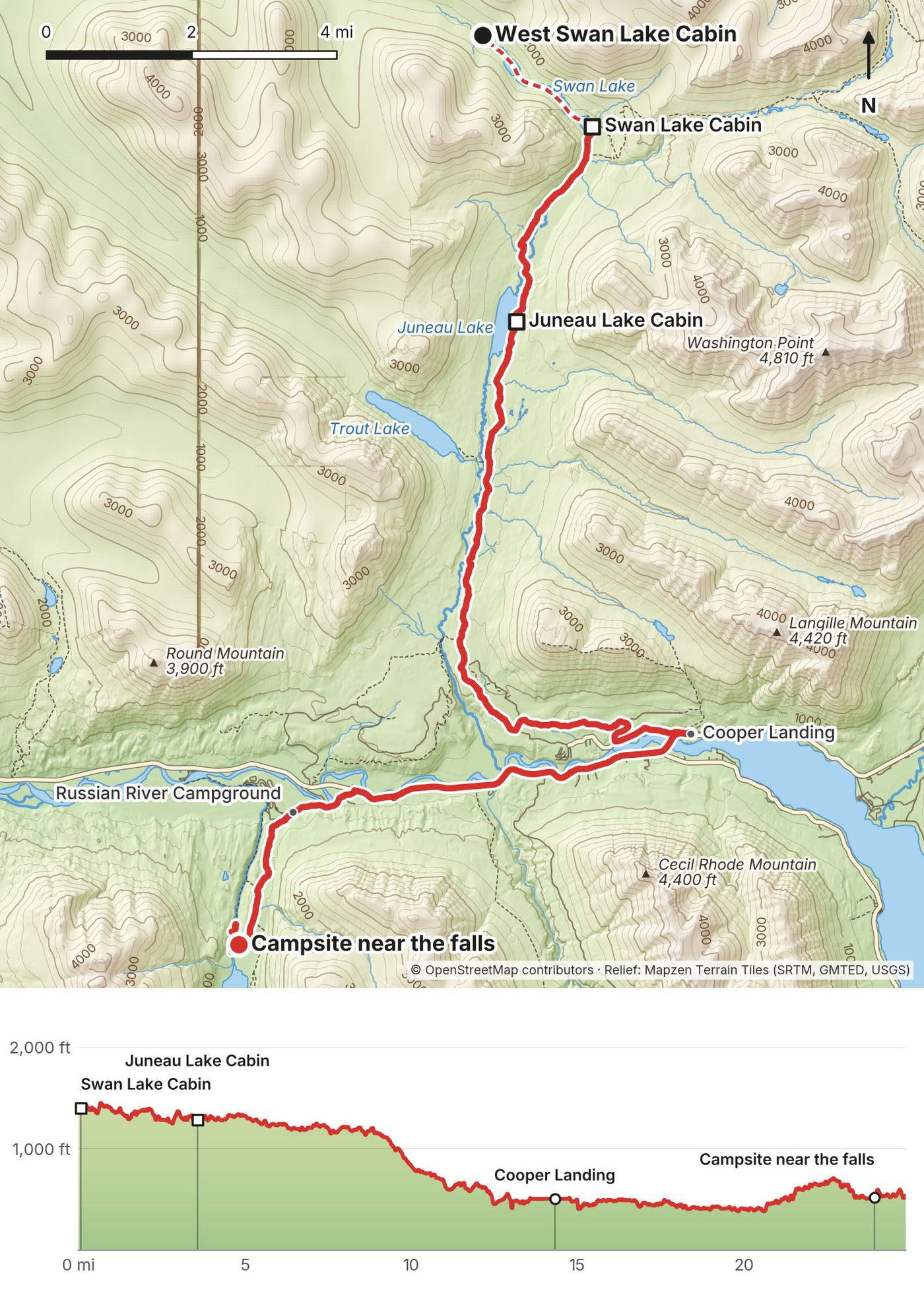
The Resurrection Pass Trail follows the chain of lakes south: Juneau Lake Cabin at mile 3.6 of my day and Romig Cabin just after, then Trout Lake off to the west. A Forest Service note says the 2019 Swan Lake Fire left trees down between Trout and Juneau Lakes. At mile 8.6 I left the Resurrection Pass Trail for the Bean Creek Trail, which drops to Bean Creek Road and Slaughter Ridge Road in Cooper Landing. I reached the Sterling Highway at about mile 13.4 and Wildman's at 13.6.
From Wildman's I walked west on the Sterling Highway, about 6.4 miles, past the Resurrection Pass Trail's south trailhead (mile 20.6 of my day) to the Russian River Campground. The Russian Lakes trailhead is about a mile inside the campground (mile 21.0). The trail climbs gently to Russian River Falls; the campsite is at mile 2.3 of the trail (Forest Service), mile 24.9 of my day.
Skip Cooper Landing. If you don't need Cooper Landing, stay on the Resurrection Pass Trail to its south trailhead at Sterling Highway mile 53.2, cross to the Russian River Campground and save most of the road walk. That's the classic line.
If you need to get off
Cooper Landing is on the Sterling Highway, with food, a fuel station, and the Alaska Bus Company's Anchorage to Seward buses (Sterling Highway pickups by phone). This is the easy place to end the trip.
Watch this day
Film, Day 3 · Rowing back in the morning · Wildman's
Day 4: Russian River Falls to the Resurrection River
- Distance
- 25.3 mi (40.7 km)
- Climbing
- 2,021 ft (616 m)
- Descent
- 2,064 ft (629 m)
- Time I took
- 11.9 hours, 8.3 of them moving (7:27 a.m. to 7:23 p.m.)
- High point
- 1,247 ft (380 m), on the Russian Lakes Trail before the junction
- Trail
- Russian Lakes Trail past Lower and Upper Russian Lake, then the Resurrection River Trail
- Sleep
- My tent beside the Resurrection River Trail (not a designated campsite)
- Cabins on the way
- Barber (Lower Russian Lake), Aspen Flats, Upper Russian Lake
- Food and water
- Nothing to buy. Lakes and streams.
My day
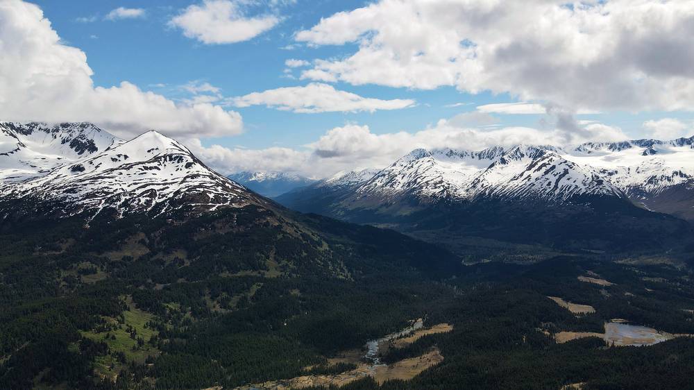
A long day in the forest. I walked past Lower Russian Lake, Aspen Flats and Upper Russian Lake, stopping at the Upper Russian Lake cabin around noon, then climbed a little to the junction with the Resurrection River Trail at 3 p.m. The sun came out, with snowy peaks all around.
The last section of the trail got gradually harder. I actually lost the trail a few times and had to zigzag until I found it again. It was always such a victory to find the trail again, because you go so slow, you get wet, and I have so many scratches on my legs from twigs and branches. Bushwhacking is not for the faint of heart. It makes you appreciate trails so much. I camped in the trees beside the trail at about 7:30 p.m.
The trail
The Russian Lakes Trail runs 21.78 miles from Russian River Campground to Cooper Lake (Forest Service). I walked it from my camp at its mile 2.3 to the Resurrection River Trail junction at its mile 16.2: about 13.9 miles by the Forest Service's count, 16.6 by my GPS. From the falls it passes the spur to Barber Cabin on Lower Russian Lake (about mile 2.5 of my day), Aspen Flats Cabin (8.0) and Upper Russian Lake Cabin (11.5), mostly in forest and meadows and fairly level. Past Upper Russian Lake it climbs to my high point of 1,247 ft and meets the Resurrection River Trail at mile 16.6 (Forest Service: mile 16.2 of the Russian Lakes Trail).
The Resurrection River Trail is 16.3 miles to Exit Glacier Road. The Forest Service calls it moderate to difficult, about 10 hours, and a primitive route from the Russian Lakes Trail to Martin Creek: expect downed trees, heavy brush and mud, and be ready to navigate where there's no trail. My GPS shows me off the trail several times from about mile 19 on, and it took me 20 miles over two days to cover the 16.3.
If you need to get off
Before the junction, the Russian Lakes Trail continues east to its Cooper Lake trailhead (about 5.6 miles from the junction), reached by Snug Harbor Road from the Sterling Highway at mile 48. That's the way out if the Resurrection River Trail looks too wet. Once you're on the Resurrection River Trail, the closest road is Exit Glacier Road at the end.
Watch this day
Film, Day 4 · The log crossing and the brush
Day 5: Resurrection River to Exit Glacier Road
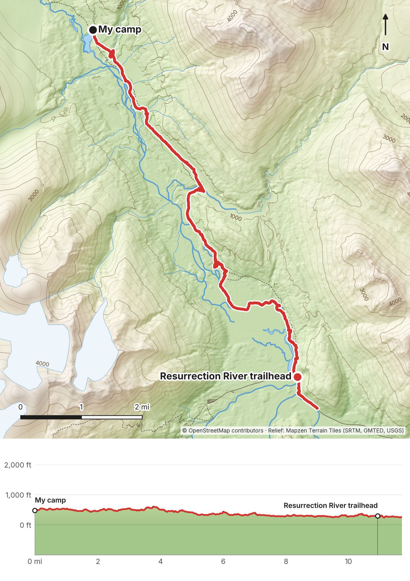
- Distance
- 11.8 mi (19.0 km)
- Climbing
- 745 ft (227 m)
- Descent
- 969 ft (295 m)
- Time I took
- 6 hours, 4.3 of them moving (6:59 a.m. to 1:01 p.m.)
- High point
- 612 ft (187 m)
- Trail
- Resurrection River Trail to its trailhead on Exit Glacier (Herman Leirer) Road
- Sleep
- Seldovia (I flew back from Seward that afternoon)
- Fords
- Rivers with no bridges, including the chest-deep crossing I describe below
- Food and water
- Nothing until Seward.
My day
On the Resurrection River Trail I had three major water crossings that increased in difficulty as I went, and I decided to keep my shoes and socks on. That was a game changer: before, I'd take them off and put them back on, and that took forever. Just going across was faster and easier, it dried off much quicker than I thought, and it's safer, because bare feet on slippery rocks are how you twist an ankle in a river.
The film shows only two crossings, because the last one was so extreme that I couldn't film it. I stripped down to my underwear, put everything in my pack, and the water came up to my chest in a freezing, very wide, deep and fast river. I wasn't sure I'd be able to cross it standing, and there was really no option to go back. I was really scared. If my pack had fallen, it would have been gone. I made it, and I had a war cry on the shore.
I reached the trailhead at 12:30 p.m. As soon as I exited the trail, a passing RV stopped and a happy couple who watch my videos jumped out to say hello. I hadn't seen anyone in a full day or two. An older couple gave me a ride down the road to Seward, because there was no reason to walk the road.
The trail
More of the same brushy, sometimes lost trail through forest along the Resurrection River, with river flats and big views of the snowy peaks near the end. My GPS shows me off the trail at miles 0.2 to 1.2, 3.6 to 4.0 and 7.5 to 9.1. The trailhead is at mile 11.0 of my day, on Exit Glacier Road; I walked on to about mile 11.8 before the ride.
The Forest Service trail sheet (2021): no bridges at Martin Creek (mile 4.5 from the trailhead, washed out in 2002) or Boulder Creek (mile 8, washed out in 1996), and many other creeks have no bridge; these fords may be impassable in snowmelt or heavy rain, and miles 2 to 3 near the trailhead are often flooded. Bear density is relatively high. Go in the morning, when the water is lower, and turn back if a ford looks wrong.
If you need to get off
There's no road until the trailhead. Exit Glacier Road opened for summer on May 14 in 2026; it closes to cars in winter and can close for flooding. From the trailhead it's about 11 miles by road to Seward (7 miles down Exit Glacier Road, then 3.7 miles on the Seward Highway).
Watch this day
Film, Day 5 · The river crossings · The trailhead and Seward
Getting home
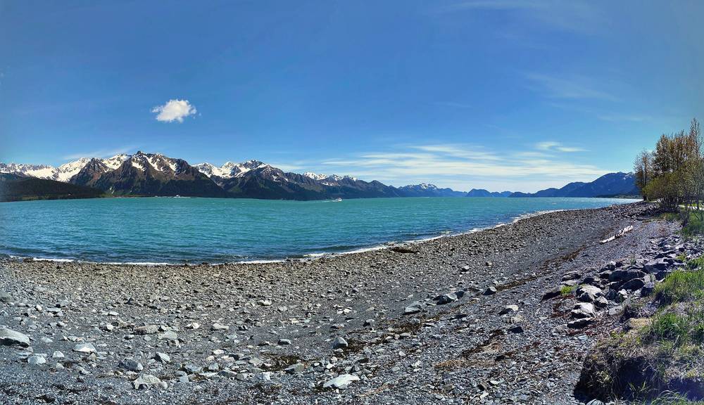
What I did. Seward is a lovely town. I walked around, saw the RVs and people camping and fishing, all the birds and the really beautiful view, grabbed some coffee, and made my way to the local airport, where Jon picked me up and flew me back to Seldovia. On the way we flew over the giant ice field on top of the mountains. You only do that on clear days, and it was amazing to see from above.
Trains and buses from Seward.
- Alaska Railroad, Coastal Classic. The 2027 season runs daily May 14 to September 12, 2027: Seward 6:00 p.m. to Anchorage 10:15 p.m. (and Anchorage 6:45 a.m. to Seward 11:20 a.m.). Adventure Class one way was listed at $133.
- Park Connection Motorcoach. Anchorage to Seward in summer (May 15 to September 15 and $80 adult in 2026, from search listings; check alaskacoach.com for 2027).
- Alaska Bus Company. Anchorage to Seward, with stops at Girdwood, Cooper Landing and Moose Pass, $79 to $119 one way.
Getting to Seward from the trailhead. I got a ride. In summer, shuttles run between Seward and the park's Exit Glacier Nature Center (Adventure Sixty North and Exit Glacier Guides, about $20 to $35 round trip in 2026), and the park suggests a shuttle or taxi. They go past the Resurrection River trailhead, so ask ahead about a trailhead pickup, book a Seward taxi, or leave a car.
Other ways to do it
I walked the five days in this guide. These are other ways to use it, and I didn't do them.
The classic: Resurrection Pass Trail only (3 to 4 days)
Hope to the Sterling Highway at mile 53.2, 38.4 miles (the official figure), with eight cabins and campsites the whole way. It's the classic route, and the easiest to plan: car at each end, or a drop-off. Use my Days 1 and 2 and the first 8.6 miles of Day 3, then stay on the Resurrection Pass Trail to its south trailhead.
A 4-day version: Hope to Caribou Creek (about 7 mi), to East Creek (7.5), over the pass to Swan Lake or Juneau Lake (11 to 14), then out to the Sterling Highway (9.5 to 13). Book cabins, or camp at the designated campsites.
The short cut: Devil's Pass Trail
From south of the pass, the Devil's Pass Trail runs about 10 miles east to the Seward Highway: 31.7 miles from Hope that way (Forest Service).
Hope to Seward, slower (7 days)
My line split at cabins and campsites. Distances from my GPS where I recorded them.
- Hope to a campsite near Fox Creek Cabin (about 15 mi, with the road from the Hope airstrip)
- Over the pass to Swan Lake Cabin (about 13 mi)
- Past Juneau Lake to the south trailhead and Russian River Campground; resupply in Cooper Landing by bus or ride (about 14 mi)
- Russian Lakes Trail to Aspen Flats Cabin (9 mi)
- To the Resurrection River Trail junction and about 3 miles down it (about 10 mi)
- Down the Resurrection River Trail (about 8 mi)
- Out to Exit Glacier Road (about 5 mi), then a ride to Seward
The Resurrection River Trail is the part to take slowly: fords, brush and lost trail.
What I'd tell you
In my research the Resurrection Pass Trail kind of pops up if you look for long hikes in Alaska, and adding the Russian Lakes and Resurrection River trails made it a real traverse to Seward. The first half was a little wider than what I was used to, because of the bikes; I'd much rather hike on a trail that is only accessible by foot. The Resurrection River Trail was where I lost the trail and had the hard river crossings.
Food and water
Food. I had a bunch of Mountain House meals. They're really a luxury now that I've been trying to go stoveless, and with hot meals I felt like royalty on the trail. I had tea, hot chocolate and coffee at almost every meal. Carry food for the whole trip plus a spare day; the only place on the route to buy anything is Cooper Landing.
Wildman's, Cooper Landing. My halfway stop: a burger, free Wi-Fi and outlets, and supplies. It's a store and café on the Sterling Highway (19194 Sterling Hwy, mile 47.5, 907-595-1456; its site lists 5:30 a.m. to 7 p.m. in September 2026). Cooper Landing also has other cafés and restaurants on the highway.
Water. There was plenty of running water on this trail. I only brought a half-liter bottle, and that was more than enough; I filled up at streams every so often, and I got most of my water from boiling it for cooking and hot drinks. The Forest Service says Giardia may be in all open water: filter it, or boil it.
Bear-proof your food. Use the bear boxes at the campsites, never keep food or anything that smells in your tent, and cook away from where you sleep. See Bears.
What I paid
My records for this trip are thin: no booking emails or receipts survive. This is what's on record.
| Item | What I paid |
|---|---|
| Flights to Hope and back from Seward | A friend flew me; no cost on record |
| West Swan Lake Cabin, one night | About $80 (my words, June 2020; it sleeps four or five, so it's cheap for a group) |
| Wildman's, Cooper Landing | A burger and supplies; not on record |
| Campsites | Nothing on record |
| Rides from Hope and to Seward | Free |
For your budget (2026 prices). Cabins $60 to $75 a night plus the recreation.gov fee. Russian River trailhead parking $14 per 12 hours. Seward to Anchorage: bus from $79 to $119, the train $133 one way (2027 fare). Getting to Hope needs a car or a ride.
Gear for this route
What this trip needs
- Rain gear and warm layers, even in summer, and a tent that handles rain
- Shoes you can ford in, and a plan for crossing rivers
- Bear spray you know how to use, and food storage (bear boxes, a bear-resistant container, or a hang)
- A stove, fuel bought in Anchorage, a filter, and food for the whole trip plus a spare day
- A head net for mosquitoes in summer
- Offline maps with the GPX files, a power bank, and a satellite messenger
Paid links: I earn a commission if you buy through these links, at no extra cost to you. As an Amazon Associate I earn from qualifying purchases.
Five days alone in bear country, with river crossings and rain. Here's what I carried in May 2020, what I'd take now, and what I filmed with.
What I carried in 2020
- Shoes: trail running shoes and thin socks. I hiked the shoes into oblivion on this trip. With the sun out they dry off super quickly after a river; no boot keeps you dry when the river is over the top of it.
- Pants: zip-off pants
- Clothes: rain gear and warm layers. All of the clothing I needed for any kind of temperature or weather. My mentality is clothing and shoes that dry quickly.
- Tent: my tent
- Sleeping mat: an inflatable sleeping mat. Blowing it up gives me a head rush every time.
- Stove: Jetboil mini stove. With Mountain House meals, tea, hot chocolate and coffee. Now that I use a stove and have these hot meals, I feel like royalty on the trail. Similar: Jetboil Stash (Amazon).
- Water: a half-liter water bottle. That was more than enough: there was plenty of running water, and I was boiling so much for meals.
- Bear spray: bear spray. I carried it the whole way.
What I'd take now
My current kit for what this route needs.
- Shoes: Brooks Cascadia 17 (now the Cascadia 20) (Amazon). Trail runners you can ford in and that dry fast.
- Rain shell: Arc’teryx Beta AR Jacket (Arc’teryx). It rained when I went over the main pass.
- Puffy: Arc’teryx Cerium Hoody (Arc’teryx)
- Tent: NEMO Hornet Elite OSMO 1P (Amazon). This route needs a tent that handles rain.
- Sleeping pad: Therm-a-Rest NeoAir XLite NXT (Amazon)
- Stove: Jetboil Stash (Amazon). Buy fuel in Anchorage: airlines restrict flying with it.
- Water filter: Katadyn BeFree AC · 1L (Amazon). Plenty of streams to fill up from; filter or treat it.
- Power bank: Nitecore NB20000 (Amazon). I charged everything at Wildman's in Cooper Landing, halfway.
- Navigation: AllTrails+ (AllTrails, 30% off). Import my GPX files and download them offline. I lost the trail a few times on the last section. Offline maps need the paid plan.
Filming kit
What I filmed this trip with in 2020. My setup is smaller now (below).
- Camera: Sony a6600 (Amazon). My first trip with it.
- Lens: Sony E 10-18mm f/4 OSS (Amazon)
- Drone: DJI Mavic Air 2 (Amazon), now the Air 3S. The first time I shot with it, with three batteries. Much smaller and lighter than the Mavic 2 Pro.
- Mic: Rode VideoMic NTG (Amazon). With the dead cat. I am in love with this mic.
- Tripod: Sirui tripod legs
- Tripod head: Joby BallHead 3K (now the 3K PRO) (Amazon). On the Sirui legs.
What I film with now
Since September 2026 I film with a smaller setup: the Pocket 4 and the Mic 3 on the trail, and the Mini 5 Pro in the air.
- Camera: DJI Osmo Pocket 4 (Amazon)
- Mic: DJI Mic 3 · 1 TX + 1 RX (Amazon). It pairs with the Pocket 4.
- Drone: DJI Mini 5 Pro (Amazon)
Bears
This is bear country, black and brown. The Forest Service calls bear density on the Resurrection River Trail relatively high, and the Russian River draws bears in salmon season.
What I did. You want to be seen and heard on the trail, so you don't surprise a bear. Most mountain bikers have a bell, and a lot of people travel in groups, play music or chat as they walk. When I saw the bear on the trail, I stopped and talked to it, and it ran off, which is usually how it goes. If a bear keeps coming, you get big and louder and more aggressive, and bear spray is the last resort: you make a wall of it in front of you. I carried it the whole way. I cooked far from where I slept, and kept all food and anything that smells out of my tent, in the bear boxes where there were any.
The official advice (Alaska Department of Fish and Game): make noise, travel in groups, carry bear spray (it works at about 15 to 30 feet), store food in bear-resistant containers or hang it, and don't run. If a brown bear attacks defensively, play dead; fight back against a black bear, or any bear that attacks you as prey.
Moose. The Forest Service trail sheets say to use caution with bears and moose. Give moose plenty of room, especially cows with calves.
Weather and safety
Emergency: 911. Phone numbers don't give you signal, and I can't tell you where there is any on these trails. A satellite messenger or personal locator beacon is the real backup. Leave your plan with someone at home.
Contacts. Seward Ranger District, Chugach National Forest: 907-288-3178 (weekdays 8 to 4). Kenai Fjords National Park: 907-318-2040.
Forecast. The National Weather Service in Anchorage: weather.gov/afc. Rain came through on my first days, and it rained on the pass.
Where to be careful:
- Snow in Resurrection Pass into early June (Day 2), and rain and cloud on the pass
- Bears everywhere, especially near the Russian River in salmon season
- The Resurrection River Trail (Days 4 and 5): lost trail, brush, downed trees, mud
- Unbridged fords on the Resurrection River Trail: Martin Creek, Boulder Creek and more. My last one was chest deep. In snowmelt or after rain they may be impassable
- The road walk on the Sterling Highway (Day 3): traffic and RVs
- Winter: avalanche chutes on the north half, and motorized use in some winters
Going solo. I hiked alone. If you do, be conservative at the rivers: there's no one to help if you slip, and if my pack had gone down the river, that would have been the end of me.
Using the GPX files
My own GPS recordings from May 23, 25, 26 and 27, 2020, with all timestamps removed. May 24 (Day 2) wasn't recorded, so there's no Day 2 file: follow the Resurrection Pass Trail on your offline map, where it's marked.
| File | What it is |
|---|---|
| resurrection-pass-day-1.gpx | Day 1: Hope to Fox Creek (the car ride in the middle is left out) |
| resurrection-pass-day-3.gpx | Day 3: Swan Lake to Russian River Falls |
| resurrection-pass-day-4.gpx | Day 4: Russian River Falls to the Resurrection River |
| resurrection-pass-day-5.gpx | Day 5: Resurrection River to Exit Glacier Road (the ride to Seward is left out) |
| resurrection-pass-full-route.gpx | All four days, the rowing as its own track, and waypoints for the trailheads, cabins, my camps and the pass |
AllTrails. On a computer, sign in at alltrails.com, create a new map and use Import. It then shows up in the app on your phone. Offline maps need a paid plan.
Gaia GPS. Open the file from Files, email or AirDrop and choose Gaia GPS, or use Import on gaiagps.com. Download the map area offline.
Garmin. In Garmin Connect on the web, go to Training, Courses, Import. Save it as a course and send it to your watch.
Organic Maps (free). Download the offline map for Alaska, then open the GPX file and choose Organic Maps. It works fully offline.
Before you leave, download offline maps for the whole route, turn on airplane mode, and check that each day and your location show up.
Before you go, check these
These change every year. Everything else in this guide stays the same.
Cabins and camping
- Book cabins on recreation.gov, up to 180 days ahead, and check the 2027 prices
- The Chugach National Forest alerts page (fs.usda.gov/r10/chugach/alerts) for closures, fire restrictions and the Russian River rules
- Snow in the pass early in the season: ask the Seward Ranger District (907-288-3178)
- The Resurrection River Trail: bridges, flooding and brush, from the ranger district
Getting there and away
- A ride or car to Hope, and a pickup at the Resurrection River trailhead or in Cooper Landing
- Exit Glacier Road's opening date
- The 2027 train and bus timetables and fares from Seward
Prices, conditions and your stuff
- Prices (this guide uses 2026 prices), and Wildman's hours if you're counting on it
- The forecast at weather.gov/afc, and fire danger at akfireinfo.com
- Bear spray and stove fuel bought in Anchorage, a filter, a head net, a spare day of food
- Offline maps and the GPX files on your phone, and a satellite messenger
One-page trip sheet
| Day | mi (km) | From, to | Sleep | Notes |
|---|---|---|---|---|
| 0 | Anchorage to Hope (about 88 road mi) | Hope | Buy food, fuel, bear spray in Anchorage | |
| 1 | 14.9 (24.0) | Hope to Fox Creek | Campsite past Fox Creek Cabin | Resurrection Creek Road, gentle climb |
| 2 | about 13 (21) | Over Resurrection Pass to Swan Lake | West Swan Lake Cabin (or Swan Lake Cabin) | Pass about 2,600 ft, snow into June |
| 3 | 24.9 (40.0) | Swan Lake to Russian River Falls | Campsite, mile 2.3 of the Russian Lakes Trail | Wildman's in Cooper Landing; road walk |
| 4 | 25.3 (40.7) | Russian Lakes to the Resurrection River | My tent | Junction at mile 16.6; brush after |
| 5 | 11.8 (19.0) | Resurrection River to Exit Glacier Road | Seward | Unbridged fords; ride to Seward |
| Total | about 90 (145) | 76.9 mi recorded; Day 2 on the map |
Trailheads: Resurrection Pass north: Hope Highway mile 15, then 4 mi on Resurrection Creek Road · Resurrection Pass south: Sterling Highway mile 53.2 · Russian Lakes: Russian River Campground, Sterling Highway mile 52.6 ($14 parking) · Resurrection River: Exit Glacier Road, mile 7
Cabins (recreation.gov, $60 to $75): Caribou Creek · Fox Creek · East Creek · Devil's Pass · Swan Lake · West Swan Lake (fly-in) · Juneau Lake · Romig · Trout Lake · Barber · Aspen Flats · Upper Russian Lake
Rules: no camping within 300 ft of a cabin you didn't book · food within 3 ft of you near the Russian River, June 1 to October 1 · motorized use closed May 1 to November 30 · check fire restrictions
Apps and sites: weather.gov/afc · fs.usda.gov/r10/chugach/alerts · recreation.gov · your offline map with the GPX files
Emergency: 911 · Seward Ranger District 907-288-3178 · Kenai Fjords National Park 907-318-2040
About this guide
Resurrection Pass Hiking Guide: 5 days alone from Hope to Seward, Alaska, by Kraig Adams. 2027 season edition, updated September 2026.
I hiked from Hope to Seward alone from May 23 to 27, 2020, and made a film about it: Hiking 100 miles Alone in Alaska. A few days later I recorded a podcast about making it, and my words in this guide come from that podcast. Everything in first person comes from that trip, the film, the podcast, my GPS recordings and my photos. Cabin, trail, rule, transport and safety facts were checked in September 2026, and anything that changes yearly is dated.
Updates and contact. If something has changed, or you spot a mistake, email me at kraig@kraigadams.com.
Paid links, no sponsors. The gear links in this guide are paid links: I earn a commission if you buy through them, at no extra cost to you. Nobody paid for a mention in this guide, and it isn't sponsored.
Safety. Hiking in Alaska has real risks: bears, cold and fast rivers, snow, brush and lost trail, and weather far from help. This guide describes my trip and what I found, not current conditions. Trails, rules, prices and timetables change. Check the weather and the forest alerts, follow the rules, and turn back when conditions aren't right. You're responsible for your own safety.
Copyright. © 2026 Kraig Adams. This guide, its photos and the GPX files are for your personal use. Please don't share or resell them.
Credits. Photos are mine, from my trip; the cover is my film's thumbnail. GPX files are my own recordings. Maps © OpenStreetMap contributors, openstreetmap.org/copyright (ODbL). Relief: Mapzen Terrain Tiles (SRTM, GMTED, USGS). Cabin, trail and rule facts from the USDA Forest Service, Chugach National Forest, and the National Park Service, Kenai Fjords National Park.
The details
- Format
- A 59-page PDF sized for a phone (A5, prints fine too) and a folder of GPX files, in one zip download.
- Edition
- 2027 season edition, updated September 2026.
- Questions
- Email kraig@kraigadams.com.
Questions
- How many days does the Resurrection Pass Trail take?
- I walked Hope to Seward, about 90 miles, in five long days. The Resurrection Pass Trail by itself is 38.4 miles, usually 3 to 4 days. For the whole way to Seward, a week is comfortable.
- When is the best time to hike Resurrection Pass?
- June to September. The Forest Service says there's heavy snow in the pass into early June. I went May 23 to 27, 2020, and the snow was patchy enough to walk through.
- Where do you sleep on the Resurrection Pass Trail?
- In public use cabins or at designated campsites. There are eight cabins on the Resurrection Pass Trail, booked on recreation.gov up to 180 days ahead, and cabins on these trails were $60 to $75 a night in 2026. I camped 3 nights and stayed 1 in West Swan Lake Cabin.
- Do you need a permit for the Resurrection Pass Trail?
- The Forest Service trail pages list no hiking permit. You need a reservation for any public use cabin, and you can't camp within 300 feet of a cabin you haven't booked.
- How do you get to the Resurrection Pass trailhead?
- Hope is about 88 road miles from Anchorage. The north trailhead is at Hope Highway mile 15, then 4 miles down Resurrection Creek Road. The research for this guide found no scheduled bus to Hope, so plan a car, a ride or a drop-off.
Timeline · newest first
Published · September 29, 2026
Wrote the guide
The day-by-day guide to the route, made from my film, my GPS recording and my notes.
Published · May 31, 2020 · YouTube · 2,172,873 views
Published the film: Hiking 100 miles Alone in Alaska
On the trail · May 23, 2020
Day 5: Resurrection River to Exit Glacier Road
The day in the guide: Day 5: Resurrection River to Exit Glacier Road.
On the trail · May 23, 2020
Day 4: Russian River Falls to the Resurrection River
The day in the guide: Day 4: Russian River Falls to the Resurrection River.
On the trail · May 23, 2020
Day 3: West Swan Lake to Russian River Falls
The day in the guide: Day 3: West Swan Lake to Russian River Falls.
On the trail · May 23, 2020
Day 2: Fox Creek over Resurrection Pass to West Swan Lake
The day in the guide: Day 2: Fox Creek over Resurrection Pass to West Swan Lake.
On the trail · May 23, 2020
Day 1: Hope to Fox Creek
The day in the guide: Day 1: Hope to Fox Creek.
On the trail · May 23, 2020
The trip: Across the Kenai Peninsula
Kenai Peninsula, Alaska · 5 days · about 90 miles by my GPS