
Trip · Scottish Highlands, Scotland · June 2023
West Highland Way and Ben Nevis
- Hiking
- Video
- Guide
- Photos
I went alone, in June 2023. 4 days, about 105 miles by my GPS. My film of it is below, and my free guide to the route, day by day, is in Details.
Highlights
Milestone · July 6, 2023
Hiking 100 miles on the West Highland Way in Scotland

My film of the trip, published July 2023.
Milestone · September 28, 2026
The free guide
4 days alone from Milngavie to Fort William, plus Ben Nevis. In June 2023 I hiked the whole West Highland Way alone in four days, from Milngavie on the edge of Glasgow to Fort William, then climbed Ben Nevis the next morning by the Carn Mor Dearg Arete. Loch Lomond and Conic Hill, Glen Falloch, Rannoch Moor, Glencoe and the Devil's Staircase, and the worst midges of my life. This guide has my GPS files, maps and notes for every day, where to sleep and the Loch Lomond camping rules, the trains and buses, and a plan for the usual six to eight days. Every page is free to read in Details below, with the PDF and GPX download.
Story
Photos
Photos from the trip.
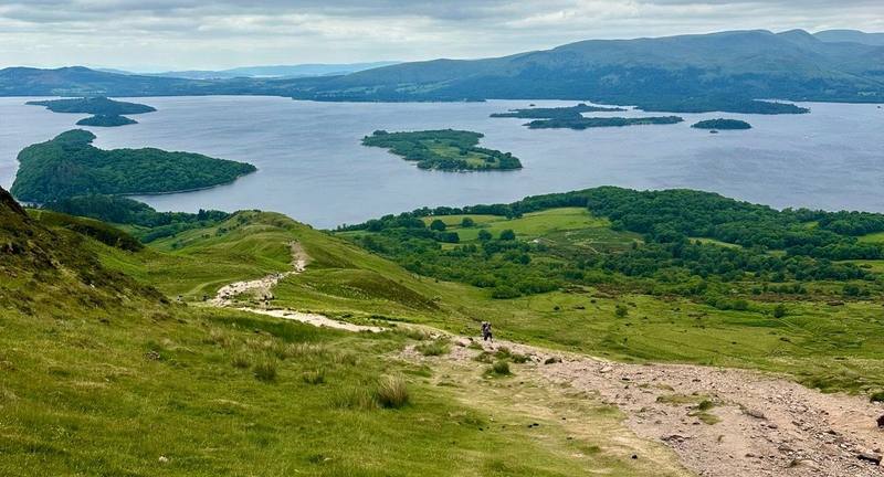
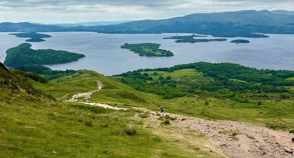
Loch Lomond and its islands from the path over Conic Hill, Day 1. 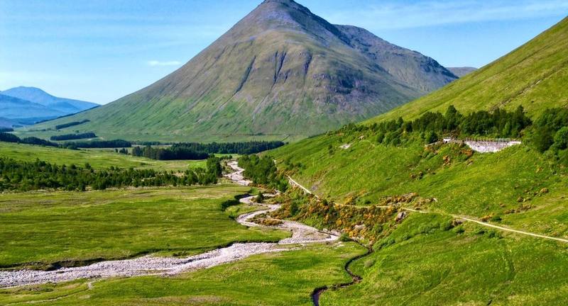
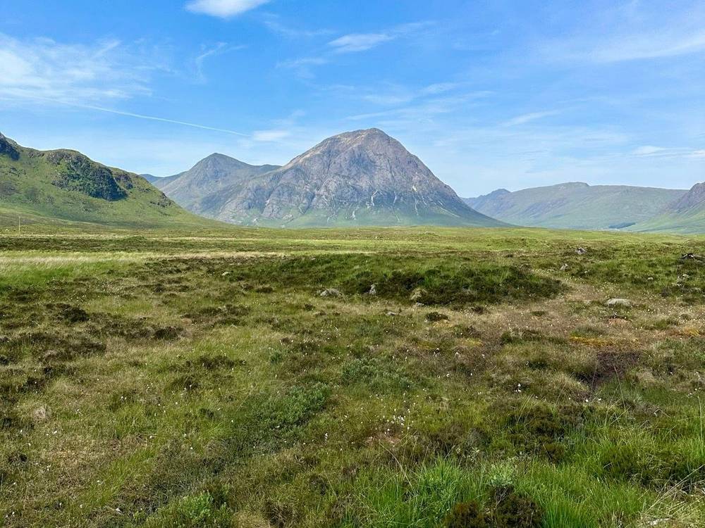
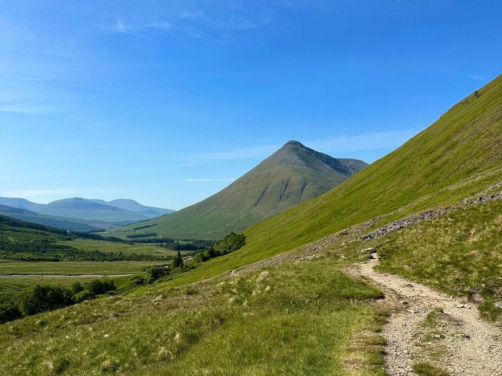
Beinn Dorain above the valley on Day 2. 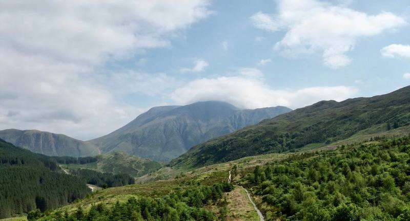
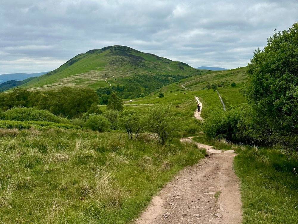
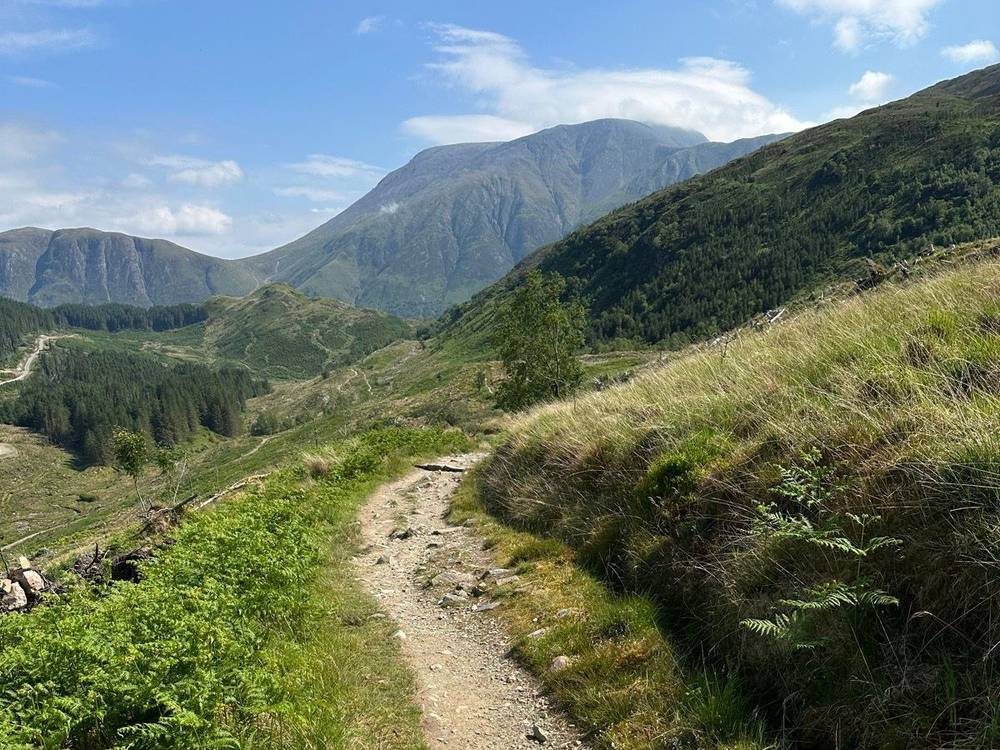
The Way through the forest above Glen Nevis, Day 4. 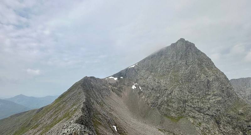
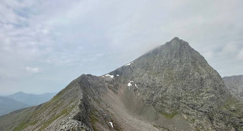
On the Carn Mor Dearg Arete, Day 5.
Newsletter
Get my letter
Get a short letter from me every couple of weeks: new trips, guides and what I'm building.
Free. Unsubscribe any time.
Details
The guide · Free · 54-page PDF + GPX files · 2027 season edition
West Highland Way Hiking Guide
4 days alone from Milngavie to Fort William, plus Ben Nevis. Every page is below: read it here, or take it offline as a PDF with my GPX files (54-page PDF + GPX files, in one zip). No sign-up needed.
The route
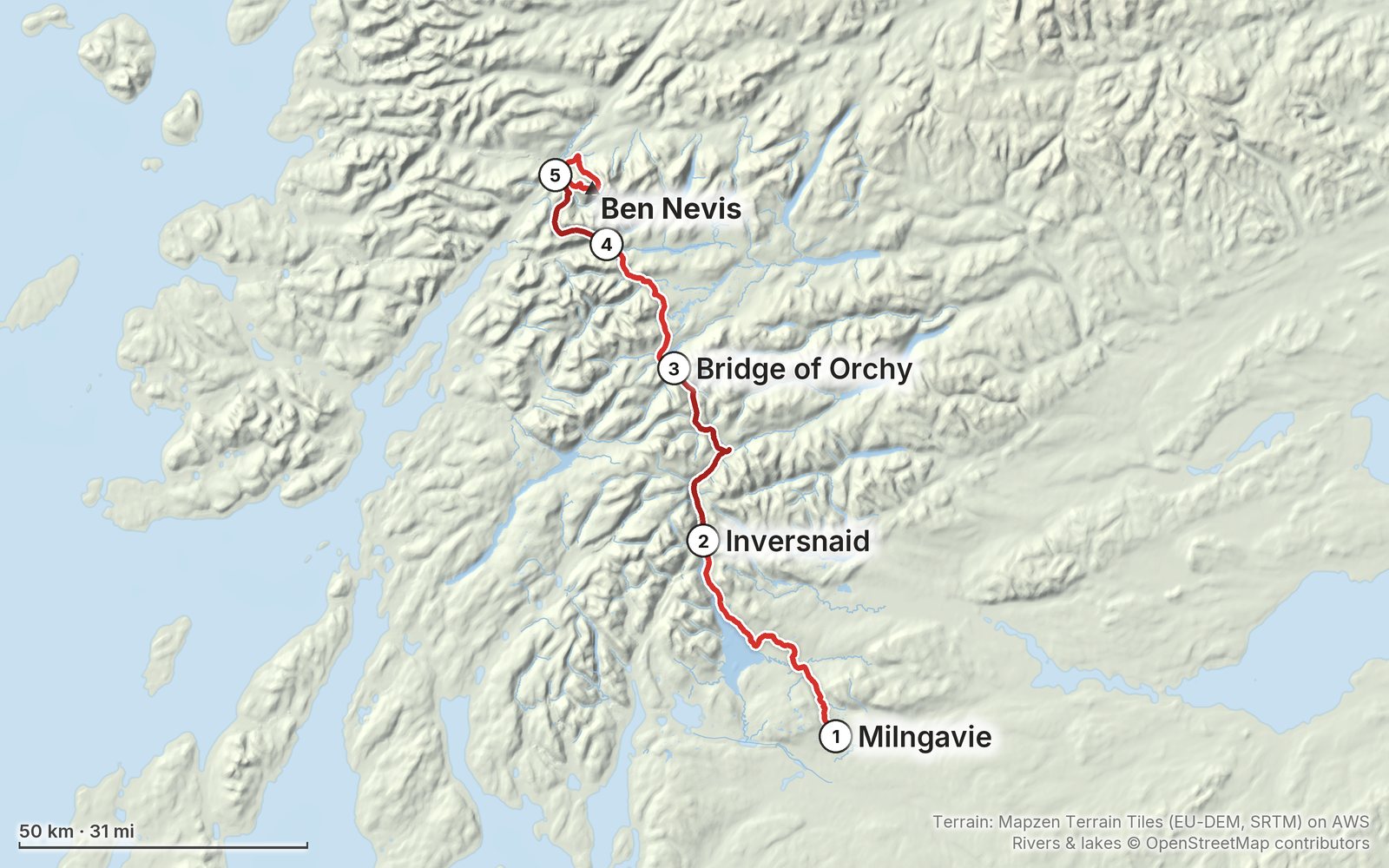
My GPS recording of 5 days on a relief map. The numbers are where each day starts; the red dot is the finish. The day maps are in the guide below, and the GPX files are a free download.
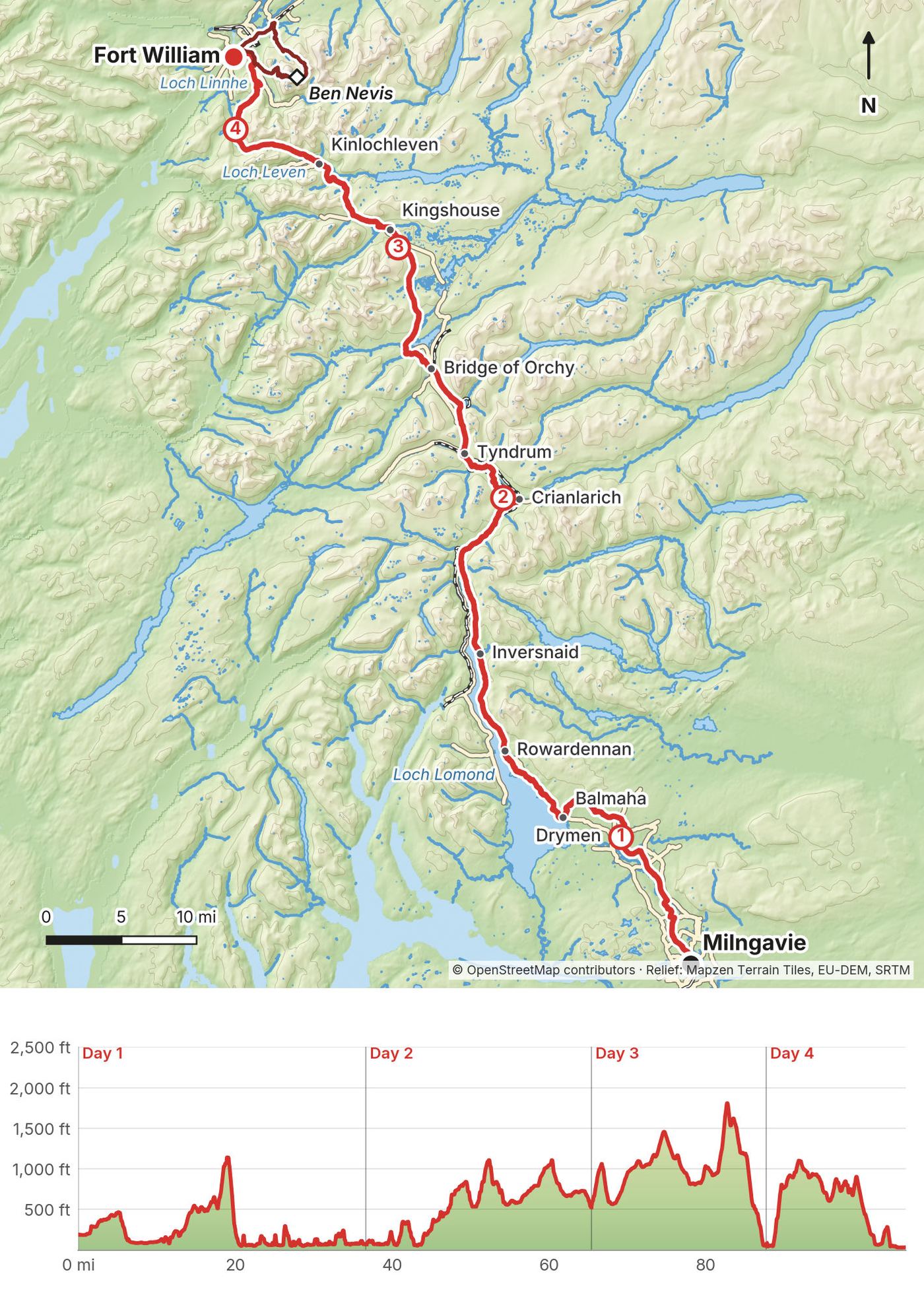
Elevation, start to finish: highest 4,390 ft (1,337 m), lowest sea level.
At a glance
- Days
- 4 days
- Distance
- 96 miles
- Climbing
- About 10,140 ft (3,090 m) up
- Nights
- 2 in my tent, 1 in a hostel in Kinlochleven, 1 in Fort William
- Route
- Milngavie to Gordon Square
Contents
- Welcome
- At a glance
- Straight answers
- When to go
- Where to sleep
- Getting there
- Day 1 Milngavie to Inversnaid
- Day 2 Inversnaid to Bridge of Orchy
- Day 3 Bridge of Orchy to Kinlochleven
- Day 4 Kinlochleven to Fort William
- Day 5 Ben Nevis by the Carn Mor Dearg Arete
- Getting home
- Other ways to do it
- Food, water and midges
- Gear for this route
- Weather and safety
- Using the GPX files
- Before you go, check these
- One-page trip sheet
- About this guide
Welcome
In June 2023 I hiked the whole West Highland Way alone, from Milngavie, on the edge of Glasgow, to Fort William, in four days. The next morning I climbed Ben Nevis, the highest mountain in the UK, by the Carn Mor Dearg Arete. It was my first time in Scotland. Scottish subscribers had been asking me to come and hike for a while. Most higher trails in Europe and North America were still under snow, so after four days in Switzerland, early June seemed like a nice time.
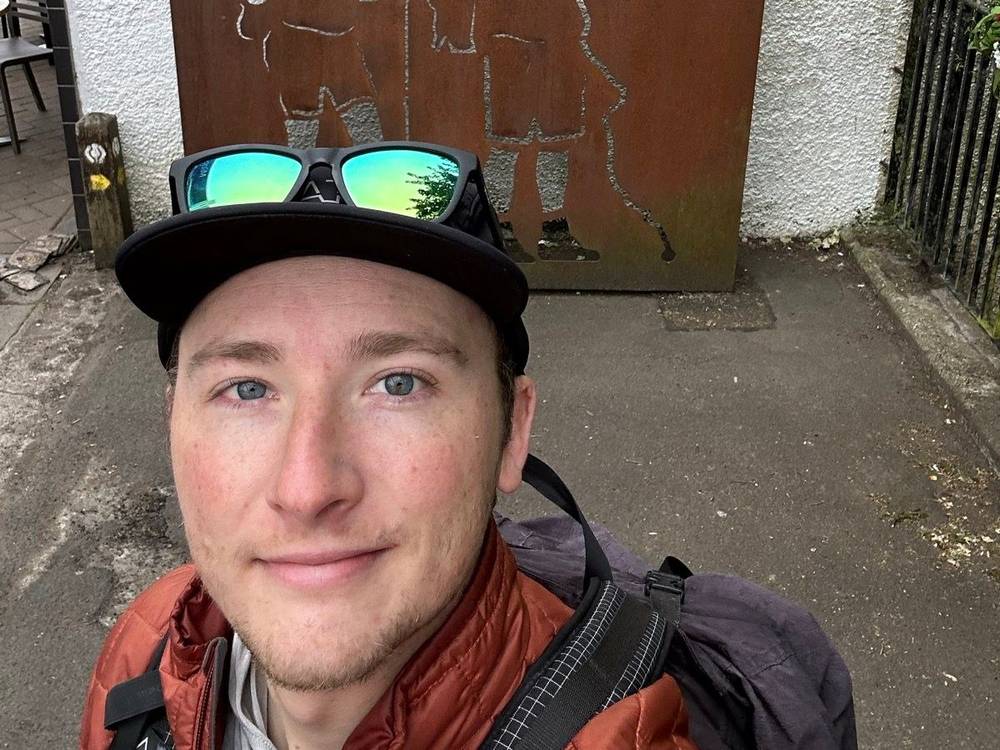
I wanted to see how fast I could hike the trail. I had my eyes set on three days and pushed it to three and a half right at the end, because of the Ben Nevis summit. Most people take six or seven days. On the trail I talked to plenty of other hikers taking seven or eight days to mosey their way up north. Everyone hikes for their own reason and at their own pace, which is nice.
This was one of my easiest long-distance hikes ever. It stays close to sea level and has little climbing for its distance. It's very well marked, it passes a village, an inn or a campsite every few hours, and the railway runs close to it from the head of Loch Lomond to Bridge of Orchy. What it does have is length and midges. I camped two nights, slept in a hostel one night, and had the worst bug experience of my life on the morning of Day 3.
This guide shows you my trip day by day, with my GPS files, maps, notes and film links, and adds what you'll need that I didn't write down at the time.
What's inside
- Straight answers, when to go, where to sleep and the camping rules in plain terms
- Getting to Milngavie and home from Fort William, with 2026 facts
- All four days on the Way, plus Ben Nevis: my notes, the trail, where to get off, a map with an elevation profile, and links to that day in my film
- Other ways to do it, including the usual 6 to 8 days
- Food, water and midges, gear for this route, weather and safety, one page of things to check before you go, and a printable trip sheet
How to use it offline
Save this PDF to your phone's Files or Books app before you leave home. Load the GPX files and download offline maps while you still have Wi-Fi. Each day starts on a new page. The film links need a connection; everything else works in airplane mode.
When I say "I," it's my own trip. Prices, timetables and rules change, so they're dated, and the checks are collected on one page: Before you go, check these.
At a glance
| Quick facts | |
|---|---|
| Distance | The Way is 96 miles (154 km) officially. My GPS: 105.3 miles (169.5 km) in 4 days, with a side trip into Crianlarich and some walking in towns |
| Climbing | About 10,140 ft (3,090 m) up and 10,340 ft (3,150 m) down on the Way, by my GPS |
| Start | Milngavie, a town on the northern edge of Glasgow, about 25 minutes by train from the city centre |
| Finish | Gordon Square, Fort William, at the west end of the High Street |
| High point | The top of the Devil's Staircase on Day 3: 1,821 ft (555 m) on my GPS; 550 m officially |
| Plus | Ben Nevis, 4,413 ft (1,345 m), from Fort William on Day 5: 17.5 miles (28.2 km) and 4,930 ft (1,500 m) of climbing my way |
| Nights | 2 in my tent, 1 in a hostel in Kinlochleven, 1 in Fort William |
| When | I walked June 8 to 11, 2023, and climbed Ben Nevis on June 12 |
| Most people take | 6 to 7 days (the official site); a suggested 5 to 7 |
| Direction | South to north, the usual way: the easier stages come first |
| Waymarking | The whole way, with the Scotland's Great Trails thistle-in-a-hexagon marker |
| Difficulty | In my words: one of my easiest long-distance hikes ever. Long, low, well marked and busy; rough underfoot along Loch Lomond; exposed on Rannoch Moor |
| Day | Route | Miles (km) | Up / down (ft) | Night |
|---|---|---|---|---|
| 1 | Milngavie to Inversnaid | 37.0 (59.5) | 2,857 / 2,971 | Tent by Loch Lomond |
| 2 | Inversnaid to Bridge of Orchy | 28.6 (46.1) | 2,628 / 2,169 | Tent at Bridge of Orchy |
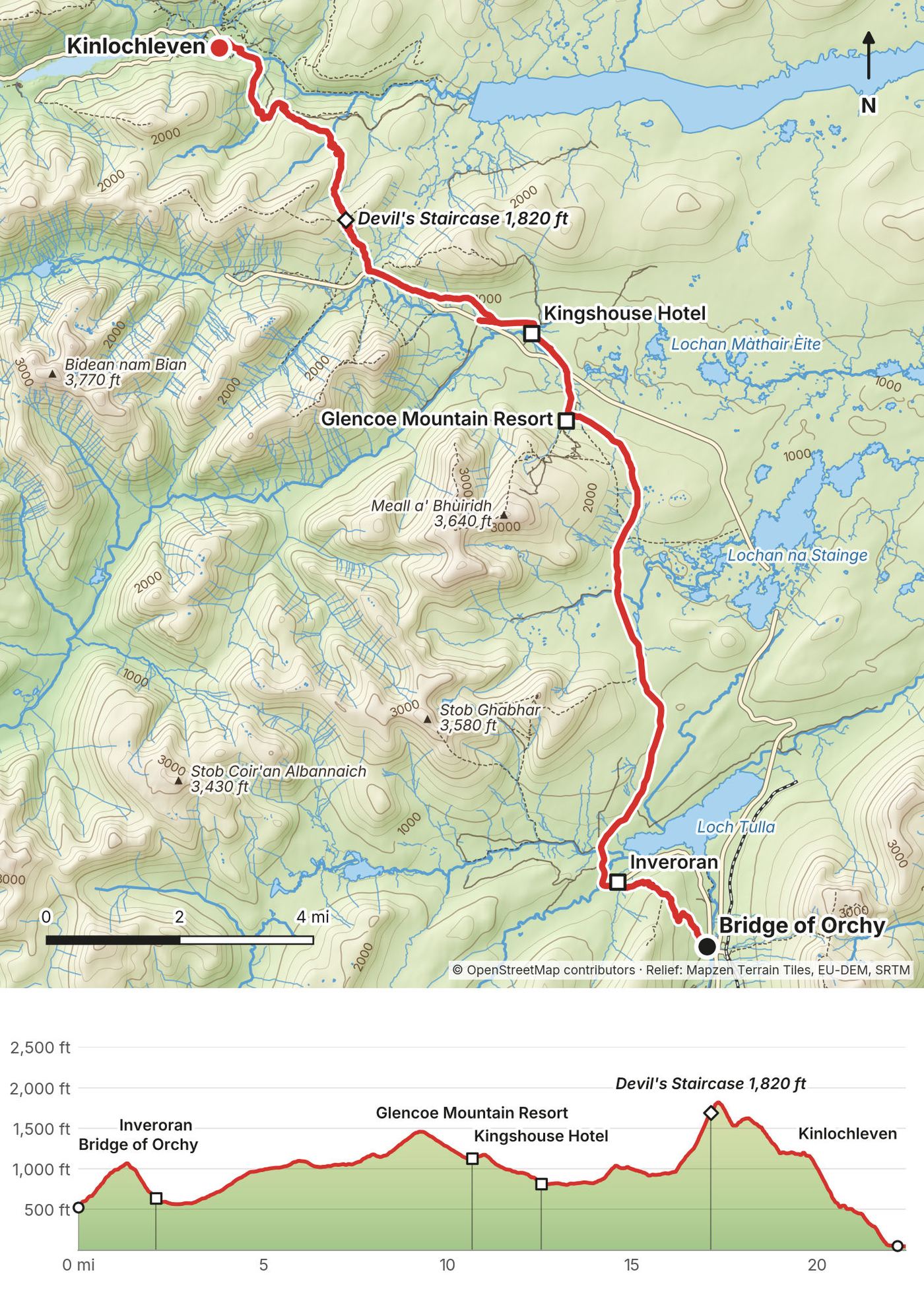
| 3 | Bridge of Orchy to Kinlochleven | 22.2 (35.8) | 2,684 / 3,184 | Hostel |
| 4 | Kinlochleven to Fort William | 17.5 (28.1) | 1,976 / 2,023 | Fort William |
| 5 | Ben Nevis from Fort William | 17.5 (28.2) | 4,932 / 4,945 |
The numbers come from my own GPS recordings, smoothed the same way for every day. My film calls it 100 miles.
Straight answers
Did you do the whole Way? Yes, all of it, from the start in Milngavie to the finish in Fort William, on foot, in four days. I set out to see how fast I could hike it. Ben Nevis the day after is not part of the Way, and I've kept it separate: its own day and its own GPX file.
How many days should I plan? The official site says most people take six to seven days, and its suggested itineraries run from five to seven. Four days meant 37, 29, 22 and 17 miles for me. Unless you're a fast, fit hiker who wants long days, plan six to eight. See Other ways to do it.
How hard is it? For me, one of my easiest long-distance hikes ever: close to sea level, with little climbing for its distance. The highest point is 1,821 ft (555 m), at the top of the Devil's Staircase. What makes it hard is the distance, the rough lochside path north of Rowardennan, the open moor with no shade or shelter, and the weather.
Can I wild camp? Outside the Loch Lomond camping zones, yes, under the Scottish Outdoor Access Code. On the east shore of Loch Lomond, from March 1 to September 30, you can only camp in a campsite or a permit area. I camped twice: by the loch north of Inversnaid and at Bridge of Orchy. See Where to sleep.
Are the midges really that bad? On Day 3, yes. It was the worst bug experience of my life, while packing up my tent in the morning. During the day they weren't a problem at all, because of the sun, the wind and the temperature. Bring a proper midge head net, not a mosquito net. See Food, water and midges.
When should I go? The official site says May is the most popular month. I went in early June and had hot, sunny weather and bad midges. Looking back, I'd go a little earlier. See When to go.
Do I need to book? Beds and campsites, yes, in season. The official site says May puts pressure on accommodation and suggests not starting on a Saturday. Loch Lomond camping permits are booked online, up to four weeks ahead.
Can someone carry my bag? Yes. Two baggage services run the whole Way, Travel-Lite and AMS Scotland: £80 a bag for the full route in 2026. I carried everything myself.
Can I climb Ben Nevis afterward? Yes, straight from Fort William. The Mountain Track from Glen Nevis is the ordinary way: 6 to 9 hours up and down. I went up the Carn Mor Dearg Arete, a longer route with an easy scramble on a narrow ridge. See Day 5.
What does it cost? My records don't show what I spent on this trip. For 2026: a Loch Lomond camping permit is £4.50 a tent a night, a tent pitch at Glen Nevis £13.50 to £17 a person, baggage transfer £80 a bag, and a UK Electronic Travel Authorisation (for US citizens) £20.
Is it well marked? Very. It has a brand and a logo, and there are a lot of signs, especially at the beginning and the end. The official site still says to carry a map and know how to use it.
When to go
The official site says May is the most popular month for walking the West Highland Way. Midges, the tiny biting flies of the Highlands, are out from about May to October, worst in midsummer, and worst early and late in the day and on calm, overcast days (VisitScotland). In 2026 the first big midge peak came in early to mid June (the Smidge midge forecast).
I hiked in early June 2023. Glasgow had lovely sunny weather, and on the trail it was really hot and really sunny, hot for Scotland I presume, with little to no shade on the moor.
Looking back, I think it would have been ideal to go a little earlier, for a couple of reasons. There would be no bugs and fewer people. It would be a little colder. There would also be snow on the tops of the mountains, and the grass in the lowlands would be brown and tan. That's the vibe I've seen online, and it's really cool and unique looking, so I kind of regret not doing the hike then.
While snow still covers the upper part of Ben Nevis, in winter and into early summer, Mountaineering Scotland says you may also need an ice axe, crampons and rigid mountaineering boots, and to know how to use them. See Day 5.
Two things to check for your dates: races, and lambing. The West Highland Way Race (96 miles, overnight) starts in Milngavie in June (June 19 to 20 in 2027), and the Highland Fling runs from Milngavie to Tyndrum (August 29 in 2026; it has usually been in April). During lambing, usually mid April to the end of May, dogs are not allowed in two fields on the way up Conic Hill, even on a lead.
Where to sleep
I slept in my tent twice, in a hostel once, and in Fort William the night after I finished (my records don't show where). There are beds and campsites all along the Way, and most people use them. Here are my four nights, then the rules, then the main places, north from Drymen. Everything was checked on the places' own sites on September 28, 2026, unless it says otherwise.
| Night | Where I slept | What it was |
|---|---|---|
| After Day 1 | By Loch Lomond, 0.4 mi north of the Inversnaid Hotel | My tent, next to the loch. Not a campsite |
| After Day 2 | Bridge of Orchy, across the old bridge from the hotel | My tent. Not a campsite |
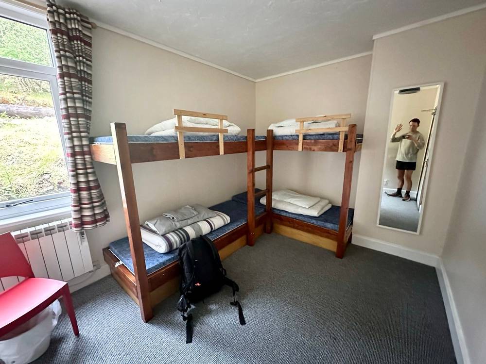
| After Day 3 | Kinlochleven | A zero-staff hostel. My Day 4 recording starts a few yards from the West Highland Lodge |
| After Day 4 | Fort William | My records don't show where |
The camping rules
Loch Lomond & The Trossachs National Park. From March 1 to September 30, parts of the park are Camping Management Zones, and in them you may only camp in a campsite or with a camping permit. On the Way, the official site says the restrictions begin as you leave Drymen. The east shore of Loch Lomond is one of the zones. A permit costs £4.50 per tent per night in 2026, for up to three nights in one permit area, booked online up to four weeks ahead (lochlomond-trossachs.org). Breaking the byelaws can mean a fine of up to £500. The park is reviewing these rules; the current ones stay in force in 2026 and 2027.
Where exactly the east shore zone ends isn't written on the park's pages; its online map shows it. Walkers' guides put the end above Ptarmigan Lodge, about 2 miles north of Rowardennan, with signs at both ends. My Day 1 tent, north of Inversnaid, was beyond that point. Check the park's map before you rely on it.
Everywhere else: the Scottish Outdoor Access Code. Access rights cover "lightweight camping in a tent, in small numbers and for no more than two or three nights in one place." Use a small tent and camp well away from buildings and roads, avoid fields with crops or farm animals, take away all your litter and leave no trace, and don't light fires when the fire risk is high: use a stove. Pee at least 30 m (100 ft) from lochs, rivers and burns. The official site asks walkers not to camp in the field between Gartness Road and the A811 near Drymen. My Bridge of Orchy camp was under these rules.
I'm telling you where I camped so you know what my GPS shows. Plan on campsites and beds, and treat wild camping as a choice you make on the day under the rules above.
Campsites, bothies and beds along the Way
Loch Lomond, east shore. Milarrochy Bay (Camping and Caravanning Club, tents welcome) and Cashel campsite are right on the Way between Balmaha and Rowardennan. Sallochy campsite, run by the park, lists £11.20 per adult per night in 2026 (no car charge if you arrive on foot or by bike; no showers, tents only), but on October 1, 2026 both its own page and the park's campsite list showed it as closed: check. Rowardennan Lodge Youth Hostel (March to October) has beds and tent pitches. North of Rowardennan there are two free Mountain Bothies Association bothies on the Way: Rowchoish, and Doune Byre near the head of the loch. At Inversnaid, the Inversnaid Hotel welcomes walkers; the Inversnaid Bunkhouse's 2026 dates aren't shown on its site.
Inverarnan to Tyndrum. Beinglas Farm (camping, huts, rooms, a shop, showers and the Stagger Inn for food; they ask walkers to book ahead), the Drovers Inn across the river, and Crianlarich Youth Hostel (April to October), down in the village.
Bridge of Orchy and the moor. The Bridge of Orchy Hotel, and the West Highland Way Sleeper, a bunkhouse on the station platform (from about £35 a person, a secondary source; its own site didn't load). The Kingshouse Hotel at the edge of Rannoch Moor has rooms and a bunkhouse, and its Way Inn is a pit stop for walkers.
Kinlochleven. Blackwater Hostel and Campsite (bunk rooms, pods and tent pitches), which also runs the West Highland Lodge, and the MacDonald Hotel's cabins and small-tent camping.
Glen Nevis and Fort William. Glen Nevis Youth Hostel (open all year) and the Glen Nevis Caravan and Camping Park (tents £13.50 to £17 per adult per night in 2026; it fills up in busy spells).
Your bag. Travel-Lite and AMS Scotland move bags between your nights for £80 a bag for the whole route (1 to 4 bags, up to 20 kg each), March 21 to October 18, 2026 (to Inversnaid only April 1 to October 4).
Getting there
To Glasgow. Glasgow Airport is the nearest. The Glasgow Airport Express, bus 500, runs to the city centre (Buchanan Bus Station, Queen Street and Central stations) 24 hours a day, every 10 minutes at busy times, in about 15 minutes. Since September 7, 2026, it has been covered by Scotland's £2 bus fare cap, cash or contactless on the bus. If you're from the US, you need a UK Electronic Travel Authorisation (ETA) before you fly: £20 in 2026, from the official UK ETA app or gov.uk/eta, valid for two years.
In Glasgow. I spent a couple of days in Glasgow before the hike, running around the city, drinking coffee, going to restaurants and getting ready. The day before I started I went for an easy run along the river.
To Milngavie. Direct ScotRail trains run from Glasgow Queen Street to Milngavie several times an hour, in about 25 minutes (a secondary source; check ScotRail). The Way starts at the obelisk in the town centre, a short walk from the station. My records don't show how I got to Milngavie.
From London. The Caledonian Sleeper runs overnight from London Euston to Fort William (every night but Saturday), calling at Crianlarich, Upper Tyndrum and Bridge of Orchy, which is handy for leaving a bag or starting part of the Way. For Milngavie, get a train or bus to Glasgow first.
Day 1: Milngavie to Inversnaid
- Distance
- 37.0 mi (59.5 km)
- Climbing
- 2,857 ft (871 m)
- Descent
- 2,971 ft (905 m)
- Time I took
- 13 hours (6:46 a.m. to 7:44 p.m.), with stops
- High point
- The path over Conic Hill, 1,151 ft (351 m) on my GPS, just below the 1,184 ft (361 m) summit
- Night
- My tent by Loch Lomond, 0.4 mi north of the Inversnaid Hotel
- Food on the way
- Milngavie, Drymen (half a mile off the Way), Balmaha, Rowardennan, the Inversnaid Hotel
- Terrain
- Paths, farm tracks and an old railway line, one real climb over Conic Hill, then a rolling lochside path through woods
My day
It was my first time in Scotland. I'd spent a couple of days in Glasgow running around the city, drinking coffee, going to restaurants and getting ready. The afternoon before, after a rest-day run by the river, I wrote down the plan: start the West Highland Way the next morning and try to speed run it in 3 to 4 days.
My recording starts in Milngavie at 6:46 a.m., and I set off up the Way at about 7:40. The trail is very well marked. It has a brand and a logo, and there are a lot of signs, especially at the beginning and the end. About 10 miles in I came across my first honesty box: supplies, camping fuel, food and drinks, and you put your money in. It's a trust system. There's no one there.
About 20 miles in I reached Conic Hill, the first viewpoint of the loch and a bit of a climb. It was a little windy up there, and the wind, as you come to realize, is nice, because it gets rid of the bugs. I stopped in Balmaha at the bottom for about 25 minutes.
Then Loch Lomond. As soon as I saw the trail and how many miles it runs along the shore, I thought it was going to get old after the first mile, and it did. It just keeps going and going. It was mostly flat trail, though, and that helped me push past 30 miles. There were other hikers, all with huge packs and super friendly. I passed the Inversnaid Hotel at 7:30 p.m. and pitched my tent next to the loch a little further on. The midges had come.
The trail
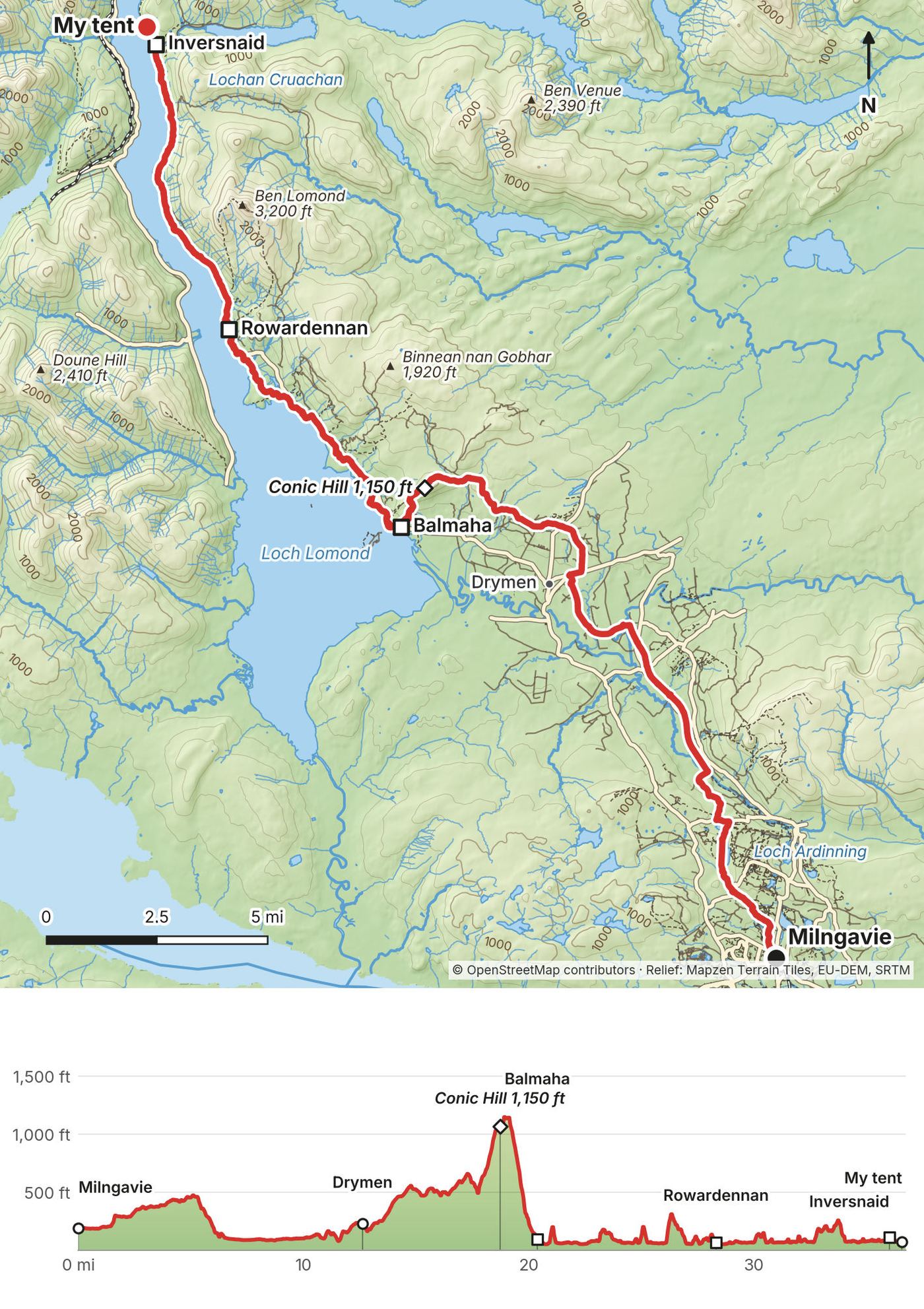
From the start in the centre of Milngavie the Way heads north through Mugdock Wood, past small lochs and farmland, and drops into the Blane valley, where it follows the line of an old railway past Dumgoyne. After Gartness it runs along quiet lanes and tracks to the edge of Drymen, 13 miles in (the village is half a mile off the Way).
From Drymen the path climbs through forest and out onto open hill. The Way crosses the shoulder of Conic Hill at 19 miles, just below the summit, with the whole of Loch Lomond and its islands below, then drops steeply to Balmaha on the shore at 21 miles.
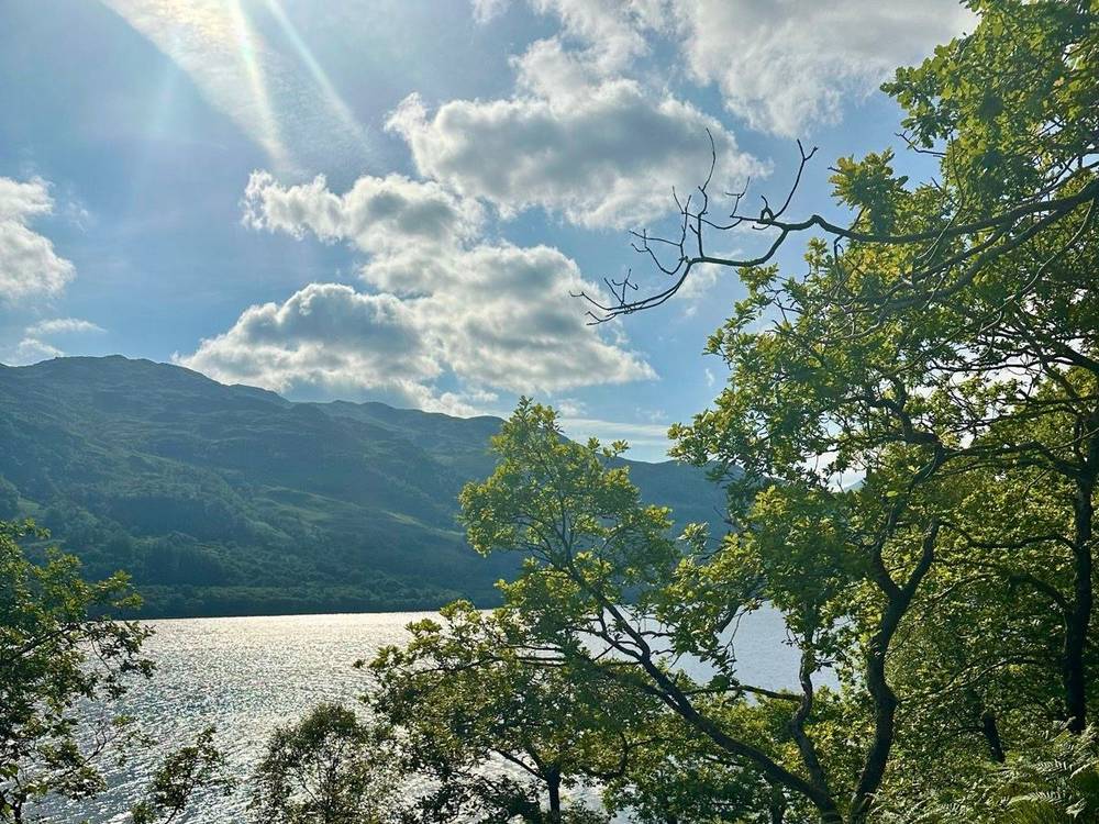
From Balmaha it follows the east shore of the loch: short climbs and drops through oak woods, bays and small beaches. The road ends at Rowardennan, 29 miles in. North of it the Way is a forest track, then a narrower path, rough in places, to Inversnaid at 37 miles.
If you need to get off
Milngavie has trains back to Glasgow. Drymen and Balmaha are on roads; check traveline.info for buses. At Rowardennan the road ends; a waterbus crosses to Tarbet, but only on some days in summer (Fridays and Saturdays, May 2 to September 27, in 2026). From Inversnaid the Cruise Loch Lomond waterbus crosses to Tarbet (March 27 to November 1, 2026), where there are trains and Citylink buses. North of Rowardennan there's no road along the east shore: the way out is by boat or on foot.
Watch this day
Film, Day 1: Loch Lomond · Behind the scenes
Day 2: Inversnaid to Bridge of Orchy
- Distance
- 28.6 mi (46.1 km), including 1 mi down to Crianlarich and back
- Climbing
- 2,628 ft (801 m)
- Descent
- 2,169 ft (661 m)
- Time I took
- 12.5 hours (6:36 a.m. to 7:04 p.m.), with over 2 hours of stops
- High point
- 1,115 ft (340 m) on my GPS, in the forest above Crianlarich
- Night
- My tent at Bridge of Orchy, across the old bridge from the hotel
- Food on the way
- Beinglas Farm near Inverarnan, Crianlarich (off the Way), Tyndrum, Bridge of Orchy
- Terrain
- A rough, rocky lochside path for the first 6 miles, then tracks, old roads and forest paths up Glen Falloch and on to Tyndrum
My day
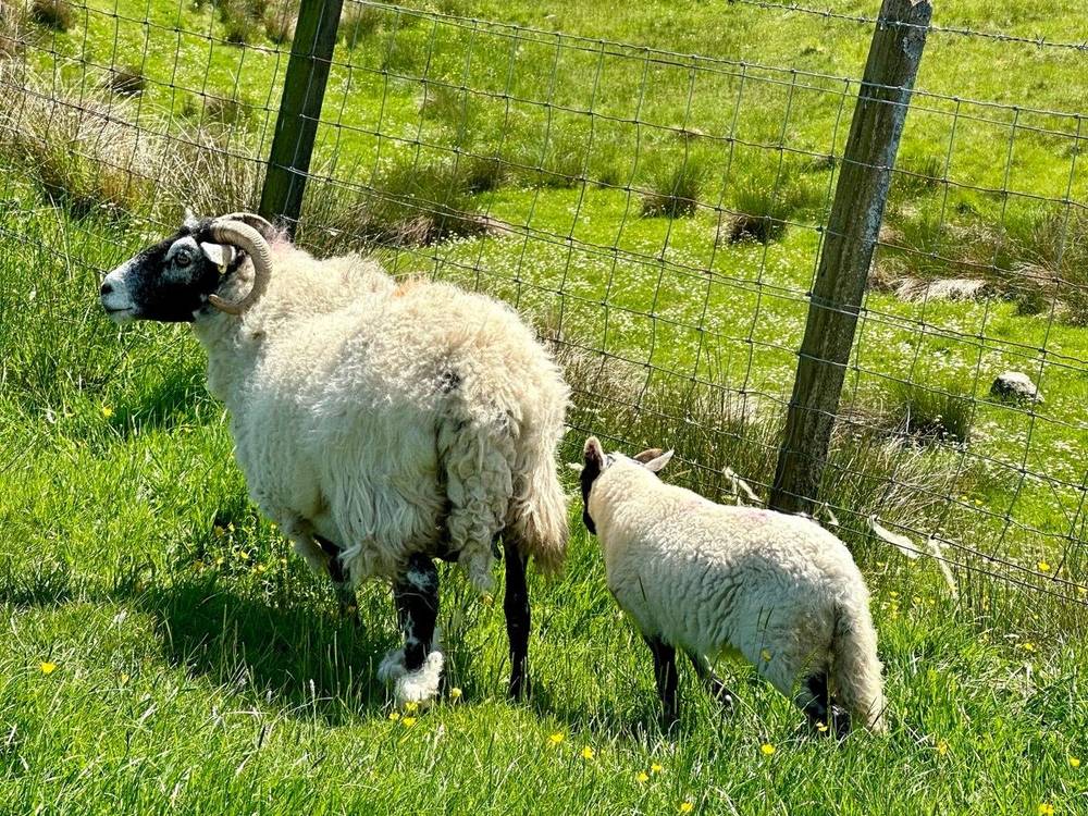
I saw some goats around the loch the next morning. The shore path kept going and going. Day 2 got more into the Highlands, but it's still a lot of road walking: old roads and tracks, often beside the main road and the railway.
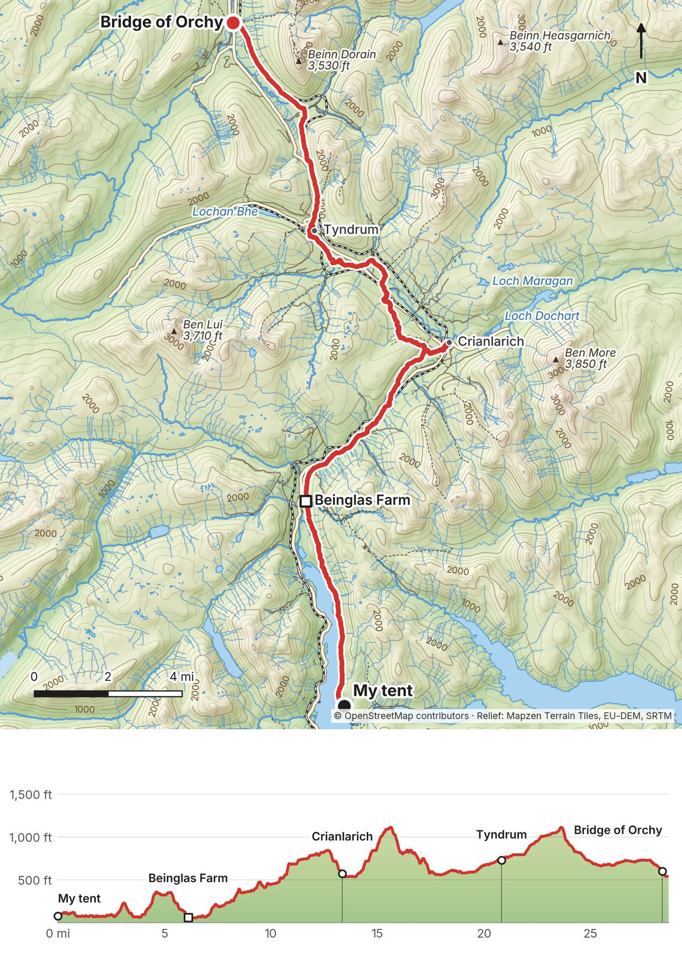
My stops that day, from my GPS: half an hour at Beinglas Farm near Inverarnan at 9:20 a.m., an hour in Crianlarich at lunchtime (I went down off the Way into the village and back up), 40 minutes in Tyndrum in the afternoon, and 20 minutes at Bridge of Orchy before I crossed the old bridge and put up my tent.
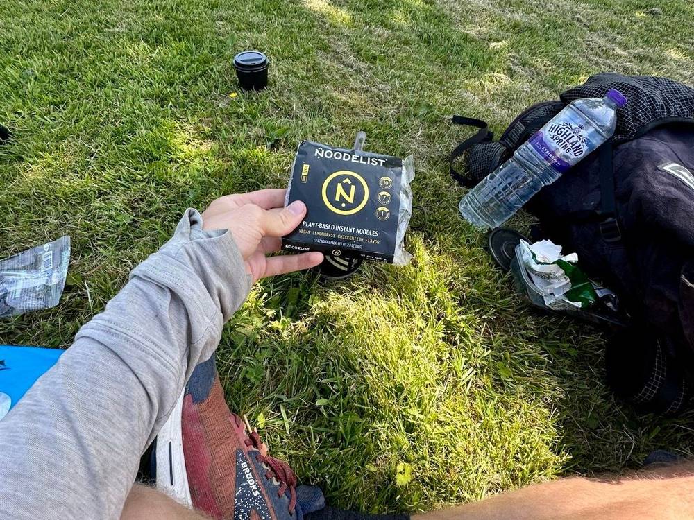
When I went to the Strava event in LA a couple of weeks before, the owner of Noodlist, a plant-based instant noodle company, gave me a bunch of packs. I brought them on this trail, and they were delicious.
The trail
North of Inversnaid the Way stays on the shore of Loch Lomond: a narrow path over roots and boulders, slow going, to the head of the loch. At about 6 miles it passes Beinglas Farm, just across the river from Inverarnan and its hotel.
From there the Way climbs gently up Glen Falloch beside the river, then on old tracks and under the railway to the forest above Crianlarich, 13 miles in. The Way doesn't go through Crianlarich: a path leads down to the village and the station, about half a mile. The Way itself stays in the forest, crosses the main road and follows the valley past Auchtertyre to Tyndrum, at 21 miles.
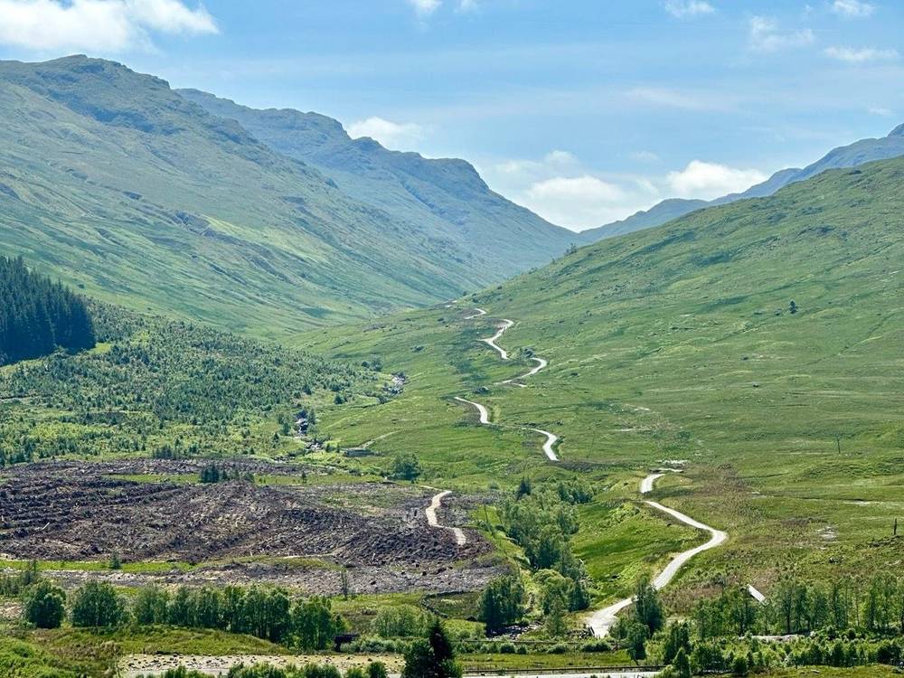
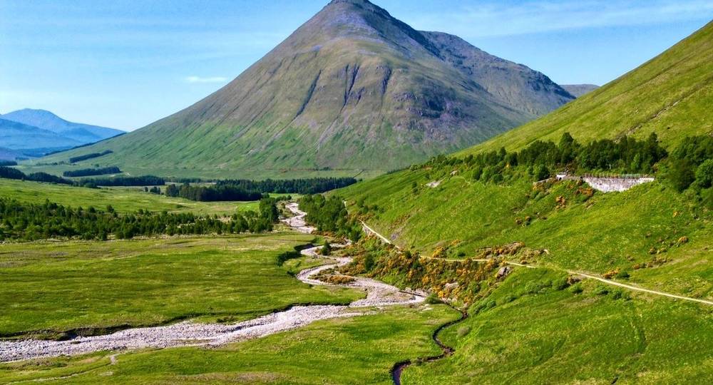
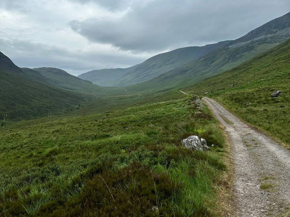
From Tyndrum an old road runs north up the valley between the road and the railway, under the steep cone of Beinn Dorain, to Bridge of Orchy at 28.6 miles: a hotel, a station, and the old bridge over the river.
If you need to get off
At the head of the loch, the Ardlui Hotel runs a small ferry from Ardleish across to Ardlui, which has a station (you raise a signal ball to call the boat; it runs about hourly in the daytime, and its 2026 timetable ends in late October). Inverarnan, Crianlarich, Tyndrum and Bridge of Orchy are all on the Citylink coach route between Glasgow and Fort William, and Crianlarich, Upper Tyndrum and Bridge of Orchy have stations on the West Highland Line.
Watch this day
Day 3: Bridge of Orchy to Kinlochleven
- Distance
- 22.2 mi (35.8 km)
- Climbing
- 2,684 ft (818 m)
- Descent
- 3,184 ft (970 m)
- Time I took
- 9 hours (7:09 a.m. to 4:20 p.m.), with an hour's stop
- High point
- The top of the Devil's Staircase, 1,821 ft (555 m) on my GPS, the highest point of the Way
- Night
- A hostel in Kinlochleven
- Food on the way
- Inveroran Hotel, the cafe at the Glencoe Mountain Resort (off the Way), the Kingshouse Hotel, Kinlochleven
- Terrain
- An old stony road across open moor with no shade, then the zigzag climb of the Devil's Staircase and a long, rocky track down
My day
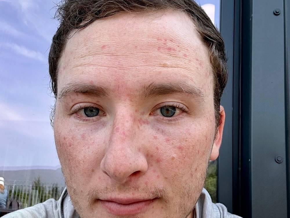
The morning of Day 3 with the midges was the absolute worst. I could see them outside my tent, so I packed as much as I could inside, then ran out, packed the tent up and just started walking. Within those two or three minutes I got bitten so much. It was one of the worst bug experiences of my life. I knew about the midges going into this hike, so I'd brought a head net, but it was for mosquitoes, and the midges were small enough to go through the holes. They got through the net and attacked my face.
Then it was sunny and hot, hot for Scotland I presume, with little to no shade. My GPS shows an hour and 10 minutes at the Glencoe Mountain Resort, at the edge of Rannoch Moor, late in the morning, then the Kingshouse Hotel and the Devil's Staircase in the afternoon. I was in Kinlochleven at 4:20 p.m.
That night I stayed in a hostel. I'd decided to break the last 35-mile section into two days. Time for fish and chips. I'm for sure American: I'd never had fish and chips before. It's kind of basic, I guess. It's pub food, and I just don't like pub food in general. I'd say chicken wings are better. But I had fish and chips while in Scotland, so I can at least say that.
The trail
From Bridge of Orchy the Way climbs about 500 ft (150 m) over a small hill through forest, to about 1,100 ft (330 m), with a view of Loch Tulla, and drops to the Inveroran Hotel at 2 miles. From there it follows an old military road: a wide, stony track across Rannoch Moor, climbing gently to about 1,400 ft. It's open, empty country, with no shade and no water you'd want to drink without treating it.
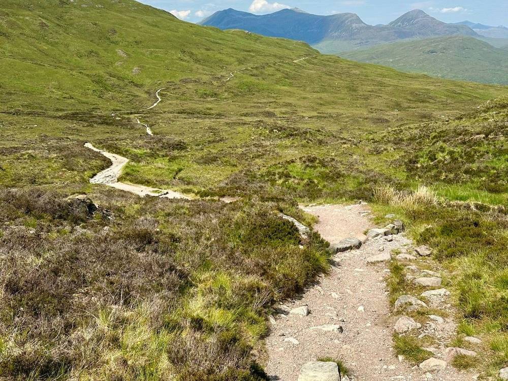
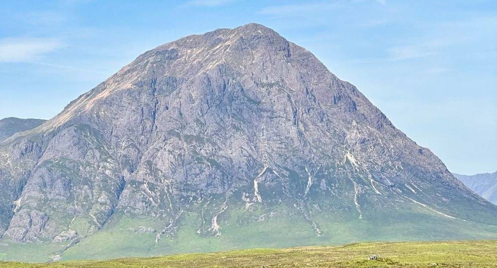
At 10.9 miles a road leads a few hundred yards up to the Glencoe Mountain Resort (a ski centre with a cafe and a campsite). The Way goes on past the Kingshouse Hotel at 12.7 miles and along the valley under Buachaille Etive Mor to Altnafeadh. There the Devil's Staircase zigzags up to 1,821 ft, the top at 17.4 miles. The last 5 miles are a long, rocky descent, much of it on a track beside big water pipes, down to Kinlochleven at sea level.
If you need to get off
After Inveroran there's nothing for about 9 miles across Rannoch Moor. The Citylink coach stops at the Glencoe Ski Centre road end, near the Kingshouse Hotel. From Kinlochleven, Shiel Buses route 44 runs to Fort William in about 55 minutes, several times a day.
Watch this day
Day 4: Kinlochleven to Fort William
- Distance
- 17.5 mi (28.1 km)
- Climbing
- 1,976 ft (602 m)
- Descent
- 2,023 ft (617 m)
- Time I took
- 7 hours (7:14 a.m. to 2:14 p.m.); at the finish at 2:00 p.m.
- High point
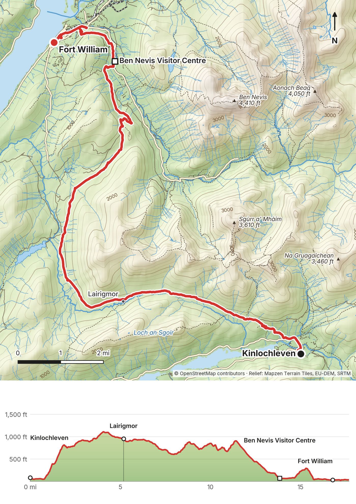
- 1,113 ft (339 m) on my GPS, on the old military road above Kinlochleven
- Night
- Fort William (my records don't show where)
- Food on the way
- None between Kinlochleven and Glen Nevis, 14 miles; then Glen Nevis and Fort William
- Terrain
- A steep climb out of Kinlochleven, a long stony track through an empty glen, forest paths, then a road into town
My day
I'd stayed in a zero-staff hostel. My Day 4 recording starts a few yards from the West Highland Lodge, a bunkhouse in Kinlochleven.
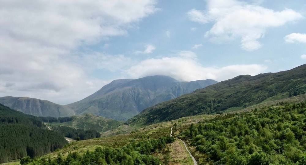
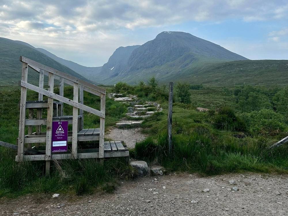
This was an easy last day, with eventual views of Ben Nevis towering above. It was pleasant saying hello to subscribers along the trail. I stopped for half an hour at the Ben Nevis Visitor Centre in Glen Nevis at 12:30, and reached the end of the West Highland Way in Fort William at 2 p.m.
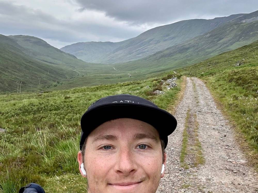
Fort William reminded me of Canada a bit. It was pretty cute, a little touristy, but it was nice to finish the hike. I'd set my eyes on three days, and I pushed it to three and a half right at the end because of the Ben Nevis summit. That evening I wrote down the next plan: a sunrise summit up the spine route the next morning, then a bus back to Glasgow airport and home.
The trail
From Kinlochleven the Way climbs steeply through woods to the old military road, 1,000 ft above the loch, then follows it west up the Lairigmor, a long, empty glen with a few ruins, for about 6 miles. It's a wide, stony track, easy to follow.
After the Lairigmor the Way turns north into forest and follows paths and forest tracks along the hillside above Glen Nevis, with Ben Nevis ahead, before dropping to the road in Glen Nevis near the Ben Nevis Visitor Centre, 14 miles in. The last 3 miles are along the road into Fort William. The official finish is at the west end of the High Street, 17 miles in by my GPS.
If you need to get off
There's no road between Kinlochleven and Glen Nevis. For the first few miles, turning back to Kinlochleven is quickest; after the Lairigmor, keep going. From the Ben Nevis Visitor Centre it's about 3 miles by road into Fort William.
Watch this day
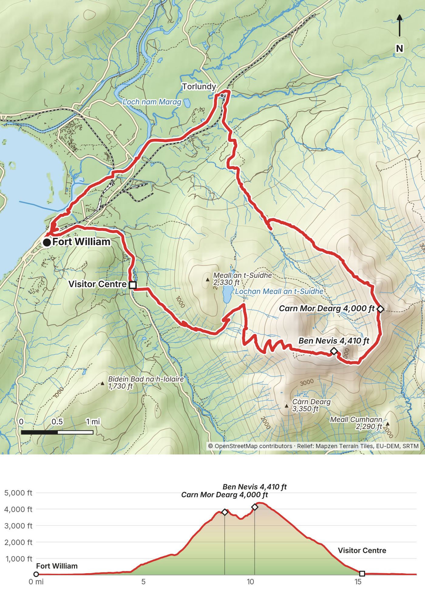
Day 5: Ben Nevis by the Carn Mor Dearg Arete
- Distance
- 17.5 mi (28.2 km), from Fort William town centre and back
- Climbing
- 4,932 ft (1,503 m)
- Descent
- 4,945 ft (1,507 m)
- Time I took
- 9.5 hours (4:25 a.m. to 2:00 p.m.), including the walk to the hill and back
- High point
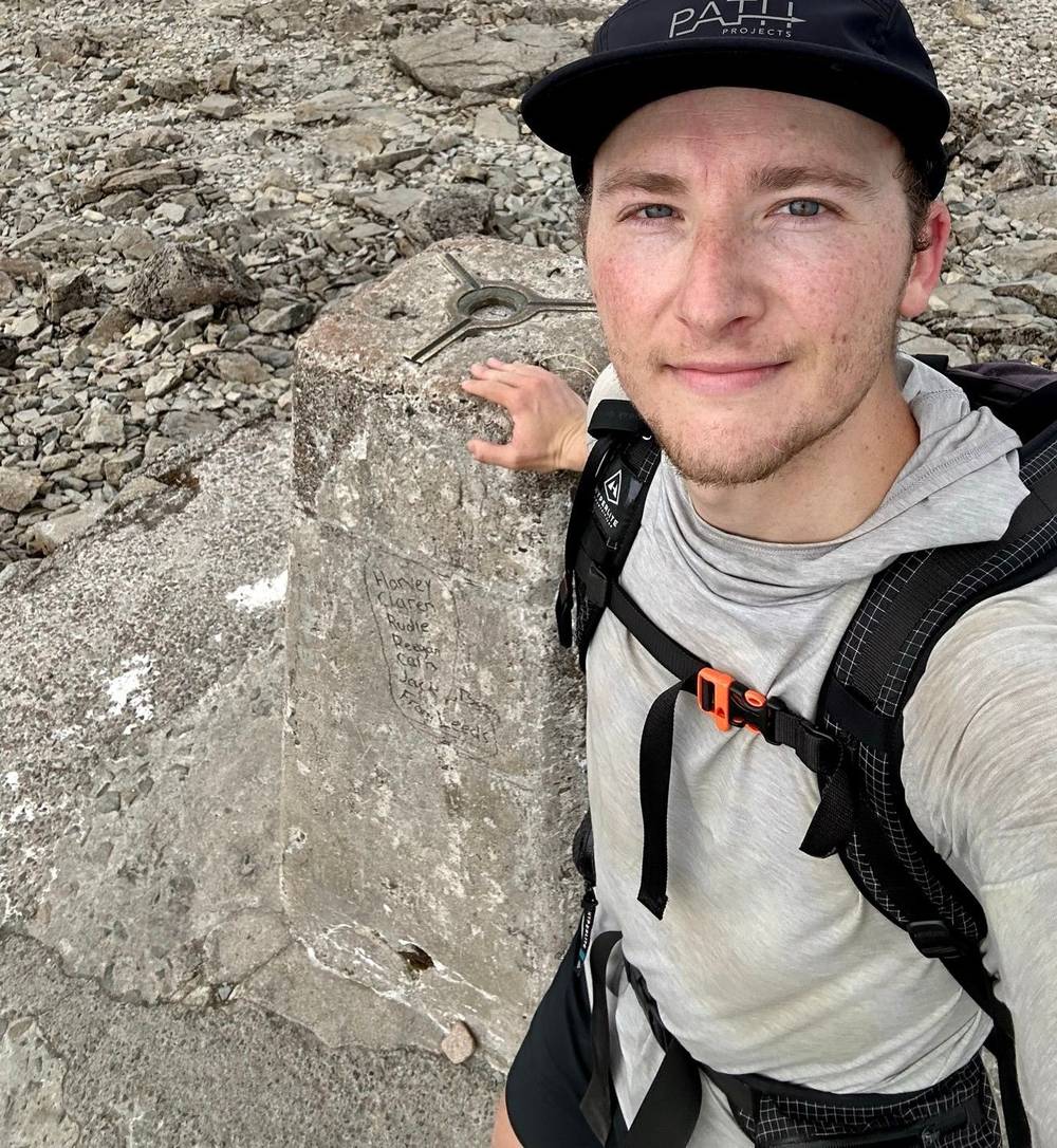
- Ben Nevis, 4,413 ft (1,345 m), the highest point in the UK (4,387 ft, 1,337 m on my GPS)
- Also
- Carn Mor Dearg, 4,003 ft (1,220 m)
- Food on the way
- None on the hill; the cafe at the Ben Nevis Visitor Centre and Fort William at the end
- Terrain
- Roads and forest tracks, a steep, pathless grassy climb, boulder ridges, the narrow granite arete, then the rocky, zigzag Mountain Track down
My day
Next to Fort William is Ben Nevis, the highest point in the UK, and I decided to go and summit it after the West Highland Way. It's not technically part of the Way, but I included it in my film and in this guide.
I started before 4:30 a.m. because there was a bit of a hike to the trailhead, and I went up the less popular Carn Mor Dearg route, which had a little bit of scrambling. It wasn't anything crazy at all. It was pretty easy, to be honest. But I didn't see anyone on that entire route, which is kind of crazy, because going down the other side there were hundreds of people on the tourist route, which is kind of like a staircase up to the peak.
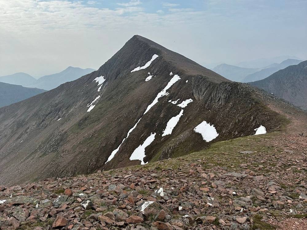
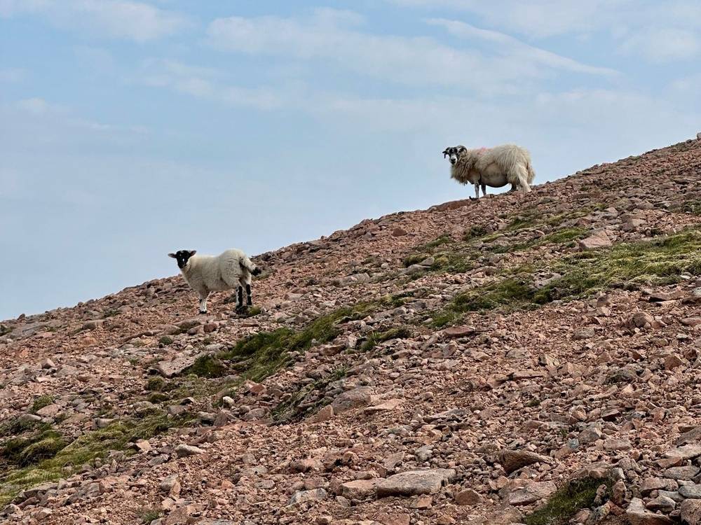
At one point I was the highest person in the UK. My GPS has me on Carn Mor Dearg at 9:14 a.m. and on the summit of Ben Nevis at 10:38. I'm glad I did it. It was a big ascent, but a nice little day hike. I listened to The Dark Forest and The Three-Body Problem for most of it. I was destroying audiobooks on this trip, because there were a lot of long days on flat trails: just me and the sheep out there.
The trail
My line: from the centre of Fort William along roads and paths northeast to Torlundy, 3.5 miles, then up a forest track and path along the Allt a' Mhuilinn toward the north face of Ben Nevis. At about 4.5 miles I left the path and climbed the steep grassy ridge east of the burn to Carn Beag Dearg, then followed the ridge over Carn Dearg Meadhonach to Carn Mor Dearg, 9 miles in. From Carn Mor Dearg the arete curves south and west to the boulder slopes of Ben Nevis and the summit plateau, 10.5 miles in. I came down the Mountain Track, the main path, which zigzags down the west side of the mountain to Glen Nevis and the Ben Nevis Visitor Centre, 15.5 miles in, and walked back to town.
The Carn Mor Dearg Arete is for experienced hillwalkers with a good head for heights. VisitScotland gives 10 to 11 hours for the round; Walkhighlands (a secondary source) calls the arete "a long but easy scramble", Grade 1 in summer, and starts it from the North Face car park above Torlundy. The ordinary way up Ben Nevis is the Mountain Track from the Ben Nevis Visitor Centre in Glen Nevis: Mountaineering Scotland calls it "a demanding walk which takes 6-9 hours". Even in summer the summit can be very cold, wet, windy and covered in snow, and there were still patches of snow on the ridges when I went, on June 12. Mountaineering Scotland says that in winter and into early summer, while snow still covers the upper mountain, you may need an ice axe, crampons and rigid mountaineering boots, and to know how to use them. Coming down the Mountain Track with snow about, keep out of the Red Burn, a known avalanche area. If the arete or the summit plateau still holds snow and you don't have that kit and those skills, take the Mountain Track or turn back.
If you need to get off
On the Carn Mor Dearg Arete the safe way off is to go back or go on: the sides are steep. From the summit of Ben Nevis the way down is the Mountain Track. In cloud, the summit plateau is dangerous: the path passes close to the tops of steep gullies on the north face. Mountaineering Scotland's advice for poor visibility: from the summit, walk 150 m on a grid bearing of 231 degrees, then follow 282 degrees to reach the zigzags. Practise with a compass before you need it.
Watch this day
Getting home
My plan, as I wrote it the evening I finished: the Ben Nevis summit the next morning, then a bus back to Glasgow airport and home.
Fort William to Glasgow by coach. Scottish Citylink runs from Fort William to Glasgow Buchanan Bus Station in about 3 hours, with up to 11 departures a day in the summer 2026 timetable (June 6 to September 18; some only from late June to late August). Some call at Glasgow Airport. The winter timetable from September 19, 2026, wasn't published when I checked; see citylink.co.uk.
By train. ScotRail's West Highland Line runs from Fort William to Glasgow Queen Street in about 3 hours 45 minutes, three trains a day and one on Sundays (a secondary source; check ScotRail). It crosses Rannoch Moor, well east of the Way.
To London. The Caledonian Sleeper leaves Fort William at 19:50 Monday to Friday and 19:00 on Sundays (no Saturday train), arriving at London Euston about 8 a.m.
Other ways to do it
The usual way: 6 to 8 days. The official site splits the Way into eight sections. Most people take six or seven days by joining two of the shorter ones:
| Section | Miles (km) | My day |
|---|---|---|
| Milngavie to Drymen | 12 (19) | 1 |
| Drymen to Rowardennan, over Conic Hill and through Balmaha | 15 (24) | 1 |
| Rowardennan to Inverarnan | 14 (22.5) | 1 and 2 |
| Inverarnan to Tyndrum | 12 (19.5) | 2 |
| Tyndrum to Inveroran | 9 (14.5) | 2 and 3 |
| Inveroran to Kingshouse | 10 (16) | 3 |
| Kingshouse to Kinlochleven | 9 (14.5) | 3 |
| Kinlochleven to Fort William | 15 (24) | 4 |
Four days, like me. It means long days: Day 1 took me 13 hours, Day 2 twelve and a half. The places I stopped in each night (Inversnaid, Bridge of Orchy, Kinlochleven) all have beds, so you don't need to wild camp to do it my way.
With your bag carried. Travel-Lite and AMS Scotland move bags between your nights (£80 a bag in 2026). You walk with a daypack.
The low route past Conic Hill. The official alternative follows the road from Drymen to Milton of Buchanan and the B837 into Balmaha. It's what dog walkers use in lambing season.
The new High Route into Fort William. Since June 2026 there's an optional waymarked path about 50 to 70 m above Glen Nevis, around part of Cow Hill, coming down near the Leisure Centre at the end of Alma Road, a short walk from the finish. It didn't exist in 2023; my line is the old one.
Ben Nevis the easy way. The Mountain Track from the Ben Nevis Visitor Centre, 6 to 9 hours up and down. More than 130,000 people a year climb the Ben (John Muir Trust); I saw hundreds on it coming down.
More of the UK. After this trip I said I'd looked at Snowdonia and the Lake District, and that the Isle of Skye looked interesting. I went back to Scotland in 2026 for the Skye Trail, which has its own guide.
Food, water and midges
Food. There's food every few hours on the Way: shops, cafes, pubs and hotels. Banks and cash machines are in Milngavie, Drymen, Crianlarich, Tyndrum, Kinlochleven and Fort William (official FAQ). About 10 miles in on Day 1 I came across my first honesty box: supplies, camping fuel, food and drinks, and you put your money in. The longest stretch with nothing is Kinlochleven to Glen Nevis, 14 miles on Day 4.
Some places I passed, open in 2026: the Green Welly Stop in Tyndrum (a snack cafe open 7 a.m. to 7 p.m. and a restaurant), the Real Food Cafe in Tyndrum, Beinglas Farm's Stagger Inn and the Drovers Inn near Inverarnan, the Bridge of Orchy Hotel bar, and the Kingshouse Hotel's Way Inn. Kinlochleven and Fort William have supermarkets.
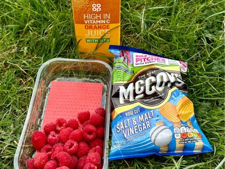
What I ate, from my record: Noodlist plant-based instant noodles (a bunch of packs from the owner, given to me at a Strava event in LA; they were delicious), my post-hike cravings at the end of Day 3 (salt and vinegar chips, orange juice and berries, fantastic), and my first ever fish and chips, in Scotland. It's kind of basic. I'd say chicken wings are better.
Water. My records don't say how I got water. There are taps in the villages and at campsites. Burns (streams) are everywhere, but sheep and cattle graze along much of the Way. Use taps marked as drinking water where you can. Filter stream water and also boil it or treat it chemically, above all where livestock graze, as on the way up Conic Hill (Lomond Mountain Rescue, May 2026).
Midges. Midges are tiny biting flies. When I hiked, in early June, the whole time I was hiking during the day they weren't a problem at all, because of the sun, the wind and the temperature. The only time they're a problem is when you stop, and in the morning and at night at camp. If there's no wind, the bugs come out; the wind gets rid of them. I'd only seen midges once before, in Iceland in summer, and they were bad, but this was the worst bug experience of my entire life. I brought a head net, but it was a mosquito net, and the midges were small enough to go through the holes.
What to do about them, from the official site and VisitScotland: they're most active at dawn and dusk and on calm, overcast days, and they don't fly in a breeze. Bring a proper midge head net (a finer mesh than a mosquito net), repellent, and long sleeves. Camp where there's a breeze. Check the Smidge midge forecast (smidgeup.com/midge-forecast).
Ticks. NHS inform says there are a high number of ticks in the Scottish Highlands, with a higher risk of Lyme disease in woodland and moorland from March to October. Stay on paths, wear long sleeves and tuck your trousers into your socks, and check your skin every evening. Remove ticks quickly. A circular rash 3 to 30 days after a bite, or flu-like symptoms, is a reason to see a doctor.
Gear for this route
My advice then was the same as now: minimalism helps me hike better. Hiking is all about balancing safety and fun. Most people start out bringing too much stuff to make sure they're safe, but that added weight makes things less fun. Less is more.
For Ben Nevis, even in summer, Mountaineering Scotland advises warm, windproof and waterproof layers, a hat and gloves, and boots with good grip.
Paid links: I earn a commission if you buy through these links, at no extra cost to you. As an Amazon Associate I earn from qualifying purchases.
My records don't list my kit for this trip, so here's what they show, what I'd take now, and what I filmed with.
What I carried in 2023
From my film, my photos and my notes. No brands for most of it, so no links.
- Tent: a small green tent. For my two wild camps.
- Head net: a mosquito head net. The midges went straight through it. Bring a midge net.
- Shoes: Brooks trail runners. A month later I wrote that the Brooks shoes from my last few hikes had given me plantar fasciitis.
- Headphones: Shokz OpenFit. Open-ear headphones. I was destroying audiobooks on this trip, because there were a lot of long days on flat trails.
- Also: a black backpack, a cap and a light sun hoodie. In my photos.
What I'd take now
What I'd bring for this route from my current kit.
- Tent: NEMO Hornet Elite OSMO 1P (Amazon). If you wild camp. Camp where there's a breeze: midges don't fly in one.
- Pack: Hyperlite Mountain Gear Waypoint 35 (Hyperlite). I carried everything myself.
- Sun hoodie: PATH Projects Pyrenees T19 Hoodie (PATH Projects). Long sleeves for the midges and ticks too.
- Rain shell: Arc’teryx Beta AR Jacket (Arc’teryx). For Ben Nevis, even in summer.
- Warm layer: Arc’teryx Cerium Hoody (Arc’teryx). For Ben Nevis.
- Hat: PATH Projects Hoyt Merino Beanie (PATH Projects). For Ben Nevis.
- Gloves: Unigear Touchscreen Liner Gloves (Amazon). For Ben Nevis.
- Water filter: Katadyn BeFree AC · 1L (Amazon). Filter stream water and also boil it or treat it chemically where livestock graze.
- Power bank: Nitecore NB20000 (Amazon)
- Navigation: AllTrails+ (AllTrails, 30% off). Load my GPX files and download offline maps while you still have Wi-Fi. Offline maps need the paid plan.
- Phone data: Airalo eSIM (Airalo, $3 off). Data in Scotland without a SIM swap.
Filming kit
What I filmed this trip with in 2023. My setup is much smaller now (below).
- Camera: my camera on a tripod
What I film with now
Since September 2026 I film with a smaller setup: the Pocket 4 and the Mic 3 on the trail.
- Camera: DJI Osmo Pocket 4 (Amazon)
- Mic: DJI Mic 3 · 1 TX + 1 RX (Amazon). It pairs with the Pocket 4.
- Tripod: SmallRig Carbon Fiber Tripod (Amazon)
Weather and safety
Weather. I had hot, sunny days. That's not normal: plan for rain and wind at any time of year. One Met Office mountain forecast covers the whole Way and Ben Nevis: Southwest Highlands. The Mountain Weather Information Service has a West Highlands forecast too (mwis.org.uk).
Rannoch Moor and the Lairigmor (Days 3 and 4) are open and exposed, with no shelter, no shade and no shops for hours. Carry water in hot weather and layers in cold weather.
Ben Nevis is a big mountain, with snow on it well into summer (ice axe and crampons while it's there) and steep cliffs and gullies on the north side of the summit plateau. See Day 5 for the navigation bearings.
In an emergency call 999 or 112 and ask for Police, then Mountain Rescue. Have ready where you are (a grid reference and a named landmark), who's hurt and how, and your phone numbers. Register for emergency texts before you go: text the word "register" to 999 and follow the reply. The distress signal is six whistle blasts or torch flashes a minute.
Ticks and midges: see Food, water and midges.
Using the GPX files
My own GPS recordings from June 2023, with all timestamps removed.
| File | What it is |
|---|---|
| west-highland-way-day-1.gpx to west-highland-way-day-4.gpx | One file per day on the Way, Milngavie to Fort William |
| west-highland-way-day-5-ben-nevis.gpx | Ben Nevis from Fort William by the Carn Mor Dearg Arete, down the Mountain Track |
| west-highland-way-full-route.gpx | The four days on the Way, with waypoints for my nights, the villages, my stops, the Devil's Staircase and Ben Nevis |
The files show the way I walked, including a side trip down into Crianlarich and back on Day 2 and some walking around town at both ends. The Way is waymarked: where my line and the markers differ, follow the markers.
AllTrails. On a computer, sign in at alltrails.com, create a new map and use Import. It then shows up in the app on your phone. Offline maps need a paid plan.
Gaia GPS. Open the file from Files, email or AirDrop and choose Gaia GPS, or use Import on gaiagps.com. Download the map area offline.
Garmin. In Garmin Connect on the web, go to Training, Courses, Import. Save it as a course and send it to your watch.
Organic Maps (free). Download the offline map for Scotland, then open the GPX file and choose Organic Maps. It works fully offline.
Before you leave Glasgow, download offline maps for the whole Way, turn on airplane mode, and check that each day and your location show up.
Before you go, check these
These change from year to year; everything else in this guide stays the same. Checked September 28 and October 1, 2026. Check them again when you book and the week you go.
On the trail
- Diversions and closures on the Way: the official notices page, westhighlandway.org/notices
- Loch Lomond camping permits, the dates the byelaws apply (March 1 to September 30) and the zone map: lochlomond-trossachs.org
- Whether Sallochy campsite is open, and the Inversnaid Bunkhouse's dates
- Race and event dates, and lambing-season dog rules on Conic Hill: westhighlandway.org
Getting there and back
- ScotRail trains to Milngavie and on the West Highland Line: scotrail.co.uk
- The Citylink winter timetable (from September 19, 2026): citylink.co.uk
- The Loch Lomond waterbuses (Tarbet to Inversnaid, Rowardennan to Tarbet) and the Ardlui ferry season
- A UK ETA if you're from the US: gov.uk/eta (£20 in September 2026)
Health and safety
- The mountain forecast for the Southwest Highlands, and the midge forecast
- Emergency texts: text "register" to 999 before you go
- For Ben Nevis: snow on the summit (ice axe and crampons if it's still there), and your map and compass skills
Bookings and gear
- Beds, campsites and baggage transfer for your dates, above all in May; a midge head net, repellent and rain gear
One-page trip sheet
| Day | Date 2023 | From, to | mi (km) | Night |
|---|---|---|---|---|
| June 7 | Glasgow, rest day | Glasgow | ||
| 1 | June 8 | Milngavie to Inversnaid | 37.0 (59.5) | Tent by Loch Lomond |
| 2 | June 9 | Inversnaid to Bridge of Orchy | 28.6 (46.1) | Tent, Bridge of Orchy |
| 3 | June 10 | Bridge of Orchy to Kinlochleven | 22.2 (35.8) | Hostel, Kinlochleven |
| 4 | June 11 | Kinlochleven to Fort William | 17.5 (28.1) | Fort William |
| 5 | June 12 | Ben Nevis by the Carn Mor Dearg Arete | 17.5 (28.2) | |
| Total | The Way, Days 1 to 4 | 105.3 (169.5) | About 10,140 ft up |
Official: 96 miles (154 km), Milngavie to Fort William; the high point is the Devil's Staircase, 550 m. Most people take 6 to 7 days.
Camping: Loch Lomond east shore zone, March 1 to September 30: campsites or a permit only (£4.50 a tent a night in 2026). Elsewhere: the Scottish Outdoor Access Code.
Ways out: Tarbet waterbuses (Rowardennan, Inversnaid), the Ardlui ferry, Citylink and trains at Inverarnan, Crianlarich, Tyndrum and Bridge of Orchy, Citylink near Kingshouse, bus 44 from Kinlochleven.
Ben Nevis in cloud: from the summit, 150 m on a grid bearing of 231 degrees, then 282 degrees to the zigzags.
Emergency: 999 or 112, ask for Police, then Mountain Rescue.
About this guide
West Highland Way Hiking Guide: 4 days alone from Milngavie to Fort William, plus Ben Nevis, by Kraig Adams. 2027 season edition, updated September 2026.
I hiked the West Highland Way alone from June 8 to 11, 2023, and climbed Ben Nevis on June 12. I made a film of it: Hiking 100 miles on the West Highland Way in Scotland. Everything in first person comes from that trip: my film, my GPS recordings, my Strava notes and photos, and a magazine interview I answered the week after. Rules, prices, timetables and safety facts were checked in September 2026, and anything that changes is dated.
Updates and contact. If something has changed, or you spot a mistake, email me at kraig@kraigadams.com.
Paid links, no sponsors. The gear links in Gear for this route are paid links: I earn a commission if you buy through them, at no extra cost to you. This guide isn't sponsored.
Safety. This guide describes my trip and what I found, not current conditions. Paths, rules, timetables and advice change. Check the weather, carry a map and know how to use it, follow the camping rules, and turn back when conditions aren't right. The Carn Mor Dearg Arete is for experienced hillwalkers. You're responsible for your own safety.
Copyright. © 2026 Kraig Adams. This guide, its photos and the GPX files are for your personal use. Please don't share or resell them.
Credits. Photos are mine, from my trip. The cover is from my film. GPX files are my own recordings. Maps © OpenStreetMap contributors, openstreetmap.org/copyright (ODbL). Relief: Mapzen Terrain Tiles, from EU-DEM and SRTM data.
The details
- Format
- A 54-page PDF sized for a phone (A5, prints fine too) and a folder of GPX files, in one zip download.
- Edition
- 2027 season edition, updated September 2026.
- Questions
- Email kraig@kraigadams.com.
Questions
- How many days does the West Highland Way take?
- The official site says most people take six to seven days, and its suggested itineraries run from five to seven. I hiked it alone in four days in June 2023: 37, 29, 22 and 17 miles. Unless you're a fast, fit hiker who wants long days, plan six to eight.
- How hard is the West Highland Way?
- For me it was one of my easiest long-distance hikes: close to sea level, very well marked, with little climbing for its distance. The highest point is the top of the Devil's Staircase, 1,821 ft (555 m) on my GPS. What makes it hard is the distance, the rough lochside path north of Rowardennan, the open moor and the weather.
- Can you wild camp on the West Highland Way?
- Outside the Loch Lomond camping zones, yes, under the Scottish Outdoor Access Code. On the east shore of Loch Lomond, from March 1 to September 30, you may only camp in a campsite or with a camping permit: £4.50 per tent per night in 2026, booked online up to four weeks ahead.
- Are the midges bad on the West Highland Way?
- They can be. Midges are out from about May to October, worst in midsummer, early and late in the day and on calm, overcast days. In early June 2023 I had the worst bug experience of my life packing up my tent one morning, though during the day the sun and wind kept them away. Bring a proper midge head net.
- Can someone carry your bag on the West Highland Way?
- Yes. Travel-Lite and AMS Scotland move bags between your nights for the whole Way: £80 a bag in 2026, from March 21 to October 18. I carried everything myself.
- Can you climb Ben Nevis after the West Highland Way?
- Yes, straight from Fort William. The Mountain Track from Glen Nevis is the ordinary way, 6 to 9 hours up and down. The morning after I finished, I went up by the Carn Mor Dearg Arete, a longer route with an easy scramble: 17.5 miles and about 4,930 ft of climbing my way.
Timeline · newest first
Published · September 28, 2026
Wrote the guide
The day-by-day guide to the route, made from my film, my GPS recording and my notes.
Published · July 6, 2023 · YouTube · 328,778 views
Published the film: Hiking 100 miles on the West Highland Way in Scotland
On the trail · June 2023
Day 5: Ben Nevis by the Carn Mor Dearg Arete
The day in the guide: Day 5: Ben Nevis by the Carn Mor Dearg Arete.
On the trail · June 2023
Day 4: Kinlochleven to Fort William
The day in the guide: Day 4: Kinlochleven to Fort William.
On the trail · June 2023
Day 3: Bridge of Orchy to Kinlochleven
The day in the guide: Day 3: Bridge of Orchy to Kinlochleven.
On the trail · June 2023
Day 2: Inversnaid to Bridge of Orchy
The day in the guide: Day 2: Inversnaid to Bridge of Orchy.
On the trail · June 2023
Day 1: Milngavie to Inversnaid
The day in the guide: Day 1: Milngavie to Inversnaid.
On the trail · June 2023
The trip: West Highland Way and Ben Nevis
Scottish Highlands, Scotland · 4 days · about 105 miles by my GPS