
Trip · Taiwan · September 2022
Taiwan and Yushan
- Hiking
- Video
- Guide
- Photos
I went with friends, in September 2022. 2 days on Yushan, about 16 miles. My film of it is below, and my free guide to the route, day by day, is in Details.
Highlights
Milestone · March 7, 2023
Hiking the Highest Peak in Taiwan

My film of the trip, published March 2023.
Also from this trip:
Milestone · October 2, 2026
The free guide
Tataka to Taiwan's highest peak and North Peak in 2 days. At the end of September 2022 I hiked Yushan, Jade Mountain, the highest peak in Taiwan, with two local hikers: up from the Tataka trailhead to Paiyun Lodge, then a 2:30 a.m. start past the Main Peak to North Peak and its weather station for sunrise, back to the summit, and all the way down the same morning. It's the trip from my film Hiking the Highest Peak in Taiwan. This guide has my GPS files, maps and notes for both days, the two permits, the Paiyun Lodge lottery and the foreigner quota in 2026, getting to the trailhead with or without a car, the weather month by month, altitude, and a trip sheet. Every page is free to read in Details below, with the PDF and GPX download.
Story
Photos
Photos from the trip.
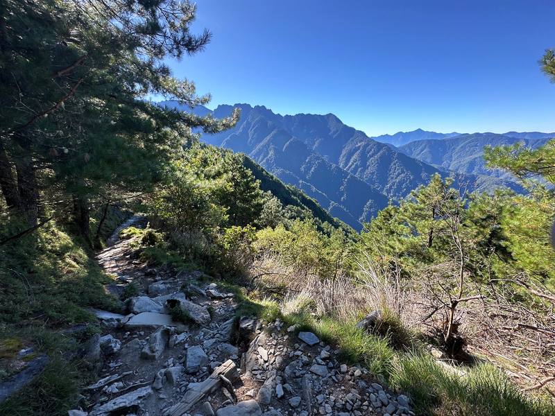
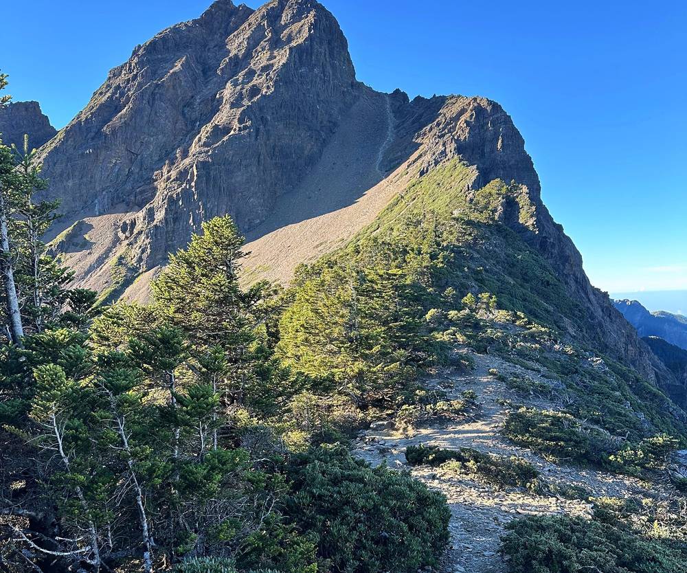
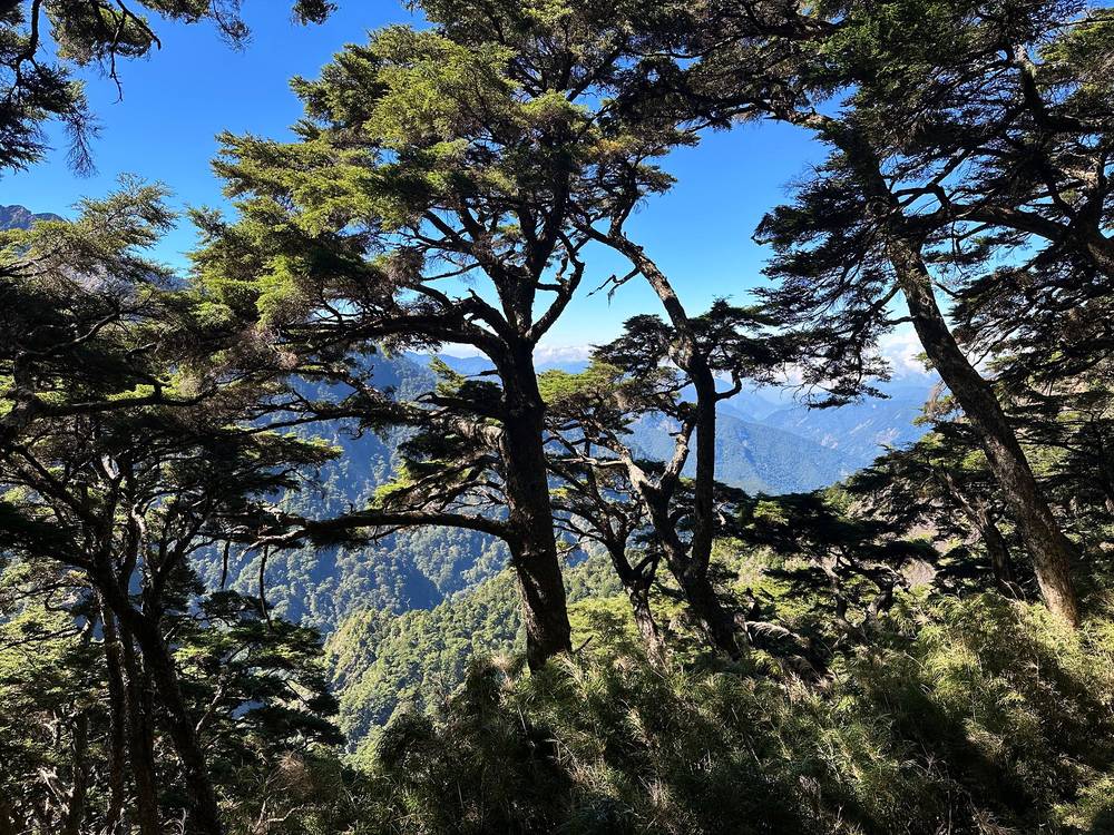
Mountains from the trail before the Mengluting shelter, Day 1 mile 0.9. 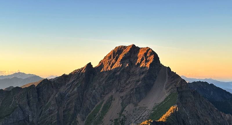
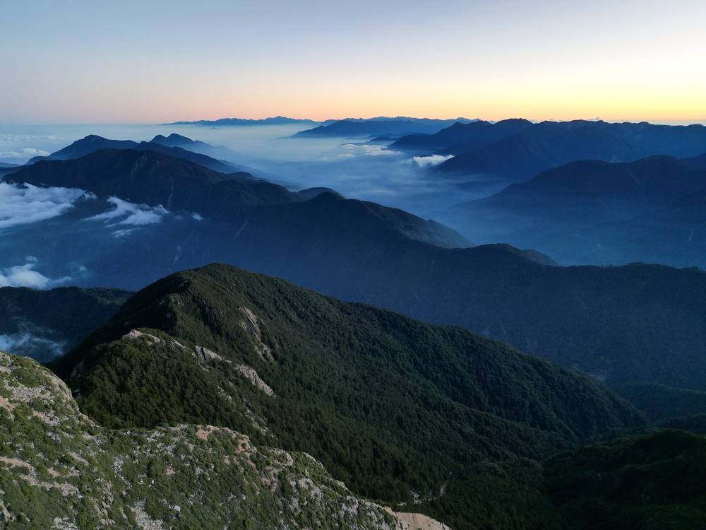
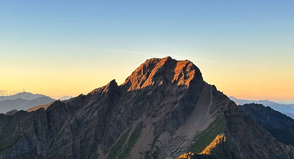
The Main Peak in the first sun, from North Peak at 5:55 a.m. on Day 2.
Newsletter
Get my letter
Get a short letter from me every couple of weeks: new trips, guides and what I'm building.
Free. Unsubscribe any time.
Details
The guide · Free · 40-page PDF + GPX files · 2027 season edition
Yushan Hiking Guide
Tataka to Taiwan's highest peak and North Peak in 2 days. Every page is below: read it here, or take it offline as a PDF with my GPX files (40-page PDF + GPX files, in one zip). No sign-up needed.
The route
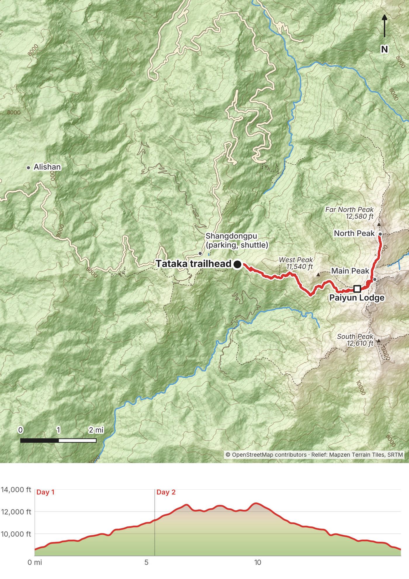
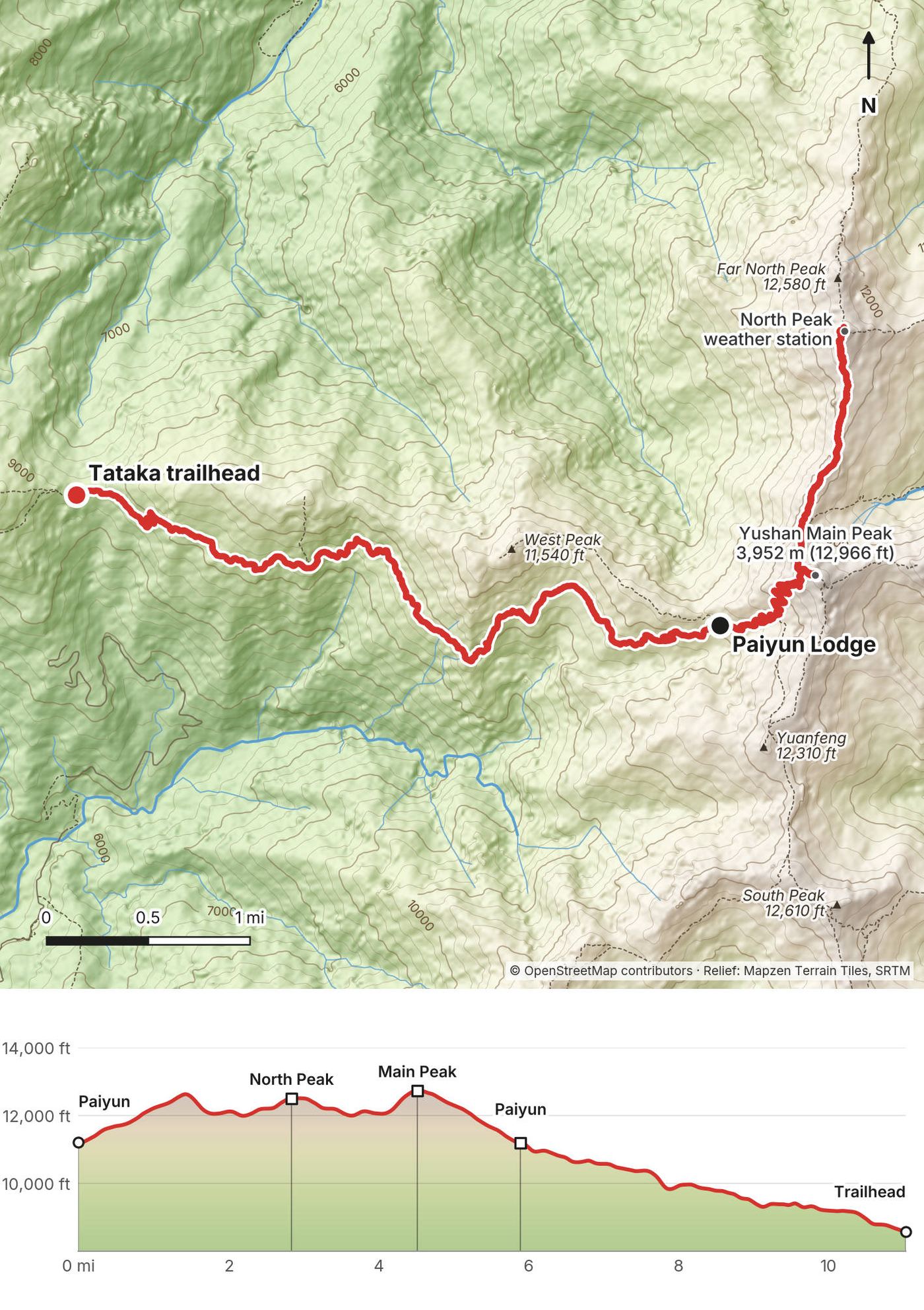
My GPS recording of 2 days on a relief map. The numbers are where each day starts; the red dot is the finish. The day maps are in the guide below, and the GPX files are a free download.
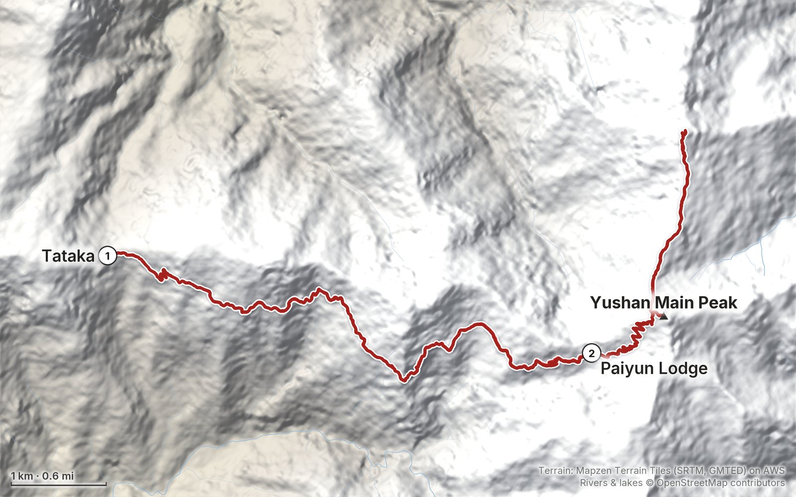
Elevation, start to finish: highest 12,750 ft (3,886 m), lowest 8,550 ft (2,606 m).
At a glance
- Days
- 2 days
- Distance
- 16.4 miles
- Climbing
- About 6,230 ft (1,900 m) up
- Permit
- Two free permits on Hike Smart Taiwan
- Start and end
- The Tataka trailhead
Contents
- Welcome
- At a glance
- Is it open? (October 2026)
- Straight answers
- When to go
- Permits and the lodge
- Getting there
- Day 1 Tataka trailhead to Paiyun Lodge
- Day 2 Paiyun Lodge to North Peak, the Main Peak and Tataka
- Other ways to do it
- Where I slept, food and water
- What I paid
- What I carried
- Weather, altitude and safety
- Using the GPX files
- Before you go, check these
- One-page trip sheet
- About this guide
Welcome
At the end of September 2022 I hiked Yushan, Jade Mountain, the highest peak in Taiwan, with two local hikers, Curtis and Larry. We drove down from Taipei through the night, took the shuttle to the Tataka trailhead and hiked about five miles up to Paiyun Lodge on the first day. On the second day we left the lodge at 2:30 a.m., went past the Main Peak in the dark and on to North Peak and its weather station for sunrise, came back and summited the Main Peak, 12,966 ft (3,952 m), and then I hiked all the way back down to the trailhead the same morning. Two days, about 16.4 miles by my GPS: 5.4 on the first day and 11.0 on the second. It's the trip from my film Hiking the Highest Peak in Taiwan.
Taiwan had been on my bucket list for a while, and Jade Mountain was at the top of my list.
Good to know first (October 2026). The Yushan main trail is open. You need two free permits, and the beds at Paiyun Lodge, the only place to sleep on the route, are given out by lottery a month ahead; foreigners also have 24 reserved beds a night from Sunday to Thursday, applied for 35 days to 4 months ahead. Every year from about January to March only teams with snow experience and gear can go up, and a typhoon warning closes the park. See Is it open?.
What's inside
- Where things stand in October 2026, and straight answers to the questions people ask about Yushan
- When to go, the permits, the lottery and the foreigner quota, Paiyun Lodge, and getting to the trailhead with or without a car
- Both days: my notes, the trail, where to get off, maps with elevation profiles, and links to that day in my film
- Other ways to do it, where I slept, food and water, what it cost us, what I carried
- Weather, altitude and safety, one page of things to check before you go, and a printable trip sheet
How to use it offline
Save this PDF to your phone's Files or Books app before you leave home. Load the GPX files and download offline maps before you drive up into the mountains. Each day starts on a new page. The film links need a connection; everything else works in airplane mode.
When I say "I," it's my own trip. Rules, quotas and fees change, so they're dated, and the checks are collected on one page: Before you go, check these. Times are Taiwan time.
At a glance
| Quick facts | |
|---|---|
| Distance | 16.4 miles (26.4 km) by my GPS, including my detour to North Peak |
| Climbing | About 6,230 ft (1,900 m) up and 6,220 ft (1,895 m) down |
| Days | 2: 5.4 miles on Day 1, 11.0 on Day 2 |
| Start and finish | The Tataka trailhead, about 8,560 ft (2,610 m), reached by a shuttle from the Shangdongpu parking lot |
| High point | Yushan's Main Peak, 12,966 ft (3,952 m), the highest point in Taiwan. North Peak is 12,657 ft (3,858 m) |
| Sleep | Paiyun Lodge, 11,161 ft (3,402 m), 5.3 miles (8.5 km) from the trailhead |
| Difficulty | A steady trail to the lodge, then a night start, thin air, scree, a chained scramble and a long way down |
| Permits (2026) | Two free permits on Hike Smart Taiwan; Paiyun's beds by lottery or the foreigner quota; NT$480 a night |
| Day | Route | Miles (km) | Up / down (ft) | Sleep |
|---|---|---|---|---|
| 1 | Tataka trailhead to Paiyun Lodge | 5.4 (8.7) | 3,013 / 369 | Paiyun Lodge, 11,161 ft |
| 2 | Paiyun Lodge to North Peak, the Main Peak and back down to Tataka | 11.0 (17.8) | 3,218 / 5,851 |
Distances and climbing are from my own GPS, smoothed the same way every day. Heights of the peaks and the lodge are the park's published figures; the other heights are from my GPS, so they're given as "about."
Is it open? (October 2026)
Checked on the Yushan National Park's and Hike Smart Taiwan's own pages, and in Taiwanese news, on October 2, 2026.
Open. On October 2, 2026 the park's trail status page showed the Yushan peaks trails open. Only the Batongguan crossing trail, a different route from the east, was closed, because of damage to a suspension bridge.
It closes for typhoons. When a typhoon warning is issued and the park closes, your permit is void. The park was reported closed for a typhoon warning from August 27, 2026, and Typhoon Podul closed the trails from August 14 to 18, 2025, when rockfall also hit a bridge at the 5.5 km mark. Typhoon season runs from about July to October. Keep a spare day, or be ready to try again.
Snow season. Every winter, from about January 1 to March 31 (some years from mid-December), only teams with snow experience, a helmet, crampons and an ice axe can go up, at most six to a team, and the one-day permits are suspended. Permits approved before the season starts are returned.
Changes since my trip. A new permit site, Hike Smart Taiwan, replaced the old one in September 2024. Rockfall smashed the steel fence that shelters the trail at the wind gap below the summit in March 2025; it was rebuilt by July 2025. Around June 1, 2026 a boulder tore out part of the chained section about 420 m (a quarter mile) before the summit along the trail, and stone steps now replace that piece. Paiyun Lodge reopened after work in 2026 with 136 beds, up from 116, and a higher fee is planned but not announced. These changes are as reported in Taiwanese news; I haven't seen them myself.
What to do. Check the park's trail status page (ysnp.gov.tw) and the Central Weather Administration's forecast for typhoons the week before, and again the day before.
Straight answers
How many days do I need? Two, with one night at Paiyun Lodge. That's what I did, and it's the usual plan: up to the lodge on the first day, the summit for sunrise and all the way down on the second. There's also a one-day permit, but it's a very long day; see Other ways to do it. Plan a few days around it in case your lottery date or the weather doesn't work out.
How hard is it? The first day is about five miles, so a pretty short day: about 3,000 ft of climbing on a good, steady trail, ending at Paiyun Lodge, 11,161 ft. The second day is the hard one: a start at 2:30 a.m., thin air above 12,000 ft, loose scree at the wind gap and a steep rock scramble with chains to the top, then over 5,800 ft down to the trailhead. With my detour to North Peak it was 11 miles. My track took 8.3 hours, about 6.1 of them moving, and I trail ran down.
Can a foreigner get a permit? Yes. You apply for two free permits online on Hike Smart Taiwan, and you need a bed at Paiyun Lodge. Foreigners can apply for 24 reserved beds a night, Sunday to Thursday, 35 days to 4 months ahead; otherwise you go into the lottery with everyone else. I joined Curtis and Larry, who applied for our permits and entered the lottery. See Permits and the lodge.
Do I need a guide? I couldn't find any rule that says so. I went with two Taiwanese hikers who handled the permits, did the driving and translated for me. Guided trips exist, but a guide doesn't get you around the lottery or the quota.
Should I add North Peak? I went past the Main Peak in the dark to North Peak and its weather station for sunrise, because we wanted to see Jade Mountain with the sun rising on it, then came back and summited the Main Peak. Getting to the peaks at sunrise just makes the trip worth it. It added about 2.9 miles and, with the wait for sunrise, over three hours to my day. To add North Peak, put it on your itinerary when you apply. The permit system lists it with East Peak, and hikers commonly add it to the summit day of a two-day trip, but the park doesn't let you change an approved route, so a peak that isn't on your permit can't be added on the day.
How cold does it get? It depends on the month. At the end of September it was very hot midday and not that cold at night. In January the Yushan weather station, on North Peak, averages lows of about 25°F (-4°C), and there's snow up there in winter. See When to go.
Can I camp? No. Tents are banned around Paiyun Lodge, and the lodge is the only place to sleep on the two-day route.
Is there a phone signal? Reports say there's 4G at Paiyun Lodge and on the Main Peak, from a shared mast on North Peak. Download your permit to your phone anyway; you have to show it.
When to go
The end of September. I went on September 28 and 29. It was very hot midday and not that cold at night, and the mornings were clear: cloud filled the valleys below the peaks at sunrise. The afternoon at the lodge was foggy.
The best odds. Outside the snow season, October to December are the driest months at the summit: about 10, 8 and 7 rain days a month. From May to August there are 18 or more. May and June are the plum rain season, and typhoons come from about July to October.
Winter. From about January to March the snow-season rules apply (see Is it open?). The first snow can come in October, and snow is usually gone by May. The recent deaths reported on Yushan were falls, some of them on ice, in February 2024 and March 2025.
At the Yushan weather station on North Peak (12,615 ft, 3,845 m; the Central Weather Administration's averages for 1991 to 2020, as published on Wikipedia):
| Month | High / low °F (°C) | Rain, in (days) | Sunrise from the summit |
|---|---|---|---|
| January | 40 / 25 (4.6 / -4.0) | 3.3 (7) | about 6:30 |
| February | 40 / 26 (4.5 / -3.4) | 2.6 (7) | about 6:20 |
| March | 44 / 29 (6.4 / -1.7) | 3.7 (8) | about 5:57 |
| April | 48 / 33 (8.7 / 0.6) | 7.9 (13) | about 5:27 |
| May | 52 / 37 (11.2 / 3.0) | 16.7 (19) | about 5:05 |
| June | 55 / 40 (12.9 / 4.5) | 18.1 (18) | about 4:59 |
| July | 58 / 40 (14.4 / 4.6) | 17.1 (18) | about 5:08 |
| August | 57 / 40 (14.0 / 4.6) | 20.3 (18) | about 5:22 |
| September | 57 / 39 (14.0 / 4.1) | 11.7 (14) | about 5:33 |
| October | 57 / 37 (13.9 / 2.8) | 5.7 (10) | about 5:43 |
| November | 51 / 33 (10.6 / 0.7) | 3.9 (8) | about 6:00 |
| December | 44 / 28 (6.7 / -2.1) | 3.2 (7) | about 6:20 |
The sunrise times are worked out for the 15th of each month from the summit; check a sunrise table before you go. On my trip, my photo of the Main Peak in the sun is from 5:55 a.m., from North Peak. Paiyun Lodge is about 1,450 ft lower than the weather station, so probably a few degrees warmer.
Permits and the lodge
These were checked on the official Hike Smart Taiwan site (hike.taiwan.gov.tw, which has an English version) and the park's pages on October 2, 2026, unless I say otherwise.
Two permits, both free. For the Main Peak you need a park entry permit and a police mountain entry permit. You apply for both on Hike Smart Taiwan; once the park permit is approved, the site can send the police application for you, 3 to 124 days before you start. Applications are taken from 7 a.m. to 11 p.m. Taiwan time.
When to apply. The standard window is 5 days to 2 months before your start date. Paiyun Lodge's beds go by lottery, drawn about a month before the night you want, between 3 and 4 p.m. Taiwan time; to be in it, apply between 2 months ahead and the draw. Winners get an email and a text. If you lose, or apply after the draw, you can join the waiting list from 4 p.m. that day, until 5 days before your start. Teams are 1 to 12 people, with an adult leader.
The foreigner quota. Paiyun keeps 24 beds a night for foreigners, on Sunday to Thursday nights only and not on Taiwanese public holidays. Apply 35 days to 4 months ahead under "Paiyun Lodge Advanced Application": it's first come, first served, with a passport scan for each foreigner and a Taiwanese emergency contact. A team of up to five foreigners can include one Taiwanese person, and a team of six or more can include two. Each person other than the leader can use the quota once a year, and if you cancel later than 35 days before, you lose it for that year. If the quota is full, your team goes into the normal lottery. (While the lodge was being worked on in 2025 and 2026 the quota was reported cut to 18; the official page, dated May 2026, says 24.)
How I did it, 2022. Curtis and Larry had their own plans to hike Yushan, and when I announced that I wanted to hike it too, we joined forces. They took the initiative to apply for the permits and enter the lottery, and they booked backup hikes in case this one didn't turn out: we had a plan B and a plan C.
Paying. Pay the lodge fee within 3 days of winning, or the booking is cancelled. You can pay by bank transfer, postal order, Taiwan Pay, at a convenience store, or, as a foreigner, in cash at the Paiyun or Dongpu service center. If you don't show up and didn't cancel, you're banned from applying for six months.
Check in on the day. On the day you start, not before, check in at the Paiyun Mountain Service Center by the Shangdongpu parking lot, where the shuttle leaves, with your permit and your original passport. Staff check teams in from 6:30 a.m. to noon; the park asks you not to come after noon. Self check-in before 6:30 needs a Taiwanese ID card, so foreigners starting earlier check in with the manager at Paiyun Lodge. After the hike, report your exit online. In 2022 Curtis and Larry had our permits checked at a table outside the police station before we took the shuttle.
Paiyun Lodge. 11,161 ft (3,402 m), 5.3 miles (8.5 km) up the trail from Tataka and 1.5 miles (2.4 km) below the Main Peak. NT$480 a night in October 2026 (about US$15). Check in after 2 p.m., out by 10 a.m. There's power from 6 to 8 p.m., and hot water from 1:30 to 2:30 a.m., 7 to 9 a.m. and 2 to 5 p.m. The lodge lends helmets for the rockfall sections above it. A higher fee is planned; the amount wasn't published as of July 2026.
Meals and sleeping bags. The lodge's caterer (玉山雲之端, yushansky.com.tw) sells dinner or lunch for NT$400, any breakfast for NT$200 (the early one is served from 1:30 to 3:30 a.m.), and a down sleeping bag with a liner for NT$400. Its package of dinner, early breakfast, brunch and a sleeping bag is NT$1,050. Order between a month and 7 days ahead and pay by bank transfer; your team leader collects the bags and meal tickets at 3 p.m. We rented three sleeping bags at the lodge, so we didn't have to carry them up, and had dinner there.
Rules. Carry your permit and your original passport. No pets, no fires, no camping outside designated sites, and no music on speakers; carry out all your trash. The park tells you to buy mountain or travel insurance; nobody checks it.
Drones. I flew a small drone on this trip. Since 2020 flying in Taiwan's national parks' protected areas has needed the park's approval, as reported; I couldn't find Yushan's own page on it. Ask the park before you fly.
Getting there
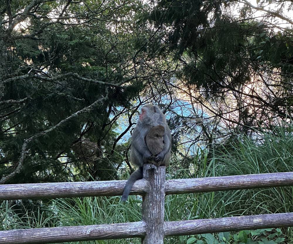
My way in, 2022. I flew in and spent a lot of time in Taipei. Curtis and Larry picked me up in Taipei in the dead of night and did all the driving, a four-hour drive to the trailhead and almost 10 hours round trip, while I slept in the back seat. We stopped at a 7-Eleven at about 5 a.m. in the Alishan area for instant noodles and food for the hike, drove on along the Alishan Highway past the Yu-Shan National Park sign, where macaques sat by the road, and parked at Shangdongpu. From there we took a little shuttle up to the trailhead, because the road is closed to cars. Technically you could walk this route, but it's just very cheap and easy and most people take the shuttle, so I recommend doing that.
Driving (2026). From Chiayi, take Highway 18 (the Alishan Highway); from Nantou, Highway 21 (the New Central Cross-Island Highway) by way of Shuili. Park at the Shangdongpu lot by the Paiyun Mountain Service Center. Highway 21 is closed every night from 5:30 p.m. to 7 a.m. between Caopingtou and Tataka (km 110.5 to 144.3), because of rockfall and no lighting, so if you're driving up overnight like we did, come up Highway 18. I found no regular night closure on Highway 18, but it closes for typhoons and ice; its road office is on 05-2592426. In the Alishan flower season each spring (March 10 to April 10 in 2026), on weekends and holidays from 6 to 11 a.m., small cars are stopped at km 66 unless they have a pass or proof of lodging, as reported; I couldn't find whether a Yushan permit counts, so drive through before 6 a.m. The lots at Tataka restrict what can park there, with fines of NT$3,000. There's fuel on Highway 18 at km 87.3 and on Highway 21 at km 87.5 and 97.5.
The shuttle. From the Shangdongpu lot to the Tataka trailhead: NT$150 (about US$5) each way from 6:30 a.m. to 5 p.m. in 2026 (phone 049-2702213), and reported as NT$200 from 5 to 7 p.m. Older guides say NT$100.
Without a car.
- To Alishan. The high-speed rail from Taipei to Chiayi takes about 1.5 hours (NT$1,080 for a reserved standard seat). From Chiayi HSR station, the Taiwan Tourist Shuttle, Alishan Route A (bus 7329), takes about 2 hours to Alishan (reported at NT$283); Route B (7322) leaves from the regular Chiayi train station. Both take EasyCard and iPASS. The Alishan Forest Recreation Area charges NT$300 to enter; whether you pay it just to change buses there, I couldn't confirm.
- To the trailhead. Yuanlin bus 6739 runs between Sun Moon Lake and Alishan by way of Tataka and Shangdongpu, twice a day each way; book online 2 days ahead or call 049-2770041. On weekdays it leaves Sun Moon Lake at 8:00 and 9:30 a.m. and reaches Shangdongpu at 10:38 a.m. and 12:08 p.m. From Alishan it leaves at 1:00 and 2:30 p.m. and reaches Shangdongpu at 1:32 and 3:02 p.m. (holidays differ). Alishan to Shangdongpu is NT$63; Sun Moon Lake to Shangdongpu is NT$269.
- The way back. There's no afternoon 6739 from Shangdongpu back up to Alishan. Toward Sun Moon Lake it leaves Shangdongpu at 1:32 and 3:02 p.m. on weekdays (1:32 and 2:32 on holidays). If you can't make those after the summit, Dongpu Lodge runs a charter (NT$1,500 from Tataka to Alishan, NT$3,500 to Shuili), or sleep another night.
- Arriving by bus on Day 1 is tight. The afternoon bus from Alishan reaches Shangdongpu at 1:32 p.m., after the noon check-in time, which leaves the 5.3-mile climb to the lodge for late in the day. The morning bus from Sun Moon Lake (Shangdongpu at 10:38 a.m.) is better. Without a car, plan on sleeping near the trailhead the night before.
Sleep high the night before. The park advises a night at about 8,200 ft (2,500 m) before going above 9,840 ft (3,000 m). Dongpu Lodge (東埔山莊, about 8,460 ft, 2,580 m), at Tataka, has beds for NT$500, booked online only, up to 30 days ahead (dongpusky.tw). Alishan has hotels too. We didn't: we drove up through the night and started hiking the same morning.
Entering Taiwan (2026). US citizens can stay 90 days without a visa, with a passport valid for the stay and an onward ticket, and must file the online arrival card within 7 days before arriving. In early October 2026 US$1 bought about NT$32.
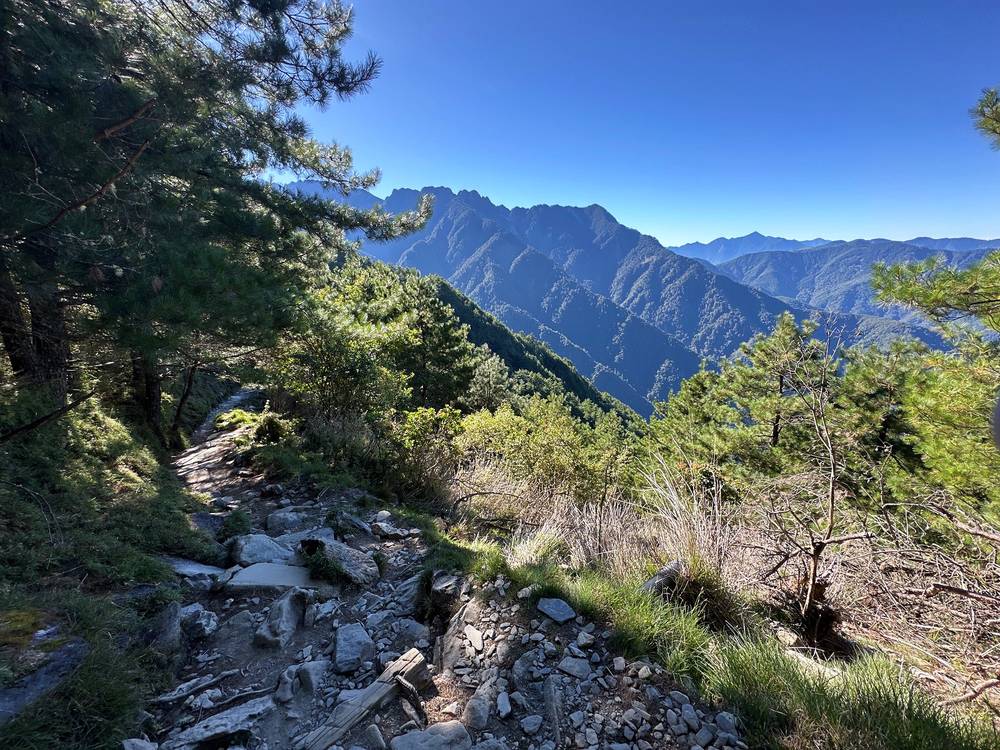
Day 1: Tataka trailhead to Paiyun Lodge
- Distance
- 5.4 mi (8.7 km)
- Climbing
- 3,013 ft (918 m)
- Descent
- 369 ft (112 m)
- Time I took
- 4.4 hours (7:51 a.m. to 12:12 p.m.), about 3.2 of them moving
- High point
- Paiyun Lodge, 11,161 ft (3,402 m)
- On the way
- Mengluting shelter (mile 1.0), the Front Peak junction (1.7), the White Wood Forest shelter (3.2)
- Sleep
- Paiyun Lodge, by lottery or the foreigner quota
- Water
- carry the day's water from Tataka; the lodge has water
My day
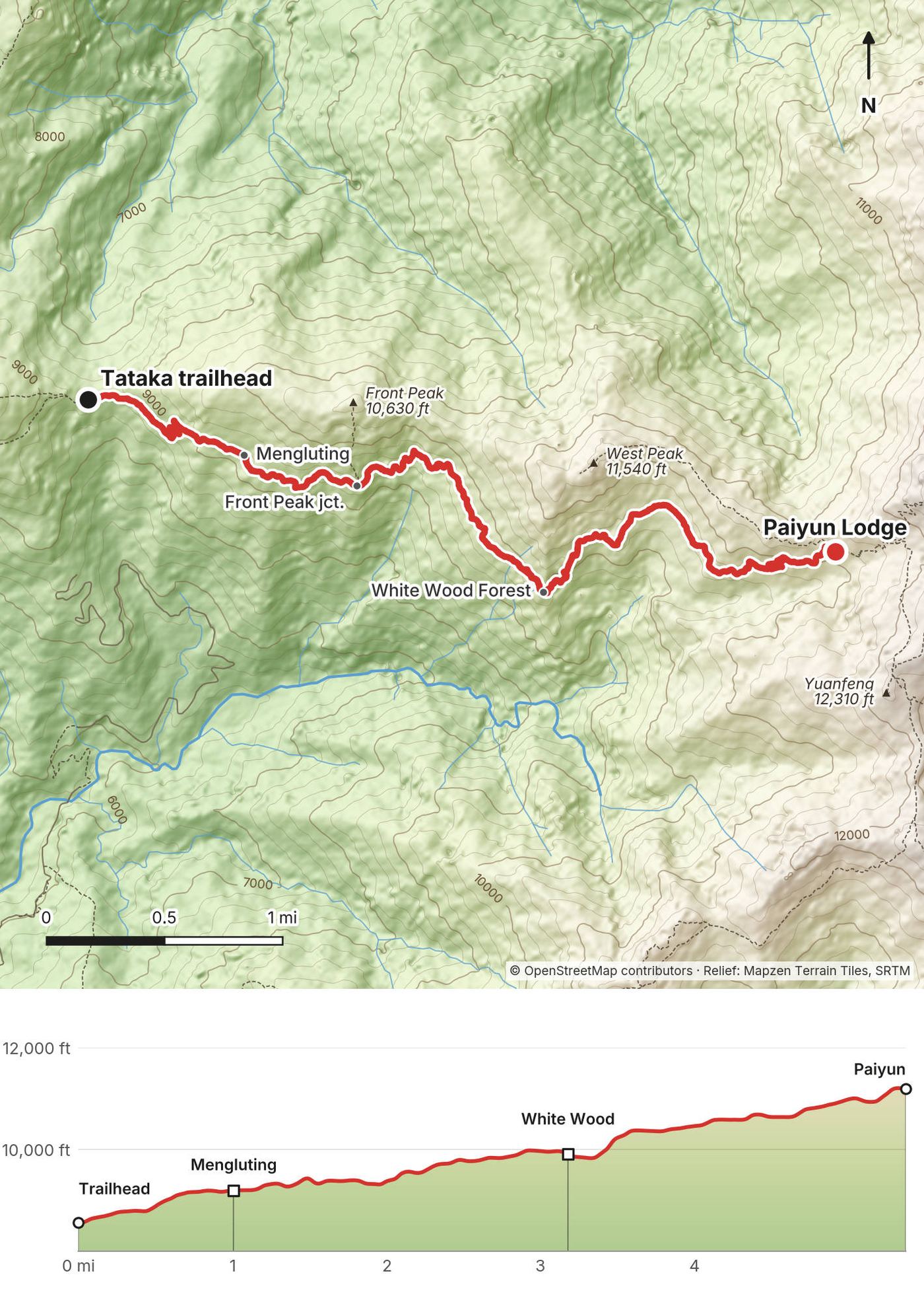
We got to the trailhead early, after the night drive and the shuttle, and I started recording on my AllTrails app at 7:51 a.m. The first day we hiked from the trailhead all the way up to the lodge where we'd be spending the night. It was about five miles, so a pretty short day. Our elevation started at about 8,500 ft and ended at about 11,000.
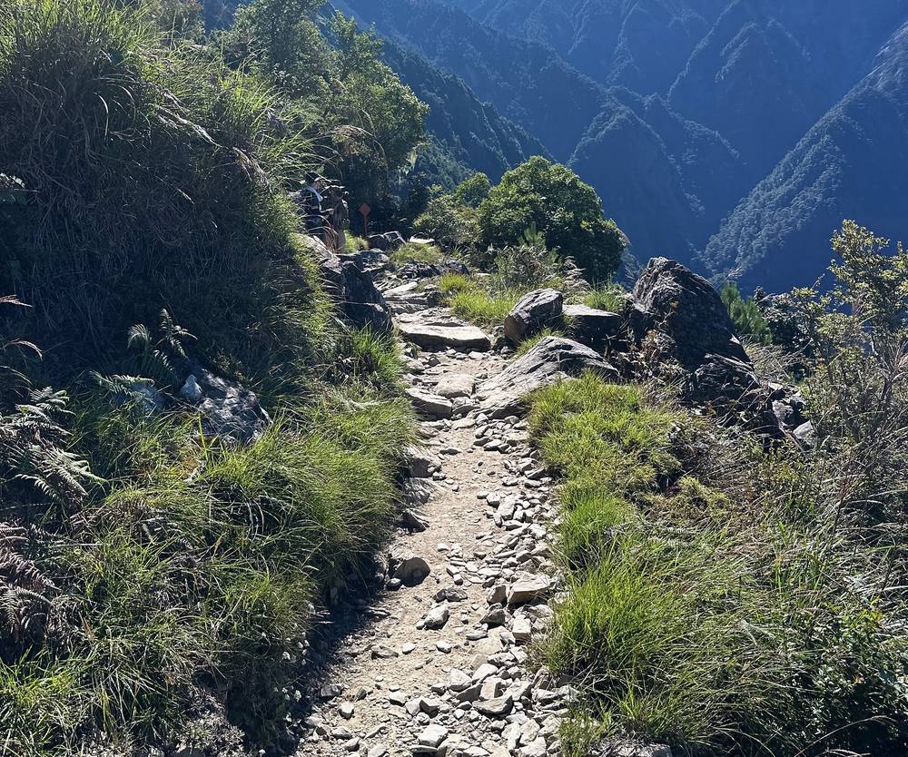
I passed the Mengluting shelter at 8:26 and stopped for a while a little past it. At certain points I was hiking with Curtis and Larry and at others without them: I pushed forward on my own to get specific shots. I stopped at the White Wood Forest shelter at about 10:30. It was very hot midday.
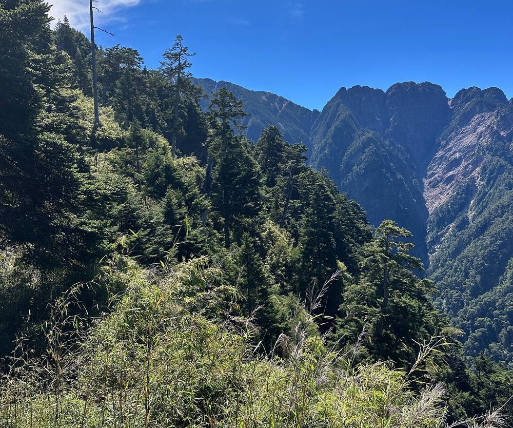
I reached Paiyun Lodge at 12:12. In the afternoon the clouds came up and the lodge sat in fog. We had dinner at the lodge, and I slept in a bunk under one of the sleeping bags we'd rented there.
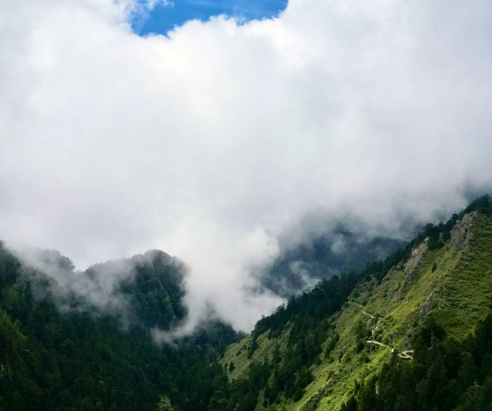
The trail
The Tataka trailhead. My recording starts at the trailhead, about 8,560 ft (2,610 m), where the shuttle stops. Next to it is a big stone marker for the Yushan trail.
To Mengluting. The trail is well built: stone steps at first, then a path that traverses the south side of the ridge, climbing gently. At mile 1.0 it passes Mengluting, a roofed rest shelter with toilets nearby. OpenStreetMap shows distance markers every half kilometer along the trail, counted from the trailhead; the park gives its distances the same way.
The Front Peak junction. At mile 1.7, about 9,380 ft (2,860 m) by my GPS, a side trail climbs to Yushan Front Peak (10,627 ft, 3,239 m). I didn't go up it. The main trail keeps traversing, in and out of side valleys, with views across the valley to the south.
The White Wood Forest. At mile 3.2, about 9,920 ft (3,020 m), the White Wood Forest (Baimulin) has a roofed rest shelter and toilets; it's named for its bleached dead trees. OpenStreetMap puts the 5 km marker next to it.
Up to Paiyun. The last two miles climb more steadily, about 1,300 ft, crossing the open slopes below West Peak. Past the White Wood Forest, at about the 6.7 km marker by hikers' accounts, the trail runs below the Great Cliff (大峭壁), where rockfall is the main danger. Keep moving under it. Paiyun Lodge, at 11,161 ft (3,402 m), is at mile 5.4 of my track, 8.5 km by the park's count. The trail to West Peak leaves from the lodge.
If you need to get off
The only way off is back down the way you came, to the Tataka trailhead. From the White Wood Forest that's about 3.2 miles and 1,400 ft down. Turn back if you're feeling the altitude badly (a headache that gets worse, vomiting, confusion), if a storm is coming, or if you're too slow to reach the lodge comfortably in daylight. Rockfall is the main danger on the stretch below the lodge in heavy rain and after earthquakes.
Watch this day
The drive and the trailhead · Day 1 · Which route did we take? (from 10:22)
Day 2: Paiyun Lodge to North Peak, the Main Peak and Tataka
- Distance
- 11.0 mi (17.8 km)
- Climbing
- 3,218 ft (981 m)
- Descent
- 5,851 ft (1,783 m)
- Time I took
- 8.3 hours (2:27 a.m. to 10:47 a.m.), about 6.1 of them moving
- High point
- Yushan's Main Peak, 12,966 ft (3,952 m)
- On the way
- the South Peak junction (mile 0.6), the North Peak junction (1.45), North Peak (2.8), back at the junction (4.4), the Main Peak (4.5), Paiyun Lodge (5.9)
- Finish
- the Tataka trailhead, about 8,560 ft (2,610 m)
- Turnaround
- if you're on a one-day permit, you must be at Paiyun Lodge by 10 a.m.
My day
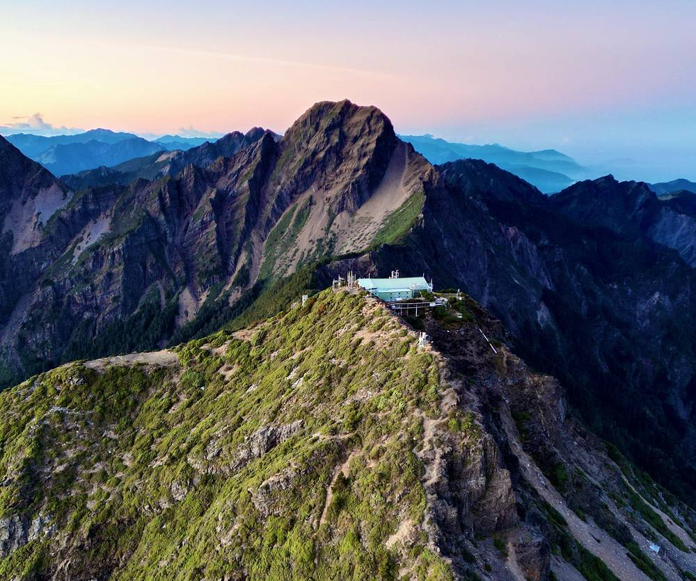
I woke up at 1:57 a.m., had breakfast in the dark, and left the lodge at 2:27 with my headlamp on. We made the ascent up past Jade Mountain: the peak is right above the lodge, but in the darkness we went past it, down and then back up to the north, to North Peak. There's a weather station up there, and we did this for sunrise because we wanted to be able to actually see Jade Mountain with the sun rising on it.
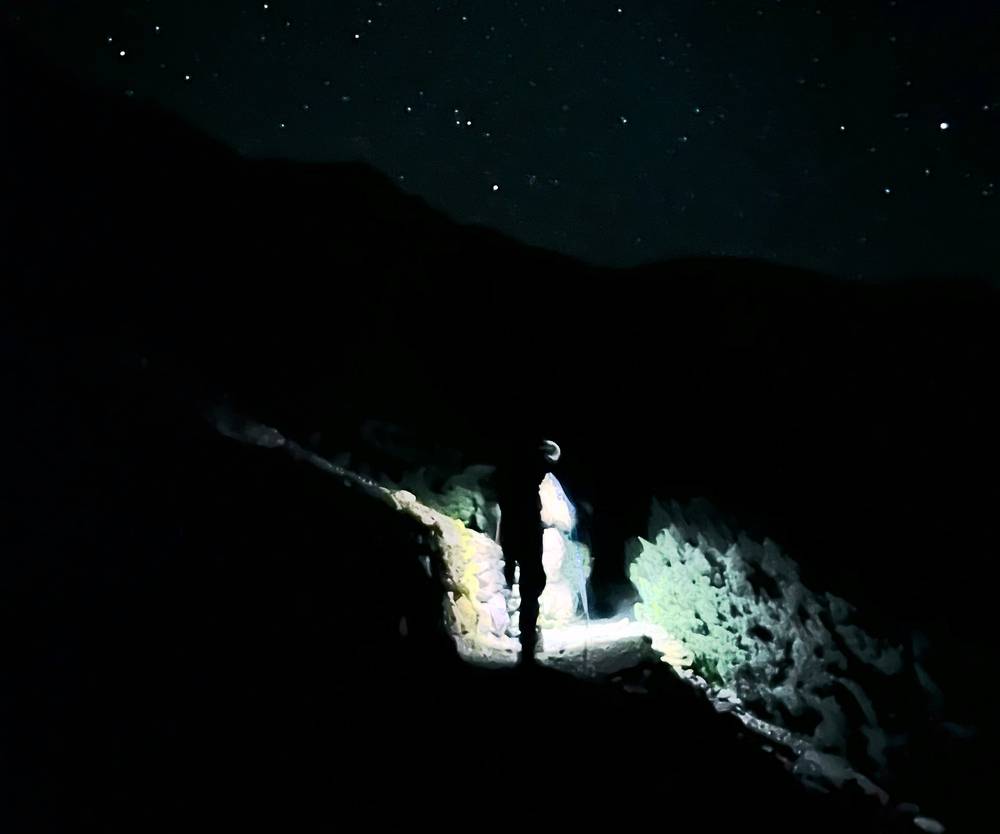
I reached the junction below the Main Peak at 4:12 and North Peak at 5:23, just before sunrise. I spent about 50 minutes up there around the weather station. Cloud filled the valleys below us, and by 5:55 the sun was on the Main Peak.
After the sun was up, I went back down along the ridge and finally summited Jade Mountain at 7:43. I climbed the last steep section of rock with the help of the chains and stood on the summit marker. I stayed about half an hour.
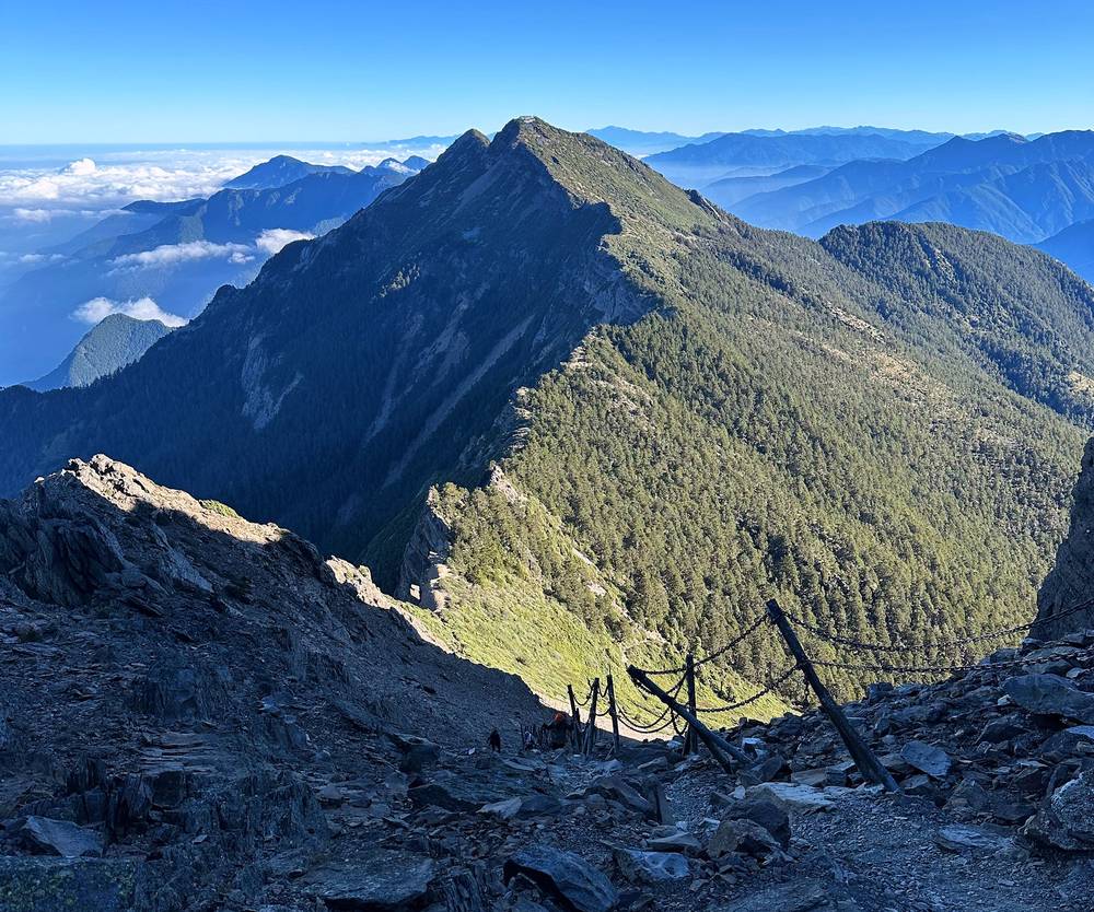
Then, the same day, I descended all the way back to the trailhead. I did this really quickly and trail ran as much as I could where it made sense, without being obnoxious and being in people's way. I passed Paiyun Lodge at 8:52 and was back at the trailhead at 10:47. My AllTrails map of the route says 15 miles; I probably did a bit more, going back for the camera and zigzagging.
The trail
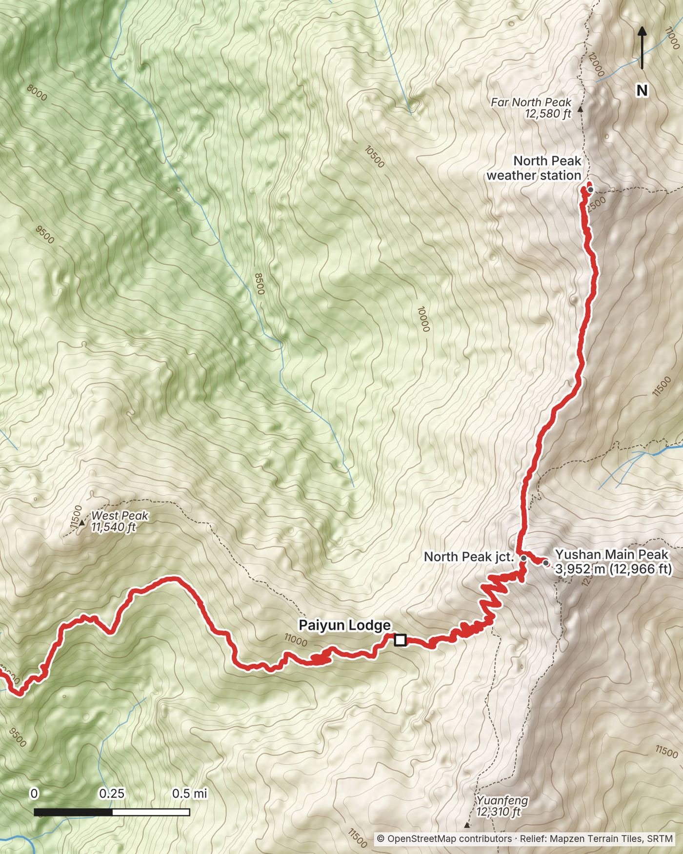
Above the lodge. The trail climbs in switchbacks east of Paiyun Lodge. At mile 0.6 the trail to the South Peak and Yuanfeng hut turns off to the right. Keep left for the Main Peak. Above it the trail zigzags up through low shrubs and then onto open scree.
The wind gap and the North Peak junction. At mile 1.45 by my GPS, just below the Main Peak's summit rocks, the trail reaches the wind gap, an open slope of loose scree where the wind is strong and slopes are slippery, as the park puts it. A steel rockfall fence shelters the trail here. The North Peak trail turns off to the north at this junction; the last climb to the Main Peak goes up from it.
To North Peak. The North Peak trail drops off the north side of the ridge and runs about 1.4 miles along it, down and then back up, to North Peak, 12,657 ft (3,858 m), and the Central Weather Administration's Yushan weather station, Taiwan's highest. I took about 1 hour 10 minutes from the junction in the dark and about an hour and a quarter back, with stops.
The Main Peak. The last stretch to the summit is a steep scramble up rock, with chains to hold on to. Around June 1, 2026 a boulder tore out part of the chained section about 420 m (a quarter mile) before the summit along the trail, and stone steps now replace that piece, as reported. The lodge lends helmets; wear one above Paiyun. The summit, 12,966 ft (3,952 m), has a stone marker and views in every direction. My GPS, which takes its heights from a terrain model, reads lower there.
Down to Tataka. From the summit it's back down past the junction and the switchbacks to Paiyun Lodge (mile 5.9), then the same trail as Day 1 to the trailhead. It's 5.3 miles (8.5 km) by the park's count and about 2,600 ft down from the lodge.
If you need to get off
The way off is back down to Paiyun Lodge and the trail you came up. From the wind gap the lodge is about 1.45 miles and 1,500 ft down. Turn back before the scree and the chains if the wind is strong, if there's ice, if a storm is coming, or if you're feeling the altitude badly: the only treatment that works is going down. If you're on a one-day permit, the park says anyone not at Paiyun Lodge by 10 a.m. must turn back. I found no official summit cutoff for overnight teams; the park tells teams to agree their own turnaround time.
Watch this day
Day 2 · Which route did we take? (from 10:22)
Other ways to do it
The Main Peak only
The simpler plan skips North Peak: leave Paiyun Lodge in the dark, reach the Main Peak for sunrise, and go back down. Paiyun to the Main Peak is 1.5 miles (2.4 km) each way by the park's count, so the second day is about 8.3 miles (13.3 km) to the trailhead.
In one day
Depending on your permits and your situation, I think it's possible to day hike if you start early, do a summit and then head all the way back. It might be super ambitious to do both peaks in one day. The park has a one-day permit for the Main Peak: 60 people a day, by lottery, for teams of 1 to 12. You may start after 5 a.m., must be at Paiyun Lodge by 10 a.m. or turn back, and must be out by 5 p.m. It's suspended every January to March, and the leader has to confirm that everyone has hiked above 9,840 ft (3,000 m) before. The round trip to the Main Peak is about 13.5 miles (21.8 km) with at least 4,400 ft of climbing.
Longer routes
The permit system lists other Yushan routes: the Main Peak and West Peak (West Peak's trail leaves from Paiyun Lodge), the Main Peak, East Peak and North Peak (grade 4 on the park's 0 to 6 scale, a step harder than the Main Peak's grade 3), and the peaks to the south by way of Yuanfeng hut. Each needs its own permit; a team booked at Yuanfeng that sleeps at Paiyun voids its permit.
With a guide
Guided trips run from Taipei, with transport, lodging and meals. One company listed a private two-day trip at NT$62,000 for one or two people in 2026. A guide doesn't get you around the lottery or the quota, and some companies don't apply for weekend dates.
Where I slept, food and water
Where I slept
| Night | Where | Height |
|---|---|---|
| Before | The back seat of the car, on the drive from Taipei | |
| 1 | Paiyun Lodge (Day 1 mile 5.4) | 11,161 ft (3,402 m) |
| After | Back to Taipei by car |
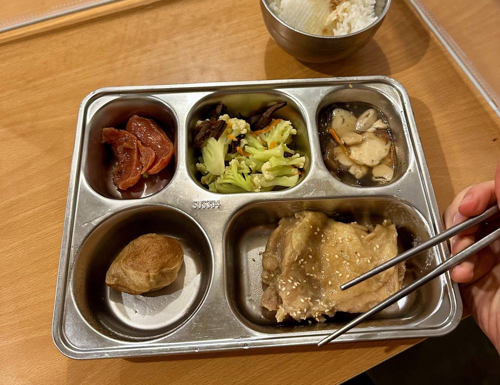
Paiyun Lodge. It's an orange building on the mountainside, with a deck out front, solar panels on the roof, a dining room and rooms of bunks. Inside, I changed into the lodge's slippers. In the afternoon the lodge sat in the fog. We'd rented three sleeping bags at the lodge so we didn't have to bring those up, and we had dinner there: rice, chicken and vegetables on a metal tray. Hikers were up and moving with headlamps around 2 a.m.
In 2026 the lodge has 136 beds, and the work finished in 2026 added a drying room, changing rooms and more toilets, as reported. No camping is allowed near it.
Food and water
What we ate. We stopped at a 7-Eleven on the drive in for instant noodles and food for the hike, had dinner at the lodge, and ate breakfast in its dining room before the 2:30 a.m. start. See Permits and the lodge for the lodge's meals in 2026.
Water. My record doesn't show a water source between the trailhead and the lodge, so carry what you need for Day 1 from the start. The lodge has water (it can freeze in winter) and hot water at set times. On Day 2 carry enough for the summit and back to the lodge.
After. We stopped at the Tataka Visitor Center (its food service runs from 9 a.m. to 5 p.m. in 2026), and later had hot pot.
What I paid
The whole trip, for all three of us, for three days (September 27 to 29), with transportation, the hotel, the lodges, 7-Eleven food, three rented sleeping bags at the lodge, dinner, parking and the shuttle buses, came to about US$370, which is very cheap. The cost card in my film breaks it down in Taiwanese dollars:
| Item (for three of us, 2022) | NT$ |
|---|---|
| Gas and highway tolls (ETag) | 2,163 |
| Paiyun Lodge, three beds, with the handling fee | 1,470 |
| Paiyun Lodge, dinner and three rented sleeping bags, with the handling fee | 1,965 |
| Shuttle buses | 300 |
| Dinner on September 27, the night we left | 1,170 |
| A hotel (two lines on the card) | 1,344 |
| Our plan B: Tianchi Lodge on another mountain, beds and food | 3,300 |
| Total | 11,712 (about US$370, US$120 each) |
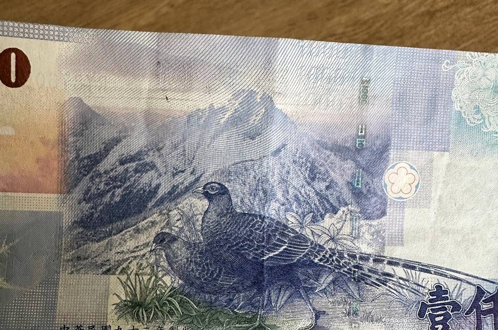
For your budget (2026). Both permits are free. Paiyun Lodge is NT$480 a night (a rise is planned) and the caterer's meals and sleeping bag package NT$1,050. The shuttle is NT$150 each way. Dongpu Lodge, the night before, NT$500. Without a car from Taipei, by high-speed rail and buses, plan on about NT$5,800 (about US$180) for the trip. Taiwan's national parks may start charging an entry fee, possibly by the end of 2027 (reported in August 2026).
Cash and cards. Buses take EasyCard and iPASS; the caterer takes bank transfers only. Carry Taiwanese dollars in cash for the shuttle, the lodge and food.
What I carried
From my film and photos (I have no full gear list for this trip):
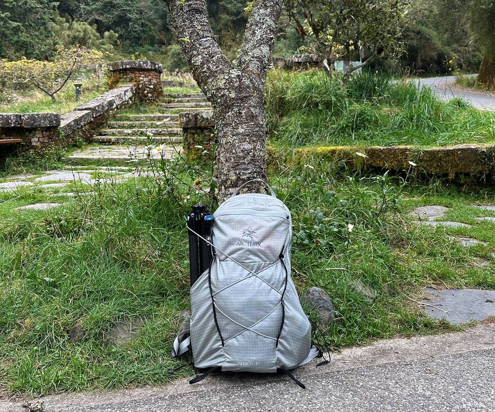
- Pack: a light grey pack. We rented sleeping bags at the lodge instead of carrying them
- Clothes and light: trail runners, a headlamp for the 2:30 a.m. start, and for sunrise a dark shell jacket, a beanie and sunglasses
- Camera: my iPhone 14 Pro and a DJI Mini 3 drone; I shot the whole film on those two
- Navigation: my phone with my AllTrails map of the route, downloaded for offline use. I like to always know where I am with GPS
What this hike needs:
- Your two permits on your phone, and your original passport
- Warm layers, a hat, gloves and rain gear
- A headlamp with spare batteries, and a helmet above the lodge (it lends them)
- Water, sun protection, cash in Taiwanese dollars, and insurance that covers hiking at altitude
- In the snow season: crampons, an ice axe, a helmet and the experience to use them
Weather, altitude and safety
Emergencies. Call 119 for rescue, fire and ambulance, and 110 for the police. Reports say there's 4G at Paiyun Lodge and on the Main Peak. Leave your plan with someone.
Altitude. The park says more than a quarter of the people who climb Yushan get altitude sickness. At the lodge's weekend clinic in 2018 and 2019, 57% of the 1,021 patients had it, and the doctors estimated that about 15% of climbers needed medical help. The risk is highest if you're young, haven't been above 9,840 ft (3,000 m) in the last three months, or have never been that high. The park advises a night at about 8,200 ft (2,500 m) before you go above that. Watch each other for headache, nausea, vomiting and breathlessness, and go down if it gets worse: descent is the treatment.
Rockfall. The stretch below the high cliff before the lodge, the wind gap and the chained section below the summit all get rockfall, especially after heavy rain and earthquakes. Wear a helmet above the lodge, don't stop under loose slopes, and don't knock rocks down on people below.
Wind and cold. The wind gap and the summit are exposed. Even at the end of September, when it wasn't that cold, you start in the dark at over 11,000 ft. In winter the average lows at the weather station on North Peak are below freezing.
Snow and ice. In winter the trail above the lodge can be icy. Taiwanese news reported that in March 2025 two hikers in their twenties died in a fall down an icy slope, and that in February 2024 two hikers died in falls in the park within a week, one at the wind gap on ice. Go in winter only with snow experience and the gear the snow-season rules require.
Typhoons and rain. A typhoon warning closes the park and voids your permit. In the wet months, afternoon storms and fog are common: start early.
The dark. You start Day 2 around 2 a.m. Carry a good headlamp, know the junctions (the South Peak junction and the North Peak junction), and have the GPX track on your phone.
Using the GPX files
My own GPS recordings, with all timestamps removed.
| File | What it is |
|---|---|
| yushan-day-1.gpx | Day 1: the Tataka trailhead to Paiyun Lodge, 5.4 mi |
| yushan-day-2.gpx | Day 2: Paiyun Lodge to North Peak, the Main Peak and back down to the Tataka trailhead, 11.0 mi |
| yushan-full-route.gpx | Both days in one file, with waypoints for the places in this guide |
The tracks show where I actually went: a record of my trip, not an official trail line. On Day 2 they include my detour to North Peak and back, and the trail between the lodge and the trailhead appears twice.
AllTrails: on alltrails.com, create a new map and use Import (offline maps need a paid plan). Gaia GPS: open the file on your phone and choose Gaia GPS, or Import on gaiagps.com. Garmin: Garmin Connect on the web, Training, Courses, Import, then send it to your watch. Organic Maps (free): download the offline map for Taiwan, then open the GPX file with it.
Before you go, check these
These change every year. Everything else in this guide stays the same.
Permits and the lodge
- Your park and police permits on Hike Smart Taiwan, and your Paiyun Lodge bed (the lottery a month ahead, or the foreigner quota 35 days to 4 months ahead)
- North Peak on your itinerary when you apply, if you want to add it
- The lodge fee for 2027, and your meal and sleeping bag order (a month to 7 days ahead)
- Whether a park entry fee has started
Is it open?
- The park's trail status page (ysnp.gov.tw), any typhoon warning, and the snow-season dates
Getting there
- Highway 21's night closure and Highway 18's spring flower-season control if you drive, the shuttle hours, and the 6739 bus timetable and booking if you don't
- Your bed the night before (Dongpu Lodge or Alishan)
On the day
- Check in at the Paiyun Mountain Service Center (staff 6:30 a.m. to noon) with your permit and passport, and report your exit online afterwards
Your stuff
- Warm layers, a headlamp, rain gear, water, cash in Taiwanese dollars, insurance
- Offline maps and the GPX files on your phone
One-page trip sheet
| Day | mi (km) | From, to | Sleep | Notes |
|---|---|---|---|---|
| 1 | 5.4 (8.7) | The Tataka trailhead to Paiyun Lodge | Paiyun Lodge, 11,161 ft | Mengluting 1.0, Front Peak junction 1.7, White Wood Forest 3.2 |
| 2 | 11.0 (17.8) | Paiyun Lodge to North Peak, the Main Peak and the Tataka trailhead | South Peak junction 0.6, North Peak junction 1.45, North Peak 2.8, Main Peak 4.5, Paiyun 5.9 | |
| Total | 16.4 (26.4) | About 6,230 ft up, 6,220 ft down |
Places: the Shangdongpu parking lot and service center · the Tataka trailhead · Mengluting · the Front Peak junction · the White Wood Forest · Paiyun Lodge, 11,161 ft · the wind gap · North Peak and its weather station, 12,657 ft · Yushan's Main Peak, 12,966 ft
Status (October 2026): open. Closed by typhoon warnings; snow-season rules from about January to March.
Permits (2026): two free permits on Hike Smart Taiwan (hike.taiwan.gov.tw); Paiyun by lottery a month ahead, or 24 foreigner beds Sunday to Thursday, 35 days to 4 months ahead. Check in at Shangdongpu with your passport (staff 6:30 a.m. to noon).
The lodge (2026): NT$480 a night; meals and a sleeping bag NT$1,050 if ordered ahead; helmets to borrow.
Getting there: park at Shangdongpu; the shuttle to the trailhead NT$150, 6:30 a.m. to 5 p.m. Highway 21 closed 5:30 p.m. to 7 a.m. Bus 6739 by way of Shangdongpu.
Rules: no camping near the lodge, no fires, no pets, no music on speakers; carry out your trash.
Altitude: a night at about 8,200 ft first; go down if it gets worse.
Emergency: 119 · police 110.
About this guide
Yushan Hiking Guide: The Tataka trailhead to Taiwan's highest peak and North Peak in 2 days, by Kraig Adams. 2027 season edition, updated October 2026.
I hiked it with Curtis and Larry on September 28 and 29, 2022, and made a film about it: Hiking the Highest Peak in Taiwan. Everything in first person comes from that trip: the film and its description, my GPS recordings and my photos. Permits, access and safety facts were checked on October 2, 2026, and anything that changes yearly is dated.
The trip. Taiwan Pitch invited me to Taiwan in 2022 to make two films, a city hike in Taipei and this hike; the film was made with the support of Taiwan Pitch, TaiwanPlus and Taiwan's Ministry of Culture. Nobody paid for this guide or saw it before it was published.
Updates and contact. If something has changed, or you spot a mistake, email me at kraig@kraigadams.com.
No affiliate links. There are none in this guide, and nobody paid for a mention in it.
Safety. Yushan has real risks: altitude, rockfall, wind, ice in winter, typhoons and a long day in the dark. This guide describes my trip, not current conditions. Check with the park, and turn back when conditions aren't right. You're responsible for your own safety.
Copyright. © 2026 Kraig Adams. This guide, its photos and the GPX files are for your personal use. Please don't share or resell them.
Credits. Photos are mine, from the trip, some from my drone; the cover is my film's YouTube thumbnail. GPX files are my own recordings. Maps © OpenStreetMap contributors, openstreetmap.org/copyright (ODbL). Relief: Mapzen Terrain Tiles, from SRTM. Facts from Yushan National Park, Hike Smart Taiwan, the National Police Agency, the Central Weather Administration and the operators named.
The details
- Format
- A 40-page PDF sized for a phone (A5, prints fine too) and a folder of GPX files, in one zip download.
- Edition
- 2027 season edition, updated October 2026.
- Questions
- Email kraig@kraigadams.com.
Questions
- Is Yushan open?
- Yes, in October 2026: the park's trail status page showed the Yushan peaks trails open on October 2, 2026. A typhoon warning closes the park and voids permits, and from about January to March only teams with snow experience and gear can go up.
- How long is the Yushan hike?
- My GPS recorded 16.4 miles over two days: 5.4 from the Tataka trailhead to Paiyun Lodge, then 11.0 on the second day with a detour to North Peak, the Main Peak and back down to the trailhead. The Main Peak only is about 13.5 miles round trip. The summit is 12,966 ft (3,952 m).
- How do foreigners get a Yushan permit?
- You need two free permits, a park permit and a police mountain permit, applied for online on Hike Smart Taiwan, and a bed at Paiyun Lodge. Foreigners can apply for 24 reserved beds a night, Sunday to Thursday, 35 days to 4 months ahead; otherwise the beds go by lottery a month before.
- Do you need a guide to hike Yushan?
- I couldn't find any rule that requires one. I went with two Taiwanese hikers who handled the permits and the driving. A guide doesn't get you around the lottery or the foreigner quota.
- Can you hike Yushan in one day?
- Yes, with the one-day permit: 60 people a day by lottery, starting after 5 a.m., at Paiyun Lodge by 10 a.m. or you turn back, and out by 5 p.m. It's suspended from January to March, and it's about 13.5 miles round trip.
- How much does it cost to hike Yushan?
- The permits are free. Paiyun Lodge is NT$480 a night in 2026, with meals and a sleeping bag NT$1,050 if ordered ahead, and the trailhead shuttle NT$150 each way. Our whole trip for three people, from Taipei, came to about US$370 in 2022.
Timeline · newest first
Published · October 2, 2026
Wrote the guide
The day-by-day guide to the route, made from my film, my GPS recording and my notes.
Published · March 7, 2023 · YouTube · 193,998 views
Published the film: Hiking the Highest Peak in Taiwan
Published · March 4, 2023 · YouTube · 94,687 views
Published the film: 8 Days in Taiwan - Jiufen, Taipei and Houtong Cat Village
On the trail · September 2022
Day 2: Paiyun Lodge to North Peak, the Main Peak and Tataka
The day in the guide: Day 2: Paiyun Lodge to North Peak, the Main Peak and Tataka.
On the trail · September 2022
Day 1: Tataka trailhead to Paiyun Lodge
The day in the guide: Day 1: Tataka trailhead to Paiyun Lodge.
On the trail · September 2022
The trip: Taiwan and Yushan
Taiwan · 2 days on Yushan · about 16 miles