
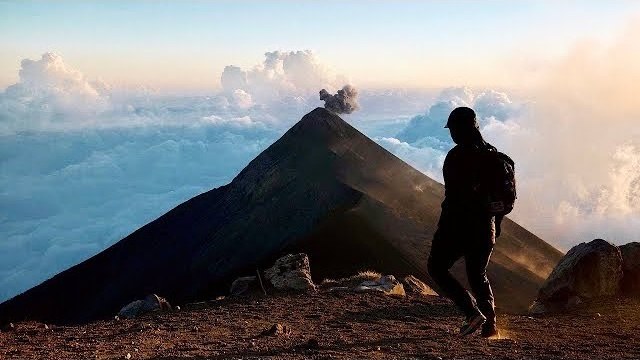
Guatemala · December 2020 · Solo
Acatenango Volcano
16.8 KM · 2 DAYS · 1,590 M
La Soledad to the summit and a night facing Fuego in 2 days.
Watch the film 19:11 · 401K viewsAt a glance
- Where
- Guatemala
- Distance
- 16.8 km (10.5 miles)
- Days
- 2: 6.5 miles on Day 1, 4.0 on Day 2
- Climbing
- About 5,210 ft (1,590 m) up and 5,060 ft (1,540 m) down
- Season
- I went December 16 and 17, 2020
- Difficulty
- One long, steady climb of over 5,000 ft on soft, steep volcanic ground, at an altitude most people aren't used to, then a freezing night
- Start and end
- La Soledad
- When I went
- December 2020
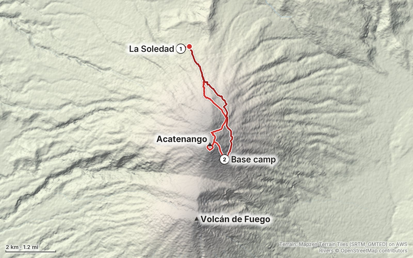
Elevation, start to finish: highest 13,050 ft (3,979 m), lowest 7,900 ft (2,409 m).
My GPS recording on a relief map. The numbers are where each day starts. The GPX files come with the guide.
Everything I made about it
The film

Photos
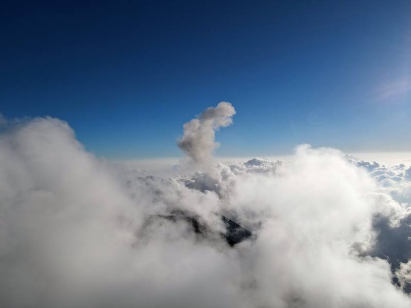
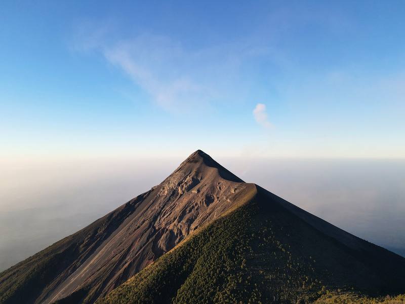
Fuego's summit and a puff of ash above the clouds, from near the saddle below Acatenango's summit, Day 1 mile 4.4. 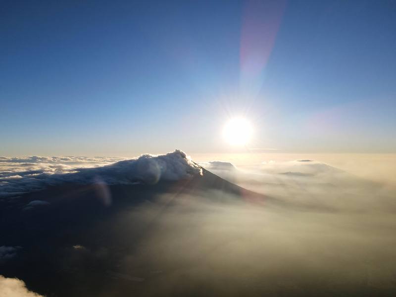
Sunrise above the clouds from the base camp, the morning of Day 2.
The guide · 40-page PDF + GPX files · 2027 season edition
Do it yourself
La Soledad to the summit and a night facing Fuego in 2 days.
- Where things stand
- Both days
- My GPX files
- Fees, guides and rules
- Getting there
Free sample
Try Day 1 free
The whole Day 1, La Soledad to the summit and the base camp page from the guide as a PDF, plus my camping packing list: the 42 things I carry, with a note on each. Both come by email. You'll also get my emails about new guides and trips, a few a year.
Gear on this trip
Paid links: I earn a commission if you buy through these links, at no extra cost to you. As an Amazon Associate I earn from qualifying purchases.
What I carried in 2020
- PackZpacks Sub-Nero 30L
- DuffelZpacks Travel DuffelNo checked bags.
- TentNEMO Hornet
- Sleeping padTherm-a-Rest NeoAir XLite
- LinerOutdoor Vitals Sleeping Bag LinerNo sleeping bag: a mistake. I was freezing with only the liner.
- WaterKatadyn BeFree AC · 1LThere was nothing to filter: carry all your water.
- HeadlampSLONIK rechargeable headlampFog came in fast at sunset and it got dark very quickly.
- ShirtAmazon Essentials Quick-Dry Tech Hoodie
- PantsPatagonia Terrebonne JoggersSimilar now: PATH Projects Killam PX Pant
- Rain shellThe North Face Dryzzle Futurelight JacketSimilar now: Arc’teryx Beta AR Jacket
- PuffyPatagonia Nano Puff JacketSimilar now: Arc’teryx Cerium Hoody
- GlovesUnigear Touchscreen Liner GlovesThin, but I was super glad I brought them.
- ShoesBrooks Cascadia
- Alsoa pillow, shorts, a sweatshirt, socks, wipes, my phone with offline AllTrails maps, and a mask (it was 2020; on the summit I put it over my mouth just to catch a breath in the wind)
Filming kit
- CameraPanasonic Lumix S5With the 20-60 mm lens. Panasonic sponsored this film.
- MicRode VideoMic NTG
- WindscreenRode WS11 windscreen
- Tripoda tripod
- Tripod headJoby ball head
- Dronemy droneThe controller wouldn't stop beeping at the trailhead.
What I'd take now
My current kit
- Sleeping bagHyperlite Mountain Gear 20° Mummy Bag
- HatPATH Projects Hoyt Merino Beanie
- PolesBlack Diamond Alpine Carbon Z Poles
- NavigationAllTrails+
- Phone dataAiralo eSIM
- CameraDJI Osmo Pocket 4
The Americas and New Zealand bundle
This guide is in The Americas and New Zealand Hiking Guide Pack: 36 guides for $39. Or all 62 guides for $59.
Short answers
- Is Acatenango open?
- Yes, in October 2026. The Municipalidad de Acatenango reopened it on August 7, 2026, after Fuego's August 3 to 5 eruption, on its approved routes only. It closes at short notice whenever Fuego erupts hard, so check INSIVUMEH's bulletins and ask your guide the day before.
- How long is the Acatenango hike?
- My GPS recorded 10.5 miles over two days: 6.5 from La Soledad to the summit and down to the base camp, then 4.0 back down to La Soledad, with about 5,200 ft of climbing. The summit is 13,045 ft (3,976 m).
- Do you need a guide to hike Acatenango?
- I went alone in 2020. In 2026 many sources say a registered guide is required and that hikers without one can be turned back at La Soledad, though no official text says so. Plan on a guide: every tour from Antigua includes one.
- Can you hike Fuego from Acatenango?
- No. Since July 14, 2026 a CONAP rule bans visits to Fuego for any kind of tourism, and the ridge between the two volcanoes is off limits. You watch Fuego erupt from Acatenango.
- How much does it cost to hike Acatenango?
- The entrance fee for foreigners is about Q100 (US$13) cash in 2026; I paid Q50 in 2020. Two-day tours from Antigua run about US$57 to $160, and a taxi to La Soledad about Q150 to Q200 each way.
- How cold is Acatenango at night?
- Around freezing at the base camp all year, and much colder in the wind on the summit. I took only a sleeping bag liner and was freezing. Bring a sleeping bag rated below freezing, or take the one your tour lends you.
I make my guides with AI, from my own films and GPS recordings. How.