Arizona · 2 days · 26 miles · Grand Canyon

Grand Canyon Tonto Trail Hiking Guide

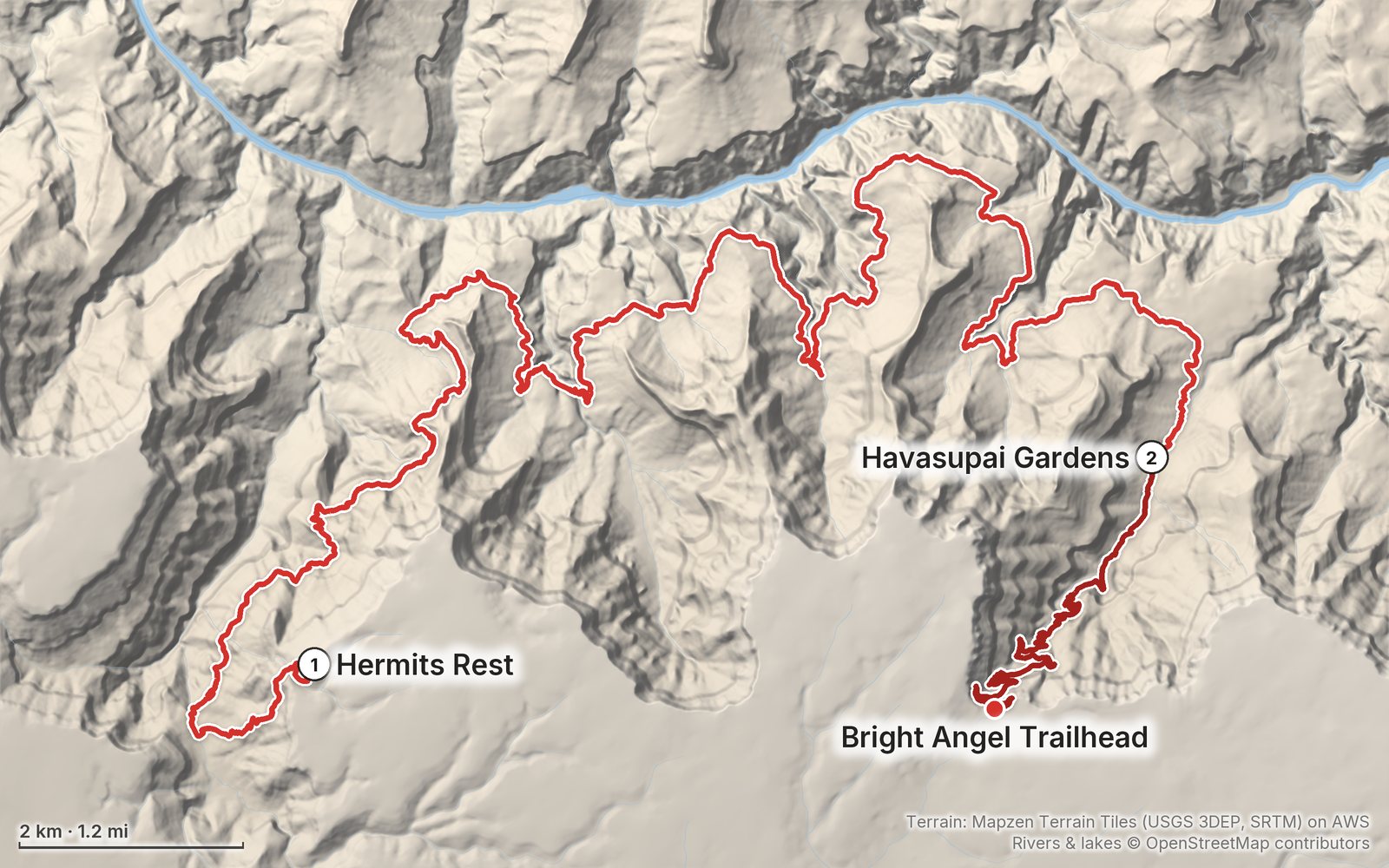
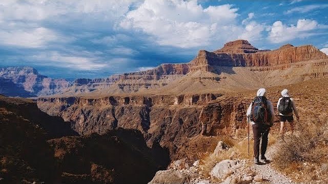
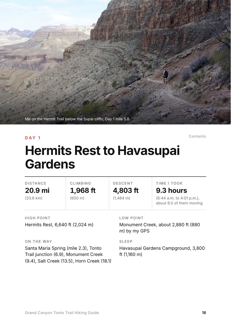
In November 2020 my brother and I hiked the Tonto Trail in the Grand Canyon in two days: down the Hermit Trail from Hermits Rest, east along the Tonto Trail past Monument Creek, Salt Creek and Horn Creek to a night at Havasupai Gardens (then Indian Garden), and out the Bright Angel Trail the next morning. It's the trip from my film Hiking the Grand Canyon Tonto Trail. This guide has my GPS files, maps and notes for both days, every water source with the park's warnings, the permit and how to book a one-night trip, getting to Hermits Rest early, heat and when to go, and where things stand after the 2026 flood.

Paying in the Facebook/Instagram app? Tap ⋯ and Open in browser to use Apple Pay or Google Pay.

$19Watch the film

Instant download: PDF + GPX files.
Not useful? Email me within 30 days for a refund.

The cover of the Grand Canyon Tonto Trail Hiking Guide

What's inside

Look inside

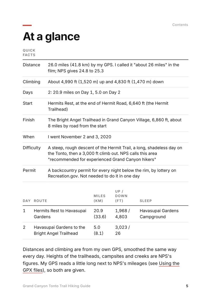
At a glance page from the Grand Canyon Tonto Trail Hiking Guide
At a glance
A day page page from the Grand Canyon Tonto Trail Hiking Guide
A day page
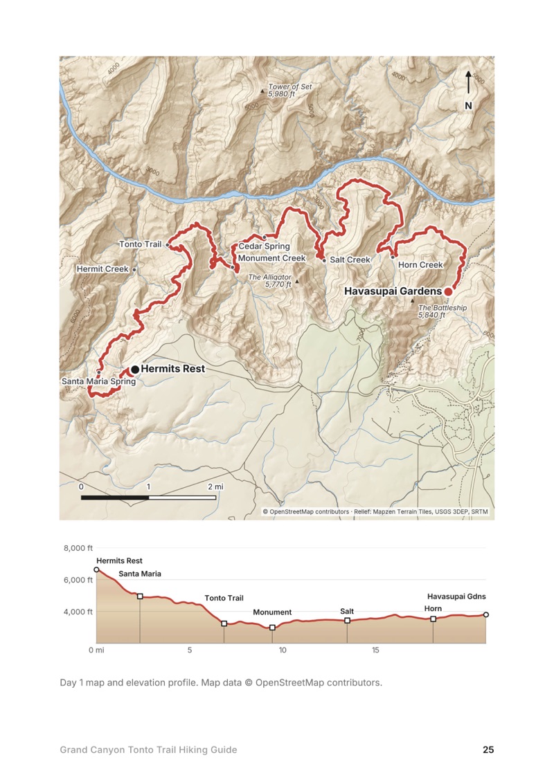
A day map and elevation profile page from the Grand Canyon Tonto Trail Hiking Guide
A day map and elevation profile
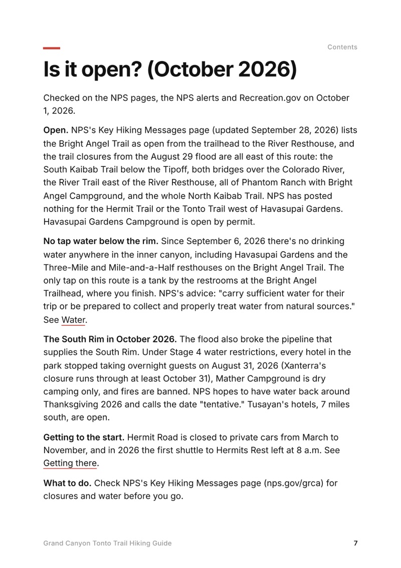
Is it open? page from the Grand Canyon Tonto Trail Hiking Guide
Is it open?

The details

Format
A 41-page PDF sized for a phone (A5, prints fine too) and a folder of GPX files, in one zip download.
Edition
2027 season edition, updated October 2026.
Delivery
Instant. After you pay you get a private download link. Bookmark it to download again on any device.
Payment
Secure checkout through Stripe, in your own currency. Tax is included in the price, except in the US and Canada, where any sales tax is added at checkout.
Refunds
Not useful? Email me within 30 days for a refund: kraig@kraigadams.com.
Questions
Email kraig@kraigadams.com.

Paying in the Facebook/Instagram app? Tap ⋯ and Open in browser to use Apple Pay or Google Pay.

$19

Questions

Is the Tonto Trail open?
Yes, in October 2026. The August 29, 2026 flood closed the trails east of it (the South Kaibab below the Tipoff, Phantom Ranch and the North Kaibab), not the Hermit Trail, the Tonto Trail west of Havasupai Gardens or the Bright Angel Trail above the River Resthouse. But every water tap below the rim has been off since September 6, 2026, including Havasupai Gardens. Check the park's Key Hiking Messages page before you go.
How long is the Hermit Trail to Bright Angel Trail hike on the Tonto?
My GPS recorded 26.0 miles: 20.9 from Hermits Rest down the Hermit Trail and along the Tonto Trail to Havasupai Gardens, then 5.0 up the Bright Angel Trail, with about 4,990 ft of climbing. NPS gives 24.8 to 25.3 miles. I called it about 26 miles in my film.
Is there water on the Tonto Trail?
Very little. Monument Creek always has water, Santa Maria Spring is a trickle and Cedar Spring is unreliable; NPS doesn't recommend Salt Creek (highly mineralized) or Horn Creek (radioactive). It's 10.7 miles from Monument Creek to Havasupai Gardens, whose tap is off in October 2026. Treat all water.
Do you need a permit for the Tonto Trail?
For any night below the rim, yes: a backcountry permit by lottery on Recreation.gov, $10 plus $15 per person per night in 2026, with camping only at designated sites. A day hike needs no permit. Booking Hermits Rest to Havasupai Gardens as a single night needs a ranger's help.
How do you get to the Hermit Trailhead?
It's at Hermits Rest, at the west end of Hermit Road, which is closed to private cars from March to November. In 2026 the free shuttle's first bus left the village at 8 a.m. Backpackers with a permit for the Hermit area get a gate code to drive to the trailhead.
When is the best time to hike the Tonto Trail?
Mid-September to November, and March to April. The Tonto has almost no shade, and NPS doesn't recommend its camps from late May through mid-September. I went in early November: very hot in the sun at midday, comfortable at night.
More guides

All guides
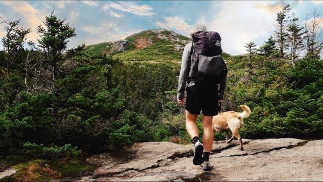
Adirondack High Peaks, High Peaks Wilderness, New York

High Peaks Wilderness, New York

Adirondack High Peaks

2 days · 18 miles · lean-to

A 2-day loop over Mount Marcy and Algonquin Peak from the Adirondak Loj in New York's High Peaks, with a night at Lake Colden, plus a 3-day traverse from Keene Valley.

  • Both days of the loop
  • My GPX files
  • My 2019 traverse
  • Permits and rules

See the guide: Adirondack High Peaks · $19

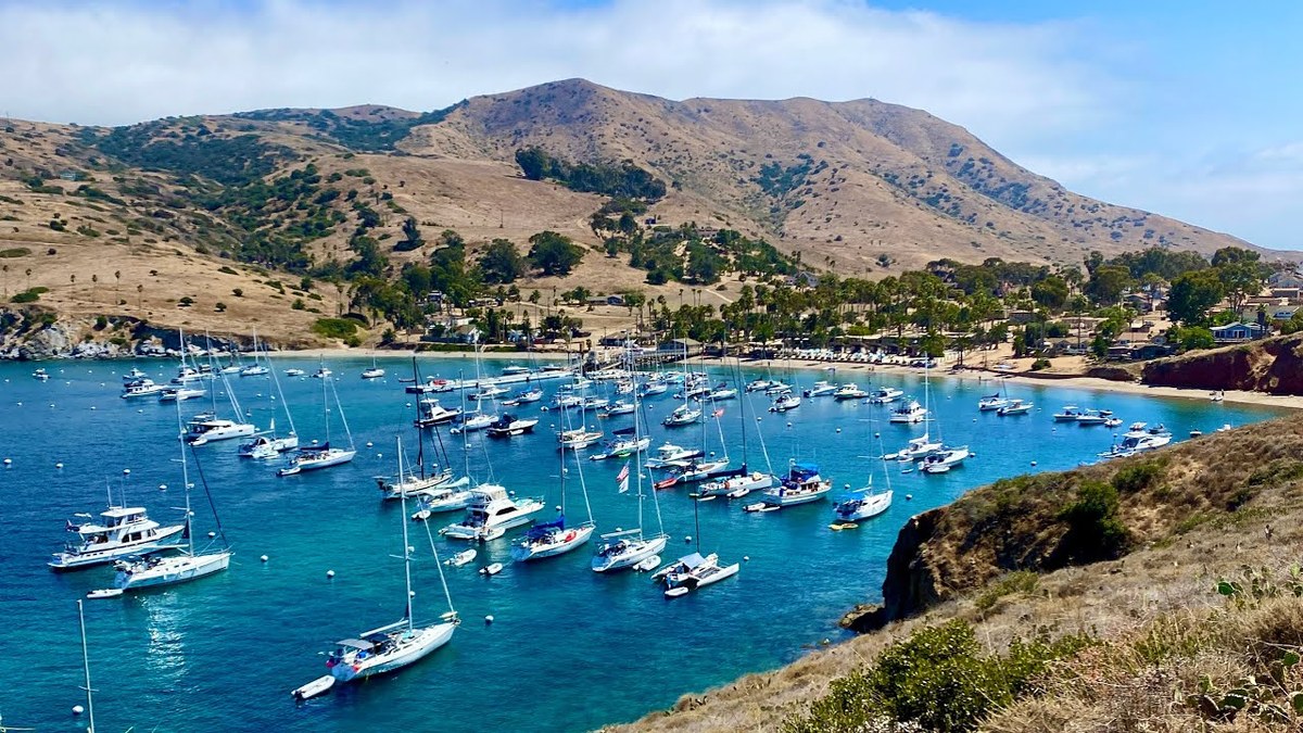
Trans-Catalina Trail, Southern California

Southern California

Trans-Catalina Trail

2 days · 42 miles · Catalina Island

A 2-day hike across Santa Catalina Island, California, on the Trans-Catalina Trail: from Avalon to Little Harbor, then to Two Harbors by way of the Silver Peak Trail and Parsons Landing.

  • Where things stand
  • Both days
  • My GPX files
  • Permits, campgrounds and rules

See the guide: Trans-Catalina Trail · $19

Timberline Trail, Mount Hood, Oregon

Mount Hood, Oregon

Timberline Trail

2 days · 40 miles · tent, campground

The 40-mile Timberline Trail loop around Mount Hood in Oregon, clockwise from Timberline Lodge past Ramona Falls, Elk Cove and Cloud Cap.

  • Both days
  • My GPX files
  • The river crossings
  • Permits and rules

See the guide: Timberline Trail · $19

Get the next guide

I'm making guides for more of my hikes, and I host a group trip about once a year. Get an email when a new guide or trip is out. A few emails a year.