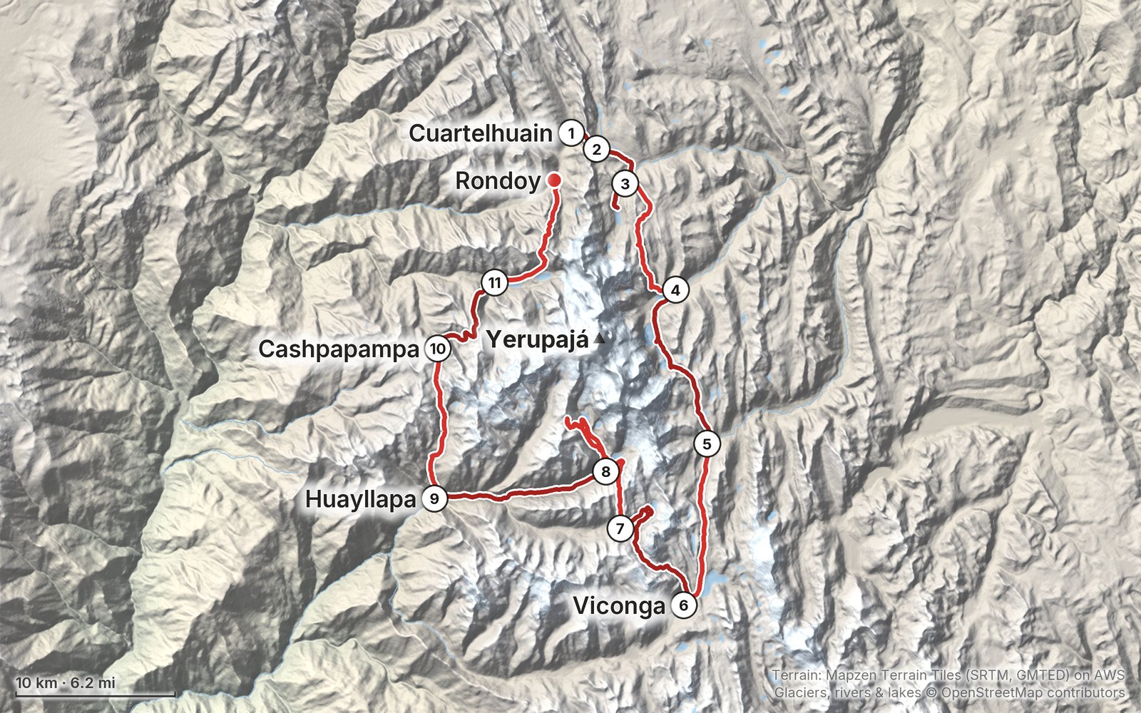
My GPS recording of 11 days on a relief map. The numbers are where each day starts; the red dot is the finish. The full GPX files and the day maps come with the guide.
1234567891011Highest 16,800 ft (5,121 m)
Elevation, start to finish: highest 16,800 ft (5,121 m), lowest 11,430 ft (3,484 m).
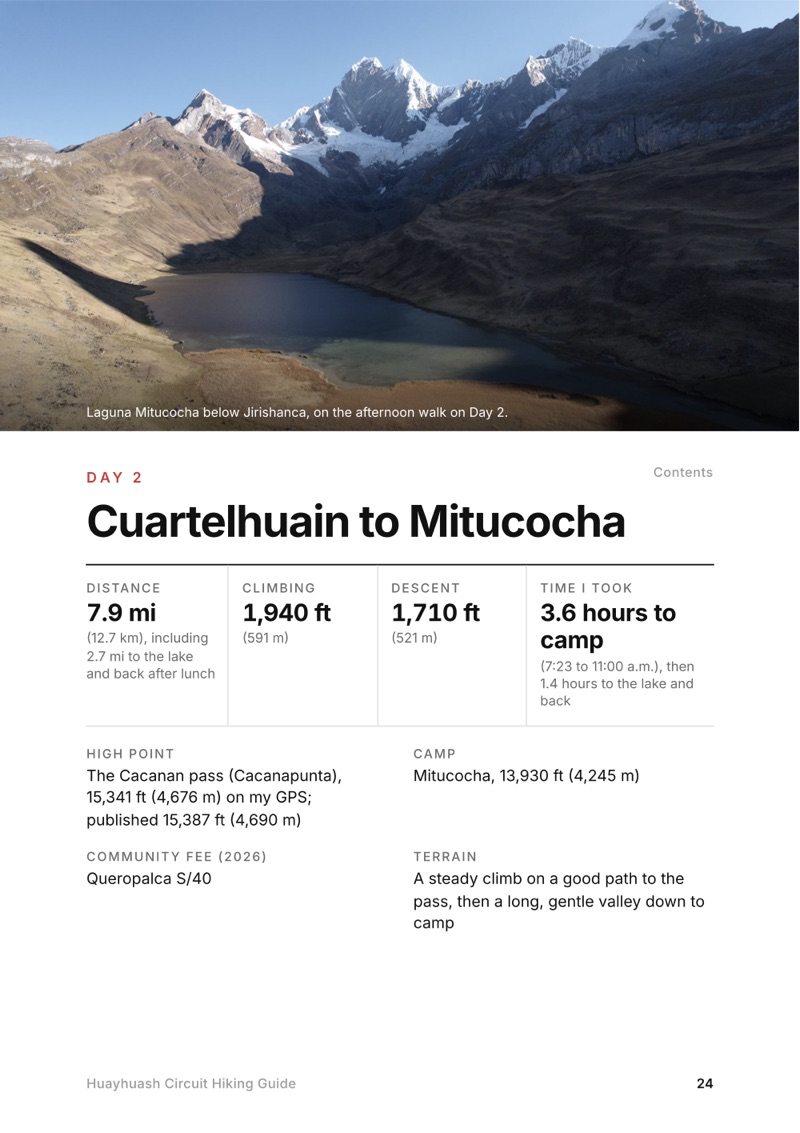
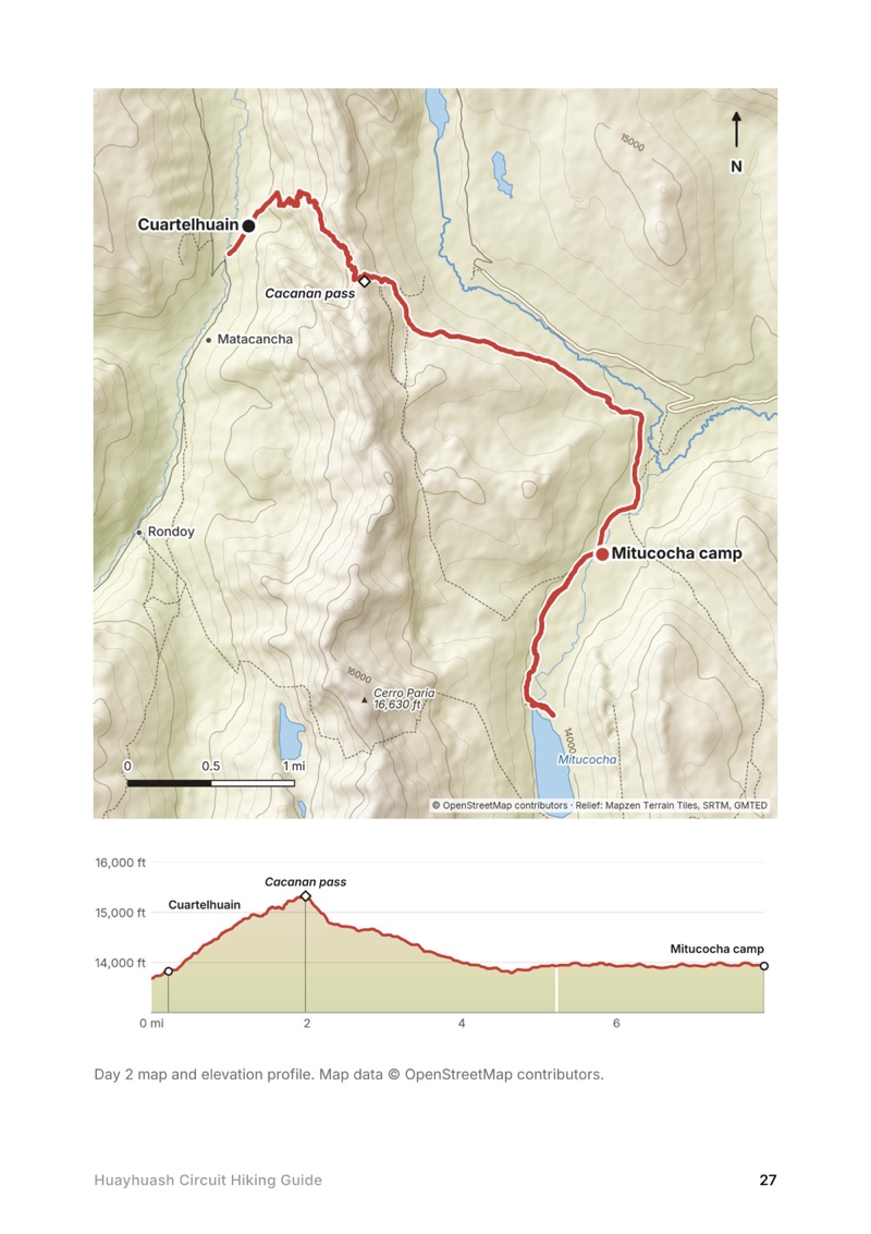
All eleven days. Stats, the time I took, my notes, the trail, where to get off, a map with an elevation profile, and links to that day in my film.
My GPX files. My own recordings for each day, the full circuit and my acclimatization hike, with waypoints for every camp, pass and Huayllapa, ready for AllTrails, Gaia GPS, Garmin or Organic Maps.
How this trek works. What my operator included and what it didn't, what my group paid, and what you need to arrange: an operator or muleteer, cash, gear and spare days.
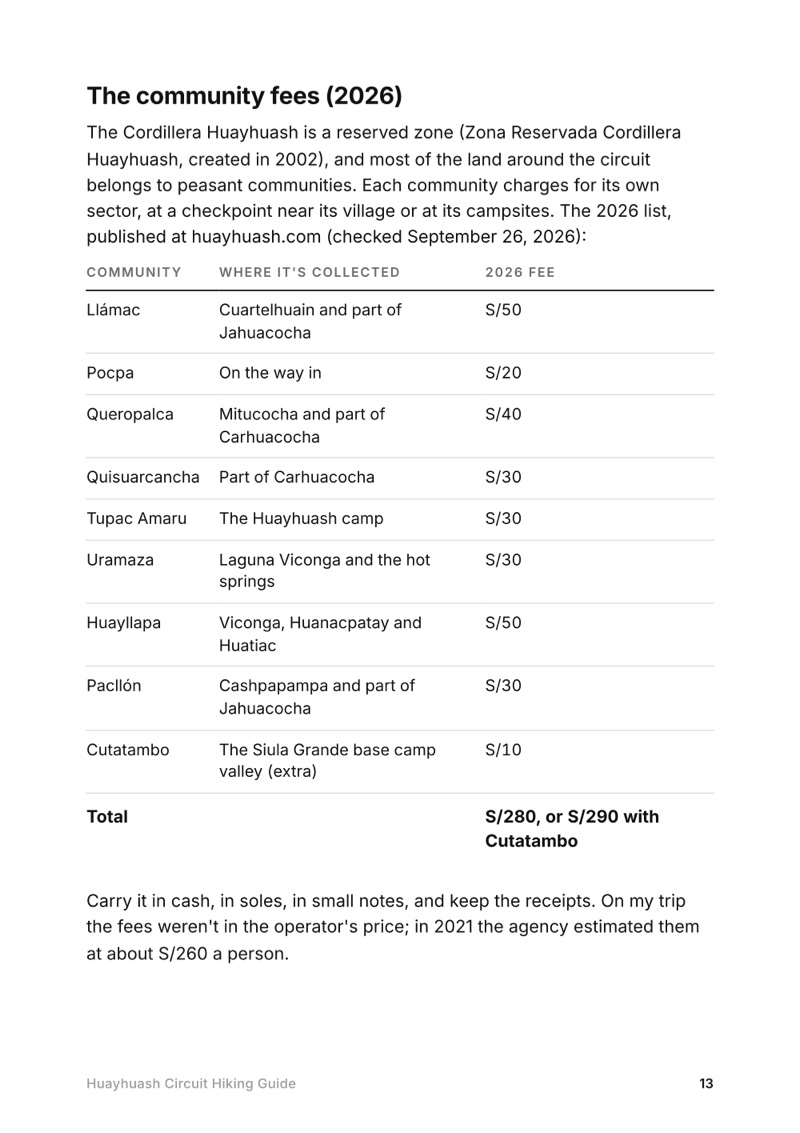
The community fees. Every community fee on the circuit, where it's collected and the 2026 amounts, in soles, day by day.
Altitude, explained. How I acclimatized in Huaraz, every camp height from my GPS, the three high points over 5,000 m, and the signs of altitude sickness to watch for.
Getting there and home. Lima to Huaraz by bus, the days in Huaraz, the drive to the trailhead and the ways out from each part of the circuit.
Camp life, costs and gear. What the food and camps were like, the operator's inclusions and prices, and what to bring.
Before you go and a trip sheet. One page of year-to-year checks and a printable one-page summary of the whole trek.
About this trip
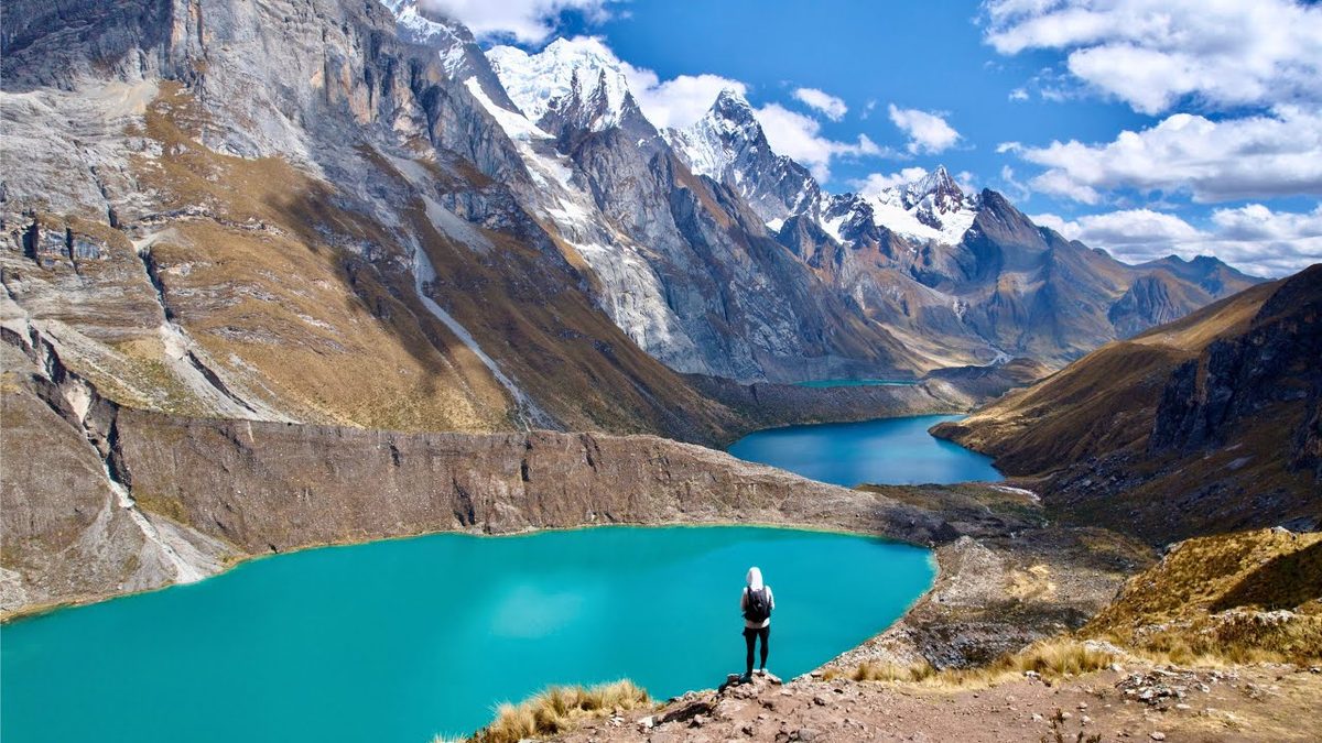
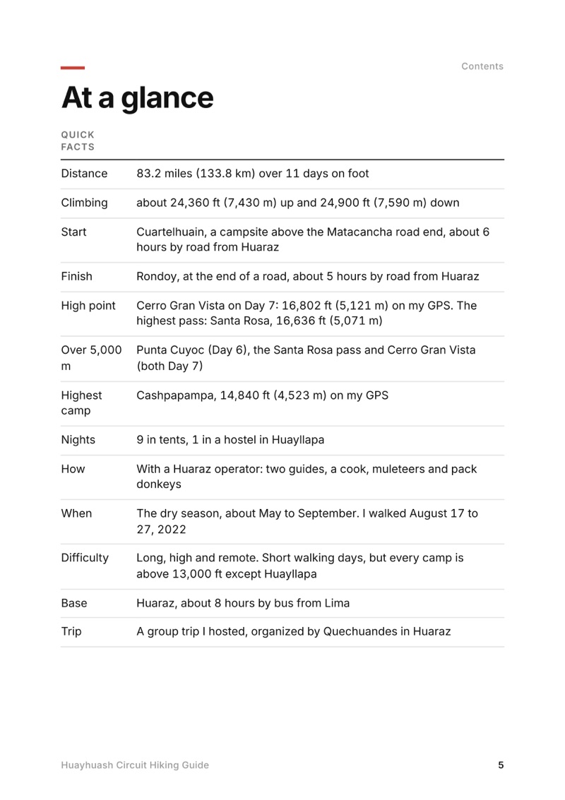
In August 2022 I spent eleven days walking about 83 miles around Peru's Cordillera Huayhuash with five subscribers, two guides, a cook and pack donkeys: glacial lakes under Yerupajá and Siula Grande, hot springs, the village of Huayllapa, and passes over 16,000 feet almost every day. This guide has my GPS files, maps and notes for every day, what my Huaraz operator arranged, the community fees at each camp, and what you'll need to arrange yourself.
WaterKatadyn BeFree AC · 1LAmazonThe cook boiled water morning and evening. Treat stream water: there are animals everywhere.
Power bankNitecore NB20000AmazonThere's no charging in camp. Huayllapa, on Day 8, was the only place I charged batteries.
NavigationAllTrails+AllTrails · 30% offLoad my GPX files and download offline maps while you still have Wi-Fi in Huaraz. Offline maps need the paid plan.
Phone dataAiralo eSIMAiralo · $3 offData in Lima and Huaraz. Don't count on a signal once you leave the road.
Filming kit
What I filmed this trip with in 2022. My setup is different now (below). Check the current rules for flying a drone in Peru before you bring one.
Dronemy DJI droneI shot this trip mainly with a drone and an iPhone. I charged three drone batteries at the hostel in Huayllapa.
Phonean iPhoneI'd sold a lot of my Sony gear and was testing how little I could get away with.
Tripoda tripodFor setting up the iPhone and walking past.
What I film with now
Since September 2026 I film with a smaller setup: the Pocket 4 and the Mic 3 on the trail, and the Mini 5 Pro in the air.
The whole day page from the guide as a PDF, plus my camping packing list: the 42 things I carry, with a note on each. The PDF opens right away and both come by email.
You'll also get my emails about new guides and trips, a few a year.
The details
Format
A 69-page PDF sized for a phone (A5, prints fine too) and a folder of GPX files, in one zip download.
Edition
2027 season edition, updated September 2026.
Delivery
Instant. After you pay you get a private download link. Bookmark it to download again on any device.
Payment
Secure checkout through Stripe, in your own currency. Tax is included in the price, except in the US and Canada, where any sales tax is added at checkout.
How many days do you need for the Huayhuash circuit?
I did the full circuit in eleven days, from Cuartelhuain to Rondoy. Add at least two or three days in Huaraz first to acclimatize, and a day each way between Lima and Huaraz.
When is the best time to trek the Huayhuash?
The dry season, about May to September. I walked August 17 to 27, 2022, and had clear days for the big passes, frost on the tents by Day 5 and hot middays.
Where do you sleep on the Huayhuash trek?
In tents at community campsites, every one above 13,000 ft except Huayllapa. I slept 9 nights in a tent and 1 in a hostel in Huayllapa. My Huaraz operator supplied the tents, cook and donkeys.
How much are the Huayhuash community fees?
Each community collects its own fee at its campsite or checkpoint, in soles. In 2026 the nine fees add up to S/290 a person including Cutatambo. Carry cash in small notes and keep the receipts.
How do you get to the Huayhuash trailhead?
Fly to Lima and take the bus to Huaraz, about 8 hours. Our operator drove us from Huaraz to Cuartelhuain, about six hours via Chiquián. Without an agency, take a minibus to Chiquián and a local car to Llamac, Pocpa or Matacancha.