The Torres del Paine film: Patagonia, Chile

Patagonia, Chile · 5 days · 85 miles

Torres del Paine Hiking Guide

The O and the W alone in 5 days, Patagonia, Chile.

Watch the film · 1.9M views
Free sample
  • 1.9M YouTube views
  • Instant PDF + GPX
  • 30-day refund
  • Free updates

Look inside

Real pages from the guide. Tap one to see it big.

  • A day page page from the Torres del Paine Hiking Guide
    A day page
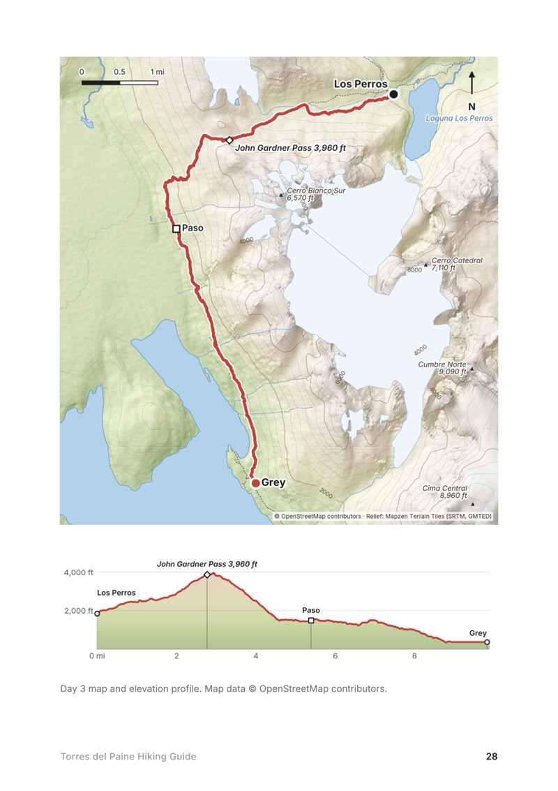
  • A day map and elevation profile page from the Torres del Paine Hiking Guide
    A day map and elevation profile
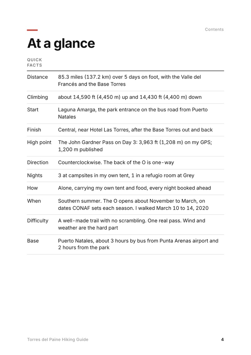
  • At a glance page from the Torres del Paine Hiking Guide
    At a glance
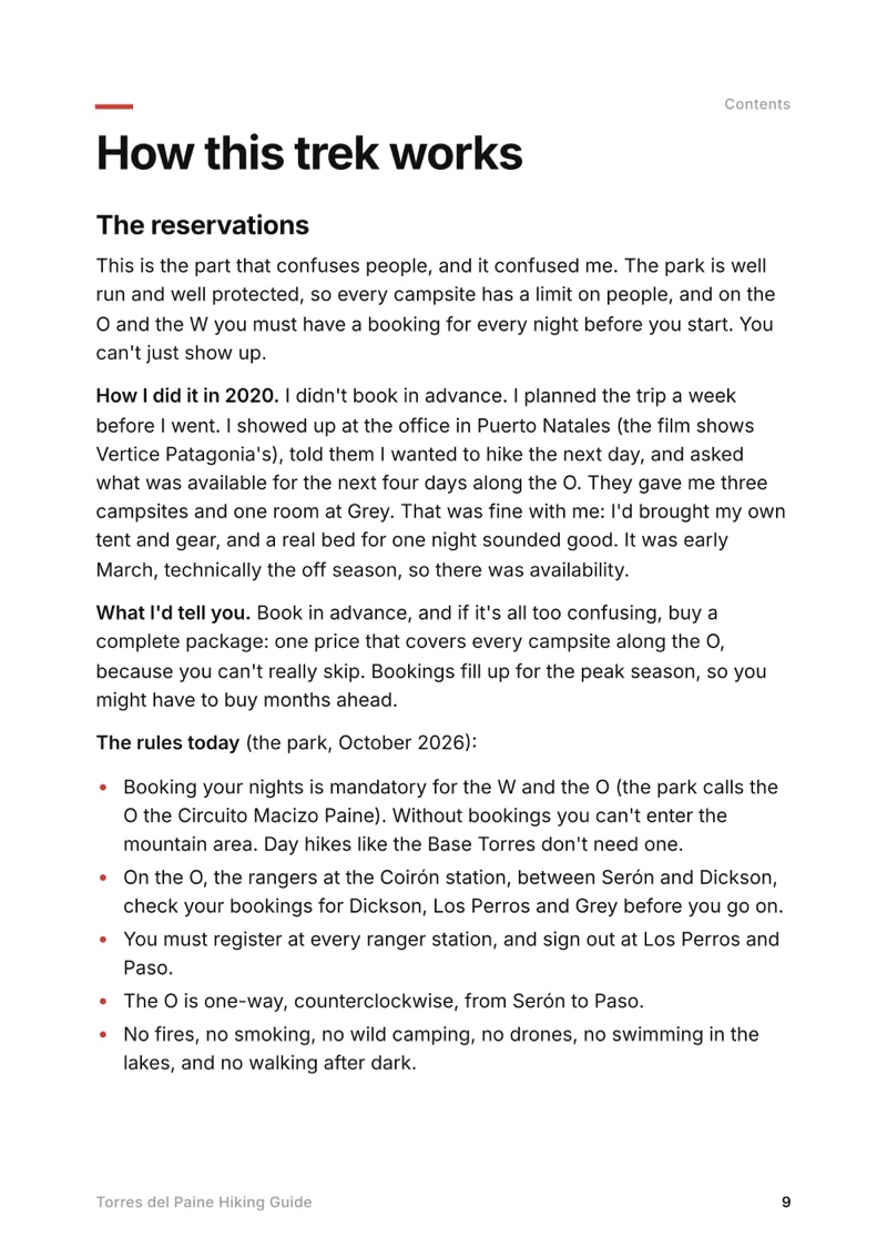
  • How this trek works page from the Torres del Paine Hiking Guide
    How this trek works

Swipe for more pages

Get Day 3 free

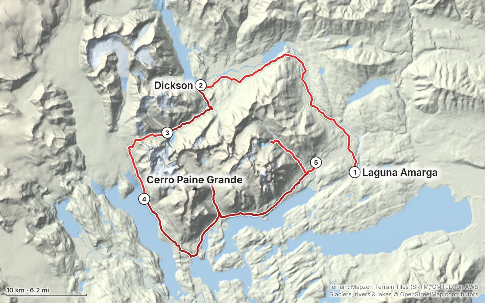
The route

My GPS recording of 5 days on a relief map. The numbers are where each day starts; the red dot is the finish. The full GPX files and the day maps come with the guide.

Relief map of the Torres del Paine route: 5 days drawn in red with numbered day starts, labelled Laguna Amarga, Cerro Paine Grande and Dickson.
Day 123Day 4Day 5Highest 3,960 ft (1,208 m)

Elevation, start to finish: highest 3,960 ft (1,208 m), lowest 100 ft (31 m).

Map data: Terrain: Mapzen Terrain Tiles (SRTM, GMTED) on AWS · Glaciers, rivers & lakes © OpenStreetMap contributors

At a glance

Days
5 days
Distance
85 miles
Climbing
About 14,590 ft (4,450 m) up
Season
Southern summer
Nights
3 at campsites in my own tent, 1 in a refugio room at Grey
Route
Laguna Amarga to Central

What's inside

  • All five days. Stats, the time I took, my notes, the trail, where to get off, a map with an elevation profile, and links to that day in my film.
  • My GPX files. My own recordings for each day and the full route, with waypoints for every camp, refugio, the pass and the viewpoints, ready for AllTrails, Gaia GPS, Garmin or Organic Maps.
  • How this trek works. The mandatory bookings, the one-way rule on the O, who runs which camp, the park ticket, and how I booked everything in Puerto Natales a day ahead.
  • Costs, then and now. What I spent in 2020, line by line, and the 2026-27 prices for the park ticket, the camps, the refugios, meals, buses and the catamaran.
  • Getting there. Punta Arenas to Puerto Natales, where I stayed, buying food, and the bus into the park, with 2026-27 times and fares.
  • Food, water and gear. What I ate, what I carried, where you can cook, and the camera kit I tested on this trip.
  • Weather and safety. The wind on the John Gardner Pass, the fire rules, the park's closing times and what to do if something goes wrong.
  • Before you go and a trip sheet. One page of year-to-year checks and a printable one-page summary of the whole trek.

About this trip

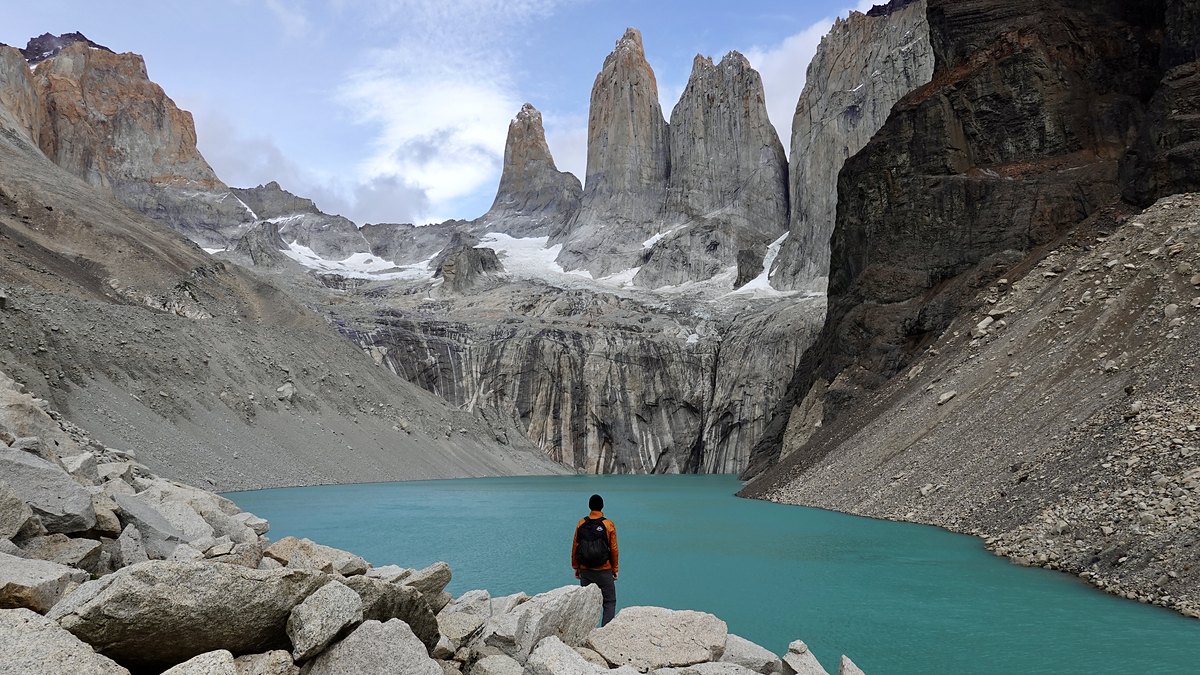
In March 2020 I hiked Torres del Paine alone: the O circuit counterclockwise around the back of the Paine massif, over the John Gardner Pass above the Grey glacier, then the W along its front to the foot of the three towers. About 85 miles in five days. This guide has my GPS files, maps and notes for every day, how the park's reservations and one-way rule work, who runs which camp, the 2026-27 prices, and how to get there from Punta Arenas and Puerto Natales.

Watch the film on YouTube (1.9M views).

Gear for this route

Paid links: I earn a commission if you buy through these links, at no extra cost to you. As an Amazon Associate I earn from qualifying purchases.

I carried my own tent and food for four nights. Here's what I carried in 2020, what I'd take now for Patagonian wind and rain, and what I filmed with.

What I carried in 2020

The full gear list I made for the film is no longer in its description. This is what my record shows.

  • Packa black roll-top backpack
  • Tentmy own tentA green one in the film. I slept in it three nights, at Dickson, Los Perros and Central.
  • Water filtera filter that screws onto my water bottlePeople said you could drink the glacier water straight. I never trust it.
  • Power banka portable batteryI charged the camera from it over USB, sometimes while hiking, with the battery in my side pocket.
  • Foodsausage, cheese, crackers, nuts and dried fruitPlus two Meal2Go bars and about five pouches of Performance Nut Butter from the States (see Food and water).

What I'd take now

My current kit for what this route needs. Wind and weather are the hard part here, above all on the John Gardner Pass.

Filming kit

This trip was a test of a much smaller camera than the Sony a7 III I'd been using. I didn't take my laptop or my drone into the park; my hostel kept them in its locker room. Recreational drones are banned in the park (see Straight answers).

  • CameraSony RX100 VIIThe size and weight were the big plus. I couldn't open its battery door with the tripod plate on, so I kept one battery in the whole time. The image quality and the built-in microphone weren't as good, and for the Pacific Crest Trail I leaned toward a bigger, better camera.
  • Camera poucha waterproof pouch on my hip beltThe camera rode in it.
  • Tripoda tripodAt full height in strong wind, the camera was knocked over completely once. Nothing broke.

What I film with now

Since September 2026 I film with a smaller setup: the Pocket 4 and the Mic 3 on the trail, and the Mini 5 Pro in the air.

Everything I carry now: my gear page.

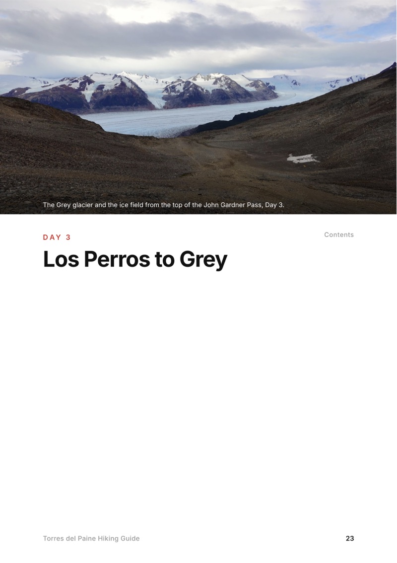
The Day 3, Los Perros to Grey page from the Torres del Paine Hiking Guide

Free sample + packing list

Try Day 3 free, plus my packing list

Los Perros to Grey

The whole day page from the guide as a PDF, plus my camping packing list: the 42 things I carry, with a note on each. The PDF opens right away and both come by email. You'll also get my emails about new guides and trips, a few a year.

The details

Format
A 51-page PDF sized for a phone (A5, prints fine too) and a folder of GPX files, in one zip download.
Edition
2027 season edition, updated October 2026.
Delivery
Instant. After you pay you get a private download link. Bookmark it to download again on any device.
Payment
Secure checkout through Stripe, in your own currency. Tax is included in the price, except in the US and Canada, where any sales tax is added at checkout.
Refunds
Not useful? Email me within 30 days for a refund: kraig@kraigadams.com.
Questions
Email kraig@kraigadams.com.

Paying in the Facebook/Instagram app? Tap ⋯ and Open in browser to use Apple Pay or Google Pay.

$19

Questions

How many days do you need for the Torres del Paine O circuit?
I walked the O and the W in 5 days in March 2020, about 85 miles on my GPS, with two very long days. Most people take longer: the park suggests 8 to 10 days for the O and the operators about 8 to 9. Your camp bookings decide your days.
Do you need reservations to hike the O or the W?
Yes. On the O and the W every night must be booked before you go in, with Vertice (Dickson, Los Perros, Grey, Paine Grande) or Las Torres (Serón, Francés, Los Cuernos, Central, Chileno). The rangers at Coirón check your O bookings. Day hikes like the Base Torres need only a park ticket, bought online at least 24 hours ahead.
Which direction do you hike the O?
Counterclockwise. The stretch from Serón over the John Gardner Pass to Paso is one-way, and you register at every ranger station and sign out at Los Perros and Paso.
Do you need a guide for Torres del Paine?
Not in summer. On the W and the Base Torres guides stopped being required on September 16, 2026, after the winter rule, though microspikes and trekking poles were still required while snow and ice lasted. The O is closed in winter; on October 1, 2026 it was closed until October 31, pending the park's weather and safety review.
How much does it cost to hike Torres del Paine?
The park ticket for a foreign adult is CLP 48,500 for more than one day (2026). Camps in 2026-27 run from about US$11 a night with your own tent at Vertice's camps to US$50 or more at Las Torres. In 2020 I spent about $300 in pesos on the trek, plus about $1,000 for my flight.
How high is the John Gardner Pass?
My GPS read 1,208 m (3,963 ft) at the pass; 1,200 m is the published figure. It is the one real climb of the circuit, about 2,100 ft up from Los Perros, and the windiest place on the route.
More guides

All guides
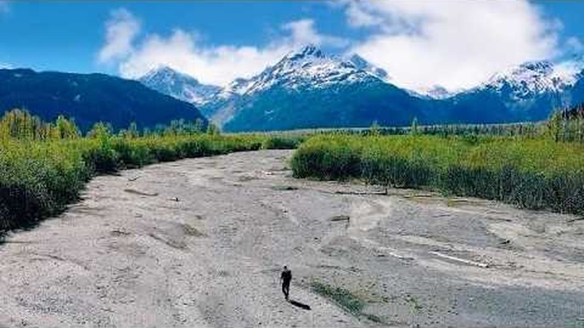
Resurrection Pass, Kenai Peninsula, Alaska

Kenai Peninsula, Alaska

Resurrection Pass

5 days · about 90 miles · solo, tent and a cabin

Hope to Seward on the Resurrection Pass, Russian Lakes and Resurrection River trails, through Cooper Landing, Kenai Peninsula, Alaska.

  • All five days
  • My GPX files
  • The cabins and camping
  • The Resurrection River Trail

See the guide: Resurrection Pass · $19

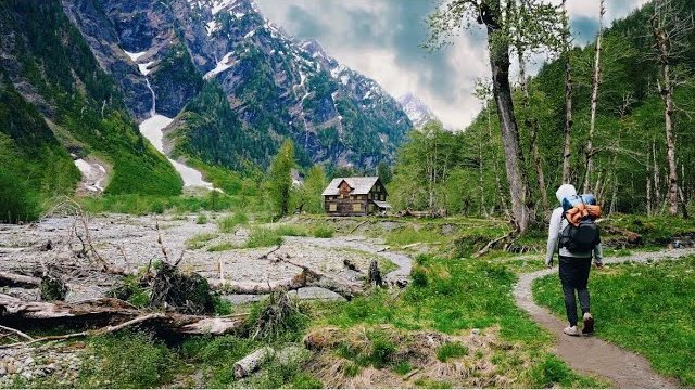
Enchanted Valley, Olympic National Park, Washington

Olympic National Park, Washington

Enchanted Valley

5 days · 38 miles · tent, wilderness camps

Five days up the East Fork Quinault River to the Enchanted Valley and its chalet, with a day hike to Anderson Pass, in Washington's Olympic National Park.

  • All five days
  • My GPX files
  • Permits and rules
  • Anderson Pass in the snow

See the guide: Enchanted Valley · $19

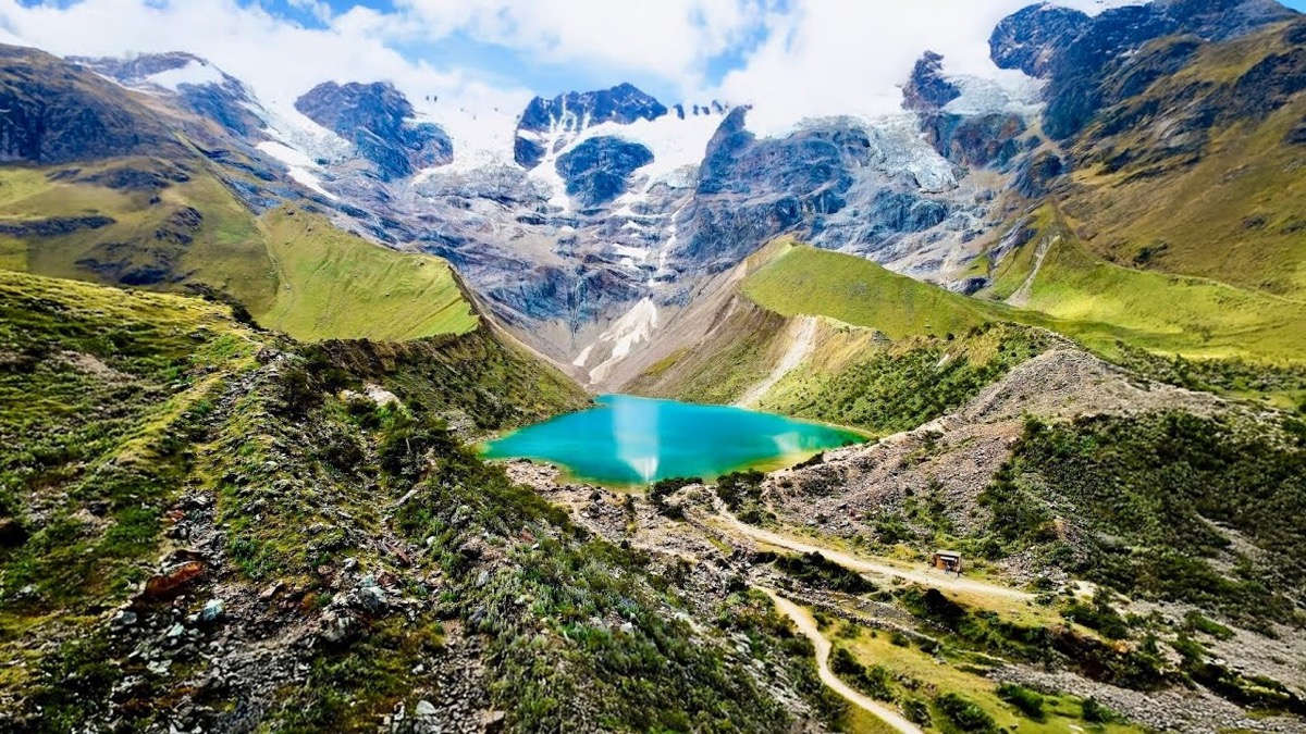
Salkantay Trek, Cusco region, Peru

Cusco region, Peru

Salkantay Trek

4 days · 42 miles · lodges, no tent

From Challacancha over the Salkantay Pass to Aguas Calientes and Machu Picchu, in Peru's Cusco region.

  • All four days
  • My GPX files
  • Machu Picchu
  • With a company or on your own

See the guide: Salkantay Trek · $19

Get the next guide

I'm making guides for more of my hikes, and I host a group trip about once a year. Get an email when a new guide or trip is out. A few emails a year.

Torres del Paine Hiking GuideInstant PDF + GPX