
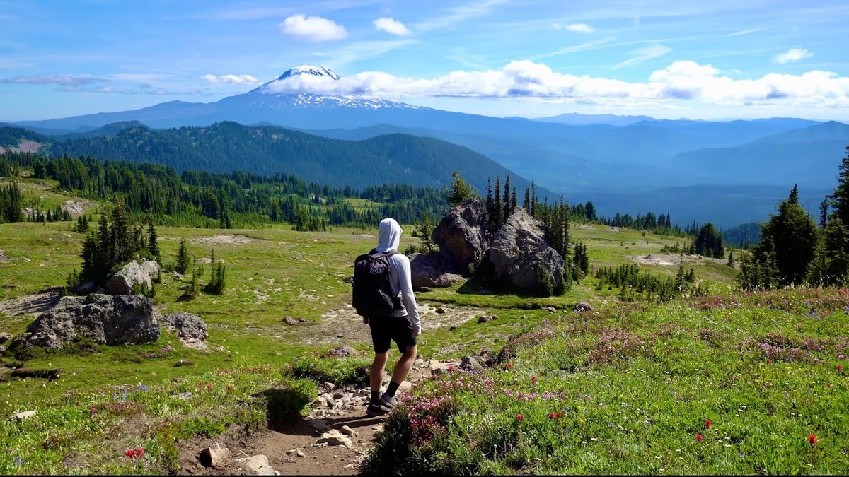
Goat Rocks Wilderness, Washington · August 2020 · Solo
Goat Rocks
63.2 KM · 3 DAYS · 2,280 M
A 3-day loop over Old Snowy and the Knife's Edge.
Watch the film 23:28 · 323K viewsAt a glance
- Where
- Goat Rocks Wilderness, Washington
- Distance
- 63.2 km (39.3 miles)
- Days
- 3 days, 2 nights in my tent, alone, carrying all my food. I started at 3 p.m. on Day 1
- Climbing
- About 7,490 ft (2,280 m) up and 7,420 ft (2,260 m) down
- Season
- Late July to September, when the snow is mostly gone. I walked August 7 to 9, 2020
- Difficulty
- Good trails, one steep scramble to the top of Old Snowy, a narrow ridge on the Knife's Edge, and snowfields that can last into August
- Start and end
- Walupt Lake trailhead
- When I went
- August 2020
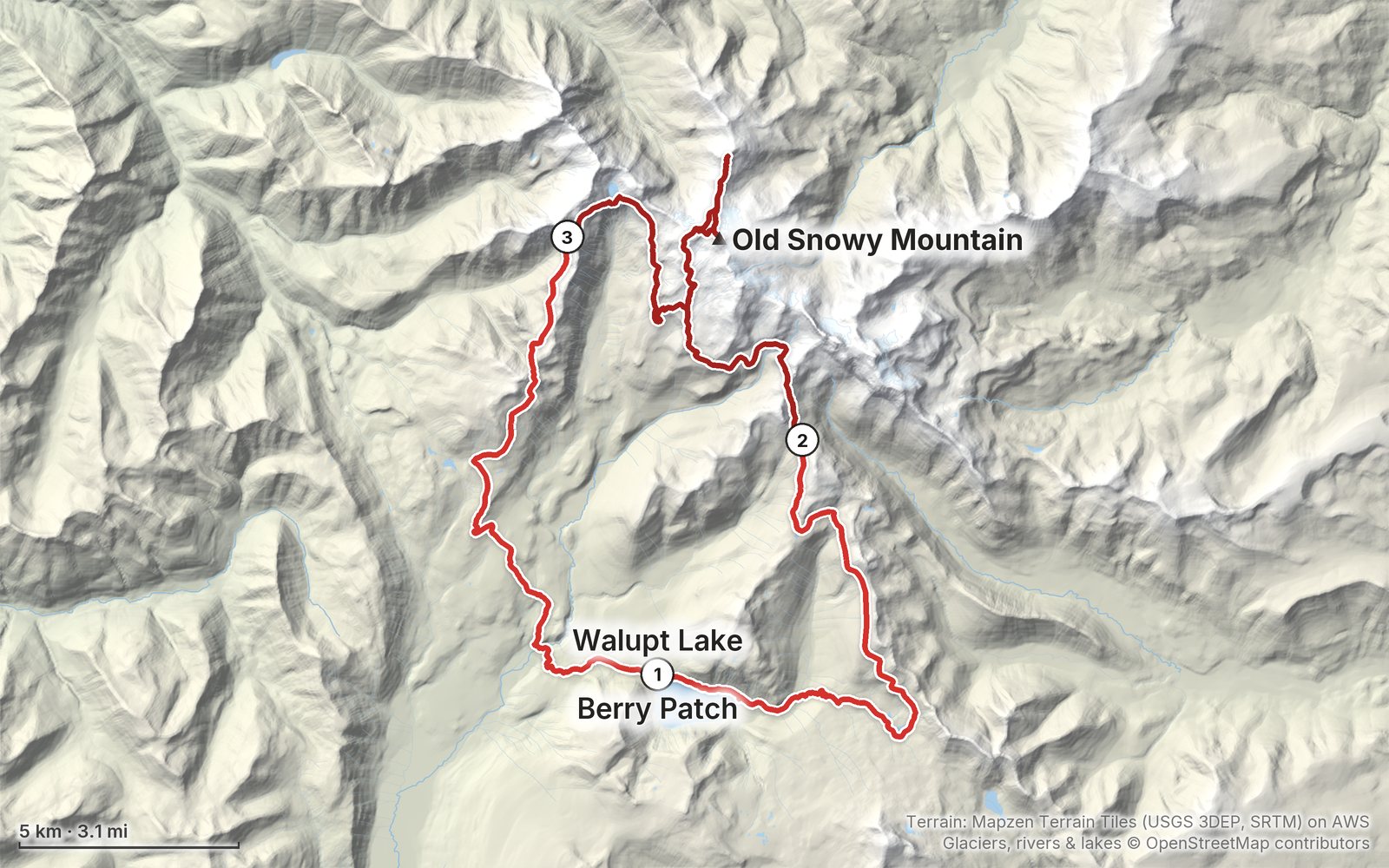
Elevation, start to finish: highest 7,900 ft (2,407 m), lowest 3,330 ft (1,016 m).
My GPS recording on a relief map. The numbers are where each day starts. The GPX files come with the guide.
Everything I made about it
The film

Photos
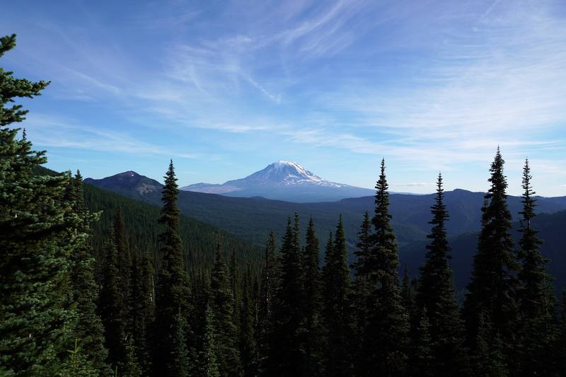
Mount Adams from the PCT, the evening of Day 1. 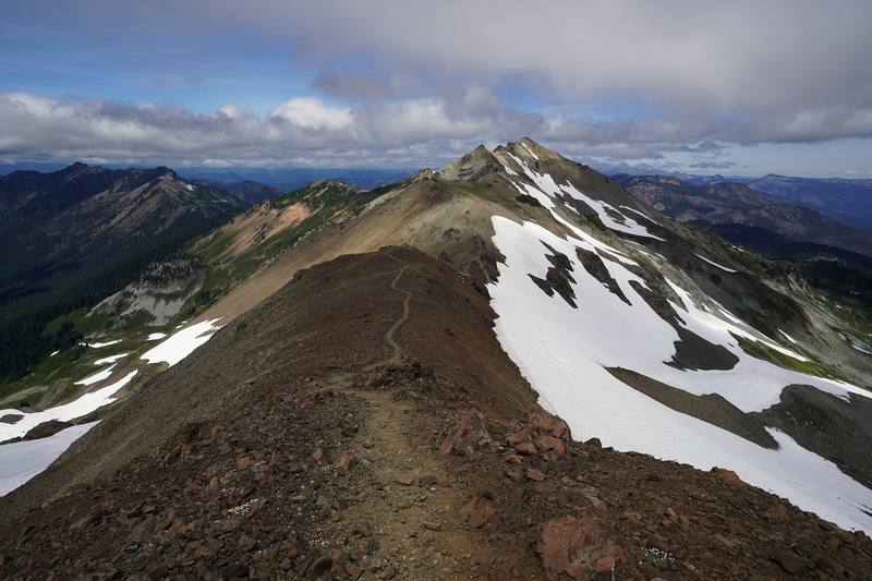
The PCT along the crest north of Old Snowy, toward the Knife's Edge, Day 2. 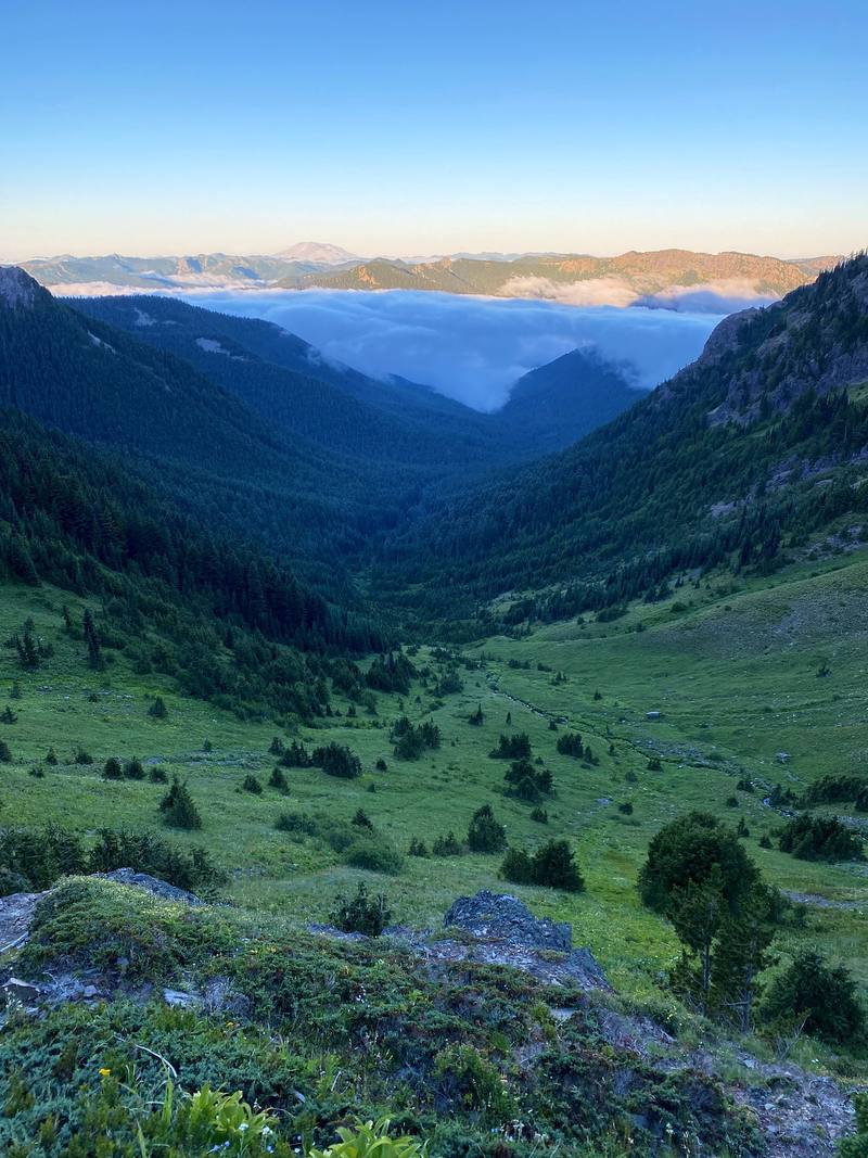
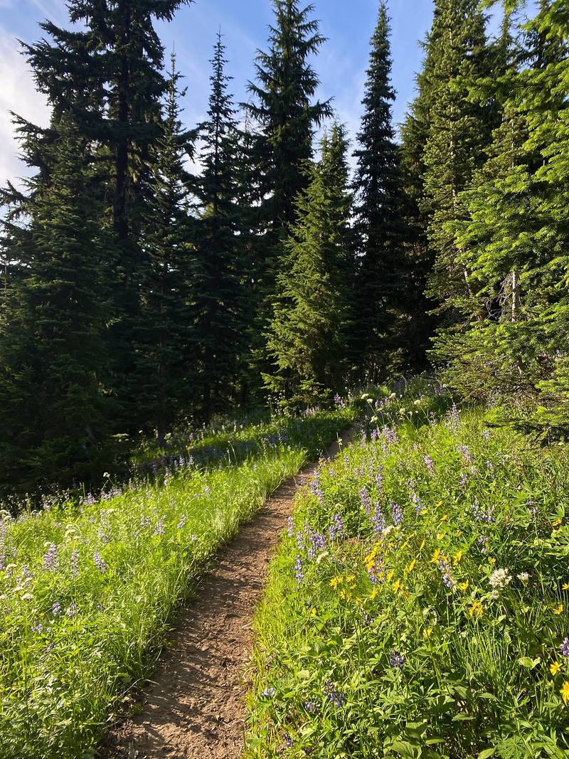
Morning from Goat Ridge, the start of Day 3.
The guide · 43-page PDF + GPX files · 2027 season edition
Do it yourself
A 3-day loop over Old Snowy and the Knife's Edge.
- All three days
- My GPX files
- Permits and rules
- Old Snowy and the Knife's Edge
- Getting there
Free sample
Try Day 2 free
The whole Day 2, Cispus Pass, Old Snowy and the Knife's Edge to Goat Lake page from the guide as a PDF, plus my camping packing list: the 42 things I carry, with a note on each. Both come by email. You'll also get my emails about new guides and trips, a few a year.
Gear on this trip
Paid links: I earn a commission if you buy through these links, at no extra cost to you. As an Amazon Associate I earn from qualifying purchases.
What I carried in 2020
- TentNEMO Hornet 1PMy second night the gusts folded it flat on top of me.
- FootprintNEMO Hornet 1P footprint
- Sleeping bagUGQ Bandit quiltSimilar now: Hyperlite Mountain Gear 20° Quilt
- LinerOutdoor Vitals Sleeping Bag Liner
- Sleeping pada sleeping pad
- PillowKlymit Pillow X
- PackHyperlite Mountain Gear Southwest 2400
- Stuff sacksHyperlite Mountain Gear drawstring stuff sacks
- WaterKatadyn BeFree AC · 1LThe one-liter filter bottle.
- BottleSmartwater bottle
- StoveJetboil MiniMoFires are banned in much of the area.
- SporkSea to Summit Alpha Light long spoon
- Alsoa lighter and wipes
- HeadlampSLONIK rechargeable headlamp
- Satellite messengerGarmin inReach Mini
- Bear sprayCounter Assault bear spray
- HatZOWYA running cap
- SunglassesWarby Parker Barkley sunglassesSimilar now: Goodr OG Sunglasses
- ShirtAmazon Essentials Quick-Dry Tech Hoodie
- ShortsAmazon Essentials training shorts
- PantsPatagonia Terrebonne JoggersSimilar now: PATH Projects Killam PX Pant
- ShellThe North Face Dryzzle jacketSimilar now: Arc’teryx Beta AR Jacket
- Down jacketPatagonia Nano Puff JacketSimilar now: Arc’teryx Cerium Hoody
- SocksPeople Socks merino crew socks
- ShoesBrooks Cascadia 13
- Phonethe AllTrails appRecording the whole hike, in airplane mode. You still have GPS location, so you can see where you are on the map the entire time.
Filming kit
- CameraSony a6600
- LensSony E 10-18mm f/4 OSS
- MicRode VideoMic NTG
- Tripoda tripod
- Spare batteriesSony NP-FZ100 batteries
What I'd take now
My current kit
- Sleeping padTherm-a-Rest NeoAir XLite NXT
- Rain shellArc’teryx Beta AR Jacket
- TractionYatta Life Ice Spikes
- PolesBlack Diamond Alpine Carbon Z Poles
- Power bankNitecore NB20000
- NavigationAllTrails+
The Americas and New Zealand bundle
This guide is in The Americas and New Zealand Hiking Guide Pack: 36 guides for $39. Or all 62 guides for $59.
Short answers
- How long is the Goat Rocks loop?
- My loop from Walupt Lake was 39.3 miles on my GPS (the film says 40), with about 7,490 ft of climbing, over three days in August 2020: up to the PCT and north below Cispus Pass, then Old Snowy, the Knife's Edge and Goat Lake, then down Goat Ridge to Berry Patch and back to Walupt Lake.
- Do you need a permit for the Goat Rocks Wilderness?
- In 2026 the wilderness permit is free and you fill it out yourself at the trailhead; there's no quota or reservation. You also need a parking pass at Walupt Lake, Berry Patch and Snowgrass: a Northwest Forest Pass ($30 a year or $5 a day) or an Interagency pass.
- Can you camp at Goat Lake?
- Yes, but not within 100 feet of the shore, and campfires are banned within a quarter mile of the lake. Camping is also banned within 100 feet of the PCT and anywhere in Snowgrass Flat. When I was there in August 2020 the lake was still frozen and very crowded.
- How high is Old Snowy Mountain?
- My GPS read 7,897 ft (2,407 m) on top, the high point of my loop. It's a short scramble off the PCT's Old Snowy Alternate, with a very small top.
- When is the best time to hike the Goat Rocks?
- Late July to September. The Forest Service says the high trails usually melt out by mid-July and snowfields can last into August; the busiest months are August and September. I went August 7 to 9, 2020, and still crossed snow near Old Snowy.
- Is the Knife's Edge in Goat Rocks dangerous?
- The Forest Service calls the PCT between Elk Pass and the Packwood Glacier narrow, rugged and treacherous. It's exposed, with loose rock and snow early in the season. I went out along it in good weather and turned back partway. Skip it in wind, storms or snow.
I make my guides with AI, from my own films and GPS recordings. How.