

Hong Kong · January 2025
Lantau Trail
48.9 KM · 4 DAYS · 1,990 M
Mui Wo over Lantau Peak to Tai O in 4 days.
Watch the film 15:43 · 137K viewsAt a glance
- Where
- Hong Kong
- Distance
- 48.9 km (30.4 miles)
- Days
- 4, with 3 nights: 4.8 miles on Day 1 (an afternoon), 7.2 on Day 2, 12.8 on Day 3, 5.7 on Day 4
- Climbing
- About 6,530 ft (1,990 m) up and 6,300 ft (1,920 m) down, going west like I did
- Difficulty
- Sections 2 and 3 (Sunset Peak and Lantau Peak) are rated 4 of 5, Difficult, by the government: long stone staircases. The rest is 1 to 3 of 5
- Route
- Mui Wo ferry pier to South Lantau Road at Shek Pik
- When I went
- January 2025
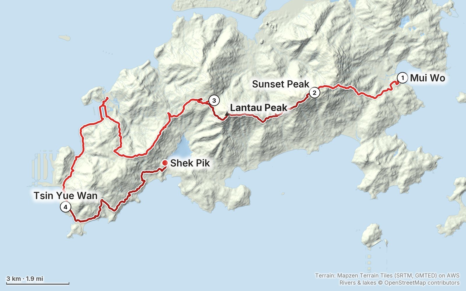
Elevation, start to finish: highest 2,930 ft (892 m), lowest sea level.
My GPS recording on a relief map. The numbers are where each day starts. The GPX files come with the guide.
Everything I made about it
The film

Photos
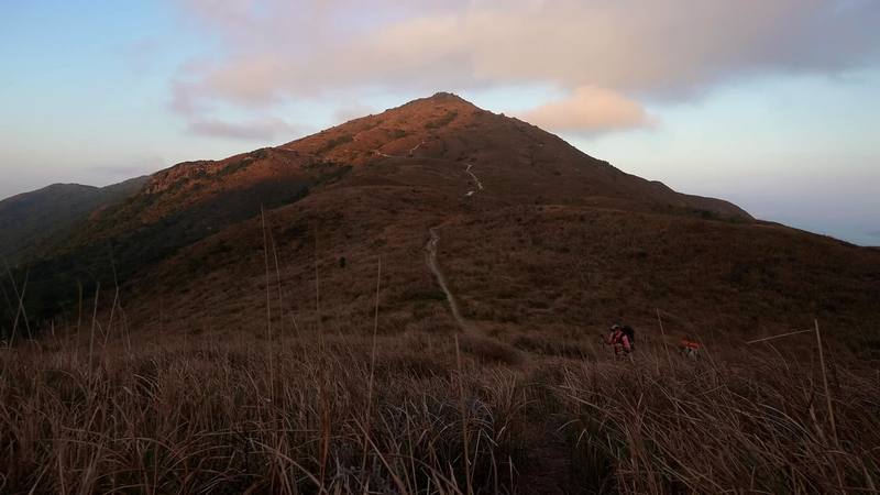
The ridge below Sunset Peak at dusk, Day 1. 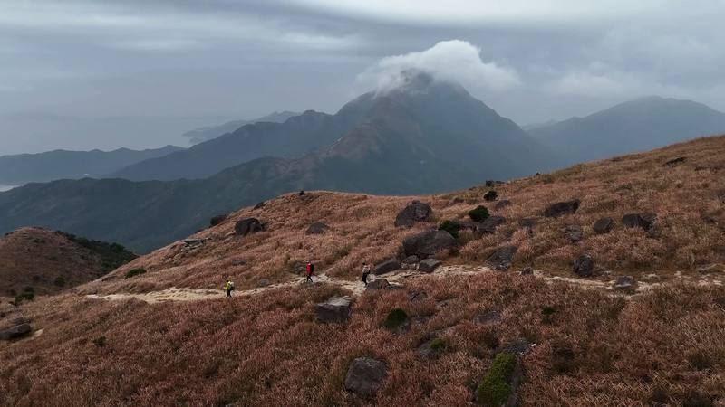
Lantau Peak in cloud from Sunset Peak's shoulder, Day 2 morning. 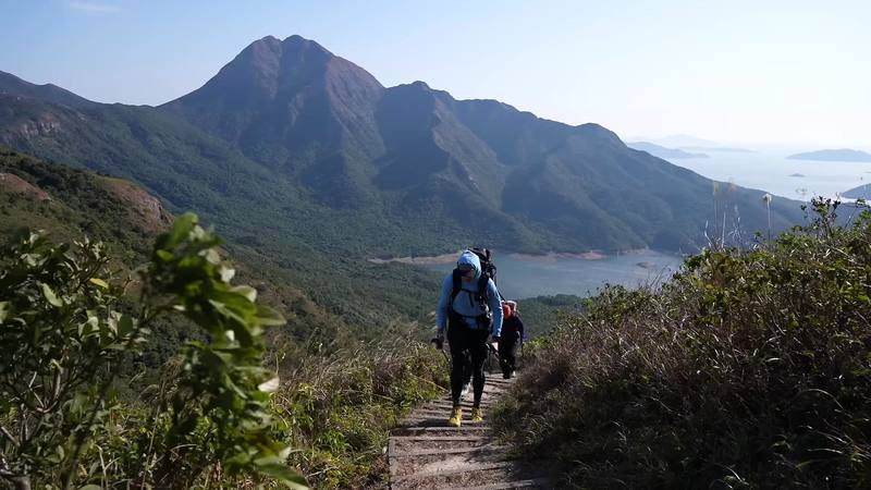
Lantau Peak and Shek Pik Reservoir from the ridge, Day 3. 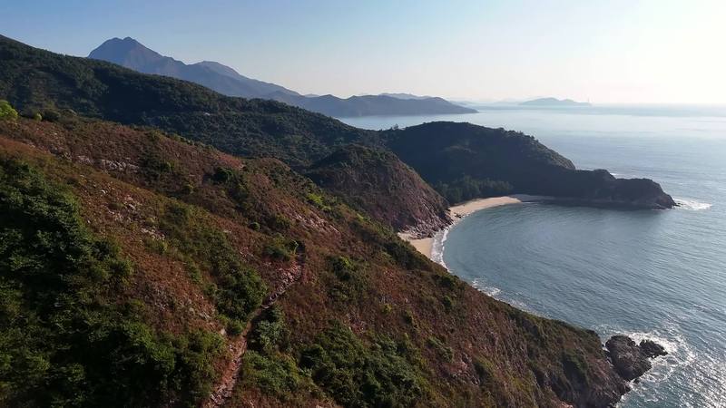
The south coast on Day 4, from my drone.
The guide · 53-page PDF + GPX files · 2027 season edition
Do it yourself
Mui Wo over Lantau Peak to Tai O in 4 days.
- Where things stand
- All four days
- A plan for 2027
- My GPX files
- The rules and camping
Free sample
Try Day 2 free
The whole Day 2, Sunset Peak to Ngong Ping page from the guide as a PDF, plus my camping packing list: the 42 things I carry, with a note on each. Both come by email. You'll also get my emails about new guides and trips, a few a year.
Music in this film
- CirclesSarah Watson · Musicbed
- DiveTraveler · Musicbed
- ELEGANCEWhy We Wander · Musicbed
- Enveloped In LoveLofi Sunday · Musicbed
- Field of ShapesAlaskan Tapes · Musicbed
- FleurieTony Anderson · Musicbed
- Groter dan ons samen (Laplander remix) - InstrumentalMensenkinderen · Musicbed
- Groter dan ons samen (Mensenkinderen & Mooizaam remix)Mensenkinderen · Musicbed
- Homecoming - InstrumentalGraham Colton · Musicbed
- Homeward (Piano Only) - InstrumentalKollen · Musicbed
- It Became Clear Again (Light Mix) - InstrumentalBrylom · Musicbed
- Just TruthLofi Sunday · Musicbed
- Like MossAlaskan Tapes · Musicbed
- My Guy - InstrumentalLonely Benson · Musicbed
- PastoralTony Anderson · Musicbed
- Pleisterplaats (SILMUS remix) - InstrumentalMensenkinderen · Musicbed
- THE TRUTH BEYONDWhy We Wander · Musicbed
What I'd take now
My current kit
Asia bundle
This guide is in Asia Hiking Guide Pack: 8 guides for $39. Or all 62 guides for $59.
Short answers
- Is the Lantau Trail open?
- Mostly, in October 2026. Sections 1 to 6 and 8 are open. Part of Section 7, from south of Kan Tau Au past Tsin Yue Wan to Fan Lau, and Tsin Yue Wan Campsite have been closed since October 10, 2025, after typhoon landslides. Check AFCD's notices at hiking.gov.hk before you go.
- How long is the Lantau Trail?
- The whole loop is 70 km (43.5 miles) in 12 sections, starting and ending at Mui Wo. I walked Sections 1 to 8, Mui Wo to Shek Pik, which AFCD gives as 43.5 km; my GPS recorded 30.4 miles (48.9 km) over four days, including wandering in Ngong Ping and Tai O.
- Can you camp on the Lantau Trail?
- Yes, but only at designated campsites: Hong Kong law bans camping elsewhere in country parks. They're free and first come, first served. On or near Sections 1 to 8 they include Nam Shan, Ngong Ping, Man Cheung Po, Kau Ling Chung and Shek Pik. There's no campsite on Sunset Peak.
- Is there water on the Lantau Trail?
- Not on the mountains: there's none between Nam Shan and Ngong Ping, over Sunset Peak and Lantau Peak. Fill up in Mui Wo or at Nam Shan, then in Ngong Ping and Tai O. Campsite streams are seasonal.
- How do you get to the start of the Lantau Trail?
- Take the ferry from Central Pier 6 to Mui Wo: about 35 to 40 minutes, all fast ferries, HK$33.50 Monday to Saturday and HK$48.50 on Sundays and holidays (2026). The trail starts at the pier.
- When is the best time to hike the Lantau Trail?
- October to March, the cool, dry season. The Hong Kong Observatory says November and December are many people's favorite months. Summer is hot and wet, with typhoons possible from May to November.
I make my guides with AI, from my own films and GPS recordings. How.