The film of Lantau Trail Watch the film

137K views on YouTube. This guide is that trip, day by day.

Hong Kong · 4 days · 30.4 miles · Hong Kong

Lantau Trail Hiking Guide

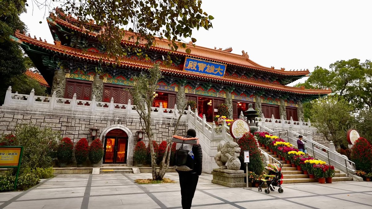
In January 2025 I hiked the Lantau Trail in Hong Kong with two friends: the ferry to Mui Wo, a night above the airport below Sunset Peak, Lantau Peak in the fog, the Big Buddha at Ngong Ping, the fishing village of Tai O and the quiet west coast, out to Shek Pik. It's the trip from my film Hiking in Hong Kong. This guide has my GPX files, maps and notes for all four days, the legal campsites and where the water is, the Section 7 closure and a plan for 2027 around it, the ferry, buses and cable car, the weather by month, safety, and a trip sheet.

Days
4 days
Distance
30.4 miles
Climbing
About 6,530 ft (1,990 m) up
Nights
Free campsites, first come, first served
Permit
None to hike or to camp at the campsites
Route
Mui Wo ferry pier to South Lantau Road at Shek Pik

Paying in the Facebook/Instagram app? Tap ⋯ and Open in browser to use Apple Pay or Google Pay.

$19

Instant download: PDF + GPX files.
Not useful? Email me within 30 days for a refund.

Free updates. 2027 season edition, updated October 2026. When I update the guide, your download link gets the new version.

Or get it in Asia: 8 guides for $39, or all 58 for $59.

The cover of the Lantau Trail Hiking Guide

What's inside

The route

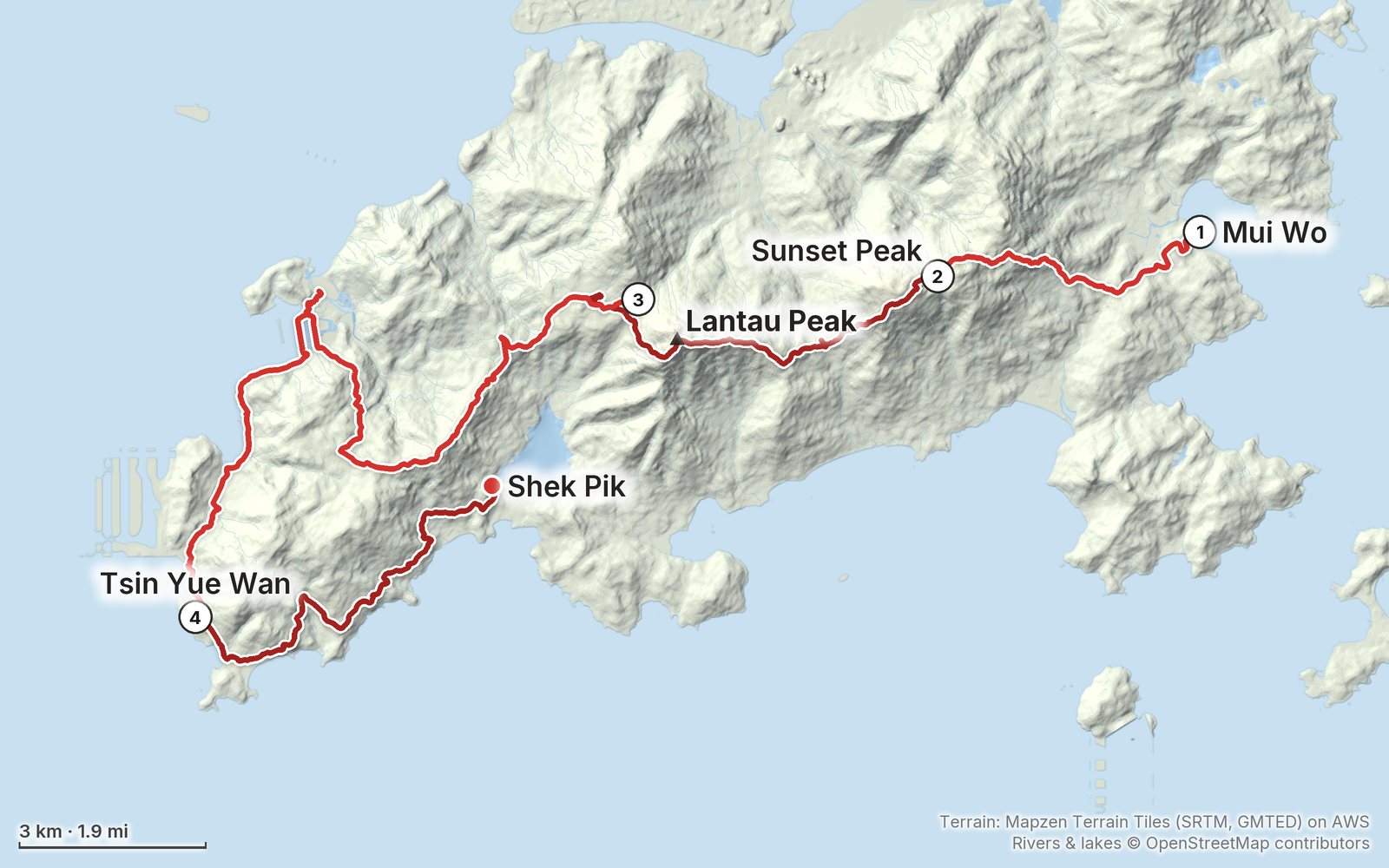
My GPS recording of 4 days, simplified. The numbers are where each day starts; the dot is the finish. The full GPX files and the maps come with the guide.

12345 km (3.1 mi)N

Elevation, start to finish: highest 2,930 ft (892 m), lowest sea level.

Look inside

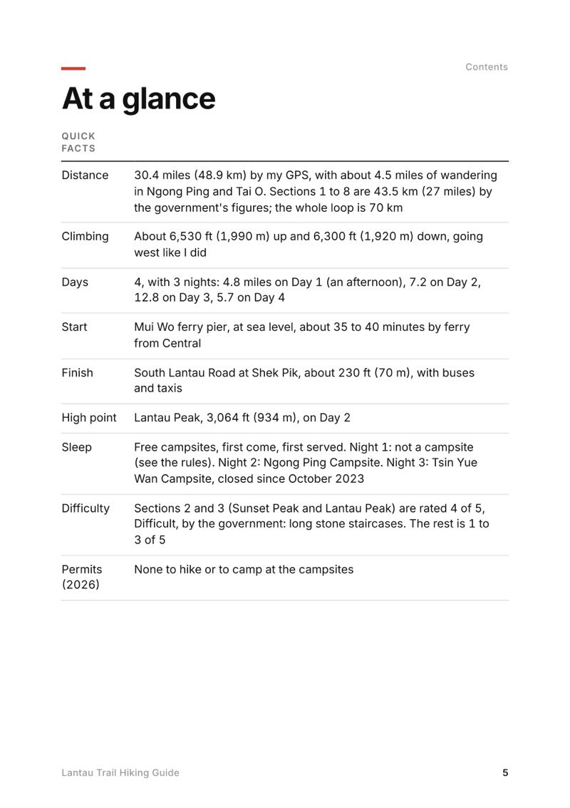
At a glance page from the Lantau Trail Hiking Guide
At a glance
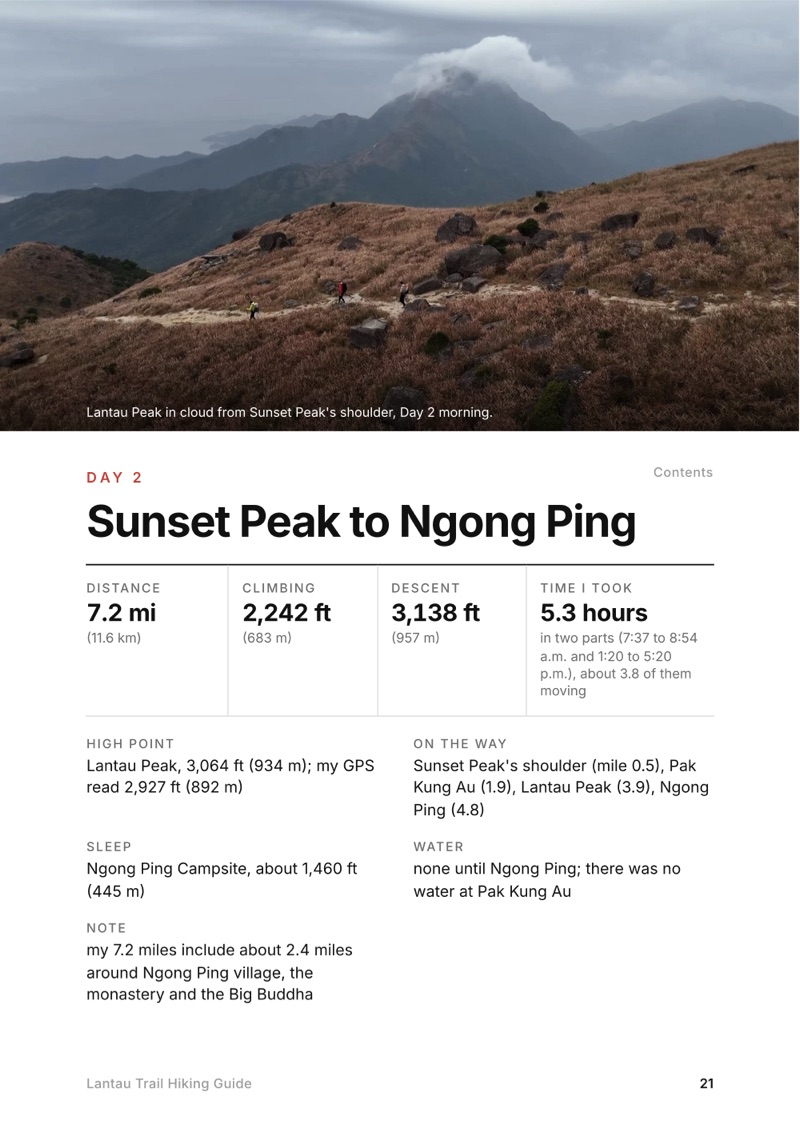
A day page page from the Lantau Trail Hiking Guide
A day page
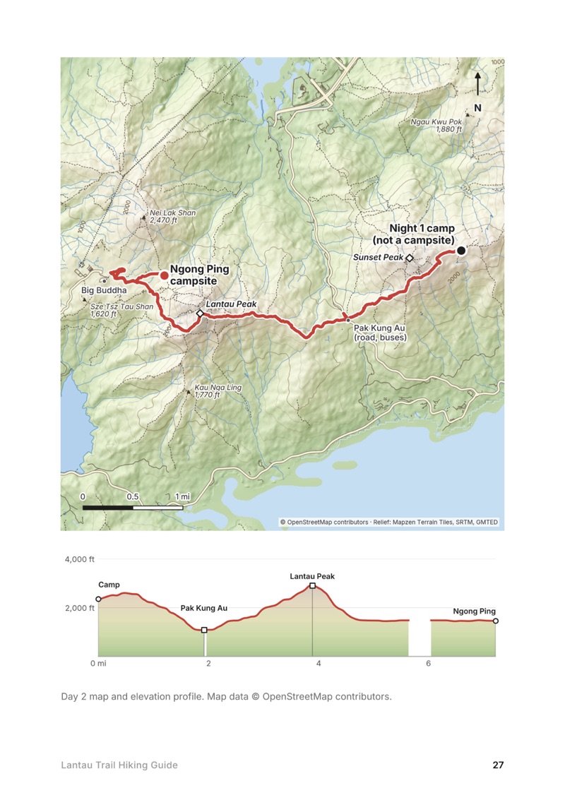
A day map and elevation profile page from the Lantau Trail Hiking Guide
A day map and elevation profile
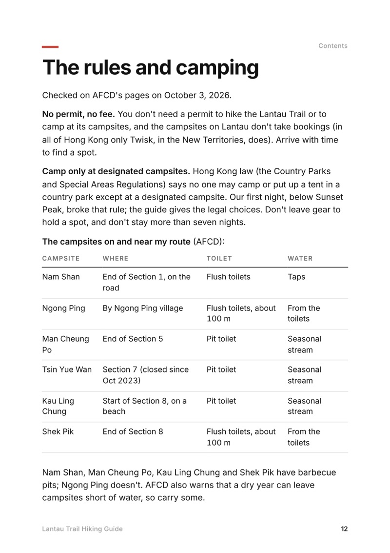
The rules and camping page from the Lantau Trail Hiking Guide
The rules and camping

The details

Format
A 53-page PDF sized for a phone (A5, prints fine too) and a folder of GPX files, in one zip download.
Edition
2027 season edition, updated October 2026.
Delivery
Instant. After you pay you get a private download link. Bookmark it to download again on any device.
Payment
Secure checkout through Stripe, in your own currency. Tax is included in the price, except in the US and Canada, where any sales tax is added at checkout.
Refunds
Not useful? Email me within 30 days for a refund: kraig@kraigadams.com.
Questions
Email kraig@kraigadams.com.

Paying in the Facebook/Instagram app? Tap ⋯ and Open in browser to use Apple Pay or Google Pay.

$19

Questions

Is the Lantau Trail open?
Mostly, in October 2026. Sections 1 to 6 and 8 are open. Part of Section 7, from south of Kan Tau Au past Tsin Yue Wan to Fan Lau, and Tsin Yue Wan Campsite have been closed since October 10, 2025, after typhoon landslides. Check AFCD's notices at hiking.gov.hk before you go.
How long is the Lantau Trail?
The whole loop is 70 km (43.5 miles) in 12 sections, starting and ending at Mui Wo. I walked Sections 1 to 8, Mui Wo to Shek Pik, which AFCD gives as 43.5 km; my GPS recorded 30.4 miles (48.9 km) over four days, including wandering in Ngong Ping and Tai O.
Can you camp on the Lantau Trail?
Yes, but only at designated campsites: Hong Kong law bans camping elsewhere in country parks. They're free and first come, first served. On or near Sections 1 to 8 they include Nam Shan, Ngong Ping, Man Cheung Po, Kau Ling Chung and Shek Pik. There's no campsite on Sunset Peak.
Is there water on the Lantau Trail?
Not on the mountains: there's none between Nam Shan and Ngong Ping, over Sunset Peak and Lantau Peak. Fill up in Mui Wo or at Nam Shan, then in Ngong Ping and Tai O. Campsite streams are seasonal.
How do you get to the start of the Lantau Trail?
Take the ferry from Central Pier 6 to Mui Wo: about 35 to 40 minutes, all fast ferries, HK$33.50 Monday to Saturday and HK$48.50 on Sundays and holidays (2026). The trail starts at the pier.
When is the best time to hike the Lantau Trail?
October to March, the cool, dry season. The Hong Kong Observatory says November and December are many people's favorite months. Summer is hot and wet, with typhoons possible from May to November.

More guides

All guides
Mardi Himal, Annapurna region, Nepal

Annapurna region, Nepal

Mardi Himal

4 days · 32 miles · teahouse trek

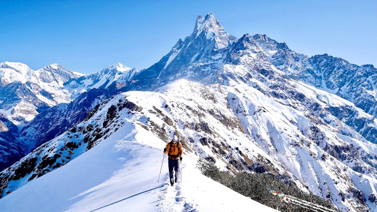
Kande through Pothana, Forest Camp, Low Camp and High Camp to the ridge below Machapuchare, and down to Sidhing.
  • All four days
  • My GPX files
  • Permits and the guide rule
  • Getting there and home

See the guide: Mardi Himal · $19

MacLehose Trail, Hong Kong

Hong Kong

MacLehose Trail

5 days · 71 miles · camping

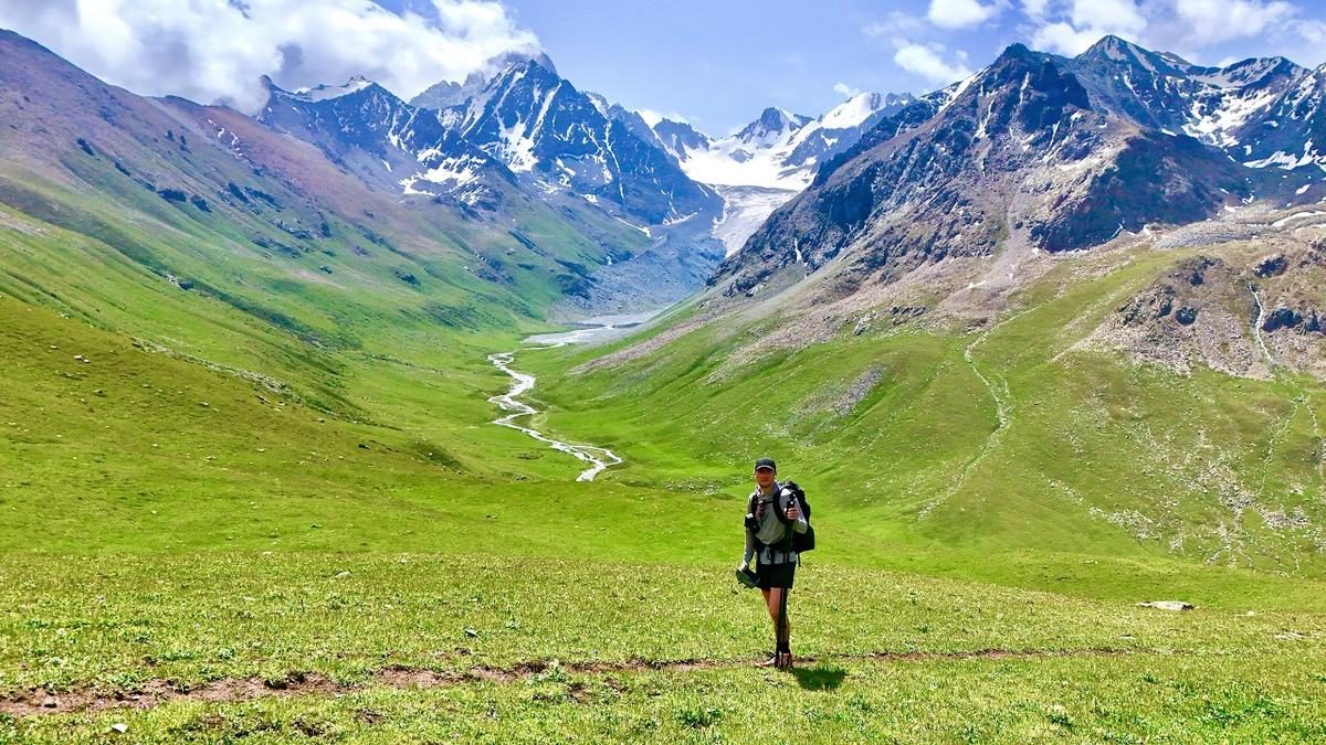
From Pak Tam Chung in Sai Kung over Ma On Shan, Lion Rock and Tai Mo Shan to Tuen Mun, across Hong Kong's New Territories.

  • All five days
  • My GPX files
  • Planning the nights
  • Getting there and getting off

See the guide: MacLehose Trail · $19

Get the next guide

I'm making guides for more of my hikes, and I host a group trip about once a year. Get an email when a new guide or trip is out. A few emails a year.