The Enchanted Valley film: Olympic National Park, Washington

Olympic National Park, Washington · 5 days · 38 miles

Enchanted Valley Hiking Guide

5 days to the chalet and Anderson Pass in Olympic National Park.

Watch the film · 316K views
Free sample
  • 316K YouTube views
  • Instant PDF + GPX
  • 30-day refund
  • Free updates

Look inside

Real pages from the guide. Tap one to see it big.

  • A day page page from the Enchanted Valley Hiking Guide
    A day page
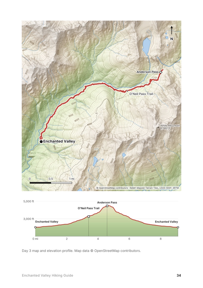
  • A day map and elevation profile page from the Enchanted Valley Hiking Guide
    A day map and elevation profile
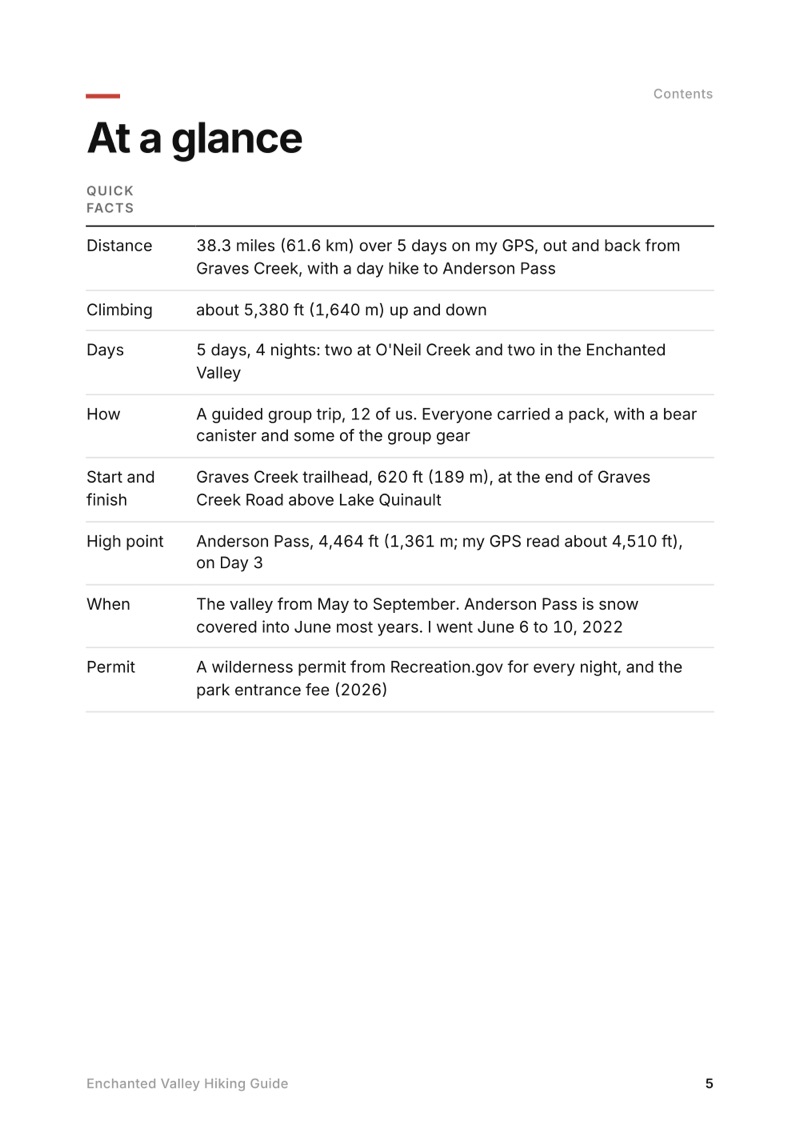
  • At a glance page from the Enchanted Valley Hiking Guide
    At a glance
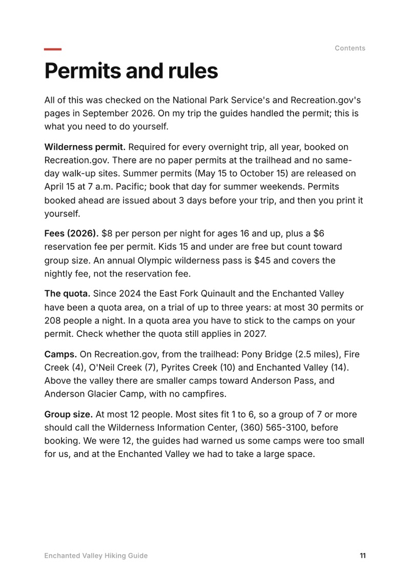
  • Permits and rules page from the Enchanted Valley Hiking Guide
    Permits and rules

Swipe for more pages

Get Day 3 free

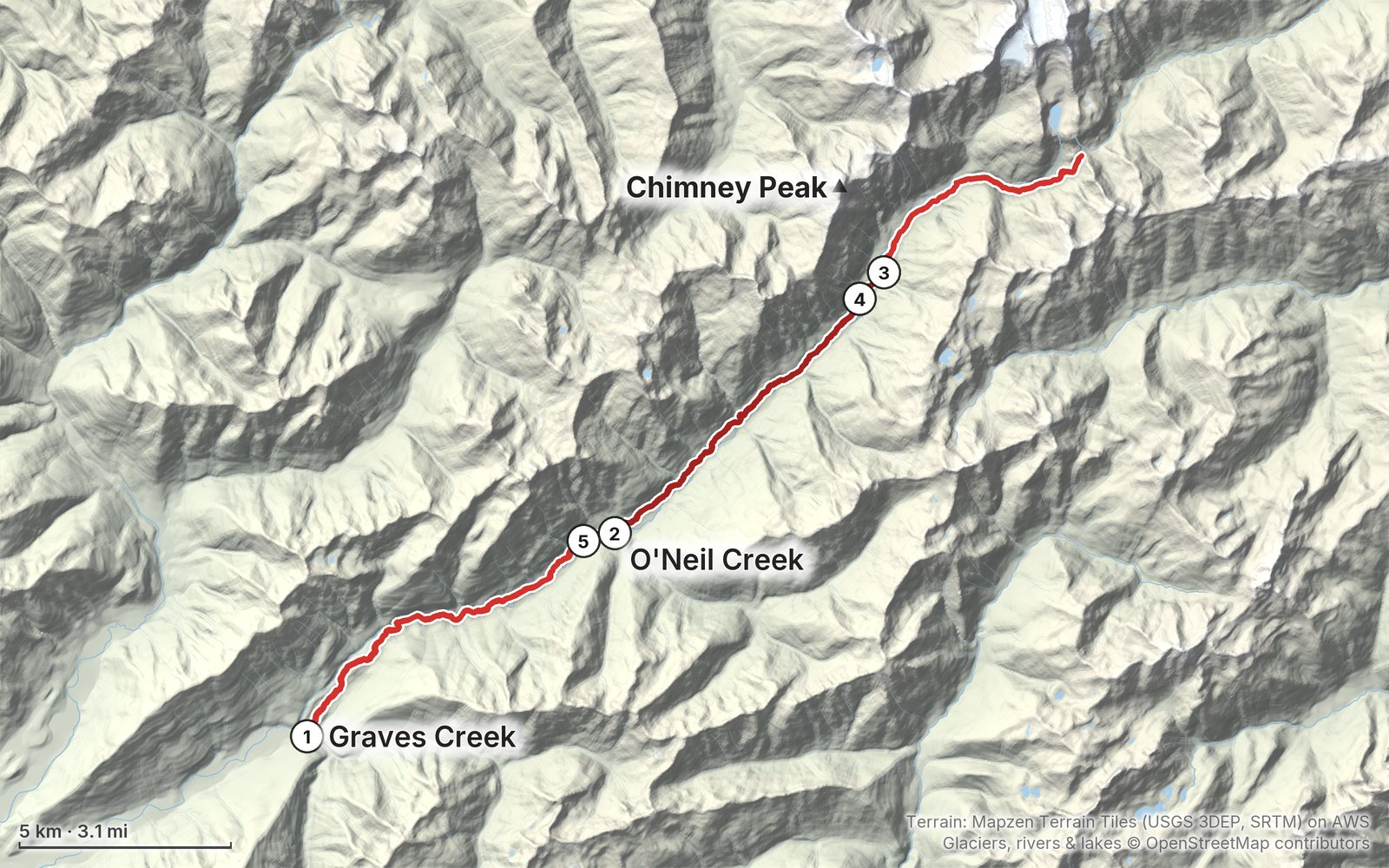
The route

My GPS recording of 5 days on a relief map. The numbers are where each day starts; the red dot is the finish. The full GPX files and the day maps come with the guide.

Relief map of the Enchanted Valley route: 5 days drawn in red with numbered day starts, labelled Graves Creek, Chimney Peak and O'Neil Creek.
Day 1Day 2Day 3Day 4Day 5Highest 4,510 ft (1,375 m)

Elevation, start to finish: highest 4,510 ft (1,375 m), lowest 610 ft (186 m).

Map data: Terrain: Mapzen Terrain Tiles (USGS 3DEP, SRTM) on AWS · Glaciers, rivers & lakes © OpenStreetMap contributors

At a glance

Days
5 days
Distance
38 miles
Climbing
About 5,380 ft (1,640 m) up
Season
The valley from May to September
Permit
A wilderness permit from Recreation.gov for every night, and the park entrance fee (2026)
Start and end
Graves Creek trailhead

What's inside

  • All five days. Stats, the time we took, my notes, the trail, where to get off, a map with an elevation profile, and links to that day in my film.
  • My GPX files. My own recordings for each day, with waypoints for the camps, the chalet, the O'Neil Pass junction and Anderson Pass, ready for AllTrails, Gaia GPS, Garmin or Organic Maps.
  • Permits and rules. The Recreation.gov wilderness permit, the East Fork Quinault quota, fees, bear canisters, campfires and group size, checked in September 2026.
  • Anderson Pass in the snow. How the day hike above the valley went in early June, the White Creek ford, and when to go for a snow-free pass.
  • Getting there. The North Shore Road and Graves Creek Road while the South Shore Road is closed, the trailhead, and the ranger station.
  • A guided trip, explained. What the company handled for us, and what you need to arrange yourself if you go on your own.
  • Before you go and a trip sheet. One page of year-to-year checks and a printable one-page summary of the whole trip.

About this trip

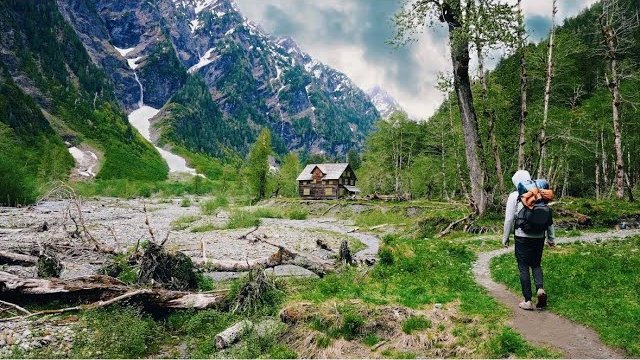
In June 2022 I spent five days backpacking into the Enchanted Valley in Olympic National Park, Washington: up the East Fork Quinault River from Graves Creek through old-growth rainforest, two nights at O'Neil Creek and two in the valley under the old chalet, and a snowy day hike up to Anderson Pass. It was a guided group trip with nine subscribers, and it's the trip from my film Hiking 50 Miles Through Washington's Enchanted Valley. This guide has my GPS files, maps and notes for every day, the wilderness permit, quota and bear canister rules in 2026, the road in now that the South Shore Road is closed, the river crossings and washouts to check, and what we ate and carried.

Watch the film on YouTube (316K views).

Gear for this route

Paid links: I earn a commission if you buy through these links, at no extra cost to you. As an Amazon Associate I earn from qualifying purchases.

What I carried in 2022

From the film and my photos. The company supplied the tents, sleeping pads and bags, packs for anyone who wanted one, trekking poles, cooking gear, water filtration, food and microspikes.

  • Packmy own Hyperlite packThe company's packs were very large, and that helped, because we carried a lot. Mine was smaller, so I had to strap the bear can on top.
  • Bear canistera bear canisterEveryone carried one, with group meals and our own snacks.
  • Rainan umbrellaSo clutch. In the alpine, with exposure, the wind gets you wet from the side and breaks umbrellas, but under the trees it keeps you dry, and I mostly stayed dry.
  • Feettrail runnersI never took them off at the stream crossings.
  • Snowmicrospikes from the companyWe absolutely needed them on the way to Anderson Pass.
  • Watera filterThe company provided water filtration.
  • PhoneAllTrailsRecording every day.

What I'd take now

My current kit for what this trip needs, if you go on your own.

Filming kit

What I filmed with in 2022. No drones anywhere in the park: see Permits and rules.

What I film with now

Everything I carry now: my gear page.

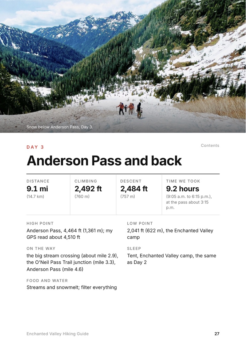
The Day 3, Anderson Pass and back page from the Enchanted Valley Hiking Guide

Free sample + packing list

Try Day 3 free, plus my packing list

Anderson Pass and back

The whole day page from the guide as a PDF, plus my camping packing list: the 42 things I carry, with a note on each. The PDF opens right away and both come by email. You'll also get my emails about new guides and trips, a few a year.

The details

Format
A 53-page PDF sized for a phone (A5, prints fine too) and a folder of GPX files, in one zip download.
Edition
2027 season edition, updated September 2026.
Delivery
Instant. After you pay you get a private download link. Bookmark it to download again on any device.
Payment
Secure checkout through Stripe, in your own currency. Tax is included in the price, except in the US and Canada, where any sales tax is added at checkout.
Refunds
Not useful? Email me within 30 days for a refund: kraig@kraigadams.com.
Questions
Email kraig@kraigadams.com.

Paying in the Facebook/Instagram app? Tap ⋯ and Open in browser to use Apple Pay or Google Pay.

$19

Questions

How long is the hike to the Enchanted Valley?
The National Park Service puts the Enchanted Valley 13 miles from the Graves Creek trailhead and Anderson Pass 18.2. My whole trip, in and out with a day hike to Anderson Pass, was 38.3 miles on my GPS over five days in June 2022, with about 5,380 ft of climbing.
Do you need a permit for the Enchanted Valley?
Yes. Every overnight trip in Olympic National Park needs a wilderness permit from Recreation.gov, and there are no walk-ups. In 2026 it was $8 per adult per night plus a $6 reservation fee, summer permits opened April 15 at 7 a.m. Pacific, and the East Fork Quinault was a quota area on a trial that started in 2024.
How do you get to the Graves Creek trailhead?
In 2026 the South Shore Road was closed by a washout, so the only way was the North Shore Road from US 101 at Amanda Park, then 6 miles of narrow gravel on Graves Creek Road. No RVs or trailers. There's no bus to the trailhead.
Do you need a bear canister in the Enchanted Valley?
Yes. Bear canisters are required in all wilderness camps in Olympic National Park, and hanging food isn't allowed in the Enchanted Valley. We saw one or two black bears every day of my trip.
Can you stay in the Enchanted Valley Chalet?
No. The chalet was built in 1930 and 1931, moved back from the river in 2014, and in 2026 it was closed and boarded up. You camp in the valley near it with a permit.
When is Anderson Pass free of snow?
The Park Service says the trail above about 3,500 ft is snow covered from November to June. I went on June 8, 2022 and climbed the last part on snow with microspikes. For a snow-free pass, plan July to September.
More guides

All guides
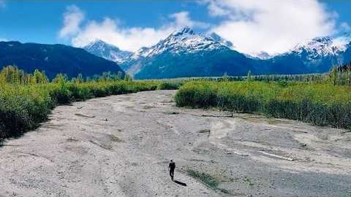
Resurrection Pass, Kenai Peninsula, Alaska

Kenai Peninsula, Alaska

Resurrection Pass

5 days · about 90 miles · solo, tent and a cabin

Hope to Seward on the Resurrection Pass, Russian Lakes and Resurrection River trails, through Cooper Landing, Kenai Peninsula, Alaska.

  • All five days
  • My GPX files
  • The cabins and camping
  • The Resurrection River Trail

See the guide: Resurrection Pass · $19

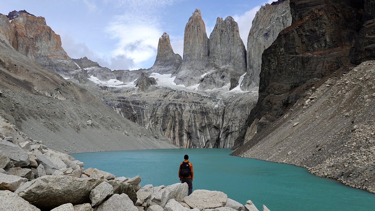
Torres del Paine, Patagonia, Chile

Patagonia, Chile

Torres del Paine

5 days · 85 miles · solo, O + W

The O counterclockwise from Laguna Amarga over the John Gardner Pass to Grey, then the W to Central and the Base Torres.

  • All five days
  • My GPX files
  • How this trek works
  • Costs, then and now

See the guide: Torres del Paine · $19

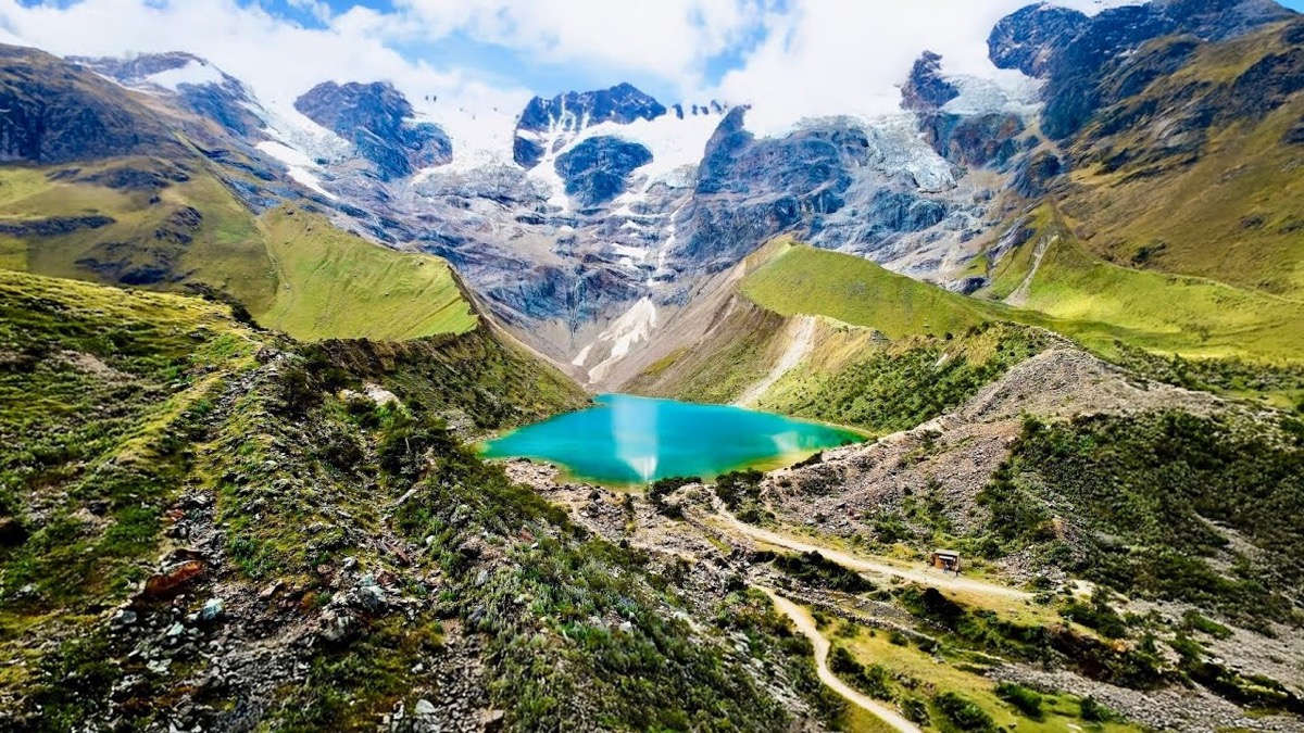
Salkantay Trek, Cusco region, Peru

Cusco region, Peru

Salkantay Trek

4 days · 42 miles · lodges, no tent

From Challacancha over the Salkantay Pass to Aguas Calientes and Machu Picchu, in Peru's Cusco region.

  • All four days
  • My GPX files
  • Machu Picchu
  • With a company or on your own

See the guide: Salkantay Trek · $19

Get the next guide

I'm making guides for more of my hikes, and I host a group trip about once a year. Get an email when a new guide or trip is out. A few emails a year.

Enchanted Valley Hiking GuideInstant PDF + GPX