The Half Dome film: Yosemite, California

Yosemite, California · 2 days · 24.8 miles

Half Dome Hiking Guide

Glacier Point to Half Dome and the Mist Trail in 2 days, Yosemite.

Watch the film · 338K views
Free sample
  • 338K YouTube views
  • Instant PDF + GPX
  • 30-day refund
  • Free updates

Look inside

Real pages from the guide. Tap one to see it big.

  • A day page page from the Half Dome Hiking Guide
    A day page
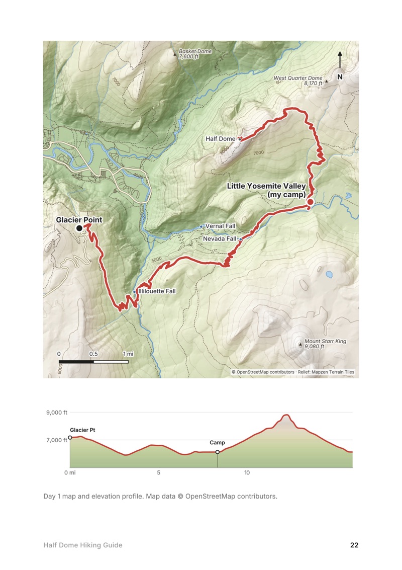
  • A day map and elevation profile page from the Half Dome Hiking Guide
    A day map and elevation profile
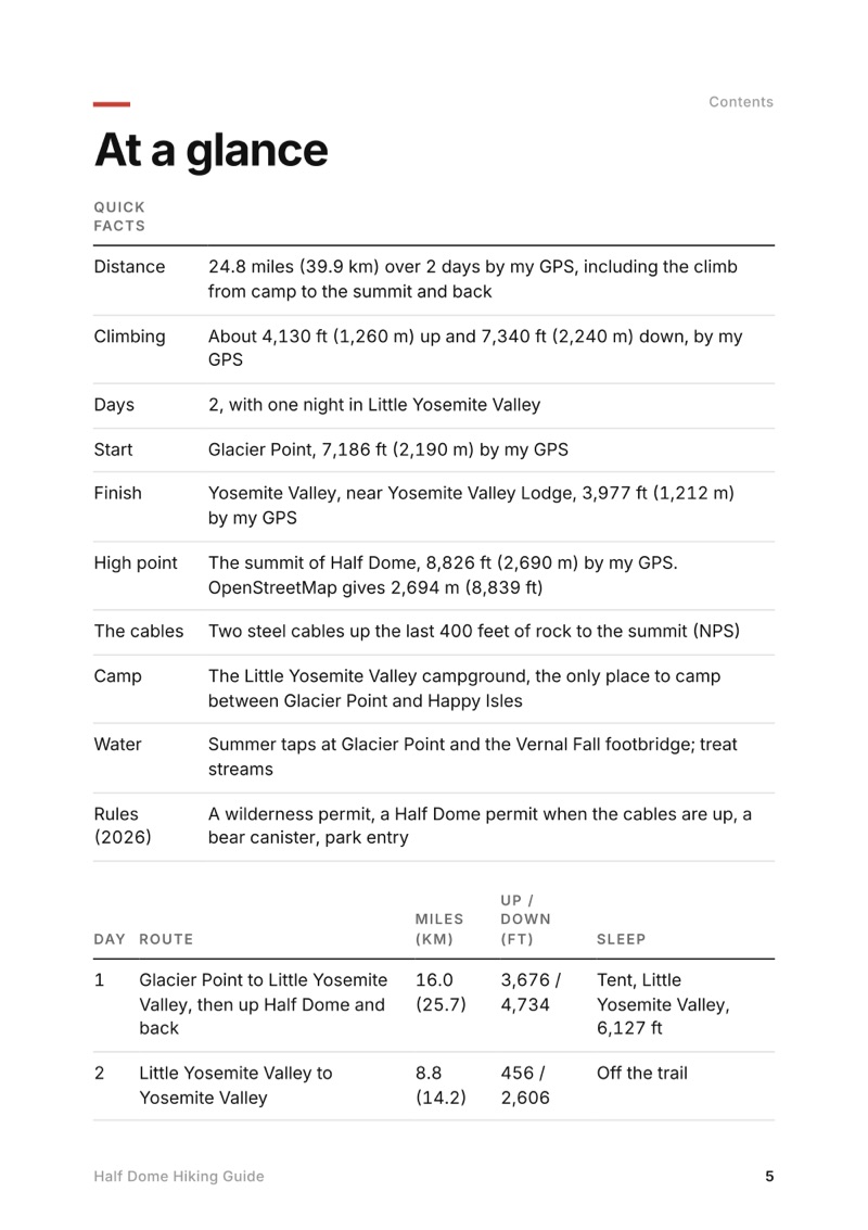
  • At a glance page from the Half Dome Hiking Guide
    At a glance
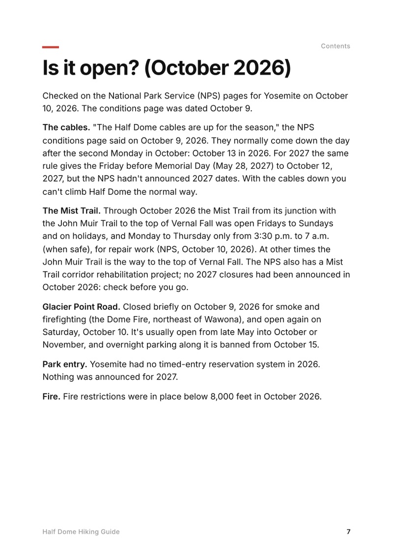
  • Is it open? (October 2026) page from the Half Dome Hiking Guide
    Is it open? (October 2026)

Swipe for more pages

Get Day 1 free

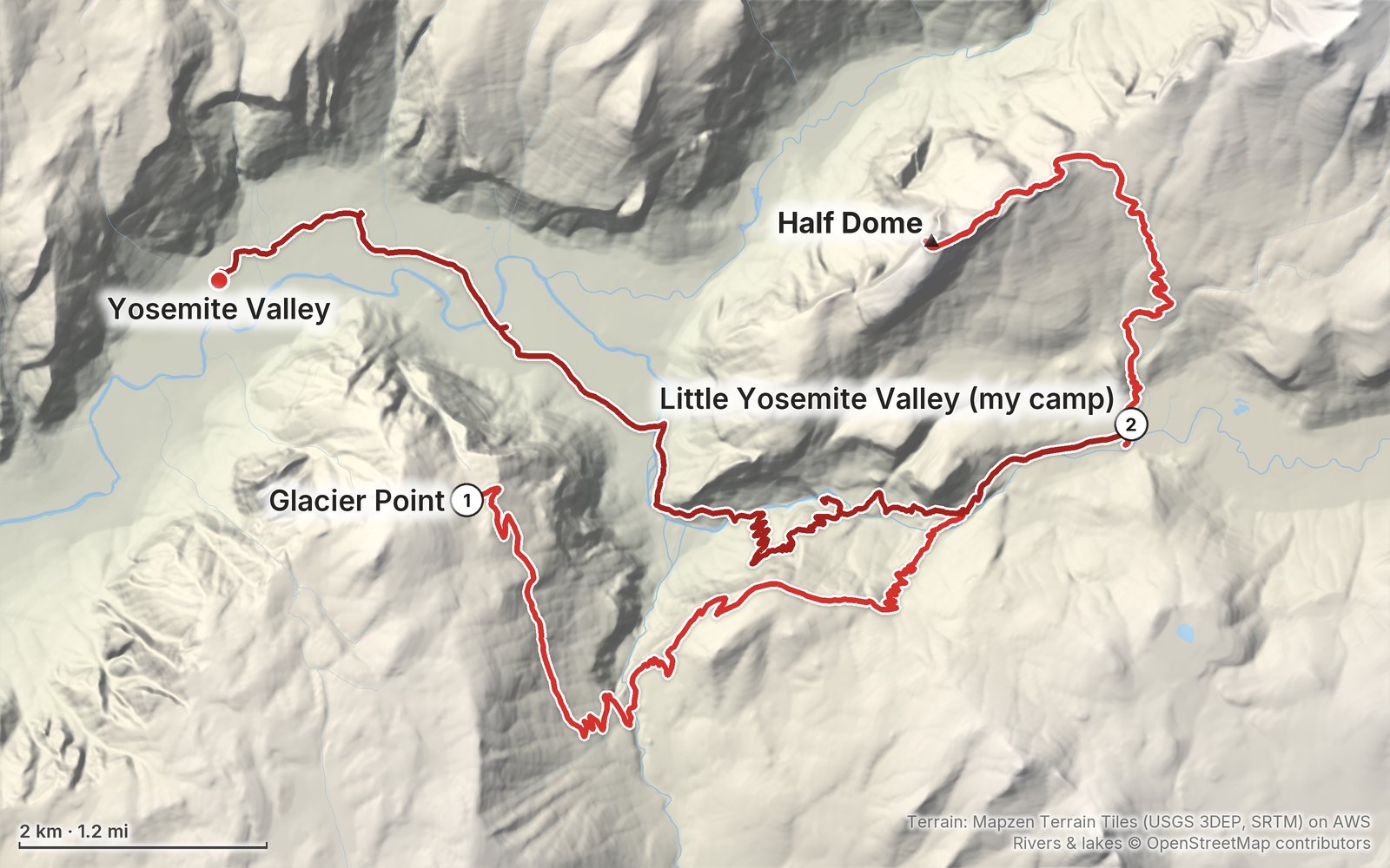
The route

My GPS recording of 2 days on a relief map. The numbers are where each day starts; the red dot is the finish. The full GPX files and the day maps come with the guide.

Relief map of the Half Dome route: 2 days drawn in red with numbered day starts, labelled Glacier Point, Yosemite Valley, Half Dome and Little Yosemite Valley (my camp).
Day 1Day 2Highest 8,830 ft (2,690 m)

Elevation, start to finish: highest 8,830 ft (2,690 m), lowest 3,970 ft (1,210 m).

Map data: Terrain: Mapzen Terrain Tiles (USGS 3DEP, SRTM) on AWS · Rivers & lakes © OpenStreetMap contributors

At a glance

Days
2 days
Distance
24.8 miles
Climbing
About 4,130 ft (1,260 m) up
Route
Glacier Point to Yosemite Valley

What's inside

  • Where things stand. Half Dome in October 2026: the cables season, the Mist Trail repairs, Glacier Point Road and park entry, checked on the NPS pages.
  • Both days. Stats, the time I took, my notes, the route, where to turn back, maps with elevation profiles, and links to that part of my film.
  • My GPX files. My own recordings of both days, plus the full route with waypoints, ready for AllTrails, Gaia GPS, Garmin or Organic Maps.
  • Permits. The Half Dome lotteries, adding the Half Dome permit to a wilderness permit as a backpacker, the trailhead quotas, and how I got mine.
  • The cables. What they're like, how my two climbs went in 2019 and 2023, gloves, crowds and why never to go up wet.
  • Getting there. Yosemite Valley by car or YARTS, the Glacier Point Tour bus, parking for backpackers and where to sleep the night before, with 2026 prices.
  • Costs, safety and a trip sheet. Other ways to do it, food and water, what a trip costs in 2026, heat and storms, one page of checks and a printable summary of the route.

About this trip

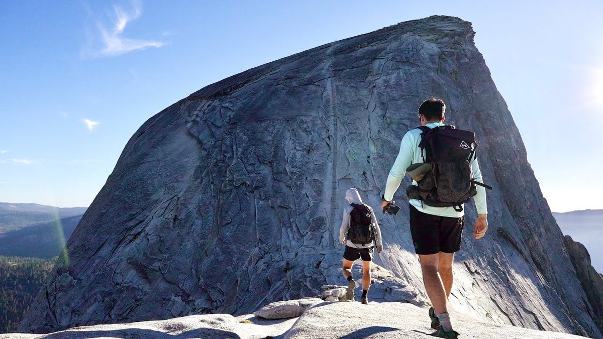
In July 2023 I hiked Half Dome over two days: from Glacier Point down the Panorama Trail to a camp in Little Yosemite Valley, up the cables to the summit in the evening light, and down past the falls to Yosemite Valley the next morning. It's the trip from my film Hiking Half Dome in Yosemite with Henry Golding, and I first climbed the cables in 2019. This guide has my GPX files, maps and notes for both days, how the Half Dome and wilderness permits work in 2026, the cables, getting to Glacier Point, other ways to do it, costs, heat and storm safety, and a trip sheet.

Watch the film on YouTube (338K views).

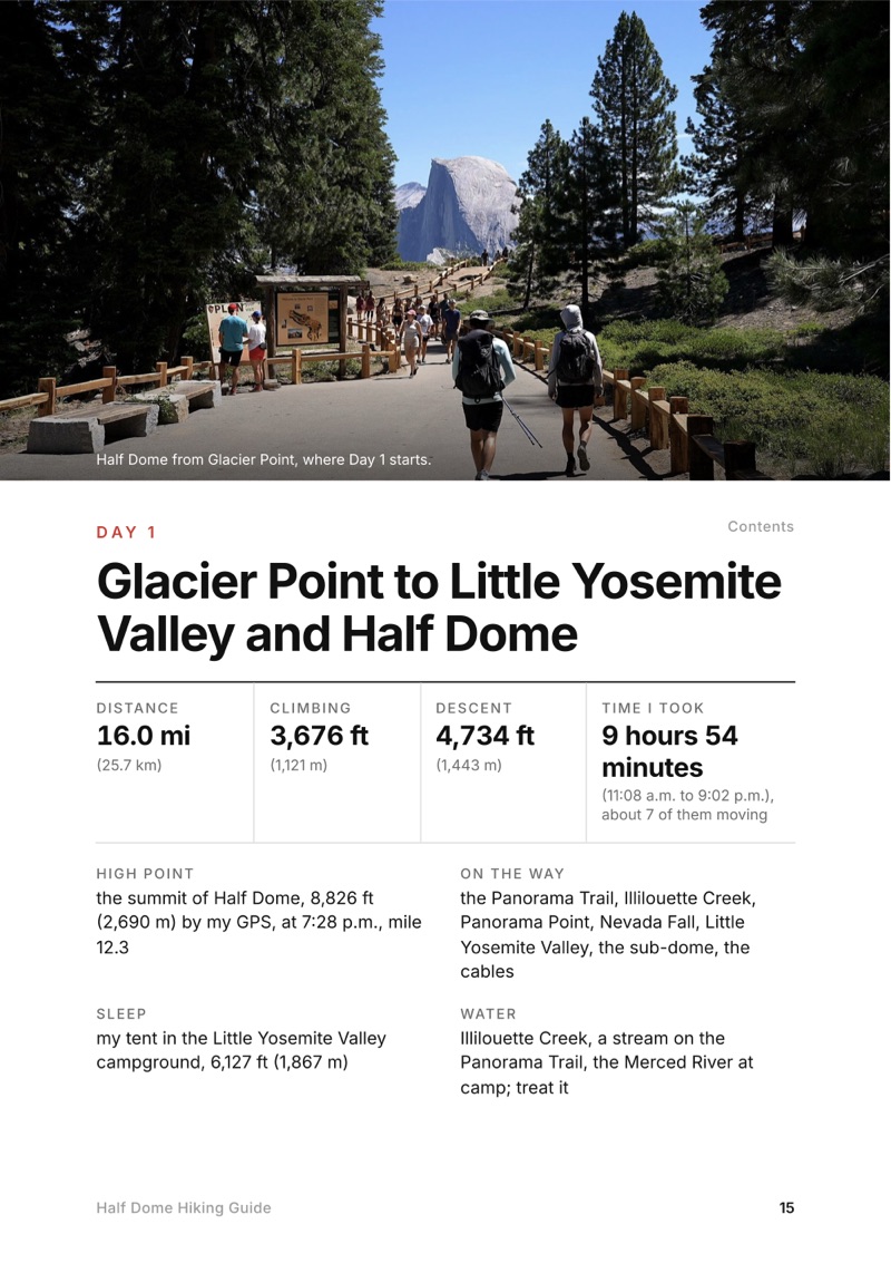
The Day 1, Glacier Point to Little Yosemite Valley and Half Dome page from the Half Dome Hiking Guide

Free sample + packing list

Try Day 1 free, plus my packing list

Glacier Point to Little Yosemite Valley and Half Dome

The whole day page from the guide as a PDF, plus my camping packing list: the 42 things I carry, with a note on each. The PDF opens right away and both come by email. You'll also get my emails about new guides and trips, a few a year.

The details

Format
A 39-page PDF sized for a phone (A5, prints fine too) and a folder of GPX files, in one zip download.
Edition
2027 season edition, updated October 2026.
Delivery
Instant. After you pay you get a private download link. Bookmark it to download again on any device.
Payment
Secure checkout through Stripe, in your own currency. Tax is included in the price, except in the US and Canada, where any sales tax is added at checkout.
Refunds
Not useful? Email me within 30 days for a refund: kraig@kraigadams.com.
Questions
Email kraig@kraigadams.com.

Paying in the Facebook/Instagram app? Tap ⋯ and Open in browser to use Apple Pay or Google Pay.

$19

Questions

Do you need a permit to hike Half Dome?
Yes, whenever the cables are up, seven days a week. Get one in the preseason lottery in March or the daily lottery two days ahead ($10 to apply plus $10 a person), or, as a backpacker, add it to your wilderness permit at pickup for $10 a person. The NPS allows at most 300 hikers a day (as of October 2026).
How long is the Half Dome hike?
The NPS gives 14 to 16 miles round trip from Yosemite Valley with about 4,800 feet of climbing. My two-day route from Glacier Point, with a night in Little Yosemite Valley, was 24.8 miles (39.9 km) by my GPS.
When are the Half Dome cables up?
Normally from the Friday before Memorial Day to the day after the second Monday in October (NPS). In 2026 they came down on October 13; 2027 dates weren't announced in October 2026.
Can you hike Half Dome in two days?
Yes. With a wilderness permit from Glacier Point or Happy Isles you spend the first night in the Little Yosemite Valley campground and climb Half Dome from there. I did it from Glacier Point in July 2023 and reached the summit in the evening light, as the sun went down.
Do you need gloves for the Half Dome cables?
The NPS says many people find sturdy gloves very helpful, and asks you to pack them out. I used them both times I climbed the cables.
Is the Mist Trail open?
In October 2026 the Mist Trail to the top of Vernal Fall was open Fridays to Sundays and on holidays, for repair work; the John Muir Trail is the way around it. Check the NPS conditions page before you go.
More guides

All guides
Adirondack High Peaks, High Peaks Wilderness, New York

High Peaks Wilderness, New York

Adirondack High Peaks

2 days · 18 miles · lean-to

A 2-day loop over Mount Marcy and Algonquin Peak from the Adirondak Loj in New York's High Peaks, with a night at Lake Colden, plus a 3-day traverse from Keene Valley.

  • Both days of the loop
  • My GPX files
  • My 2019 traverse
  • Permits and rules

See the guide: Adirondack High Peaks · $19

Trans-Catalina Trail, Southern California

Southern California

Trans-Catalina Trail

2 days · 42 miles · Catalina Island

A 2-day hike across Santa Catalina Island, California, on the Trans-Catalina Trail: from Avalon to Little Harbor, then to Two Harbors by way of the Silver Peak Trail and Parsons Landing.

  • Where things stand
  • Both days
  • My GPX files
  • Permits, campgrounds and rules

See the guide: Trans-Catalina Trail · $19

Get the next guide

I'm making guides for more of my hikes, and I host a group trip about once a year. Get an email when a new guide or trip is out. A few emails a year.

Half Dome Hiking GuideInstant PDF + GPX