Near Mexico City · 2 days · 14.4 miles · Mexico

Iztaccíhuatl Hiking Guide

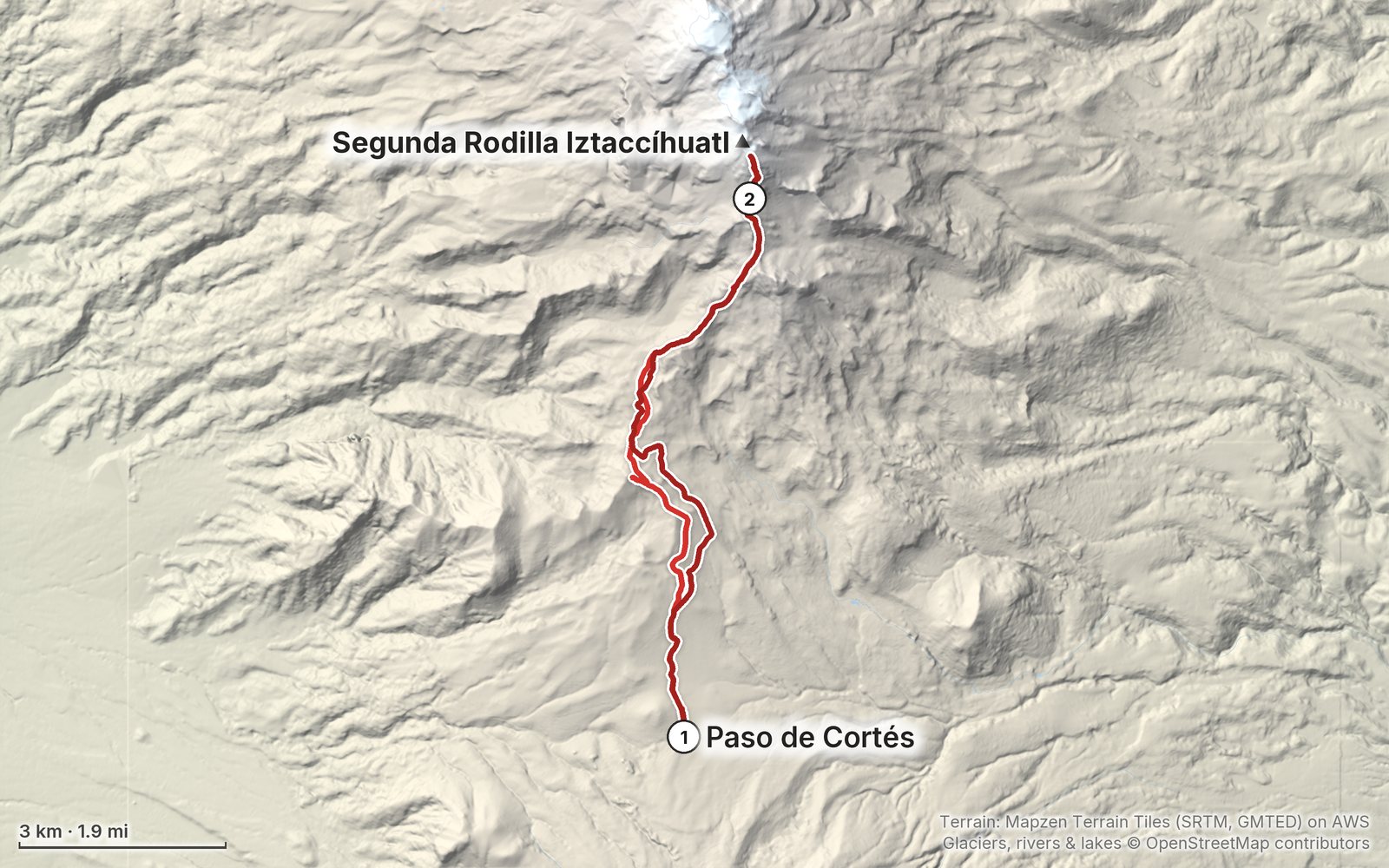
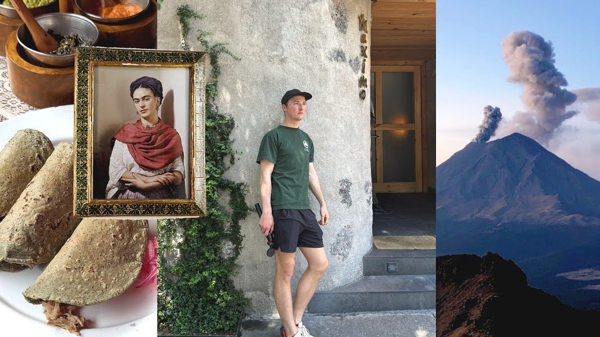
In March 2023 I hiked up Iztaccíhuatl, the sleeping-woman volcano outside Mexico City, on my own: from Paso de Cortés past La Joya and up the Portillos route to the little Grupo de los Cien hut at about 15,500 ft, a night there with a stray dog and Popocatépetl erupting next door, then up the ridge at dawn to the First Knee at about 16,500 ft, where I turned around short of the summit. It's the Iztaccíhuatl part of my film 5 Days in Mexico City. This guide has my GPS files, maps and notes for both days, where things stand in 2026 with Popocatépetl, the new fee and the La Joya reservation, getting there from Mexico City by car or bus, altitude and cold, the route to the summit as reported, and a trip sheet.

Paying in the Facebook/Instagram app? Tap ⋯ and Open in browser to use Apple Pay or Google Pay.

$19Watch the film

Instant download: PDF + GPX files.
Not useful? Email me within 30 days for a refund.

The cover of the Iztaccíhuatl Hiking Guide

What's inside

Look inside

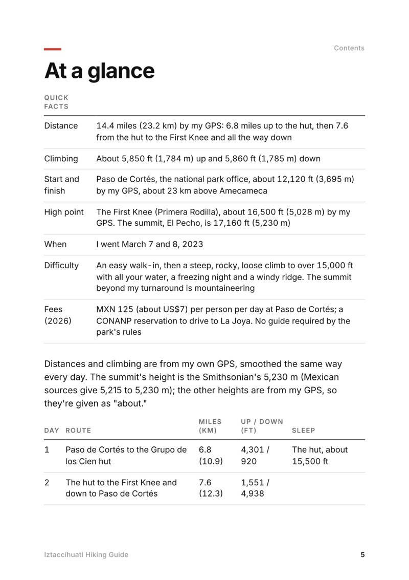
At a glance page from the Iztaccíhuatl Hiking Guide
At a glance
A day page page from the Iztaccíhuatl Hiking Guide
A day page
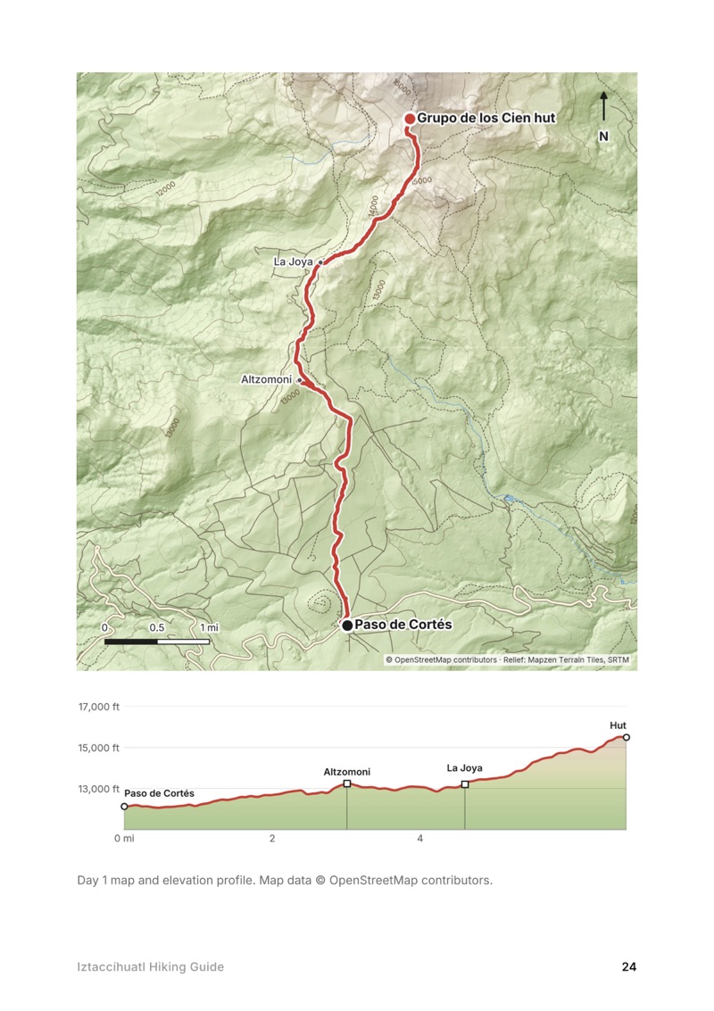
A day map and elevation profile page from the Iztaccíhuatl Hiking Guide
A day map and elevation profile
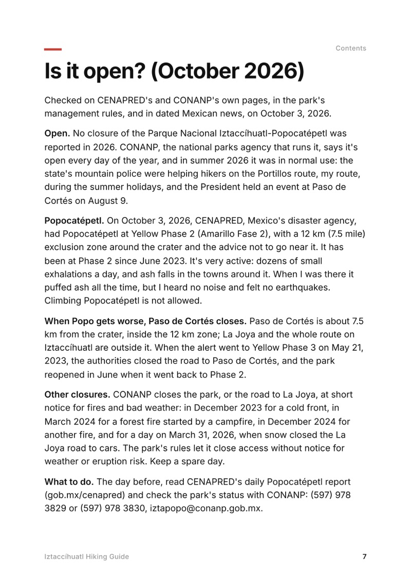
Is it open? page from the Iztaccíhuatl Hiking Guide
Is it open?

The details

Format
A 43-page PDF sized for a phone (A5, prints fine too) and a folder of GPX files, in one zip download.
Edition
2027 season edition, updated October 2026.
Delivery
Instant. After you pay you get a private download link. Bookmark it to download again on any device.
Payment
Secure checkout through Stripe, in your own currency. Tax is included in the price, except in the US and Canada, where any sales tax is added at checkout.
Refunds
Not useful? Email me within 30 days for a refund: kraig@kraigadams.com.
Questions
Email kraig@kraigadams.com.

Paying in the Facebook/Instagram app? Tap ⋯ and Open in browser to use Apple Pay or Google Pay.

$19

Questions

Is Iztaccíhuatl open?
Yes, in October 2026: no closure of the Parque Nacional Iztaccíhuatl-Popocatépetl was reported that year. Popocatépetl, next door, is at Yellow Phase 2 on CENAPRED's alert; if it goes to Phase 3 the road to Paso de Cortés closes, as it did in May 2023. Fires, snow and cold fronts close it at short notice too, so check CENAPRED and CONANP the day before.
How much does it cost to enter Iztaccíhuatl-Popocatépetl National Park?
MXN 125 (about US$7) per person per day in 2026, paid at the park office at Paso de Cortés. Mexicans and foreign residents pay half. Driving up to La Joya also needs a reservation with CONANP. I paid about $1.50 in 2023.
Do you need a guide to climb Iztaccíhuatl?
No. The park's rules say visitors may hire guides, preferably local ones, but don't require one, and I went alone. CONANP advises not hiking alone, and the summit ridge beyond the knees is a mountaineering route where a guide makes sense.
How long is the hike to the Grupo de los Cien hut?
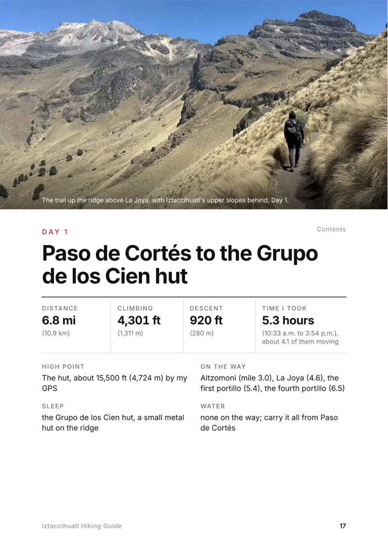
By my GPS, 6.8 miles (10.9 km) from Paso de Cortés with about 4,300 ft of climbing, or 2.2 miles and about 2,300 ft from La Joya. The hut is at about 15,500 ft (4,724 m) by my GPS; published figures are 4,730 to 4,780 m.
How do you get to Iztaccíhuatl from Mexico City?
By car, about two hours via the México-Puebla toll road, Amecameca and the paved road up to Paso de Cortés. Without a car, take a Volcanes or Sur bus from the TAPO station to Amecameca, then a taxi to Paso de Cortés or La Joya (about MXN 250 to 450 one way, as reported).
Is there water on Iztaccíhuatl?
No. It's a dry volcano hike with no water sources: carry all of it from Paso de Cortés. I brought about two liters for two days and was almost out by the second morning.
More guides

All guides
Adirondack High Peaks, High Peaks Wilderness, New York

High Peaks Wilderness, New York

Adirondack High Peaks

2 days · 18 miles · lean-to

A 2-day loop over Mount Marcy and Algonquin Peak from the Adirondak Loj in New York's High Peaks, with a night at Lake Colden, plus a 3-day traverse from Keene Valley.

  • Both days of the loop
  • My GPX files
  • My 2019 traverse
  • Permits and rules

See the guide: Adirondack High Peaks · $19

Trans-Catalina Trail, Southern California

Southern California

Trans-Catalina Trail

2 days · 42 miles · Catalina Island

A 2-day hike across Santa Catalina Island, California, on the Trans-Catalina Trail: from Avalon to Little Harbor, then to Two Harbors by way of the Silver Peak Trail and Parsons Landing.

  • Where things stand
  • Both days
  • My GPX files
  • Permits, campgrounds and rules

See the guide: Trans-Catalina Trail · $19

Get the next guide

I'm making guides for more of my hikes, and I host a group trip about once a year. Get an email when a new guide or trip is out. A few emails a year.