Sierra Nevada · 2 days · 20.8 miles · California

Mount Whitney Hiking Guide

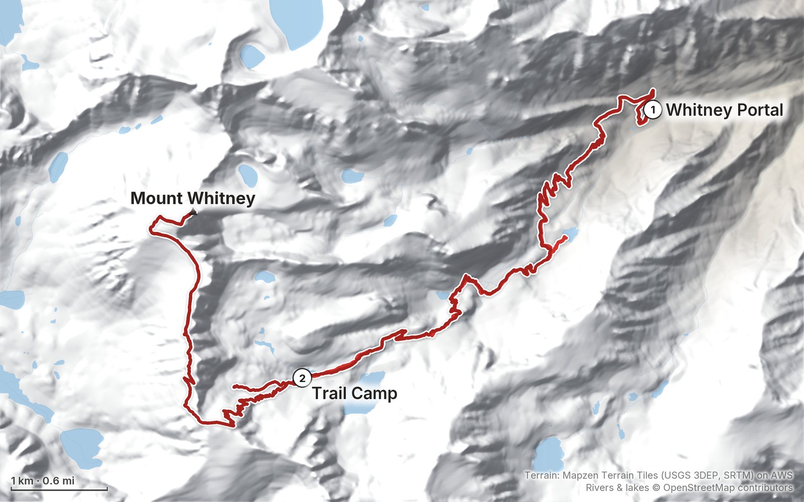
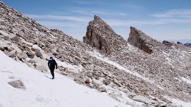
In April 2021 I hiked Mount Whitney, 14,505 ft, the highest point in the lower 48 states: up from Whitney Portal to Trail Camp for the night, then the 99 switchbacks, Trail Crest and the ridge to the summit, and all the way back down to my car the same day. It's the trip from my film Summiting Mt Whitney in California. This guide has my GPX files, maps and notes for both days, the permit lottery and the off-season permits in 2026, the rules, getting to Whitney Portal, snow and gear by month, altitude, and a trip sheet.

Paying in the Facebook/Instagram app? Tap ⋯ and Open in browser to use Apple Pay or Google Pay.

$19Watch the film

Instant download: PDF + GPX files.
Not useful? Email me within 30 days for a refund.

The cover of the Mount Whitney Hiking Guide

What's inside

Look inside

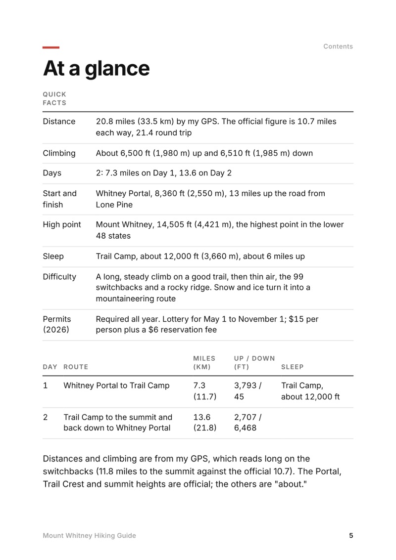
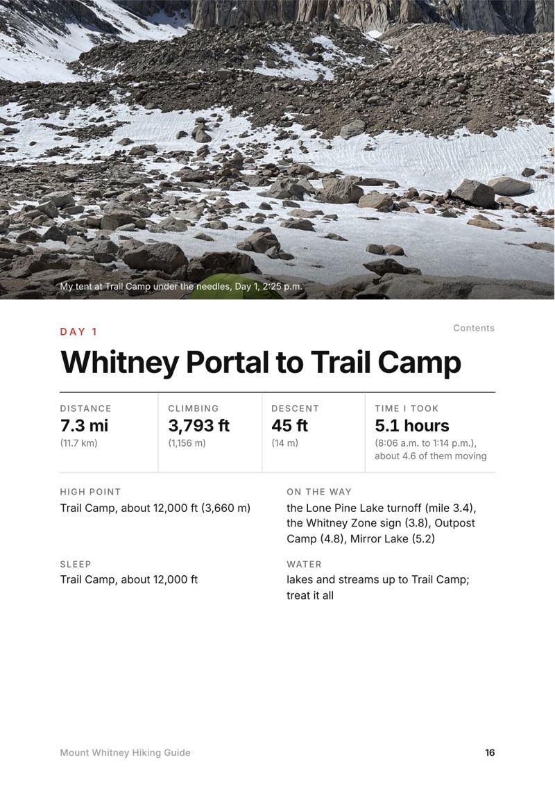
At a glance page from the Mount Whitney Hiking Guide
At a glance
A day page page from the Mount Whitney Hiking Guide
A day page
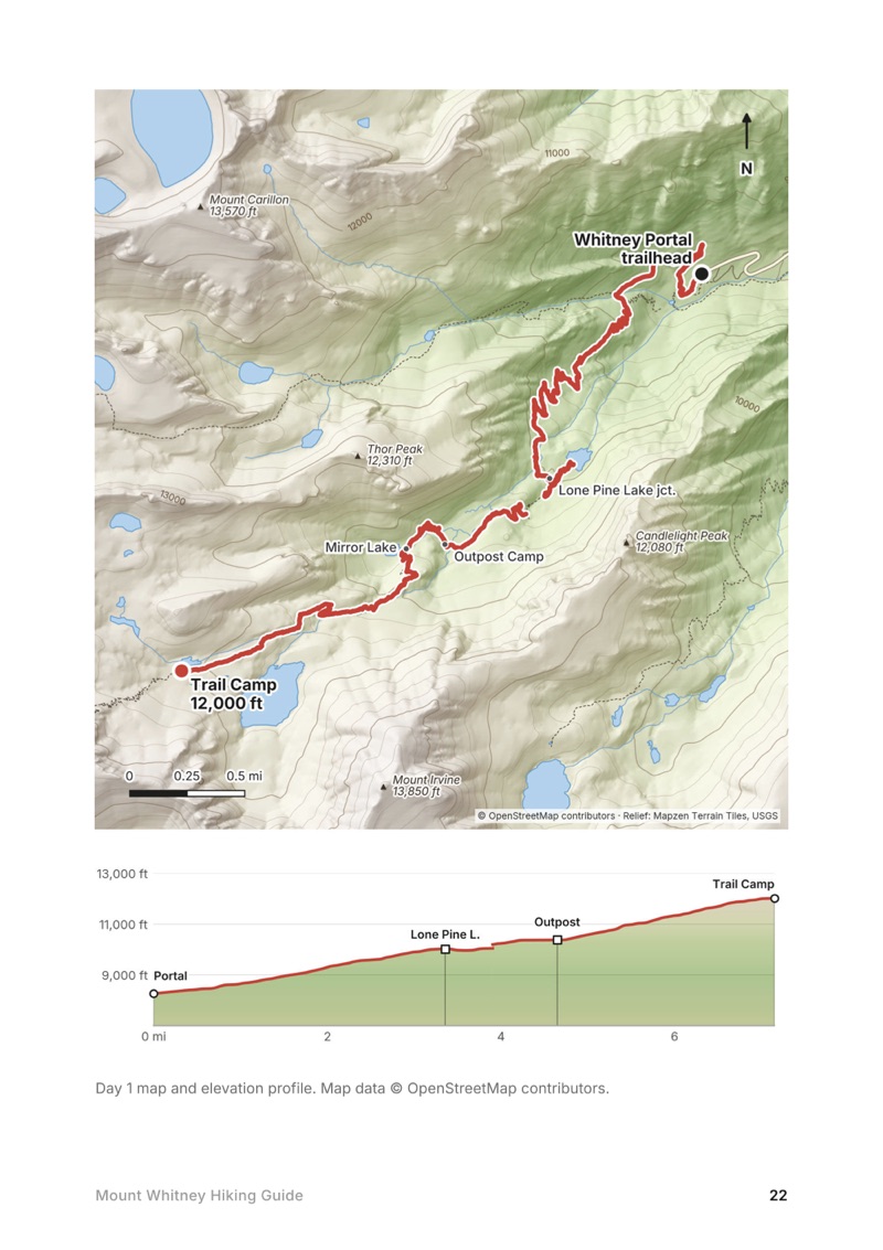
A day map and elevation profile page from the Mount Whitney Hiking Guide
A day map and elevation profile
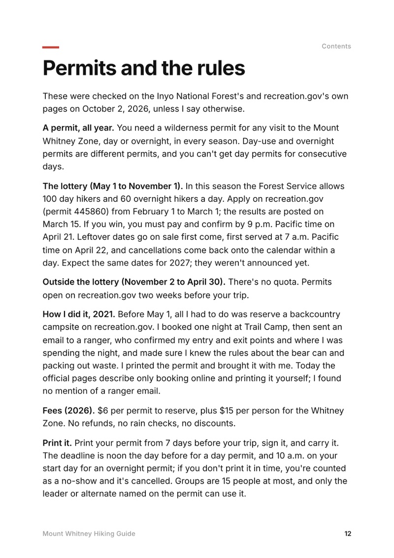
Permits and the rules page from the Mount Whitney Hiking Guide
Permits and the rules

The details

Format
A 41-page PDF sized for a phone (A5, prints fine too) and a folder of GPX files, in one zip download.
Edition
2027 season edition, updated October 2026.
Delivery
Instant. After you pay you get a private download link. Bookmark it to download again on any device.
Payment
Secure checkout through Stripe, in your own currency. Tax is included in the price, except in the US and Canada, where any sales tax is added at checkout.
Refunds
Not useful? Email me within 30 days for a refund: kraig@kraigadams.com.
Questions
Email kraig@kraigadams.com.

Paying in the Facebook/Instagram app? Tap ⋯ and Open in browser to use Apple Pay or Google Pay.

$19

Questions

Is Mount Whitney open?
Yes, in October 2026: the Inyo National Forest listed no trail closure and Whitney Portal Road was open all the way up. The road is gated below the trailhead in winter, and outside about late June to mid-October there's snow and ice above Trail Camp.
How long is the Mount Whitney hike?
Officially 10.7 miles each way from Whitney Portal, 21.4 round trip, with over 6,000 ft of climbing. My GPS recorded 20.8 miles over two days: 7.3 to Trail Camp, then 13.6 to the summit and back down to the Portal.
Do you need a permit to hike Mount Whitney?
Yes, for day hikes and overnight trips, all year. From May 1 to November 1 permits go by a lottery on recreation.gov (apply February 1 to March 1; leftover dates from April 22). From November 2 to April 30 there's no quota and you book two weeks ahead. $15 per person plus a $6 reservation fee.
Do you need crampons for Mount Whitney?
It depends on the month. From about late June to mid-October you usually need neither crampons nor an ice axe. In spring, early summer and late autumn the Forest Service and the national park say ice axe and crampons; I wore microspikes in late April 2021 in a light snow year.
Can you hike Mount Whitney in one day?
Yes: most permits are day permits. It's about 21 to 22 miles round trip with over 6,000 ft up and down, and day hikers take about 12 to 16 hours. Spend a night or two at around 8,000 ft first for the altitude.
How much does it cost to hike Mount Whitney?
The permit is $15 per person plus $6. Waste kits are free, a bear can rents for about $5 a day in Lone Pine, and Whitney Portal Campground is $34 a night. A three-night trip from Las Vegas by car comes to roughly $550 to $950 for one person before food, flights not included.
More guides

All guides
Adirondack High Peaks, High Peaks Wilderness, New York

High Peaks Wilderness, New York

Adirondack High Peaks

2 days · 18 miles · lean-to

A 2-day loop over Mount Marcy and Algonquin Peak from the Adirondak Loj in New York's High Peaks, with a night at Lake Colden, plus a 3-day traverse from Keene Valley.

  • Both days of the loop
  • My GPX files
  • My 2019 traverse
  • Permits and rules

See the guide: Adirondack High Peaks · $19

Trans-Catalina Trail, Southern California

Southern California

Trans-Catalina Trail

2 days · 42 miles · Catalina Island

A 2-day hike across Santa Catalina Island, California, on the Trans-Catalina Trail: from Avalon to Little Harbor, then to Two Harbors by way of the Silver Peak Trail and Parsons Landing.

  • Where things stand
  • Both days
  • My GPX files
  • Permits, campgrounds and rules

See the guide: Trans-Catalina Trail · $19

Get the next guide

I'm making guides for more of my hikes, and I host a group trip about once a year. Get an email when a new guide or trip is out. A few emails a year.