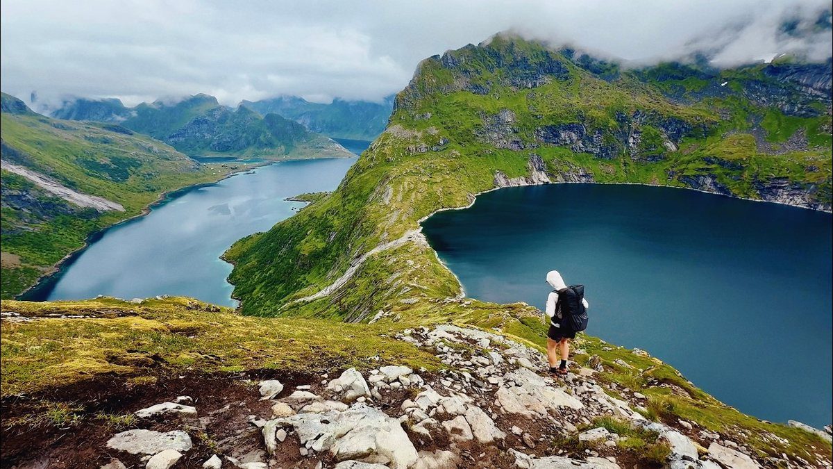
The Peaks of the Balkans film: Kosovo, Montenegro and Albania

Kosovo, Montenegro and Albania · 6 days · 115 miles

Peaks of the Balkans Hiking Guide

6 days through Kosovo, Montenegro and Albania.

Watch the film · 33K views
Free sample
  • 124K YouTube views
  • Instant PDF + GPX
  • 30-day refund
  • Free updates

Look inside

Real pages from the guide. Tap one to see it big.
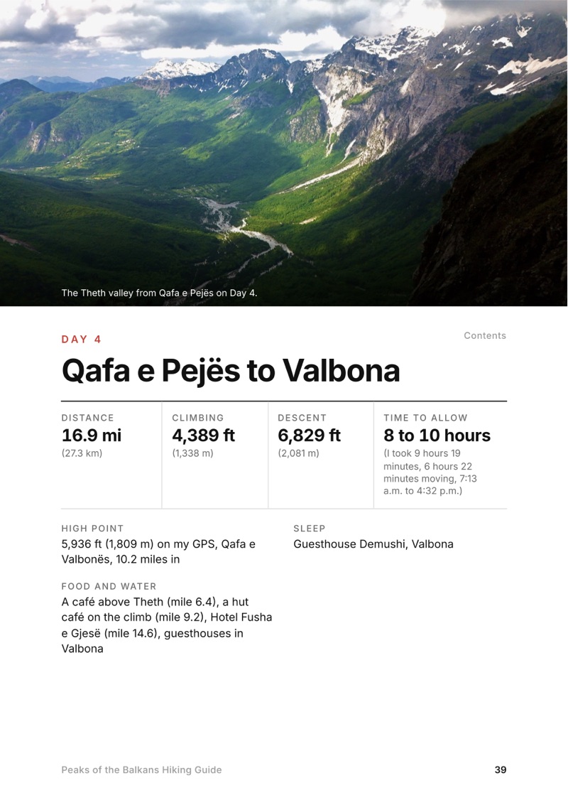
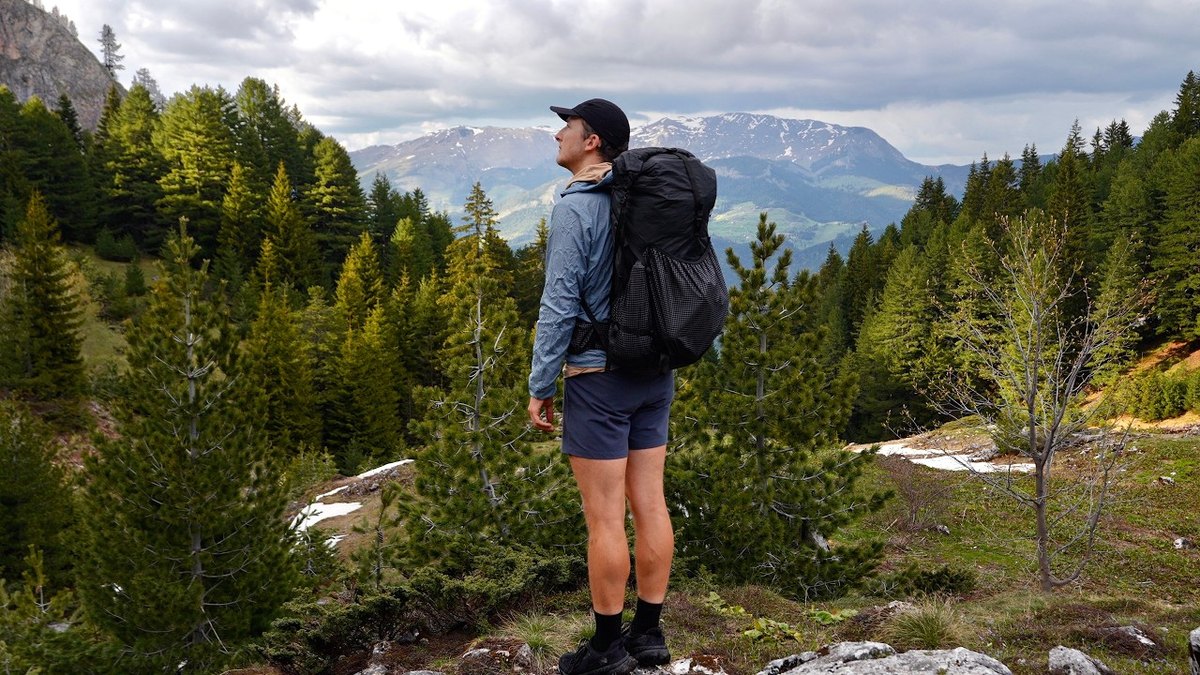
  • A day page page from the Peaks of the Balkans Hiking Guide
    A day page
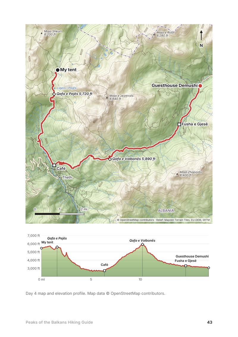
  • A day map and elevation profile page from the Peaks of the Balkans Hiking Guide
    A day map and elevation profile
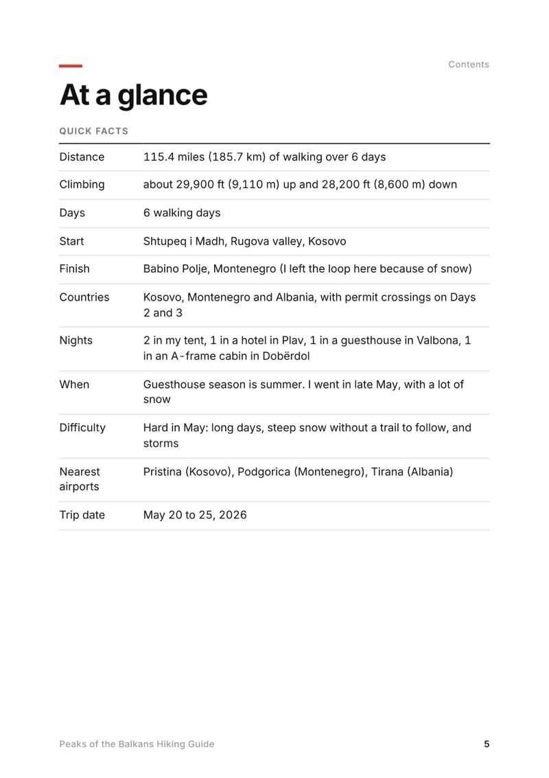
  • At a glance page from the Peaks of the Balkans Hiking Guide
    At a glance
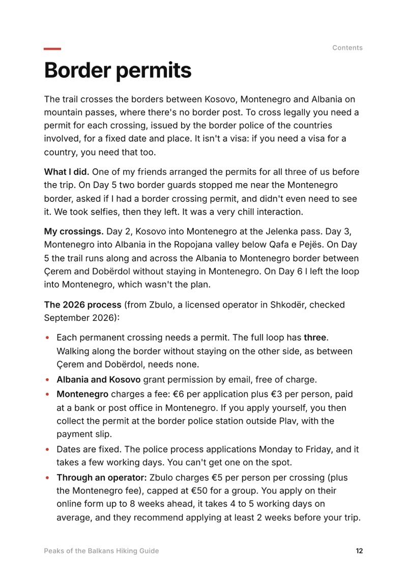
  • Border permits page from the Peaks of the Balkans Hiking Guide
    Border permits

Swipe for more pages

Get Day 4 free

The route

My GPS recording of 6 days on a relief map. The numbers are where each day starts; the red dot is the finish. The full GPX files and the day maps come with the guide.
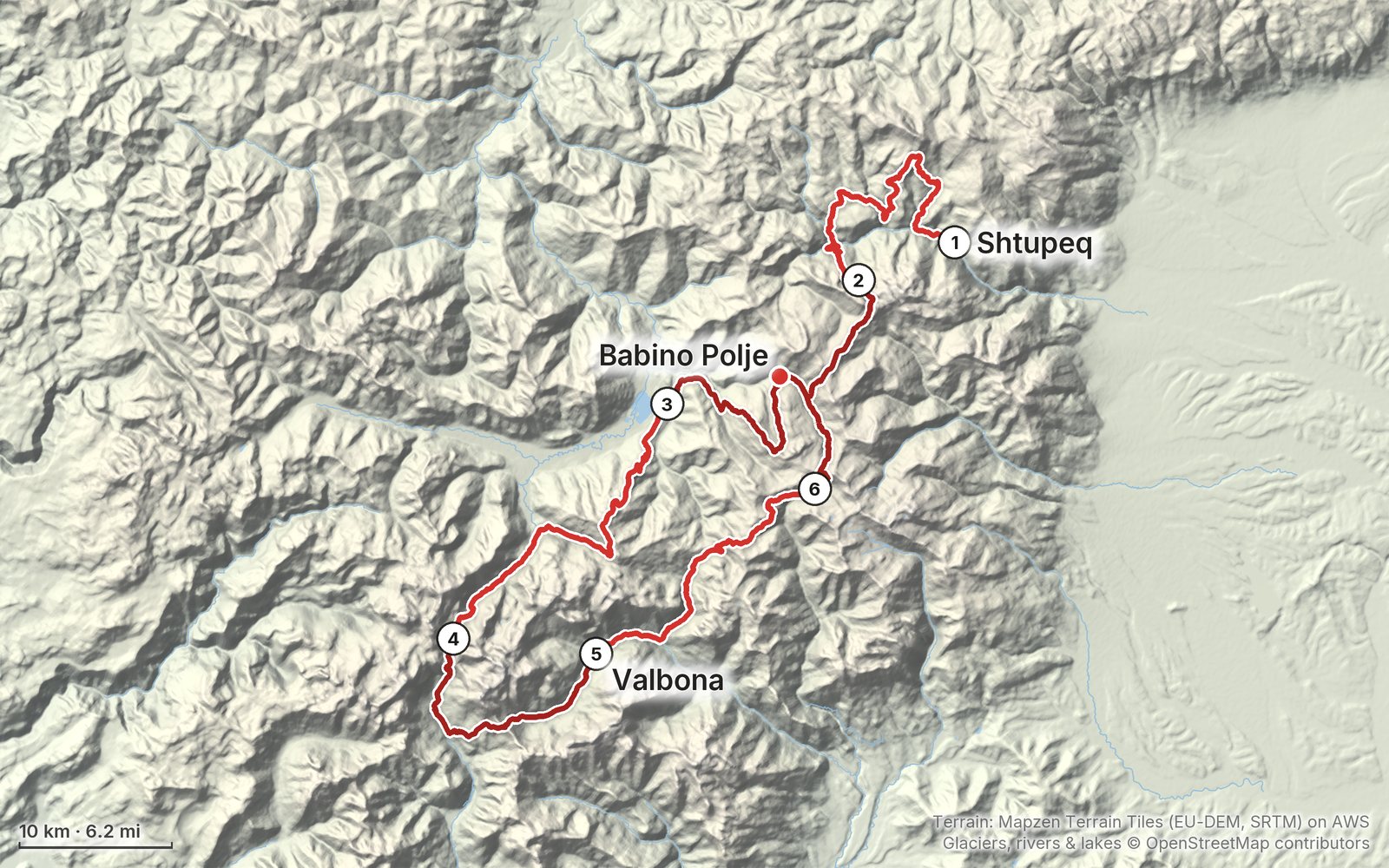
Relief map of the Peaks of the Balkans route: 6 days drawn in red with numbered day starts, labelled Shtupeq, Babino Polje and Valbona.
Day 1Day 2Day 3Day 4Day 56Highest 7,450 ft (2,270 m)

Elevation, start to finish: highest 7,450 ft (2,270 m), lowest 2,240 ft (682 m).

Map data: Terrain: Mapzen Terrain Tiles (EU-DEM, SRTM) on AWS · Glaciers, rivers & lakes © OpenStreetMap contributors

At a glance

Days
6 days
Distance
115 miles
Climbing
About 29,900 ft (9,110 m) up
Season
Guesthouse season is summer
Route
Shtupeq i Madh to Babino Polje

What's inside

  • All six days. Stats, time to allow, my notes, the trail, where to get off, a map with an elevation profile, and links to that day in both of my films.
  • My GPX files. My own recordings for each day, with waypoints for where I slept and ate, the passes and where I turned back, ready for AllTrails, Gaia GPS, Garmin or Organic Maps.
  • Border permits, explained. Which crossings need one, what Albania, Kosovo and Montenegro each ask for, the 2026 fees, and how to apply.
  • Guesthouses and getting there. Where I slept each night and how it was booked, plus the buses, minibuses and the Komani ferry from Pristina, Podgorica and Shkodër.
  • Early-season snow. What late May was really like on each pass, the 2026 snow report, and what to carry if you go before summer.
  • A 10-stage plan from my GPS. The usual loop from Theth, with my measured distances for each stage, and the part I didn't walk.
  • Food, water, cash and costs. Every place I found a meal, where the ATMs are (and aren't), and what I paid.
  • Before you go and a trip sheet. One page of year-to-year checks and a printable one-page summary of the whole trip.

About this trip

In late May 2026 I spent six days on the Peaks of the Balkans trail, from the Rugova valley in Kosovo through Montenegro and over to Theth and Valbona in Albania. It was so early in the season that the trails were empty but buried in snow, and on the last day I turned back from an icy pass. This guide has my GPS files, maps and notes for every day, plus the border permits, guesthouses, transport, cash and what it cost.

Watch the film on YouTube (33K views).

The Day 4, Qafa e Pejës to Valbona page from the Peaks of the Balkans Hiking Guide

Free sample + packing list

Try Day 4 free, plus my packing list

Qafa e Pejës to Valbona

The whole day page from the guide as a PDF, plus my camping packing list: the 42 things I carry, with a note on each. The PDF opens right away and both come by email. You'll also get my emails about new guides and trips, a few a year.

The details

Format
A 68-page PDF sized for a phone (A5, prints fine too) and a folder of GPX files, in one zip download.
Edition
2027 season edition, updated September 2026.
Delivery
Instant. After you pay you get a private download link. Bookmark it to download again on any device.
Payment
Secure checkout through Stripe, in your own currency. Tax is included in the price, except in the US and Canada, where any sales tax is added at checkout.
Refunds
Not useful? Email me within 30 days for a refund: kraig@kraigadams.com.
Questions
Email kraig@kraigadams.com.

Paying in the Facebook/Instagram app? Tap ⋯ and Open in browser to use Apple Pay or Google Pay.

$19

Questions

How many days do you need for the Peaks of the Balkans?
Most people take 10 to 12 days, a stage a day, with a guesthouse every night. I walked 115 miles in six days, which meant long days of 17 to 25 miles.
Do you need a permit for the Peaks of the Balkans?
Yes, to cross the borders on the trail. It's free in Albania and Kosovo, and Montenegro charges EUR 6 per application plus EUR 3 per person (2026). Apply at least two weeks ahead, or pay a local operator to do it.
When is the best time to hike the Peaks of the Balkans?
Roughly mid-June to mid-September, when the guesthouses are open and the snow is gone. I went in late May 2026. The trails were empty, but the high passes were buried in snow and I didn't finish the loop.
Where do you sleep on the Peaks of the Balkans?
In guesthouses. Families in the villages rent beds and cook dinner and breakfast, and many pack lunch. I also camped twice when there was nowhere else to sleep that high up.
How do you get to the Peaks of the Balkans trail?
There's a way in from each country: buses from Pristina to Peja and the Rugova valley, from Podgorica to Plav, or minibuses from Shkodër to Theth and the Komani ferry toward Valbona. I flew into Pristina and started in Rugova.

More guides

All guides
Lofoten, Lofoten Islands, Norway

Lofoten Islands, Norway

Lofoten

6 days · 85 miles · tent, boat and buses

Across Lofoten from the Moskenes ferry past Å, Vindstad and Nusfjord to the E10 near Borg.
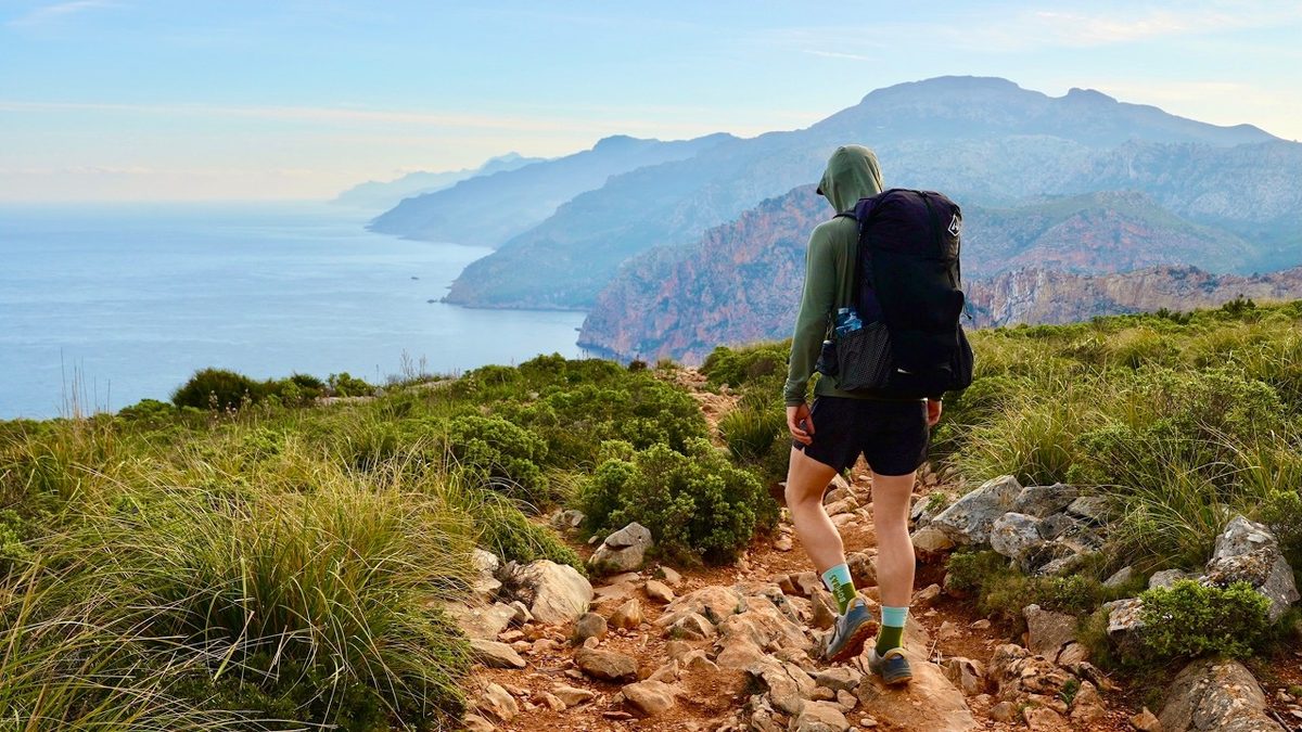
  • All six days
  • My GPX files
  • Ferries, boats and buses
  • Camping, explained

See the guide: Lofoten · $19

GR221, Mallorca, Spain

Mallorca, Spain

GR221

5 days · 88 miles · refuges or camping

The Dry Stone Route across Mallorca's mountains, from Port d'Andratx to Pollença.
  • All five days
  • A map and elevation profile for every day
  • GPX files
  • Water

See the guide: GR221 · $19

Picos de Europa, Northern Spain

Northern Spain

Picos de Europa

7 days · 90 miles · solo loop

A loop from the Fuente Dé cable car through Sotres, Urriellu, Bulnes, the Cares gorge, Caín, Vega de Ario, Vegabaño and Collado Jermoso.

  • All seven days
  • My GPX files
  • Where to sleep
  • The refuge version

See the guide: Picos de Europa · $19

Get the next guide

I'm making guides for more of my hikes, and I host a group trip about once a year. Get an email when a new guide or trip is out. A few emails a year.

Peaks of the Balkans Hiking GuideInstant PDF + GPX