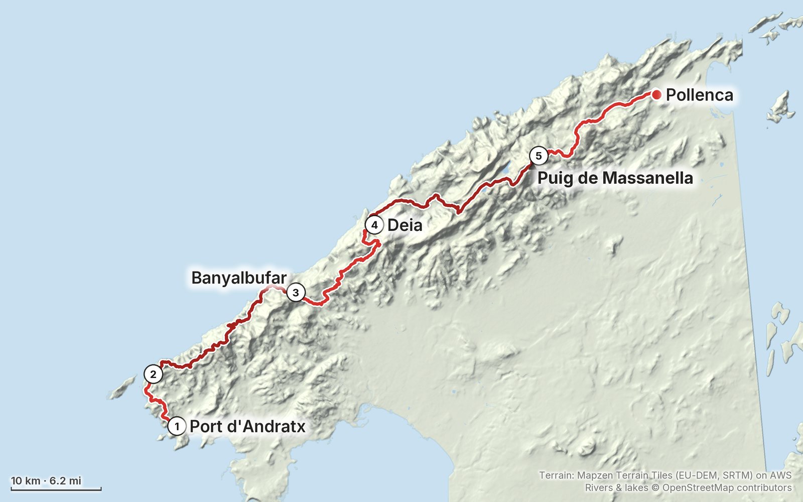
My GPS recording of 5 days on a relief map. The numbers are where each day starts; the red dot is the finish. The full GPX files and the day maps come with the guide.
1Day 2Day 3Day 4Day 5Highest 4,040 ft (1,232 m)
Elevation, start to finish: highest 4,040 ft (1,232 m), lowest sea level.
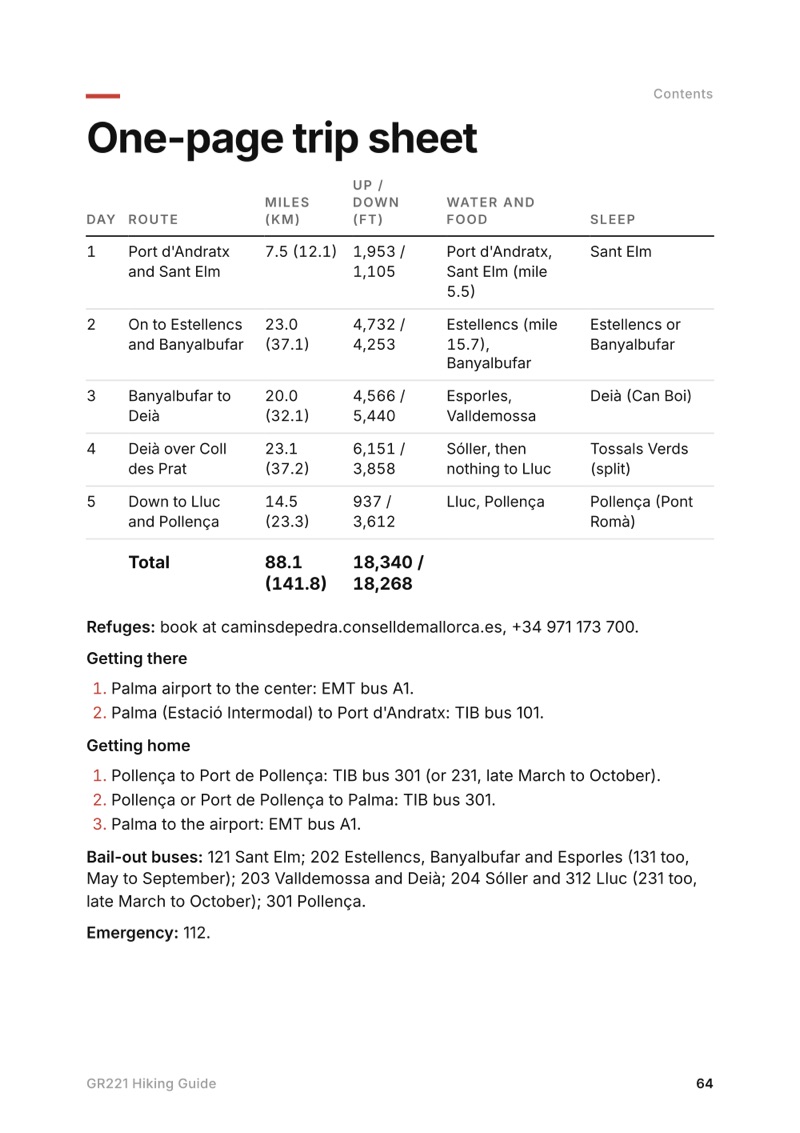
All five days. Distance, climbing, time to allow, food and water, where to get off the trail, and links to that day in my films.
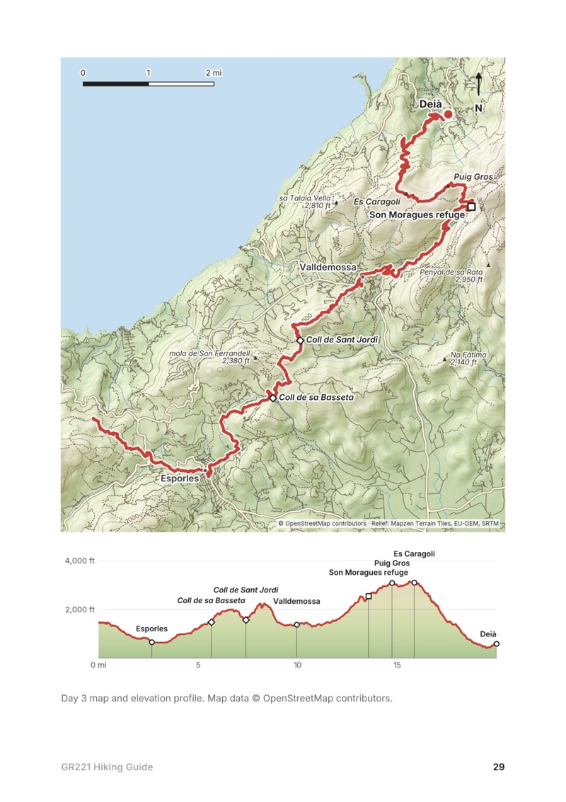
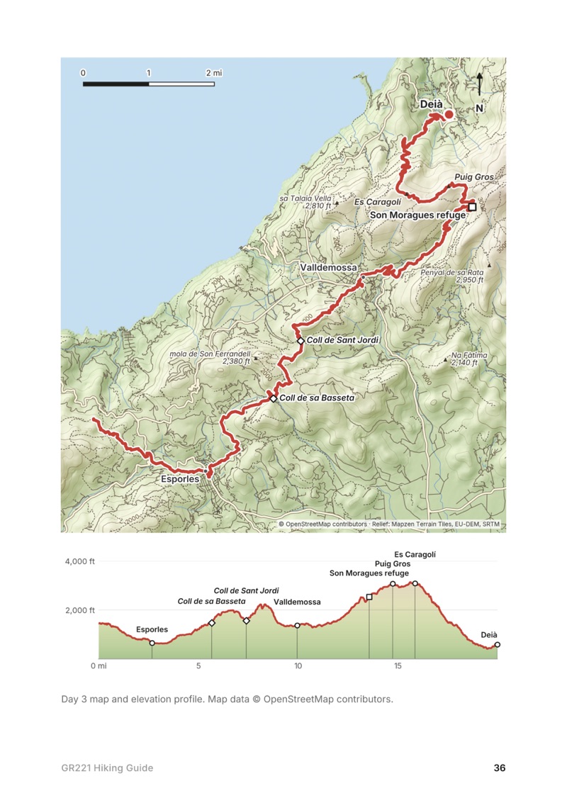
A map and elevation profile for every day. Plus an overview map of the whole route from Port d'Andratx to Pollença.
GPX files. One for each day and one for the full route, from my own recording. Load them into AllTrails, Gaia GPS, Garmin or Organic Maps.
Water. Where I filled up each day, where I ran out, and the long dry stretches to plan for.
Where to sleep. Phone numbers, beds and 2026 prices for the Consell de Mallorca refuges, a booking email in English and Spanish, and the camping, fire and drone rules stated plainly.
Getting there and home. Palma airport to Port d'Andratx and Pollença back to Palma, with the bus lines and a bail-out bus for every town.
Other ways to do it. The official 9-stage refuge plan, my Day 4 split into two, and a shorter trip from Sóller.
A one-page trip sheet. The whole itinerary, water stops and buses on one printable page.
About this trip
Everything from my March 2026 hike across Mallorca on the GR221, from Port d'Andratx to Pollença, in one guide you can keep on your phone. Day-by-day stats and maps, where I found water, the refuges and rules for planning your nights, the buses in and out, and GPX files for every day.
The whole day page from the guide as a PDF, plus my camping packing list: the 42 things I carry, with a note on each, and this route's own list on top. The PDF opens right away and both come by email.
You'll also get my emails about new guides and trips, a few a year.
The details
Format
A 65-page PDF sized for a phone (A5, prints fine too) and a folder of GPX files, in one zip download.
Edition
2027 season edition, updated September 2026.
Delivery
Instant. After you pay you get a private download link. Bookmark it to download again on any device.
Payment
Secure checkout through Stripe, in your own currency. Tax is included in the price, except in the US and Canada, where any sales tax is added at checkout.
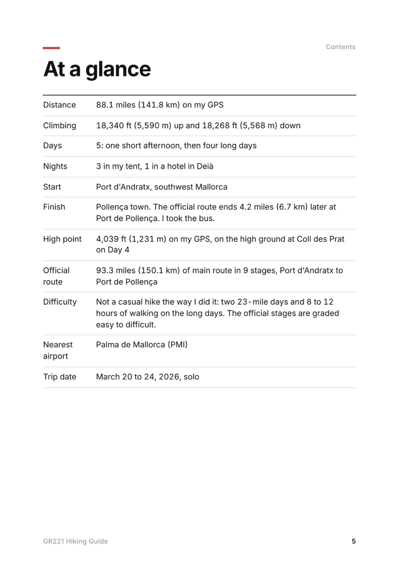
I did it in five: a short first afternoon and then four long days, about 88 miles. The official route is 9 stages between refuges and towns.
When is the best time to hike the GR221?
Spring and autumn are the usual seasons. I went March 20 to 24, 2026, with cold mornings and shorts in the day. Summer is hot and dry, and open fires are banned on forest land from May 1 to October 15.
Where do you sleep on the GR221?
The Consell de Mallorca runs hiker refuges along the route, and a dorm bed was 14 euros in 2026. The towns have hotels. I slept in my tent three nights and in a hotel in Deià one night.
Can you camp on the GR221?
Not freely. Camping and bivouacking on forest land in the Serra de Tramuntana need authorization all year, and almost 95% of the area is private land. There are official camping areas near Lluc that you reserve.
How do you get to the start of the GR221?
Fly into Palma. EMT bus A1 runs from the airport to the center, and TIB bus 101 goes from the Estació Intermodal to Port d'Andratx. At the end, bus 301 runs from Pollença back to Palma.
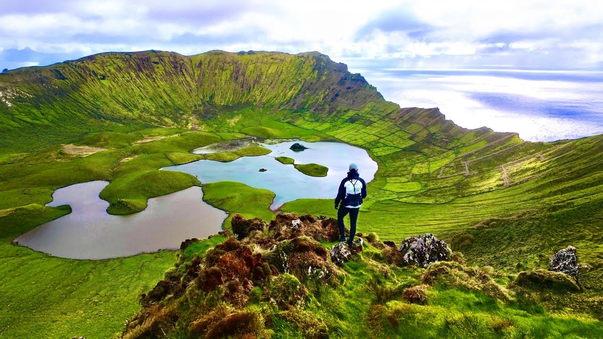
Five hikes on three Azores islands in a week: the Sete Cidades crater rim on São Miguel, the Grande Rota das Flores on Flores in three days, and the Caldeirão on Corvo.
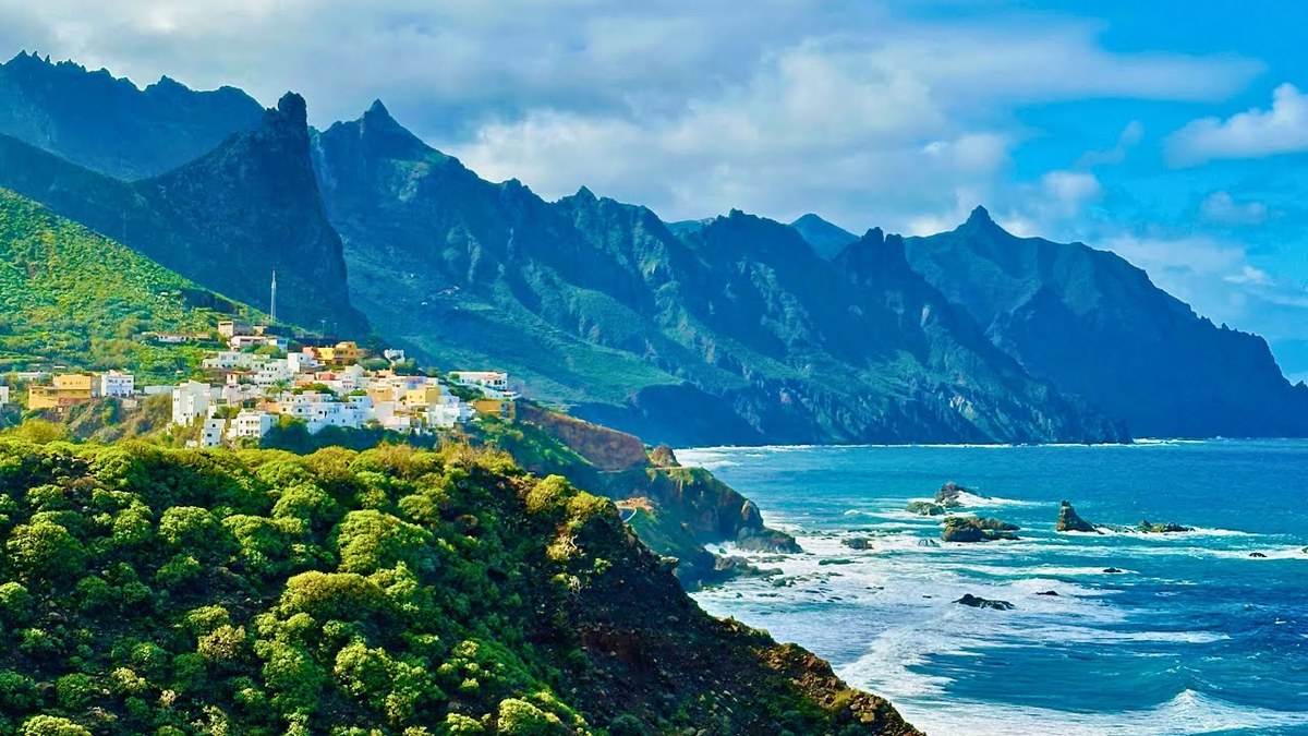
A 5-day walk across Tenerife: Cruz del Carmen in the Anaga mountains to the north coast and back to La Laguna, then the GR 131 through the Corona Forestal, past El Portillo and across Las Cañadas below Teide to Vilaflor.