The Petrópolis–Teresópolis film: Serra dos Órgãos, Brazil

Serra dos Órgãos, Brazil · 2 days · 18.9 miles

Petrópolis–Teresópolis Hiking Guide

The Serra dos Órgãos traverse in Brazil, Bonfim to Teresópolis in 2 days.

Watch the film · 146K views
Free sample
  • 146K YouTube views
  • Instant PDF + GPX
  • 30-day refund
  • Free updates

Look inside

Real pages from the guide. Tap one to see it big.

  • A day page page from the Petrópolis–Teresópolis Hiking Guide
    A day page
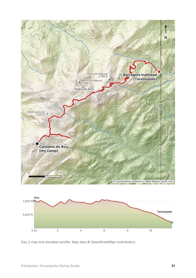
  • A day map and elevation profile page from the Petrópolis–Teresópolis Hiking Guide
    A day map and elevation profile
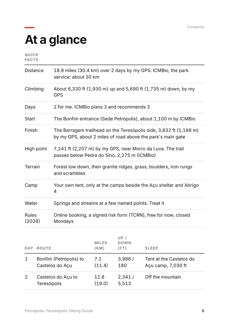
  • At a glance page from the Petrópolis–Teresópolis Hiking Guide
    At a glance
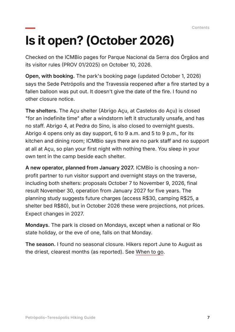
  • Is it open? (October 2026) page from the Petrópolis–Teresópolis Hiking Guide
    Is it open? (October 2026)

Swipe for more pages

Get Day 2 free

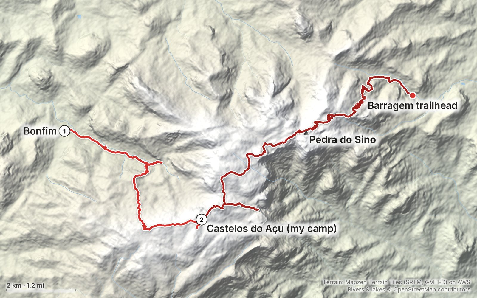
The route

My GPS recording of 2 days on a relief map. The numbers are where each day starts; the red dot is the finish. The full GPX files and the day maps come with the guide.

Relief map of the Petrópolis–Teresópolis route: 2 days drawn in red with numbered day starts, labelled Bonfim, Barragem trailhead, Pedra do Sino and Castelos do Açu (my camp).
Day 1Day 2Highest 7,240 ft (2,207 m)

Elevation, start to finish: highest 7,240 ft (2,207 m), lowest 3,210 ft (978 m).

Map data: Terrain: Mapzen Terrain Tiles (SRTM, GMTED) on AWS · Rivers & lakes © OpenStreetMap contributors

At a glance

Days
2 days
Distance
18.9 miles
Climbing
About 6,330 ft (1,930 m) up
Route
The Bonfim entrance to the Barragem trailhead on the Teresópolis side

What's inside

  • Where things stand. The traverse in October 2026: the booking, the closed shelters, the new operator from 2027 and Monday closures, checked on ICMBio's pages.
  • Both days. Stats, the time I took, my notes, the route, where to turn back, maps with elevation profiles, and links to that part of my film.
  • My GPX files. My own recordings of both days, plus the full route with waypoints, ready for AllTrails, Gaia GPS, Garmin or Organic Maps.
  • Booking and rules. How the online booking opens two months ahead, the signed risk form, where you may camp, the waste kit, hours and what's free.
  • Getting there. Rio to Petrópolis and Bonfim by bus or Uber, and back from Teresópolis to Rio, with 2026 fares as reported.
  • Other ways to do it. ICMBio's three-day plan, the reverse direction, day hikes, going with a guide, and Pedra da Gávea and Sugarloaf in Rio.
  • Costs, safety and a trip sheet. Food, water and stove fuel, what a trip costs in 2026, fog, the Cavalinho and rescue, one page of checks and a printable summary of the route.

About this trip

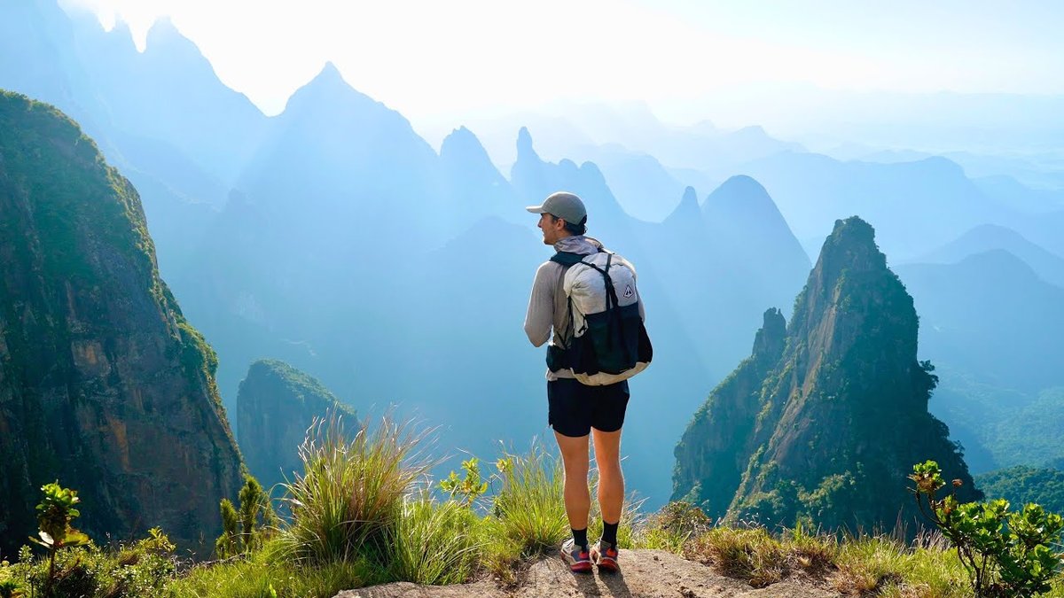
At the end of April 2024 I hiked the Petrópolis-Teresópolis traverse alone in Serra dos Órgãos National Park, Brazil: up from Bonfim to a tent at Castelos do Açu the first afternoon, then out in the dark for sunrise at the Portais de Hércules and across the high peaks past Pedra do Sino to Teresópolis. It's the trip from my film Hiking Alone in Brazil. This guide has my GPX files, maps and notes for both days, the 2026 booking and rules, getting there from Rio by bus, the usual three-day plan, two Rio hikes for before or after, costs, fog and safety, and a trip sheet.

Watch the film on YouTube (146K views).

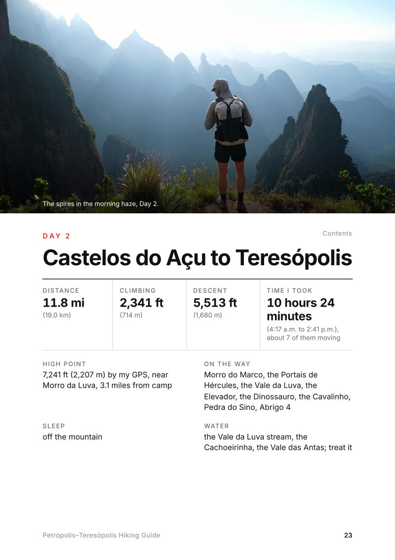
The Day 2, Castelos do Açu to Teresópolis page from the Petrópolis–Teresópolis Hiking Guide

Free sample + packing list

Try Day 2 free, plus my packing list

Castelos do Açu to Teresópolis

The whole day page from the guide as a PDF, plus my camping packing list: the 42 things I carry, with a note on each. The PDF opens right away and both come by email. You'll also get my emails about new guides and trips, a few a year.

The details

Format
A 45-page PDF sized for a phone (A5, prints fine too) and a folder of GPX files, in one zip download.
Edition
2027 season edition, updated October 2026.
Delivery
Instant. After you pay you get a private download link. Bookmark it to download again on any device.
Payment
Secure checkout through Stripe, in your own currency. Tax is included in the price, except in the US and Canada, where any sales tax is added at checkout.
Refunds
Not useful? Email me within 30 days for a refund: kraig@kraigadams.com.
Questions
Email kraig@kraigadams.com.

Paying in the Facebook/Instagram app? Tap ⋯ and Open in browser to use Apple Pay or Google Pay.

$19

Questions

Do you need a permit for the Petrópolis-Teresópolis traverse?
For an overnight trip, yes: an online booking with ICMBio, which opens two months ahead at midnight, plus a signed risk form (the TCRN) handed in at the entrance. A day hike needs only the form. In October 2026 entry and camping were free; ICMBio plans a new operator from January 2027, which may charge fees.
How long is the Petrópolis-Teresópolis traverse?
ICMBio, the park service, says about 30 km. My GPS recorded 18.9 miles (30.4 km) and about 6,330 ft (1,930 m) of climbing over two days, from Bonfim above Petrópolis to the Teresópolis side. ICMBio plans and recommends three days.
Where do you sleep on the Petrópolis-Teresópolis traverse?
In your own tent, only at the two designated camps beside the Açu shelter (Castelos do Açu) and Abrigo 4 (Pedra do Sino). In October 2026 both shelters were closed to overnight guests; the Açu shelter has no staff or support at all, and Abrigo 4 opens only mornings and evenings for its kitchen and dining room.
Do you need a guide for the Petrópolis-Teresópolis traverse?
ICMBio recommends a guide but doesn't require one; without one, someone in the group must know the route. It's steep and rocky, with iron rungs and scrambles like the Cavalinho, where ICMBio says a rope is mandatory, and fog makes the route easy to lose. I hiked it alone.
How do you get to the Petrópolis-Teresópolis traverse from Rio?
Take a bus from Rio's Rodoviária Novo Rio to Petrópolis (about 1 hour 10 to 1 hour 20 minutes), then a city bus or taxi to the Bonfim entrance. From Teresópolis, buses run back to Rio roughly hourly, about 2 hours (as reported in 2026).
When is the best time to hike the Petrópolis-Teresópolis traverse?
Hikers report June to August as the driest, clearest months. I went at the end of April. The park is closed on Mondays, except holidays, and no camp can start on a Monday.
More guides

All guides
Adirondack High Peaks, High Peaks Wilderness, New York

High Peaks Wilderness, New York

Adirondack High Peaks

2 days · 18 miles · lean-to

A 2-day loop over Mount Marcy and Algonquin Peak from the Adirondak Loj in New York's High Peaks, with a night at Lake Colden, plus a 3-day traverse from Keene Valley.

  • Both days of the loop
  • My GPX files
  • My 2019 traverse
  • Permits and rules

See the guide: Adirondack High Peaks · $19

Trans-Catalina Trail, Southern California

Southern California

Trans-Catalina Trail

2 days · 42 miles · Catalina Island

A 2-day hike across Santa Catalina Island, California, on the Trans-Catalina Trail: from Avalon to Little Harbor, then to Two Harbors by way of the Silver Peak Trail and Parsons Landing.

  • Where things stand
  • Both days
  • My GPX files
  • Permits, campgrounds and rules

See the guide: Trans-Catalina Trail · $19

Get the next guide

I'm making guides for more of my hikes, and I host a group trip about once a year. Get an email when a new guide or trip is out. A few emails a year.

Petrópolis–Teresópolis Hiking GuideInstant PDF + GPX