Mount Hood, Oregon · 2 days · 40 miles · tent, campground

Timberline Trail Hiking Guide

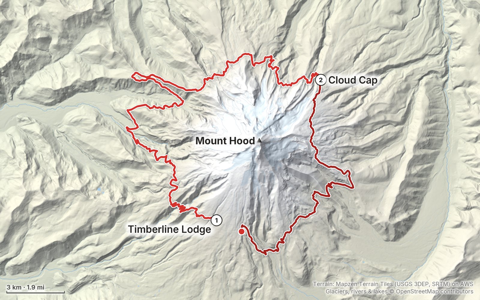
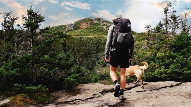
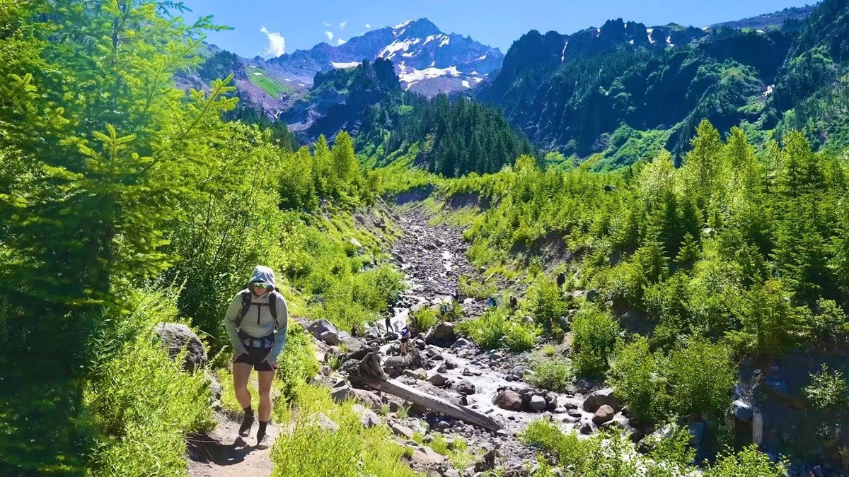
In July 2023 I hiked the Timberline Trail alone, all the way around Mount Hood in Oregon: about 40 miles clockwise from Timberline Lodge, past Zigzag Canyon, the Sandy River, Ramona Falls, Cairn Basin, Elk Cove and Cloud Cap, over the high point of the loop on the east side and back across the White River. It's the trip from my film Hiking 40 miles on the Timberline Loop in Oregon. This guide has my GPS files, maps and notes for both days, every river crossing and how the Eliot Branch works now, the free permit and the 2026 camping, fire and closure rules, getting to the lodge from Portland, water and heat, and what I paid.

$19Watch the film
The cover of the Timberline Trail Hiking Guide

What's inside

Look inside

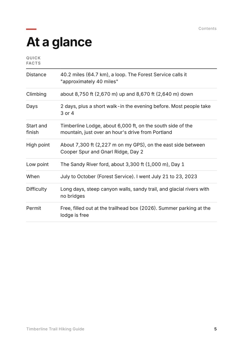
At a glance page from the Timberline Trail Hiking Guide
At a glance
A day page page from the Timberline Trail Hiking Guide
A day page
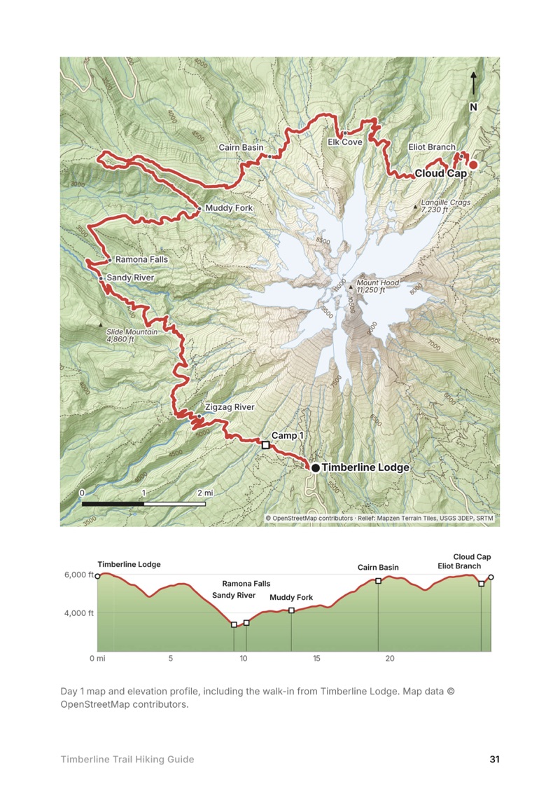
A day map and elevation profile page from the Timberline Trail Hiking Guide
A day map and elevation profile
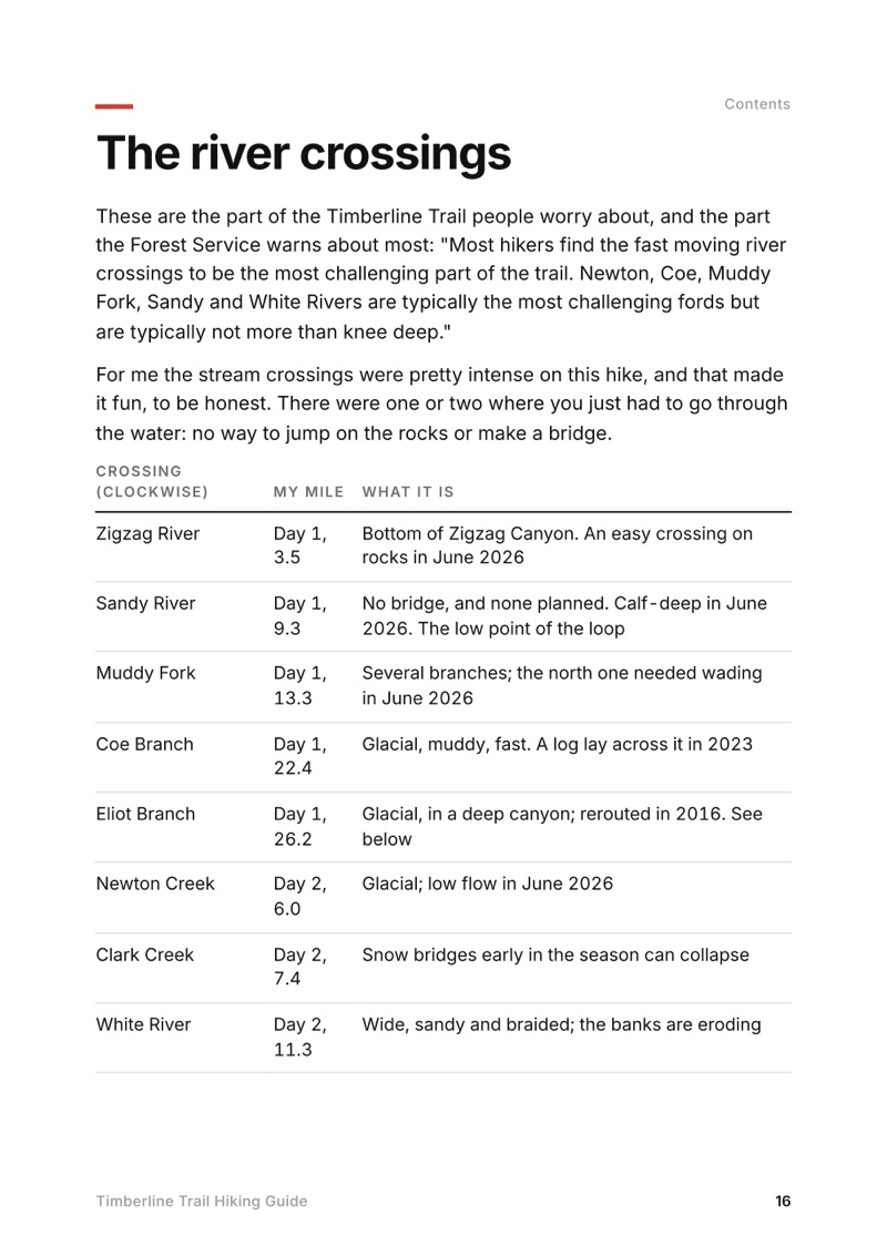
The river crossings page from the Timberline Trail Hiking Guide
The river crossings

The details

Format
A 50-page PDF sized for a phone (A5, prints fine too) and a folder of GPX files, in one zip download.
Edition
2027 season edition, updated October 2026.
Delivery
Instant. After you pay you get a private download link. Bookmark it to download again on any device.
Payment
Secure checkout through Stripe. The price is in US dollars, and sales tax or VAT is added where it applies.
Questions
Email kraig@kraigadams.com.
$19

Questions

How long is the Timberline Trail?
My loop around Mount Hood was 40.2 miles on my GPS, with about 8,750 ft of climbing, clockwise from Timberline Lodge. The Forest Service calls it an approximately 40-mile loop.
How many days does the Timberline Trail take?
The Forest Service says most trips take 3 to 4 days. I did it in two in July 2023, after a short walk-in the evening before: almost 27 miles to Cloud Cap on Day 1 and 13 miles back to the lodge on Day 2.
Do you need a permit for the Timberline Trail?
A free wilderness permit you fill out yourself at the trailhead box, from May 15 to October 15. There's no quota or reservation in 2026. Summer parking at Timberline Lodge is free; from November 1 to April 30 you need an Oregon Sno-Park permit.
Is the Eliot Branch crossing open?
Yes. A debris flow washed out the old crossing in 2006, and the Forest Service rerouted the trail across the Eliot Branch in 2016, reopening the full loop. It's still a ford with no bridge, and it was open with no closure in 2026.
Is there a bridge over the Sandy River on the Timberline Trail?
No. The Forest Service says there is no bridge and none will be installed. It's a ford, like the Muddy Fork, Coe Branch, Eliot Branch, Newton Creek and White River. Cross in the morning, when the glacial rivers are lower.
When is the best time to hike the Timberline Trail?
The Forest Service gives July to October. Snow lingers into July on the high east side. I went July 21 to 23, 2023, and it was clear and very hot. In August 2026 a wildfire closed part of the east side until September 4, so check the alerts.
More guides

All guides
Teton Crest Trail, Grand Teton National Park, Wyoming

Grand Teton National Park, Wyoming

Teton Crest Trail

2 days · 50 miles · tent, a loop

A two-day loop in Grand Teton National Park from String Lake over Paintbrush Divide and Hurricane Pass to Alaska Basin, the northern half of the Teton Crest Trail, then over Static Peak Divide and down Death Canyon back to String Lake. Covers the park permits and the 2026 Death Canyon Trailhead closure.

  • Both days
  • My GPX files
  • Permits and camping
  • The 2026 closures

See the guide: Teton Crest Trail · $19

Sawtooth Wilderness Loop, Sawtooth Wilderness, Idaho

Sawtooth Wilderness, Idaho

Sawtooth Wilderness Loop

3 days · 71 miles · tent, a loop

A loop through Idaho's Sawtooth Wilderness from Grandjean past Sawtooth Lake, the Baron Lakes, the Cramer Lakes and the Ten Lake Basin, back down the South Fork Payette. The Grandjean start is closed through December 31, 2026; the guide covers the closure and the ways in from the Stanley side.

  • All three days
  • My GPX files
  • The 2026 closure
  • Permits and rules

See the guide: Sawtooth Wilderness Loop · $19

Choquequirao, Apurímac canyon, Peru

Apurímac canyon, Peru

Choquequirao

3 days · 29 miles · tent, no guide

From Capuliyoc above Cachora down into Peru's Apurímac canyon, up to the Inca site of Choquequirao and back.

  • All three days
  • My GPX files
  • The park
  • Getting there

See the guide: Choquequirao · $19

Get the next guide

I'm making guides for more of my hikes, and I host a group trip about once a year. Get an email when a new guide or trip is out. A few emails a year.