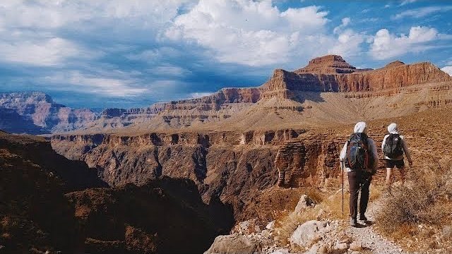
The film of Capitol Reef and Bryce Canyon Watch the film

213K views on YouTube. This guide is that trip, day by day.

Utah · 2 days · 26.7 miles · Utah

Capitol Reef and Bryce Canyon Hiking Guide

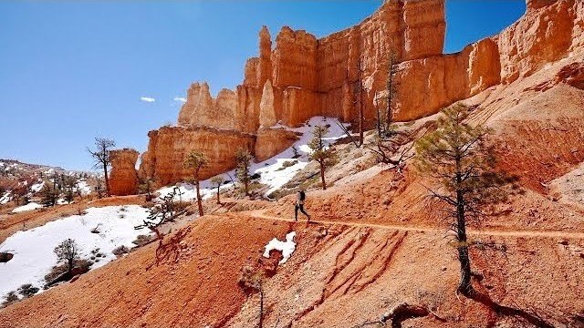
In late March 2022 I spent two days hiking alone in two Utah national parks. In Capitol Reef I hiked the Chimney Rock Loop, then Cohab Canyon, the Frying Pan Trail and Cassidy Arch down to Grand Wash, one way to Utah 24. The next day in Bryce Canyon I walked the Rim Trail and the whole Fairyland Loop through the hoodoos, then went down Queen's Garden and up the Navajo Loop. It's the trip from my films Hiking Alone in Capitol Reef National Park Utah and Hiking the Fairyland Loop in Bryce Canyon National Park. This guide has my GPX files, a map and elevation profile for every hike, the 2026 fees and rules, getting there and between the parks, other hikes nearby, costs, heat, flash floods, snow and safety, and a trip sheet.

Days
2 days
Distance
26.7 miles
Climbing
About 4,630 ft (1,410 m) up

Paying in the Facebook/Instagram app? Tap ⋯ and Open in browser to use Apple Pay or Google Pay.

$19

Instant download: PDF + GPX files.
Not useful? Email me within 30 days for a refund.

Free updates. 2027 season edition, updated October 2026. When I update the guide, your download link gets the new version.

Or get it in The Americas and New Zealand: 32 guides for $39, or all 58 for $59.

The cover of the Capitol Reef and Bryce Canyon Hiking Guide

What's inside

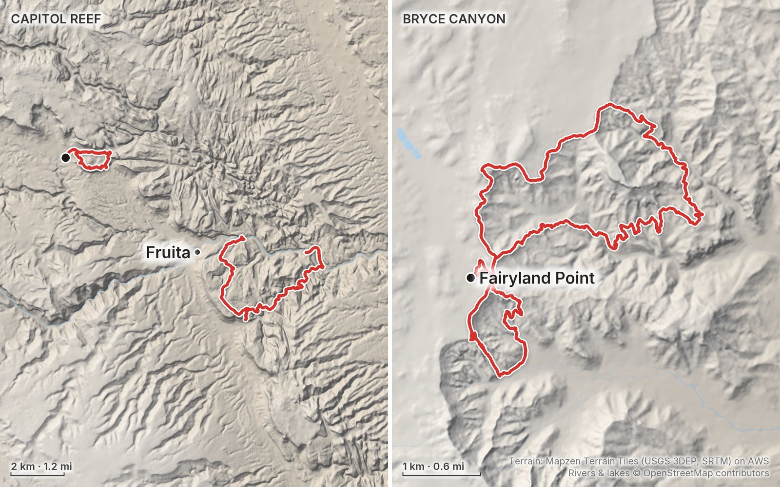
The route

My GPS recording of 2 days, simplified. The numbers are where each day starts; the dot is the finish. The full GPX files and the maps come with the guide.

1220 km (12.4 mi)N

Elevation, start to finish: highest 8,160 ft (2,486 m), lowest 6,050 ft (1,843 m).

Look inside

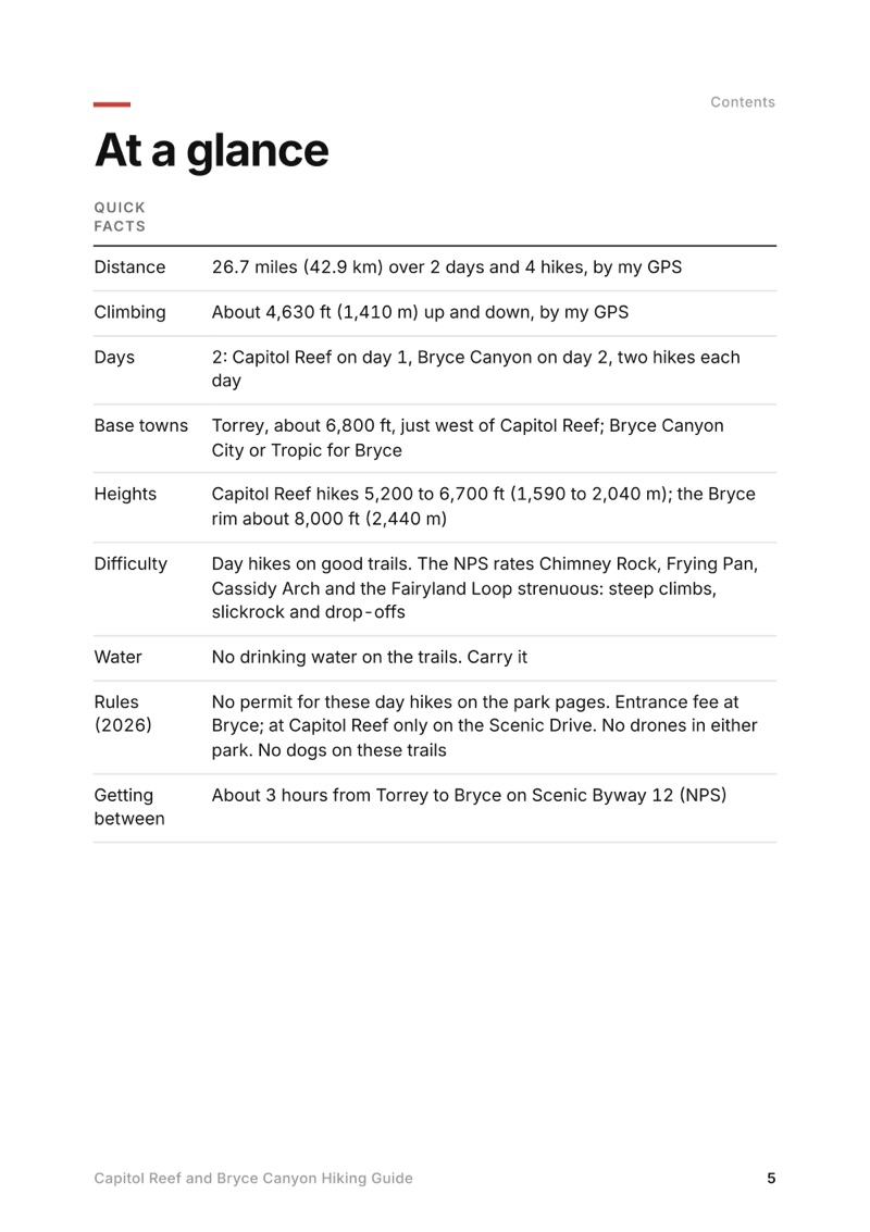
At a glance page from the Capitol Reef and Bryce Canyon Hiking Guide
At a glance
A day page page from the Capitol Reef and Bryce Canyon Hiking Guide
A day page
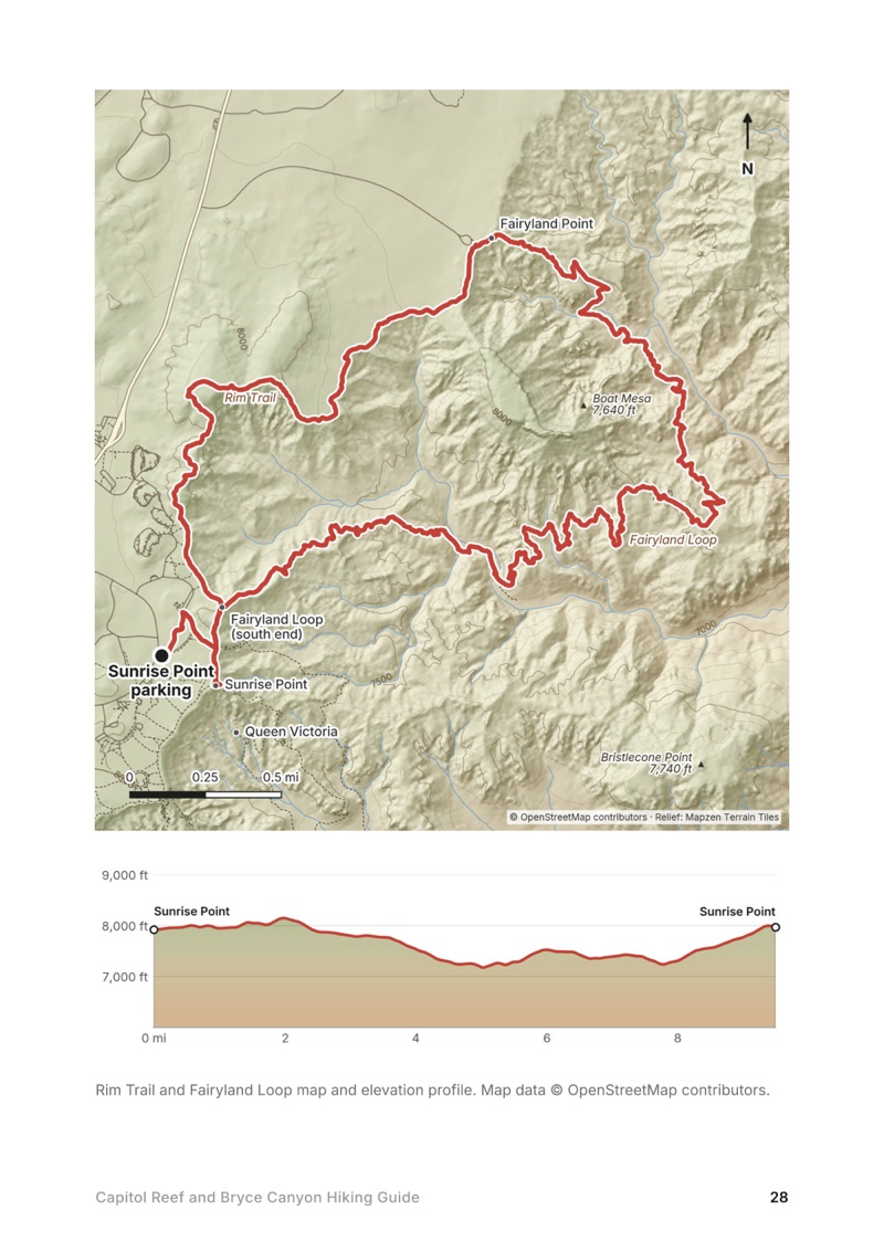
A day map and elevation profile page from the Capitol Reef and Bryce Canyon Hiking Guide
A day map and elevation profile
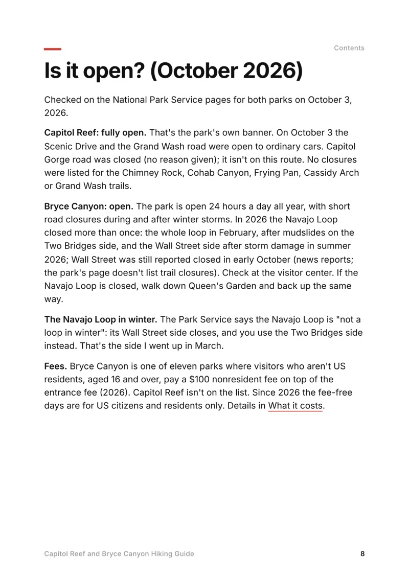
Is it open? (October 2026) page from the Capitol Reef and Bryce Canyon Hiking Guide
Is it open? (October 2026)

The details

Format
A 43-page PDF sized for a phone (A5, prints fine too) and a folder of GPX files, in one zip download.
Edition
2027 season edition, updated October 2026.
Delivery
Instant. After you pay you get a private download link. Bookmark it to download again on any device.
Payment
Secure checkout through Stripe, in your own currency. Tax is included in the price, except in the US and Canada, where any sales tax is added at checkout.
Refunds
Not useful? Email me within 30 days for a refund: kraig@kraigadams.com.
Questions
Email kraig@kraigadams.com.

Paying in the Facebook/Instagram app? Tap ⋯ and Open in browser to use Apple Pay or Google Pay.

$19

Questions

Do you need a permit to hike in Capitol Reef or Bryce Canyon?
Not for day hikes like these: the park pages list no permit. You pay the entrance fee at each park: in 2026, $20 a car at Capitol Reef and $35 at Bryce Canyon, or an $80 America the Beautiful pass for US residents.
Is there a fee for non-US visitors at Bryce Canyon?
Yes. From 2026, visitors who aren't US residents, aged 16 and over, pay a $100 nonresident fee on top of the entrance fee at Bryce Canyon and ten other parks. Capitol Reef isn't on the list.
How long is the Fairyland Loop?
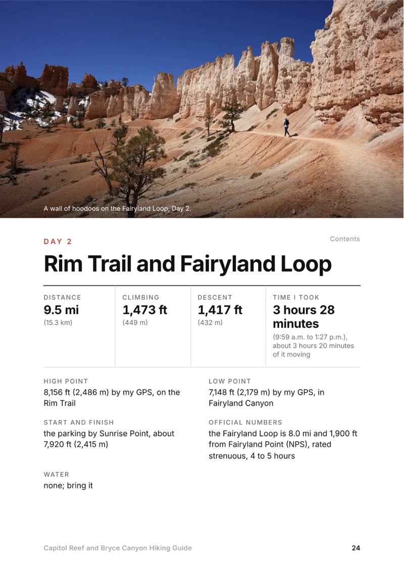
8.0 miles and 1,900 ft of elevation change from Fairyland Point, by the Park Service. I started from Sunrise Point and walked the Rim Trail to Fairyland Point first: 9.5 miles by my GPS, in about 3.5 hours in late March.
How do you hike the Frying Pan Trail to Cassidy Arch and Grand Wash?
From the Hickman Bridge trailhead on Utah 24, up Cohab Canyon, along the Frying Pan Trail to Cassidy Arch, down into Grand Wash and out to Utah 24: 8.4 miles one way by my GPS. It ends about 2 miles by road from where you start, so bring two cars or arrange a ride.
Can you hike Bryce Canyon in March?
Yes. In late March 2022 I had pockets of snow but didn't need microspikes. The Park Service warns that March and April storms can bring heavy snow, recommends traction devices on icy trails, and the Navajo Loop's Wall Street side is closed in winter.
How far is it from Capitol Reef to Bryce Canyon?
Scenic Byway 12 runs 123 miles from Torrey toward Bryce Canyon, about three hours of driving according to the Park Service.
More guides

All guides
Adirondack High Peaks, High Peaks Wilderness, New York

High Peaks Wilderness, New York

Adirondack High Peaks

2 days · 18 miles · lean-to

A 2-day loop over Mount Marcy and Algonquin Peak from the Adirondak Loj in New York's High Peaks, with a night at Lake Colden, plus a 3-day traverse from Keene Valley.

  • Both days of the loop
  • My GPX files
  • My 2019 traverse
  • Permits and rules

See the guide: Adirondack High Peaks · $19

Trans-Catalina Trail, Southern California

Southern California

Trans-Catalina Trail

2 days · 42 miles · Catalina Island

A 2-day hike across Santa Catalina Island, California, on the Trans-Catalina Trail: from Avalon to Little Harbor, then to Two Harbors by way of the Silver Peak Trail and Parsons Landing.

  • Where things stand
  • Both days
  • My GPX files
  • Permits, campgrounds and rules

See the guide: Trans-Catalina Trail · $19

Get the next guide

I'm making guides for more of my hikes, and I host a group trip about once a year. Get an email when a new guide or trip is out. A few emails a year.