The Yushan film: East Asia

East Asia · 2 days · 16.4 miles

Yushan Hiking Guide

Tataka to Taiwan's highest peak and North Peak in 2 days.

Watch the film · 194K views
Free sample
  • 194K YouTube views
  • Instant PDF + GPX
  • 30-day refund
  • Free updates

Look inside

Real pages from the guide. Tap one to see it big.
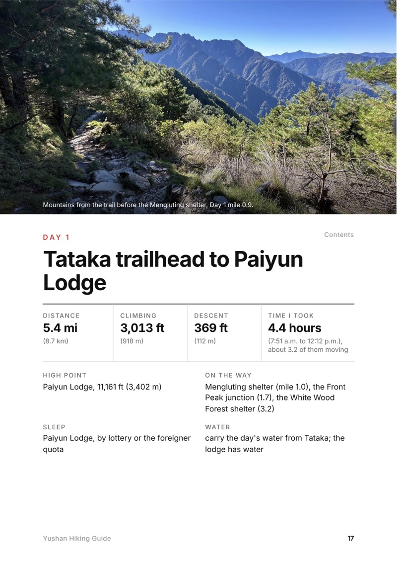
  • A day page page from the Yushan Hiking Guide
    A day page
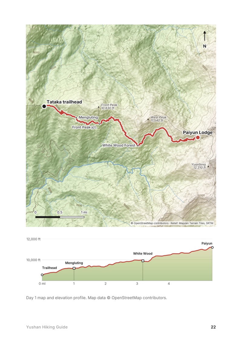
  • A day map and elevation profile page from the Yushan Hiking Guide
    A day map and elevation profile
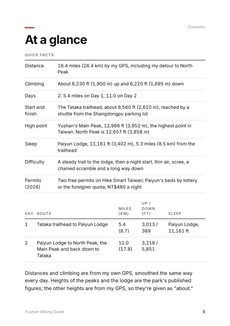
  • At a glance page from the Yushan Hiking Guide
    At a glance
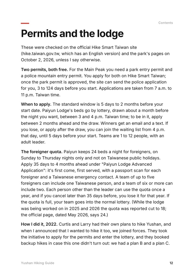
  • Permits and the lodge page from the Yushan Hiking Guide
    Permits and the lodge

Swipe for more pages

Get Day 1 free

The route

My GPS recording of 2 days on a relief map. The numbers are where each day starts; the red dot is the finish. The full GPX files and the day maps come with the guide.
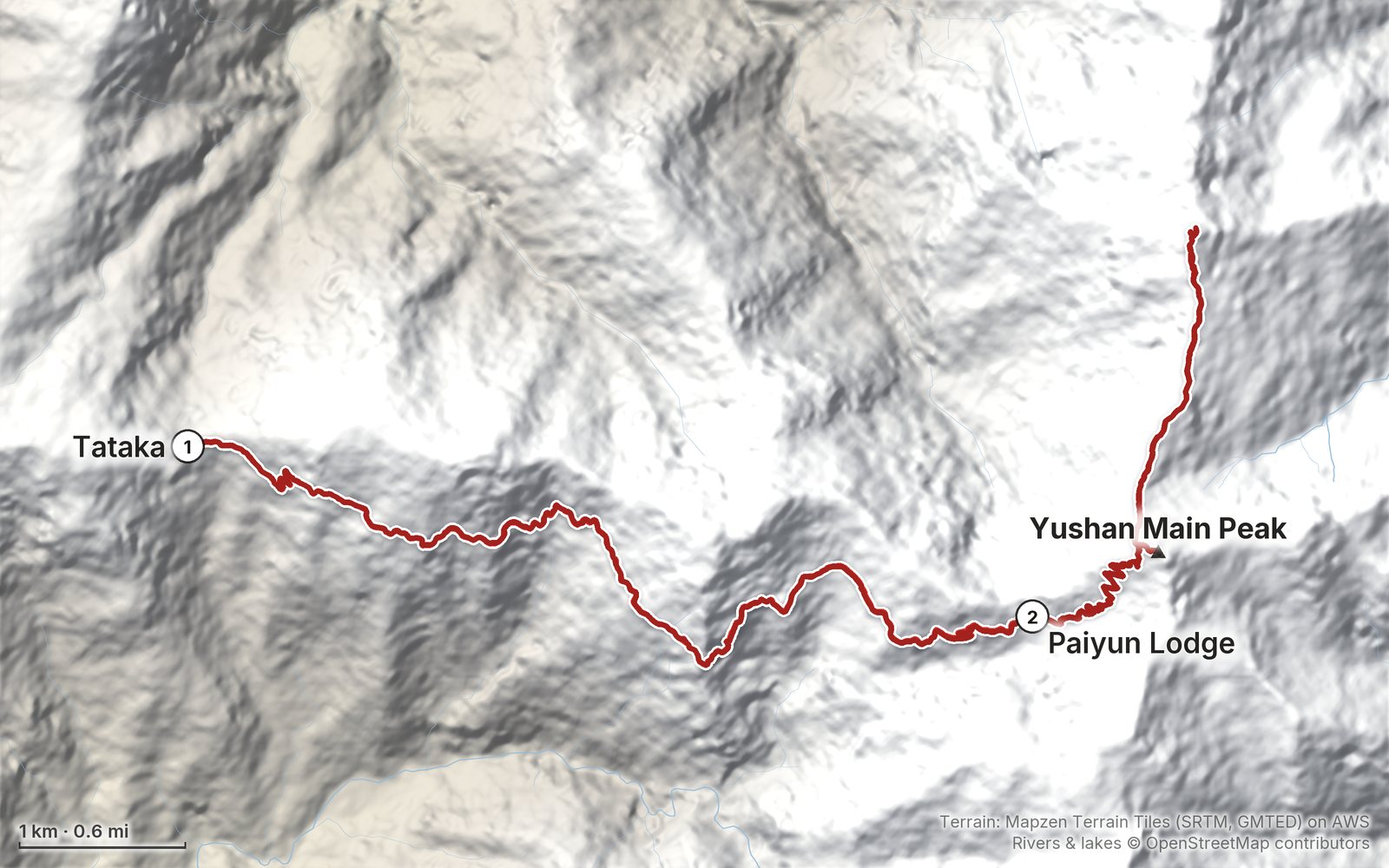
Relief map of the Yushan route: 2 days drawn in red with numbered day starts, labelled Tataka, Yushan Main Peak and Paiyun Lodge.
Day 1Day 2Highest 12,750 ft (3,886 m)

Elevation, start to finish: highest 12,750 ft (3,886 m), lowest 8,550 ft (2,606 m).

Map data: Terrain: Mapzen Terrain Tiles (SRTM, GMTED) on AWS · Rivers & lakes © OpenStreetMap contributors

At a glance

Days
2 days
Distance
16.4 miles
Climbing
About 6,230 ft (1,900 m) up
Permit
Two free permits on Hike Smart Taiwan
Start and end
The Tataka trailhead

What's inside

  • Where things stand. Yushan in October 2026: open, the snow season and typhoon closures, and what has changed on the trail since my trip, checked on the park's own pages.
  • Both days. Stats, the time I took, my notes, the trail, where to get off, maps with elevation profiles, and links to that day in my film.
  • My GPX files. My own recordings of both days, with waypoints for the trailhead, the shelters, the junctions, Paiyun Lodge, North Peak and the Main Peak, ready for AllTrails, Gaia GPS, Garmin or Organic Maps.
  • Permits and the lodge. The two free permits on Hike Smart Taiwan, the Paiyun Lodge lottery, the foreigner quota, checking in, the lodge's beds, meals and sleeping bags, and the rules.
  • Getting there. Driving and the Highway 21 night closure, the shuttle from Shangdongpu, and the high-speed rail and bus 6739 without a car, with 2026 prices and times.
  • Weather, altitude and safety. The summit's weather month by month with sunrise times, altitude sickness, rockfall, ice and typhoons, and what to carry.
  • Before you go and a trip sheet. One page of checks and a printable one-page summary of the route.

About this trip

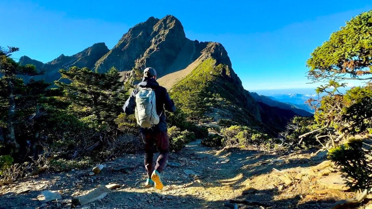
At the end of September 2022 I hiked Yushan, Jade Mountain, the highest peak in Taiwan, with two local hikers: up from the Tataka trailhead to Paiyun Lodge, then a 2:30 a.m. start past the Main Peak to North Peak and its weather station for sunrise, back to the summit, and all the way down the same morning. It's the trip from my film Hiking the Highest Peak in Taiwan. This guide has my GPS files, maps and notes for both days, the two permits, the Paiyun Lodge lottery and the foreigner quota in 2026, getting to the trailhead with or without a car, the weather month by month, altitude, and a trip sheet.

Watch the film on YouTube (194K views).

The Day 1, Tataka trailhead to Paiyun Lodge page from the Yushan Hiking Guide

Free sample + packing list

Try Day 1 free, plus my packing list

Tataka trailhead to Paiyun Lodge

The whole day page from the guide as a PDF, plus my hut-to-hut packing list: the 35 things I carry, with a note on each. The PDF opens right away and both come by email. You'll also get my emails about new guides and trips, a few a year.

The details

Format
A 40-page PDF sized for a phone (A5, prints fine too) and a folder of GPX files, in one zip download.
Edition
2027 season edition, updated October 2026.
Delivery
Instant. After you pay you get a private download link. Bookmark it to download again on any device.
Payment
Secure checkout through Stripe, in your own currency. Tax is included in the price, except in the US and Canada, where any sales tax is added at checkout.
Refunds
Not useful? Email me within 30 days for a refund: kraig@kraigadams.com.
Questions
Email kraig@kraigadams.com.

Paying in the Facebook/Instagram app? Tap ⋯ and Open in browser to use Apple Pay or Google Pay.

$19

Questions

Is Yushan open?
Yes, in October 2026: the park's trail status page showed the Yushan peaks trails open on October 2, 2026. A typhoon warning closes the park and voids permits, and from about January to March only teams with snow experience and gear can go up.
How long is the Yushan hike?
My GPS recorded 16.4 miles over two days: 5.4 from the Tataka trailhead to Paiyun Lodge, then 11.0 on the second day with a detour to North Peak, the Main Peak and back down to the trailhead. The Main Peak only is about 13.5 miles round trip. The summit is 12,966 ft (3,952 m).
How do foreigners get a Yushan permit?
You need two free permits, a park permit and a police mountain permit, applied for online on Hike Smart Taiwan, and a bed at Paiyun Lodge. Foreigners can apply for 24 reserved beds a night, Sunday to Thursday, 35 days to 4 months ahead; otherwise the beds go by lottery a month before.
Do you need a guide to hike Yushan?
I couldn't find any rule that requires one. I went with two Taiwanese hikers who handled the permits and the driving. A guide doesn't get you around the lottery or the foreigner quota.
Can you hike Yushan in one day?
Yes, with the one-day permit: 60 people a day by lottery, starting after 5 a.m., at Paiyun Lodge by 10 a.m. or you turn back, and out by 5 p.m. It's suspended from January to March, and it's about 13.5 miles round trip.
How much does it cost to hike Yushan?
The permits are free. Paiyun Lodge is NT$480 a night in 2026, with meals and a sleeping bag NT$1,050 if ordered ahead, and the trailhead shuttle NT$150 each way. Our whole trip for three people, from Taipei, came to about US$370 in 2022.

More guides

All guides
Mardi Himal, Annapurna region, Nepal

Annapurna region, Nepal

Mardi Himal

4 days · 32 miles · teahouse trek

Kande through Pothana, Forest Camp, Low Camp and High Camp to the ridge below Machapuchare, and down to Sidhing.

  • All four days
  • My GPX files
  • Permits and the guide rule
  • Getting there and home

See the guide: Mardi Himal · $19

Lantau Trail, Hong Kong

Hong Kong

Lantau Trail

4 days · 30.4 miles · Hong Kong

A 4-day hike on the Lantau Trail in Hong Kong, Sections 1 to 8: Mui Wo over Sunset Peak and Lantau Peak to Ngong Ping, then Tai O and the west coast to Shek Pik.

  • Where things stand
  • All four days
  • A plan for 2027
  • My GPX files

See the guide: Lantau Trail · $19

Get the next guide

I'm making guides for more of my hikes, and I host a group trip about once a year. Get an email when a new guide or trip is out. A few emails a year.

Yushan Hiking GuideInstant PDF + GPX