
Hiking Capitol Reef and Bryce Canyon alone
In late March 2022 I flew from New York to Las Vegas, rented a car and drove to southern Utah for three national parks in a row: Capitol Reef, Bryce Canyon, then Zion.
Watch it: Hiking Alone in Capitol Reef National Park Utah
In late March 2022 I flew from New York to Las Vegas, rented a car and drove to southern Utah for three national parks in a row: Capitol Reef, Bryce Canyon, then Zion. This guide is the first two. On a Monday in Capitol Reef I hiked the Chimney Rock Loop in the morning, then Cohab Canyon, the Frying Pan Trail, Cassidy Arch and Grand Wash in the afternoon, one way to Utah 24. The next day in Bryce Canyon I walked the Rim Trail and the whole Fairyland Loop, then went down Queen's Garden and up the Navajo Loop in the afternoon. Four day hikes, about 26.7 miles (42.9 km) and 4,630 ft of climbing in two days by my GPS.
I hiked alone. It was the very start of the season: cold nights, no leaves on the trees in Fruita yet, and pockets of snow on the trails at Bryce.
On the trail
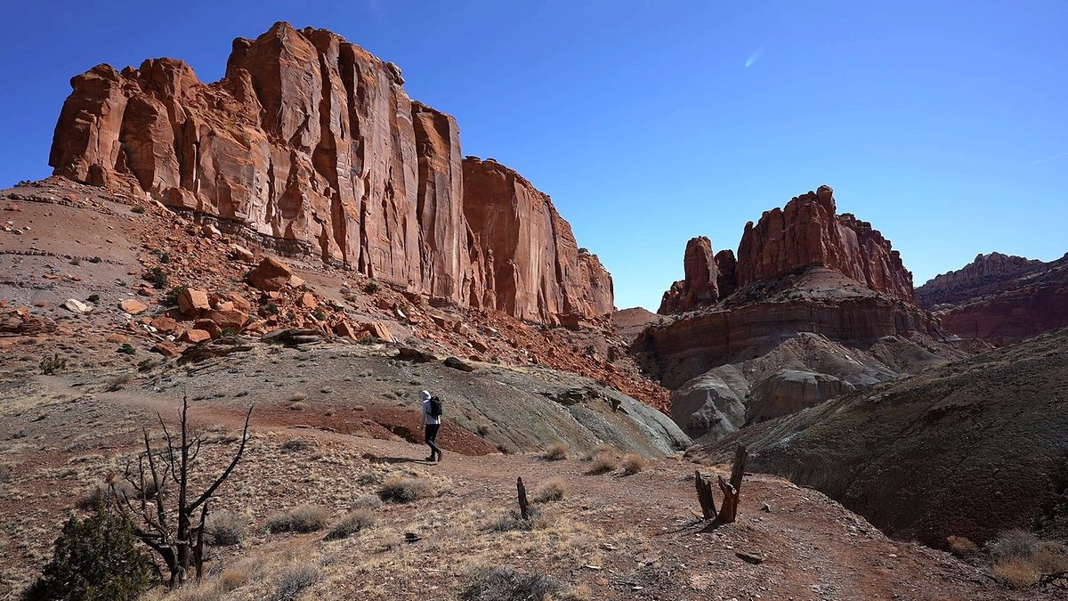
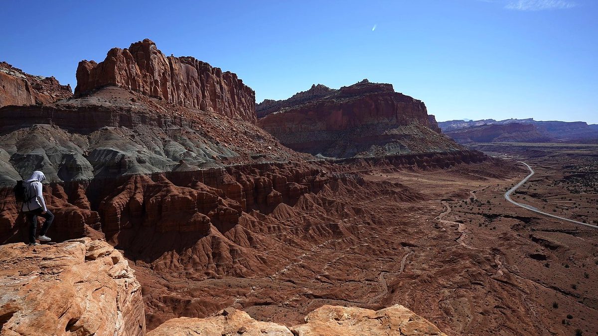
Monday, March 21, 2022. I'd booked Fruita Campground for the night before, but with a low around 20 F I stayed in a hotel in Torrey instead. I picked my Capitol Reef hikes by searching AllTrails for the most popular ones. I parked at the Chimney Rock trailhead and started at 10:42 a.m. The trail climbs a grey slope to the rim. At the Chimney Rock overlook, a mile in, you look down on the red tower of Chimney Rock and Utah 24 winding through the valley below. "This whole thing is kind of worth it just for this." "I'm pretty sure I'm gonna use this for the thumbnail."
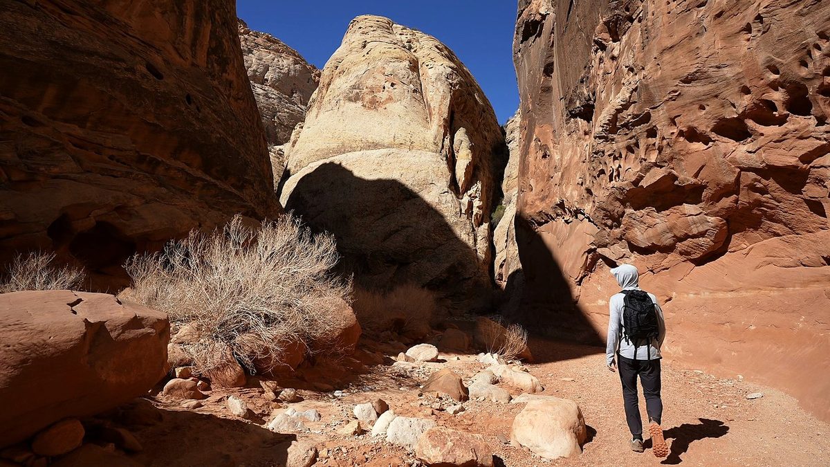
I drove a few miles east on Utah 24 and parked at the Hickman Bridge trailhead. At 12:33 p.m. I walked along the highway bridge beside the Fremont River to the Cohab Canyon trail and its "CARRY WATER" sign. Then it was "up up up," on rocky trail and slickrock. "Nothing too interesting, not many people." The Frying Pan Trail runs along the top for about 3 miles. I kept expecting it to follow the rim, and it doesn't, but "once you get over this hump you start to get some more views": big slickrock domes, junipers and the canyons below. My GPS high point was here, at about mile 2.8.
Tuesday, March 22, 2022. I parked by Sunrise Point, where snow still covered the edges of the lot, and set off at 9:59 a.m. "It's cold and windy." The Fairyland Loop is a loop, but "the first part is just along that rim," and it took me a while to get to the real start at Fairyland Point. The Rim Trail runs north through the pines, with snow patches and views down into the hoodoos, and reaches Fairyland Point after 3.6 miles by my GPS.
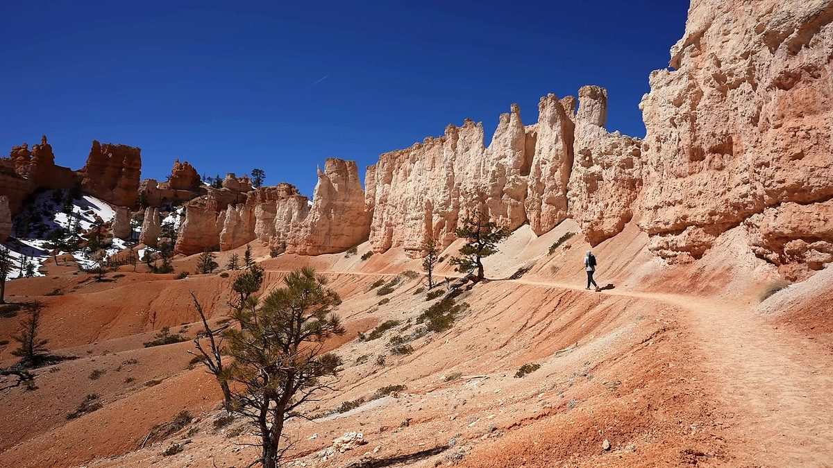
After coffee, a snack and sunscreen at the car I went back out at 3:03 p.m. for "a more popular, easier one." From Sunrise Point the Queen's Garden trail drops through the hoodoos, past the one called Queen Victoria. On this hike the trail also goes through a tunnel in a rock fin. At the bottom, at 3:48 p.m., I joined the Navajo Loop and went up its Two Bridges side, below Thor's Hammer, then up the switchbacks to Sunset Point. There were lots of people on the switchbacks, and on the rim. I walked the paved Rim Trail back to Sunrise Point and the car, at 4:27 p.m.
What I took from it
It ends on Utah 24 at the Grand Wash trailhead, about 2 miles by road from where I parked at the Hickman Bridge trailhead. I hitchhiked back. Two cars, or a friend with a car, is easier. Or hike it as an out-and-back.
Bryce. On the trail there I said "This is ten times better than Capitol Reef," and it's "one of my favorites." I'm "not the biggest fan of desert hikes in general." Capitol Reef was "okay, it's a desert, some canyon stuff, wasn't that interesting to me, but I'm happy I went out there." On Chimney Rock I said "this whole thing is kind of worth it just for this" view.
The route day by day, with maps and my GPX files, is in my free guide: Capitol Reef and Bryce Canyon on Follow the Hiker.