The film of Canary Islands Watch the film

113K views on YouTube. This guide is that trip, day by day.

Tenerife, Spain · 5 days · 80.5 miles · Tenerife, Canary Islands

Canary Islands Hiking Guide

In December 2024 I set out to walk across Tenerife alone: from the green Anaga mountains down to the north coast and back, through La Laguna, up the GR 131 through the pine forest, past Aguamansa and El Portillo, across Las Cañadas below Teide, and over the caldera rim to Vilaflor, where I stopped, sick. It's the trip from my film Hiking Alone in the Canary Islands. This guide covers Tenerife only. It has my GPX files, maps and notes for all five days, where to sleep and camp legally, the buses, Teide's 2026 permits and the cable car, water, seasons, a plan for a shorter-day crossing, and a trip sheet.

Days
5 days
Distance
80.5 miles
Climbing
About 16,640 ft (5,070 m) up
Permit
None for the trails I walked
Route
Cruz del Carmen to Vilaflor

Paying in the Facebook/Instagram app? Tap ⋯ and Open in browser to use Apple Pay or Google Pay.

$19

Instant download: PDF + GPX files.
Not useful? Email me within 30 days for a refund.

Free updates. 2027 season edition, updated October 2026. When I update the guide, your download link gets the new version.

Or get it in Europe: 11 guides for $39, or all 57 for $59.

The cover of the Canary Islands Hiking Guide

What's inside

The route

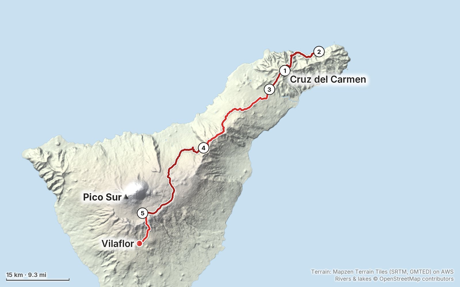
My GPS recording of 5 days, simplified. The numbers are where each day starts; the dot is the finish. The full GPX files and the maps come with the guide.

1234510 km (6.2 mi)N

Elevation, start to finish: highest 7,910 ft (2,411 m), lowest 40 ft (13 m).

Look inside

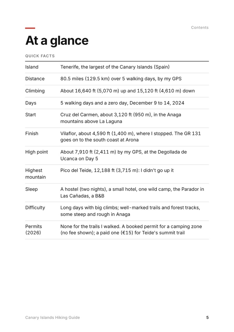
At a glance page from the Canary Islands Hiking Guide
At a glance
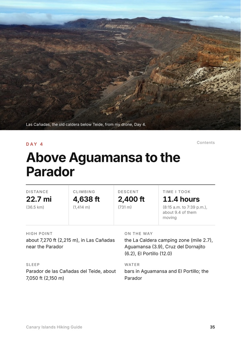
A day page page from the Canary Islands Hiking Guide
A day page
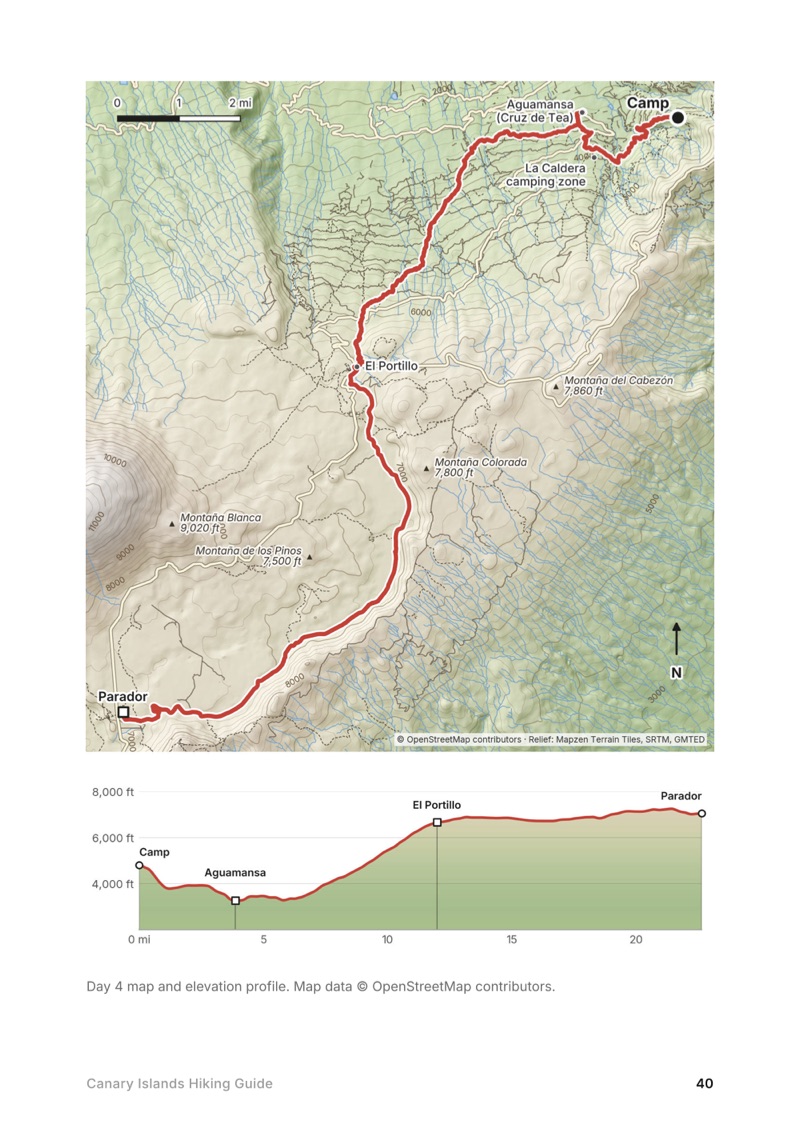
A day map and elevation profile page from the Canary Islands Hiking Guide
A day map and elevation profile
Teide: permits and the cable car page from the Canary Islands Hiking Guide
Teide: permits and the cable car

The details

Format
A 62-page PDF sized for a phone (A5, prints fine too) and a folder of GPX files, in one zip download.
Edition
2027 season edition, updated October 2026.
Delivery
Instant. After you pay you get a private download link. Bookmark it to download again on any device.
Payment
Secure checkout through Stripe, in your own currency. Tax is included in the price, except in the US and Canada, where any sales tax is added at checkout.
Refunds
Not useful? Email me within 30 days for a refund: kraig@kraigadams.com.
Questions
Email kraig@kraigadams.com.

Paying in the Facebook/Instagram app? Tap ⋯ and Open in browser to use Apple Pay or Google Pay.

$19

Questions

Can you walk across Tenerife?
Yes. The GR 131 (Anaga-Chasna) crosses Tenerife for 85.55 km from El Rosario and La Esperanza, through the Corona Forestal and Las Cañadas below Teide, to Arona in the south, with no booking needed. I walked from Cruz del Carmen in Anaga to Vilaflor in five days, about 80.5 miles by my GPS, and stopped there sick, one stage short of the coast.
Can you wild camp on Tenerife?
No. Camping in Tenerife's protected natural spaces and public forests needs an authorization, which means booking one of the Cabildo's camping zones on Tenerife ON (no fee shown in 2026, 7 nights at most per person), and camping isn't allowed in Teide National Park. The Cabildo lists a 400 euro fine for camping in a restricted zone.
Do you need a permit to climb Teide?
Yes, for the last 0.66 km to the summit (trail 10, Telesforo Bravo). Book it on Tenerife ON; since January 19, 2026, slots between 9 a.m. and 5 p.m. cost 15 euros for visitors. A night at the Refugio de Altavista, reopened in July 2026, includes an early-morning summit permit.
How much is the Teide cable car?
In 2026 a return ticket is 42 euros for visitors (23.50 one way). From October 25 to December 31 the last ride up is at 4 p.m. It closes in strong wind, and the ticket doesn't include the summit permit.
Is there water on the GR 131 on Tenerife?
Not reliably between La Esperanza and El Portillo: the taps at picnic areas and camping zones are often marked not drinkable. Fill up in La Esperanza and Aguamansa and carry 2 to 3 liters.
When is the best time to hike across Tenerife?
By AEMET's averages, March to May and October to early November. December to February brings rain and cloud in Anaga and frost, snow and wind up high; summer is hot in the south and the season of highest fire risk.

More guides

All guides
GR221, Mallorca, Spain

Mallorca, Spain

GR221

5 days · 88 miles · refuges or camping

The Dry Stone Route across Mallorca's mountains, from Port d'Andratx to Pollença.
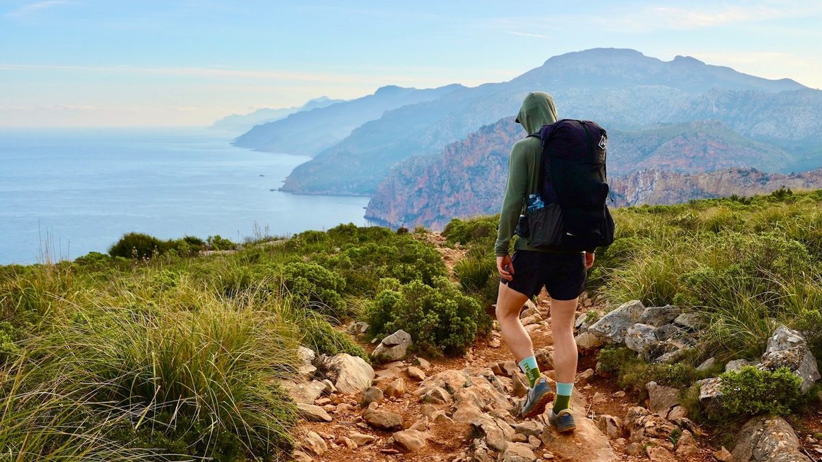
  • All five days
  • A map and elevation profile for every day
  • GPX files
  • Water

See the guide: GR221 · $19

Azores, São Miguel, Flores and Corvo, Portugal

São Miguel, Flores and Corvo, Portugal

Azores

5 hikes · 47.3 miles · Azores

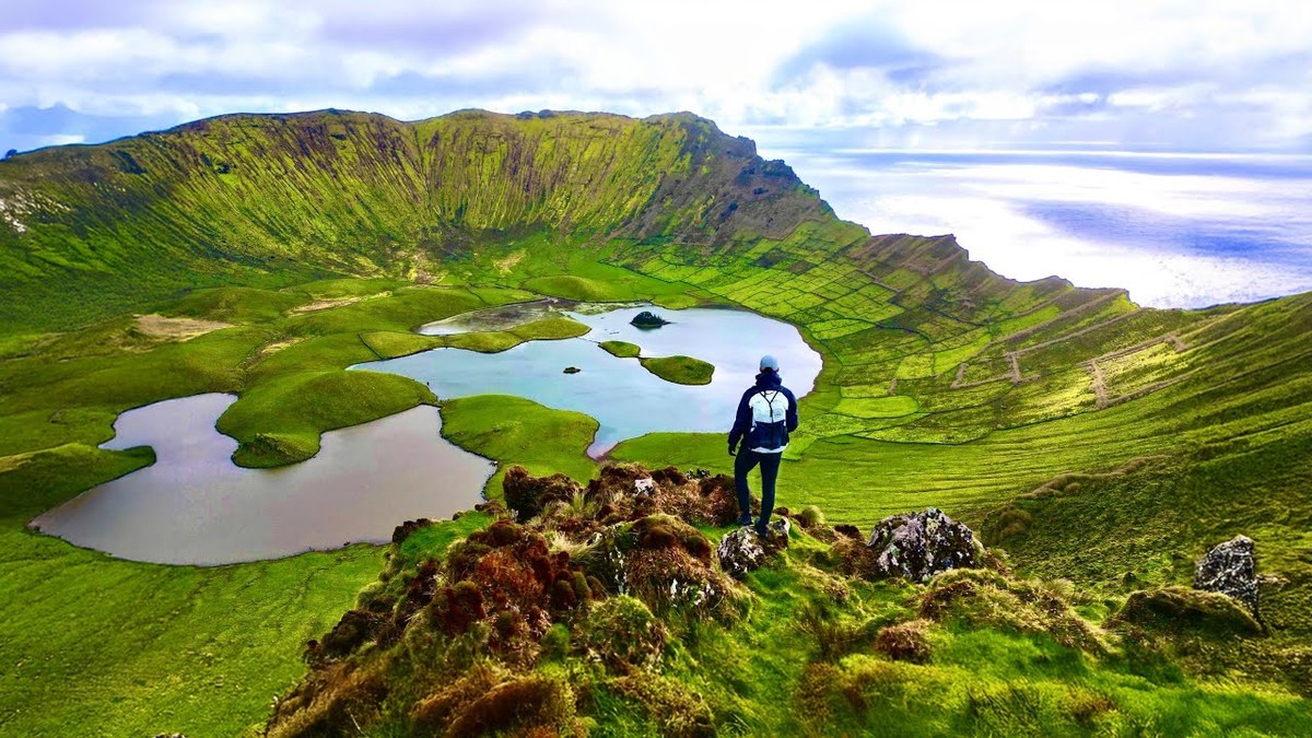
Five hikes on three Azores islands in a week: the Sete Cidades crater rim on São Miguel, the Grande Rota das Flores on Flores in three days, and the Caldeirão on Corvo.
  • Where things stand
  • All five hikes
  • My GPX files
  • Islands, flights and ferries

See the guide: Azores · $19

Skye Trail, Isle of Skye, Scotland

Isle of Skye, Scotland

Skye Trail

4 days · 82 miles · wild camping

The length of Skye, from Rubha Hunish over the Trotternish ridge to Broadford.

  • All four days
  • My GPX files
  • Wild camping, explained
  • Getting there without a car

See the guide: Skye Trail · $19

Get the next guide

I'm making guides for more of my hikes, and I host a group trip about once a year. Get an email when a new guide or trip is out. A few emails a year.