The Skye Trail film: Isle of Skye, Scotland

Isle of Skye, Scotland · 4 days · 82 miles

Skye Trail Hiking Guide

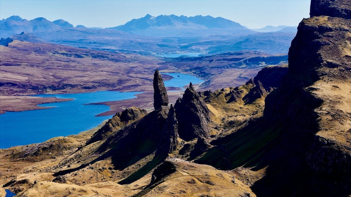
4 days along the length of Skye.

Watch the film · 128K views
Free sample
  • 128K YouTube views
  • Instant PDF + GPX
  • 30-day refund
  • Free updates

Look inside

Real pages from the guide. Tap one to see it big.

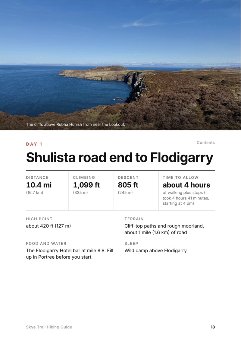
  • A day page page from the Skye Trail Hiking Guide
    A day page
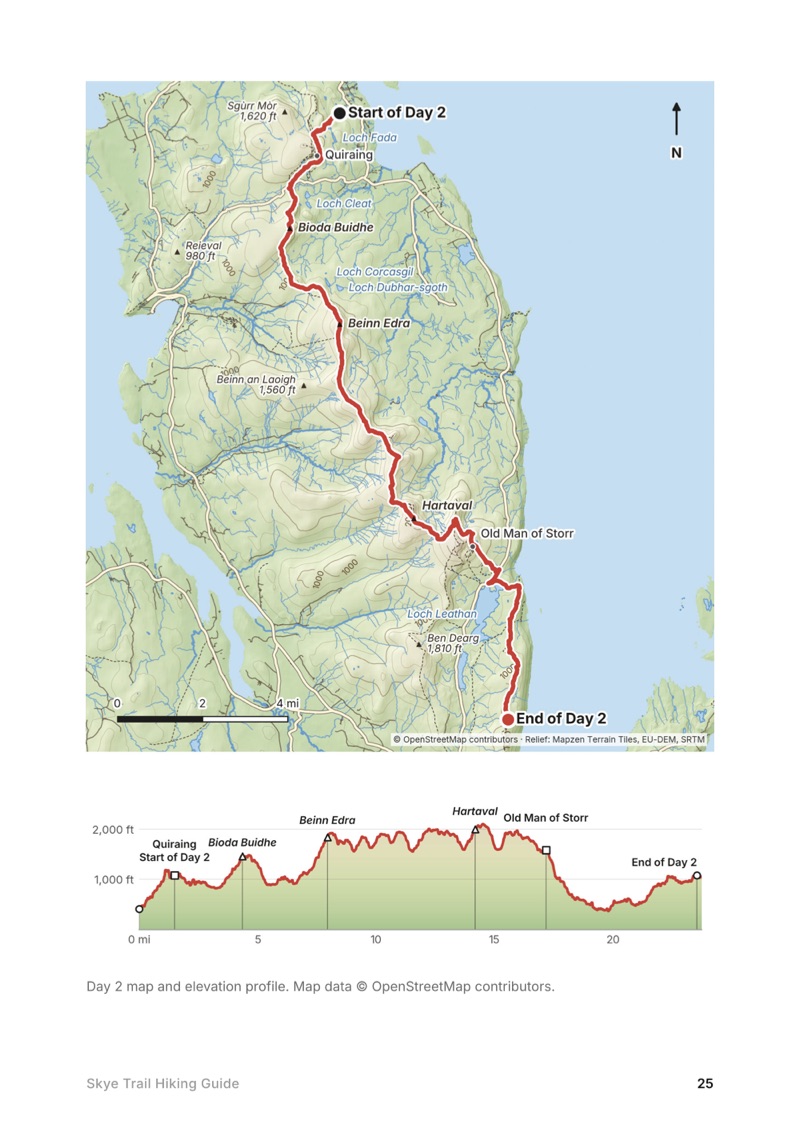
  • A day map and elevation profile page from the Skye Trail Hiking Guide
    A day map and elevation profile
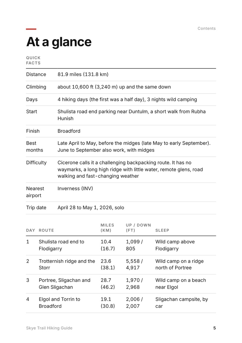
  • At a glance page from the Skye Trail Hiking Guide
    At a glance
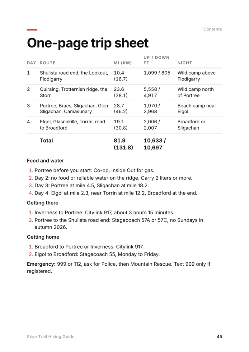
  • The one-page trip sheet page from the Skye Trail Hiking Guide
    The one-page trip sheet

Swipe for more pages

Get Day 2 free

The route

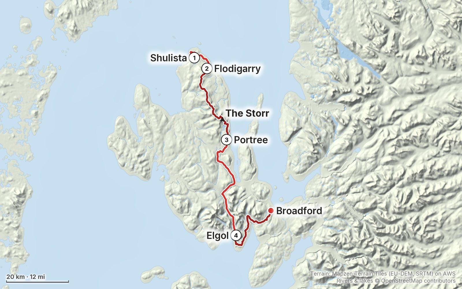
My GPS recording of 4 days on a relief map. The numbers are where each day starts; the red dot is the finish. The full GPX files and the day maps come with the guide.

Relief map of the Skye Trail route: 4 days drawn in red with numbered day starts, labelled Shulista, Broadford, Flodigarry, The Storr, Portree and Elgol.
1Day 2Day 3Day 4Highest 2,110 ft (642 m)

Elevation, start to finish: highest 2,110 ft (642 m), lowest sea level.

Map data: Terrain: Mapzen Terrain Tiles (EU-DEM, SRTM) on AWS · Rivers & lakes © OpenStreetMap contributors

At a glance

Days
4 days
Distance
82 miles
Climbing
About 10,600 ft (3,240 m) up
Season
Late April to May, before the midges
Route
Shulista road end parking near Duntulm to Broadford

What's inside

  • All four days. Stats, my notes, the trail, where to get off, a map with an elevation profile, and links to that day in my film.
  • My GPX files. My own recordings for each day and the full route, with waypoints, ready for AllTrails, Gaia GPS, Garmin or Organic Maps.
  • Wild camping, explained. The Scottish Outdoor Access Code in plain terms, where I slept each night, and the bothies, campsite and beds on the route.
  • Getting there without a car. Citylink and Stagecoach buses from Inverness to Portree and the start, and back from Broadford, with 2026 times.
  • Food and water. Where to eat and resupply, with the mile on my route, and why you need to carry water on the ridge.
  • Other ways to do it. A 7-day plan and a 2-day ridge-only plan built from my GPS line, clearly marked as options I didn't walk.
  • What I carried and paid. My full 2026 kit list and the costs from my trip.
  • Before you go and a trip sheet. One page of year-to-year checks and a printable one-page summary of the whole trip.

About this trip

I hiked about 80 miles alone on the Skye Trail in Scotland from April 28 to May 1, 2026, from Rubha Hunish at the northern tip over the Trotternish ridge, through Portree and Glen Sligachan, to Broadford. I wild camped three nights and followed my own line, including a road finish from Torrin. This guide has my GPS files, maps and notes for every day, plus the buses, camping rules and food stops you need to plan your own trip.

Watch the film on YouTube (128K views).

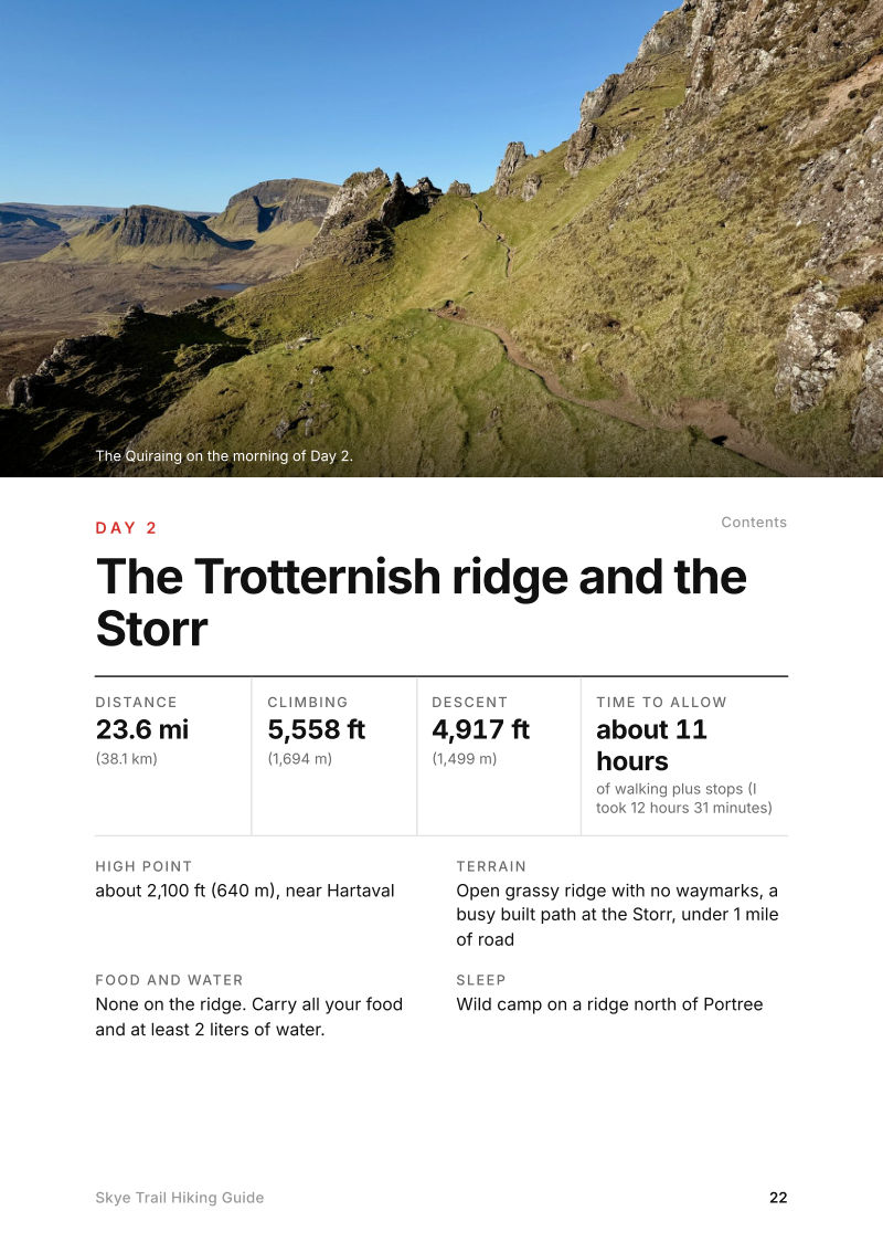
The Day 2, The Trotternish ridge and the Storr page from the Skye Trail Hiking Guide

Free sample + packing list

Try Day 2 free, plus my packing list

The Trotternish ridge and the Storr

The whole day page from the guide as a PDF, plus my camping packing list: the 42 things I carry, with a note on each, and this route's own list on top. The PDF opens right away and both come by email. You'll also get my emails about new guides and trips, a few a year.

The details

Format
A 46-page PDF sized for a phone (A5, prints fine too) and a folder of GPX files, in one zip download.
Edition
2027 season edition, updated September 2026.
Delivery
Instant. After you pay you get a private download link. Bookmark it to download again on any device.
Payment
Secure checkout through Stripe, in your own currency. Tax is included in the price, except in the US and Canada, where any sales tax is added at checkout.
Refunds
Not useful? Email me within 30 days for a refund: kraig@kraigadams.com.
Questions
Email kraig@kraigadams.com.

Paying in the Facebook/Instagram app? Tap ⋯ and Open in browser to use Apple Pay or Google Pay.

$19

Questions

How many days does the Skye Trail take?
I did it in four, and the first was really a half day. Most people take about a week: the Cicerone guidebook splits the Skye Trail into seven stages.
When is the best time to hike the Skye Trail?
Late April to May, before the midges come out from late May to early September. I went April 28 to May 1, 2026 and had dry weather, but it's usually a wet hike with rain and fog.
Where do you sleep on the Skye Trail?
Mostly in a tent. Scotland allows responsible wild camping under the Scottish Outdoor Access Code, and I camped three nights. There are beds in Portree, a campsite and hotel at Sligachan, more in Broadford, and two free bothies on the route.
Can you hike the Skye Trail without a car?
Yes. Citylink bus 917 runs from Inverness to Portree, and Stagecoach buses 57A and 57C loop around the north of Skye past the start at the Shulista road end. From Broadford, the 917 goes back to Portree and Inverness.
Is the Skye Trail waymarked?
No. It's an unofficial route with no signs or waymarks of its own. You follow paths, open ridge and glen, and roads, so carry GPX files, offline maps and a paper map and compass.
More guides

All guides
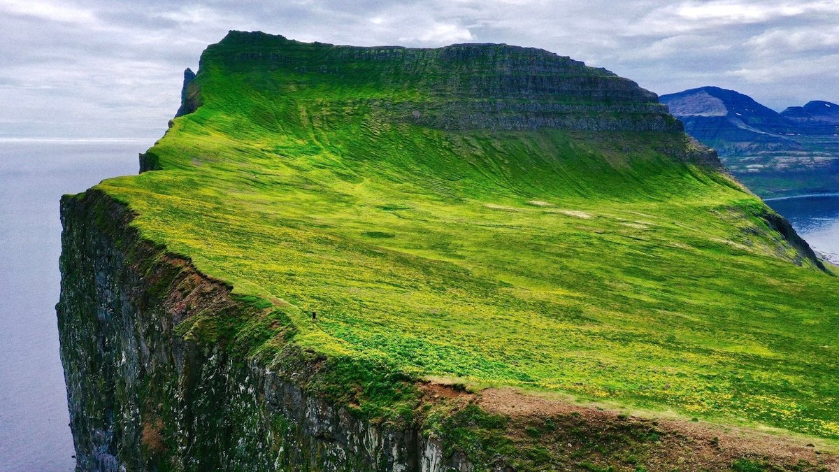
Hornstrandir, Westfjords, Iceland

Westfjords, Iceland

Hornstrandir

4 days · 58 miles · tent and two boats

Across Iceland's Hornstrandir reserve from Hesteyri past Aðalvík, Fljótavík and Hornvík to the Hornbjarg cliffs and Veiðileysufjörður.

  • All four days
  • My GPX files
  • The boats
  • The reserve rules and campsites

See the guide: Hornstrandir · $19

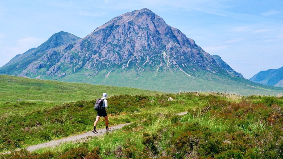
West Highland Way, Scottish Highlands, Scotland

Scottish Highlands, Scotland

West Highland Way

4 days · 96 miles · solo, plus Ben Nevis

The West Highland Way from Milngavie to Fort William: Loch Lomond, Glen Falloch, Tyndrum, Bridge of Orchy, Rannoch Moor, the Devil's Staircase, Kinlochleven and the Lairigmor, then Ben Nevis by the Carn Mor Dearg Arete.

  • All four days, plus Ben Nevis
  • My GPX files
  • Where to sleep
  • Getting there and home

See the guide: West Highland Way · $19

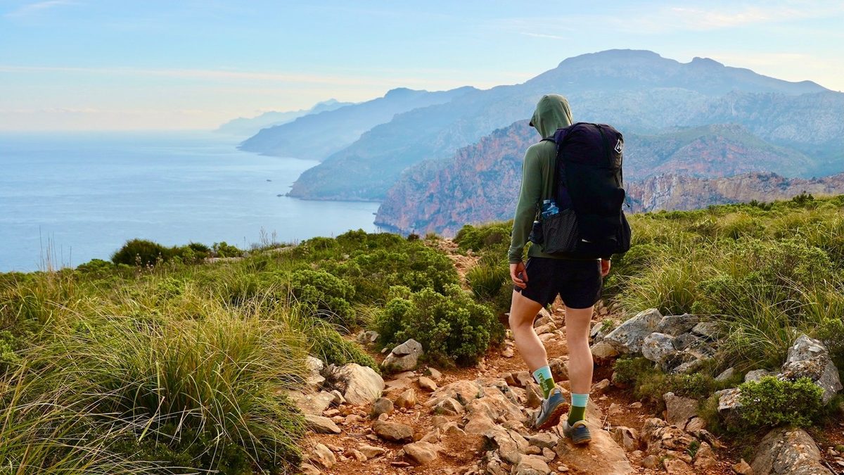
GR221, Mallorca, Spain

Mallorca, Spain

GR221

5 days · 88 miles · refuges or camping

The Dry Stone Route across Mallorca's mountains, from Port d'Andratx to Pollença.

  • All five days
  • A map and elevation profile for every day
  • GPX files
  • Water

See the guide: GR221 · $19

Get the next guide

I'm making guides for more of my hikes, and I host a group trip about once a year. Get an email when a new guide or trip is out. A few emails a year.

Skye Trail Hiking GuideInstant PDF + GPX