How I make animated hiking route maps from my own GPS tracks
Claude and I turn my GPS tracks, open terrain data and clips from my films into split-screen route map videos. How they're built and how they're doing.
I make long films about hiking alone, mostly for YouTube. This fall I'm giving about 250 of them a second life as short vertical videos on every platform, with Claude, Anthropic's AI model, and KraigOS, the system we built to track my projects, footage and posts.
The format doing the most work is the animated route map. When I posted one on X, the post said the maps "aren't from an app. They're custom made from my own GPS tracks laid over terrain data." Why bother? As I put it on October 5: "It'll drive discovery to long form videos. And then it'll also serve as ads for the hiking guides."
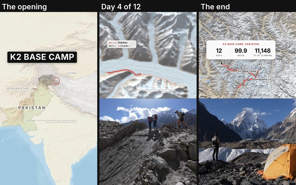
Where it started: one test reel from Hornstrandir
On September 29, Claude made three test reels, each copying a format that worked for other creators. One, from my four days alone in Hornstrandir, Iceland, opened on a route map, then cut to the trail. I asked: "Maybe the map should animate on the top split screen while the day footage plays out below?"
Claude rebuilt it that way, and it took off. On October 2 I said: "I think we should for sure develop and make those map animation with footage of the hike shorts."
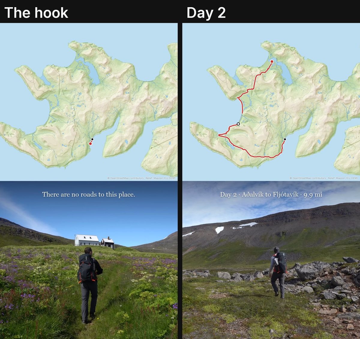
What goes in
- My GPS tracks, one file per day, from each route's hiking guide: the red line, and the miles and elevation on screen.
- Terrain: free elevation data (Terrain Tiles on AWS) shaded on my Mac, with water from OpenStreetMap and borders from Natural Earth, credited on every frame. On the Salkantay Trek the camera starts on South America and ends close in on Machu Picchu.
- The film's shot log: Gemini, Google's AI model, has logged every moment of my films, with a quality score and a transcript.
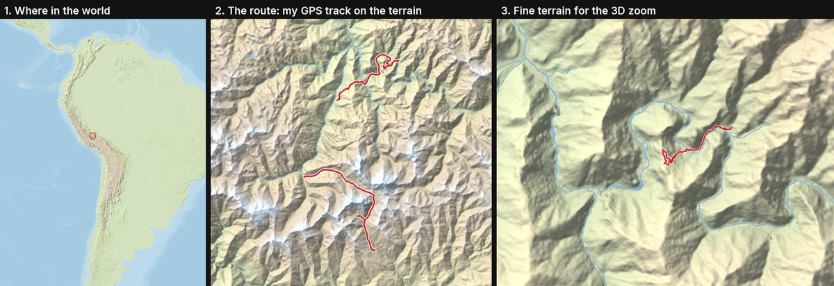
How one map video is made
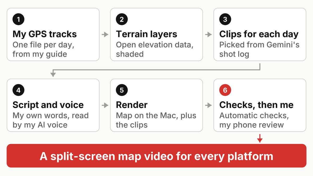
- Clips. Claude picks each day's clips from the shot log.
- Script and voice. The narrated version only uses things I actually said, each line with its source. An AI copy of my voice, made with Artlist's voice tool, reads it, and Whisper times the captions.
- Render. A Python program Claude wrote draws the map like a 3D game, and ffmpeg joins it with the clips. A small card shows what I asked for: "cumulative mileage that ticks up as we go along, as well as the current elevation of the dot."
- Checks, then me. I watch it on my phone and say what's wrong. Almost every change here started as one of those notes.
From first draft to version 3: the route is the hero
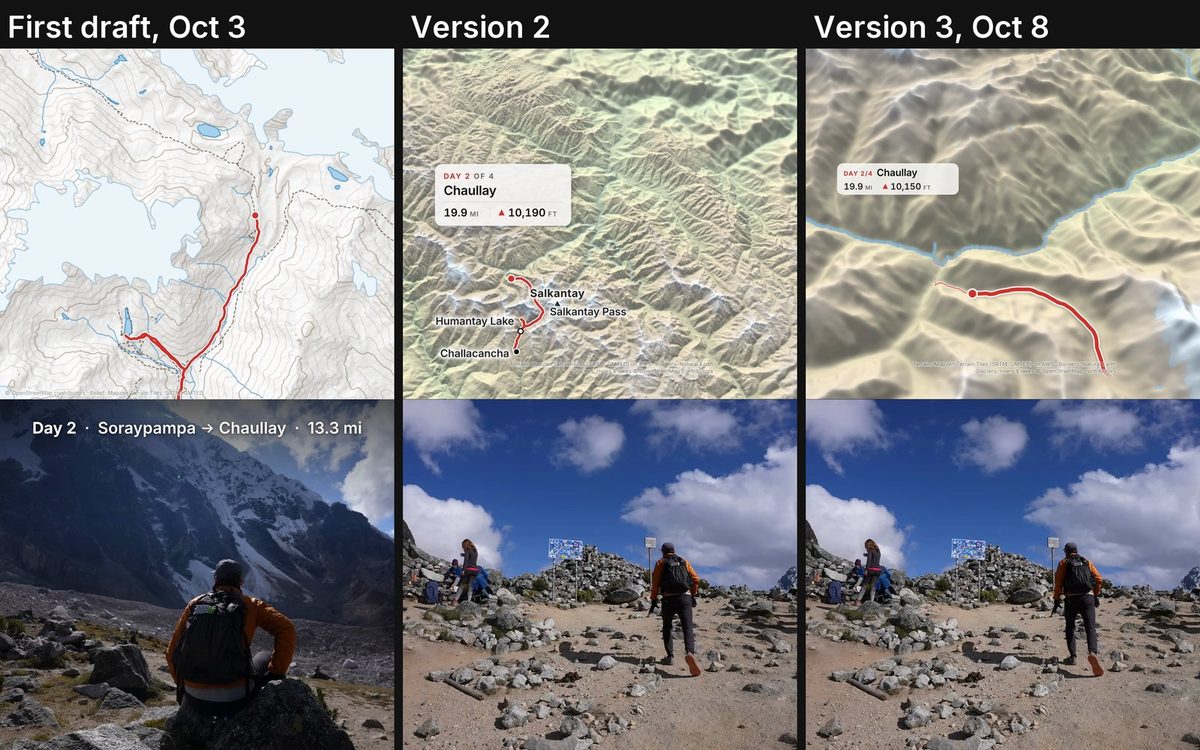
The first eight drafts were ready on October 3, on a flat map zoomed in tight on each day. My review: "The map is too zoomed in. It starts too quickly and I can't tell where we are." I asked for a music-only version and one with a "Kraig VO talking with more context," and "slow movement that is smooth, maybe 3D when it makes sense."
Version 2 came the same day, starting with K2 Base Camp: the country, then the whole route, with slow camera moves. I called both K2 versions "really good."
By October 8, on Salkantay, it had gone too far the other way: "the map just seems so zoomed out and I kind of wish we had more of a focus on the route." I also wanted "some kind of map zoom in animation for the Machu Picchu area."
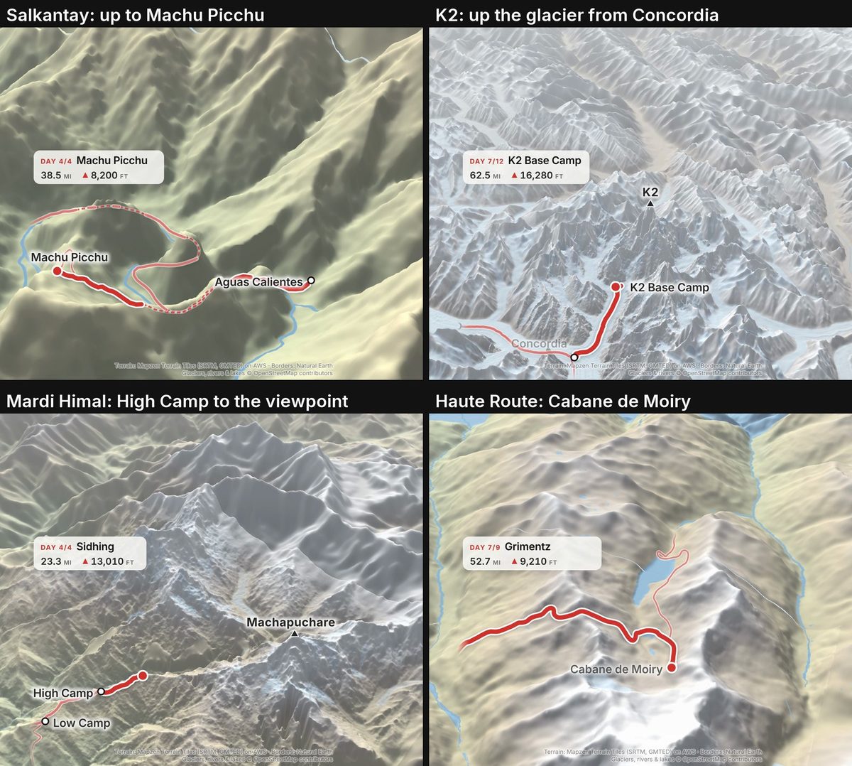
Version 3 makes the route the hero. The camera follows the line closely, and each route gets one 3D moment, a tilted fly-around of the place that matters most. My reaction: "That animation style for the Salkantay track is like awesome... we should start doing the zoom ins... for all of them." That afternoon Claude made it for the other routes, and I approved six: the Haute Route, Mardi Himal, Three Fingers Lookout, K2, Big Bend and the Peaks of the Balkans.
Four fixes that became automatic checks
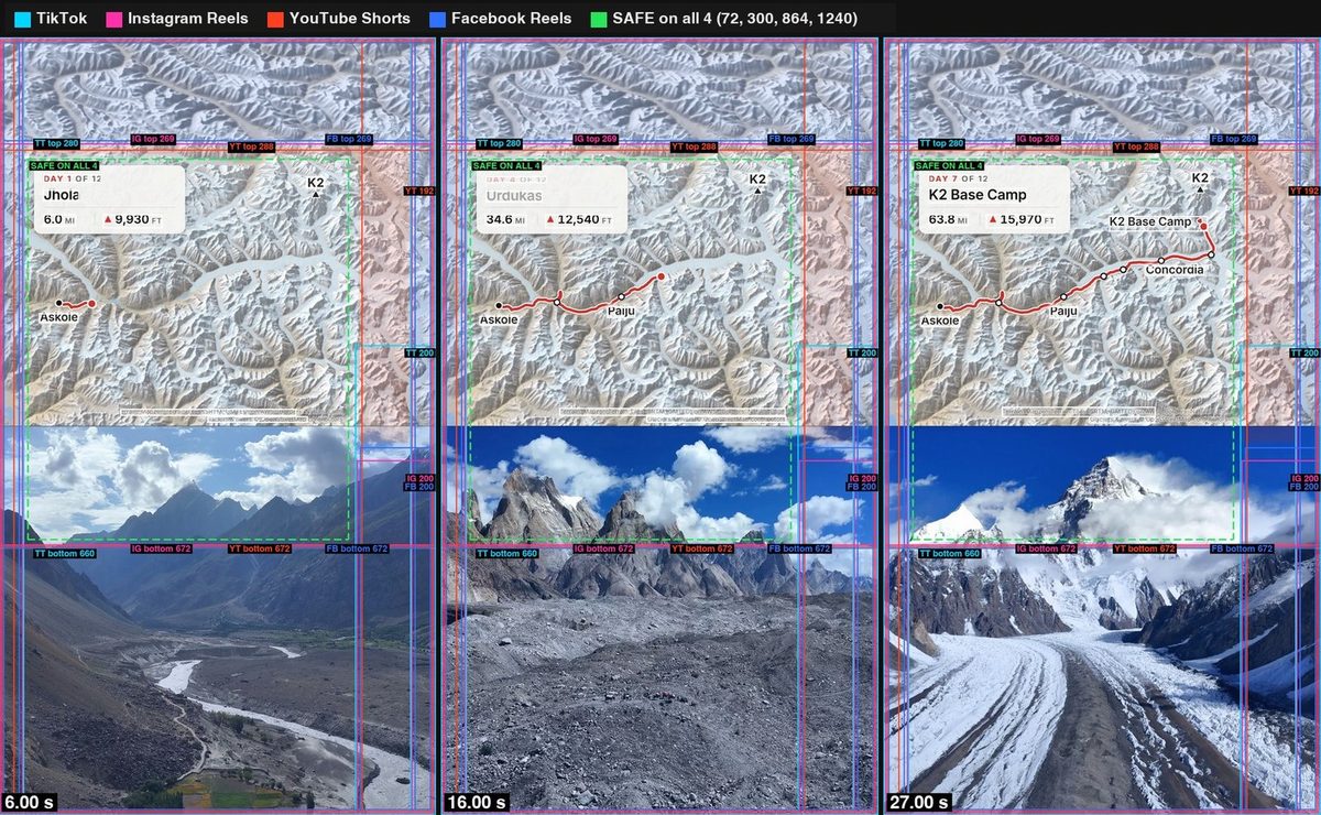
- Nothing under the buttons. On TikTok, the app's buttons covered parts of the first K2 videos: "You need to take into account the blocks of where you can post content without it overlapping anything. And you should do that for each social media platform." Everything readable now sits in the one rectangle that's clear on all four apps.
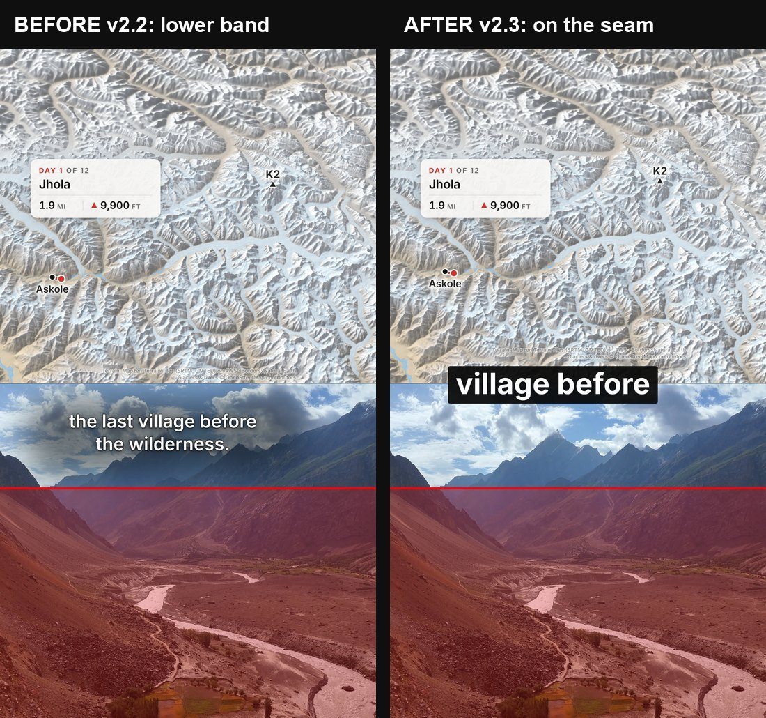
- Captions on the seam. Then TikTok's caption covered the narrated captions: "TikTok showing text over my video text, which is not good." I sent Claude another creator's reel as an example: "Clean text captions in the middle between frames looks better." Now captions are two to four words on the seam.
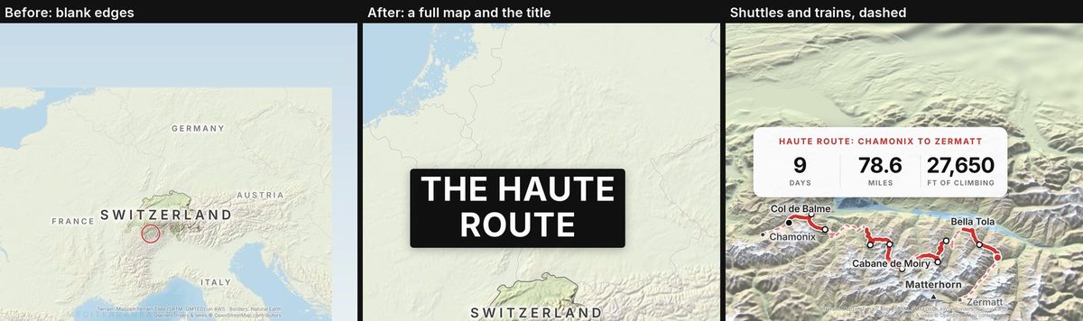
- No blank edges, and a title first. In the Haute Route opening, the map ran past the edge of the terrain: "there shouldn't be any like negative space outside of the map area." Now a check scans for blank strips. I also asked for "the title of the hike as like a hook and then a full screen of the zoomed out map and it zooms in." They all open that way now.
- Honest lines. As my Haute Route guide says, I rode some of it, so the line is solid where I walked and dashed where I rode.
Openings I tried and dropped
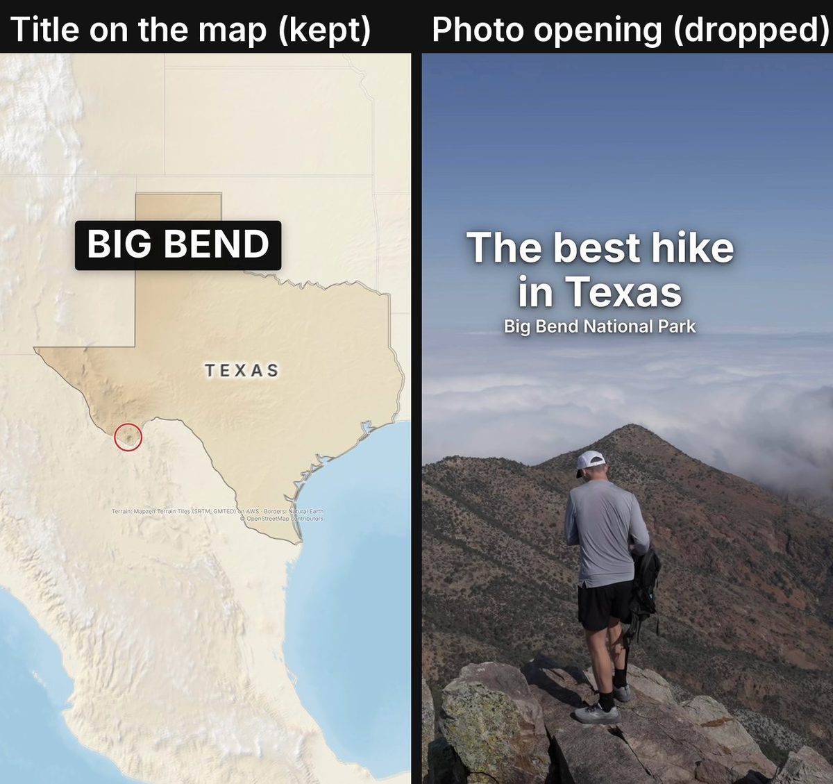
I wondered if the map is the best first image, or "if it's like the most striking visual with the name of the hike, just like clean, like white on the image with no backdrop." For Big Bend, Claude opened on my best shot, with "The best hike in Texas," then the map. My verdict: "The uh, Big Bend update is bad. I don't like it." The title on the map stays.
Acatenango, a volcano in Guatemala facing the erupting Fuego, was the hard one. Version 3 was "not angled well," so version 4 tilted the camera, on Sentinel-2 cloudless satellite imagery by EOX (CC BY 4.0). On TikTok it stopped at about 1,000 views, and the next day I said: "I think the Acatenango reel just isn't that good."
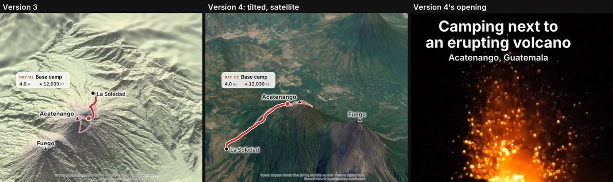
So we dropped the map for that one and rebuilt it as one shot of Fuego, the way the top Acatenango videos do it. The full story: I studied 700 Acatenango videos to remake one short.
How the map videos are doing
Views as of October 11:
- Hornstrandir (music only, 22 seconds): 158,000 views on Facebook in ten days and 109,000 on Instagram in a week. Split-map reels were the strongest new format on my Facebook Page: What 201 Facebook reels taught me.
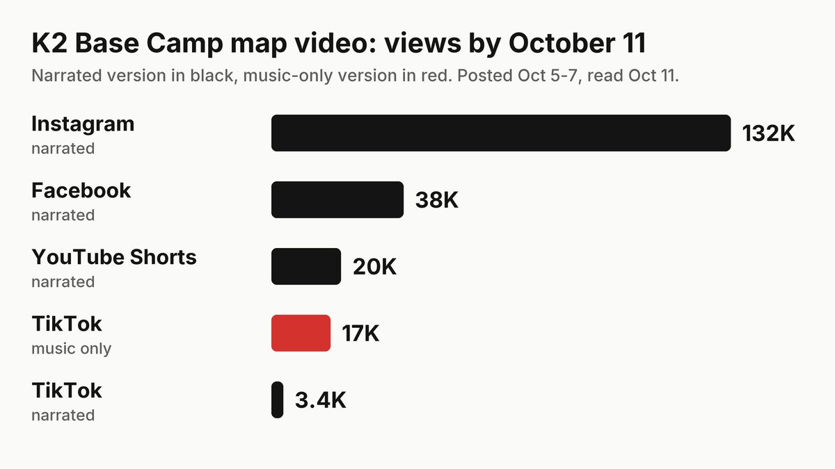
- K2 Base Camp: narrated, 132,000 on Instagram but only about 3,400 on TikTok. The 42-second music-only one reached 17,000 on TikTok, my first TikTok post to break out.
Posting depends on the platform: "With TikTok, we can post whatever... It's low risk. But with YouTube, it's a little higher risk. With Instagram, it's the highest of risk." So TikTok and Facebook can take map videos back to back; Instagram and YouTube Shorts mix in other formats.
What I learned
- People come for the route. The best single change was following the line.
- Narration depends on the platform. The narrated K2 did best on Instagram; on TikTok, the music-only one got five times the narrated one's views.
- Test ideas. My photo opening lost when I watched it, and for a volcano erupting at night, the footage beat the map.
- Being open about AI is easy when the inputs are real: my GPS track, real elevation data, and an AI voice that only says what I said.
What's next
- Post what's approved. The version 3 videos are next in line: music-only first on TikTok, narrated on Instagram.
- A pause on new versions. On October 8 I said: "We've been working with these map style shorts for a while, but like I said, I want to switch up the format." New narration waits for a better copy of my voice, trained with ElevenLabs.
- Shorter cuts when they restart: 30 to 45 seconds, the length that has done best on Facebook and TikTok.
- Research first. If the Acatenango remake beats its map version, other routes get the same study.
FAQ
What app makes these animated route maps?
None. Claude wrote a Python program that draws the map on my Mac from my GPS tracks and free elevation data, then joins it with my film clips using ffmpeg.
Is the voice in the narrated versions really you?
It's an AI copy of my voice, made with Artlist's voice tool. It only reads lines I said in my films or wrote in my guides.
Which platform do map videos do best on?
So far, Facebook and Instagram: Hornstrandir passed 150,000 views on Facebook, and the narrated K2 reached 132,000 on Instagram. On TikTok, music-only did far better than narrated.
Can I get the GPS tracks?
Yes. Each route's hiking guide includes my GPS files, one per day.