
Notes · October 2026
The hiking guides
- Hiking
- AI
- Notes
- Guide
My hiking guides: one for the routes in my films, day by day, with my GPS files. Every guide is free to read.
I make them with AI, from my own films, GPS recordings and notes, and keep them accurate season to season. How that works is below.
Highlights
Story · October 9, 2026
How I make my hiking guides with AI, from my own films and GPS
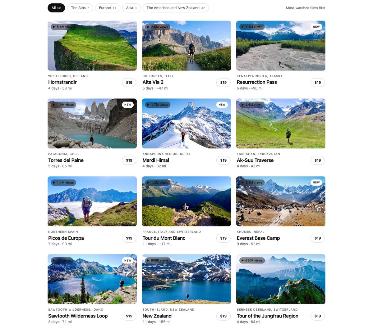
My 58 hiking guides are built with AI from my own films, GPS tracks and notes, checked by a second AI, and sold as PDFs with GPX files of each route.
Read it all 8 min
I make long films about hiking alone, mostly for YouTube: about 250 over ten years, from the Dolomites to Patagonia to the Karakoram. People often ask in the comments how to do the hike themselves. This fall I started answering with a guide for each route, built with AI, first Codex and now Claude, from things that already existed.
How it started, in my own words
Making hiking guides was always the plan, and I'd tried a couple of times without it really working. Most recently I made guides on Gumroad, Substack and Patreon, and had a little success with those, mostly because my Alta Via 1 video was taking off on a few social platforms, so there was traffic going there. I made a bunch of sales.
Then, in the airport about to head out to Norway, I realized how good AI, specifically Codex, was at making the guides for me and gathering my information to build them: my AllTrails recordings, my itinerary, everything I'd said in the videos. So I set it loose to make one good guide, and I realized I could eventually do this for close to 50 of them. It took a good month to get them all to a point where I liked them, and maybe another week to build out the website and the payment workflow and everything that goes with selling guides. The guides are one of the main reasons I have a website now.
It felt really good. I was pleasantly surprised at how good the first guide came out, and that made me realize there was a lot of potential for this to be a real product. So much of the selling and marketing could be automated too, which excited me. But I've done the hard work: going on these hikes, capturing the photos and videos, recording the AllTrails activity, making the behind-the-scenes sections of the videos where I talk about my experience. There's a lot of unique, valuable information in these guides. AI let me organize it in one clean format and add the missing pieces and helpful things I wouldn't have thought of. If I make a hiking guide on my own, it's usually just from my perspective, but a lot of other people out there trying to do these hikes would get something different from a guide made for them. I think it's a really good product, and I plan to keep improving it.
How a guide gets made
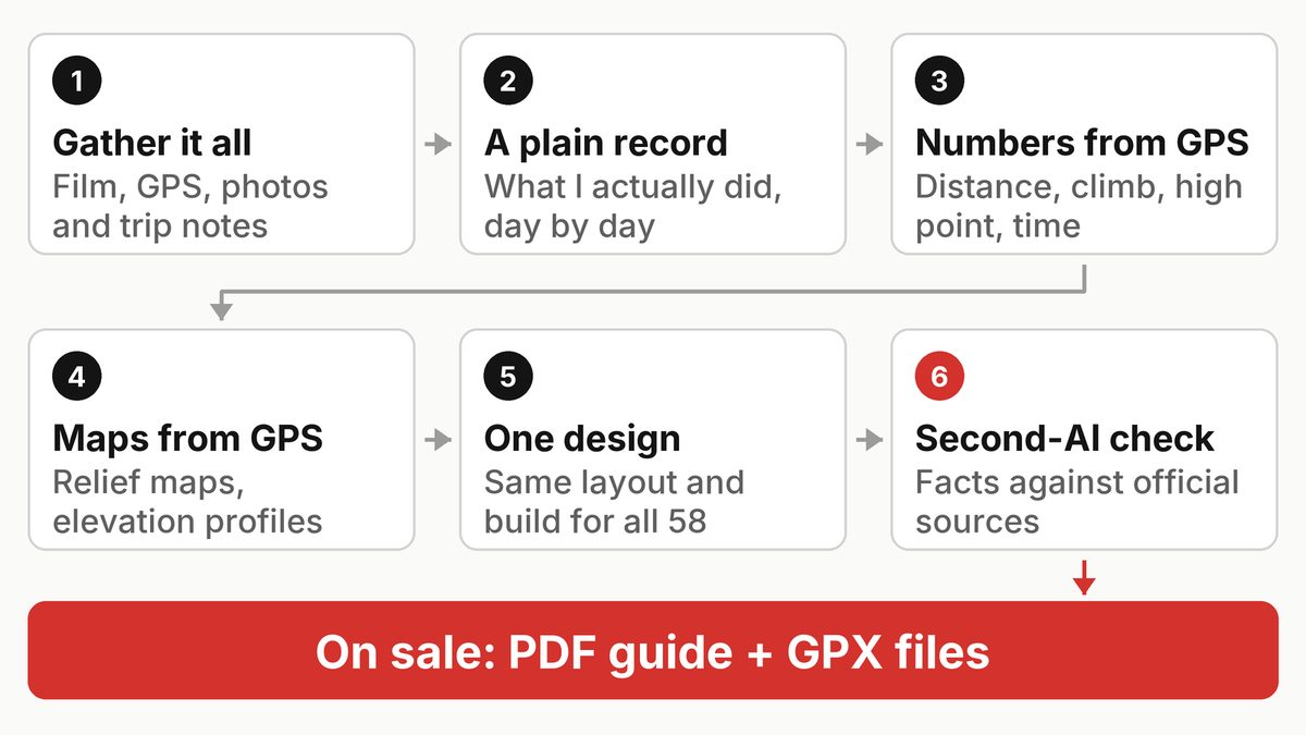
AI gathers what already exists (my film, my AllTrails GPS recordings, my photos, the film's description and my trip notes) and writes a plain record of what I actually did, day by day. Then it works out the numbers and draws the maps from my GPS, builds the guide in one shared design, and a second AI checks it. It goes on sale as a PDF, with my GPX files in the same download.
The rule: only my own trip
When we rebuilt my old Alta Via 1 write-up as a proper guide, Claude asked me for twenty minutes of new input, like which hut I liked best. I said no: "I've already given personal accounts in my YouTube videos, and I want these guides 100% built with AI now."
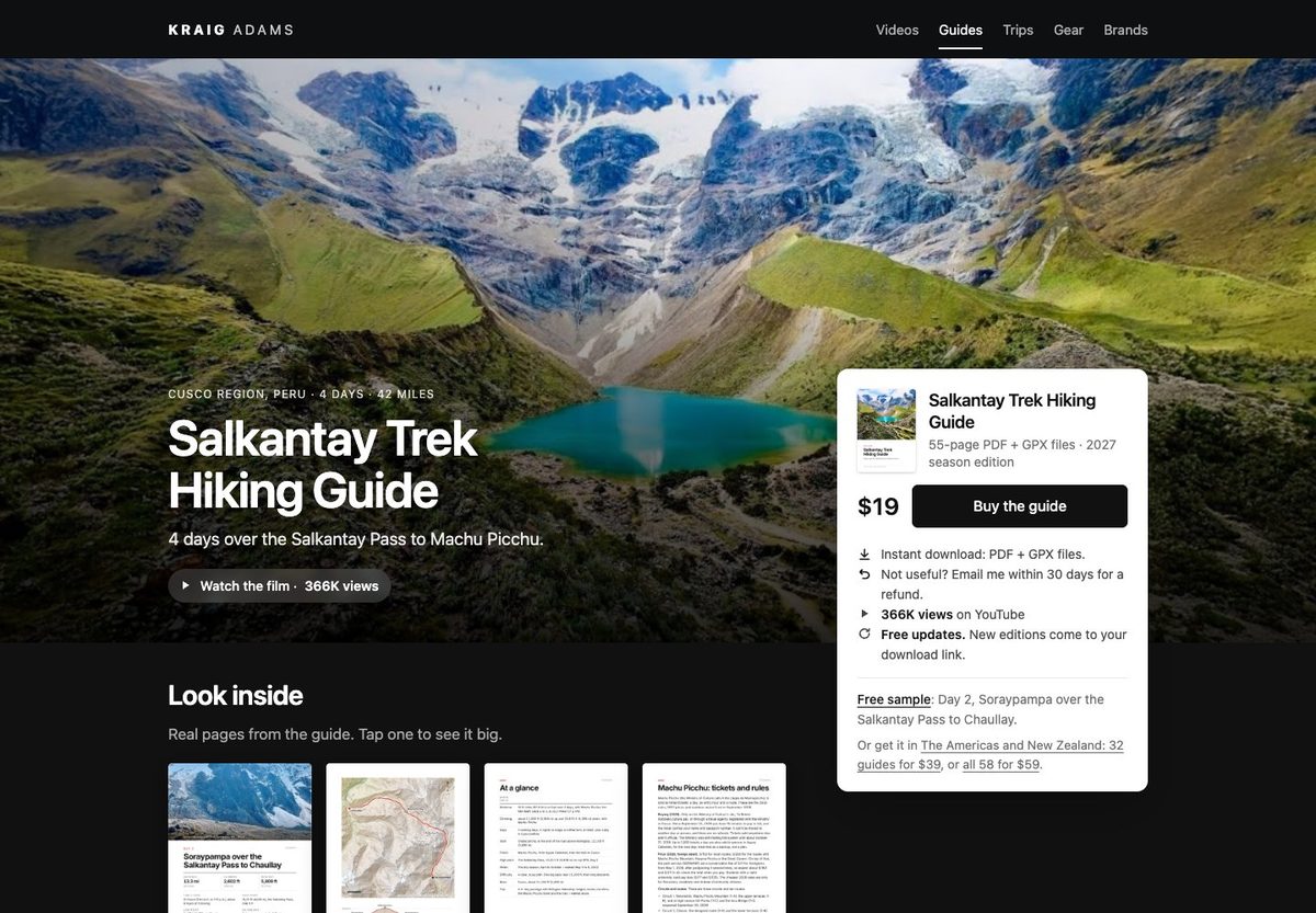
So my voice comes only from what I've already said or written: my films, their descriptions, my old write-ups, my GPS, photos and receipts. Claude never invents an opinion, a rating, a meal or a feeling. When a guide says "I," I did it. The record also fills gaps: on the Salkantay Trek (the film) my GPS and the map data named the shuttle drop-off I never knew, Challacancha.
The same rule picks the routes. Claude ranked my films in KraigOS, the database we built to run my work: most-watched first, but only routes I walked with my own GPS. So the list opens with Hornstrandir in Iceland, and there's no Kilimanjaro guide: in that film I turned back before the summit.
Numbers and maps from my GPS
Every distance, climb and high point is worked out from my GPS files the same way, with the elevation smoothed so small wobbles don't count as climbing. Apps count differently: for Lofoten (the film), AllTrails shows about 20,500 feet of climbing, and the guide says about 17,900 and explains why. GPS has limits too: on the K2 Base Camp trek (the film), my GPS read lower than published sources at the Gondogoro La, so the guide gives both and says to plan for the higher one.
The GPX files, one per day plus the whole route, work in AllTrails, Gaia GPS, Garmin or Organic Maps, with timestamps stripped.
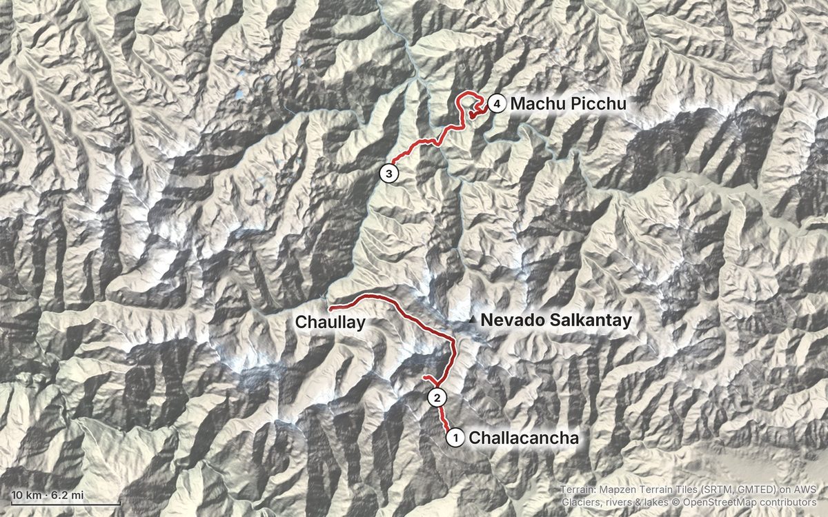
A script draws every map: my GPS line over open elevation data (Mapzen's Terrain Tiles), with lakes, rivers and peaks from OpenStreetMap. Each day's elevation profile shows where the climb is before you start it.
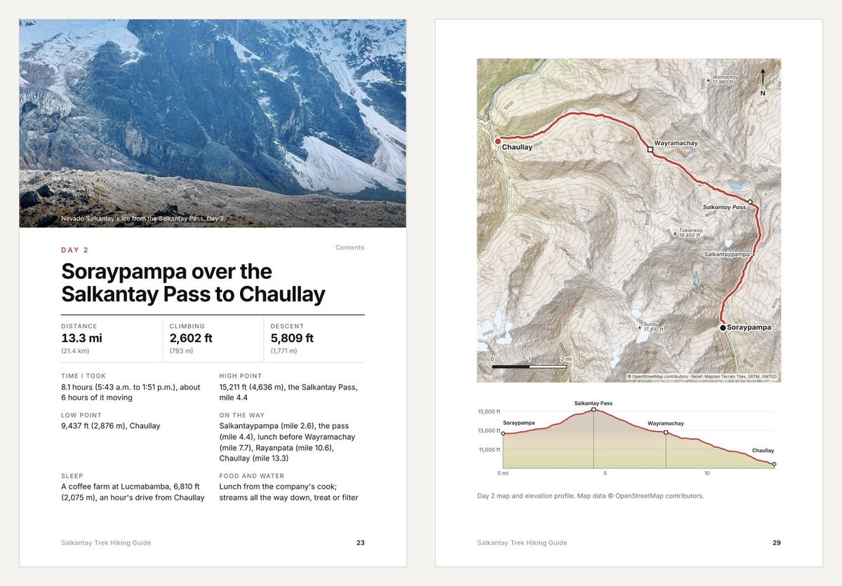
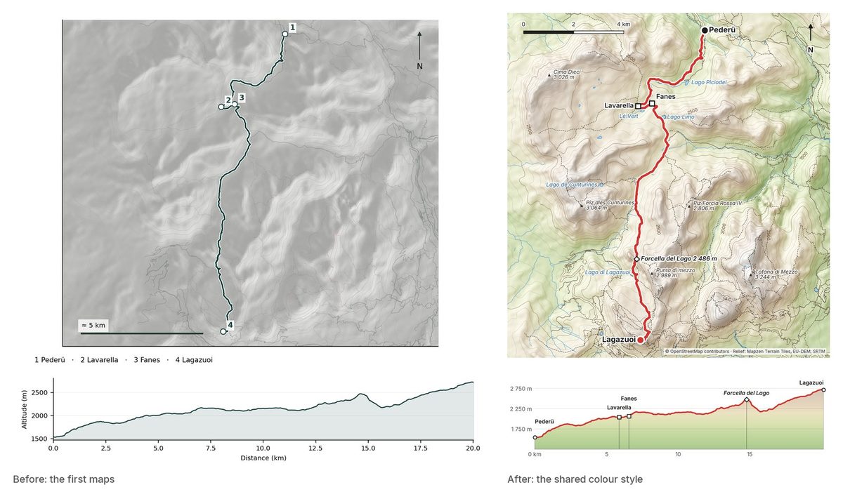
The first maps were, in my note at the time, "grey and boring," so every map was redrawn in one colour style with the route in red, the same relief as my animated map videos.
One design for every guide
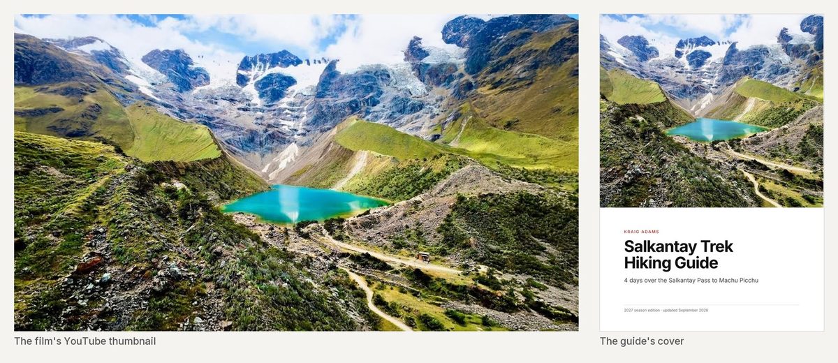
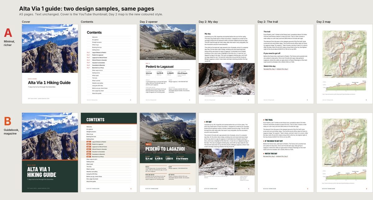
My note on the first draft: the content was pretty good, but it "could be designed nicer and have better and more photos." Claude laid out the same pages two ways, and I picked the minimal one: white, black and grey with one red, from the Alta Via trail signs. The cover is always the film's YouTube thumbnail.
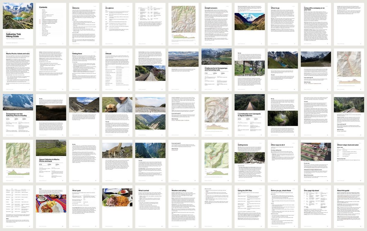
Every guide has the same parts:
- Up front: the trip at a glance and straight answers to the five planning questions Claude found in the comments on my two Alta Via 1 films (narrated and ambient): how many days, when to go, how to get beds in the huts, am I fit enough, and what will it cost.
- Each day: a big photo, the day's numbers, what happened in my words, and links to that day in my film.
- At the back: what I carried, how to load the GPX files, a dated list of things to check before you go, and a trip sheet to print.
One build script makes every PDF, so a layout fix for one guide fixes all 58.
A second AI checks the first
Before a guide goes on sale, a separate Claude session that didn't write it checks every fact that could change against official sources and every number against the GPS. Newer guides also get a pass from Google's Gemini. On the Salkantay guide it caught:
- A closing time. The Machu Picchu sanctuary entry at Hidroeléctrica, on Day 3, closes at 4:30 p.m. (the park service), so a slow walker could arrive too late. The guide says so now.
- Words I never said. A draft had me calling Machu Picchu "one of the most unique places I've been." In the film I said "you got to visit this spot, it's really unique." The guide uses my words.
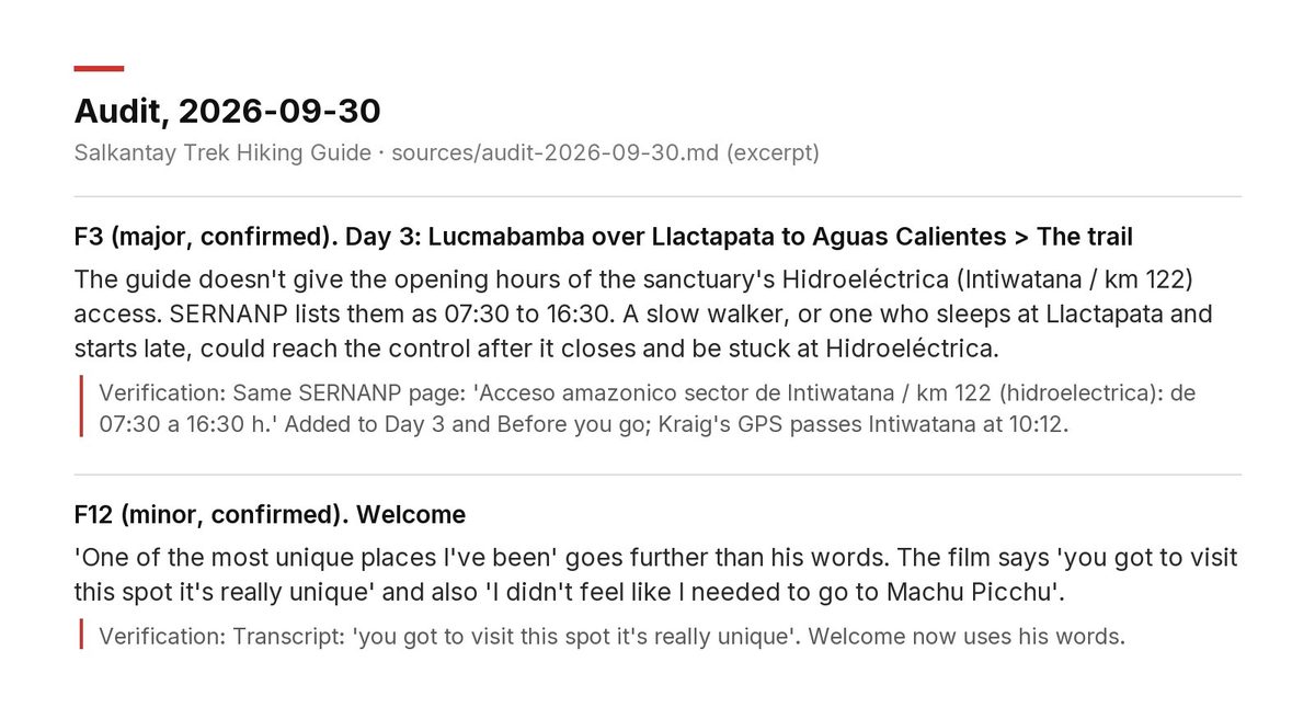
The time-sensitive checks run again on launch day: when the Laguna 69 guide went on sale on October 4 (the film), a forest fire had just stopped visits to the lake, so the guide said so from day one. Anything about my story, my opinions or the price comes back to me.
Where to get them, and the gear links
Only on my website, and since November 2026 every guide is free: the whole guide is on its page, and the PDF and GPX files are one free download.
Since October, most guides have a "Gear for this route" section with affiliate links to the gear I used or its current version. No company paid to be in a guide. Where a company was part of my trip, the guide says so: my Salkantay trip was with a local company that helped sponsor the film.
What I learned, and what's next
Pick one way to count climbing and use it everywhere. And a second AI catches what the first one misses, including words I never said.
Next: sharper photos from my full library, free to buyers as an update, and the next route, Colorado's San Juan Mountains, which is nearly ready.
FAQ
Are the guides written by AI?
Yes. AI builds them, first Codex and now Claude, from my own films, GPS recordings, photos and notes, and never invents an opinion or experience. A second AI checks the facts before a guide goes on sale.
Where does the information come from?
My films, my AllTrails GPS recordings, my photos and my old write-ups. Things that change, like opening hours, permits and prices, are checked against official sources and dated.
What's in a guide?
A PDF with the trip at a glance, straight answers to the big planning questions, every day with its own map and elevation profile, what I carried and a printable trip sheet, plus GPX files.
Are there affiliate links?
Yes, in the gear sections of most guides, to the gear I used or its current version. No company paid to be in a guide, and if a company was part of my trip, the guide says so.
How much is a guide, and how do I get one?
Free on my website: read the whole guide on its page, or download the PDF and GPX files.
Do I need to sign up?
No. Every guide is on its page in full, and the download needs no email. If you want to hear about new trips and guides, my letter is on every page.
Story · October 11, 2026
How I keep my AI-built hiking guides accurate, season to season
Before a hiking guide of mine goes on sale, a second AI checks it against official sources. Each season the dated facts are checked again, free for buyers.
Read it all 8 min
I make long hiking films for YouTube, and this fall I turned the routes into hiking guides, built with AI from my own films, GPS tracks and notes. How they're made is in an earlier article. This one is about the part that never ends: keeping them right.
My trip doesn't change. The world around it does: huts move their booking dates, buses get winter timetables, bridges close. So every guide gets checked before it goes on sale and again each season.
How the check works
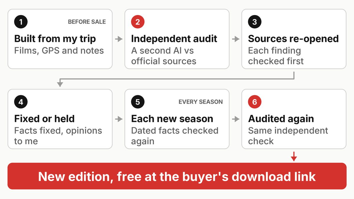
- An independent audit. A separate Claude session that didn't write the guide checks every fact that can change against official sources: parks, huts, ferries, buses, emergency services. It also checks numbers against my GPS and quotes against my films. New guides get a second opinion from Gemini too.
- Every source re-opened. For every serious finding, the main Claude session opens the official source itself before changing a line.
- Fixed, or held for me. Plain facts get fixed. My opinions or story, a price, removing a section, or sources that disagree come to me instead.
- Every season, again. The time-sensitive facts are checked and audited again, then a new edition goes out.
Since September 30, no guide goes on sale without passing the audit, so I don't have to read every guide line by line. The jobs live in KraigOS, the database we built to run my work, as tasks Claude picks up on its own.
Kesugi Ridge: a park report one day old
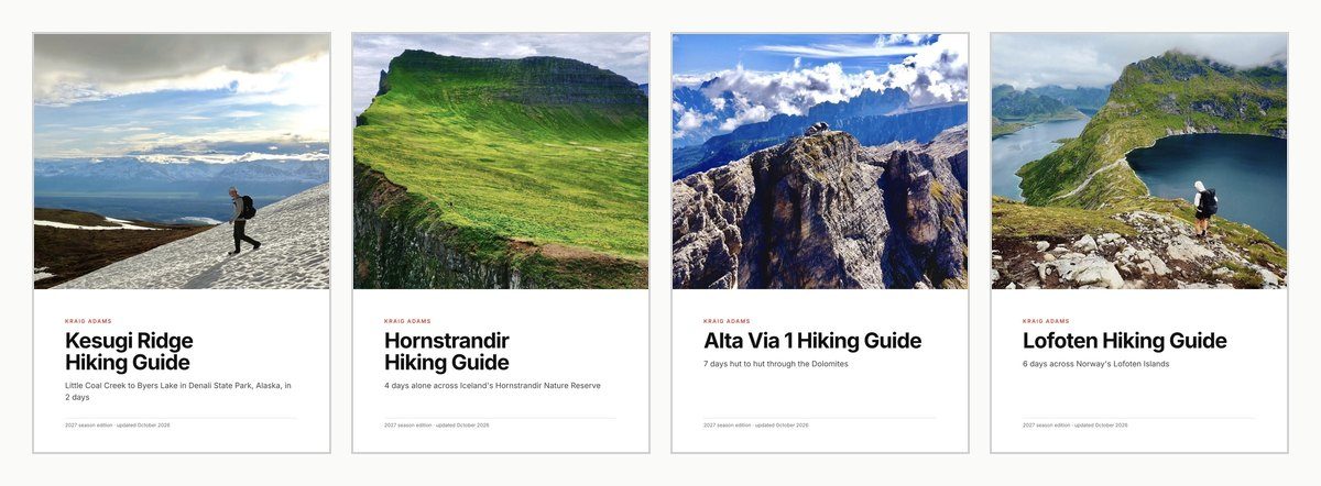
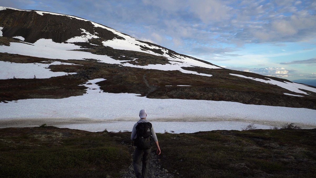
The Kesugi Ridge guide follows my 2020 film, two days on the ridge above Denali State Park in Alaska, and went on sale on October 10.
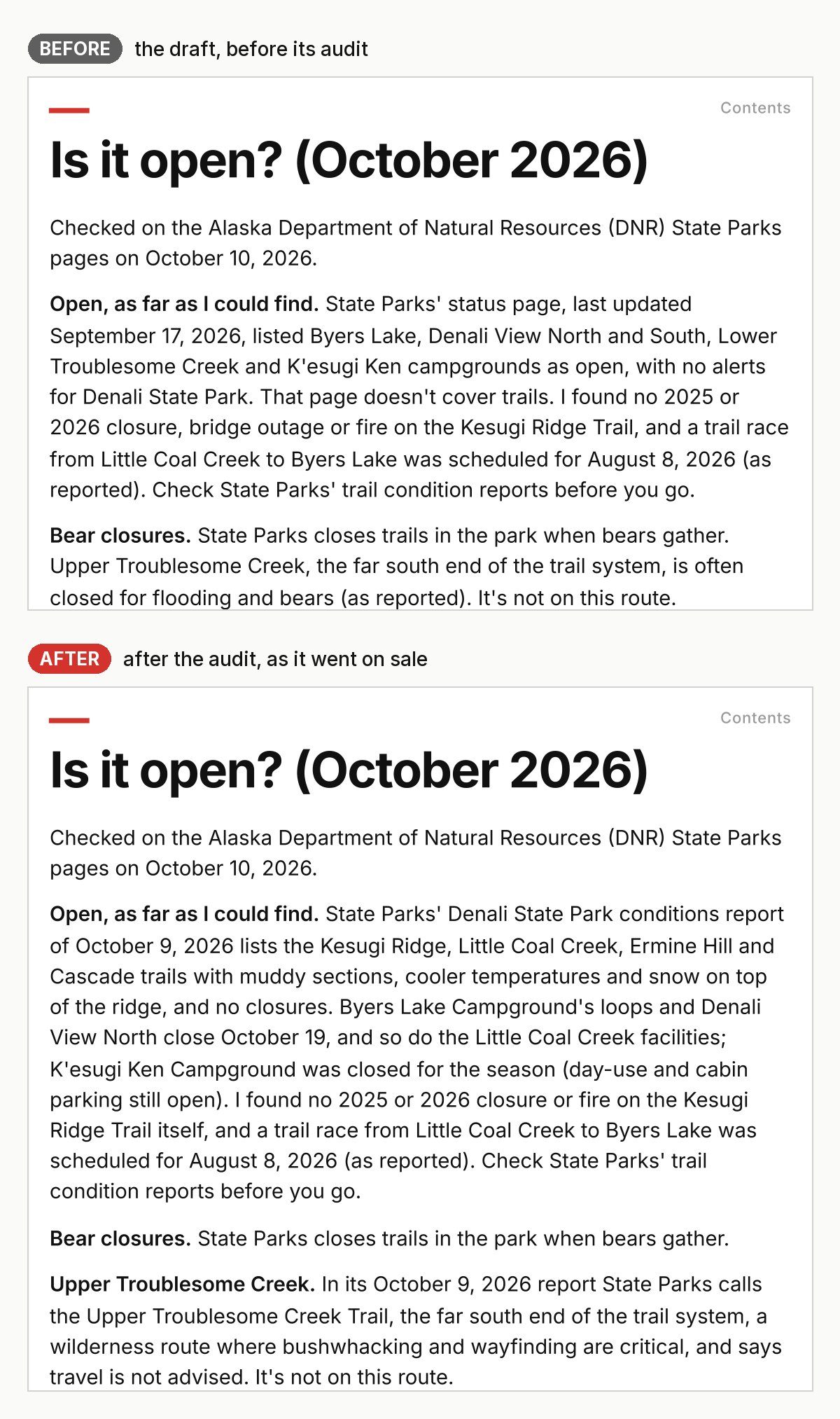
The draft said the trail looked open. Its source was a state parks status page last updated September 17. The audit, on the morning of October 10, found a newer one: Alaska State Parks' Denali State Park conditions report, dated October 9, linked from its park condition reports page. It changed several things:
- Snow on top of the ridge, with muddy sections and cooler temperatures on the trails.
- K'esugi Ken Campground closed for the season. The draft had listed it as open.
- More facilities closing October 19, including Byers Lake Campground's loops.
- The Outlet Bridge at Byers Lake closed, so the Byers Lake Loop, one of the guide's shorter options, can't be walked as a loop for now. My route wasn't affected.
- Upper Troublesome Creek, the far south end, now a wilderness route where the parks advise against travel.
Claude re-read the park report itself before fixing anything. The audit also found GPS distances a little off and two lines that went further than what I'd actually said, and Gemini caught that my film's title card says "30 mile hike," not "30 miles." Thirteen findings in all, every one fixed, and the guide went on sale that morning.
Three 2027 editions in one morning
On October 11, Claude refreshed three of the most popular guides for the 2027 season, and a second, independent session checked every change. I said yes, and all three were live by mid-morning.
Alta Via 1: hut bookings and buses
The Alta Via 1 guide follows my film of seven days hut to hut through the Dolomites. Hut booking dates moved:
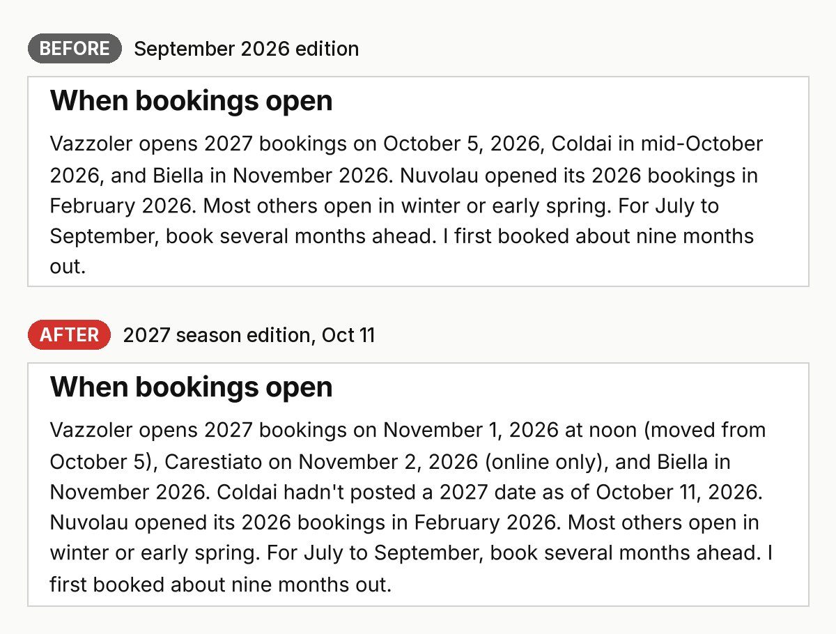
- Rifugio Vazzoler moved its 2027 booking day to November 1, 2026 (the hut's site).
- Rifugio Carestiato opens 2027 bookings on November 2, online only (its site).
- Rifugio Coldai had no 2027 date posted as of October 11 (its site), so the guide now says that instead of mid-October.
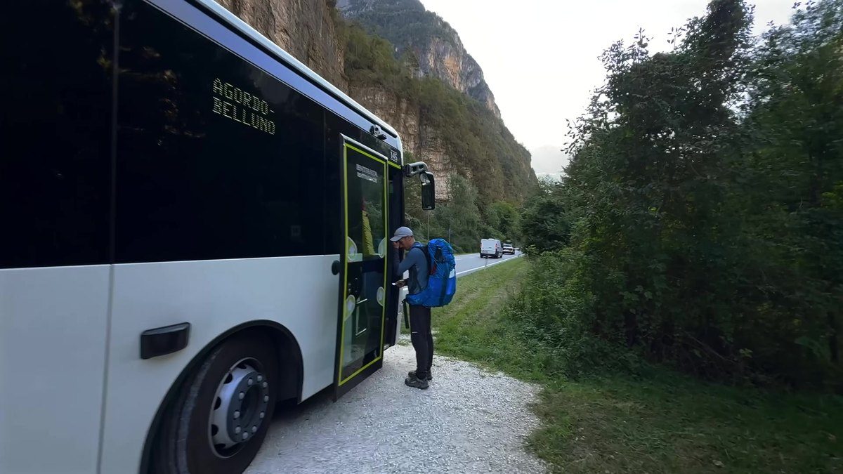
The bus from La Pissa, where the trail ends, to Belluno got a revised winter timetable from October 12, with a new weekday evening bus and still none on Sundays (Dolomiti Bus timetable).
At the start, the Cortina Express bus from Venice airport moved its Cortina stop to Piazzale Revis on October 1 (Cortina Express notice). My own line about a "2-hour FlixBus" stayed as I said it.
Hornstrandir: an emergency number
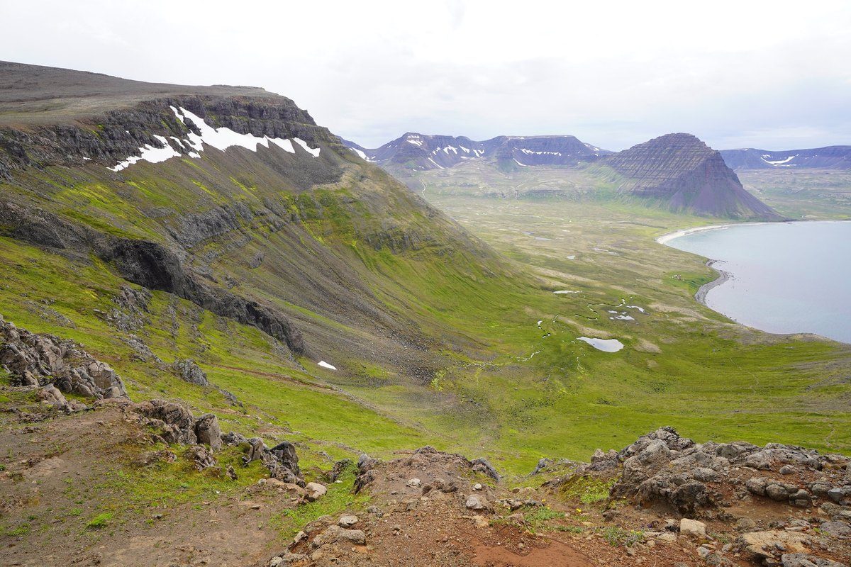
The Hornstrandir guide covers my four days alone in Iceland's Hornstrandir Nature Reserve, where there's almost no phone signal. The most important fix was small. The guide's number for calling Iceland's emergency line from a satellite phone came from SafeTravel's hiking page. The emergency line's own site, 112.is, says that number is for calling from abroad and lists a different one for satellite phones. When two sources disagree, the one that runs the service wins.
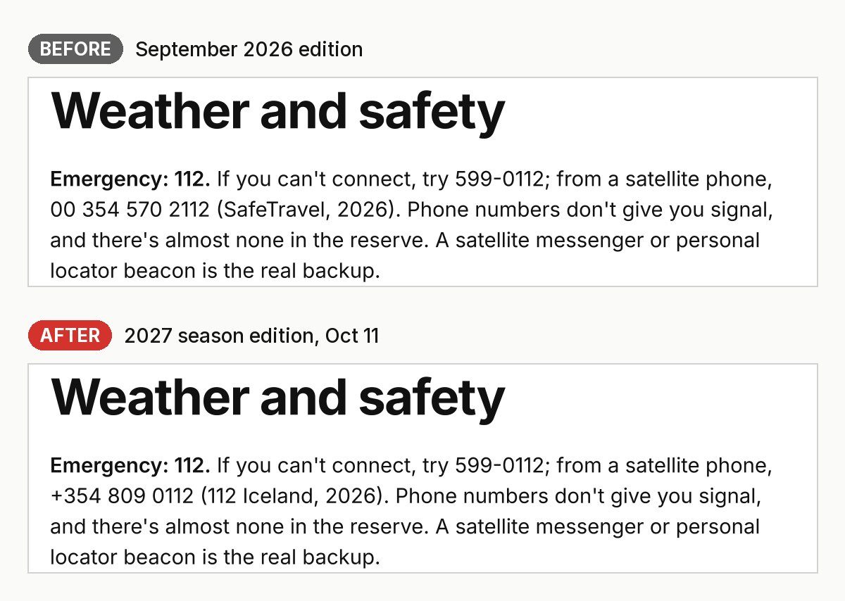
The rest:
- The boats. There are no roads in the reserve. None of the three boat companies from Ísafjörður (Borea, Hornstrandaferðir and West Tours) had posted 2027 timetables by October 11, and the guide says so, with the date.
- Flights. A state contract now keeps Icelandair's flights to Ísafjörður until at least August 2030.
- Polar bears. A new line: very rare, but one came ashore in the reserve's Jökulfirðir in September 2024. Call 112.
Lofoten: a closed hut and the camping rules
The Lofoten guide follows my six days across Norway's Lofoten Islands this summer.
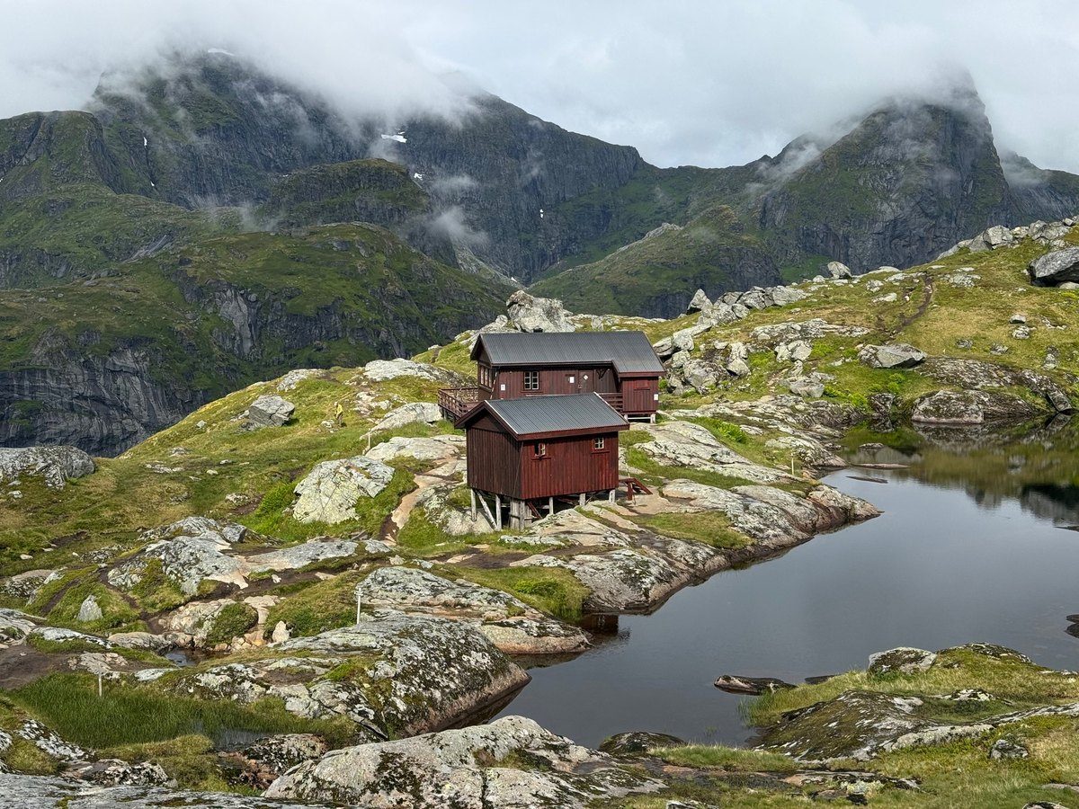
- Munkebu, the small red hut I walked past on Day 2, was still listed as closed on October 11 (its page on ut.no), so the guide says to check it for your dates.
- Timetables. The summer 2027 boat timetables aren't out yet; the Bodø to Moskenes ferry has only its winter one posted (Torghatten).
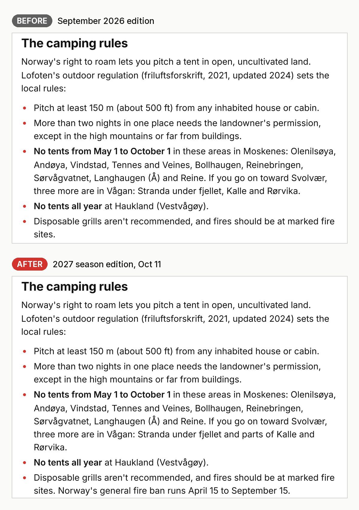
- The no-tent zones. The second check read the regulation itself (Lovdata) and found two zones near Svolvær are only partly closed to tents, not whole zones.
- Fires. The camping rules now include Norway's general fire ban, April 15 to September 15 (Visit Lofoten).
How I plan my own trips, in my own words
I usually do a lot of research on a trail, but it's hard to find specific information about the places you stay. Usually I can just see the type, whether it's a campsite, a hut or a refuge, and maybe a photo or two. So I often go into these hikes completely blind, and I'm usually pleasantly surprised. Over the years I've come to understand the different kinds of huts: what to expect at different elevations and from where they sit on the map. I read the AllTrails map to get a sense of what the experience will be like. Now I know that if I'm sleeping in a valley, sunrise and sunset will probably be lackluster compared to a more remote hut higher up, on the edge of a cliff or on a peak, where the light keeps hitting me until the sun goes down or after it comes up. When I'm after good views and good footage for a film, I plan around those sunrise and sunset shots.
What happens when nothing is known yet
A lot of 2027 isn't published in October. The rule is to never guess. The guide keeps the last confirmed facts with their year, and where something isn't out yet it says so with the date it was checked. Each refresh also ends with a watch list, like Lofoten's summer timetables and whether Munkebu opens. Those become the next check. Nothing in these three refreshes needed me, so nothing was held.
Free updates for buyers
Every guide's cover now carries its edition, like "2027 season edition, updated October 2026". If you've already bought a guide, the new edition comes to your download link for free, as every guide page says next to the buy button.
What I learned, and what's next
Official sources update quietly: a park report one day old changed half a page. A second AI that didn't write the guide, made to show its source, catches what the first one misses, and re-opening that source before a fix keeps the auditor honest too.
Next: checking the dates on each watch list as they're published, and the same 2027 refresh for more of the guides.
FAQ
Who checks the guides, a person or AI?
AI. A separate Claude session that didn't write the guide audits it against official sources, and new guides also get a pass from Google's Gemini. Anything about my opinions, my story or a price comes back to me.
What does the audit check?
Anything that can change: opening dates, hut bookings, timetables, closures, rules, emergency numbers. It also checks distances and climbing against my GPS and every quote against my films.
How often are guides updated?
Before a new season, starting with the most popular guides. Hornstrandir, Alta Via 1 and Lofoten got their 2027 editions on October 11, 2026.
I already bought a guide. Do I get the new edition?
Yes, free. New editions come to the same download link.
How do I know how current my guide is?
The edition is on the cover, and time-sensitive facts are dated in the text. Each guide also has a "Before you go" list of things to check close to your trip.
What if something isn't announced yet?
The guide says so, with the date it was checked, instead of guessing.
Story · October 11, 2026
How AI worked out my hiking gear from my own photos
Claude read the camera data in my trip photos and what I say in my films to list the gear I carried on each route. 40 of my 62 hiking guides have it now.
Read it all 7 min
My hiking guides are PDFs built with AI from my own films and GPS (how they're made). Until October 10 they had no affiliate links. I asked Claude to put gear lists in every guide that would "help solve the problem of ... knowing what gear they need or if they want to film a similar video."
The hard part: most of these trips are years old, and I didn't keep packing lists. So Claude had to work out what I carried from my photos and my films.
How AI worked out my gear
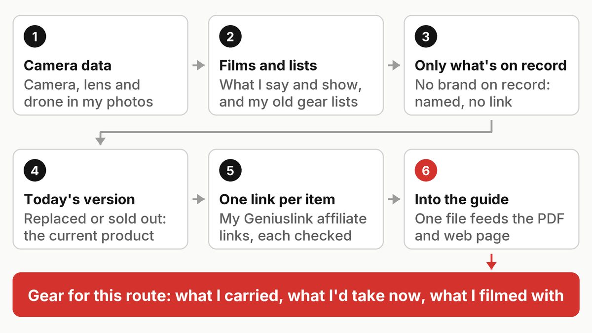
- Read the camera data in my photos. Every photo stores the camera and lens that took it. Claude read it, read-only, for each trip's dates.
- Read and watch the films. What I say about my gear, what's on screen, and the gear lists in old YouTube descriptions.
- List only what's on record. If I said "my tent" but never which one, the guide says "my tent", with no brand and no link.
- Find today's version. The guide names what I used, then points to the current model or a similar one.
- Check every link. A script follows each one and flags any that doesn't reach a store under my own affiliate tag.
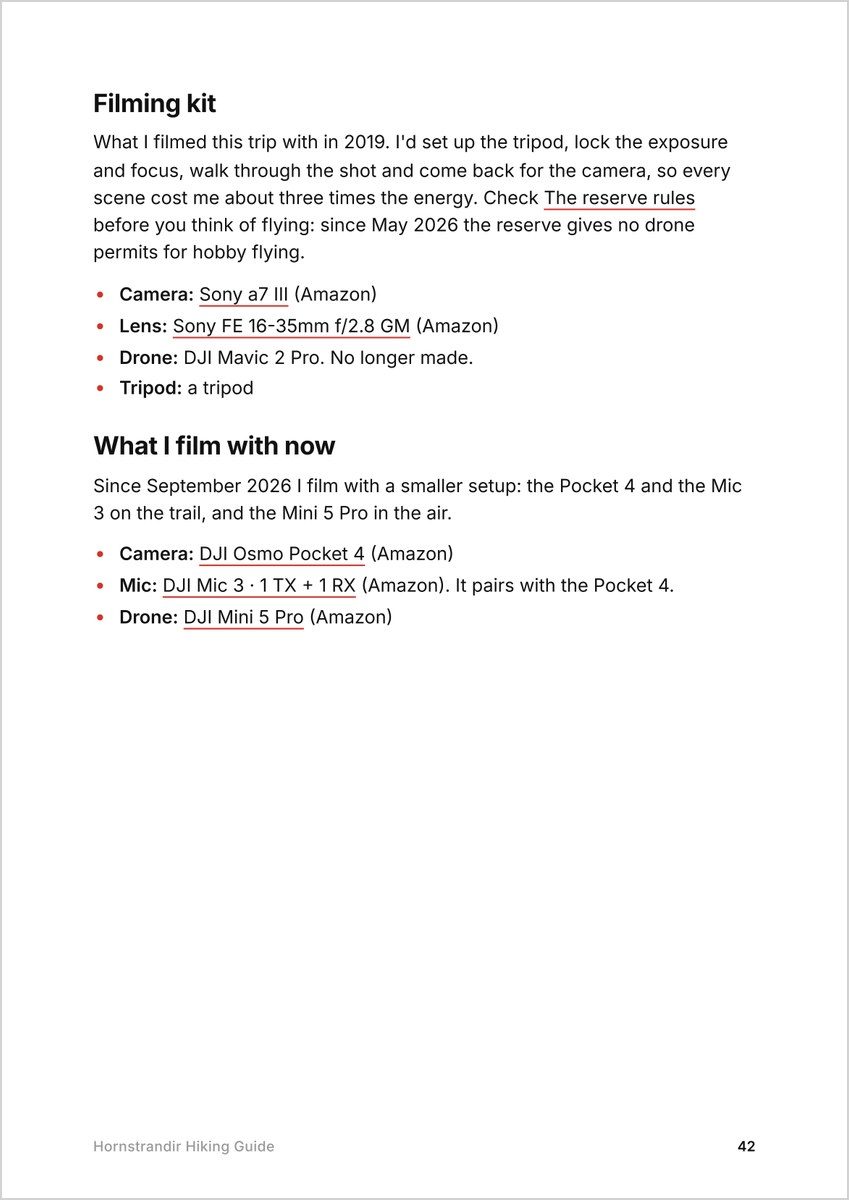
The section always runs: what this route needs (just advice, no links), what I carried that year, what I'd take now, my filming kit then, and what I film with now.
What the camera data says
My photos kept a record of my camera kit that I never wrote down. Here it is for twelve trips:
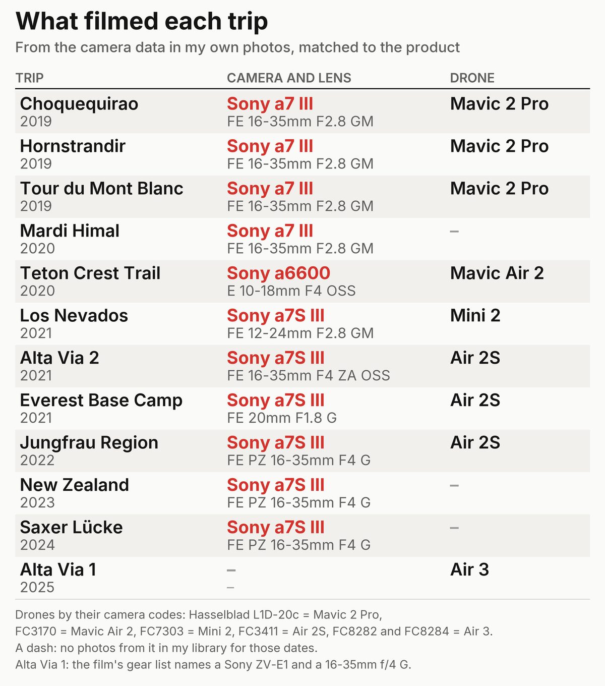
A drone writes a camera code, not its name: a Mavic 2 Pro photo says "Hasselblad L1D-20c", an Air 2S photo "FC3411". Claude matched each code to the drone.
Example 1: Hornstrandir, 2019
Hornstrandir is my most-watched route (the film, and the guide video I made after). In the guide video all I say is "I had a Sony camera on a tripod", plus the drone footage. The photos filled in the rest: a Sony a7 III with the 16-35mm f/2.8 GM, and a DJI Mavic 2 Pro.
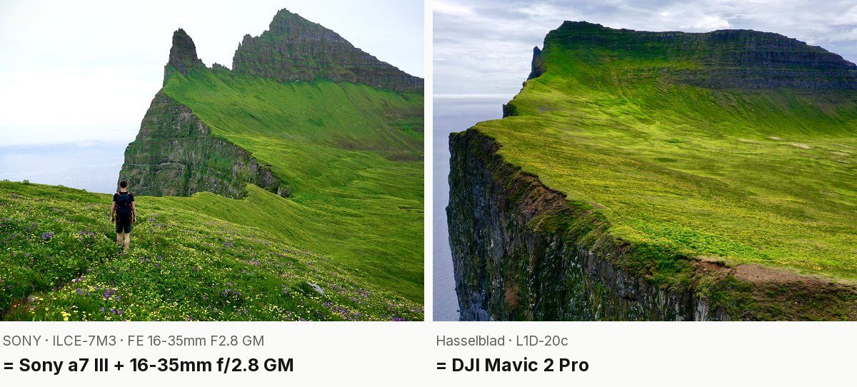
I was, in my words, a "noob" hiker on that trip, so the guide lists "a small backpack" and "my old boots" with no links, because I never said which ones. What I wished I'd had, like a cap after I got sunburned, goes under "What I'd take now".
Example 2: Everest Base Camp, 2021
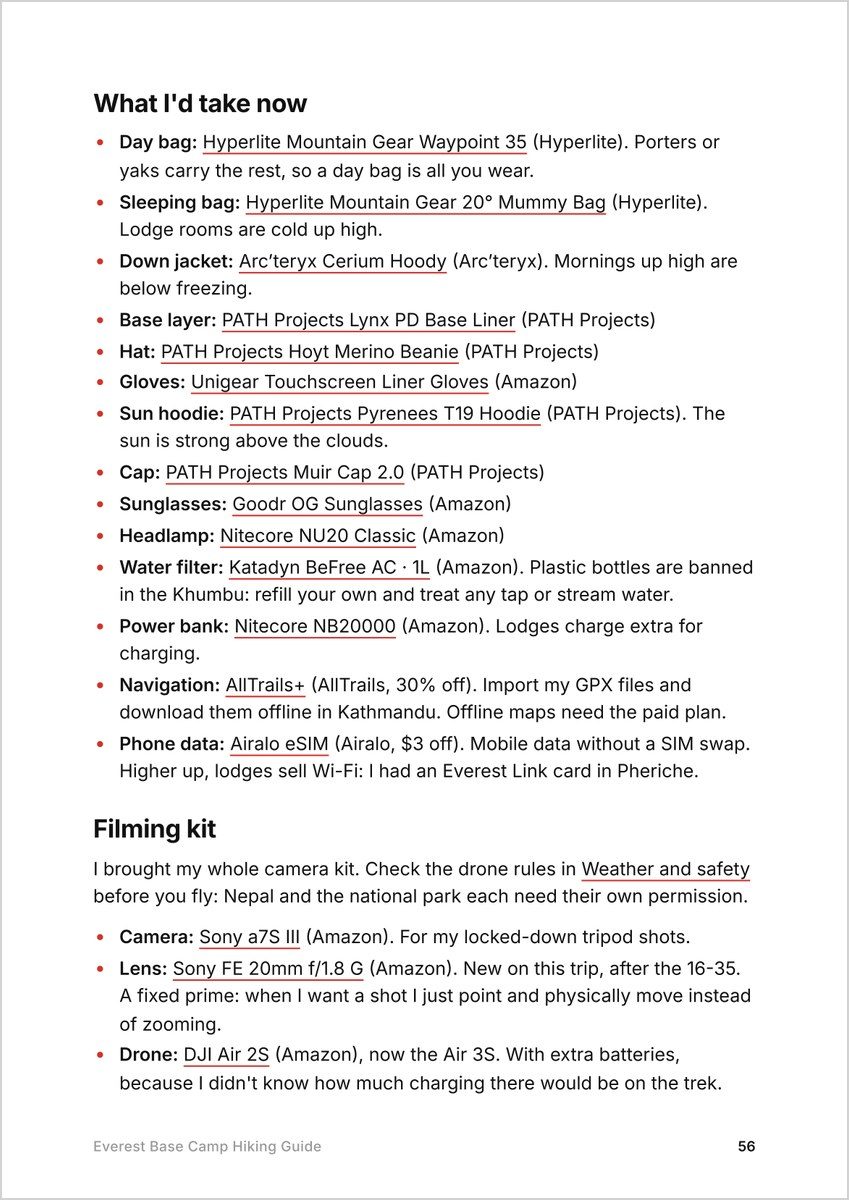
On the Everest Base Camp trek (the film, and the narrated one) I mention a new lens. The film's captions have me saying "a sony 20 millimeter f 1.4". The camera data in my photos says FE 20mm F1.8 G. So the guide links the f/1.8 G, the lens I actually used.
Same with the drone. In the film I say I bought extra batteries "for the mavic 2 air s". There's no such drone. The photos say FC3411, which is the DJI Air 2S. The Air 2S is discontinued now, so the guide says "DJI Air 2S, now the Air 3S", and the link goes to the current one.
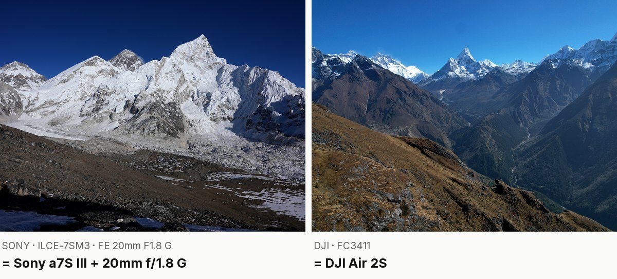
The hiking side of that trip is thin on record, so the guide lists only the day bag, duffel, jacket and headlamp the films show, and puts my current cold-weather kit under "What I'd take now".
Example 3: Alta Via 2, 2021
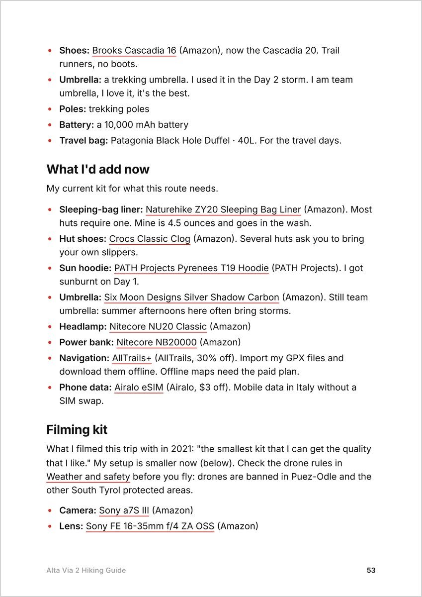
In the Alta Via 2 film (watch it here) I say I shot it on a "Sony a7s Mark III with a 16 to35 F4". Sony has made two 16-35mm f/4 lenses. The camera data settled which one: FE 16-35mm F4 ZA OSS, in 67 photos from the trip.
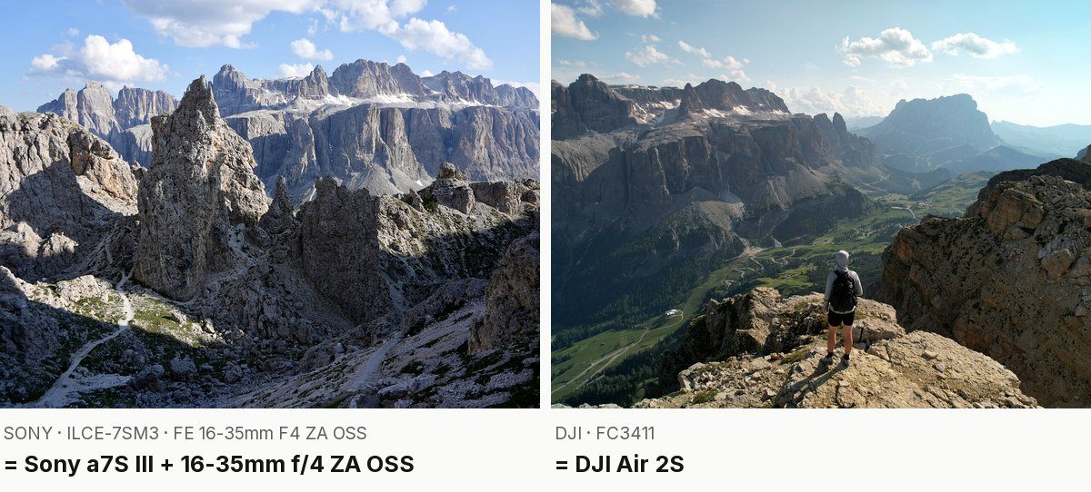
Compare the Laguna 69 guide, from the same year: its record only says "16-35mm f/4", so the lens is named without a link. Guessing isn't allowed.
The Alta Via 2 guide shows the other rules too. My Brooks Cascadia 16 shoes are now the Cascadia 20, so the guide says that. And the trekking umbrella stays in, because I said it in the film: "I am team umbrella I love it it's the best."
Why my cameras changed, in my own words
My cameras have changed a lot over the years, but also kind of not. There are two- or three-year stretches where I use the same camera and the same lens. The trend has been toward easier to use, even at a little less quality, and now the iPhone. Right now I'm deciding between going iPhone or DJI; I'll probably use both for the time being, and I still have my Sony with its microphone and lens. I've always wanted the simplest, lightest rig that gets me the best footage, and that's been the trend over time. But the jump to the iPhone has been a big one for ease of use and compatibility. Being able to upload the footage to iCloud and have AI edit it in real time would be a game changer.
Where it started: Alta Via 1 and Lofoten
We tested it on Alta Via 1 and Lofoten on the morning of October 10, and they went live that day.
On Lofoten, the film shows my tripod breaking and me throwing it away, so that tripod is in the guide, with a note that I bought the same one again. My tent, pad and sleeping bag aren't named anywhere in the record, so they aren't named in the guide. On Alta Via 1, my Senchi hoodie and Territory Run shorts have no store to link, so they stay named, followed by a similar item from my gear page.
From 2 guides to 40
After the test, the KraigOS worker took over: Claude running on a schedule through the night, a few guides per run, most-watched films first, checking every new page and link. I said yes to each batch before it went live. By the morning of October 11, 40 guides had the section, and anyone who already bought one gets the new version from the same link.
The 40 guides with gear lists: Acatenango Volcano, Adirondack High Peaks, Ak-Suu Traverse, Alta Via 1, Alta Via 2, Azores, Choquequirao, Enchanted Valley, Everest Base Camp, Four Pass Loop, Goat Rocks, Grand Canyon Rim to Rim, Half Dome, Haute Route, Hornstrandir, Huayhuash Circuit, K2 Base Camp, Laguna 69, Laugavegur Trail, Lofoten, Los Nevados, MacLehose Trail, Manaslu Circuit, Mardi Himal, New Zealand, Picos de Europa, Resurrection Pass, Salkantay Trek, San Juans 14ers, Santa Cruz Trek, Sawtooth Wilderness Loop, Saxer Lücke, Teton Crest Trail, The Enchantments, Three Fingers Lookout, Torres del Paine, Tour du Mont Blanc, Tour of the Jungfrau Region, Trans-Catalina Trail and West Highland Way.
About the links
They're affiliate links, and every guide says so before the first one: "Paid links: I earn a commission if you buy through these links, at no extra cost to you. As an Amazon Associate I earn from qualifying purchases." Each link also names its store, like "(Amazon)".
They go through Geniuslink, which I already use under my films, so a link fixed once on my gear page is fixed in every guide that uses it.
What I learned, and what's next
The camera data was exact where my own words weren't: a lens I named wrong, a drone I mixed up, a "Sony camera" with no model. "Only what's on record" makes a shorter list, but every line in it is true.
Next: the other 22 guides, the same way, and keeping the links pointed at products you can still buy.
FAQ
How did AI know what gear you carried?
Claude read the camera model and lens stored in my photos from each trip, plus what I say and show in my films. Nothing is listed as carried unless one of those shows it.
Are the links affiliate links?
Yes. I earn a commission if you buy through them, at no extra cost to you. Every guide says so above the first link, and each link names its store.
What if something isn't sold anymore?
The guide names what I used and says what replaced it, like "DJI Air 2S, now the Air 3S". If there's no store to link, it names a similar item from my gear page.
Which guides have a gear list?
40 of my 62 guides, listed above. The rest are next. My full current kit is on my gear page.
What do you film with now?
Since September 2026, a DJI Osmo Pocket 4 and a Mic 3 on the trail, and a DJI Mini 5 Pro in the air. Every gear section ends with that kit too.
Do I need the same gear to do these hikes?
No. Each section starts with what the route actually needs, with no links, before any product. The rest is what I happened to carry.
Newsletter
Get my letter
Get a short letter from me every couple of weeks: new trips, guides and what I'm building.
Free. Unsubscribe any time.
Details
Timeline · newest first
Milestone · November 2, 2026
Every guide is free
Every page of every guide is free to read on its project's page, with the PDF and GPX download.
Making of · October 11, 2026
Wrote: How I keep my AI-built hiking guides accurate, season to season
Making of · October 11, 2026
Wrote: How AI worked out my hiking gear from my own photos
Making of · October 9, 2026
Wrote: How I make my hiking guides with AI, from my own films and GPS